19:
4364:
1169:
2140:
825:
1501:
1942:
231:
373:
1305:
2929:
2603:
2539:
1876:
1752:
3886:
2416:
2351:
2009:
166:
2864:
2281:
1812:
3069:
2999:
1692:
1567:
957:
4204:
3770:
3473:
3411:
2474:
2074:
1632:
1098:
1032:
3559:
3349:
1370:
4742:
4396:
4097:
3139:
2729:
1235:
891:
563:
3278:
2798:
1436:
759:
699:
503:
442:
96:
3825:
2211:
629:
297:
3634:
3700:
2663:
3951:
4747:
4074:
2775:
3753:
City
Council voted unanimously to pursue dam removal in 2010. As of 2023, the dams are owned by a developer who wants to remove them before building housing in the area.
4308:
4256:
3978:
3199:
4389:
3973:
3968:
4752:
4464:
3226:
4382:
3221:
4177:
4405:
3216:
1415:
The dam was originally constructed to create
Maxwell Pond on Black Brook in 1900 for the purpose of ice harvesting. Owned by the City of Manchester.
4680:
4574:
1275:
799:
4282:
1410:
4614:
4579:
4368:
3963:
3045:
1008:
349:
4716:
4654:
4519:
4609:
4584:
4706:
4449:
4178:"Over $ 200,000 Awarded from Aquatic Resource Mitigation Funds for Dam Removal and Partial Restoration of Brennan Brook in Francestown"
4569:
4564:
4439:
4624:
4504:
3211:
4067:
4688:
4644:
4514:
4454:
4444:
4649:
4664:
4639:
4459:
4419:
4156:
669:
2579:
932:
4737:
4230:
2975:
2251:
622:
4696:
1209:
18:
4619:
4604:
4509:
4474:
3062:
4711:
4534:
3865:
3513:
2514:
4659:
4529:
4594:
4549:
4539:
4524:
4499:
4479:
4434:
3926:
3179:
1002:
884:
4544:
4484:
4429:
4003:
4599:
4554:
4494:
4469:
4424:
4629:
3627:
3528:
2133:
2114:
4701:
4634:
4589:
4489:
2467:
1745:
1685:
1625:
1560:
1363:
1298:
496:
2181:
3750:
3552:
3466:
3404:
3342:
2992:
2922:
2596:
2532:
1869:
1025:
692:
224:
3271:
2067:
2002:
1429:
1091:
950:
818:
435:
271:
3937:
3879:
3329:
3132:
2791:
2204:
1805:
1494:
1162:
752:
366:
3818:
2857:
2722:
2656:
1935:
159:
89:
39:
2904:
1345:
206:
3763:
3693:
2409:
2344:
2274:
1607:
1228:
997:
556:
290:
31:
3533:
3451:
3184:
2969:
2392:
1541:
1072:
27:
1852:
1476:
4038:
3674:
3599:
2256:
603:
343:
338:
4148:
136:
608:
Dam built for conservation and agriculture. Owned by the
Cheshire County Fish & Game Club.
3323:
865:
674:
4374:
4674:
3745:
2326:
1143:
1138:
141:
3328:
Mill dam built in 1922, converted into a hydroelectric dam in 1986. As of April 2023,
4045:
4013:
3538:
1280:
3740:
3318:
3109:
3039:
1983:
1916:
418:
413:
3612:, with the intention of creating a self-sustaining population and ending the need for
4731:
4333:
3679:
3613:
2839:
2769:
2321:
2186:
2049:
1988:
Dam built for recreation. Owned by the Girl Scouts of the Green and White
Mountains.
679:
Grist mill dam owned by the
Connecticut River Conservancy and Mill Dam Water Supply.
23:
3609:
3389:
2703:
4283:"'State of disrepair': Durham makes call to remove Mill Pond dam on Oyster River"
3605:
43:
3936:
In 2020 the Davis
Conservation Foundation granted the New Hampshire Chapter of
4122:
3931:
3114:
3902:
3888:
3841:
3827:
3786:
3772:
3716:
3702:
3650:
3636:
3575:
3561:
3489:
3475:
3427:
3413:
3365:
3351:
3294:
3280:
3155:
3141:
3085:
3071:
3015:
3001:
2945:
2931:
2880:
2866:
2814:
2800:
2745:
2731:
2679:
2665:
2619:
2605:
2555:
2541:
2490:
2476:
2432:
2418:
2367:
2353:
2297:
2283:
2227:
2213:
2156:
2142:
2090:
2076:
2025:
2011:
1958:
1944:
1892:
1878:
1828:
1814:
1768:
1754:
1708:
1694:
1648:
1634:
1583:
1569:
1517:
1503:
1452:
1438:
1386:
1372:
1321:
1307:
1251:
1237:
1185:
1171:
1114:
1100:
1048:
1034:
973:
959:
907:
893:
841:
827:
775:
761:
715:
701:
645:
631:
579:
565:
519:
505:
458:
444:
389:
375:
313:
299:
247:
233:
182:
168:
112:
98:
4363:
1285:
Water supply dam for the
Benjamin Chase Mill. Owned by the Town of Derry.
4309:"Durham votes to remove Mill Pond dam with 74% of vote and large turnout"
4257:"Gonic Mill owner wants to build housing. Two dams must be removed first"
4008:
4205:"Coordinator Details Trout Breeder Pond Project In Franconia Notch"
4098:"Nature Conservancy studying removal of Fiske Mill Dam in Hinsdale"
17:
4039:"DAMS SLATED FOR REMOVAL IN 2007 AND DAMS REMOVED FROM 1999-2006"
3608:. This would allow trout to move freely between Breeder Pond and
4378:
1546:
Dam built for transportation, owned by the Town of
Bedford.
46:
as physical impediments to free-flowing rivers or streams.
870:
Hydroelectric dam owned by the
Vermont River Conservancy.
4123:"Grant F22AP02005 (Connecticut River Watershed Council)"
2909:
Dam built for recreation, owned by Durham Public Works.
3604:
The project would remove the dam and replace it with a
348:
Dam built for recreation and log storage. Owned by the
22:
The 2019 removal of the Upper Sawyer Mill Dam from the
4068:"Projects: Planned, Completed and Under Consideration"
276:
Water supply dam owned by
Littleton Water and Light.
4687:
4673:
4412:
4743:Lists of buildings and structures in New Hampshire
4075:New Hampshire Department of Environmental Services
2776:New Hampshire Department of Environmental Services
804:Dam built in the 1970s by Cold River Materials.
1153:Greene Wildlife Pond Dam (Ainsworth Pond Dam)
1148:Paper mill dam owned by the Town of Henniker.
4390:
3332:was in talks to purchase and remove the dam.
1921:Grist mill dam later used as a water supply.
1197:Greene Wildlife Pond Dam (Ainsworth Pond Dam)
8:
4033:
4031:
4748:Lists of dam removals in the United States
4406:Lists of dam removals in the United States
4397:
4383:
4375:
4149:"Washburn Dam Removal on the Mohawk River"
3940:$ 15,000 toward a dam removal assessment.
3241:
53:
3522:Brennan Brook/Crochet Mountain Brook Dam
4182:NH Department of Environmental Services
3995:
2119:Dam built for recreation and wildlife.
1214:Dam built for recreation and wildlife.
482:Owned by the McGoldrick Paper Company.
4281:Fernandes, Megan (17 September 2021).
4004:"American Rivers Dam Removal Database"
3046:New Hampshire Fish and Game Department
1009:New Hampshire Fish and Game Department
350:New Hampshire Fish and Game Department
7:
4229:O'Donnell, Jake (9 September 2010).
3949:Map this section's coordinates using
3547:Breeder Pond Dam (Highway Pond Dam)
3197:Map this section's coordinates using
4753:New Hampshire history-related lists
4255:Dandurant, Karen (22 March 2023).
2124:Boyce Pond Dam/Horseshoe Pond Dam
14:
4307:Dandurant, Karen (8 March 2022).
4231:"Gonic dams removal grant sought"
4203:Blechl, Robert (3 January 2022).
2168:Boyce Pond Dam/Horseshoe Pond Dam
4362:
4157:U.S. Fish & Wildlife Service
4096:Browder, Jamie (26 April 2023).
4340:. Davis Conservation Foundation
1485:Jenkins Road McQuade Brook Dam
853:Lyman Falls Dam Remnant Removal
2976:U.S. Fish and Wildlife Service
2974:Water supply dam owned by the
1529:Jenkins Road McQuade Brook Dam
1:
4369:Removed dams in New Hampshire
3238:Planned and proposed removals
1926:Anne Jackson Girl Scout Dam
215:South Branch Gale River Dam
3979:GPX (secondary coordinates)
3227:GPX (secondary coordinates)
1970:Anne Jackson Girl Scout Dam
357:Homestead Woolen Mills Dam
259:South Branch Gale River Dam
4769:
2325:
1792:Stormwater retention dam.
1739:2.5 ft (0.76 m)
1679:2.5 ft (0.76 m)
1290:Berry Brook Reservoir Dam
1279:
937:Dam built for recreation.
401:Homestead Woolen Mills Dam
3974:GPX (primary coordinates)
3749:
3744:
3739:
3537:
3322:
3222:GPX (primary coordinates)
2578:
2390:
2320:
1606:
1333:Berry Brook Reservoir Dam
1142:
1001:
673:
668:
417:
412:
140:
83:5.1 ft (1.6 m)
4707:Northern Mariana Islands
4338:www.davisfoundations.org
3957:Download coordinates as:
3205:Download coordinates as:
3126:18 ft (5.5 m)
3056:20 ft (6.1 m)
2986:14 ft (4.3 m)
2851:15 ft (4.6 m)
2716:16 ft (4.9 m)
2650:16 ft (4.9 m)
2461:15 ft (4.6 m)
2403:15 ft (4.6 m)
2338:18 ft (5.5 m)
2127:11 ft (3.4 m)
2061:19 ft (5.8 m)
1996:12 ft (3.7 m)
1488:14 ft (4.3 m)
1357:15 ft (4.6 m)
1156:13 ft (4.0 m)
1085:10 ft (3.0 m)
878:30 ft (9.1 m)
809:Lyman Falls Dam Remnant
616:15 ft (4.6 m)
550:11 ft (3.4 m)
490:3 ft (0.91 m)
360:14 ft (4.3 m)
218:14 ft (4.3 m)
4287:Foster's Daily Democrat
4261:Foster's Daily Democrat
4235:Foster's Daily Democrat
2914:Lower Peverly Pond Dam
2391:Mill dams that powered
2268:4 ft (1.2 m)
1929:8 ft (2.4 m)
1619:5 ft (1.5 m)
1554:4 ft (1.2 m)
1423:9 ft (2.7 m)
1222:8 ft (2.4 m)
1077:Fish rearing pond dam.
1019:8 ft (2.4 m)
812:4 ft (1.2 m)
746:7 ft (2.1 m)
284:6 ft (1.8 m)
272:South Branch Gale River
3938:The Nature Conservancy
3330:The Nature Conservancy
2957:Lower Peverly Pond Dam
2400:Upper Sawyer Mill Dam
2335:Lower Sawyer Mill Dam
1861:Merrimack Village Dam
1736:South Main Street Dam
35:
4738:Dams in New Hampshire
3969:GPX (all coordinates)
3874:Beech River Mill Dam
3217:GPX (all coordinates)
2848:Little Hale Pond Dam
2588:Champlin Pond Dam #2
2524:Champlin Pond Dam #1
2444:Upper Sawyer Mill Dam
2379:Lower Sawyer Mill Dam
1993:Buck Street Dam West
1904:Merrimack Village Dam
1780:South Main Street Dam
151:Pearl Lake Brook Dam
146:Water diversion dam.
40:dams in New Hampshire
21:
4371:at Wikimedia Commons
3914:Beech River Mill Dam
2892:Little Hale Pond Dam
2631:Champlin Pond Dam #2
2567:Champlin Pond Dam #1
2265:Bellamy River Dam V
2037:Buck Street Dam West
1797:Magazine Street Dam
194:Pearl Lake Brook Dam
4717:U.S. Virgin Islands
3903:43.7507°N 71.1395°W
3898: /
3842:43.1309°N 70.9189°W
3837: /
3787:43.2704°N 70.9764°W
3782: /
3717:43.2735°N 70.9773°W
3712: /
3651:42.7550°N 72.1270°W
3646: /
3576:44.1672°N 71.6804°W
3571: /
3490:44.8766°N 71.3711°W
3485: /
3428:44.7418°N 71.5993°W
3423: /
3366:44.4849°N 71.5625°W
3361: /
3295:42.7857°N 72.4814°W
3290: /
3185:Winnipesaukee River
3156:43.4521°N 71.4689°W
3151: /
3086:43.8281°N 71.2987°W
3081: /
3053:Bearcamp River Dam
3016:43.0368°N 70.8477°W
3011: /
2983:Winnicut River Dam
2946:43.0833°N 70.8423°W
2941: /
2876: /
2810: /
2746:43.0403°N 71.1294°W
2741: /
2680:42.9813°N 70.9445°W
2675: /
2620:43.2764°N 70.9317°W
2615: /
2556:43.2708°N 70.9313°W
2551: /
2491:43.4951°N 71.0262°W
2486: /
2428: /
2393:Sawyer Woolen Mills
2363: /
2309:Bellamy River Dam V
2298:43.1763°N 70.8717°W
2293: /
2228:43.6068°N 71.7422°W
2223: /
2157:42.7533°N 72.1719°W
2152: /
2091:43.3421°N 71.6837°W
2086: /
2026:43.1595°N 71.4074°W
2021: /
1959:42.8295°N 71.7679°W
1954: /
1893:42.8604°N 71.4932°W
1888: /
1840:Magazine Street Dam
1829:42.9573°N 71.5426°W
1824: /
1769:42.9682°N 71.4821°W
1764: /
1709:42.9679°N 71.4812°W
1704: /
1644: /
1584:42.9694°N 71.4811°W
1579: /
1518:42.9056°N 71.5237°W
1513: /
1453:43.1086°N 71.4485°W
1448: /
1387:43.0103°N 71.4791°W
1382: /
1322:43.2911°N 71.3010°W
1317: /
1252:42.9016°N 71.2992°W
1247: /
1181: /
1115:43.1654°N 71.8427°W
1110: /
1049:43.3876°N 72.3513°W
1044: /
974:43.5536°N 72.1308°W
969: /
942:Butternut Pond Dam
908:42.8711°N 72.4691°W
903: /
842:44.7774°N 71.5956°W
837: /
776:43.1302°N 72.4187°W
771: /
716:44.0899°N 71.9977°W
711: /
646:44.0891°N 72.0251°W
641: /
580:42.9755°N 72.2422°W
575: /
520:42.7768°N 72.3834°W
515: /
459:42.7877°N 72.4706°W
454: /
390:42.8714°N 72.3281°W
385: /
314:44.7354°N 71.1879°W
309: /
248:44.2423°N 71.6378°W
243: /
183:44.2069°N 71.8919°W
178: /
113:44.1461°N 71.7734°W
108: /
28:Sawyer Woolen Mills
4102:The Keene Sentinel
4016:. 13 February 2023
3758:Gonic Sawmill Dam
3600:Pemigewasset River
3460:Washburn Mill Dam
3398:Kimball Brook Dam
3097:Bearcamp River Dam
3027:Winnicut River Dam
2881:43.143°N 70.9213°W
2815:43.0349°N 71.189°W
2458:Union Village Dam
2433:43.179°N 70.8766°W
2368:43.1783°N 70.875°W
2257:Pemigewasset River
2058:Tannery Brook Dam
1649:42.969°N 71.4813°W
1186:42.821°N 72.0578°W
1082:West Henniker Dam
1016:Stevens Brook Dam
985:Butternut Pond Dam
344:Androscoggin River
339:Androscoggin River
50:Completed removals
38:This is a list of
36:
4725:
4724:
4367:Media related to
4313:Portsmouth Herald
4209:Caledonian Record
4127:www.highergov.com
3944:
3943:
3908:43.7507; -71.1395
3847:43.1309; -70.9189
3798:Gonic Sawmill Dam
3792:43.2704; -70.9764
3722:43.2735; -70.9773
3656:42.7550; -72.1270
3581:44.1672; -71.6804
3501:Washburn Mill Dam
3495:44.8766; -71.3711
3439:Kimball Brook Dam
3433:44.7418; -71.5993
3371:44.4849; -71.5625
3337:Israel River Dam
3324:Connecticut River
3300:42.7857; -72.4814
3192:
3191:
3161:43.4521; -71.4689
3091:43.8281; -71.2987
3021:43.0368; -70.8477
2951:43.0833; -70.8423
2751:43.0403; -71.1294
2685:42.9813; -70.9445
2625:43.2764; -70.9317
2561:43.2708; -70.9313
2502:Union Village Dam
2496:43.4951; -71.0262
2303:43.1763; -70.8717
2233:43.6068; -71.7422
2162:42.7533; -72.1719
2102:Tannery Brook Dam
2096:43.3421; -71.6837
2031:43.1595; -71.4074
1964:42.8295; -71.7679
1898:42.8604; -71.4932
1834:42.9573; -71.5426
1774:42.9682; -71.4821
1714:42.9679; -71.4812
1676:McQuesten Dam #3
1616:McQuesten Dam #2
1589:42.9694; -71.4811
1551:McQuesten Dam #1
1523:42.9056; -71.5237
1458:43.1086; -71.4485
1392:43.0103; -71.4791
1354:Maxwell Pond Dam
1327:43.2911; -71.3010
1257:42.9016; -71.2992
1126:West Henniker Dam
1120:43.1654; -71.8427
1060:Stevens Brook Dam
1054:43.3876; -72.3513
979:43.5536; -72.1308
913:42.8711; -72.4691
866:Connecticut River
847:44.7774; -71.5956
781:43.1302; -72.4187
721:44.0899; -71.9977
675:Connecticut River
651:44.0891; -72.0251
585:42.9755; -72.2422
525:42.7768; -72.3834
464:42.7877; -72.4706
395:42.8714; -72.3281
319:44.7354; -71.1879
253:44.2423; -71.6378
188:44.2069; -71.8919
118:44.1461; -71.7734
4760:
4681:Washington, D.C.
4675:Federal district
4399:
4392:
4385:
4376:
4366:
4350:
4349:
4347:
4345:
4330:
4324:
4323:
4321:
4319:
4304:
4298:
4297:
4295:
4293:
4278:
4272:
4271:
4269:
4267:
4252:
4246:
4245:
4243:
4241:
4226:
4220:
4219:
4217:
4215:
4200:
4194:
4193:
4191:
4189:
4174:
4168:
4167:
4165:
4163:
4145:
4139:
4138:
4136:
4134:
4119:
4113:
4112:
4110:
4108:
4093:
4087:
4086:
4084:
4082:
4072:
4064:
4058:
4057:
4055:
4053:
4043:
4035:
4026:
4025:
4023:
4021:
4000:
3923:
3922:
3921:
3919:
3918:
3917:
3915:
3910:
3909:
3904:
3899:
3896:
3895:
3894:
3891:
3862:
3861:
3860:
3858:
3857:
3856:
3854:
3849:
3848:
3843:
3838:
3835:
3834:
3833:
3830:
3807:
3806:
3805:
3803:
3802:
3801:
3799:
3794:
3793:
3788:
3783:
3780:
3779:
3778:
3775:
3746:Piscataqua River
3737:
3736:
3735:
3733:
3732:
3731:
3729:
3724:
3723:
3718:
3713:
3710:
3709:
3708:
3705:
3671:
3670:
3669:
3667:
3666:
3665:
3663:
3658:
3657:
3652:
3647:
3644:
3643:
3642:
3639:
3596:
3595:
3594:
3592:
3591:
3590:
3588:
3587:Breeder Pond Dam
3583:
3582:
3577:
3572:
3569:
3568:
3567:
3564:
3510:
3509:
3508:
3506:
3505:
3504:
3502:
3497:
3496:
3491:
3486:
3483:
3482:
3481:
3478:
3448:
3447:
3446:
3444:
3443:
3442:
3440:
3435:
3434:
3429:
3424:
3421:
3420:
3419:
3416:
3386:
3385:
3384:
3382:
3381:
3380:
3378:
3377:Israel River Dam
3373:
3372:
3367:
3362:
3359:
3358:
3357:
3354:
3315:
3314:
3313:
3311:
3310:
3309:
3307:
3302:
3301:
3296:
3291:
3288:
3287:
3286:
3283:
3242:
3176:
3175:
3174:
3172:
3171:
3170:
3168:
3163:
3162:
3157:
3152:
3149:
3148:
3147:
3144:
3123:Badger Pond Dam
3106:
3105:
3104:
3102:
3101:
3100:
3098:
3093:
3092:
3087:
3082:
3079:
3078:
3077:
3074:
3036:
3035:
3034:
3032:
3031:
3030:
3028:
3023:
3022:
3017:
3012:
3009:
3008:
3007:
3004:
2966:
2965:
2964:
2962:
2961:
2960:
2958:
2953:
2952:
2947:
2942:
2939:
2938:
2937:
2934:
2905:Littlehole Creek
2901:
2900:
2899:
2897:
2896:
2895:
2893:
2888:
2887:
2886:43.143; -70.9213
2882:
2877:
2874:
2873:
2872:
2869:
2835:
2834:
2833:
2831:
2830:
2829:
2827:
2822:
2821:
2820:43.0349; -71.189
2816:
2811:
2808:
2807:
2806:
2803:
2783:Rex Tannery Dam
2766:
2765:
2764:
2762:
2761:
2760:
2758:
2753:
2752:
2747:
2742:
2739:
2738:
2737:
2734:
2713:Bunker Pond Dam
2708:Industrial dam.
2700:
2699:
2698:
2696:
2695:
2694:
2692:
2687:
2686:
2681:
2676:
2673:
2672:
2671:
2668:
2640:
2639:
2638:
2636:
2635:
2634:
2632:
2627:
2626:
2621:
2616:
2613:
2612:
2611:
2608:
2576:
2575:
2574:
2572:
2571:
2570:
2568:
2563:
2562:
2557:
2552:
2549:
2548:
2547:
2544:
2519:Hydropower dam.
2511:
2510:
2509:
2507:
2506:
2505:
2503:
2498:
2497:
2492:
2487:
2484:
2483:
2482:
2479:
2453:
2452:
2451:
2449:
2448:
2447:
2445:
2440:
2439:
2438:43.179; -70.8766
2434:
2429:
2426:
2425:
2424:
2421:
2388:
2387:
2386:
2384:
2383:
2382:
2380:
2375:
2374:
2373:43.1783; -70.875
2369:
2364:
2361:
2360:
2359:
2356:
2327:Piscataqua River
2318:
2317:
2316:
2314:
2313:
2312:
2310:
2305:
2304:
2299:
2294:
2291:
2290:
2289:
2286:
2248:
2247:
2246:
2244:
2243:
2242:
2240:
2235:
2234:
2229:
2224:
2221:
2220:
2219:
2216:
2177:
2176:
2175:
2173:
2172:
2171:
2169:
2164:
2163:
2158:
2153:
2150:
2149:
2148:
2145:
2111:
2110:
2109:
2107:
2106:
2105:
2103:
2098:
2097:
2092:
2087:
2084:
2083:
2082:
2079:
2046:
2045:
2044:
2042:
2041:
2040:
2038:
2033:
2032:
2027:
2022:
2019:
2018:
2017:
2014:
1979:
1978:
1977:
1975:
1974:
1973:
1971:
1966:
1965:
1960:
1955:
1952:
1951:
1950:
1947:
1913:
1912:
1911:
1909:
1908:
1907:
1905:
1900:
1899:
1894:
1889:
1886:
1885:
1884:
1881:
1849:
1848:
1847:
1845:
1844:
1843:
1841:
1836:
1835:
1830:
1825:
1822:
1821:
1820:
1817:
1789:
1788:
1787:
1785:
1784:
1783:
1781:
1776:
1775:
1770:
1765:
1762:
1761:
1760:
1757:
1729:
1728:
1727:
1725:
1724:
1723:
1721:
1720:McQuesten Dam #3
1716:
1715:
1710:
1705:
1702:
1701:
1700:
1697:
1669:
1668:
1667:
1665:
1664:
1663:
1661:
1660:McQuesten Dam #2
1656:
1655:
1654:42.969; -71.4813
1650:
1645:
1642:
1641:
1640:
1637:
1604:
1603:
1602:
1600:
1599:
1598:
1596:
1595:McQuesten Dam #1
1591:
1590:
1585:
1580:
1577:
1576:
1575:
1572:
1538:
1537:
1536:
1534:
1533:
1532:
1530:
1525:
1524:
1519:
1514:
1511:
1510:
1509:
1506:
1473:
1472:
1471:
1469:
1468:
1467:
1465:
1460:
1459:
1454:
1449:
1446:
1445:
1444:
1441:
1407:
1406:
1405:
1403:
1402:
1401:
1399:
1398:Maxwell Pond Dam
1394:
1393:
1388:
1383:
1380:
1379:
1378:
1375:
1346:Berry Pond Brook
1342:
1341:
1340:
1338:
1337:
1336:
1334:
1329:
1328:
1323:
1318:
1315:
1314:
1313:
1310:
1272:
1271:
1270:
1268:
1267:
1266:
1264:
1259:
1258:
1253:
1248:
1245:
1244:
1243:
1240:
1219:Beaver Lake Dam
1206:
1205:
1204:
1202:
1201:
1200:
1198:
1193:
1192:
1191:42.821; -72.0578
1187:
1182:
1179:
1178:
1177:
1174:
1144:Contoocook River
1139:Contoocook River
1135:
1134:
1133:
1131:
1130:
1129:
1127:
1122:
1121:
1116:
1111:
1108:
1107:
1106:
1103:
1069:
1068:
1067:
1065:
1064:
1063:
1061:
1056:
1055:
1050:
1045:
1042:
1041:
1040:
1037:
994:
993:
992:
990:
989:
988:
986:
981:
980:
975:
970:
967:
966:
965:
962:
928:
927:
926:
924:
923:
922:
920:
915:
914:
909:
904:
901:
900:
899:
896:
875:Hubner Pond Dam
862:
861:
860:
858:
857:
856:
854:
849:
848:
843:
838:
835:
834:
833:
830:
796:
795:
794:
792:
791:
790:
788:
783:
782:
777:
772:
769:
768:
767:
764:
736:
735:
734:
732:
731:
730:
728:
723:
722:
717:
712:
709:
708:
707:
704:
666:
665:
664:
662:
661:
660:
658:
653:
652:
647:
642:
639:
638:
637:
634:
600:
599:
598:
596:
595:
594:
592:
587:
586:
581:
576:
573:
572:
571:
568:
547:Ferry Brook Dam
540:
539:
538:
536:
535:
534:
532:
527:
526:
521:
516:
513:
512:
511:
508:
479:
478:
477:
475:
474:
473:
471:
466:
465:
460:
455:
452:
451:
450:
447:
410:
409:
408:
406:
405:
404:
402:
397:
396:
391:
386:
383:
382:
381:
378:
334:
333:
332:
330:
329:
328:
326:
321:
320:
315:
310:
307:
306:
305:
302:
268:
267:
266:
264:
263:
262:
260:
255:
254:
249:
244:
241:
240:
239:
236:
207:Pearl Lake Brook
203:
202:
201:
199:
198:
197:
195:
190:
189:
184:
179:
176:
175:
174:
171:
142:Ammonoosuc River
133:
132:
131:
129:
128:
127:
125:
120:
119:
114:
109:
106:
105:
104:
101:
54:
4768:
4767:
4763:
4762:
4761:
4759:
4758:
4757:
4728:
4727:
4726:
4721:
4683:
4669:
4408:
4403:
4359:
4354:
4353:
4343:
4341:
4334:"Grant History"
4332:
4331:
4327:
4317:
4315:
4306:
4305:
4301:
4291:
4289:
4280:
4279:
4275:
4265:
4263:
4254:
4253:
4249:
4239:
4237:
4228:
4227:
4223:
4213:
4211:
4202:
4201:
4197:
4187:
4185:
4176:
4175:
4171:
4161:
4159:
4147:
4146:
4142:
4132:
4130:
4121:
4120:
4116:
4106:
4104:
4095:
4094:
4090:
4080:
4078:
4070:
4066:
4065:
4061:
4051:
4049:
4046:American Rivers
4041:
4037:
4036:
4029:
4019:
4017:
4014:American Rivers
4002:
4001:
3997:
3992:
3987:
3986:
3985:
3984:
3983:
3913:
3911:
3907:
3905:
3901:
3900:
3897:
3892:
3889:
3887:
3885:
3884:
3883:
3882:
3852:
3850:
3846:
3844:
3840:
3839:
3836:
3831:
3828:
3826:
3824:
3823:
3822:
3821:
3797:
3795:
3791:
3789:
3785:
3784:
3781:
3776:
3773:
3771:
3769:
3768:
3767:
3766:
3727:
3725:
3721:
3719:
3715:
3714:
3711:
3706:
3703:
3701:
3699:
3698:
3697:
3696:
3661:
3659:
3655:
3653:
3649:
3648:
3645:
3640:
3637:
3635:
3633:
3632:
3631:
3630:
3621:Stone Pond Dam
3586:
3584:
3580:
3578:
3574:
3573:
3570:
3565:
3562:
3560:
3558:
3557:
3556:
3555:
3539:Merrimack River
3500:
3498:
3494:
3492:
3488:
3487:
3484:
3479:
3476:
3474:
3472:
3471:
3470:
3469:
3438:
3436:
3432:
3430:
3426:
3425:
3422:
3417:
3414:
3412:
3410:
3409:
3408:
3407:
3376:
3374:
3370:
3368:
3364:
3363:
3360:
3355:
3352:
3350:
3348:
3347:
3346:
3345:
3305:
3303:
3299:
3297:
3293:
3292:
3289:
3284:
3281:
3279:
3277:
3276:
3275:
3274:
3265:Fiske Mill Dam
3240:
3235:
3234:
3233:
3232:
3231:
3167:Badger Pond Dam
3166:
3164:
3160:
3158:
3154:
3153:
3150:
3145:
3142:
3140:
3138:
3137:
3136:
3135:
3096:
3094:
3090:
3088:
3084:
3083:
3080:
3075:
3072:
3070:
3068:
3067:
3066:
3065:
3026:
3024:
3020:
3018:
3014:
3013:
3010:
3005:
3002:
3000:
2998:
2997:
2996:
2995:
2956:
2954:
2950:
2948:
2944:
2943:
2940:
2935:
2932:
2930:
2928:
2927:
2926:
2925:
2891:
2889:
2885:
2883:
2879:
2878:
2875:
2870:
2867:
2865:
2863:
2862:
2861:
2860:
2826:Rex Tannery Dam
2825:
2823:
2819:
2817:
2813:
2812:
2809:
2804:
2801:
2799:
2797:
2796:
2795:
2794:
2757:Bunker Pond Dam
2756:
2754:
2750:
2748:
2744:
2743:
2740:
2735:
2732:
2730:
2728:
2727:
2726:
2725:
2690:
2688:
2684:
2682:
2678:
2677:
2674:
2669:
2666:
2664:
2662:
2661:
2660:
2659:
2630:
2628:
2624:
2622:
2618:
2617:
2614:
2609:
2606:
2604:
2602:
2601:
2600:
2599:
2566:
2564:
2560:
2558:
2554:
2553:
2550:
2545:
2542:
2540:
2538:
2537:
2536:
2535:
2501:
2499:
2495:
2493:
2489:
2488:
2485:
2480:
2477:
2475:
2473:
2472:
2471:
2470:
2443:
2441:
2437:
2435:
2431:
2430:
2427:
2422:
2419:
2417:
2415:
2414:
2413:
2412:
2378:
2376:
2372:
2370:
2366:
2365:
2362:
2357:
2354:
2352:
2350:
2349:
2348:
2347:
2308:
2306:
2302:
2300:
2296:
2295:
2292:
2287:
2284:
2282:
2280:
2279:
2278:
2277:
2238:
2236:
2232:
2230:
2226:
2225:
2222:
2217:
2214:
2212:
2210:
2209:
2208:
2207:
2167:
2165:
2161:
2159:
2155:
2154:
2151:
2146:
2143:
2141:
2139:
2138:
2137:
2136:
2101:
2099:
2095:
2093:
2089:
2088:
2085:
2080:
2077:
2075:
2073:
2072:
2071:
2070:
2036:
2034:
2030:
2028:
2024:
2023:
2020:
2015:
2012:
2010:
2008:
2007:
2006:
2005:
1969:
1967:
1963:
1961:
1957:
1956:
1953:
1948:
1945:
1943:
1941:
1940:
1939:
1938:
1903:
1901:
1897:
1895:
1891:
1890:
1887:
1882:
1879:
1877:
1875:
1874:
1873:
1872:
1839:
1837:
1833:
1831:
1827:
1826:
1823:
1818:
1815:
1813:
1811:
1810:
1809:
1808:
1779:
1777:
1773:
1771:
1767:
1766:
1763:
1758:
1755:
1753:
1751:
1750:
1749:
1748:
1719:
1717:
1713:
1711:
1707:
1706:
1703:
1698:
1695:
1693:
1691:
1690:
1689:
1688:
1659:
1657:
1653:
1651:
1647:
1646:
1643:
1638:
1635:
1633:
1631:
1630:
1629:
1628:
1608:McQuesten Brook
1594:
1592:
1588:
1586:
1582:
1581:
1578:
1573:
1570:
1568:
1566:
1565:
1564:
1563:
1528:
1526:
1522:
1520:
1516:
1515:
1512:
1507:
1504:
1502:
1500:
1499:
1498:
1497:
1463:
1461:
1457:
1455:
1451:
1450:
1447:
1442:
1439:
1437:
1435:
1434:
1433:
1432:
1420:Heads Pond Dam
1397:
1395:
1391:
1389:
1385:
1384:
1381:
1376:
1373:
1371:
1369:
1368:
1367:
1366:
1332:
1330:
1326:
1324:
1320:
1319:
1316:
1311:
1308:
1306:
1304:
1303:
1302:
1301:
1281:Merrimack River
1263:Beaver Lake Dam
1262:
1260:
1256:
1254:
1250:
1249:
1246:
1241:
1238:
1236:
1234:
1233:
1232:
1231:
1196:
1194:
1190:
1188:
1184:
1183:
1180:
1175:
1172:
1170:
1168:
1167:
1166:
1165:
1125:
1123:
1119:
1117:
1113:
1112:
1109:
1104:
1101:
1099:
1097:
1096:
1095:
1094:
1059:
1057:
1053:
1051:
1047:
1046:
1043:
1038:
1035:
1033:
1031:
1030:
1029:
1028:
998:Butternut Brook
984:
982:
978:
976:
972:
971:
968:
963:
960:
958:
956:
955:
954:
953:
919:Hubner Pond Dam
918:
916:
912:
910:
906:
905:
902:
897:
894:
892:
890:
889:
888:
887:
852:
850:
846:
844:
840:
839:
836:
831:
828:
826:
824:
823:
822:
821:
786:
784:
780:
778:
774:
773:
770:
765:
762:
760:
758:
757:
756:
755:
743:Cold River Dam
726:
724:
720:
718:
714:
713:
710:
705:
702:
700:
698:
697:
696:
695:
684:Clark Pond Dam
656:
654:
650:
648:
644:
643:
640:
635:
632:
630:
628:
627:
626:
625:
623:North Haverhill
591:Ferry Brook Dam
590:
588:
584:
582:
578:
577:
574:
569:
566:
564:
562:
561:
560:
559:
530:
528:
524:
522:
518:
517:
514:
509:
506:
504:
502:
501:
500:
499:
487:Winchester Dam
469:
467:
463:
461:
457:
456:
453:
448:
445:
443:
441:
440:
439:
438:
427:McGoldrick Dam
400:
398:
394:
392:
388:
387:
384:
379:
376:
374:
372:
371:
370:
369:
324:
322:
318:
316:
312:
311:
308:
303:
300:
298:
296:
295:
294:
293:
258:
256:
252:
250:
246:
245:
242:
237:
234:
232:
230:
229:
228:
227:
193:
191:
187:
185:
181:
180:
177:
172:
169:
167:
165:
164:
163:
162:
123:
121:
117:
115:
111:
110:
107:
102:
99:
97:
95:
94:
93:
92:
80:Judd Brook Dam
52:
12:
11:
5:
4766:
4764:
4756:
4755:
4750:
4745:
4740:
4730:
4729:
4723:
4722:
4720:
4719:
4714:
4709:
4704:
4699:
4697:American Samoa
4693:
4691:
4685:
4684:
4679:
4677:
4671:
4670:
4668:
4667:
4662:
4657:
4652:
4647:
4642:
4637:
4632:
4627:
4622:
4617:
4615:South Carolina
4612:
4607:
4602:
4597:
4592:
4587:
4582:
4580:North Carolina
4577:
4572:
4567:
4562:
4557:
4552:
4547:
4542:
4537:
4532:
4527:
4522:
4517:
4512:
4507:
4502:
4497:
4492:
4487:
4482:
4477:
4472:
4467:
4462:
4457:
4452:
4447:
4442:
4437:
4432:
4427:
4422:
4416:
4414:
4410:
4409:
4404:
4402:
4401:
4394:
4387:
4379:
4373:
4372:
4358:
4357:External links
4355:
4352:
4351:
4325:
4299:
4273:
4247:
4221:
4195:
4184:. 25 July 2023
4169:
4140:
4114:
4088:
4077:. January 2020
4059:
4027:
3994:
3993:
3991:
3988:
3982:
3981:
3976:
3971:
3966:
3960:
3954:
3947:
3946:
3945:
3942:
3941:
3934:
3929:
3924:
3877:
3875:
3871:
3870:
3868:
3863:
3816:
3813:
3812:Mill Pond Dam
3809:
3808:
3761:
3759:
3755:
3754:
3748:
3743:
3741:Cochecho River
3738:
3691:
3689:
3685:
3684:
3682:
3677:
3672:
3662:Stone Pond Dam
3625:
3622:
3618:
3617:
3602:
3597:
3550:
3548:
3544:
3543:
3541:
3536:
3531:
3526:
3523:
3519:
3518:
3516:
3511:
3464:
3461:
3457:
3456:
3454:
3449:
3402:
3399:
3395:
3394:
3392:
3387:
3340:
3338:
3334:
3333:
3326:
3321:
3319:Ashuelot River
3316:
3306:Fiske Mill Dam
3269:
3266:
3262:
3261:
3258:
3255:
3252:
3249:
3246:
3239:
3236:
3230:
3229:
3224:
3219:
3214:
3208:
3202:
3195:
3194:
3193:
3190:
3189:
3187:
3182:
3177:
3130:
3127:
3124:
3120:
3119:
3117:
3112:
3110:Bearcamp River
3107:
3063:South Tamworth
3060:
3057:
3054:
3050:
3049:
3042:
3040:Winnicut River
3037:
2990:
2987:
2984:
2980:
2979:
2972:
2967:
2920:
2917:
2915:
2911:
2910:
2907:
2902:
2855:
2852:
2849:
2845:
2844:
2842:
2836:
2789:
2786:
2784:
2780:
2779:
2772:
2767:
2720:
2717:
2714:
2710:
2709:
2706:
2701:
2654:
2651:
2648:
2644:
2643:
2641:
2594:
2591:
2589:
2585:
2584:
2582:
2577:
2530:
2527:
2525:
2521:
2520:
2517:
2512:
2465:
2462:
2459:
2455:
2454:
2407:
2404:
2401:
2397:
2396:
2389:
2342:
2339:
2336:
2332:
2331:
2329:
2324:
2319:
2272:
2269:
2266:
2262:
2261:
2259:
2254:
2252:Newfound River
2249:
2202:
2199:
2197:
2196:Upper IPC Dam
2193:
2192:
2189:
2184:
2178:
2131:
2128:
2125:
2121:
2120:
2117:
2112:
2065:
2062:
2059:
2055:
2054:
2052:
2047:
2000:
1997:
1994:
1990:
1989:
1986:
1984:Souhegan River
1980:
1933:
1930:
1927:
1923:
1922:
1919:
1917:Souhegan River
1914:
1867:
1864:
1862:
1858:
1857:
1855:
1850:
1803:
1800:
1798:
1794:
1793:
1790:
1743:
1740:
1737:
1733:
1732:
1730:
1683:
1680:
1677:
1673:
1672:
1670:
1623:
1620:
1617:
1613:
1612:
1610:
1605:
1558:
1555:
1552:
1548:
1547:
1544:
1539:
1492:
1489:
1486:
1482:
1481:
1479:
1474:
1464:Heads Pond Dam
1427:
1424:
1421:
1417:
1416:
1413:
1408:
1361:
1358:
1355:
1351:
1350:
1348:
1343:
1296:
1293:
1291:
1287:
1286:
1283:
1278:
1273:
1226:
1223:
1220:
1216:
1215:
1212:
1207:
1160:
1157:
1154:
1150:
1149:
1146:
1141:
1136:
1089:
1086:
1083:
1079:
1078:
1075:
1070:
1023:
1020:
1017:
1013:
1012:
1005:
1000:
995:
948:
945:
943:
939:
938:
935:
929:
882:
879:
876:
872:
871:
868:
863:
816:
813:
810:
806:
805:
802:
797:
787:Cold River Dam
750:
747:
744:
740:
739:
737:
727:Clark Pond Dam
690:
687:
685:
681:
680:
677:
672:
667:
620:
617:
614:
613:Pine Mill Dam
610:
609:
606:
601:
554:
551:
548:
544:
543:
541:
531:Winchester Dam
494:
491:
488:
484:
483:
480:
470:McGoldrick Dam
433:
430:
428:
424:
423:
421:
419:Ashuelot River
416:
414:Ashuelot River
411:
364:
361:
358:
354:
353:
346:
341:
335:
288:
285:
282:
281:Munn Pond Dam
278:
277:
274:
269:
222:
219:
216:
212:
211:
209:
204:
157:
154:
152:
148:
147:
144:
139:
134:
124:Judd Brook Dam
87:
84:
81:
77:
76:
73:
70:
67:
64:
61:
58:
51:
48:
13:
10:
9:
6:
4:
3:
2:
4765:
4754:
4751:
4749:
4746:
4744:
4741:
4739:
4736:
4735:
4733:
4718:
4715:
4713:
4710:
4708:
4705:
4703:
4700:
4698:
4695:
4694:
4692:
4690:
4686:
4682:
4678:
4676:
4672:
4666:
4663:
4661:
4658:
4656:
4655:West Virginia
4653:
4651:
4648:
4646:
4643:
4641:
4638:
4636:
4633:
4631:
4628:
4626:
4623:
4621:
4618:
4616:
4613:
4611:
4608:
4606:
4603:
4601:
4598:
4596:
4593:
4591:
4588:
4586:
4583:
4581:
4578:
4576:
4573:
4571:
4568:
4566:
4563:
4561:
4560:New Hampshire
4558:
4556:
4553:
4551:
4548:
4546:
4543:
4541:
4538:
4536:
4533:
4531:
4528:
4526:
4523:
4521:
4520:Massachusetts
4518:
4516:
4513:
4511:
4508:
4506:
4503:
4501:
4498:
4496:
4493:
4491:
4488:
4486:
4483:
4481:
4478:
4476:
4473:
4471:
4468:
4466:
4463:
4461:
4458:
4456:
4453:
4451:
4448:
4446:
4443:
4441:
4438:
4436:
4433:
4431:
4428:
4426:
4423:
4421:
4418:
4417:
4415:
4411:
4407:
4400:
4395:
4393:
4388:
4386:
4381:
4380:
4377:
4370:
4365:
4361:
4360:
4356:
4339:
4335:
4329:
4326:
4314:
4310:
4303:
4300:
4288:
4284:
4277:
4274:
4262:
4258:
4251:
4248:
4236:
4232:
4225:
4222:
4210:
4206:
4199:
4196:
4183:
4179:
4173:
4170:
4158:
4154:
4150:
4144:
4141:
4128:
4124:
4118:
4115:
4103:
4099:
4092:
4089:
4076:
4069:
4063:
4060:
4047:
4040:
4034:
4032:
4028:
4015:
4011:
4010:
4005:
3999:
3996:
3989:
3980:
3977:
3975:
3972:
3970:
3967:
3965:
3962:
3961:
3959:
3958:
3953:
3952:OpenStreetMap
3950:
3939:
3935:
3933:
3930:
3928:
3925:
3920:
3881:
3878:
3876:
3873:
3872:
3869:
3867:
3864:
3859:
3853:Mill Pond Dam
3820:
3817:
3814:
3811:
3810:
3804:
3765:
3762:
3760:
3757:
3756:
3752:
3747:
3742:
3734:
3695:
3692:
3690:
3687:
3686:
3683:
3681:
3680:Millers River
3678:
3676:
3673:
3668:
3629:
3626:
3623:
3620:
3619:
3615:
3611:
3607:
3603:
3601:
3598:
3593:
3554:
3551:
3549:
3546:
3545:
3542:
3540:
3535:
3534:Brennan Brook
3532:
3530:
3527:
3524:
3521:
3520:
3517:
3515:
3512:
3507:
3468:
3465:
3462:
3459:
3458:
3455:
3453:
3452:Kimball Brook
3450:
3445:
3406:
3403:
3400:
3397:
3396:
3393:
3391:
3388:
3383:
3344:
3341:
3339:
3336:
3335:
3331:
3327:
3325:
3320:
3317:
3312:
3273:
3270:
3267:
3264:
3263:
3259:
3256:
3253:
3250:
3248:Expected year
3247:
3244:
3243:
3237:
3228:
3225:
3223:
3220:
3218:
3215:
3213:
3210:
3209:
3207:
3206:
3201:
3200:OpenStreetMap
3198:
3188:
3186:
3183:
3181:
3178:
3173:
3134:
3131:
3128:
3125:
3122:
3121:
3118:
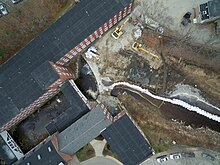
3116:
3113:
3111:
3108:
3103:
3064:
3061:
3058:
3055:
3052:
3051:
3047:
3044:Owned by the
3043:
3041:
3038:
3033:
2994:
2991:
2988:
2985:
2982:
2981:
2977:
2973:
2971:
2970:Peverly Brook
2968:
2963:
2924:
2921:
2918:
2916:
2913:
2912:
2908:
2906:
2903:
2898:
2859:
2856:
2853:
2850:
2847:
2846:
2843:
2841:
2840:Lamprey River
2838:Tributary to
2837:
2832:
2793:
2790:
2787:
2785:
2782:
2781:
2777:
2774:Owned by the
2773:
2771:
2770:Lamprey River
2768:
2763:
2724:
2721:
2718:
2715:
2712:
2711:
2707:
2705:
2702:
2697:
2658:
2655:
2652:
2649:
2646:
2645:
2642:
2637:
2598:
2595:
2592:
2590:
2587:
2586:
2583:
2581:
2573:
2534:
2531:
2528:
2526:
2523:
2522:
2518:
2516:
2513:
2508:
2469:
2466:
2463:
2460:
2457:
2456:
2450:
2411:
2408:
2405:
2402:
2399:
2398:
2394:
2385:
2346:
2343:
2340:
2337:
2334:
2333:
2330:
2328:
2323:
2322:Bellamy River
2315:
2276:
2273:
2270:
2267:
2264:
2263:
2260:
2258:
2255:
2253:
2250:
2245:
2239:Upper IPC Dam
2206:
2203:
2200:
2198:
2195:
2194:
2190:
2188:
2187:Millers River
2185:
2183:
2180:Tributary to
2179:
2174:
2135:
2132:
2129:
2126:
2123:
2122:
2118:
2116:
2115:Tannery Brook
2113:
2108:
2069:
2066:
2063:
2060:
2057:
2056:
2053:
2051:
2050:Suncook River
2048:
2043:
2004:
2001:
1998:
1995:
1992:
1991:
1987:
1985:
1982:Tributary to
1981:
1976:
1937:
1934:
1931:
1928:
1925:
1924:
1920:
1918:
1915:
1910:
1871:
1868:
1865:
1863:
1860:
1859:
1856:
1854:
1851:
1846:
1807:
1804:
1801:
1799:
1796:
1795:
1791:
1786:
1747:
1744:
1741:
1738:
1735:
1734:
1731:
1726:
1687:
1684:
1681:
1678:
1675:
1674:
1671:
1666:
1627:
1624:
1621:
1618:
1615:
1614:
1611:
1609:
1601:
1562:
1559:
1556:
1553:
1550:
1549:
1545:
1543:
1542:McQuade Brook
1540:
1535:
1496:
1493:
1490:
1487:
1484:
1483:
1480:
1478:
1475:
1470:
1431:
1428:
1425:
1422:
1419:
1418:
1414:
1412:
1409:
1404:
1365:
1362:
1359:
1356:
1353:
1352:
1349:
1347:
1344:
1339:
1300:
1297:
1294:
1292:
1289:
1288:
1284:
1282:
1277:
1274:
1269:
1230:
1227:
1224:
1221:
1218:
1217:
1213:
1211:
1208:
1203:
1164:
1161:
1158:
1155:
1152:
1151:
1147:
1145:
1140:
1137:
1132:
1093:
1090:
1087:
1084:
1081:
1080:
1076:
1074:
1073:Stevens Brook
1071:
1066:
1027:
1024:
1021:
1018:
1015:
1014:
1010:
1007:Owned by the
1006:
1004:
999:
996:
991:
952:
949:
946:
944:
941:
940:
936:
934:
933:Hubbard Brook
931:Tributary to
930:
925:
886:
883:
880:
877:
874:
873:
869:
867:
864:
859:
820:
817:
814:
811:
808:
807:
803:
801:
798:
793:
754:
751:
748:
745:
742:
741:
738:
733:
694:
691:
688:
686:
683:
682:
678:
676:
671:
663:
657:Pine Mill Dam
624:
621:
618:
615:
612:
611:
607:
605:
602:
597:
558:
555:
552:
549:
546:
545:
542:
537:
498:
495:
492:
489:
486:
485:
481:
476:
437:
434:
431:
429:
426:
425:
422:
420:
415:
407:
368:
365:
362:
359:
356:
355:
351:
347:
345:
342:
340:
337:Tributary to
336:
331:
325:Munn Pond Dam
292:
289:
286:
283:
280:
279:
275:
273:
270:
265:
226:
223:
220:
217:
214:
213:
210:
208:
205:
200:
161:
158:
155:
153:
150:
149:
145:
143:
138:
135:
130:
91:
88:
85:
82:
79:
78:
74:
71:
68:
65:
62:
59:
56:
55:
49:
47:
45:
41:
33:
29:
25:
24:Bellamy River
20:
16:
4712:Puerto Rico
4620:South Dakota
4610:Rhode Island
4605:Pennsylvania
4585:North Dakota
4559:
4344:14 September
4342:. Retrieved
4337:
4328:
4318:14 September
4316:. Retrieved
4312:
4302:
4292:14 September
4290:. Retrieved
4286:
4276:
4266:14 September
4264:. Retrieved
4260:
4250:
4240:14 September
4238:. Retrieved
4234:
4224:
4214:14 September
4212:. Retrieved
4208:
4198:
4188:14 September
4186:. Retrieved
4181:
4172:
4162:14 September
4160:. Retrieved
4152:
4143:
4133:14 September
4131:. Retrieved
4126:
4117:
4107:14 September
4105:. Retrieved
4101:
4091:
4081:12 September
4079:. Retrieved
4062:
4052:11 September
4050:. Retrieved
4048:. p. 32
4018:. Retrieved
4007:
3998:
3956:
3955:
3948:
3866:Oyster River
3610:Profile Lake
3514:Mohawk River
3390:Israel River
3204:
3203:
3196:
2704:Exeter River
2515:Branch River
1853:Riddle Brook
1477:Browns Brook
1276:Beaver Brook
885:Chesterfield
63:Year removed
44:been removed
37:
15:
4689:Territories
4535:Mississippi
4450:Connecticut
4129:. HigherGov
3927:Beech River
3906: /
3845: /
3790: /
3720: /
3675:Scott Brook
3654: /
3628:Fitzwilliam
3606:fish ladder
3579: /
3529:Francestown
3493: /
3431: /
3369: /
3298: /
3254:Watercourse
3180:Tioga River
3159: /
3089: /
3019: /
2949: /
2884: /
2818: /
2749: /
2683: /
2623: /
2580:Clark Brook
2559: /
2494: /
2436: /
2371: /
2301: /
2231: /
2160: /
2134:Fitzwilliam
2094: /
2029: /
1962: /
1896: /
1832: /
1772: /
1712: /
1652: /
1587: /
1521: /
1456: /
1411:Black Brook
1390: /
1325: /
1255: /
1210:Stony Brook
1189: /
1118: /
1052: /
1003:Sugar River
977: /
911: /
845: /
779: /
719: /
670:Clark Brook
649: /
604:Ferry Brook
583: /
523: /
462: /
393: /
317: /
251: /
186: /
116: /
69:Watercourse
4732:Categories
4650:Washington
4570:New Mexico
4565:New Jersey
4440:California
3990:References
3932:Saco River
3912: (
3893:71°08′22″W
3890:43°45′03″N
3851: (
3832:70°55′08″W
3829:43°07′51″N
3796: (
3777:70°58′35″W
3774:43°16′13″N
3726: (
3707:70°58′38″W
3704:43°16′25″N
3688:Gonic Dam
3660: (
3641:72°07′37″W
3638:42°45′18″N
3585: (
3566:71°40′49″W
3563:44°10′02″N
3499: (
3480:71°22′16″W
3477:44°52′36″N
3437: (
3418:71°35′57″W
3415:44°44′30″N
3375: (
3356:71°33′45″W
3353:44°29′06″N
3304: (
3285:72°28′53″W
3282:42°47′09″N
3165: (
3146:71°28′08″W
3143:43°27′08″N
3115:Saco River
3095: (
3076:71°17′55″W
3073:43°49′41″N
3025: (
3006:70°50′52″W
3003:43°02′12″N
2955: (
2936:70°50′32″W
2933:43°05′00″N
2890: (
2871:70°55′17″W
2868:43°08′35″N
2824: (
2805:71°11′20″W
2802:43°02′06″N
2755: (
2736:71°07′46″W
2733:43°02′25″N
2689: (
2670:70°56′40″W
2667:42°58′53″N
2647:Great Dam
2629: (
2610:70°55′54″W
2607:43°16′35″N
2565: (
2546:70°55′53″W
2543:43°16′15″N
2500: (
2481:71°01′34″W
2478:43°29′42″N
2468:Winchester
2442: (
2423:70°52′36″W
2420:43°10′44″N
2377: (
2358:70°52′30″W
2355:43°10′42″N
2307: (
2288:70°52′18″W
2285:43°10′35″N
2237: (
2218:71°44′32″W
2215:43°36′24″N
2191:Mill dam.
2182:Kemp Brook
2166: (
2147:72°10′19″W
2144:42°45′12″N
2100: (
2081:71°41′01″W
2078:43°20′32″N
2035: (
2016:71°24′27″W
2013:43°09′34″N
1968: (
1949:71°46′04″W
1946:42°49′46″N
1902: (
1883:71°29′36″W
1880:42°51′37″N
1838: (
1819:71°32′33″W
1816:42°57′26″N
1778: (
1759:71°28′56″W
1756:42°58′06″N
1746:Manchester
1718: (
1699:71°28′52″W
1696:42°58′04″N
1686:Manchester
1658: (
1639:71°28′53″W
1636:42°58′08″N
1626:Manchester
1593: (
1574:71°28′52″W
1571:42°58′10″N
1561:Manchester
1527: (
1508:71°31′25″W
1505:42°54′20″N
1462: (
1443:71°26′55″W
1440:43°06′31″N
1396: (
1377:71°28′45″W
1374:43°00′37″N
1364:Manchester
1331: (
1312:71°18′04″W
1309:43°17′28″N
1299:Pittsfield
1261: (
1242:71°17′57″W
1239:42°54′06″N
1195: (
1176:72°03′28″W
1173:42°49′16″N
1124: (
1105:71°50′34″W
1102:43°09′55″N
1058: (
1039:72°21′05″W
1036:43°23′15″N
983: (
964:72°07′51″W
961:43°33′13″N
917: (
898:72°28′09″W
895:42°52′16″N
851: (
832:71°35′44″W
829:44°46′39″N
800:Cold River
785: (
766:72°25′07″W
763:43°07′49″N
725: (
706:71°59′52″W
703:44°05′24″N
655: (
636:72°01′30″W
633:44°05′21″N
589: (
570:72°14′32″W
567:42°58′32″N
529: (
510:72°23′00″W
507:42°46′36″N
497:Winchester
468: (
449:72°28′14″W
446:42°47′16″N
399: (
380:72°19′41″W
377:42°52′17″N
323: (
304:71°11′16″W
301:44°44′07″N
257: (
238:71°38′16″W
235:44°14′32″N
192: (
173:71°53′31″W
170:44°12′25″N
137:Judd Brook
122: (
103:71°46′24″W
100:44°08′46″N
42:that have
4660:Wisconsin
4625:Tennessee
4530:Minnesota
4505:Louisiana
4020:25 August
3751:Rochester
3728:Gonic Dam
3553:Franconia
3467:Colebrook
3405:Stratford
3343:Lancaster
3257:Watershed
2993:Greenland
2923:Newington
2691:Great Dam
2597:Rochester
2533:Rochester
1870:Merrimack
1026:Claremont
693:Haverhill
225:Bethlehem
72:Watershed
4645:Virginia
4595:Oklahoma
4575:New York
4550:Nebraska
4540:Missouri
4525:Michigan
4515:Maryland
4500:Kentucky
4480:Illinois
4455:Delaware
4445:Colorado
4435:Arkansas
4009:Figshare
3614:stocking
3272:Hinsdale
3251:Location
2068:Boscawen
2003:Pembroke
1430:Hooksett
1092:Henniker
951:Grantham
819:Columbia
436:Hinsdale
66:Location
4665:Wyoming
4640:Vermont
4545:Montana
4485:Indiana
4465:Georgia
4460:Florida
4430:Arizona
4420:Alabama
4153:FWS.gov
3880:Ossipee
3133:Belmont
2792:Raymond
2205:Bristol
1806:Bedford
1495:Bedford
1163:Jaffrey
753:Walpole
367:Swanzey
4600:Oregon
4555:Nevada
4495:Kansas
4470:Hawaii
4425:Alaska
4413:States
3819:Durham
3260:Notes
2858:Durham
2723:Epping
2657:Exeter
1936:Wilton
160:Lisbon
90:Easton
75:Notes
60:Height
4630:Texas
4510:Maine
4475:Idaho
4071:(PDF)
4042:(PDF)
3815:2024
3764:Gonic
3694:Gonic
3624:2024
3525:2024
3463:2023
3401:2023
3268:2024
3129:2004
3059:2003
2989:2009
2919:2021
2854:2019
2788:2010
2719:2011
2653:2016
2593:2005
2529:2005
2464:2014
2410:Dover
2406:2019
2345:Dover
2341:2018
2275:Dover
2271:2004
2201:2008
2130:2014
2064:2015
1999:2011
1932:2012
1866:2008
1802:2014
1742:2016
1682:2016
1622:2016
1557:2016
1491:2012
1426:2010
1360:2009
1295:2013
1229:Derry
1225:2012
1159:2015
1088:2004
1022:2011
947:2013
881:2019
815:2022
749:2003
689:2018
619:2019
557:Keene
553:2019
493:2002
432:2001
363:2010
291:Errol
287:2019
221:2020
156:2008
86:2017
32:Dover
4702:Guam
4635:Utah
4590:Ohio
4490:Iowa
4346:2023
4320:2023
4294:2023
4268:2023
4242:2023
4216:2023
4190:2023
4164:2023
4135:2023
4109:2023
4083:2023
4054:2023
4022:2023
3964:KML
3245:Dam
3212:KML
57:Dam
30:in
26:at
4734::
4336:.
4311:.
4285:.
4259:.
4233:.
4207:.
4180:.
4155:.
4151:.
4125:.
4100:.
4073:.
4044:.
4030:^
4012:.
4006:.
3616:.
3048:.
2978:.
2778:.
2395:.
1011:.
352:.
4398:e
4391:t
4384:v
4348:.
4322:.
4296:.
4270:.
4244:.
4218:.
4192:.
4166:.
4137:.
4111:.
4085:.
4056:.
4024:.
3916:)
3855:)
3800:)
3730:)
3664:)
3589:)
3503:)
3441:)
3379:)
3308:)
3169:)
3099:)
3029:)
2959:)
2894:)
2828:)
2759:)
2693:)
2633:)
2569:)
2504:)
2446:)
2381:)
2311:)
2241:)
2170:)
2104:)
2039:)
1972:)
1906:)
1842:)
1782:)
1722:)
1662:)
1597:)
1531:)
1466:)
1400:)
1335:)
1265:)
1199:)
1128:)
1062:)
987:)
921:)
855:)
789:)
729:)
659:)
593:)
533:)
472:)
403:)
327:)
261:)
196:)
126:)
34:.
Text is available under the Creative Commons Attribution-ShareAlike License. Additional terms may apply.