62:
74:
86:
1470:
50:
under the jurisdiction of an upper-tier municipality such as
Hastings County and thus, are outside of the geographic limits of Hastings County for municipal purposes. For geographic purposes however, Quinte West and Belleville are within the geographic limits of Hastings County. The cities form part
1333:
1313:
1273:
1420:
1238:
1278:
1283:
1186:
1293:
1318:
1308:
1410:
1338:
1248:
73:
1425:
1405:
1400:
1374:
1223:
1415:
1364:
1323:
1288:
1263:
61:
1359:
1354:
1328:
1298:
1268:
1493:
1395:
1303:
1258:
1233:
1228:
1218:
1213:
1498:
1379:
1369:
1243:
1179:
341:
85:
1451:
44:
1430:
1473:
1446:
1172:
179:
from
Belleville Road to York Road; a.k.a. Dundas Street in Trenton, Dundas Street in Belleville and Dundas Street in Deseronto
884:
461:
36:
1019:
588:
1124:
473:
24:
1076:
969:
30:
1115:
1010:
987:
938:
918:
898:
814:
748:
674:
493:
477:
407:
362:
311:
278:
252:
176:
697:
654:
649:
582:
382:
357:
172:
1456:
141:
52:
18:
1487:
157:
1195:
1146:
611:
1164:
1199:
1168:
1148:
O. Reg. 180/03: Division of
Ontario into Geographic Areas, s. 2
43:
The City of Quinte West and the City of
Belleville are
168:
Trenton, Belleville, Milltown, Marysville, Deseronto
1439:
1388:
1347:
1206:
79:
Diagram of a shield for
Wollaston Township Road 620
316:Anson, Stirling, West Huntingdon Station, Moira
283:Blessington, Halston, Chisholms Mills, Roslin
1180:
8:
894:Trenton, Frankford, River Valley, Stirling
390:Hazzards Corners, Rimington, Allen, Cooper
1469:
1187:
1173:
1165:
726:Chisholms Mills, Moneymore, Coulters Hill
415:Stoco, Larkins, Farrell Corners, Marlbank
1029:Formerly part of King's Highway 62
103:
1138:
57:
231:Wooler, Stockdale, Frankford, Foxboro
442:Foxboro, Stirling, Bonarlaw, Marmora
67:Shield for Tyendinaga Township Road 2
7:
260:Blessington, Read, Albert, Ebenezer
702:Lennox and Addington County limits
340:This road is the boundary between
14:
202:Trenton, Glenn Miller, Frankford
1468:
537:College Street East, Belleville
84:
72:
60:
1447:List of county roads in Ontario
923:Spring Brook, Crookston, Tweed
543:Belleville, Belleville Airport
1334:Stormont, Dundas and Glengarry
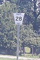
91:Shield for Quinte West Road 28
1:
1494:Lists of Ontario county roads
1112:Peterborough County Road 620
1066:Peterborough County Road 504
1499:Transport in Hastings County
1069:Wollaston Township Road 620
1026:Maynooth, Maple Leaf, Purdy
885:Prince Edward County Road 33
1007:Peterson Colonization Road
462:Tyendinaga Mohawk Territory
1515:
476:at Exit 566; continues as
116:Northern/Eastern Terminus
113:Southern/Western Terminus
45:single-tier municipalities
1465:
132:Wallbridge-Loyalist Road
877:Frankford-Stirling Road
37:Hastings County, Ontario
19:numbered municipal roads
1151:, Government of Ontario
822:minor connecting route
344:and Hastings counties.
1047:Renfrew County limits
1020:Renfrew County Road 62
869:Trenton-Frankford Road
1125:Secondary Highway 620
1077:Secondary Highway 504
427:Foxboro-Stirling Road
196:Dixon Drive, Trenton
1474:List of County roads
1314:Prescott and Russell
1279:Lennox and Addington
1039:Kamaniskeg Lake Road
946:Cosy Cove, Sulphide
646:St. Lawrence Street
1452:Provincial highways
1274:Leeds and Grenville
995:Phillipston, Moira
855:Carrying Place Road
576:Queensborough Road
119:Settlements served
859:Dundas Street West
777:minor rural route
587:Hazzards Corners,
474:King's Highway 401
272:Shannonville Road
257:Scott's Mill Road
193:Riverside Parkway
162:Stoney Point Road
16:This is a list of
1481:
1480:
1130:
1129:
1120:Coe Hill, Ormsby
1116:King's Highway 62
1053:minor bush route
1044:District Road 62
1023:
1011:King's Highway 62
988:King's Highway 37
984:Phillipston Road
943:Otter Creek Road
939:King's Highway 37
919:King's Highway 37
910:Spring Brook Road
899:King's Highway 33
897:Formerly part of
888:
815:King's Highway 62
749:King's Highway 37
675:King's Highway 49
494:King's Highway 49
478:King's Highway 49
408:King's Highway 37
387:Bannockburn Road
363:King's Highway 62
312:King's Highway 37
297:Campbellford Road
279:King's Highway 37
253:King's Highway 37
191:Glenn Miller Road
177:King's Highway 49
122:Additional Notes
107:Municipal Road #
1506:
1472:
1471:
1457:Roads in Ontario
1189:
1182:
1175:
1166:
1159:
1158:
1157:
1156:
1143:
1017:
882:
880:Old Portage Road
853:Loyalist Parkway
838:Cold Water Road
765:New Wooler Road
698:King's Highway 7
671:Belleville Road
655:King's Highway 7
650:King's Highway 7
583:King's Highway 7
534:Airport Parkway
513:Point Anne Road
383:King's Highway 7
358:King's Highway 7
243:Blessington Road
173:King's Highway 2
142:Loyalist College
104:
88:
76:
64:
51:of the county's
1514:
1513:
1509:
1508:
1507:
1505:
1504:
1503:
1484:
1483:
1482:
1477:
1461:
1435:
1401:Greater Sudbury
1389:Municipal roads
1384:
1343:
1202:
1193:
1163:
1162:
1154:
1152:
1145:
1144:
1140:
1135:
1040:
1016:
966:County Road 28
963:County Road 33
959:
958:County Road 40
912:Crookston Road
911:
881:
876:
874:
872:
870:
868:
866:
864:
862:
861:Division Street
860:
858:
857:Dufferin Avenue
856:
854:
808:Vermilyea Road
793:County Road 31
771:County Road 40
745:County Road 30
742:Tank Farm Road
741:
739:
723:County Road 32
717:Moneymore Road
679:County Road 10
608:County Road 22
579:County Road 12
561:County Road 14
457:
456:Waddingham Road
455:
454:Marysville Road
439:Vansickle Road
432:
430:
428:
403:
367:Deloro, Malone
328:Deseronto Road
308:Wingfield Road
304:
302:
300:
298:
296:
249:Deseronto Road
248:
246:
244:
228:County Road 41
225:County Road 28
221:
219:
217:
215:
199:County Road 33
192:
190:
165:County Road 10
156:
138:County Road 14
102:
96:
92:
89:
80:
77:
68:
65:
53:census division
12:
11:
5:
1512:
1510:
1502:
1501:
1496:
1486:
1485:
1479:
1478:
1466:
1463:
1462:
1460:
1459:
1454:
1449:
1443:
1441:
1437:
1436:
1434:
1433:
1428:
1423:
1418:
1416:Kawartha Lakes
1413:
1408:
1403:
1398:
1392:
1390:
1386:
1385:
1383:
1382:
1377:
1372:
1367:
1362:
1357:
1351:
1349:
1348:Regional roads
1345:
1344:
1342:
1341:
1336:
1331:
1326:
1321:
1316:
1311:
1306:
1301:
1296:
1294:Northumberland
1291:
1286:
1281:
1276:
1271:
1266:
1261:
1256:
1251:
1246:
1241:
1236:
1231:
1226:
1221:
1216:
1210:
1208:
1204:
1203:
1196:Numbered roads
1194:
1192:
1191:
1184:
1177:
1169:
1161:
1160:
1137:
1136:
1134:
1131:
1128:
1127:
1121:
1118:
1113:
1110:
1107:
1101:
1100:
1098:
1095:
1092:
1089:
1086:
1080:
1079:
1073:
1070:
1067:
1064:
1061:
1055:
1054:
1051:
1048:
1045:
1042:
1037:
1031:
1030:
1027:
1024:
1018:(continues as
1013:
1008:
1005:
999:
998:
996:
993:
992:County Road 8
990:
985:
982:
976:
975:
973:
967:
964:
961:
956:
950:
949:
947:
944:
941:
936:
935:Sulphide Road
933:
927:
926:
924:
921:
916:
915:Rylstone Road
913:
908:
902:
901:
895:
892:
891:County Road 8
889:
883:(continues as
878:
867:Trenton Street
851:
845:
844:
842:
839:
836:
835:County Road 3
833:
830:
824:
823:
820:
817:
812:
811:County Road 1
809:
806:
800:
799:
797:
794:
791:
790:County Road 2
788:
787:Sidney Street
785:
779:
778:
775:
772:
769:
766:
763:
757:
756:
754:
751:
746:
743:
740:Cannifton Road
738:Maitland Drive
736:
730:
729:
727:
724:
721:
720:County Road 7
718:
715:
709:
708:
706:
703:
700:
695:
692:
686:
685:
683:
680:
677:
672:
669:
663:
662:
660:
657:
652:
647:
644:
638:
637:
635:
632:
631:County Road 1
629:
628:County Road 4
626:
625:Hamilton Road
623:
617:
616:
614:
609:
606:
605:County Road 2
603:
600:
594:
593:
591:
585:
580:
577:
574:
568:
567:
565:
562:
559:
558:County Road 8
556:
555:Wellmans Road
553:
547:
546:
544:
541:
540:County Road 7
538:
535:
532:
526:
525:
523:
520:
519:County Road 2
517:
516:Lane Crescent
514:
511:
505:
504:
502:
499:
498:County Road 2
496:
491:
490:Bayshore Road
488:
482:
481:
470:
467:
466:County Road 6
464:
459:
452:
446:
445:
443:
440:
437:
436:County Road 5
434:
429:Forsyth Street
425:
419:
418:
416:
413:
410:
405:
400:
394:
393:
391:
388:
385:
380:
377:
371:
370:
368:
365:
360:
355:
352:
346:
345:
338:
335:
334:Kennelly Road
332:
331:County Road 2
329:
326:
320:
319:
317:
314:
309:
306:
293:
287:
286:
284:
281:
276:
275:County Road 2
273:
270:
264:
263:
261:
258:
255:
250:
241:
235:
234:
232:
229:
226:
223:
218:Frankford Road
212:
206:
205:
203:
200:
197:
194:
187:
181:
180:
169:
166:
163:
160:
153:
147:
146:
144:
139:
136:
135:County Road 2
133:
130:
124:
123:
120:
117:
114:
111:
110:Local Name(s)
108:
101:
98:
94:
93:
90:
83:
81:
78:
71:
69:
66:
59:
13:
10:
9:
6:
4:
3:
2:
1511:
1500:
1497:
1495:
1492:
1491:
1489:
1476:
1475:
1464:
1458:
1455:
1453:
1450:
1448:
1445:
1444:
1442:
1438:
1432:
1429:
1427:
1424:
1422:
1419:
1417:
1414:
1412:
1409:
1407:
1404:
1402:
1399:
1397:
1394:
1393:
1391:
1387:
1381:
1378:
1376:
1373:
1371:
1368:
1366:
1363:
1361:
1358:
1356:
1353:
1352:
1350:
1346:
1340:
1337:
1335:
1332:
1330:
1327:
1325:
1322:
1320:
1319:Prince Edward
1317:
1315:
1312:
1310:
1307:
1305:
1302:
1300:
1297:
1295:
1292:
1290:
1287:
1285:
1282:
1280:
1277:
1275:
1272:
1270:
1267:
1265:
1262:
1260:
1257:
1255:
1252:
1250:
1247:
1245:
1242:
1240:
1237:
1235:
1232:
1230:
1227:
1225:
1222:
1220:
1217:
1215:
1212:
1211:
1209:
1205:
1201:
1197:
1190:
1185:
1183:
1178:
1176:
1171:
1170:
1167:
1150:
1149:
1142:
1139:
1132:
1126:
1122:
1119:
1117:
1114:
1111:
1108:
1106:
1103:
1102:
1099:
1096:
1093:
1091:Boulter Road
1090:
1087:
1085:
1082:
1081:
1078:
1074:
1071:
1068:
1065:
1062:
1060:
1057:
1056:
1052:
1049:
1046:
1043:
1041:Siberia Road
1038:
1036:
1033:
1032:
1028:
1025:
1021:
1014:
1012:
1009:
1006:
1004:
1001:
1000:
997:
994:
991:
989:
986:
983:
981:
978:
977:
974:
971:
968:
965:
962:
957:
955:
952:
951:
948:
945:
942:
940:
937:
934:
932:
929:
928:
925:
922:
920:
917:
914:
909:
907:
904:
903:
900:
896:
893:
890:
886:
879:
852:
850:
847:
846:
843:
840:
837:
834:
832:Napanee Road
831:
829:
826:
825:
821:
818:
816:
813:
810:
807:
805:
802:
801:
798:
795:
792:
789:
786:
784:
781:
780:
776:
773:
770:
767:
764:
762:
759:
758:
755:
752:
750:
747:
744:
737:
735:
732:
731:
728:
725:
722:
719:
716:
714:
711:
710:
707:
704:
701:
699:
696:
694:Flinton Road
693:
691:
688:
687:
684:
681:
678:
676:
673:
670:
668:
665:
664:
661:
658:
656:
653:
651:
648:
645:
643:
640:
639:
636:
633:
630:
627:
624:
622:
619:
618:
615:
613:
610:
607:
604:
601:
599:
596:
595:
592:
590:
589:Queensborough
586:
584:
581:
578:
575:
573:
570:
569:
566:
563:
560:
557:
554:
552:
549:
548:
545:
542:
539:
536:
533:
531:
528:
527:
524:
521:
518:
515:
512:
510:
507:
506:
503:
500:
497:
495:
492:
489:
487:
484:
483:
479:
475:
471:
468:
465:
463:
460:
458:Melrose Road
453:
451:
448:
447:
444:
441:
438:
435:
433:Cordova Road
426:
424:
421:
420:
417:
414:
411:
409:
406:
404:Napanee Road
402:Marlbank Road
401:
399:
396:
395:
392:
389:
386:
384:
381:
378:
376:
373:
372:
369:
366:
364:
361:
359:
356:
353:
351:
348:
347:
343:
339:
336:
333:
330:
327:
325:
322:
321:
318:
315:
313:
310:
307:
294:
292:
289:
288:
285:
282:
280:
277:
274:
271:
269:
266:
265:
262:
259:
256:
254:
251:
242:
240:
237:
236:
233:
230:
227:
224:
220:Ashley Street
214:County Road 5
213:
211:
208:
207:
204:
201:
198:
195:
189:Sidney Street
188:
186:
183:
182:
178:
174:
170:
167:
164:
161:
159:
158:Dundas Street
155:Old Highway 2
154:
152:
149:
148:
145:
143:
140:
137:
134:
131:
129:
126:
125:
121:
118:
115:
112:
109:
106:
105:
99:
97:
87:
82:
75:
70:
63:
58:
56:
54:
49:
46:
41:
39:
38:
33:
32:
27:
26:
21:
20:
1467:
1396:Chatham-Kent
1309:Peterborough
1253:
1207:County roads
1153:, retrieved
1147:
1141:
1109:Highway 620
1104:
1094:Coulas Road
1088:Highway 517
1083:
1063:Highway 504
1058:
1034:
1015:Schweig Road
1002:
979:
960:Wooler Road
953:
930:
905:
871:Trent Street
865:Water Street
863:Front Street
848:
827:
803:
782:
768:Dalmas Road
760:
733:
712:
689:
666:
641:
620:
597:
571:
550:
529:
508:
485:
449:
422:
412:Youngs Road
397:
379:Cooper Road
374:
354:Deloro Road
349:
323:
299:Front Street
290:
267:
247:Enright Road
238:
222:Mudcat Road
209:
184:
150:
127:
95:
47:
42:
35:
29:
23:
17:
15:
970:Highway 401
875:River Drive
873:Mill Street
796:Belleville
682:Marysville
612:CFB Trenton
522:Point Anne
472:Intersects
431:Main Street
305:Moira Road
301:Mill Street
295:Hoards Road
216:Mill Street
25:Quinte West
1488:Categories
1339:Wellington
1249:Haliburton
1155:2020-06-24
1133:References
1097:Craigmont
753:Cannifton
602:RCAF Road
501:Deseronto
337:Deseronto
303:Ridge Road
175:; follows
31:Belleville
1406:Haldimand
1284:Middlesex
1239:Frontenac
1123:Formerly
1075:Formerly
972:Exit 522
841:Marlbank
469:Lonsdale
245:Read Road
1440:See also
1421:Kingston
1411:Hamilton
1375:Waterloo
1254:Hastings
1224:Dufferin
705:Elzevir
634:Trenton
564:Wellman
1426:Muskoka
1365:Niagara
1324:Renfrew
1289:Norfolk
1264:Lambton
1200:Ontario
171:Former
1431:Ottawa
1360:Halton
1355:Durham
1329:Simcoe
1299:Oxford
1269:Lanark
659:Madoc
342:Lennox
1304:Perth
1259:Huron
1234:Essex
1229:Elgin
1219:Bruce
1214:Brant
1072:none
1050:none
819:none
774:none
1380:York
1370:Peel
1244:Grey
100:List
34:and
1198:in
1105:620
1084:517
1059:504
48:not
22:in
1490::
1035:69
1003:62
980:41
954:40
931:39
906:38
849:33
828:32
804:31
783:30
761:28
734:27
713:26
690:25
667:24
642:23
621:22
598:21
572:20
551:19
530:18
509:17
486:16
480:.
450:15
423:14
398:13
375:12
350:11
324:10
55:.
40:.
28:,
1188:e
1181:t
1174:v
1022:)
887:)
291:8
268:7
239:6
210:5
185:4
151:2
128:1
Text is available under the Creative Commons Attribution-ShareAlike License. Additional terms may apply.