53:
247:
277:
581:
567:
60:
502:. It protects a still largely natural example of a high-elevation lake, most of which have been cleared or severely modified in the region. The lagoon fills a natural depression in the tableland landscape; a former agricultural drainage ditch has been filled in to restore its original water depth of about 2 metres (6 ft 7 in) when full. The vegetation includes
284:
254:
484:
The Little
Llangothlin Nature Reserve has some of the last high-elevation freshwater lagoons on basalt soil on the New England Tableland. The reserve is situated in an area that has lost most of its vegetation to create arable land. It thus serves as a refuge for numerous species of birds, mammals,
2827:
1132:
1291:
1248:
52:
246:
157:
809:
1284:
1001:
1539:
97:
2837:
2817:
1277:
1064:
1170:
464:
The reserve contains the 120-hectare (300-acre) Little
Llangothlin Lagoon, part of the smaller Billy Bung Lagoon, and was established in 1979 under the
2832:
2108:
1938:
313:
802:
1185:
857:
276:
2802:
438:
1225:
1069:
1029:
1006:
2842:
2807:
2778:
2426:
1367:
1300:
795:
596:
219:
2822:
834:
818:
758:
2186:
1602:
1351:
360:
2343:
1715:
1513:
1493:
1180:
986:
948:
473:
453:. The 257-hectare (640-acre) reserve is situated approximately 10 kilometres (6.2 mi) north-east of the rural locality of
1983:
1238:
862:
38:
2656:
2503:
2447:
1691:
750:
716:
687:
627:
2812:
2764:
2718:
2519:
2437:
2284:
2239:
1669:
1243:
1117:
826:
454:
90:
83:
2645:
2489:
2472:
2244:
2163:
2074:
2028:
1726:
1710:
1356:
1039:
852:
2754:
2713:
2542:
2042:
1991:
1978:
1761:
1696:
1561:
1472:
1418:
1102:
907:
741:
2797:
2759:
2738:
2679:
2629:
2514:
2386:
2155:
2138:
1865:
1477:
1439:
1378:
498:
on the New
England Plateau at an elevation of 1,360 metres (4,460 ft) above sea level, and is surrounded by
2640:
2621:
2411:
2406:
2270:
2121:
1967:
1831:
1553:
1431:
1426:
1122:
953:
619:
2749:
2421:
2330:
2222:
2205:
1634:
872:
518:
442:
679:
2442:
2416:
2372:
2335:
2191:
2116:
2023:
1447:
1215:
1137:
1112:
1054:
991:
572:
458:
708:
168:
2604:
1482:
1160:
1049:
522:
534:
2085:
1195:
1092:
930:
1200:
1034:
958:
917:
768:
586:
530:
1269:
1165:
1152:
925:
887:
754:
653:
469:
184:
1084:
580:
507:
499:
1107:
1074:
978:
897:
867:
844:
780:
526:
446:
29:
1253:
1127:
968:
538:
434:
367:
355:
2791:
1258:
1210:
996:
468:. In 1996 the reserve was designated a wetland of international importance under the
345:
1233:
1142:
1097:
1059:
1044:
877:
1205:
963:
902:
892:
940:
562:
503:
428:
328:
315:
112:
99:
2828:
New South Wales places listed on the defunct
Register of the National Estate
1190:
1175:
1011:
787:
542:
450:
472:. It, with the adjacent area of Bagot Road, is also listed on Australia’s
1021:
514:
489:
550:
431:
492:
553:. A 4.8-kilometre (3.0 mi) walking track encircles the lagoon.
680:"Little Llangothlin Nature Reserve: Plants, animals and landscape"
648:
511:
546:
495:
1273:
791:
59:
743:
620:"Little Llangothlin Nature Reserve: Park management"
537:
are found there. The wetlands of the reserve form a
457:, and some 20 kilometres (12 mi) north-east of
2703:
2459:
2323:
1931:
1770:
1681:
1456:
1396:
1308:
1224:
1151:
1083:
1020:
977:
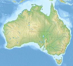
939:
916:
843:
825:
413:
405:
397:
389:
381:
377:
366:
354:
344:
305:
234:
215:
199:
191:
182:
175:
163:
151:
143:
128:
89:
77:
23:
283:
253:
1002:Coorong and Lakes Alexandrina and Albert Wetland
306:
1285:
803:
8:
18:Protected area in New South Wales, Australia
229:Freshwater, high altitude lake in Australia
1292:
1278:
1270:
810:
796:
788:
231:
20:
545:as well as supporting several species of
1133:Port Phillip Bay and Bellarine Peninsula
466:NSW National Parks and Wildlife Act 1974
608:
158:NSW National Parks and Wildlife Service
776:
766:
674:
672:
1035:Cape Barren Island east coast lagoons
614:
612:
198:
190:
181:
41:IV (habitat/species management area)
7:
2838:Protected areas established in 1979
709:"Little Llangothlin Nature Reserve"
649:"Little Llangothlin Nature Reserve"
401:1.20 km (0.46 sq mi)
2818:Nature reserves in New South Wales
2779:Protected areas of New South Wales
1301:Nature reserves of New South Wales
713:Office of Environment and Heritage
684:Office of Environment and Heritage
624:Office of Environment and Heritage
597:Protected areas of New South Wales
147:2.57 km (1.0 sq mi)
14:
1254:Hosnies Spring (Christmas Island)
425:Little Llangothlin Nature Reserve
169:Little Llangothlin Nature Reserve
66:Little Llangothlin Nature Reserve
25:Little Llangothlin Nature Reserve
2833:1979 establishments in Australia
579:
565:
282:
275:
252:
245:
58:
51:
987:Banrock Station Wetland Complex
474:Register of the National Estate
412:
404:
396:
388:
380:
1171:Forrestdale and Thomsons Lakes
863:Fivebough and Tuckerbil Swamps
409:2 m (6 ft 7 in)
350:Freshwater, high altitude lake
1:
1249:Elizabeth and Middleton Reefs
751:Government of New South Wales
717:Government of New South Wales
688:Government of New South Wales
628:Government of New South Wales
1244:The Dales (Christmas Island)
827:Australian Capital Territory
417:1,360 m (4,460 ft)
2803:Wetlands of New South Wales
1040:Interlaken Lakeside Reserve
393:1.17 km (0.73 mi)
385:1.38 km (0.86 mi)
266:Show map of New South Wales
2859:
2460:Southeast & Tablelands
2233:South West Solitary Island
2202:North-West Solitary Island
1457:Hunter & Central Coast
1186:Lakes Argyle and Kununurra
1103:Edithvale-Seaford Wetlands
2843:Armidale Regional Council
2808:Ramsar sites in Australia
2776:
2473:Barunguba Montague Island
2109:Julian Rocks Nguthungulli
1939:Andrew Johnston Big Scrub
1075:Pittwater–Orielton Lagoon
883:Little Llangothlin Lagoon
819:Ramsar sites in Australia
656:Sites Information Service
485:amphibians and reptiles.
290:Little Llangothlin Lagoon
260:Little Llangothlin Lagoon
239:
235:Little Llangothlin Lagoon
211:
207:
46:
36:
2823:Lakes of New South Wales
1309:Central West & Orana
1566:Little Broughton Island
873:Hunter Estuary Wetlands
519:New England peppermints
437:that is located on the
2704:Sydney & Surrounds
1876:Mother Of Ducks Lagoon
1771:New England-North West
1487:Brimbin Nature Reserve
1138:Western District Lakes
1065:Lower Ringarooma River
1055:Little Waterhouse Lake
992:Bool and Hacks Lagoons
858:Central Murray Forests
573:New South Wales portal
2236:Split Solitary Island
2199:North Solitary Island
2143:Little Pimlico Island
1819:Doctors Nose Mountain
1216:Vasse-Wonnerup System
1161:Becher Point Wetlands
296:Show map of Australia
1682:Illawarra-Shoalhaven
1490:Bugan Nature Reserve
1226:External territories
1201:Peel-Yalgorup System
1196:Ord River Floodplain
1118:Hattah-Kulkyne Lakes
931:Kakadu National Park
488:The reserve lies on
153:Managing authorities
79:Nearest town or city
2813:Northern Tablelands
2427:South West Woodland
2403:Murrumbidgee Valley
2177:Muckleewee Mountain
1368:South West Woodland
439:Northern Tablelands
325: /
109: /
2366:Flagstaff Memorial
1900:Stony Batter Creek
1861:Little Llangothlin
1825:Dthinna Dthinnawan
1239:Coral Sea Reserves
1191:Muir-Byenup System
1181:Lake Warden System
959:Great Sandy Strait
918:Northern Territory
753:. 4 October 1998.
587:environment portal
541:for many kinds of
531:Hairy Anchor Plant
329:30.083°S 151.783°E
220:Protected areas of
200:Reference no.
132:December 1979
113:30.083°S 151.783°E
2785:
2784:
2684:Wollondilly River
2530:Cullendulla Creek
2438:The Charcoal Tank
2292:Willi Willi Caves
2187:Muttonbird Island
2020:Cooperabung Creek
1975:Bridal Veil Falls
1734:Narrawallee Creek
1352:Macquarie Marshes
1267:
1266:
1166:Eighty Mile Beach
1153:Western Australia
1007:Piccaninnie Ponds
949:Bowling Green Bay
926:Cobourg Peninsula
888:Macquarie Marshes
500:pastoral farmland
470:Ramsar Convention
421:
420:
414:Surface elevation
227:
226:
2850:
2798:IUCN Category IV
2664:Tollgate Islands
2344:Boginderra Hills
2249:Tabbimoble Swamp
2008:Clarence Estuary
1996:Burnt-Down Scrub
1842:Guy Fawkes River
1716:Cambewarra Range
1625:Spectacle Island
1514:Coocumbac Island
1494:Burning Mountain
1466:Bandicoot Island
1294:
1287:
1280:
1271:
1143:Western Port Bay
954:Currawinya Lakes
812:
805:
798:
789:
784:
778:
774:
772:
764:
748:
728:
727:
725:
723:
705:
699:
698:
696:
694:
676:
667:
666:
664:
662:
645:
639:
638:
636:
634:
616:
589:
584:
583:
575:
570:
569:
568:
535:Austral Toadflax
517:. Trees include
340:
339:
337:
336:
335:
334:-30.083; 151.783
330:
326:
323:
322:
321:
318:
308:
297:
286:
285:
279:
267:
256:
255:
249:
232:
171:
154:
139:
137:
124:
123:
121:
120:
119:
118:-30.083; 151.783
114:
110:
107:
106:
105:
102:
80:
62:
61:
55:
32:
26:
21:
2858:
2857:
2853:
2852:
2851:
2849:
2848:
2847:
2788:
2787:
2786:
2781:
2772:
2699:
2480:Bell Bird Creek
2455:
2324:Riverina-Murray
2319:
2298:Woodford Island
2149:Marshalls Creek
2056:Fishermans Bend
1984:Brunswick Heads
1927:
1879:Mount Mackenzie
1766:
1743:Saltwater Swamp
1720:Comerong Island
1677:
1654:Wamberal Lagoon
1642:Tingira Heights
1613:Saratoga Island
1593:One Tree Island
1452:
1392:
1304:
1298:
1268:
1263:
1220:
1147:
1123:Kerang Wetlands
1113:Gunbower Forest
1108:Gippsland Lakes
1079:
1070:Moulting Lagoon
1016:
979:South Australia
973:
935:
912:
898:Narran Wetlands
868:Gwydir Wetlands
845:New South Wales
839:
821:
816:
775:
765:
761:
746:
740:
737:
732:
731:
721:
719:
707:
706:
702:
692:
690:
678:
677:
670:
660:
658:
647:
646:
642:
632:
630:
618:
617:
610:
605:
593:
592:
585:
578:
571:
566:
564:
559:
482:
447:New South Wales
370: countries
333:
331:
327:
324:
319:
316:
314:
312:
311:
301:
300:
299:
298:
295:
294:
293:
292:
291:
287:
270:
269:
268:
265:
264:
263:
262:
261:
257:
230:
222:New South Wales
221:
187:
167:
152:
135:
133:
117:
115:
111:
108:
103:
100:
98:
96:
95:
78:
73:
72:
71:
70:
69:
68:
67:
63:
42:
30:New South Wales
28:
27:
24:
19:
12:
11:
5:
2856:
2854:
2846:
2845:
2840:
2835:
2830:
2825:
2820:
2815:
2810:
2805:
2800:
2790:
2789:
2783:
2782:
2777:
2774:
2773:
2771:
2770:
2767:
2762:
2757:
2752:
2747:
2744:
2741:
2736:
2733:
2730:
2727:
2724:
2721:
2716:
2711:
2707:
2705:
2701:
2700:
2698:
2697:
2694:
2691:
2688:
2685:
2682:
2677:
2674:
2671:
2668:
2665:
2662:
2659:
2657:Strike-a-Light
2654:
2651:
2648:
2643:
2638:
2635:
2632:
2627:
2624:
2619:
2616:
2613:
2610:
2607:
2602:
2599:
2596:
2593:
2592:Mount Clifford
2590:
2587:
2584:
2581:
2578:
2575:
2572:
2569:
2566:
2563:
2560:
2559:Hattons Corner
2557:
2554:
2551:
2548:
2545:
2540:
2537:
2534:
2531:
2528:
2525:
2522:
2517:
2512:
2509:
2506:
2504:Broulee Island
2501:
2498:
2495:
2492:
2487:
2484:
2481:
2478:
2475:
2470:
2467:
2463:
2461:
2457:
2456:
2454:
2453:
2450:
2448:Wiesners Swamp
2445:
2440:
2435:
2432:
2429:
2424:
2419:
2414:
2409:
2404:
2401:
2398:
2395:
2392:
2389:
2384:
2383:Lachlan Valley
2381:
2378:
2375:
2370:
2367:
2364:
2361:
2358:
2355:
2352:
2349:
2346:
2341:
2338:
2333:
2327:
2325:
2321:
2320:
2318:
2317:
2314:
2311:
2308:
2305:
2302:
2299:
2296:
2293:
2290:
2287:
2282:
2279:
2276:
2273:
2268:
2265:
2262:
2259:
2256:
2253:
2250:
2247:
2242:
2237:
2234:
2231:
2228:
2225:
2220:
2219:Richmond River
2217:
2214:
2211:
2208:
2203:
2200:
2197:
2194:
2189:
2184:
2181:
2178:
2175:
2172:
2169:
2166:
2161:
2158:
2153:
2150:
2147:
2144:
2141:
2136:
2133:
2130:
2127:
2124:
2119:
2114:
2111:
2106:
2103:
2100:
2097:
2094:
2091:
2088:
2083:
2080:
2077:
2072:
2069:
2066:
2063:
2062:Gads Sugarloaf
2060:
2057:
2054:
2051:
2048:
2045:
2040:
2039:Cumbebin Swamp
2037:
2034:
2031:
2026:
2021:
2018:
2015:
2012:
2009:
2006:
2003:
2000:
1997:
1994:
1989:
1986:
1981:
1976:
1973:
1970:
1965:
1962:
1959:
1956:
1953:
1950:
1947:
1946:Bagul Waajaarr
1944:
1941:
1935:
1933:
1929:
1928:
1926:
1925:
1922:
1919:
1916:
1913:
1910:
1907:
1904:
1901:
1898:
1895:
1892:
1889:
1886:
1883:
1880:
1877:
1874:
1871:
1870:Melville Range
1868:
1863:
1858:
1855:
1852:
1849:
1846:
1843:
1840:
1837:
1834:
1829:
1826:
1823:
1820:
1817:
1814:
1811:
1810:Captains Creek
1808:
1805:
1802:
1799:
1796:
1793:
1790:
1787:
1784:
1781:
1778:
1774:
1772:
1768:
1767:
1765:
1764:
1759:
1756:
1753:
1750:
1747:
1744:
1741:
1738:
1735:
1732:
1731:Kangaroo River
1729:
1724:
1721:
1718:
1713:
1708:
1705:
1702:
1701:Belowla Island
1699:
1694:
1692:Barren Grounds
1689:
1685:
1683:
1679:
1678:
1676:
1675:
1672:
1667:
1664:
1661:
1658:
1655:
1652:
1649:
1646:
1643:
1640:
1637:
1632:
1629:
1626:
1623:
1622:Snapper Island
1620:
1617:
1614:
1611:
1608:
1607:Regatta Island
1605:
1600:
1599:Pelican Island
1597:
1594:
1591:
1588:
1585:
1582:
1579:
1576:
1573:
1570:
1567:
1564:
1559:
1556:
1551:
1548:
1545:
1542:
1537:
1534:
1531:
1530:Durands Island
1528:
1525:
1522:
1519:
1516:
1511:
1508:
1505:
1504:Camerons Gorge
1502:
1499:
1496:
1491:
1488:
1485:
1480:
1475:
1470:
1467:
1464:
1460:
1458:
1454:
1453:
1451:
1450:
1445:
1442:
1437:
1434:
1429:
1424:
1421:
1416:
1413:
1410:
1407:
1404:
1400:
1398:
1394:
1393:
1391:
1390:
1387:
1384:
1381:
1376:
1373:
1370:
1365:
1362:
1359:
1354:
1349:
1346:
1343:
1340:
1337:
1334:
1331:
1328:
1325:
1322:
1319:
1316:
1312:
1310:
1306:
1305:
1299:
1297:
1296:
1289:
1282:
1274:
1265:
1264:
1262:
1261:
1256:
1251:
1246:
1241:
1236:
1230:
1228:
1222:
1221:
1219:
1218:
1213:
1208:
1203:
1198:
1193:
1188:
1183:
1178:
1173:
1168:
1163:
1157:
1155:
1149:
1148:
1146:
1145:
1140:
1135:
1130:
1128:Lake Albacutya
1125:
1120:
1115:
1110:
1105:
1100:
1095:
1089:
1087:
1081:
1080:
1078:
1077:
1072:
1067:
1062:
1057:
1052:
1047:
1042:
1037:
1032:
1030:Apsley Marshes
1026:
1024:
1018:
1017:
1015:
1014:
1009:
1004:
999:
994:
989:
983:
981:
975:
974:
972:
971:
969:Shoalwater Bay
966:
961:
956:
951:
945:
943:
937:
936:
934:
933:
928:
922:
920:
914:
913:
911:
910:
905:
903:Paroo Wetlands
900:
895:
890:
885:
880:
875:
870:
865:
860:
855:
849:
847:
841:
840:
838:
837:
831:
829:
823:
822:
817:
815:
814:
807:
800:
792:
786:
785:
759:
736:
735:External links
733:
730:
729:
700:
668:
640:
607:
606:
604:
601:
600:
599:
591:
590:
576:
561:
560:
558:
555:
539:drought refuge
527:silver wattles
481:
478:
435:nature reserve
419:
418:
415:
411:
410:
407:
403:
402:
399:
395:
394:
391:
387:
386:
383:
379:
378:
375:
374:
371:
364:
363:
361:Clarence River
358:
356:Catchment area
352:
351:
348:
342:
341:
309:
303:
302:
289:
288:
281:
280:
274:
273:
272:
271:
259:
258:
251:
250:
244:
243:
242:
241:
240:
237:
236:
228:
225:
224:
217:
213:
212:
209:
208:
205:
204:
201:
197:
196:
193:
189:
188:
185:Ramsar Wetland
183:
180:
179:
177:
173:
172:
165:
161:
160:
155:
149:
148:
145:
141:
140:
130:
126:
125:
93:
87:
86:
81:
75:
74:
65:
64:
57:
56:
50:
49:
48:
47:
44:
43:
37:
34:
33:
17:
13:
10:
9:
6:
4:
3:
2:
2855:
2844:
2841:
2839:
2836:
2834:
2831:
2829:
2826:
2824:
2821:
2819:
2816:
2814:
2811:
2809:
2806:
2804:
2801:
2799:
2796:
2795:
2793:
2780:
2775:
2768:
2766:
2765:Windsor Downs
2763:
2761:
2758:
2756:
2753:
2751:
2748:
2745:
2742:
2740:
2737:
2734:
2731:
2728:
2725:
2722:
2720:
2719:Dalrymple-Hay
2717:
2715:
2712:
2709:
2708:
2706:
2702:
2695:
2692:
2689:
2686:
2683:
2681:
2678:
2675:
2672:
2669:
2666:
2663:
2660:
2658:
2655:
2652:
2649:
2647:
2644:
2642:
2639:
2636:
2633:
2631:
2628:
2625:
2623:
2620:
2617:
2614:
2611:
2608:
2606:
2603:
2600:
2597:
2595:Mount Dowling
2594:
2591:
2588:
2585:
2582:
2579:
2576:
2573:
2570:
2567:
2564:
2561:
2558:
2555:
2552:
2549:
2546:
2544:
2541:
2538:
2535:
2532:
2529:
2526:
2523:
2521:
2520:Cecil Hoskins
2518:
2516:
2513:
2510:
2507:
2505:
2502:
2499:
2496:
2493:
2491:
2488:
2485:
2482:
2479:
2476:
2474:
2471:
2468:
2465:
2464:
2462:
2458:
2451:
2449:
2446:
2444:
2441:
2439:
2436:
2433:
2430:
2428:
2425:
2423:
2420:
2418:
2415:
2413:
2410:
2408:
2405:
2402:
2399:
2396:
2393:
2390:
2388:
2385:
2382:
2379:
2376:
2374:
2371:
2368:
2365:
2362:
2359:
2356:
2353:
2350:
2347:
2345:
2342:
2339:
2337:
2334:
2332:
2329:
2328:
2326:
2322:
2315:
2312:
2309:
2306:
2303:
2300:
2297:
2294:
2291:
2289:Waragai Creek
2288:
2286:
2285:Victoria Park
2283:
2280:
2277:
2274:
2272:
2269:
2266:
2264:Tweed Estuary
2263:
2260:
2257:
2254:
2251:
2248:
2246:
2243:
2241:
2240:Stotts Island
2238:
2235:
2232:
2229:
2226:
2224:
2221:
2218:
2215:
2212:
2209:
2207:
2204:
2201:
2198:
2195:
2193:
2190:
2188:
2185:
2182:
2179:
2176:
2174:Mount Seaview
2173:
2170:
2168:Mount Neville
2167:
2165:
2162:
2159:
2157:
2154:
2151:
2148:
2145:
2142:
2140:
2137:
2134:
2131:
2128:
2125:
2123:
2120:
2118:
2115:
2112:
2110:
2107:
2105:Jobs Mountain
2104:
2101:
2098:
2095:
2092:
2089:
2087:
2084:
2082:Hortons Creek
2081:
2079:Hogarth Range
2078:
2076:
2073:
2071:Hattons Bluff
2070:
2067:
2064:
2061:
2058:
2055:
2052:
2049:
2046:
2044:
2041:
2038:
2036:Cudgera Creek
2035:
2032:
2030:
2027:
2025:
2022:
2019:
2016:
2013:
2010:
2007:
2005:Chapmans Peak
2004:
2001:
1998:
1995:
1993:
1990:
1987:
1985:
1982:
1980:
1977:
1974:
1971:
1969:
1966:
1963:
1960:
1957:
1954:
1951:
1948:
1945:
1942:
1940:
1937:
1936:
1934:
1930:
1923:
1921:Watsons Creek
1920:
1917:
1915:Tuggolo Creek
1914:
1911:
1908:
1905:
1902:
1899:
1896:
1893:
1890:
1887:
1885:North Obelisk
1884:
1881:
1878:
1875:
1872:
1869:
1867:
1864:
1862:
1859:
1856:
1853:
1851:Jobs Mountain
1850:
1847:
1844:
1841:
1838:
1836:Georges Creek
1835:
1833:
1830:
1827:
1824:
1821:
1818:
1815:
1812:
1809:
1807:Burral Yurrul
1806:
1803:
1800:
1797:
1794:
1791:
1788:
1785:
1782:
1779:
1776:
1775:
1773:
1769:
1763:
1760:
1757:
1754:
1751:
1748:
1745:
1742:
1739:
1736:
1733:
1730:
1728:
1725:
1722:
1719:
1717:
1714:
1712:
1709:
1707:Brundee Swamp
1706:
1703:
1700:
1698:
1695:
1693:
1690:
1687:
1686:
1684:
1680:
1673:
1671:
1670:Wingham Brush
1668:
1665:
1662:
1659:
1656:
1653:
1651:Wallis Island
1650:
1647:
1644:
1641:
1638:
1636:
1633:
1630:
1627:
1624:
1621:
1618:
1615:
1612:
1610:Rileys Island
1609:
1606:
1604:
1603:Pulbah Island
1601:
1598:
1595:
1592:
1589:
1586:
1583:
1581:Moffats Swamp
1580:
1577:
1574:
1571:
1568:
1565:
1563:
1560:
1557:
1555:
1552:
1549:
1546:
1543:
1541:
1538:
1535:
1532:
1529:
1526:
1523:
1521:Corrie Island
1520:
1517:
1515:
1512:
1509:
1506:
1503:
1500:
1497:
1495:
1492:
1489:
1486:
1484:
1481:
1479:
1476:
1474:
1471:
1468:
1465:
1462:
1461:
1459:
1455:
1449:
1446:
1443:
1441:
1438:
1435:
1433:
1430:
1428:
1425:
1422:
1420:
1417:
1414:
1411:
1408:
1405:
1402:
1401:
1399:
1395:
1388:
1385:
1382:
1380:
1377:
1374:
1371:
1369:
1366:
1363:
1360:
1358:
1355:
1353:
1350:
1347:
1344:
1341:
1338:
1335:
1332:
1329:
1326:
1323:
1320:
1317:
1314:
1313:
1311:
1307:
1302:
1295:
1290:
1288:
1283:
1281:
1276:
1275:
1272:
1260:
1257:
1255:
1252:
1250:
1247:
1245:
1242:
1240:
1237:
1235:
1232:
1231:
1229:
1227:
1223:
1217:
1214:
1212:
1211:Toolibin Lake
1209:
1207:
1204:
1202:
1199:
1197:
1194:
1192:
1189:
1187:
1184:
1182:
1179:
1177:
1174:
1172:
1169:
1167:
1164:
1162:
1159:
1158:
1156:
1154:
1150:
1144:
1141:
1139:
1136:
1134:
1131:
1129:
1126:
1124:
1121:
1119:
1116:
1114:
1111:
1109:
1106:
1104:
1101:
1099:
1096:
1094:
1093:Barmah Forest
1091:
1090:
1088:
1086:
1082:
1076:
1073:
1071:
1068:
1066:
1063:
1061:
1058:
1056:
1053:
1051:
1048:
1046:
1043:
1041:
1038:
1036:
1033:
1031:
1028:
1027:
1025:
1023:
1019:
1013:
1010:
1008:
1005:
1003:
1000:
998:
997:Coongie Lakes
995:
993:
990:
988:
985:
984:
982:
980:
976:
970:
967:
965:
962:
960:
957:
955:
952:
950:
947:
946:
944:
942:
938:
932:
929:
927:
924:
923:
921:
919:
915:
909:
906:
904:
901:
899:
896:
894:
891:
889:
886:
884:
881:
879:
876:
874:
871:
869:
866:
864:
861:
859:
856:
854:
851:
850:
848:
846:
842:
836:
833:
832:
830:
828:
824:
820:
813:
808:
806:
801:
799:
794:
793:
790:
782:
770:
762:
760:0-7310-7693-1
756:
752:
745:
744:
739:
738:
734:
718:
714:
710:
704:
701:
689:
685:
681:
675:
673:
669:
657:
655:
650:
644:
641:
629:
625:
621:
615:
613:
609:
602:
598:
595:
594:
588:
582:
577:
574:
563:
556:
554:
552:
548:
544:
540:
536:
532:
528:
524:
520:
516:
513:
509:
505:
501:
497:
494:
491:
486:
479:
477:
475:
471:
467:
462:
460:
456:
452:
449:, in eastern
448:
444:
440:
436:
433:
430:
426:
416:
408:
400:
392:
384:
376:
372:
369:
365:
362:
359:
357:
353:
349:
347:
343:
338:
310:
304:
278:
248:
238:
233:
223:
218:
214:
210:
206:
202:
195:17 March 1996
194:
186:
178:
174:
170:
166:
162:
159:
156:
150:
146:
142:
131:
127:
122:
94:
92:
88:
85:
82:
76:
54:
45:
40:
39:IUCN category
35:
31:
22:
16:
2690:Yanununbeyan
2646:Scabby Range
2553:Goorooyarroo
2508:Burnt School
2490:Black Andrew
2469:Badja Swamps
2400:Mullengandra
2351:Clarkes Hill
2281:Verges Creek
2245:Susan Island
2216:Rawdon Creek
2183:Munro Island
2171:Mount Nullum
2164:Mount Hyland
2160:Mororo Creek
2152:Moonee Beach
2090:Inner Pocket
2075:Hayters Hill
2059:Flaggy Creek
2029:Couchy Creek
1999:Byrnes Scrub
1897:Severn River
1891:Planchonella
1860:
1789:Bolivia Hill
1727:Five Islands
1711:Brush Island
1674:Yahoo Island
1616:Seaham Swamp
1575:Mills Island
1518:Coolongolook
1498:Bushy Island
1357:Munghorn Gap
1330:Copperhannia
1259:Pulu Keeling
1234:Ashmore Reef
1098:Corner Inlet
1060:Logan Lagoon
1045:Jocks Lagoon
882:
878:Lake Pinaroo
835:Ginini Flats
742:
720:. Retrieved
712:
703:
691:. Retrieved
683:
659:. Retrieved
652:
643:
633:28 September
631:. Retrieved
623:
487:
483:
465:
463:
424:
422:
398:Surface area
15:
2755:Towra Point
2732:Long Island
2729:Kemps Creek
2714:Castlereagh
2710:Agnes Banks
2676:Wanna Wanna
2653:Stony Creek
2589:Merriangaah
2543:Eagles Claw
2524:Coolumbooka
2511:Burra Creek
2313:Yarringully
2261:Tucki Tucki
2255:The Castles
2252:Tallawudjah
2230:Snows Gully
2213:Queens Lake
2132:Koukandowie
2113:Juugawaarri
2043:Davis Scrub
2017:Cook Island
1992:Bungawalbin
1979:Broken Head
1958:Boatharbour
1955:Billinudgel
1932:North Coast
1909:The Castles
1854:Kirramingly
1786:Bluff River
1762:Yatteyattah
1737:Parma Creek
1697:Barrengarry
1666:Wingen Maid
1660:Watchimbark
1628:Stormpetrel
1590:Moon Island
1562:Lion Island
1550:Khappinghat
1533:Flat Island
1507:Cedar Brush
1501:Camels Hump
1473:Bird Island
1423:Nearie Lake
1419:Narran Lake
1383:Winburndale
1339:Evans Crown
1303:, Australia
1206:Roebuck Bay
964:Moreton Bay
908:Towra Point
893:Myall Lakes
777:|work=
529:. The rare
480:Description
455:Llangothlin
443:New England
382:Max. length
332: /
307:Coordinates
129:Established
116: /
91:Coordinates
84:Llangothlin
2792:Categories
2769:Wianamatta
2760:Wallumatta
2739:Muogamarra
2680:Wee Jasper
2630:Queanbeyan
2609:Nadgigomar
2577:Koorawatha
2556:Gungewalla
2547:Egan Peaks
2536:Dananbilla
2527:Coornartha
2515:Burrinjuck
2497:Bondi Gulf
2387:Lake Urana
2377:Jerilderie
2348:Buddigower
2340:Bogandyera
2196:North Rock
2156:Moore Park
2139:Limpinwood
2135:Lake Innes
2053:Fifes Knob
1972:Bowraville
1961:Bollanolla
1918:Wallabadah
1894:Serpentine
1866:Mann River
1822:Donnybrook
1798:Booroolong
1795:Boomi West
1783:Back River
1777:Aberbaldie
1749:Triplarina
1746:Tapitallee
1639:Tilligerry
1619:Seal Rocks
1547:Khatambuhl
1540:John Gould
1510:Cockle Bay
1478:Boondelbah
1440:Round Hill
1436:Paddington
1415:Mutawintji
1409:Ledknapper
1379:Weetalibah
1348:Koorawatha
1342:Freemantle
1327:Coolbaggie
941:Queensland
603:References
543:waterbirds
445:region of
406:Max. depth
390:Max. width
192:Designated
2746:Pitt Town
2743:Newington
2641:Robertson
2637:Razorback
2622:Oak Creek
2618:Numeralla
2598:Mundoonen
2571:Jerralong
2568:Ironmungy
2550:Good Good
2539:Dangelong
2494:Bobundara
2483:Bermaguee
2477:Bees Nest
2412:Nombinnie
2407:Nest Hill
2380:Jingellic
2363:Ellerslie
2357:Courabyra
2271:Ukerebagh
2146:Macquarie
2126:Koorebang
2122:Killabakh
2102:Jinangong
2093:Jaaningga
2047:Deer Vale
2002:Chambigne
1988:Bungabbee
1968:Boorganna
1964:Boonanghi
1906:The Basin
1839:Gibraltar
1832:Gamilaroi
1755:Woollamia
1596:Pambalong
1587:Monkeycot
1569:Manobalai
1558:Killarney
1554:Killabakh
1432:Nombinnie
1427:Nocoleche
1412:Morrisons
1403:Kajuligah
1389:Wongarbon
1345:Girralang
1176:Lake Gore
1012:Riverland
853:Blue Lake
779:ignored (
769:cite book
504:sedgeland
451:Australia
429:protected
373:Australia
176:Footnotes
2750:Prospect
2661:Tinderry
2562:Illawong
2533:Cuumbeun
2434:The Rock
2431:Tabletop
2422:Pulletop
2394:Loughnan
2391:Langtree
2360:Downfall
2354:Cocopara
2331:Big Bush
2316:Yessabah
2310:Yarravel
2304:Woregore
2267:Tyagarah
2227:Skillion
2223:Sherwood
2206:Numinbah
2014:Comboyne
1952:Banyabba
1943:Baalijin
1848:Ironbark
1813:Careunga
1801:Brigalow
1780:Arakoola
1758:Worrigee
1723:Dharawal
1704:Berkeley
1688:Bamarang
1648:Wallamba
1645:Towibakh
1635:The Glen
1631:Talawahl
1584:Monkerai
1578:Minimbah
1527:Darawank
1463:Awabakal
1406:Kemendok
1397:Far West
1372:Tollingo
1321:Binnaway
1315:Avisford
1085:Victoria
1022:Tasmania
661:25 April
557:See also
551:reptiles
523:snowgums
515:woodland
508:herbland
490:Tertiary
320:151°47′E
216:See also
104:151°47′E
2726:Gulguer
2687:Wullwye
2667:Turallo
2634:Quidong
2626:Paupong
2612:Ngadang
2586:Meringo
2583:Kybeyan
2565:Illunie
2500:Bournda
2486:Binjura
2466:Araluen
2443:Ulandra
2417:Pucawan
2397:Mudjarn
2373:Ingalba
2369:Gubbata
2336:Bimberi
2301:Wooyung
2258:Tuckean
2210:Pee Dee
2192:Ngambaa
2180:Muldiva
2117:Kattang
2024:Coramba
1949:Ballina
1912:Tomalla
1903:Taringa
1888:Pilliga
1804:Budelah
1752:Wogamia
1657:Wambina
1536:Goonook
1524:Coxcomb
1469:Berrico
1448:Yathong
1386:Woggoon
1375:Wambool
1361:Pilliga
1336:Eugowra
1324:Boronga
1050:Lavinia
749:(PDF).
722:12 July
693:12 July
441:in the
432:wetland
317:30°05′S
164:Website
136:1979-12
134: (
101:30°05′S
2735:Mulgoa
2673:Wadjan
2605:Nadgee
2601:Myalla
2574:Joadja
2295:Wilson
2275:Uralba
2129:Kororo
2099:Jasper
2050:Duroby
2033:Cudgen
2011:Cobaki
1882:Ngulin
1873:Midkin
1857:Linton
1845:Imbota
1740:Rodway
1663:Weelah
1572:Mernot
1544:Karuah
1483:Bretti
1444:Tarawi
1364:Quanda
1333:Dapper
1318:Barton
757:
654:Ramsar
512:grassy
493:basalt
2723:Dural
2696:Young
2693:Yaouk
2670:Undoo
2650:Scott
2615:Nimmo
2452:Yanga
2307:Yaegl
2278:Valla
2096:Jagun
2086:Iluka
2068:Garby
2065:Ganay
1828:Duval
1816:Demon
1792:Boomi
747:(PDF)
547:frogs
496:soils
459:Guyra
427:is a
368:Basin
2580:Kuma
1924:Yina
781:help
755:ISBN
724:2013
695:2013
663:2018
635:2014
549:and
533:and
525:and
510:and
423:The
346:Type
144:Area
203:798
2794::
773::
771:}}
767:{{
715:.
711:.
686:.
682:.
671:^
651:.
626:.
622:.
611:^
521:,
506:,
476:.
461:.
1293:e
1286:t
1279:v
811:e
804:t
797:v
783:)
763:.
726:.
697:.
665:.
637:.
138:)
Text is available under the Creative Commons Attribution-ShareAlike License. Additional terms may apply.