56:
617:
40:
63:
259:
A number of the island's geographical features have been individually charted and named. The majority, except where noted below, were first accurately charted on an
Argentine government chart of 1957, and named by the
338:. Maurstad Point lies midway along the west side of the island, 6.5 nautical miles (12 km) north-northeast of Speerschneider Point. It was named for Norwegian geographer
252:, 1903–05 and 1908–10. It was on this second expedition that Renaud Island was first charted and named. Renaud Island was again roughly surveyed in 1935–36 by the
261:
373:
368:
658:
383:
427:
104:
682:
677:
212:, 40 km (25 mi) long and from 6.4 to 16.1 km (4 to 10 mi) (average 11.3 km (7 mi)) wide, lying between the
418:
485:
467:
446:
413:
55:
593:
575:
557:
521:
503:
347:
539:
388:
423:
651:
253:
363:
245:
644:
297:
176:
315:
studies. Lively Point forms the southern extremity of Renaud Island. The point was named for the cutter
272:
Weaver Point forms the northernmost end of the island. It was named for
American professor of geography
249:
327:
343:
273:
351:
339:
308:
282:
293:
2.5 miles (4.0 km) wide, indenting the east side of Renaud Island. It was named for Soviet
331:
229:
225:
342:. Kusunoki Point is on the northwest coast of the island. It was mapped from air photos by
276:. 2.5 nmi (4.6 km) to the east is Tula Point, the island's northeast extremity.
628:
624:
378:
320:
205:
139:
671:
335:
294:
616:
393:
277:
217:
213:
39:
241:
221:
209:
92:
119:
106:
323:
extends for 9 km (6 mi) from the south-west end of Renaud Island.
304:
17:
280:
lies 1 km south-southeast of Tula Point. The point was named for the
240:
The Biscoe
Islands were discovered in 1832 by a British expedition under
326:
Malmgren Bay indents the west side of the island, immediately north of
312:
201:
290:
220:. It is separated from the Pitt Islands to the northeast by
44:
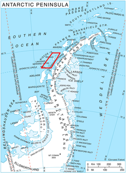
Location of Biscoe
Islands in the Antarctic Peninsula region
307:
forming the southeast end of the island. It was named for
632:
286:, one of the two vessels from Biscoe's expedition.
187:
182:
169:
161:
153:
145:
135:
98:
88:
83:
262:United Kingdom Antarctic Place-Names Committee
652:
8:
32:
369:List of Antarctic and sub-Antarctic islands
659:
645:
38:
31:
462:
460:
441:
439:
437:
334:. It was named for Swedish meteorologist
428:United States Department of the Interior
374:List of Antarctic islands south of 60° S
303:Jurva Point is the extremity of a small
405:
244:and were first roughly surveyed by the
62:
7:
613:
611:
598:Geographic Names Information System
580:Geographic Names Information System
562:Geographic Names Information System
544:Geographic Names Information System
526:Geographic Names Information System
508:Geographic Names Information System
490:Geographic Names Information System
472:Geographic Names Information System
451:Geographic Names Information System
419:Geographic Names Information System
600:. United States Geological Survey.
582:. United States Geological Survey.
564:. United States Geological Survey.
546:. United States Geological Survey.
528:. United States Geological Survey.
510:. United States Geological Survey.
492:. United States Geological Survey.
474:. United States Geological Survey.
453:. United States Geological Survey.
348:UK Antarctic Place-Names Committee
25:
354:, a Japanese sea ice specialist.
149:440 km (170 sq mi)
615:
389:Territorial claims in Antarctica
346:, 1956–57, and was named by the
61:
54:
27:Ice-covered island in Antarctica
424:United States Geological Survey
683:Biscoe Islands geography stubs
254:British Graham Land Expedition
1:
678:Islands of the Biscoe Islands
364:Composite Antarctic Gazetteer
631:. You can help Knowledge by
264:(UK-APC) during the 1950s.
246:French Antarctic Expedition
699:
610:
319:, Biscoe's other vessel.
298:Nikolay Nikolaevich Zubov
174:
49:
37:
311:, a Finnish pioneer in
165:11 km (6.8 mi)
177:Antarctic Treaty System
175:Administered under the
157:40 km (25 mi)
627:location article is a
75:Location in Antarctica
250:Jean-Baptiste Charcot
328:Speerschneider Point
228:to the southwest by
344:Hunting Aerosurveys
116: /
34:
200:is an ice-covered
640:
639:
332:Belogushev Island
195:
194:
120:65.667°S 66.000°W
16:(Redirected from
690:
661:
654:
647:
619:
612:
602:
601:
594:"Kusunoki Point"
590:
584:
583:
576:"Maurstad Point"
572:
566:
565:
554:
548:
547:
540:"Armstrong Reef"
536:
530:
529:
518:
512:
511:
500:
494:
493:
482:
476:
475:
464:
455:
454:
443:
432:
431:
410:
230:Pendleton Strait
226:Lavoisier Island
131:
130:
128:
127:
126:
125:-65.667; -66.000
121:
117:
114:
113:
112:
109:
65:
64:
58:
42:
35:
21:
698:
697:
693:
692:
691:
689:
688:
687:
668:
667:
666:
665:
608:
606:
605:
592:
591:
587:
574:
573:
569:
556:
555:
551:
538:
537:
533:
520:
519:
515:
502:
501:
497:
484:
483:
479:
466:
465:
458:
445:
444:
435:
414:"Renaud Island"
412:
411:
407:
402:
360:
289:Zubov Bay is a
270:
238:
124:
122:
118:
115:
110:
107:
105:
103:
102:
79:
78:
77:
76:
73:
72:
71:
70:
66:
45:
28:
23:
22:
15:
12:
11:
5:
696:
694:
686:
685:
680:
670:
669:
664:
663:
656:
649:
641:
638:
637:
625:Biscoe Islands
620:
604:
603:
585:
567:
558:"Malmgren Bay"
549:
531:
522:"Lively Point"
513:
495:
477:
468:"Weaver Point"
456:
433:
404:
403:
401:
398:
397:
396:
391:
386:
381:
379:Rodman Passage
376:
371:
366:
359:
356:
321:Armstrong Reef
274:John C. Weaver
269:
266:
237:
234:
206:Biscoe Islands
193:
192:
189:
185:
184:
180:
179:
172:
171:
170:Administration
167:
166:
163:
159:
158:
155:
151:
150:
147:
143:
142:
140:Biscoe Islands
137:
133:
132:
100:
96:
95:
90:
86:
85:
81:
80:
74:
68:
67:
60:
59:
53:
52:
51:
50:
47:
46:
43:
26:
24:
14:
13:
10:
9:
6:
4:
3:
2:
695:
684:
681:
679:
676:
675:
673:
662:
657:
655:
650:
648:
643:
642:
636:
634:
630:
626:
621:
618:
614:
609:
599:
595:
589:
586:
581:
577:
571:
568:
563:
559:
553:
550:
545:
541:
535:
532:
527:
523:
517:
514:
509:
505:
504:"Jurva Point"
499:
496:
491:
487:
481:
478:
473:
469:
463:
461:
457:
452:
448:
442:
440:
438:
434:
429:
425:
421:
420:
415:
409:
406:
399:
395:
392:
390:
387:
385:
382:
380:
377:
375:
372:
370:
367:
365:
362:
361:
357:
355:
353:
349:
345:
341:
337:
336:Finn Malmgren
333:
329:
324:
322:
318:
314:
310:
306:
301:
299:
296:
295:oceanographer
292:
287:
285:
284:
279:
275:
267:
265:
263:
257:
255:
251:
247:
243:
235:
233:
231:
227:
223:
219:
215:
211:
207:
203:
199:
198:Renaud Island
190:
186:
181:
178:
173:
168:
164:
160:
156:
152:
148:
144:
141:
138:
134:
129:
101:
97:
94:
91:
87:
82:
69:Renaud Island
57:
48:
41:
36:
33:Renaud Island
30:
19:
633:expanding it
622:
607:
597:
588:
579:
570:
561:
552:
543:
534:
525:
516:
507:
498:
489:
480:
471:
450:
447:"Tula Point"
417:
408:
394:Weaver Point
352:Kou Kusunoki
340:Alf Maurstad
325:
316:
302:
288:
281:
278:Alino Island
271:
258:
239:
218:Rabot Island
214:Pitt Islands
197:
196:
183:Demographics
29:
18:Lively Point
486:"Zubov Bay"
309:Risto Jurva
242:John Biscoe
224:, and from
222:Mraka Sound
191:Uninhabited
136:Archipelago
123: /
99:Coordinates
672:Categories
400:References
330:on nearby
210:Antarctica
188:Population
93:Antarctica
305:peninsula
268:Geography
84:Geography
358:See also
256:(BGLE).
89:Location
313:sea ice
236:History
204:in the
111:66°00′W
108:65°40′S
317:Lively
248:under
202:island
154:Length
623:This
162:Width
629:stub
384:SCAR
350:for
283:Tula
216:and
146:Area
291:bay
208:of
674::
596:.
578:.
560:.
542:.
524:.
506:.
488:.
470:.
459:^
449:.
436:^
426:,
422:.
416:.
300:.
232:.
660:e
653:t
646:v
635:.
430:.
20:)
Text is available under the Creative Commons Attribution-ShareAlike License. Additional terms may apply.