46:
76:
365:
83:
53:
29:
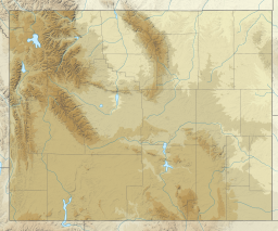
257:. The lake was once much larger, however part of the rock dam failed less than two years later, on May 18, 1927, causing deadly flooding downstream. The lake waters have natural and stocked fish including
406:
45:
130:
75:
298:
262:
425:
440:
435:
278:
399:
238:
108:
430:
392:
350:
250:
112:
266:
172:
254:
179:
376:
323:
186:
419:
162:
364:
28:
258:
242:
145:
132:
351:
U.S. Geological Survey
Geographic Names Information System: Lower Slide Lake
372:
246:
173:
116:
249:. The natural lake was created on June 23, 1925, when the
380:
224:
216:
208:
200:
196:
185:
171:
161:
122:
104:
21:
33:with Gros Ventre landslide field right background
324:"Recreational Activities Gros Ventre Wilderness"
123:
400:
8:
407:
393:
18:
299:"USGS Shadow Mountain (WY) Wyoming Topo"
263:Snake River fine-spotted cutthroat trout
82:
52:
290:
16:Lake in the American state of Wyoming
7:
361:
359:
379:. You can help Knowledge (XXG) by
14:
371:This article about a location in
363:
81:
74:
51:
44:
27:
279:Geology of the Grand Teton area
223:
215:
207:
199:
426:Lakes of Teton County, Wyoming
1:
328:Bridger-Teton National Forest
239:Bridger-Teton National Forest
109:Bridger-Teton National Forest
103:
95:Show map of the United States
228:6,908 ft (2,106 m)
457:
358:
38:
26:
441:Wyoming geography stubs
220:650 acres (260 ha)
436:Landslide-dammed lakes
304:. TopoQuest USGS Quads
146:43.63194°N 110.53000°W
322:U.S. Forest Service.
251:Gros Ventre landslide
151:43.63194; -110.53000
142: /
65:Show map of Wyoming
267:mountain whitefish
388:
387:
255:Gros Ventre River
232:
231:
225:Surface elevation
180:Gros Ventre River
448:
431:Lakes of Wyoming
409:
402:
395:
367:
360:
338:
337:
335:
334:
319:
313:
312:
310:
309:
303:
295:
285:Cited references
235:Lower Slide Lake
175:
157:
156:
154:
153:
152:
147:
143:
140:
139:
138:
135:
125:
96:
89:Lower Slide Lake
85:
84:
78:
66:
59:Lower Slide Lake
55:
54:
48:
31:
22:Lower Slide Lake
19:
456:
455:
451:
450:
449:
447:
446:
445:
416:
415:
414:
413:
356:
347:
342:
341:
332:
330:
321:
320:
316:
307:
305:
301:
297:
296:
292:
287:
275:
189: countries
174:Primary inflows
150:
148:
144:
141:
136:
133:
131:
129:
128:
100:
99:
98:
97:
94:
93:
92:
91:
90:
86:
69:
68:
67:
64:
63:
62:
61:
60:
56:
34:
17:
12:
11:
5:
454:
452:
444:
443:
438:
433:
428:
418:
417:
412:
411:
404:
397:
389:
386:
385:
368:
354:
353:
346:
345:External links
343:
340:
339:
314:
289:
288:
286:
283:
282:
281:
274:
271:
237:is located in
230:
229:
226:
222:
221:
218:
214:
213:
210:
206:
205:
202:
198:
197:
194:
193:
190:
183:
182:
177:
169:
168:
165:
159:
158:
126:
120:
119:
106:
102:
101:
88:
87:
80:
79:
73:
72:
71:
70:
58:
57:
50:
49:
43:
42:
41:
40:
39:
36:
35:
32:
24:
23:
15:
13:
10:
9:
6:
4:
3:
2:
453:
442:
439:
437:
434:
432:
429:
427:
424:
423:
421:
410:
405:
403:
398:
396:
391:
390:
384:
382:
378:
374:
369:
366:
362:
357:
352:
349:
348:
344:
329:
325:
318:
315:
300:
294:
291:
284:
280:
277:
276:
272:
270:
268:
264:
260:
256:
252:
248:
244:
240:
236:
227:
219:
212:.5 mi (.8 km)
211:
204:2 mi (3.2 km)
203:
195:
192:United States
191:
188:
184:
181:
178:
176:
170:
166:
164:
160:
155:
127:
121:
118:
114:
110:
107:
77:
47:
37:
30:
25:
20:
381:expanding it
370:
355:
331:. Retrieved
327:
317:
306:. Retrieved
293:
234:
233:
217:Surface area
167:Natural lake
113:Teton County
253:dammed the
201:Max. length
149: /
137:110°31′48″W
124:Coordinates
117:Wyoming, US
420:Categories
333:2007-06-18
308:2008-06-29
243:U.S. state
209:Max. width
134:43°37′55″N
241:, in the
273:See also
105:Location
373:Wyoming
247:Wyoming
265:, and
375:is a
302:(Map)
187:Basin
377:stub
261:and
259:lake
163:Type
245:of
422::
326:.
269:.
115:,
111:,
408:e
401:t
394:v
383:.
336:.
311:.
Text is available under the Creative Commons Attribution-ShareAlike License. Additional terms may apply.