29:
115:
108:
259:
275:
587:
396:
Gabriela Vargas-Mattos, Mauro César
Geraldes, Ramiro Matos Salinas, Reconstrucción geológica del volcán Chullcani (mioceno superior a plioceno superior): Consideraciónes generales sobre geoquímica y edad de las fases volcánicas, Andes Centrales de Bolivia,
353:
Germán
Mendoza Aruquipa, Toponimias aymara de la Marka Wiyacha. Qamasa, Revista de la carrera de historia, Universidad Indígena Tawantinsuyu Ajlla, No. 2, 2011 (in Spanish): " ... aymara: Puki uta y su significado es Casa de Poque o
463:; Lim, Darlene; Woosley, Clayton; Morris, Robert L.; Tambley, Cristian; Gaete, Victor; Galvez, Matthieu E.; Smith, Eric; Uskin-Peate, Ingrid; Salazar, Carlos; Dawidowicz, G.; Majerowicz, J. (June 2009).
628:
657:
647:
64:
459:; Minkley, Edwin; Hock, Andrew N.; Yu, Youngseob; Bebout, Leslie; Fleming, Erich; Häder, Donat P.; Demergasso, Cecilia; Gibson, John; Escudero, Lorena;
415:
667:
571:
652:
621:
515:
662:
614:
208:
162:
672:
298:
107:
564:
399:
57:
28:
594:
220:
412:
557:
375:
476:
293:
248:
313:
511:
505:
537:
484:
460:
258:
228:
251:
with a surface area of 2,500 square metres (27,000 sq ft). Deposits of elemental
456:
419:
240:
236:
174:
480:
598:
541:
151:
274:
641:
280:
431:
270:
79:
66:
288:
489:
464:
303:
244:
33:
239:, Sabaya Municipality, Julo Canton). Pukintika lies to the north of the
586:
308:
232:
212:
200:
140:
36:(left) and Pukintika (right) as seen from Polloquere hot springs area.
252:
47:
247:
volcano which is younger than
Pukintika. Pukintika also features a
257:
224:
216:
204:
184:
158:
144:
333:
207:, about 5,407 m (17,740 ft) high, situated in the
262:
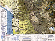
Map showing
Pukintika on the border of Bolivia and Chile
602:
545:
150:
136:
95:
56:
46:
41:
21:
469:Journal of Geophysical Research: Biogeosciences
510:. Geological Society of America. p. 248.
504:Harmon, Russell S.; Rapela, Carlos W. (1991).
622:
565:
127:Location in Bolivia, on the border with Chile
8:
413:Sabaya Municipality: population data and map
629:
615:
572:
558:
18:
507:Andean Magmatism and Its Tectonic Setting
488:
658:International mountains of South America
325:
648:Volcanoes of Arica y Parinacota Region
455:Cabrol, Nathalie A.; Grin, Edmond A.;
432:"Global Volcanism Program | Arintica"
7:
583:
581:
533:
531:
14:
400:Revista Brasileira de Geociências
366:– house of poque or 'white soil')
114:
668:Oruro Department geography stubs
585:
273:
113:
106:
27:
299:List of mountains in the Andes
255:have been found on Pukintika.
1:
653:Mountains of Oruro Department
52:5,407 m (17,740 ft)
601:. You can help Knowledge by
544:. You can help Knowledge by
221:Arica and Parinacota Region
689:
580:
530:
595:Arica y Parinacota Region
187:, Hispanicized spellings
100:
26:
465:"The High-Lakes Project"
219:. It is located in the
597:location article is a
540:location article is a
263:
189:Puguintica, Puquintica
673:Chile geography stubs
261:
209:Cordillera Occidental
163:Cordillera Occidental
663:Bolivia–Chile border
490:10.1029/2008JG000818
481:2009JGRG..114.0D06C
76: /
16:Mountain in Bolivia
418:2014-08-13 at the
334:"Cerro Puquintica"
264:
42:Highest point
610:
609:
553:
552:
517:978-0-8137-2265-8
461:Dorador, Cristina
211:on the border of
168:
167:
80:18.733°S 68.983°W
680:
631:
624:
617:
589:
582:
574:
567:
560:
538:Oruro Department
532:
522:
521:
501:
495:
494:
492:
457:Chong, Guillermo
452:
446:
445:
443:
442:
428:
422:
410:
404:
394:
388:
373:
367:
351:
345:
344:
342:
341:
330:
283:
278:
277:
229:Oruro Department
154:
117:
116:
110:
91:
90:
88:
87:
86:
85:-18.733; -68.983
81:
77:
74:
73:
72:
69:
31:
19:
688:
687:
683:
682:
681:
679:
678:
677:
638:
637:
636:
635:
579:
578:
528:
526:
525:
518:
503:
502:
498:
454:
453:
449:
440:
438:
430:
429:
425:
420:Wayback Machine
411:
407:
395:
391:
374:
370:
352:
348:
339:
337:
332:
331:
327:
322:
279:
272:
269:
241:Salar de Surire
237:Sabaya Province
152:
132:
131:
130:
129:
128:
125:
124:
123:
122:
118:
84:
82:
78:
75:
70:
67:
65:
63:
62:
37:
17:
12:
11:
5:
686:
684:
676:
675:
670:
665:
660:
655:
650:
640:
639:
634:
633:
626:
619:
611:
608:
607:
590:
577:
576:
569:
562:
554:
551:
550:
524:
523:
516:
496:
447:
436:volcano.si.edu
423:
405:
389:
376:www.illa-a.org
368:
346:
336:. mapcarta.com
324:
323:
321:
318:
317:
316:
311:
306:
301:
296:
291:
285:
284:
268:
265:
243:, east beside
166:
165:
156:
148:
147:
138:
134:
133:
126:
120:
119:
112:
111:
105:
104:
103:
102:
101:
98:
97:
93:
92:
60:
54:
53:
50:
44:
43:
39:
38:
32:
24:
23:
15:
13:
10:
9:
6:
4:
3:
2:
685:
674:
671:
669:
666:
664:
661:
659:
656:
654:
651:
649:
646:
645:
643:
632:
627:
625:
620:
618:
613:
612:
606:
604:
600:
596:
591:
588:
584:
575:
570:
568:
563:
561:
556:
555:
549:
547:
543:
539:
534:
529:
519:
513:
509:
508:
500:
497:
491:
486:
482:
478:
474:
470:
466:
462:
458:
451:
448:
437:
433:
427:
424:
421:
417:
414:
409:
406:
402:
401:
393:
390:
387:
383:
382:
377:
372:
369:
365:
361:
357:
356:tierra blanca
350:
347:
335:
329:
326:
319:
315:
312:
310:
307:
305:
302:
300:
297:
295:
292:
290:
287:
286:
282:
276:
271:
266:
260:
256:
254:
250:
246:
242:
238:
234:
230:
226:
222:
218:
214:
210:
206:
202:
198:
194:
190:
186:
183:
179:
176:
172:
164:
160:
157:
155:
149:
146:
142:
139:
135:
109:
99:
94:
89:
61:
59:
55:
51:
49:
45:
40:
35:
30:
25:
20:
603:expanding it
592:
546:expanding it
535:
527:
506:
499:
472:
468:
450:
439:. Retrieved
435:
426:
408:
398:
392:
385:
380:
379:
371:
363:
359:
355:
349:
338:. Retrieved
328:
281:Andes portal
196:
192:
188:
181:
180:white soil,
177:
170:
169:
153:Parent range
475:(G2): n/a.
294:Kimsa Chata
249:crater lake
83: /
58:Coordinates
642:Categories
441:2017-05-26
340:2012-11-25
320:References
314:Wila Qullu
197:Puquentica
193:Poquentica
403:, 12/2006
362:– house,
358:. (Note:
289:Asu Asuni
171:Pukintika
121:Pukintika
96:Geography
48:Elevation
22:Pukintika
416:Archived
364:puki uta
304:Qillwiri
267:See also
245:Arintika
227:and the
137:Location
34:Arintika
477:Bibcode
309:Uyarani
233:Bolivia
213:Bolivia
203:in the
201:volcano
199:) is a
141:Bolivia
71:68°59′W
68:18°44′S
514:
253:sulfur
175:Aymara
593:This
536:This
386:Adobe
225:Chile
217:Chile
205:Andes
185:adobe
159:Andes
145:Chile
599:stub
542:stub
512:ISBN
381:Tika
235:(in
215:and
182:tika
178:puki
485:doi
473:114
384:–
360:uta
231:of
223:of
644::
483:.
471:.
467:.
434:.
378::
195:,
191:,
161:,
630:e
623:t
616:v
605:.
573:e
566:t
559:v
548:.
520:.
493:.
487::
479::
444:.
343:.
173:(
143:-
Text is available under the Creative Commons Attribution-ShareAlike License. Additional terms may apply.