86:
106:
1088:
146:
59:
412:, to the north; an Acehnese governor was stationed in the town. The port formally came under Dutch control in 1663 by treaty with Aceh. In 1671 the Dutch built a lodge here and later, around 1684, a fort. Continuing clashes with local rulers and competition with other European trading companies resulted in the port being abandoned by the Dutch in 1770. By the early twentieth century the port was less prominent on the coast, as
253:
221:
700:
431:
153:
113:
388:. Pariaman covers an area of 73.36 km (28 sq mi), with a 12 km (7 mi) coastline. It had a population of 79,043 at the 2010 Census and 94,224 at the 2020 census; the official estimate as at mid 2023 was 97,206 - comprising 49,131 males and 48,075 females. "Pariaman" means "safe area".
454:), listed below with their areas and their populations at the 2010 Census and 2020 Census, together with the official estimates as at mid 2023. The table also includes the locations of the district administrative centres and the numbers of administrative villages in each district (comprising 55 rural
1170:
408:
visited the port, trading in pepper, gold, and other products of the interior. In the early seventeenth century the port came under control of the
Sultanate of
1146:
993:
30:
984:
85:
181:
105:
688:
427:, it was separated administratively from the regency and became an autonomous city on 10 April 2002 under Law No. 12 of that year.
898:
145:
346:
1087:
396:
According to the limited early sources available, by the sixteenth century
Pariaman was an important port city serving the
933:
779:
In the festival, two such effigies or "Tabuik", one for Hasan and one for
Hussein, are carried through the city. Named
58:
977:
881:
Dobbin, Christine (1977). Economic change in
Minangkabau as a factor in the rise of the Padri movement, 1784-1830.
746:
416:, just to the south, was the focus of Dutch activities in western Sumatra and had a railroad link to the interior.
1096:
1037:
213:
799:
drums. In the afternoon, both Tabuik are moved to the coast and before sunset they are immersed into the sea.
868:
Tsuyoshi Kato (1980). Rantau
Pariaman: the world of Minangkabau coastal merchants in the nineteenth century.
1052:
1042:
1032:
925:
424:
660:
447:
245:
970:
1077:
808:
233:
1072:
1067:
1027:
1014:
676:
772:, plays a role in the Tabuik. It presumably represents the white horse of the Imam Hussein at the
397:
1165:
1057:
773:
768:, a purported winged horse that took Muhammad on his night-long journey to heavens, i.e., the
413:
338:
1047:
761:
672:
668:
1114:
962:
738:
419:
After
Indonesian independence, Pariaman was a naval headquarters for a province called
1159:
1062:
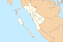
757:
730:
400:
settlements in the interior highlands of central west
Sumatra. Traders from western
1022:
996:
776:, but is portrayed with a woman's head, wings, a broad tail and carrying a coffin.
742:
381:
258:
91:
1104:
687:
The contemporary economy is primarily agricultural with 79% of land in farming.
373:
44:
733:. This practice was brought to the city in 1818, when ex-British soldiers from
1129:
1124:
699:
430:
948:
935:
196:
183:
385:
329:
226:
130:
769:
753:
726:
238:
126:
1109:
1006:
789:
722:
717:
434:
405:
334:
752:
The Tabuik festival commemorates the martyrdom of the grandsons of
1134:
795:
765:
734:
708:
698:
429:
401:
360:
712:
409:
966:
725:"tabut" meaning coffin), is held annually in the city every 10
855:
853:
827:
825:
823:
843:
841:
691:, West Sumatra's major airport, is located near the city.
737:
settled in
Pariaman. They had been disbanded when the
707:
Although the population of
Pariaman is predominantly
671:
in the north, east, and south, while it borders with
1095:
1013:
355:
345:
328:
321:
313:
305:
300:
292:
287:
277:
269:
264:
244:
232:
212:
42:
37:
21:
831:Badan Pusat Statistik, Jakarta, 28 February 2024,
462:- the latter all in Pariaman Tengah District).
446:The city is administratively divided into four
893:
891:
978:
899:"Taking in Pariaman's Unique Seaside Culture"
8:
1171:States and territories established in 2002
985:
971:
963:
78:(Together on one ship, together rowing it)
18:
1147:List of regencies and cities of Indonesia
464:
819:
354:
344:
327:
299:
286:
263:
211:
176:
97:
82:
70:
52:
41:
36:
859:Badan Pusat Statistik, Jakarta, 2021.
320:
312:
304:
296:73.36 km (28.32 sq mi)
291:
276:
268:
243:
231:
7:
847:Biro Pusat Statistik, Jakarta, 2011.
659:The city is surrounded by the rural
711:, a famous and popular festival of
703:Tabuiks being lowered into the sea
14:
787:, they are swayed accompanied by
689:Minangkabau International Airport
1086:
679:within Padang Pariaman Regency.
251:
219:
152:
151:
144:
112:
111:
104:
84:
57:
675:in the west, making Pariaman a
380:), is a coastal city in
833:Kota Pariaman Dalam Angka 2024
1:
741:handed the area back to the
650:
615:
590:
565:
540:
640:
635:
630:
625:
609:
606:
603:
600:
584:
581:
578:
575:
559:
556:
553:
550:
534:
531:
528:
525:
317:1,300/km (3,400/sq mi)
38:Other transcription(s)
1187:
835:(Katalog-BPS 1102001.1377)
747:Anglo-Dutch Treaty of 1814
16:City in Sumatra, Indonesia
1143:
1084:
1003:
377:
270: • Acting Mayor
177:
98:
83:
71:
53:
28:
870:Journal of Asian Studies
442:Administrative districts
994:Regencies and cities of
425:Padang Pariaman Regency
278: • Vice Mayor
926:Government of Pariaman
704:
438:
339:Indonesia Western Time
949:0.62639°S 100.11778°E
702:
433:
423:. Originally part of
197:0.62639°S 100.11778°E
168:Show map of Indonesia
809:Warong Nasi Pariaman
314: • Density
165:Pariaman (Indonesia)
954:-0.62639; 100.11778
945: /
202:-0.62639; 100.11778
193: /
135:Show map of Sumatra
705:
613:Padang Birik-Birik
548:(Central Pariaman)
439:
361:pariamankota.go.id
306: • Total
293: • Total
75:Sabiduak Sadayuang
1153:
1152:
774:Battle of Karbala
657:
656:
521:Pariaman Selatan
367:
366:
1178:
1090:
1038:Mentawai Islands
987:
980:
973:
964:
960:
959:
957:
956:
955:
950:
946:
943:
942:
941:
938:
924:
911:
910:
908:
906:
895:
886:
879:
873:
866:
860:
857:
848:
845:
836:
829:
598:(North Pariaman)
546:Pariaman Tengah
523:(South Pariaman)
465:
379:
363:
257:
255:
254:
225:
223:
222:
208:
207:
205:
204:
203:
198:
194:
191:
190:
189:
186:
169:
155:
154:
148:
136:
115:
114:
108:
90:Location within
88:
61:
19:
1186:
1185:
1181:
1180:
1179:
1177:
1176:
1175:
1156:
1155:
1154:
1149:
1139:
1091:
1082:
1043:Padang Pariaman
1033:Lima Puluh Kota
1009:
999:
991:
953:
951:
947:
944:
939:
936:
934:
932:
931:
923:(in Indonesian)
922:
919:
914:
904:
902:
897:
896:
889:
880:
876:
867:
863:
858:
851:
846:
839:
830:
821:
817:
805:
785:Tabuik Subarang
762:Hussein ibn Ali
745:as part of the
697:
685:
673:Mentawai Strait
669:Padang Pariaman
597:
596:Pariaman Utara
573:(East Pariaman)
572:
571:Pariaman Timur
547:
522:
515:
513:
508:
503:
501:
496:
494:
489:
487:
482:
480:
471:
469:
444:
421:Central Sumatra
404:and later from
394:
359:
252:
250:
220:
218:
201:
199:
195:
192:
187:
184:
182:
180:
179:
173:
172:
171:
170:
167:
166:
163:
162:
161:
160:
156:
139:
138:
137:
134:
133:
123:
122:
121:
120:
116:
94:
79:
77:
72:Motto(s):
67:
66:
65:
64:
33:
24:
17:
12:
11:
5:
1184:
1182:
1174:
1173:
1168:
1158:
1157:
1151:
1150:
1144:
1141:
1140:
1138:
1137:
1132:
1127:
1122:
1117:
1115:Padang Panjang
1112:
1107:
1101:
1099:
1093:
1092:
1085:
1083:
1081:
1080:
1075:
1070:
1065:
1060:
1055:
1050:
1045:
1040:
1035:
1030:
1025:
1019:
1017:
1011:
1010:
1004:
1001:
1000:
992:
990:
989:
982:
975:
967:
929:
928:
918:
917:External links
915:
913:
912:
901:. Jakarta Post
887:
874:
861:
849:
837:
818:
816:
813:
812:
811:
804:
801:
696:
693:
684:
681:
655:
654:
649:
647:Alai Gelombang
644:
639:
634:
629:
624:
618:
617:
614:
611:
608:
605:
602:
599:
593:
592:
589:
586:
583:
580:
577:
574:
568:
567:
564:
563:Alai Gelombang
561:
558:
555:
552:
549:
543:
542:
539:
536:
533:
530:
527:
524:
518:
517:
510:
505:
498:
491:
484:
477:
443:
440:
393:
390:
365:
364:
357:
353:
352:
349:
343:
342:
332:
326:
325:
323:
319:
318:
315:
311:
310:
307:
303:
302:
298:
297:
294:
290:
289:
285:
284:
279:
275:
274:
271:
267:
266:
262:
261:
248:
242:
241:
236:
230:
229:
216:
210:
209:
175:
174:
164:
158:
157:
150:
149:
143:
142:
141:
140:
124:
118:
117:
110:
109:
103:
102:
101:
100:
99:
96:
95:
89:
81:
80:
73:
69:
68:
62:
56:
55:
54:
51:
50:
47:
40:
39:
35:
34:
29:
26:
25:
22:
15:
13:
10:
9:
6:
4:
3:
2:
1183:
1172:
1169:
1167:
1164:
1163:
1161:
1148:
1142:
1136:
1133:
1131:
1128:
1126:
1123:
1121:
1118:
1116:
1113:
1111:
1108:
1106:
1103:
1102:
1100:
1098:
1094:
1089:
1079:
1076:
1074:
1071:
1069:
1066:
1064:
1061:
1059:
1056:
1054:
1053:South Pesisir
1051:
1049:
1046:
1044:
1041:
1039:
1036:
1034:
1031:
1029:
1026:
1024:
1021:
1020:
1018:
1016:
1012:
1008:
1002:
998:
995:
988:
983:
981:
976:
974:
969:
968:
965:
961:
958:
927:
921:
920:
916:
900:
894:
892:
888:
884:
878:
875:
872:39(4):729-752
871:
865:
862:
856:
854:
850:
844:
842:
838:
834:
828:
826:
824:
820:
814:
810:
807:
806:
802:
800:
798:
797:
792:
791:
786:
782:
777:
775:
771:
767:
763:
759:
758:Hasan ibn Ali
755:
750:
748:
744:
740:
736:
732:
731:Day of Ashura
728:
724:
720:
719:
715:origin named
714:
710:
701:
694:
692:
690:
682:
680:
678:
674:
670:
666:
662:
653:
648:
645:
643:
638:
633:
628:
623:
620:
619:
612:
595:
594:
587:
570:
569:
562:
545:
544:
537:
520:
519:
511:
506:
499:
492:
485:
478:
475:
467:
466:
463:
461:
458:and 16 urban
457:
453:
449:
441:
436:
432:
428:
426:
422:
417:
415:
411:
407:
403:
399:
391:
389:
387:
383:
375:
371:
362:
358:
350:
348:
340:
336:
333:
331:
324:
316:
308:
295:
283:
280:
272:
260:
249:
247:
240:
237:
235:
228:
217:
215:
206:
178:Coordinates:
147:
132:
128:
107:
93:
87:
76:
60:
48:
46:
43: •
32:
27:
20:
1119:
1078:West Pasaman
997:West Sumatra
930:
903:. Retrieved
882:
877:
869:
864:
832:
794:
788:
784:
780:
778:
751:
716:
706:
686:
677:semi-enclave
664:
658:
651:
646:
641:
636:
631:
626:
621:
588:Sungai Pasak
473:
459:
455:
451:
445:
420:
418:
395:
382:West Sumatra
369:
368:
281:
259:West Sumatra
125:Location in
92:West Sumatra
74:
63:Coat of arms
1105:Bukittinggi
1073:Tanah Datar
1068:South Solok
1028:Dharmasraya
952: /
940:100°07′04″E
885:23(1):1-38.
781:Tabuik Pasa
743:Netherlands
398:Minangkabau
200: /
1160:Categories
1145:See also:
1130:Sawahlunto
1125:Payakumbuh
815:References
793:music and
538:Kurai Taji
301:Population
265:Government
1058:Sijunjung
1015:Regencies
1005:Capital:
937:0°37′35″S
883:Indonesia
665:kabupaten
516:villages
502:mid 2023
474:kecamatan
460:kelurahan
452:kecamatan
448:districts
386:Indonesia
351:(+62) 751
347:Area code
330:Time zone
227:Indonesia
188:100°7′4″E
185:0°37′35″S
131:Indonesia
1166:Pariaman
1120:Pariaman
905:14 April
803:See also
754:Muhammad
727:Muharram
504:Estimate
470:District
468:Name of
437:monument
370:Pariaman
246:Province
159:Pariaman
119:Pariaman
23:Pariaman
1048:Pasaman
739:British
695:Culture
683:Economy
661:regency
392:History
356:Website
273:Roberia
239:Sumatra
214:Country
127:Sumatra
1110:Padang
1097:Cities
1007:Padang
790:tambur
770:Mi'raj
764:. The
729:, the
723:Arabic
721:(from
718:Tabuik
642:97,206
637:94,224
632:79,043
622:Totals
610:23,200
607:22,591
604:19,196
585:20,940
582:19,697
579:14,853
560:32,170
557:31,930
554:28,957
535:20,890
532:20,006
529:16,037
509:centre
500:Pop'n
497:Census
493:Pop'n
490:Census
486:Pop'n
435:Tabuik
414:Padang
406:Europe
378:ڤريامن
322:
309:97,206
282:Vacant
256:
234:Region
224:
49:ڤريامن
1135:Solok
1063:Solok
766:Buraq
735:India
709:Sunni
667:) of
627:73.36
601:23.35
576:17.51
551:15.68
526:16.82
507:Admin
495:2020
488:2010
479:Area
402:India
335:UTC+7
1023:Agam
907:2012
796:tasa
783:and
760:and
713:Shia
456:desa
410:Aceh
374:Jawi
288:Area
129:and
45:Jawi
31:City
616:17
591:16
566:22
541:16
512:No.
481:in
1162::
890:^
852:^
840:^
822:^
756:,
749:.
652:71
514:of
483:km
384:,
376::
986:e
979:t
972:v
909:.
663:(
476:)
472:(
450:(
372:(
341:)
337:(
Text is available under the Creative Commons Attribution-ShareAlike License. Additional terms may apply.