28:
20:
153:
in 1965, bearing the official name of Two Ocean Pass
National Natural Landmark. However, Parting of the Waters, by which this site is more commonly known, is actually about 0.4 miles (0.6 km) northwest of the low point of Two Ocean Pass, where North Two Ocean Creek emerges from its
141:
adjacent to
Parting of the Waters, water actually covers the Continental Divide such that a fish could swim from the Pacific Ocean to the Atlantic Ocean drainages. In fact, it is thought that this was the pass that provided the route for
161:
Inasmuch as North Two Ocean Creek splits into streams that flow separately to the
Atlantic and Pacific Oceans, the entire drainage of North Two Ocean Creek lies within an area that makes up the "Continental Divide" at this place.
209:
30x60 minute quad do show a split in the continental divide which includes the drainage basins of both North Two Ocean Creek and South Two Ocean Creek. The divide split is 8.7 kilometres (5.4 mi) in
285:
30×60 minute quadrangle show a split in the continental divide which includes the drainage basins of both North Two Ocean Creek and South Two Ocean Creek. The divide split is 8.7 km (5.4 mi) in length.
350:
345:
340:
59:
43:
298:
232:
77:
201:
USGS Topographic
Quadrangle, 1996: Note the 1996 quad does not show a split in the continental divide; however both the 1959
177:
113:, Pacific Creek and Atlantic Creek. From this split, Two Ocean Creek waters flow either 3,488 miles (5,613 km) to the
55:
355:
143:
325:
320:
150:
306:
257:
67:
126:
118:
106:
47:
310:
27:
155:
138:
134:
122:
114:
71:
39:
236:
334:
146:
to migrate from the Snake River (Pacific) to
Yellowstone River (Atlantic) drainages.
63:
315:
171:
110:
19:
130:
129:
Rivers, or 1,353 miles (2,177 km) to the
Pacific via Pacific Creek and the
92:
79:
31:
Topographic map showing Two Ocean Pass and the
Continental Divide (green)
51:
105:, North Two Ocean Creek flows down from its drainage on the side of
26:
18:
303:
109:, and divides its waters roughly equally between its two
16:Naturally occurring tourist attraction in Wyoming
233:"NPS: Explore Nature » NNL » Sites"
58:. Two Ocean Pass separates the headwaters of
8:
235:. Nature.nps.gov. 2012-06-28. Archived from
199:Two Ocean Pass Quadrangle, Wyoming-Teton Co.
180:, an unusual 1987 tornado that passed nearby
351:Protected areas of Teton County, Wyoming
190:
283:Yellowstone National Park South, Wyo.,
207:Yellowstone National Park South, Wyo.
7:
222:7.5 Minute Quad, US Topo, USGS, 2012
149:This site received designation as a
321:(looking downstream) Panoramio.com
281:15 minute quadrangle and the 1982
205:15-minute quadrangle and the 1982
158:on the side of Two Ocean Plateau.
14:
174:, in the Canadian Rocky Mountains
38:is an unusual hydrologic site at
326:(looking upstream) Panoramio.com
74:. At Parting of the Waters, at
137:Rivers. In the marshy area of
1:
346:Bridger–Teton National Forest
341:Great Divide of North America
258:"The Popular Science Monthly"
56:Bridger-Teton National Forest
144:Yellowstone cutthroat trout
117:via Atlantic Creek and the
372:
70:, which flows east to the
62:, which flows west to the
178:Teton–Yellowstone tornado
151:National Natural Landmark
23:The parting of the waters
279:Two Ocean Pass, Wyoming,
197:Modified portion of the
93:44.042850°N 110.175400°W
203:Two Ocean Pass, Wyoming
98:44.042850; -110.175400
32:
24:
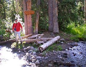
316:Parting of the Waters
36:Parting of the Waters
30:
22:
220:Two Ocean Pass, Wyo,
277:Both the USGS 1959
89: /
356:River bifurcations
309:2008-09-21 at the
33:
25:
107:Two Ocean Plateau
363:
286:
275:
269:
268:
266:
265:
254:
248:
247:
245:
244:
229:
223:
217:
211:
195:
104:
103:
101:
100:
99:
94:
90:
87:
86:
85:
82:
48:Teton Wilderness
371:
370:
366:
365:
364:
362:
361:
360:
331:
330:
311:Wayback Machine
295:
290:
289:
276:
272:
263:
261:
256:
255:
251:
242:
240:
231:
230:
226:
218:
214:
196:
192:
187:
168:
97:
95:
91:
88:
83:
80:
78:
76:
75:
17:
12:
11:
5:
369:
367:
359:
358:
353:
348:
343:
333:
332:
329:
328:
323:
318:
313:
304:Nature.nps.gov
301:
294:
293:External links
291:
288:
287:
270:
249:
224:
212:
189:
188:
186:
183:
182:
181:
175:
167:
164:
156:drainage basin
139:Two Ocean Pass
115:Gulf of Mexico
111:distributaries
72:Atlantic Ocean
68:Atlantic Creek
40:Two Ocean Pass
15:
13:
10:
9:
6:
4:
3:
2:
368:
357:
354:
352:
349:
347:
344:
342:
339:
338:
336:
327:
324:
322:
319:
317:
314:
312:
308:
305:
302:
300:
297:
296:
292:
284:
280:
274:
271:
259:
253:
250:
239:on 2015-02-24
238:
234:
228:
225:
221:
216:
213:
208:
204:
200:
194:
191:
184:
179:
176:
173:
170:
169:
165:
163:
159:
157:
152:
147:
145:
140:
136:
132:
128:
124:
120:
116:
112:
108:
102:
73:
69:
65:
64:Pacific Ocean
61:
60:Pacific Creek
57:
53:
49:
46:, within the
45:
41:
37:
29:
21:
282:
278:
273:
262:. Retrieved
252:
241:. Retrieved
237:the original
227:
219:
215:
206:
202:
198:
193:
172:Divide Creek
160:
148:
84:110°10.524′W
44:Great Divide
35:
34:
127:Mississippi
119:Yellowstone
96: /
81:44°02.571′N
335:Categories
264:2015-02-24
243:2015-02-24
185:References
299:Fs.fed.us
307:Archived
166:See also
135:Columbia
123:Missouri
50:area of
210:length.
52:Wyoming
42:on the
260:. 1895
66:, and
131:Snake
133:and
125:and
54:'s
337::
121:,
267:.
246:.
Text is available under the Creative Commons Attribution-ShareAlike License. Additional terms may apply.