721:
65:
84:
1017:
328:
53:
667:
In the township the population was spread out, with 21.1% under the age of 18, 3.2% from 18 to 24, 19.5% from 25 to 44, 28.4% from 45 to 64, and 27.7% who were 65 years of age or older. The median age was 49 years. For every 100 females, there were 86.9 males. For every 100 females age 18 and over,
663:
living together, 3.8% had a female householder with no husband present, and 28.6% were non-families. 26.3% of all households were made up of individuals, and 20.1% had someone living alone who was 65 years of age or older. The average household size was 2.41 and the average family size was 2.91.
627:
of 2000, there were 3,500 people, 1,387 households, and 990 families living in the township. The population density was 353.0 inhabitants per square mile (136.3/km). There were 1,438 housing units at an average density of 145.0 per square mile (56.0/km). The racial makeup of the township was
64:
720:
619:
At the 2010 census, the township was 93.6% non-Hispanic White, 0.7% Black or
African American, 0.1% Native American, 3.1% Asian, and 1.2% were two or more races. 1.4% of the population were of Hispanic or Latino ancestry.
671:
The median income for a household in the township was $ 83,295, and the median income for a family was $ 106,304. Males had a median income of $ 84,136 versus $ 45,298 for females. The
17:
1353:
1158:
391:, the township has a total area of 10.0 square miles (26 km), of which 9.9 square miles (26 km) is land and 0.1 square miles (0.26 km), or 1.10%, is water. Part of the
955:
2011:
1238:
1288:
1123:
1298:
101:
1283:
1213:
1208:
740:
is the most prominent highway serving
Pennsbury Township. It follows the Baltimore Pike along an east-west alignment through the northern portion of the township.
1333:
1323:
83:
1958:
832:
1268:
744:
follows Lenape Road through the northwestern portion of the township, then follows
Kennett Pike through the southwestern corner of the township. Finally,
1730:
1203:
948:
372:
356:
703:, U.S. Representative for Pennsylvania's 16th congressional district from 1861 to 1863 and Pennsylvania's 15th congressional district from 1863 to 1865
1530:
731:
730:
As of 2022, there were 39.82 miles (64.08 km) of public roads in
Pennsbury Township, of which 11.81 miles (19.01 km) were maintained by the
1816:
1575:
275:
1745:
1363:
1168:
1776:
1750:
1580:
1373:
1343:
1178:
1143:
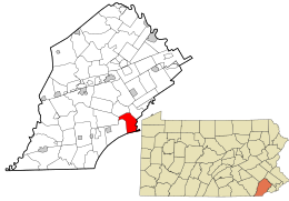
688:
1393:
1293:
1263:
1228:
1193:
941:
21:
1383:
1378:
1368:
1338:
1313:
1183:
1173:
1153:
1138:
813:
376:
1388:
1308:
1243:
1233:
1188:
2016:
1358:
1218:
1163:
1133:
404:
1408:
1303:
1253:
1248:
846:
360:
1660:
1520:
1348:
1148:
998:
765:
234:
933:
1650:
1620:
1403:
1278:
1198:
1090:
1861:
1328:
1318:
1223:
633:
1635:
1560:
1258:
637:
400:
1907:
1836:
1831:
1060:
965:
737:
312:
268:
152:
70:
928:
1981:
1851:
1761:
1600:
1555:
1128:
874:
700:
645:
388:
348:
327:
1922:
1881:
1876:
1821:
1796:
1781:
1715:
1640:
1570:
1469:
1459:
1448:
1100:
1085:
987:
1943:
1866:
1856:
1756:
1740:
1705:
1695:
1685:
1605:
1442:
1095:
1055:
1045:
1006:
599:
584:
569:
554:
539:
524:
509:
494:
479:
464:
419:
411:
396:
316:
1953:
1896:
1891:
1846:
1806:
1801:
1720:
1665:
1625:
1610:
1535:
1510:
1105:
1080:
263:
659:
There were 1,387 households, out of which 26.6% had children under the age of 18 living with them, 65.9% were
1436:
1927:
1912:
1901:
1771:
1725:
1690:
1565:
1525:
1515:
1495:
1480:
1418:
1115:
748:
follows Street Road along a northeast-southwest alignment through the northwestern portion of the township.
392:
344:
308:
43:
1948:
1871:
1735:
1700:
1615:
1550:
1500:
1050:
1040:
1027:
745:
649:
340:
1932:
1886:
1841:
1766:
1710:
1675:
1670:
1645:
1630:
1545:
1453:
1065:
818:
741:
255:
787:
675:
for the township was $ 52,530. None of the families and 1.2% of the population were living below the
1988:
1917:
1811:
1791:
1786:
1680:
1655:
1490:
1426:
1075:
1070:
1035:
653:
368:
352:
244:
1937:
1590:
1540:
1505:
1485:
1475:
1464:
641:
629:
336:
1431:
52:
672:
895:
709:, farmer, abolitionist, and station master on the Underground Railroad for more than 34 years
1826:
706:
1972:‡This populated place also has portions in an adjacent county or counties †Former borough
856:
427:
2005:
364:
676:
89:
74:
980:
116:
103:
851:
225:
734:(PennDOT) and 28.01 miles (45.08 km) were maintained by the township.
660:
624:
847:"Census 2010: Philadelphia gains, Pittsburgh shrinks in population"
719:
326:
251:
230:
808:
937:
923:
289:
1015:
679:, including no under eighteens and none of those over 64.
870:
18:
East
Pennsboro Township, Cumberland County, Pennsylvania
331:
House on
Brinton's Bridge Road in Pennsbury Township
1967:
1589:
1417:
1114:
1026:
997:
399:is in the eastern part of the township, though the
284:
274:
262:
241:
224:
216:
208:
200:
195:
187:
179:
171:
163:
158:
148:
140:
132:
34:
929:The Battle of the Brandywine in Pennsbury Township
315:, United States. The population was 3,604 at the
949:
8:
956:
942:
934:
656:of any race were 1.54% of the population.
437:
31:
2012:Townships in Chester County, Pennsylvania
732:Pennsylvania Department of Transportation
788:"Population and Housing Unit Estimates"
757:
283:
273:
261:
223:
194:
186:
157:
131:
96:
61:
49:
29:Township in Pennsylvania, United States
809:"National Register Information System"
689:Unionville-Chadds Ford School District
457:
724:US 1 southbound in Pennsbury Township
240:
215:
207:
199:
178:
170:
167:10.05 sq mi (26.04 km)
162:
147:
139:
80:
22:West Pennsboro Township, Pennsylvania
7:
814:National Register of Historic Places
648:, and 0.80% from two or more races.
410:Pennsbury Township has a hot-summer
377:National Register of Historic Places
175:9.92 sq mi (25.70 km)
687:Pennsbury Township lies within the
183:0.13 sq mi (0.34 km)
964:Municipalities and communities of
447:
69:Location of Pennsbury Township in
14:
361:Parkersville Friends Meetinghouse
82:
63:
51:
401:historic village of Chadds Ford
1:
768:. United States Census Bureau
220:368.90/sq mi (142.43/km)
73:and of Pennsbury Township in
967:Chester County, Pennsylvania
313:Chester County, Pennsylvania
875:United States Census Bureau
766:"2016 U.S. Gazetteer Files"
389:United States Census Bureau
349:Peter Harvey House and Barn
345:Fairville Historic District
209: • Estimate
2033:
15:
2017:Townships in Pennsylvania
1977:
1013:
978:
613:
598:
583:
568:
553:
538:
523:
508:
493:
478:
463:
456:
451:
446:
443:
420:humid subtropical climate
412:humid continental climate
97:
81:
62:
50:
41:
896:"Pennsbury Township map"
16:Not to be confused with
668:there were 81.8 males.
393:census-designated place
191:246 ft (75 m)
1020:
746:Pennsylvania Route 926
725:
341:Brinton-King Farmstead
332:
1019:
871:"U.S. Census website"
819:National Park Service
742:Pennsylvania Route 52
723:
439:Historical population
330:
243: • Summer (
117:39.86667°N 75.61639°W
1990:United States portal
405:Chadds Ford Township
369:William Peters House
353:William Harvey House
217: • Density
92:in the United States
1983:Pennsylvania portal
440:
337:Barns-Brinton House
122:39.86667; -75.61639
113: /
1661:Darlington Corners
1521:Lincoln University
1454:Cheyney University
1021:
924:Pennsbury Township
859:on March 14, 2011.
726:
438:
403:is to the east in
375:are listed on the
333:
305:Pennsbury Township
201: • Total
180: • Water
164: • Total
36:Pennsbury Township
1999:
1998:
1091:South Coatesville
673:per capita income
617:
616:
418:) bordering on a
387:According to the
302:
301:
172: • Land
2024:
1991:
1984:
1862:Nantmeal Village
1827:Longwood Gardens
1364:West Marlborough
1354:West Fallowfield
1169:East Marlborough
1159:East Fallowfield
1018:
990:
983:
973:
968:
958:
951:
944:
935:
911:
910:
908:
906:
900:
892:
886:
885:
883:
881:
867:
861:
860:
855:. Archived from
843:
837:
836:
829:
823:
822:
805:
799:
798:
796:
794:
784:
778:
777:
775:
773:
762:
707:Isaac Mendenhall
634:African American
459:
454:
449:
441:
298:
295:
293:
291:
248:
128:
127:
125:
124:
123:
118:
114:
111:
110:
109:
106:
86:
67:
55:
32:
2032:
2031:
2027:
2026:
2025:
2023:
2022:
2021:
2002:
2001:
2000:
1995:
1989:
1982:
1973:
1963:
1636:Chester Springs
1592:
1585:
1561:South Pottstown
1413:
1374:West Nottingham
1344:West Brandywine
1179:East Nottingham
1144:East Brandywine
1110:
1022:
1016:
1011:
993:
988:
981:
974:
971:
966:
962:
920:
915:
914:
904:
902:
898:
894:
893:
889:
879:
877:
869:
868:
864:
845:
844:
840:
831:
830:
826:
821:. July 9, 2010.
807:
806:
802:
792:
790:
786:
785:
781:
771:
769:
764:
763:
759:
754:
728:
727:
716:
697:
685:
661:married couples
638:Native American
452:
436:
385:
373:Springdale Farm
325:
288:
242:
121:
119:
115:
112:
107:
104:
102:
100:
99:
93:
77:
58:
46:
37:
30:
25:
12:
11:
5:
2030:
2028:
2020:
2019:
2014:
2004:
2003:
1997:
1996:
1994:
1993:
1986:
1978:
1975:
1974:
1971:
1969:
1965:
1964:
1962:
1961:
1959:Yellow Springs
1956:
1951:
1946:
1941:
1935:
1930:
1925:
1920:
1915:
1910:
1908:Strickersville
1905:
1899:
1894:
1889:
1884:
1879:
1874:
1869:
1864:
1859:
1854:
1849:
1844:
1839:
1837:Ludwigs Corner
1834:
1832:Lower Hopewell
1829:
1824:
1819:
1814:
1809:
1804:
1799:
1794:
1789:
1784:
1779:
1774:
1769:
1764:
1759:
1754:
1748:
1743:
1738:
1733:
1728:
1723:
1718:
1713:
1708:
1703:
1698:
1693:
1688:
1683:
1678:
1673:
1668:
1663:
1658:
1653:
1648:
1643:
1638:
1633:
1628:
1623:
1618:
1613:
1608:
1603:
1597:
1595:
1587:
1586:
1584:
1583:
1578:
1573:
1568:
1563:
1558:
1553:
1548:
1543:
1538:
1533:
1528:
1523:
1518:
1513:
1508:
1503:
1498:
1493:
1488:
1483:
1478:
1473:
1467:
1462:
1457:
1451:
1446:
1440:
1434:
1429:
1423:
1421:
1415:
1414:
1412:
1411:
1406:
1401:
1400:
1399:
1394:West Whiteland
1391:
1386:
1381:
1376:
1371:
1366:
1361:
1356:
1351:
1346:
1341:
1336:
1331:
1326:
1321:
1316:
1311:
1306:
1301:
1296:
1294:South Coventry
1291:
1286:
1281:
1276:
1271:
1266:
1264:North Coventry
1261:
1256:
1251:
1246:
1241:
1236:
1231:
1229:London Britain
1226:
1221:
1216:
1211:
1206:
1201:
1196:
1194:East Whiteland
1191:
1186:
1181:
1176:
1171:
1166:
1161:
1156:
1151:
1146:
1141:
1136:
1131:
1126:
1120:
1118:
1112:
1111:
1109:
1108:
1103:
1098:
1093:
1088:
1083:
1078:
1073:
1068:
1063:
1061:Kennett Square
1058:
1053:
1048:
1043:
1038:
1032:
1030:
1024:
1023:
1014:
1012:
1010:
1009:
1003:
1001:
995:
994:
979:
976:
975:
963:
961:
960:
953:
946:
938:
932:
931:
926:
919:
918:External links
916:
913:
912:
887:
862:
838:
824:
800:
779:
756:
755:
753:
750:
718:
717:
715:
714:Transportation
712:
711:
710:
704:
696:
695:Notable people
693:
684:
681:
615:
614:
611:
610:
607:
605:
602:
596:
595:
592:
590:
587:
581:
580:
577:
575:
572:
566:
565:
562:
560:
557:
551:
550:
547:
545:
542:
536:
535:
532:
530:
527:
521:
520:
517:
515:
512:
506:
505:
502:
500:
497:
491:
490:
487:
485:
482:
476:
475:
472:
470:
467:
461:
460:
455:
450:
445:
435:
432:
428:hardiness zone
384:
381:
324:
321:
300:
299:
286:
282:
281:
278:
272:
271:
266:
260:
259:
249:
239:
238:
228:
222:
221:
218:
214:
213:
210:
206:
205:
202:
198:
197:
193:
192:
189:
185:
184:
181:
177:
176:
173:
169:
168:
165:
161:
160:
156:
155:
150:
146:
145:
142:
138:
137:
134:
130:
129:
95:
94:
87:
79:
78:
71:Chester County
68:
60:
59:
56:
48:
47:
42:
39:
38:
35:
28:
13:
10:
9:
6:
4:
3:
2:
2029:
2018:
2015:
2013:
2010:
2009:
2007:
1992:
1987:
1985:
1980:
1979:
1976:
1970:
1966:
1960:
1957:
1955:
1952:
1950:
1947:
1945:
1942:
1939:
1936:
1934:
1931:
1929:
1926:
1924:
1921:
1919:
1916:
1914:
1911:
1909:
1906:
1903:
1900:
1898:
1895:
1893:
1890:
1888:
1885:
1883:
1880:
1878:
1875:
1873:
1870:
1868:
1865:
1863:
1860:
1858:
1855:
1853:
1852:Milford Mills
1850:
1848:
1845:
1843:
1840:
1838:
1835:
1833:
1830:
1828:
1825:
1823:
1820:
1818:
1815:
1813:
1810:
1808:
1805:
1803:
1800:
1798:
1795:
1793:
1790:
1788:
1785:
1783:
1780:
1778:
1775:
1773:
1770:
1768:
1765:
1763:
1762:Humphreyville
1760:
1758:
1755:
1752:
1749:
1747:
1744:
1742:
1739:
1737:
1734:
1732:
1729:
1727:
1724:
1722:
1719:
1717:
1714:
1712:
1709:
1707:
1704:
1702:
1699:
1697:
1694:
1692:
1689:
1687:
1684:
1682:
1679:
1677:
1674:
1672:
1669:
1667:
1664:
1662:
1659:
1657:
1654:
1652:
1651:Coventryville
1649:
1647:
1644:
1642:
1639:
1637:
1634:
1632:
1629:
1627:
1624:
1622:
1621:Byers Station
1619:
1617:
1614:
1612:
1609:
1607:
1604:
1602:
1601:Birchrunville
1599:
1598:
1596:
1594:
1588:
1582:
1579:
1577:
1574:
1572:
1569:
1567:
1564:
1562:
1559:
1557:
1556:Sadsburyville
1554:
1552:
1549:
1547:
1544:
1542:
1539:
1537:
1534:
1532:
1529:
1527:
1524:
1522:
1519:
1517:
1514:
1512:
1509:
1507:
1504:
1502:
1499:
1497:
1494:
1492:
1489:
1487:
1484:
1482:
1479:
1477:
1474:
1471:
1468:
1466:
1463:
1461:
1458:
1455:
1452:
1450:
1447:
1444:
1441:
1438:
1435:
1433:
1430:
1428:
1425:
1424:
1422:
1420:
1416:
1410:
1407:
1405:
1402:
1397:
1396:
1395:
1392:
1390:
1387:
1385:
1384:West Sadsbury
1382:
1380:
1379:West Pikeland
1377:
1375:
1372:
1370:
1369:West Nantmeal
1367:
1365:
1362:
1360:
1357:
1355:
1352:
1350:
1347:
1345:
1342:
1340:
1339:West Bradford
1337:
1335:
1332:
1330:
1327:
1325:
1322:
1320:
1317:
1315:
1314:Upper Uwchlan
1312:
1310:
1307:
1305:
1302:
1300:
1297:
1295:
1292:
1290:
1287:
1285:
1282:
1280:
1277:
1275:
1272:
1270:
1267:
1265:
1262:
1260:
1257:
1255:
1252:
1250:
1247:
1245:
1242:
1240:
1237:
1235:
1232:
1230:
1227:
1225:
1222:
1220:
1217:
1215:
1212:
1210:
1207:
1205:
1202:
1200:
1197:
1195:
1192:
1190:
1187:
1185:
1184:East Pikeland
1182:
1180:
1177:
1175:
1174:East Nantmeal
1172:
1170:
1167:
1165:
1162:
1160:
1157:
1155:
1154:East Coventry
1152:
1150:
1147:
1145:
1142:
1140:
1139:East Bradford
1137:
1135:
1132:
1130:
1127:
1125:
1122:
1121:
1119:
1117:
1113:
1107:
1104:
1102:
1099:
1097:
1094:
1092:
1089:
1087:
1084:
1082:
1079:
1077:
1074:
1072:
1069:
1067:
1064:
1062:
1059:
1057:
1054:
1052:
1049:
1047:
1044:
1042:
1039:
1037:
1034:
1033:
1031:
1029:
1025:
1008:
1005:
1004:
1002:
1000:
996:
992:
991:
984:
977:
972:United States
969:
959:
954:
952:
947:
945:
940:
939:
936:
930:
927:
925:
922:
921:
917:
897:
891:
888:
876:
872:
866:
863:
858:
854:
853:
848:
842:
839:
834:
833:"Census 2020"
828:
825:
820:
816:
815:
810:
804:
801:
789:
783:
780:
767:
761:
758:
751:
749:
747:
743:
739:
735:
733:
722:
713:
708:
705:
702:
701:Joseph Bailey
699:
698:
694:
692:
690:
682:
680:
678:
674:
669:
665:
662:
657:
655:
651:
647:
644:, 0.20% from
643:
639:
635:
631:
626:
621:
612:
608:
606:
603:
601:
597:
593:
591:
588:
586:
582:
578:
576:
573:
571:
567:
563:
561:
558:
556:
552:
548:
546:
543:
541:
537:
533:
531:
528:
526:
522:
518:
516:
513:
511:
507:
503:
501:
498:
496:
492:
488:
486:
483:
481:
477:
473:
471:
468:
466:
462:
442:
433:
431:
429:
425:
421:
417:
413:
408:
406:
402:
398:
394:
390:
382:
380:
378:
374:
370:
366:
365:Pennsbury Inn
362:
358:
354:
350:
346:
342:
338:
329:
322:
320:
318:
314:
310:
306:
297:
287:
279:
277:
270:
267:
265:
257:
253:
250:
246:
236:
232:
229:
227:
219:
211:
203:
190:
182:
174:
166:
154:
151:
143:
136:United States
135:
126:
98:Coordinates:
91:
85:
76:
72:
66:
57:Pennsbury Inn
54:
45:
40:
33:
27:
23:
19:
1923:Valley Forge
1877:Russellville
1822:London Grove
1797:Kemblesville
1782:Jennersville
1731:Hickory Hill
1716:Harmonyville
1641:Chesterville
1571:Toughkenamon
1470:Dilworthtown
1460:Cochranville
1449:Chesterbrook
1389:West Vincent
1309:Upper Oxford
1273:
1244:Lower Oxford
1234:London Grove
1189:East Vincent
1101:West Chester
1086:Phoenixville
989:West Chester
986:
903:. Retrieved
890:
878:. Retrieved
865:
857:the original
850:
841:
827:
812:
803:
791:. Retrieved
782:
770:. Retrieved
760:
738:U.S. Route 1
736:
729:
686:
677:poverty line
670:
666:
658:
622:
618:
434:Demographics
423:
415:
409:
386:
334:
304:
303:
280:42-029-59136
264:Area code(s)
144:Pennsylvania
90:Pennsylvania
88:Location of
75:Pennsylvania
26:
1944:West Goshen
1867:Parker Ford
1857:Mortonville
1757:Howellville
1741:Hinsonville
1706:Goshenville
1696:Faggs Manor
1686:Embreeville
1606:Black Horse
1593:communities
1531:Marshallton
1443:Chadds Ford
1359:West Goshen
1239:Londonderry
1219:Honey Brook
1164:East Goshen
1134:Charlestown
1096:Spring City
1056:Honey Brook
1046:Downingtown
1007:Coatesville
982:County seat
880:January 31,
646:other races
397:Chadds Ford
317:2010 census
120: /
2006:Categories
1954:Willowdale
1897:Steelville
1892:Springdell
1882:St. Peters
1847:Mendenhall
1817:Lewisville
1807:Landenberg
1802:Knauertown
1721:Hayesville
1666:Daylesford
1626:Cedarville
1611:Brandamore
1576:Unionville
1536:Nottingham
1511:Kenilworth
1409:Willistown
1304:Tredyffrin
1289:Schuylkill
1254:New London
1249:New Garden
1124:Birmingham
1106:West Grove
1081:Parkesburg
772:August 13,
752:References
623:As of the
426:) and the
292:.pennsbury
196:Population
108:75°36′59″W
105:39°52′00″N
1968:Footnotes
1928:Wagontown
1913:Sugartown
1902:Strafford
1772:Ironsides
1746:Homeville
1726:Hephzibah
1691:Ercildoun
1566:Thorndale
1526:Lionville
1516:Kimberton
1496:Glenmoore
1481:Eagleview
1437:Cambridge
1349:West Caln
1299:Thornbury
1274:Pennsbury
1149:East Caln
1116:Townships
905:March 13,
901:. PennDOT
852:USA Today
683:Education
383:Geography
276:FIPS code
226:Time zone
188:Elevation
1949:Whitford
1872:Pocopson
1777:Isabella
1751:Hopewell
1736:Hiestand
1701:Glenloch
1616:Bucktown
1581:Westwood
1551:Pughtown
1501:Hamorton
1404:Westtown
1398:Morstein
1284:Sadsbury
1279:Pocopson
1214:Highland
1209:Franklin
1199:Easttown
1051:Elverson
1041:Avondale
1028:Boroughs
650:Hispanic
640:, 2.20%
636:, 0.11%
632:, 0.71%
309:township
44:Township
1933:Warwick
1887:Siousca
1842:Lyndell
1767:Icedale
1711:Hallman
1676:Doe Run
1671:Devault
1646:Compass
1631:Chatham
1546:Pomeroy
1334:Warwick
1329:Wallace
1319:Uwchlan
1224:Kennett
1066:Malvern
793:June 9,
628:95.97%
430:is 7a.
357:Oakdale
323:History
285:Website
153:Chester
133:Country
1918:Suplee
1812:Lenape
1792:Kelton
1787:Kaolin
1681:Dorlan
1656:Cromby
1491:Frazer
1427:Berwyn
1324:Valley
1259:Newlin
1076:Oxford
1071:Modena
1036:Atglen
654:Latino
625:census
444:Census
371:, and
149:County
1938:Wayne
1591:Other
1541:Paoli
1506:Hayti
1486:Exton
1476:Eagle
1465:Devon
899:(PDF)
642:Asian
630:White
604:3,876
589:3,604
574:3,500
564:27.7%
559:3,326
549:47.7%
544:2,604
534:88.4%
529:1,763
519:36.4%
489:−2.7%
307:is a
252:UTC-4
231:UTC-5
212:3,661
204:3,604
141:State
1432:Caln
1419:CDPs
1269:Penn
1129:Caln
999:City
907:2023
882:2008
795:2017
774:2017
609:7.5%
600:2020
594:3.0%
585:2010
579:5.2%
570:2000
555:1990
540:1980
525:1970
510:1960
504:3.9%
495:1950
480:1940
465:1930
453:Note
448:Pop.
335:The
159:Area
1204:Elk
652:or
514:936
499:686
484:660
469:678
424:Cfa
416:Dfa
395:of
311:in
296:.us
294:.pa
290:www
269:610
256:EDT
245:DST
235:EST
20:or
2008::
985::
970:,
873:.
849:.
817:.
811:.
691:.
458:%±
407:.
379:.
367:,
363:,
359:,
355:,
351:,
347:,
343:,
339:,
319:.
1940:‡
1904:‡
1753:†
1472:‡
1456:‡
1445:‡
1439:‡
957:e
950:t
943:v
909:.
884:.
835:.
797:.
776:.
474:—
422:(
414:(
258:)
254:(
247:)
237:)
233:(
24:.
Text is available under the Creative Commons Attribution-ShareAlike License. Additional terms may apply.