20:
118:
The GDP in 2005 was approximately R$ 195 million, with 22 million reais from taxes, 84 million reais from services, 54 million reais from industry, and 33 million reais from agriculture. There were 628 rural producers on 18,000 hectares of land. The land is very fertile and agricultural production
130:
In the health sector there were 7 public health clinics and 1 hospital with 50 beds (2005). Patients with more serious health conditions are transported to Araxá or to Uberlândia, which are connected by good roads. Educational needs were met by 15 primary schools, 4 middle schools, and 7
119:
is high. 136 farms had tractors (2006). Approximately 2,400 persons were dependent on agriculture. The main crops are coffee, rice, soybeans, beans, and corn. There were 18,000 head of cattle (2006).
34:. Its population as of 2020 was 16,321 people living in a total area of 2,450 km². The city belongs to the meso-region of Triângulo Mineiro and
378:
339:
187:
155:
In 2000 the per capita monthly income of R$ 273.00 was just below the state and national average of R$ 276.00 and R$ 297.00 respectively.
304:
279:
230:
331:
170:
in São Paulo with 0.919, while the lowest was
Setubinha. In more recent statistics (considering 5,507 municipalities)
136:
167:
122:
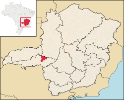
There were 4 bank (2007) and 3,525 automobiles (2007), giving a ratio of 4 inhabitants per automobile.
159:
19:
35:
55:
234:
205:
99:
75:
171:
107:
372:
91:
71:
51:
47:
31:
308:
283:
227:
267:
256:
245:
216:
175:
354:
341:
163:
46:
Perdizes is located at an elevation of 830 meters, 95 km. southeast of
50:
and south of the Nova Ponte
Reservoir. Neighboring municipalities are:
95:
87:
63:
103:
67:
59:
178:
has the lowest rating in the country—0,467—putting it in last place.
38:
and to the micro-region of Araxá. It became a municipality in 1938.
18:
30:
is a
Brazilian municipality located in the west of the state of
145:
National ranking: 1,149 out of 5,138 municipalities as of 2000
158:
The highest ranking municipality in Minas Gerais in 2000 was
16:
Town and municipality in the state of Minas Gerais, Brazil
142:
State ranking: 129 out of 853 municipalities as of 2000
151:Life expectancy: 73 (average of males and females)
106:is 95 km. The distance to the state capital,
94:by national highway BR-462. The distance to
8:
166:with 0.568. Nationally the highest was
198:
188:List of municipalities in Minas Gerais
7:
332:Prefeitura Municipal de Pedrinópolis
14:
162:with 0.841, while the lowest was
379:Municipalities in Minas Gerais
86:Perdizes is connected to both
1:
82:Communications and Distances
395:
137:Human Development Index
131:pre-primary schools.
24:
355:19.35278°S 47.29278°W
22:
360:-19.35278; -47.29278
126:Health and education
23:Location of Perdizes
351: /
114:Economic activities
233:2008-06-28 at the
168:São Caetano do Sul
148:Literacy rate: 87%
110:, is 480 km.
98:is 46 kilometers;
25:
386:
366:
365:
363:
362:
361:
356:
352:
349:
348:
347:
344:
320:
319:
317:
316:
307:. Archived from
301:
295:
294:
292:
291:
282:. Archived from
276:
270:
265:
259:
254:
248:
243:
237:
225:
219:
214:
208:
203:
174:in the state of
56:Serra do Salitre
394:
393:
389:
388:
387:
385:
384:
383:
369:
368:
359:
357:
353:
350:
345:
342:
340:
338:
337:
328:
323:
314:
312:
303:
302:
298:
289:
287:
278:
277:
273:
266:
262:
255:
251:
244:
240:
235:Wayback Machine
226:
222:
215:
211:
204:
200:
196:
184:
160:Poços de Caldas
128:
116:
102:is 35 km;
84:
44:
17:
12:
11:
5:
392:
390:
382:
381:
371:
370:
335:
334:
327:
326:External links
324:
322:
321:
296:
271:
260:
249:
238:
220:
209:
197:
195:
192:
191:
190:
183:
180:
153:
152:
149:
146:
143:
140:
139:: 0.776 (2000)
127:
124:
115:
112:
108:Belo Horizonte
83:
80:
43:
40:
36:Alto Paranaíba
15:
13:
10:
9:
6:
4:
3:
2:
391:
380:
377:
376:
374:
367:
364:
333:
330:
329:
325:
311:on 2011-07-06
310:
306:
300:
297:
286:on 2011-07-06
285:
281:
275:
272:
269:
264:
261:
258:
253:
250:
247:
242:
239:
236:
232:
229:
224:
221:
218:
213:
210:
207:
202:
199:
193:
189:
186:
185:
181:
179:
177:
173:
169:
165:
161:
156:
150:
147:
144:
141:
138:
134:
133:
132:
125:
123:
120:
113:
111:
109:
105:
101:
97:
93:
89:
81:
79:
77:
73:
72:Santa Juliana
69:
65:
61:
57:
53:
49:
41:
39:
37:
33:
29:
21:
336:
313:. Retrieved
309:the original
305:"Frigoletto"
299:
288:. Retrieved
284:the original
280:"Frigoletto"
274:
263:
252:
241:
223:
212:
201:
157:
154:
129:
121:
117:
100:Pedrinópolis
85:
76:Pedrinópolis
45:
32:Minas Gerais
27:
26:
358: /
346:47°17′34″W
343:19°21′10″S
315:2008-08-14
290:2008-08-14
228:Citybrazil
194:References
176:Pernambuco
135:Municipal
92:Uberlândia
52:Patrocínio
48:Uberlândia
206:IBGE 2020
164:Setubinha
373:Category
231:Archived
182:See also
42:Location
28:Perdizes
104:Uberaba
68:Uberaba
172:Manari
66:(SE),
58:(NE),
96:Araxá
88:Araxá
78:(W).
70:(S),
64:Araxá
62:(E),
54:(N),
268:IBGE
257:IBGE
246:IBGE
217:IBGE
90:and
74:and
60:Ibiá
375::
318:.
293:.
Text is available under the Creative Commons Attribution-ShareAlike License. Additional terms may apply.