54:
1078:
42:
963:
767:
685:
living together, 10.2% had a female householder with no husband present, and 26.8% were non-families. 22.0% of all households were made up of individuals, and 11.2% had someone living alone who was 65 years of age or older. The average household size was 2.60 and the average family size was 3.09.
689:
In the city, the population was spread out, with 26.3% under the age of 18, 6.6% from 18 to 24, 30.4% from 25 to 44, 22.7% from 45 to 64, and 14.1% who were 65 years of age or older. The median age was 36 years. For every 100 females, there were 97.4 males. For every 100 females age 18 and over,
653:
of 2000, there were 533 people, 205 households, and 150 families residing in the city. The population density was 333.5 inhabitants per square mile (128.8/km). There were 222 housing units at an average density of 138.9 per square mile (53.6/km). The racial makeup of the city was 92.87%
53:
317:
Philadelphia was founded in the early 1820s by
William Knox and Jacob Pearson. The town initially grew quickly and prospered as a center of business in the Sweetwater Valley. By the mid-19th century, Philadelphia had two general stores, a
693:
The median income for a household in the city was $ 31,563, and the median income for a family was $ 39,792. Males had a median income of $ 30,875 versus $ 14,318 for females. The
806:
1001:
1214:
1199:
1219:
903:
67:
265:
994:
973:
41:
1209:
275:
353:
987:
967:
216:
904:"Incorporated Places and Minor Civil Divisions Datasets: Subcounty Resident Population Estimates: April 1, 2010 to July 1, 2012"
659:
579:
979:
1141:
663:
593:
330:
306:
121:
1204:
882:
835:
606:
395:
933:
739:
1121:
388:
368:
334:
299:
868:
Tennessee
Historical Commission marker IF 28 in Philadelphia, Tennessee. Information accessed: December 28, 2007.
638:
522:
507:
492:
477:
462:
447:
432:
384:
1169:
1011:
291:
253:
126:
99:
791:
1107:
681:
There were 205 households, out of which 31.2% had children under the age of 18 living with them, 60.0% were
710:
1057:
671:
619:
911:
1115:
380:
338:
1176:
1052:
675:
623:
303:
226:
1131:
1096:
667:
655:
565:
714:
878:
859:," 1887. Transcribed for web content by Suzanne Pratt, 2005-2008. Retrieved: January 1, 2008.
1146:
1062:
1033:
718:
697:
for the city was $ 12,239. About 13.1% of families and 17.3% of the population were below the
694:
376:
319:
361:
713:. Philadelphia pupils are zoned to the Philadelphia School (kindergarten to grade 8) and
856:
753:
357:
326:
1193:
258:
792:
U.S. Geological Survey
Geographic Names Information System: Philadelphia, Tennessee
698:
1026:
641:, there were 607 people, 278 households, and 213 families residing in the city.
372:
109:
82:
69:
295:
207:
114:
701:, including 22.3% of those under age 18 and 15.9% of those age 65 or over.
341:. The Confederates captured 700 soldiers, 6 cannon, and 50 supply wagons.
962:
1160:‡This populated place also has portions in an adjacent county or counties
682:
398:, the city has a total area of 1.6 square miles (4.1 km), all land.
367:
Philadelphia is concentrated around an area northwest of the junction of
241:
801:
799:
650:
344:
On
October 20, 2001, there was a reenactment of the events in 1863.
233:
212:
976:— information on local government, elections, and link to charter
337:
brigade at
Philadelphia while conducting maneuvers following the
1088:
1044:
32:
983:
1076:
974:
Municipal
Technical Advisory Service entry for Philadelphia
831:
879:"Census of Population and Housing: Decennial Censuses"
58:
387:(Pond Creek Road), which connects Philadelphia with
1155:
1130:
1106:
1087:
1043:
274:
264:
252:
240:
223:
206:
198:
190:
185:
177:
169:
161:
153:
148:
140:
132:
120:
108:
98:
23:
857:Goodspeed's History of Loudon County, Tennessee
298:, United States. Its population was 656 at the
995:
8:
1002:
988:
980:
678:of any race were 0.38% of the population.
405:
20:
547:
333:cavalry regiments attacked and routed a
730:
263:
239:
205:
184:
176:
147:
131:
97:
62:
50:
38:
787:
785:
425:
826:
824:
273:
251:
222:
197:
189:
168:
160:
152:
139:
119:
107:
7:
1215:Populated places established in 1822
910:. U.S. Census Bureau. Archived from
670:, and 2.06% from two or more races.
375:), which connects Philadelphia with
173:0.00 sq mi (0.00 km)
165:1.55 sq mi (4.03 km)
157:1.55 sq mi (4.03 km)
1200:Cities in Loudon County, Tennessee
1010:Municipalities and communities of
415:
14:
322:yard, a stillhouse, and a hotel.
1220:1822 establishments in Tennessee
961:
768:"ArcGIS REST Services Directory"
740:History of the Sweetwater Valley
549:Philadelphia racial composition
325:On October 20, 1863, during the
52:
40:
18:City in Tennessee, United States
743:(Richmond Press, 1916), p. 404.
352:Philadelphia is situated along
1:
809:. United States Census Bureau
770:. United States Census Bureau
307:Metropolitan Statistical Area
202:390.35/sq mi (150.71/km)
1210:Knoxville metropolitan area
883:United States Census Bureau
836:United States Census Bureau
396:United States Census Bureau
1236:
709:Philadelphia is served by
364:a few miles to the north.
1165:
1074:
1024:
757:, 2005-2006, pp. 618-625.
639:2020 United States census
618:
605:
592:
580:Black or African American
578:
564:
559:
556:
553:
536:
521:
506:
491:
476:
461:
446:
431:
424:
419:
414:
411:
356:, which empties into the
63:
51:
39:
30:
1013:Loudon County, Tennessee
302:. It is included in the
181:879 ft (268 m)
968:Philadelphia, Tennessee
807:"Census Population API"
690:there were 99.5 males.
46:Philadelphia, Tennessee
25:Philadelphia, Tennessee
1081:
1080:
934:"Explore Census Data"
832:"U.S. Census website"
711:Loudon County Schools
407:Historical population
339:Battle of Chickamauga
225: • Summer (
83:35.67917°N 84.40000°W
1178:United States portal
970:at Wikimedia Commons
908:Population Estimates
199: • Density
1205:Cities in Tennessee
754:Tennessee Blue Book
550:
408:
360:impoundment of the
88:35.67917; -84.40000
79: /
1142:Dixie Lee Junction
1082:
715:Loudon High School
548:
406:
383:to the south, and
191: • Total
170: • Water
154: • Total
1187:
1186:
966:Media related to
717:(grades 9-12) in
695:per capita income
635:
634:
541:
540:
394:According to the
379:to the north and
285:
284:
162: • Land
1227:
1179:
1172:
1171:Tennessee portal
1079:
1036:
1029:
1019:
1014:
1004:
997:
990:
981:
965:
949:
948:
946:
944:
930:
924:
923:
921:
919:
914:on June 11, 2013
900:
894:
893:
891:
889:
875:
869:
866:
860:
853:
847:
846:
844:
842:
828:
819:
818:
816:
814:
803:
794:
789:
780:
779:
777:
775:
764:
758:
750:
744:
735:
660:African American
551:
427:
422:
417:
409:
354:Sweetwater Creek
230:
94:
93:
91:
90:
89:
84:
80:
77:
76:
75:
72:
56:
44:
21:
1235:
1234:
1230:
1229:
1228:
1226:
1225:
1224:
1190:
1189:
1188:
1183:
1177:
1170:
1161:
1151:
1133:
1126:
1122:Tellico Village
1102:
1083:
1077:
1072:
1039:
1034:
1027:
1020:
1017:
1012:
1008:
958:
953:
952:
942:
940:
938:data.census.gov
932:
931:
927:
917:
915:
902:
901:
897:
887:
885:
877:
876:
872:
867:
863:
854:
850:
840:
838:
830:
829:
822:
812:
810:
805:
804:
797:
790:
783:
773:
771:
766:
765:
761:
751:
747:
736:
732:
727:
707:
683:married couples
664:Native American
647:
594:Native American
582:(non-Hispanic)
568:(non-Hispanic)
546:
420:
404:
385:State Route 323
362:Tennessee River
350:
315:
248:
224:
87:
85:
81:
78:
73:
70:
68:
66:
65:
59:
47:
35:
26:
19:
12:
11:
5:
1233:
1231:
1223:
1222:
1217:
1212:
1207:
1202:
1192:
1191:
1185:
1184:
1182:
1181:
1174:
1166:
1163:
1162:
1159:
1157:
1153:
1152:
1150:
1149:
1144:
1138:
1136:
1128:
1127:
1125:
1124:
1119:
1112:
1110:
1104:
1103:
1101:
1100:
1093:
1091:
1085:
1084:
1075:
1073:
1071:
1070:
1065:
1060:
1055:
1049:
1047:
1041:
1040:
1025:
1022:
1021:
1009:
1007:
1006:
999:
992:
984:
978:
977:
971:
957:
956:External links
954:
951:
950:
925:
895:
870:
861:
848:
820:
795:
781:
759:
745:
729:
728:
726:
723:
706:
703:
646:
643:
633:
632:
629:
626:
616:
615:
612:
609:
603:
602:
599:
596:
590:
589:
586:
583:
576:
575:
572:
569:
562:
561:
558:
555:
545:
542:
539:
538:
534:
533:
530:
528:
525:
519:
518:
515:
513:
510:
504:
503:
500:
498:
495:
489:
488:
485:
483:
480:
474:
473:
470:
468:
465:
459:
458:
455:
453:
450:
444:
443:
440:
438:
435:
429:
428:
423:
418:
413:
403:
400:
358:Watts Bar Lake
349:
346:
314:
311:
283:
282:
279:
272:
271:
268:
262:
261:
256:
250:
249:
246:
244:
238:
237:
231:
221:
220:
210:
204:
203:
200:
196:
195:
192:
188:
187:
183:
182:
179:
175:
174:
171:
167:
166:
163:
159:
158:
155:
151:
150:
146:
145:
142:
138:
137:
134:
130:
129:
124:
118:
117:
112:
106:
105:
102:
96:
95:
61:
60:
57:
49:
48:
45:
37:
36:
31:
28:
27:
24:
17:
13:
10:
9:
6:
4:
3:
2:
1232:
1221:
1218:
1216:
1213:
1211:
1208:
1206:
1203:
1201:
1198:
1197:
1195:
1180:
1175:
1173:
1168:
1167:
1164:
1158:
1154:
1148:
1145:
1143:
1140:
1139:
1137:
1135:
1129:
1123:
1120:
1117:
1114:
1113:
1111:
1109:
1105:
1098:
1095:
1094:
1092:
1090:
1086:
1069:
1066:
1064:
1061:
1059:
1056:
1054:
1051:
1050:
1048:
1046:
1042:
1038:
1037:
1030:
1023:
1018:United States
1015:
1005:
1000:
998:
993:
991:
986:
985:
982:
975:
972:
969:
964:
960:
959:
955:
939:
935:
929:
926:
913:
909:
905:
899:
896:
884:
880:
874:
871:
865:
862:
858:
852:
849:
837:
833:
827:
825:
821:
808:
802:
800:
796:
793:
788:
786:
782:
769:
763:
760:
756:
755:
749:
746:
742:
741:
737:W.B. Lenoir,
734:
731:
724:
722:
720:
716:
712:
704:
702:
700:
696:
691:
687:
684:
679:
677:
673:
669:
665:
661:
657:
652:
644:
642:
640:
630:
627:
625:
621:
617:
613:
610:
608:
604:
600:
597:
595:
591:
587:
584:
581:
577:
573:
570:
567:
563:
552:
543:
535:
531:
529:
526:
524:
520:
516:
514:
511:
509:
505:
501:
499:
496:
494:
490:
486:
484:
481:
479:
475:
471:
469:
466:
464:
460:
456:
454:
451:
449:
445:
441:
439:
436:
434:
430:
410:
401:
399:
397:
392:
391:to the west.
390:
389:Interstate 75
386:
382:
378:
374:
370:
369:U.S. Route 11
365:
363:
359:
355:
347:
345:
342:
340:
336:
332:
328:
323:
321:
312:
310:
308:
305:
301:
297:
293:
292:Loudon County
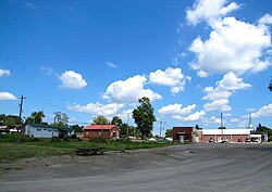
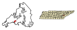
290:is a city in
289:
280:
277:
269:
267:
260:
257:
255:
245:
243:
235:
232:
228:
218:
217:Eastern (EST)
214:
211:
209:
201:
193:
180:
172:
164:
156:
143:
135:
128:
125:
123:
116:
113:
111:
104:United States
103:
101:
92:
64:Coordinates:
55:
43:
34:
29:
22:
16:
1068:Philadelphia
1067:
1032:
943:December 26,
941:. Retrieved
937:
928:
918:December 11,
916:. Retrieved
912:the original
907:
898:
886:. Retrieved
873:
864:
851:
839:. Retrieved
811:. Retrieved
772:. Retrieved
762:
752:
748:
738:
733:
708:
699:poverty line
692:
688:
680:
648:
636:
402:Demographics
393:
366:
351:
343:
324:
316:
288:Philadelphia
287:
286:
141:Incorporated
15:
1134:communities
1058:Lenoir City
1028:County seat
841:January 31,
813:October 15,
774:October 15,
645:2000 census
607:Other/Mixed
560:Percentage
544:2020 census
373:Lee Highway
331:Confederate
300:2010 census
86: /
1194:Categories
1116:Rarity Bay
725:References
649:As of the
637:As of the
381:Sweetwater
278:feature ID
186:Population
74:84°24′00″W
71:35°40′45″N
1156:Footnotes
1053:Greenback
705:Education
348:Geography
327:Civil War
304:Knoxville
296:Tennessee
266:FIPS code
254:Area code
208:Time zone
178:Elevation
115:Tennessee
1097:Farragut
888:March 4,
672:Hispanic
666:, 0.19%
662:, 0.75%
658:, 4.13%
620:Hispanic
537:Sources:
270:47-57900
242:ZIP code
631:12.52%
574:80.23%
557:Number
320:tanning
313:History
281:2404511
133:Founded
100:Country
1147:Unitia
1063:Loudon
1045:Cities
1035:Loudon
719:Loudon
676:Latino
651:census
624:Latino
614:3.29%
601:0.16%
588:3.79%
412:Census
377:Loudon
329:, two
127:Loudon
122:County
1132:Other
1089:Towns
668:Asian
656:White
566:White
554:Race
532:−7.5%
517:23.1%
502:15.1%
487:−8.7%
472:−8.5%
335:Union
247:37846
236:(EDT)
234:UTC-4
213:UTC-5
110:State
1108:CDPs
945:2021
920:2013
890:2012
843:2008
815:2022
776:2022
571:487
523:2020
508:2010
493:2000
478:1990
463:1980
448:1970
433:1880
421:Note
416:Pop.
276:GNIS
149:Area
144:1968
136:1822
33:City
674:or
628:76
622:or
611:20
585:23
527:607
512:656
497:533
482:463
467:507
452:554
437:332
259:865
227:DST
194:607
1196::
1031::
1016:,
936:.
906:.
881:.
834:.
823:^
798:^
784:^
721:.
598:1
426:%±
309:.
294:,
1118:‡
1099:‡
1003:e
996:t
989:v
947:.
922:.
892:.
855:"
845:.
817:.
778:.
457:—
442:—
371:(
229:)
219:)
215:(
Text is available under the Creative Commons Attribution-ShareAlike License. Additional terms may apply.