40:
333:, and connected by the Regional E.R.1-1ª roadway to other centers on the island. The parish is divided into three distinct zones (Piedade, Calhau and Manhenha), and includes two fishing ports (Port of Manhenha and Porto of Calhau), in addition to swimming areas in the areas of Baía da Engrade, Baía do Céu de Abraão, Baía da Caravela and Baía da Fonte. The parishes includes several localities, that includes smaller non-political communities within the civil parish, including: Altamora, Areal, Biscoito Queimado, Cabecinho, Castelete, Eiras, Galego, Calhau, Cruz do Redondo, Curral da Pedra, Engrade, Faias, Fetais, Manhenha and Ponta da Ilha.
52:
103:
39:
341:
The patrimony of the parish is diverse, although the primary buildings are the parochial church and hermitage, the curious fishing boat shelters, windmills and lighthouse. The following were classified by
366:), originally proposed in 1883, the lighthouse was only built in the mid-20th century, in lands ceded by Maria Adelaide Gomes, Paulina Gomes Ávila and their husbands for 200$ 00, rural lands in Calvino.
317:), a park dedicated to commander Manuel Matos Souto, an emigrante who departed for Brazil in the 19th century, where he made his fortune (resending his monies home in order to buy land on the island).
51:
408:
294:
plague, the vineyards in this location were great producers of the popular
Verdelho wines, becoming one of the more important agricultural centres on the island.
290:
The 1755 Lisbon earthquake affected the community, resulting in the destruction of many homes and the parochial church of the time. Before their destruction by
387:), the original church was built in 1506, but destroyed following the 1755 Lisbon earthquake, resulting in the construction of the present building after 1756.
65:
484:
419:
115:
233:
44:
Facing into the eastern coast, the lighthouse of
Manhenha is the last building in Ponta da Ilha, in the parish of Piedade
330:
137:
221:
260:
206:
380:
359:
248:
456:
432:
326:
461:(in Portuguese), Lisbon, Portugal: SIPA – Sistema de Informação para o Património Arquitectónico
437:(in Portuguese), Lisbon, Portugal: SIPA – Sistema de Informação para o Património Arquitectónico
458:
Igreja
Paroquial da Piedade / Igreja de Nossa Senhora da Piedade (IPA.00032438/PT072004030015)
196:
478:
268:
142:
243:
213:
325:
Piedade is located on the extreme east coast of Pico, bordering the parishes of
272:
130:
291:
287:
The parish was founded after 1506, from the historical registers of the time.
80:
67:
191:
30:
56:
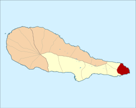
Location of
Piedade in the municipality of Lajes do Pico within Pico Island
264:
108:
343:
276:
120:
279:. The population in 2011 was 844, in an area of 12.81 km.
299:
Direcção de Serviços de
Conservação da Natureza do Pico
313:) were installed in the Parque Florestal Matos Souto (
303:
434:
Farol da Ponta da Ilha(IPA.00012774/PT072004030006)
242:
232:
220:
203:
190:
182:
174:
169:
161:
153:
148:
136:
126:
114:
96:
21:
8:
18:
401:
241:
219:
189:
168:
160:
147:
95:
60:
48:
36:
231:
202:
181:
173:
152:
135:
125:
113:
7:
431:Costa, Patrícia (2002), SIPA (ed.),
157:12.81 km (4.95 sq mi)
385:Igreja da Nossa Senhora da Piedade
377:Church of Nossa Senhora da Piedade
14:
409:Instituto Nacional de Estatística
346:as buildings of public interest:
101:
50:
38:
16:Civil parish in Azores, Portugal
455:Noe, Paula (2011), SIPA (ed.),
311:Environmental Services of Pico
1:
485:Freguesias of Lajes do Pico
356:Lighthouse of Ponta da Ilha
307:Serviço de Ambiente do Pico
501:
61:
49:
37:
28:
165:178 m (584 ft)
315:Forest Park Matos Souto
384:
364:Farol de Ponta da Ilha
363:
186:66/km (170/sq mi)
205: • Summer (
81:38.42139°N 28.06028°W
183: • Density
249:Blessed Virgin Mary
86:38.42139; -28.06028
77: /
327:Calheta de Nesquim
175: • Total
154: • Total
275:, the Portuguese
271:on the island of
254:
253:
492:
470:
469:
468:
466:
452:
446:
445:
444:
442:
428:
422:
417:
411:
406:
210:
107:
105:
104:
92:
91:
89:
88:
87:
82:
78:
75:
74:
73:
70:
54:
42:
19:
500:
499:
495:
494:
493:
491:
490:
489:
475:
474:
473:
464:
462:
454:
453:
449:
440:
438:
430:
429:
425:
418:
414:
407:
403:
394:
373:
352:
339:
323:
285:
228:
204:
102:
100:
85:
83:
79:
76:
71:
68:
66:
64:
63:
57:
45:
33:
24:
17:
12:
11:
5:
498:
496:
488:
487:
477:
476:
472:
471:
447:
423:
412:
400:
399:
398:
393:
390:
389:
388:
372:
369:
368:
367:
351:
348:
338:
335:
322:
319:
284:
281:
252:
251:
246:
240:
239:
236:
230:
229:
226:
224:
218:
217:
211:
201:
200:
194:
188:
187:
184:
180:
179:
176:
172:
171:
167:
166:
163:
159:
158:
155:
151:
150:
146:
145:
140:
134:
133:
128:
124:
123:
118:
112:
111:
98:
94:
93:
59:
58:
55:
47:
46:
43:
35:
34:
29:
26:
25:
22:
15:
13:
10:
9:
6:
4:
3:
2:
497:
486:
483:
482:
480:
460:
459:
451:
448:
436:
435:
427:
424:
421:
416:
413:
410:
405:
402:
396:
395:
391:
386:
382:
378:
375:
374:
370:
365:
361:
357:
354:
353:
349:
347:
345:
336:
334:
332:
328:
320:
318:
316:
312:
308:
304:
300:
295:
293:
288:
282:
280:
278:
274:
270:
269:Lajes do Pico
266:
262:
258:
250:
247:
245:
237:
235:
225:
223:
215:
212:
208:
198:
195:
193:
185:
177:
164:
156:
144:
143:Lajes do Pico
141:
139:
132:
129:
122:
119:
117:
116:Auton. region
110:
99:
90:
62:Coordinates:
53:
41:
32:
27:
20:
463:, retrieved
457:
450:
439:, retrieved
433:
426:
415:
404:
376:
355:
340:
337:Architecture
324:
314:
310:
306:
302:
298:
296:
289:
286:
265:municipality
261:civil parish
256:
255:
138:Municipality
31:Civil parish
222:Postal code
84: /
465:12 January
441:12 January
392:References
381:Portuguese
360:Portuguese
331:Ribeirinha
292:phylloxera
170:Population
69:38°25′17″N
371:Religious
321:Geography
234:Area code
214:UTC±00:00
197:UTC−01:00
192:Time zone
162:Elevation
72:28°3′37″W
479:Category
420:Eurostat
227:9930-206
109:Portugal
344:IGESPAR
283:History
263:in the
257:Piedade
216:(AZOST)
97:Country
23:Piedade
305:) and
277:Azores
244:Patron
199:(AZOT)
127:Island
121:Azores
106:
397:Notes
350:Civic
259:is a
467:2014
443:2014
329:and
297:The
273:Pico
149:Area
131:Pico
267:of
238:292
207:DST
178:844
481::
383::
362::
379:(
358:(
309:(
301:(
209:)
Text is available under the Creative Commons Attribution-ShareAlike License. Additional terms may apply.