1102:
64:
79:
89:
104:
789:
living together, 14.7% had a female householder with no husband present, and 37.8% were non-families. 34.5% of all households were made up of individuals, and 15.7% had someone living alone who was 65 years of age or older. The average household size was 2.19 and the average family size was 2.81.
793:
In the town, the population was spread out, with 22.5% under the age of 18, 7.3% from 18 to 24, 27.3% from 25 to 44, 23.7% from 45 to 64, and 19.2% who were 65 years of age or older. The median age was 40 years. For every 100 females, there were 79.9 males. For every 100 females age 18 and over,
753:
of 2000, there were 1,281 people, 585 households, and 363 families residing in the town. The population density was 742.3 inhabitants per square mile (286.6/km). There were 644 housing units at an average density of 373.2 per square mile (144.1/km). The racial makeup of the town was 87.82%
1210:
1040:
797:
The median income for a household in the town was $ 33,529, and the median income for a family was $ 42,279. Males had a median income of $ 31,522 versus $ 21,250 for females. The
1215:
1185:
1220:
1175:
1195:
1170:
1582:
1205:
1200:
1160:
1155:
1433:
1190:
1180:
1165:
1150:
1363:
117:
1033:
1503:
1383:
1428:
1524:
1418:
1238:
299:
1413:
1408:
1353:
103:
78:
1519:
1026:
940:
367:
1453:
1348:
309:
821:
63:
171:
1587:
250:
1018:
1388:
889:
351:
88:
28:
1478:
759:
666:
1552:
1403:
1298:
763:
680:
1398:
1368:
1253:
1050:
335:
176:
1498:
1488:
1463:
1373:
1358:
1338:
1333:
1303:
864:
771:
706:
379:
981:
1508:
1483:
1458:
1448:
1318:
1293:
1288:
1091:
1513:
1438:
1423:
1393:
1323:
738:
596:
581:
566:
551:
536:
521:
506:
491:
476:
461:
446:
431:
416:
347:
32:
1493:
1443:
1343:
1328:
1283:
287:
149:
845:
1378:
1230:
785:
There were 585 households, out of which 25.5% had children under the age of 18 living with them, 45.3% were
1529:
1473:
1468:
1308:
1278:
1273:
1243:
1121:
1072:
775:
719:
363:
1313:
1248:
1126:
945:
1559:
779:
723:
260:
1263:
767:
755:
693:
652:
909:
801:
for the town was $ 18,526. About 11.9% of families and 15.5% of the population were below the
798:
921:
846:
U.S. Geological Survey
Geographic Names Information System: Pilot Mountain, North Carolina
1142:
339:
164:
1576:
1013:
343:
292:
802:
741:, there were 1,440 people, 715 households, and 455 families residing in the town.
17:
1065:
959:
159:
132:
119:
241:
805:, including 25.1% of those under age 18 and 17.2% of those age 65 or over.
382:, the town has a total area of 1.7 square miles (4.4 km), all land.
1543:‡This populated place also has portions in an adjacent county or counties
786:
275:
1101:
323:
1008:
750:
267:
246:
935:
1113:
1083:
54:
1022:
1100:
860:
883:
881:
27:
This article is about the town. For the mountain, see
1538:
1262:
1229:
1141:
1112:
1082:
319:
308:
298:
286:
274:
257:
240:
232:
224:
219:
211:
203:
195:
187:
182:
170:
158:
148:
45:
1105:Map of North Carolina highlighting Surry County
1034:
8:
890:"City and Town Population Totals: 2020-2021"
1041:
1027:
1019:
782:of any race were 1.25% of the population.
389:
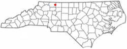
108:Location of Pilot Mountain, North Carolina
42:
350:. It is named for the nearby landmark of
634:
813:
318:
297:
273:
239:
218:
210:
181:
147:
112:
100:
72:
60:
936:"National Register Information System"
917:
907:
841:
839:
409:
354:, a distinctive geological formation.
1583:Towns in Surry County, North Carolina
855:
853:
307:
285:
256:
231:
223:
202:
194:
186:
169:
157:
40:Town in North Carolina, United States
7:
941:National Register of Historic Places
774:, and 1.41% from two or more races.
368:National Register of Historic Places
207:0.02 sq mi (0.06 km)
199:2.04 sq mi (5.27 km)
191:2.06 sq mi (5.33 km)
1049:Municipalities and communities of
960:"Census of Population and Housing"
636:Pilot Mountain racial composition
399:
346:. The population was 1,443 at the
25:
822:"ArcGIS REST Services Directory"
102:
87:
77:
62:
29:Pilot Mountain (North Carolina)
47:Pilot Mountain, North Carolina
1:
1014:Atlantic & Yadkin Railway
824:. United States Census Bureau
236:707.27/sq mi (273.08/km)
1052:Surry County, North Carolina
865:United States Census Bureau
380:United States Census Bureau
324:www.townofpilotmountain.com
1604:
215:1,099 ft (335 m)
26:
1548:
1098:
1063:
739:2020 United States census
718:
705:
692:
679:
667:Black or African American
665:
651:
646:
643:
640:
623:
610:
595:
580:
565:
550:
535:
520:
505:
490:
475:
460:
445:
430:
415:
408:
403:
398:
395:
113:
101:
73:
61:
52:
33:Pilot Mountain State Park
1588:Towns in North Carolina
794:there were 75.4 males.
1106:
364:Bank of Pilot Mountain
1554:North Carolina portal
1520:White Sulphur Springs
1104:
982:"Explore Census Data"
946:National Park Service
861:"U.S. Census website"
624:U.S. Decennial Census
391:Historical population
259: • Summer (
133:36.38556°N 80.47361°W
1561:United States portal
233: • Density
31:. For the park, see
888:Bureau, US Census.
637:
392:
138:36.38556; -80.47361
129: /
1107:
1009:Official Town Site
920:has generic name (
896:. US Census Bureau
635:
390:
366:was listed on the
225: • Total
204: • Water
188: • Total
18:Pilot Mountain, NC
1570:
1569:
799:per capita income
735:
734:
628:
627:
378:According to the
329:
328:
196: • Land
16:(Redirected from
1595:
1562:
1555:
1103:
1075:
1068:
1058:
1053:
1043:
1036:
1029:
1020:
997:
996:
994:
992:
978:
972:
971:
969:
967:
956:
950:
949:
932:
926:
925:
919:
915:
913:
905:
903:
901:
885:
876:
875:
873:
871:
857:
848:
843:
834:
833:
831:
829:
818:
760:African American
638:
411:
406:
401:
393:
264:
144:
143:
141:
140:
139:
134:
130:
127:
126:
125:
122:
106:
91:
81:
68:West Main Street
66:
43:
21:
1603:
1602:
1598:
1597:
1596:
1594:
1593:
1592:
1573:
1572:
1571:
1566:
1560:
1553:
1544:
1534:
1389:Little Richmond
1265:
1258:
1225:
1211:South Westfield
1137:
1108:
1096:
1078:
1073:
1066:
1059:
1056:
1051:
1047:
1005:
1000:
990:
988:
986:data.census.gov
980:
979:
975:
965:
963:
958:
957:
953:
948:. July 9, 2010.
934:
933:
929:
916:
906:
899:
897:
887:
886:
879:
869:
867:
859:
858:
851:
844:
837:
827:
825:
820:
819:
815:
811:
787:married couples
764:Native American
747:
681:Native American
669:(non-Hispanic)
655:(non-Hispanic)
633:
404:
388:
376:
360:
282:
258:
137:
135:
131:
128:
123:
120:
118:
116:
115:
109:
97:
96:
95:
94:
85:
84:
69:
57:
48:
41:
36:
23:
22:
15:
12:
11:
5:
1601:
1599:
1591:
1590:
1585:
1575:
1574:
1568:
1567:
1565:
1564:
1557:
1549:
1546:
1545:
1542:
1540:
1536:
1535:
1533:
1532:
1527:
1522:
1517:
1511:
1506:
1501:
1496:
1491:
1486:
1481:
1479:Slate Mountain
1476:
1471:
1466:
1461:
1456:
1451:
1446:
1441:
1436:
1434:Poplar Springs
1431:
1426:
1421:
1416:
1411:
1406:
1401:
1396:
1391:
1386:
1381:
1376:
1371:
1366:
1361:
1356:
1351:
1346:
1341:
1336:
1331:
1326:
1321:
1316:
1311:
1306:
1301:
1296:
1291:
1286:
1281:
1276:
1270:
1268:
1264:Unincorporated
1260:
1259:
1257:
1256:
1251:
1246:
1241:
1235:
1233:
1227:
1226:
1224:
1223:
1218:
1216:Stewarts Creek
1213:
1208:
1203:
1198:
1193:
1188:
1183:
1178:
1173:
1168:
1163:
1158:
1153:
1147:
1145:
1139:
1138:
1136:
1135:
1133:Pilot Mountain
1130:
1124:
1118:
1116:
1110:
1109:
1099:
1097:
1095:
1094:
1088:
1086:
1080:
1079:
1064:
1061:
1060:
1048:
1046:
1045:
1038:
1031:
1023:
1017:
1016:
1011:
1004:
1003:External links
1001:
999:
998:
973:
951:
927:
877:
849:
835:
812:
810:
807:
746:
743:
733:
732:
729:
726:
716:
715:
712:
709:
703:
702:
699:
696:
690:
689:
686:
683:
677:
676:
673:
670:
663:
662:
659:
656:
649:
648:
645:
642:
632:
629:
626:
625:
621:
620:
617:
615:
612:
608:
607:
604:
602:
599:
593:
592:
589:
587:
584:
578:
577:
574:
572:
569:
563:
562:
559:
557:
554:
548:
547:
544:
542:
539:
533:
532:
529:
527:
524:
518:
517:
514:
512:
509:
503:
502:
499:
497:
494:
488:
487:
484:
482:
479:
473:
472:
469:
467:
464:
458:
457:
454:
452:
449:
443:
442:
439:
437:
434:
428:
427:
424:
422:
419:
413:
412:
407:
402:
397:
387:
384:
375:
372:
359:
356:
352:Pilot Mountain
340:North Carolina
332:Pilot Mountain
327:
326:
321:
317:
316:
313:
306:
305:
302:
296:
295:
290:
284:
283:
280:
278:
272:
271:
265:
255:
254:
244:
238:
237:
234:
230:
229:
226:
222:
221:
217:
216:
213:
209:
208:
205:
201:
200:
197:
193:
192:
189:
185:
184:
180:
179:
174:
168:
167:
165:North Carolina
162:
156:
155:
152:
146:
145:
111:
110:
107:
99:
98:
92:
86:
82:
76:
75:
74:
71:
70:
67:
59:
58:
53:
50:
49:
46:
39:
24:
14:
13:
10:
9:
6:
4:
3:
2:
1600:
1589:
1586:
1584:
1581:
1580:
1578:
1563:
1558:
1556:
1551:
1550:
1547:
1541:
1537:
1531:
1528:
1526:
1523:
1521:
1518:
1515:
1512:
1510:
1507:
1505:
1502:
1500:
1497:
1495:
1492:
1490:
1487:
1485:
1482:
1480:
1477:
1475:
1472:
1470:
1467:
1465:
1462:
1460:
1457:
1455:
1452:
1450:
1447:
1445:
1442:
1440:
1437:
1435:
1432:
1430:
1427:
1425:
1422:
1420:
1417:
1415:
1412:
1410:
1407:
1405:
1404:Mountain Park
1402:
1400:
1397:
1395:
1392:
1390:
1387:
1385:
1382:
1380:
1377:
1375:
1372:
1370:
1367:
1365:
1364:Holly Springs
1362:
1360:
1357:
1355:
1352:
1350:
1347:
1345:
1342:
1340:
1337:
1335:
1332:
1330:
1327:
1325:
1322:
1320:
1317:
1315:
1312:
1310:
1307:
1305:
1302:
1300:
1299:Blevins Store
1297:
1295:
1292:
1290:
1287:
1285:
1282:
1280:
1277:
1275:
1272:
1271:
1269:
1267:
1261:
1255:
1252:
1250:
1247:
1245:
1242:
1240:
1237:
1236:
1234:
1232:
1228:
1222:
1219:
1217:
1214:
1212:
1209:
1207:
1204:
1202:
1199:
1197:
1194:
1192:
1189:
1187:
1184:
1182:
1179:
1177:
1174:
1172:
1169:
1167:
1164:
1162:
1159:
1157:
1154:
1152:
1149:
1148:
1146:
1144:
1140:
1134:
1131:
1128:
1125:
1123:
1120:
1119:
1117:
1115:
1111:
1093:
1090:
1089:
1087:
1085:
1081:
1077:
1076:
1069:
1062:
1057:United States
1054:
1044:
1039:
1037:
1032:
1030:
1025:
1024:
1021:
1015:
1012:
1010:
1007:
1006:
1002:
987:
983:
977:
974:
961:
955:
952:
947:
943:
942:
937:
931:
928:
923:
911:
895:
891:
884:
882:
878:
866:
862:
856:
854:
850:
847:
842:
840:
836:
828:September 20,
823:
817:
814:
808:
806:
804:
800:
795:
791:
788:
783:
781:
777:
773:
770:, 0.86% from
769:
765:
761:
757:
752:
744:
742:
740:
730:
727:
725:
721:
717:
713:
710:
708:
704:
700:
697:
695:
691:
687:
684:
682:
678:
674:
671:
668:
664:
660:
657:
654:
650:
639:
630:
622:
618:
616:
613:
609:
605:
603:
600:
598:
594:
590:
588:
585:
583:
579:
575:
573:
570:
568:
564:
560:
558:
555:
553:
549:
545:
543:
540:
538:
534:
530:
528:
525:
523:
519:
515:
513:
510:
508:
504:
500:
498:
495:
493:
489:
485:
483:
480:
478:
474:
470:
468:
465:
463:
459:
455:
453:
450:
448:
444:
440:
438:
435:
433:
429:
425:
423:
420:
418:
414:
394:
385:
383:
381:
373:
371:
369:
365:
357:
355:
353:
349:
345:
344:United States
341:
337:
334:is a town in
333:
325:
322:
314:
311:
303:
301:
294:
291:
289:
279:
277:
269:
266:
262:
252:
251:Eastern (EST)
248:
245:
243:
235:
227:
214:
206:
198:
190:
178:
175:
173:
166:
163:
161:
154:United States
153:
151:
142:
114:Coordinates:
105:
90:
80:
65:
56:
51:
44:
38:
34:
30:
19:
1399:Mount Herman
1369:Indian Grove
1254:White Plains
1132:
1071:
991:December 21,
989:. Retrieved
985:
976:
964:. Retrieved
962:. Census.gov
954:
939:
930:
918:|last1=
898:. Retrieved
893:
868:. Retrieved
826:. Retrieved
816:
803:poverty line
796:
792:
784:
748:
736:
386:Demographics
377:
361:
336:Surry County
331:
330:
37:
1504:Union Cross
1499:Turkey Ford
1489:Stony Knoll
1464:Sheltontown
1384:Level Cross
1374:Jenkinstown
1359:Hills Grove
1339:Crutchfield
1334:Crooked Oak
1304:Boones Hill
1266:communities
1067:County seat
870:January 31,
772:other races
745:2000 census
707:Other/Mixed
647:Percentage
631:2020 census
611:2021 (est.)
348:2020 census
136: /
1577:Categories
1509:Union Hill
1484:State Road
1459:Salem Fork
1449:Round Peak
1429:Pine Ridge
1319:Cedar Hill
1294:Blackwater
1289:Bannertown
1186:Mount Airy
1092:Mount Airy
894:Census.gov
809:References
749:As of the
737:As of the
312:feature ID
220:Population
124:80°28′25″W
121:36°23′08″N
1539:Footnotes
1525:Woodville
1514:Westfield
1439:Red Brush
1424:Pine Hill
1419:Oak Grove
1394:Long Hill
1324:Combstown
1239:Flat Rock
1221:Westfield
1176:Long Hill
1143:Townships
374:Geography
370:in 1997.
300:FIPS code
288:Area code
242:Time zone
212:Elevation
1494:Thurmond
1444:Rockford
1414:New Hope
1409:Mulberry
1354:Franklin
1349:Fairview
1344:Devotion
1329:Copeland
1284:Ash Hill
1196:Rockford
1171:Franklin
910:cite web
776:Hispanic
766:, 0.47%
762:, 0.16%
758:, 9.29%
720:Hispanic
304:37-51820
276:ZIP code
1379:Ladonia
966:June 4,
900:July 9,
661:84.17%
644:Number
358:History
320:Website
315:2407111
150:Country
1530:Zephyr
1474:Siloam
1469:Shoals
1309:Bottom
1279:Ararat
1274:Albion
1244:Lowgap
1206:Siloam
1201:Shoals
1161:Eldora
1156:Dobson
1122:Dobson
1074:Dobson
780:Latino
751:census
731:2.36%
724:Latino
714:5.21%
688:0.35%
675:7.01%
658:1,212
546:−16.7%
396:Census
172:County
1454:Salem
1314:Burch
1249:Toast
1191:Pilot
1181:Marsh
1166:Elkin
1151:Bryan
1127:Elkin
1114:Towns
768:Asian
756:White
701:0.9%
694:Asian
653:White
641:Race
619:−0.5%
614:1,436
606:−2.3%
601:1,443
591:15.3%
586:1,477
571:1,281
556:1,181
541:1,090
531:−0.1%
526:1,309
516:20.0%
511:1,310
501:18.1%
496:1,092
486:−8.4%
471:42.9%
466:1,010
441:−8.2%
281:27041
270:(EDT)
268:UTC-4
247:UTC-5
228:1,440
177:Surry
160:State
1231:CDPs
1084:City
993:2021
968:2016
922:help
902:2022
872:2008
830:2022
672:101
597:2020
582:2010
576:8.5%
567:2000
561:8.3%
552:1990
537:1980
522:1970
507:1960
492:1950
477:1940
462:1930
456:8.4%
447:1920
432:1910
417:1900
405:Note
400:Pop.
362:The
310:GNIS
183:Area
93:Seal
83:Flag
55:Town
778:or
728:34
722:or
711:75
698:13
481:925
451:707
436:652
421:710
293:336
261:DST
1579::
1070::
1055:,
984:.
944:.
938:.
914::
912:}}
908:{{
892:.
880:^
863:.
852:^
838:^
685:5
410:%±
342:,
338:,
1516:‡
1129:‡
1042:e
1035:t
1028:v
995:.
970:.
924:)
904:.
874:.
832:.
426:—
263:)
253:)
249:(
35:.
20:)
Text is available under the Creative Commons Attribution-ShareAlike License. Additional terms may apply.