62:
74:
720:
47:
410:
In the township the population was spread out, with 31.0% under the age of 18, 7.1% from 18 to 24, 23.1% from 25 to 44, 23.1% from 45 to 64, and 15.6% who were 65 years of age or older. The median age was 38 years. For every 100 females there were 118.9 males. For every 100 females age 18 and over,
370:
of 2000, there were 4,493 people, 1,538 households, and 1,164 families residing in the township. The population density was 174.7 inhabitants per square mile (67.5/km). There were 1,619 housing units at an average density of 62.9 per square mile (24.3/km). The racial makeup of the township was
406:
living together, 7.8% had a female householder with no husband present, and 24.3% were non-families. 20.7% of all households were made up of individuals, and 9.6% had someone living alone who was 65 years of age or older. The average household size was 2.57 and the average family size was 2.96.
61:
1091:
358:, the township has a total area of 26.0 square miles (67.4 km), of which 25.7 square miles (66.6 km) is land and 0.3 square mile (0.8 km) (1.12%) is water.
414:
The median income for a household in the township was $ 41,423, and the median income for a family was $ 44,694. Males had a median income of $ 41,597 versus $ 25,743 for females. The
831:
648:
871:
846:
1135:
946:
941:
921:
73:
956:
926:
886:
821:
816:
866:
856:
931:
836:
826:
1130:
881:
861:
841:
1140:
851:
17:
966:
916:
901:
876:
641:
1029:
936:
46:
1034:
634:
896:
961:
951:
911:
891:
439:
626:
536:
467:
989:
384:
376:
798:
758:
1068:
788:
658:
610:
586:
388:
355:
339:
107:
1019:
984:
783:
773:
297:
282:
267:
999:
778:
753:
748:
218:
52:
402:
There were 1,538 households, out of which 32.6% had children under the age of 18 living with them, 64.6% were
1055:
1009:
976:
808:
793:
763:
704:
335:
37:
1039:
743:
730:
392:
1014:
699:
210:
1075:
1024:
768:
709:
680:
396:
199:
738:
691:
380:
372:
418:
for the township was $ 18,015. About 4.8% of families and 5.9% of the population were below the
513:
556:
487:
415:
189:
568:
499:
346:, United States. The population was 4,808 at the 2020 census, down from 5,150 in 2010.
1124:
223:
419:
343:
97:
673:
92:
1106:
1093:
180:
422:, including 3.8% of those under age 18 and 4.9% of those age 65 or over.
403:
367:
206:
185:
630:
233:
718:
606:
582:
16:
461:
459:
457:
1048:
998:
975:
807:
729:
690:
229:
217:
196:
179:
171:
163:
155:
150:
142:
134:
126:
121:
113:
103:
91:
83:
28:
642:
8:
537:"City and Town Population Totals: 2020-2021"
468:"City and Town Population Totals: 2020-2022"
18:Pine Township, Pennsylvania (disambiguation)
649:
635:
627:
399:of any race were 1.05% of the population.
240:
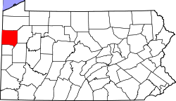
66:Location of Pine Township in Mercer County
25:
78:Location of Mercer County in Pennsylvania
1136:Townships in Mercer County, Pennsylvania
431:
228:
216:
178:
149:
120:
112:
82:
58:
43:
23:Township in Pennsylvania, United States
564:
554:
495:
485:
260:
195:
170:
162:
154:
141:
138:25.41 sq mi (65.81 km)
133:
130:25.68 sq mi (66.51 km)
125:
102:
90:
70:
7:
1131:Populated places established in 1851
391:, and 0.65% from two or more races.
1141:1851 establishments in Pennsylvania
146:0.27 sq mi (0.69 km)
657:Municipalities and communities of
514:"Census of Population and Housing"
250:
14:
72:
60:
45:
1:
442:. United States Census Bureau
51:A stream and fields south of
175:198.35/sq mi (76.58/km)
660:Mercer County, Pennsylvania
611:United States Census Bureau
587:United States Census Bureau
440:"2016 U.S. Gazetteer Files"
356:United States Census Bureau
164: • Estimate
1157:
15:
1064:
716:
671:
324:
311:
296:
281:
266:
259:
254:
249:
246:
71:
59:
44:
35:
411:there were 98.2 males.
723:
1107:41.15000°N 80.12500°W
722:
607:"U.S. Census website"
583:"U.S. Census website"
325:U.S. Decennial Census
242:Historical population
198: • Summer (
1077:United States portal
234:www.pinetownship.org
172: • Density
1112:41.15000; -80.12500
1103: /
1070:Pennsylvania portal
535:Bureau, US Census.
466:Bureau, US Census.
243:
1049:Former settlements
724:
567:has generic name (
543:. US Census Bureau
498:has generic name (
474:. US Census Bureau
241:
156: • Total
143: • Water
127: • Total
1086:
1085:
832:East Lackawannock
416:per capita income
354:According to the
329:
328:
239:
238:
135: • Land
1148:
1118:
1117:
1115:
1114:
1113:
1108:
1104:
1101:
1100:
1099:
1096:
1078:
1071:
990:Reynolds Heights
937:South Pymatuning
721:
683:
676:
666:
661:
651:
644:
637:
628:
621:
620:
618:
617:
603:
597:
596:
594:
593:
579:
573:
572:
566:
562:
560:
552:
550:
548:
532:
526:
525:
523:
521:
510:
504:
503:
497:
493:
491:
483:
481:
479:
463:
452:
451:
449:
447:
436:
385:Pacific Islander
377:African American
262:
257:
252:
244:
203:
76:
64:
49:
26:
1156:
1155:
1151:
1150:
1149:
1147:
1146:
1145:
1121:
1120:
1111:
1109:
1105:
1102:
1097:
1094:
1092:
1090:
1089:
1087:
1082:
1076:
1069:
1060:
1044:
1001:
994:
971:
803:
725:
719:
714:
686:
681:
674:
667:
664:
659:
655:
625:
624:
615:
613:
605:
604:
600:
591:
589:
581:
580:
576:
563:
553:
546:
544:
534:
533:
529:
519:
517:
512:
511:
507:
494:
484:
477:
475:
465:
464:
455:
445:
443:
438:
437:
433:
428:
404:married couples
364:
352:
255:
197:
79:
67:
55:
40:
31:
24:
21:
12:
11:
5:
1154:
1152:
1144:
1143:
1138:
1133:
1123:
1122:
1084:
1083:
1081:
1080:
1073:
1065:
1062:
1061:
1059:
1058:
1052:
1050:
1046:
1045:
1043:
1042:
1037:
1032:
1027:
1022:
1017:
1012:
1006:
1004:
1000:Unincorporated
996:
995:
993:
992:
987:
981:
979:
973:
972:
970:
969:
964:
959:
954:
949:
944:
939:
934:
929:
924:
919:
914:
909:
904:
899:
894:
889:
884:
879:
874:
869:
864:
859:
854:
849:
844:
839:
834:
829:
824:
819:
813:
811:
805:
804:
802:
801:
799:West Middlesex
796:
791:
786:
781:
776:
771:
766:
761:
759:Jackson Center
756:
751:
746:
741:
735:
733:
727:
726:
717:
715:
713:
712:
707:
702:
696:
694:
688:
687:
672:
669:
668:
656:
654:
653:
646:
639:
631:
623:
622:
598:
574:
527:
505:
453:
430:
429:
427:
424:
363:
360:
351:
348:
327:
326:
322:
321:
318:
316:
313:
309:
308:
305:
303:
300:
294:
293:
290:
288:
285:
279:
278:
275:
273:
270:
264:
263:
258:
253:
248:
237:
236:
231:
227:
226:
221:
215:
214:
204:
194:
193:
183:
177:
176:
173:
169:
168:
165:
161:
160:
157:
153:
152:
148:
147:
144:
140:
139:
136:
132:
131:
128:
124:
123:
119:
118:
115:
111:
110:
105:
101:
100:
95:
89:
88:
85:
81:
80:
77:
69:
68:
65:
57:
56:
50:
42:
41:
36:
33:
32:
29:
22:
13:
10:
9:
6:
4:
3:
2:
1153:
1142:
1139:
1137:
1134:
1132:
1129:
1128:
1126:
1119:
1116:
1079:
1074:
1072:
1067:
1066:
1063:
1057:
1054:
1053:
1051:
1047:
1041:
1038:
1036:
1033:
1031:
1028:
1026:
1023:
1021:
1018:
1016:
1013:
1011:
1008:
1007:
1005:
1003:
997:
991:
988:
986:
983:
982:
980:
978:
974:
968:
965:
963:
960:
958:
955:
953:
950:
948:
945:
943:
940:
938:
935:
933:
930:
928:
925:
923:
920:
918:
915:
913:
910:
908:
905:
903:
900:
898:
895:
893:
890:
888:
885:
883:
880:
878:
875:
873:
870:
868:
865:
863:
860:
858:
855:
853:
850:
848:
845:
843:
840:
838:
835:
833:
830:
828:
825:
823:
820:
818:
815:
814:
812:
810:
806:
800:
797:
795:
792:
790:
789:Sheakleyville
787:
785:
782:
780:
777:
775:
772:
770:
767:
765:
762:
760:
757:
755:
752:
750:
747:
745:
742:
740:
737:
736:
734:
732:
728:
711:
708:
706:
703:
701:
698:
697:
695:
693:
689:
685:
684:
677:
670:
665:United States
662:
652:
647:
645:
640:
638:
633:
632:
629:
612:
608:
602:
599:
588:
584:
578:
575:
570:
558:
542:
538:
531:
528:
515:
509:
506:
501:
489:
473:
469:
462:
460:
458:
454:
441:
435:
432:
425:
423:
421:
417:
412:
408:
405:
400:
398:
394:
390:
387:, 0.07% from
386:
382:
378:
374:
369:
361:
359:
357:
349:
347:
345:
341:
340:Mercer County
337:
333:
332:Pine Township
323:
319:
317:
314:
310:
306:
304:
301:
299:
295:
291:
289:
286:
284:
280:
276:
274:
271:
269:
265:
245:
235:
232:
225:
222:
220:
212:
208:
205:
201:
191:
187:
184:
182:
174:
166:
158:
145:
137:
129:
116:
109:
106:
99:
96:
94:
87:United States
86:
75:
63:
54:
48:
39:
34:
30:Pine Township
27:
19:
1088:
1020:Clarks Mills
985:Lake Latonka
906:
872:Lackawannock
847:French Creek
679:
614:. Retrieved
601:
590:. Retrieved
577:
565:|last1=
545:. Retrieved
540:
530:
518:. Retrieved
516:. Census.gov
508:
496:|last1=
476:. Retrieved
471:
444:. Retrieved
434:
420:poverty line
413:
409:
401:
365:
362:Demographics
353:
344:Pennsylvania
331:
330:
98:Pennsylvania
1110: /
1002:communities
947:Sugar Grove
942:Springfield
922:Sandy Creek
897:Otter Creek
784:Sharpsville
774:New Lebanon
675:County seat
389:other races
312:2022 (est.)
114:Established
1125:Categories
1098:80°07′30″W
1095:41°09′00″N
1030:Indian Run
962:Wolf Creek
957:Wilmington
952:West Salem
927:Sandy Lake
912:Pymatuning
892:New Vernon
887:Mill Creek
822:Deer Creek
817:Coolspring
779:Sandy Lake
754:Grove City
749:Greenville
616:2008-01-31
592:2017-03-05
541:Census.gov
472:Census.gov
426:References
366:As of the
151:Population
117:1851-02-17
53:Grove City
1056:Wheatland
1035:Maysville
1010:Amsterdam
867:Jefferson
857:Hempfield
809:Townships
794:Stoneboro
764:Jamestown
705:Hermitage
350:Geography
219:Area code
181:Time zone
1040:Transfer
932:Shenango
837:Fairview
827:Delaware
744:Fredonia
731:Boroughs
557:cite web
488:cite web
478:June 17,
393:Hispanic
383:, 0.09%
379:, 0.56%
375:, 5.41%
336:township
38:Township
1015:Carlton
882:Liberty
862:Jackson
842:Findley
700:Farrell
547:26 June
520:June 4,
446:Aug 14,
371:93.23%
230:Website
84:Country
1025:Hadley
852:Greene
769:Mercer
710:Sharon
692:Cities
682:Mercer
397:Latino
368:census
247:Census
108:Mercer
104:County
967:Worth
917:Salem
902:Perry
739:Clark
381:Asian
373:White
334:is a
320:−0.8%
315:4,768
307:−6.6%
302:4,808
292:14.6%
287:5,150
272:4,493
207:UTC-5
186:UTC-4
167:4,768
159:4,799
93:State
977:CDPs
907:Pine
877:Lake
569:help
549:2022
522:2016
500:help
480:2023
448:2017
298:2020
283:2010
268:2000
256:Note
251:Pop.
122:Area
395:or
338:in
224:724
211:EDT
200:DST
190:EST
1127::
678::
663:,
609:.
585:.
561::
559:}}
555:{{
539:.
492::
490:}}
486:{{
470:.
456:^
342:,
261:%±
650:e
643:t
636:v
619:.
595:.
571:)
551:.
524:.
502:)
482:.
450:.
277:—
213:)
209:(
202:)
192:)
188:(
20:.
Text is available under the Creative Commons Attribution-ShareAlike License. Additional terms may apply.