55:
523:
39:
991:
62:
431:
people. It is unclear when the area first became known as 'Pinkerton Plains', but references to
Pinkerton Plains begin to appear in newspaper reports and South Australian Government documents from about 1866, which is about when the area was first settled. The area was settled by a number of
475:
476:"Search results for 'Pinkerton Plains, LOCB' with the following datasets selected - 'Suburbs and localities', 'Counties', 'Government Towns', 'Local Government Areas', 'SA Government Regions' and 'Gazetteer'"
694:
254:
242:
1035:
687:
436:
settlers, and in 1866, the St
Benedict's Catholic Church was established there. The Church closed in 1900, but its cemetery remains in use by farmers in the area.
87:
54:
230:
680:
206:
1059:
449:, a notable farmer who invented 'McCabe's Wheat Pickler', a pickling device that was used by farmers across South Australia for a period of time.
1028:
1054:
1021:
718:
501:
959:
883:
863:
798:
783:
617:. Department of Planning, transport and Infrastructure, Government of South Australia. 5 July 2006. SA0055577. Archived from
337:
332:
954:
888:
878:
763:
223:
788:
758:
218:
80:
908:
873:
723:
247:
938:
928:
903:
853:
843:
833:
808:
738:
733:
376:
918:
898:
893:
868:
778:
773:
768:
753:
743:
371:
352:
933:
913:
828:
823:
818:
813:
803:
439:
In about 1868, a railway station was erected at
Pinkerton Plains on the railway that ran through the locality.
381:
364:
360:
348:
344:
328:
323:
191:
838:
793:
728:
923:
748:
704:
505:
211:
139:
123:
848:
614:
672:
565:
167:
38:
536:
427:, an early pastoralist active in the region in the 1840s. The land was originally the land of the
664:
592:
424:
149:
1005:
259:
235:
643:
998:
970:
522:
446:
413:
29:
593:"Monthly climate statistics: Summary statistics ROSEWORTHY AWS (nearest weather station)"
964:
433:
1048:
990:
442:
Pinkerton Plains School was established in 1886 and remained open until 1967.
177:
102:
89:
1001:
417:
409:
158:
173:
154:
428:
197:
676:
618:
1009:
445:
Pinkerton Plains' most famous resident was probably
947:
711:
395:
253:
241:
229:
217:
205:
184:
165:
148:
138:
130:
118:
79:
23:
595:. Commonwealth of Australia, Bureau of Meteorology
18:Suburb of Light Regional Council, South Australia
566:"Postcode for Pinkerton Plains, South Australia"
312:
266:
537:"GEOGRAPHICAL NAMES ACT, 1991 Notice to Assign"
1029:
688:
546:. Government of South Australia. p. 2156
8:
1036:
1022:
695:
681:
673:
521:
37:
20:
587:
585:
583:
61:
544:The South Australian Government Gazette
458:
638:
636:
615:"Placename Details: Pinkerton Plains"
470:
468:
466:
464:
462:
369:
342:
321:
314:
285:
268:
7:
987:
985:
644:"Place Names of South Australia - P"
1008:. You can help Knowledge (XXG) by
646:. State Library of South Australia
14:
506:"Pinkerton Plains (State Suburb)"
989:
317:Suburbs around Pinkerton Plains:
60:
53:
1060:South Australia geography stubs
502:Australian Bureau of Statistics
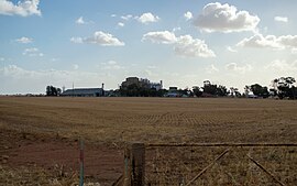
43:Ridley Mill in Pinkerton Plains
196:25 km (16 mi) NW of
190:9 km (6 mi) east of
1:
535:Kentish, P.M. (18 May 1995).
482:. South Australian Government
224:Barossa Light and Lower North
703:Towns and localities of the
1076:
984:
423:The locality is named for
387:
315:
311:
303:
265:
48:
36:
1055:Towns in South Australia
103:34.430678°S 138.616693°E
705:Light Regional Council
510:2016 Census QuickStats
480:Location SA Map Viewer
212:Light Regional Council
134:18 May 1995 (locality)
108:-34.430678; 138.616693
568:. Postcodes Australia
408:is a locality in the
712:Towns and localities
399:Adjoining localities
948:Geographic features
255:Federal division(s)
243:State electorate(s)
99: /
621:on 12 October 2016
1017:
1016:
979:
978:
425:William Pinkerton
403:
402:
391:
390:
307:
306:
1067:
1038:
1031:
1024:
993:
986:
859:Pinkerton Plains
697:
690:
683:
674:
667:
662:
656:
655:
653:
651:
640:
631:
630:
628:
626:
611:
605:
604:
602:
600:
589:
578:
577:
575:
573:
562:
556:
555:
553:
551:
541:
532:
526:
525:
520:
518:
516:
504:(27 June 2017).
498:
492:
491:
489:
487:
472:
406:Pinkerton Plains
357:Pinkerton Plains
313:
267:
166: • Summer (
114:
113:
111:
110:
109:
104:
100:
97:
96:
95:
92:
68:Pinkerton Plains
64:
63:
57:
41:
32:
26:
25:Pinkerton Plains
21:
1075:
1074:
1070:
1069:
1068:
1066:
1065:
1064:
1045:
1044:
1043:
1042:
999:South Australia
982:
980:
975:
971:Adelaide Plains
943:
719:Allendale North
707:
701:
671:
670:
663:
659:
649:
647:
642:
641:
634:
624:
622:
613:
612:
608:
598:
596:
591:
590:
581:
571:
569:
564:
563:
559:
549:
547:
539:
534:
533:
529:
514:
512:
500:
499:
495:
485:
483:
474:
473:
460:
455:
447:Nicholas McCabe
414:South Australia
363:
351:
347:
331:
298:
293:
288:
281:Annual rainfall
107:
105:
101:
98:
93:
90:
88:
86:
85:
75:
74:
73:
72:
71:
70:
69:
65:
44:
30:South Australia
28:
27:
24:
19:
12:
11:
5:
1073:
1071:
1063:
1062:
1057:
1047:
1046:
1041:
1040:
1033:
1026:
1018:
1015:
1014:
994:
977:
976:
974:
973:
967:
965:Barossa Valley
962:
957:
951:
949:
945:
944:
942:
941:
936:
931:
926:
921:
916:
911:
906:
901:
896:
891:
886:
881:
876:
871:
866:
861:
856:
851:
846:
841:
836:
831:
826:
821:
816:
811:
806:
801:
796:
791:
786:
781:
776:
771:
766:
761:
756:
751:
746:
741:
736:
731:
726:
721:
715:
713:
709:
708:
702:
700:
699:
692:
685:
677:
669:
668:
665:Austlii.edu.au
657:
632:
606:
579:
557:
527:
493:
457:
456:
454:
451:
434:Irish Catholic
401:
400:
397:
393:
392:
389:
388:
385:
384:
379:
374:
368:
367:
358:
355:
341:
340:
335:
326:
320:
319:
309:
308:
305:
304:
301:
300:
295:
290:
284:
283:
278:
273:
263:
262:
257:
251:
250:
245:
239:
238:
233:
227:
226:
221:
215:
214:
209:
203:
202:
201:
200:
194:
186:
182:
181:
171:
163:
162:
152:
146:
145:
142:
136:
135:
132:
128:
127:
120:
116:
115:
83:
77:
76:
67:
66:
59:
58:
52:
51:
50:
49:
46:
45:
42:
34:
33:
17:
13:
10:
9:
6:
4:
3:
2:
1072:
1061:
1058:
1056:
1053:
1052:
1050:
1039:
1034:
1032:
1027:
1025:
1020:
1019:
1013:
1011:
1007:
1004:article is a
1003:
1000:
995:
992:
988:
983:
972:
968:
966:
963:
961:
958:
956:
953:
952:
950:
946:
940:
937:
935:
932:
930:
927:
925:
922:
920:
917:
915:
912:
910:
907:
905:
902:
900:
897:
895:
892:
890:
887:
885:
884:Seppeltsfield
882:
880:
877:
875:
872:
870:
867:
865:
864:Reeves Plains
862:
860:
857:
855:
852:
850:
847:
845:
842:
840:
837:
835:
832:
830:
827:
825:
822:
820:
817:
815:
812:
810:
807:
805:
802:
800:
799:Kangaroo Flat
797:
795:
792:
790:
787:
785:
784:Hamley Bridge
782:
780:
777:
775:
772:
770:
767:
765:
762:
760:
757:
755:
752:
750:
747:
745:
742:
740:
737:
735:
732:
730:
727:
725:
722:
720:
717:
716:
714:
710:
706:
698:
693:
691:
686:
684:
679:
678:
675:
666:
661:
658:
645:
639:
637:
633:
620:
616:
610:
607:
594:
588:
586:
584:
580:
567:
561:
558:
545:
538:
531:
528:
524:
511:
507:
503:
497:
494:
481:
477:
471:
469:
467:
465:
463:
459:
452:
450:
448:
443:
440:
437:
435:
430:
426:
421:
419:
415:
411:
407:
398:
394:
386:
383:
380:
378:
375:
373:
370:
366:
362:
359:
356:
354:
350:
346:
343:
339:
338:Hamley Bridge
336:
334:
333:Hamley Bridge
330:
327:
325:
322:
318:
310:
302:
296:
291:
286:
282:
279:
277:
276:Mean min temp
274:
272:
271:Mean max temp
269:
264:
261:
258:
256:
252:
249:
246:
244:
240:
237:
234:
232:
228:
225:
222:
220:
216:
213:
210:
208:
204:
199:
195:
193:
189:
188:
187:
183:
179:
175:
172:
169:
164:
160:
156:
153:
151:
147:
143:
141:
137:
133:
129:
125:
121:
117:
112:
84:
82:
78:
56:
47:
40:
35:
31:
22:
16:
1010:expanding it
996:
981:
960:Gawler River
889:Shea-Oak Log
879:Rowland Flat
858:
764:Gawler River
660:
648:. Retrieved
623:. Retrieved
619:the original
609:
597:. Retrieved
570:. Retrieved
560:
548:. Retrieved
543:
530:
513:. Retrieved
509:
496:
484:. Retrieved
479:
444:
441:
438:
422:
405:
404:
316:
280:
275:
270:
15:
955:Light River
789:Hansborough
759:Gawler Belt
140:Postcode(s)
131:Established
124:2016 census
106: /
94:138°37′00″E
81:Coordinates
1049:Categories
909:Stone Well
874:Roseworthy
724:Bagot Well
599:13 January
572:13 January
550:13 January
515:13 January
486:13 January
453:References
119:Population
91:34°25′50″S
1002:geography
939:Woolsheds
929:Ward Belt
904:Stockwell
854:Nuriootpa
844:Morn Hill
834:Marananga
809:Kingsford
739:Daveyston
734:Buchfelde
650:25 August
625:25 August
418:Australia
410:Mid North
396:Footnotes
377:Woolsheds
297:388.0 mm
178:UTC+10:30
150:Time zone
122:76 (
969:Central
919:Templers
899:St Kitts
894:St Johns
869:Rosedale
814:Koonunga
779:Hamilton
774:Greenock
769:Gomersal
754:Freeling
744:Ebenezer
372:Redbanks
353:Redbanks
287:23.7 °C
185:Location
159:UTC+9:30
934:Wasleys
914:Tanunda
829:Magdala
824:Lyndoch
819:Linwood
804:Kapunda
382:Wasleys
365:Wasleys
361:Magdala
349:Mallala
345:Barabba
329:Barabba
324:Barabba
299:15.3 in
292:9.7 °C
192:Mallala
794:Hewett
729:Bethel
429:Kaurna
236:Gawler
231:County
219:Region
207:LGA(s)
198:Gawler
997:This
924:Truro
839:Moppa
749:Fords
540:(PDF)
294:49 °F
289:75 °F
248:Light
144:5400
1006:stub
849:Nain
652:2015
627:2015
601:2019
574:2019
552:2019
517:2019
488:2019
260:Grey
174:ACST
155:ACST
412:of
168:DST
1051::
635:^
582:^
542:.
508:.
478:.
461:^
420:.
416:,
1037:e
1030:t
1023:v
1012:.
696:e
689:t
682:v
654:.
629:.
603:.
576:.
554:.
519:.
490:.
180:)
176:(
170:)
161:)
157:(
126:)
Text is available under the Creative Commons Attribution-ShareAlike License. Additional terms may apply.