592:
34:
41:
172:, the fifth-highest-ranked peak in the state. It has three closed contours of between 2,200 and 2,219 feet, and survey has not determined which is taller. Two of these summits have less than 20 feet of prominence from each other, but a third has several hundred feet and is located more than two miles to the west (
267:
411:
662:
633:
652:
105:
33:
404:
626:
253:
657:
397:
619:
480:
260:
528:
98:
508:
175:
503:
455:
288:
591:
465:
318:
300:
493:
223:
599:
569:
165:
145:
88:
53:
336:
359:
377:
371:
523:
429:
559:
498:
365:
353:
330:
324:
554:
437:
236:
603:
513:
646:
549:
518:
460:
447:
306:
169:
153:
61:
488:
564:
544:
190:
177:
120:
107:
470:
421:
294:
149:
57:
245:
389:
78:
393:
249:
607:
537:
479:
446:
428:
346:
281:
141:
136:
97:
87:
77:
72:
21:
627:
405:
261:
8:
634:
620:
412:
398:
390:
268:
254:
246:
18:
226:November 20, 2006. Accessed May 31, 2012.
218:
216:
212:
663:Cook County, Minnesota geography stubs
347:Points without 300 feet of prominence
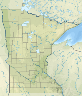
164:is a 2,210-foot (670 m) peak in
7:
588:
586:
16:Mountain in Minnesota, United States
653:Mountains of Cook County, Minnesota
40:
14:
598:This article about a location in
282:Peaks with 300 feet of prominence
590:
39:
32:
1:
203:). There is no summit trail.
606:. You can help Knowledge by
121:47.9992000°N 90.227099833°W
679:
585:
83:2,210 ft (670 m)
224:Minnesota's Top 10 Peaks.
126:47.9992000; -90.227099833
26:
466:Misquah Hills High Point
301:Misquah Hills High Point
276:High points of Minnesota
93:380 ft (120 m)
494:Disappointment Mountain
191:48.004912°N 90.276725°W
658:Mountains of Minnesota
600:Cook County, Minnesota
239:Accessed May 31, 2012.
166:Cook County, Minnesota
196:48.004912; -90.276725
524:Pincushion Mountain
430:Leaf Hills Moraines
187: /
117: /
560:Greenwood Mountain
481:Sawtooth Mountains
73:Highest point
615:
614:
583:
582:
529:Prospect Mountain
387:
386:
222:Rachford, Brian.
159:
158:
670:
636:
629:
622:
594:
587:
555:Frenchmans Bluff
438:Inspiration Peak
414:
407:
400:
391:
337:Lundeen Mountain
270:
263:
256:
247:
240:
233:
227:
220:
202:
201:
199:
198:
197:
192:
188:
185:
184:
183:
180:
132:
131:
129:
128:
127:
122:
118:
115:
114:
113:
110:
43:
42:
36:
19:
678:
677:
673:
672:
671:
669:
668:
667:
643:
642:
641:
640:
584:
579:
533:
509:Mount Josephine
499:Mallmann's Peak
475:
442:
424:
418:
388:
383:
360:Gaskin Mountain
342:
277:
274:
244:
243:
235:MN Peak Stats,
234:
230:
221:
214:
209:
195:
193:
189:
186:
181:
178:
176:
174:
173:
125:
123:
119:
116:
112:90°13′37.5594″W
111:
108:
106:
104:
103:
68:
67:
66:
65:
64:
51:
50:
49:
48:
44:
17:
12:
11:
5:
676:
674:
666:
665:
660:
655:
645:
644:
639:
638:
631:
624:
616:
613:
612:
595:
581:
580:
578:
577:
572:
567:
562:
557:
552:
547:
541:
539:
535:
534:
532:
531:
526:
521:
516:
514:Mount Northrop
511:
506:
504:Moose Mountain
501:
496:
491:
485:
483:
477:
476:
474:
473:
468:
463:
458:
456:Eagle Mountain
452:
450:
444:
443:
441:
440:
434:
432:
426:
425:
419:
417:
416:
409:
402:
394:
385:
384:
382:
381:
378:Kelso Mountain
375:
372:Brule Mountain
369:
363:
357:
350:
348:
344:
343:
341:
340:
334:
328:
322:
316:
310:
304:
298:
292:
289:Eagle Mountain
285:
283:
279:
278:
275:
273:
272:
265:
258:
250:
242:
241:
228:
211:
210:
208:
205:
157:
156:
143:
139:
138:
134:
133:
101:
95:
94:
91:
85:
84:
81:
75:
74:
70:
69:
52:
46:
45:
38:
37:
31:
30:
29:
28:
27:
24:
23:
15:
13:
10:
9:
6:
4:
3:
2:
675:
664:
661:
659:
656:
654:
651:
650:
648:
637:
632:
630:
625:
623:
618:
617:
611:
609:
605:
601:
596:
593:
589:
576:
573:
571:
568:
566:
563:
561:
558:
556:
553:
551:
550:Farquhar Peak
548:
546:
543:
542:
540:
536:
530:
527:
525:
522:
520:
519:Mount Reunion
517:
515:
512:
510:
507:
505:
502:
500:
497:
495:
492:
490:
487:
486:
484:
482:
478:
472:
469:
467:
464:
462:
461:Lima Mountain
459:
457:
454:
453:
451:
449:
448:Misquah Hills
445:
439:
436:
435:
433:
431:
427:
423:
420:Mountains of
415:
410:
408:
403:
401:
396:
395:
392:
379:
376:
373:
370:
367:
364:
361:
358:
355:
352:
351:
349:
345:
338:
335:
332:
329:
326:
323:
320:
319:Pine Mountain
317:
314:
311:
308:
307:Lima Mountain
305:
302:
299:
296:
293:
290:
287:
286:
284:
280:
271:
266:
264:
259:
257:
252:
251:
248:
238:
232:
229:
225:
219:
217:
213:
206:
204:
200:
171:
170:United States
167:
163:
155:
151:
147:
144:
140:
135:
130:
109:47°59′57.12″N
102:
100:
96:
92:
90:
86:
82:
80:
76:
71:
63:
59:
55:
35:
25:
20:
608:expanding it
597:
574:
489:Carlton Peak
312:
231:
161:
160:
565:Jasper Peak
545:Bardon Peak
194: /
146:Cook County
124: /
99:Coordinates
54:Cook County
647:Categories
575:Point 2210
570:Mount Nebo
366:Point 2230
354:Point 2246
331:Point 2110
325:Point 2163
313:Point 2210
207:References
182:90°16′36″W
179:48°00′18″N
162:Point 2210
89:Prominence
47:Point 2210
22:Point 2210
471:Peak 2266
422:Minnesota
380:(2100 ft)
374:(2226 ft)
368:(2230 ft)
362:(2245 ft)
356:(2246 ft)
339:(2093 ft)
333:(2110 ft)
327:(2163 ft)
321:(2189 ft)
315:(2210 ft)
309:(2238 ft)
303:(2260 ft)
297:(2266 ft)
295:Peak 2266
291:(2304 ft)
237:2210, MN.
150:Minnesota
137:Geography
79:Elevation
58:Minnesota
142:Location
538:Others
602:is a
604:stub
154:U.S.
62:U.S.
649::
215:^
168:,
152:,
148:,
60:,
56:,
635:e
628:t
621:v
610:.
413:e
406:t
399:v
269:e
262:t
255:v
Text is available under the Creative Commons Attribution-ShareAlike License. Additional terms may apply.
↑