29:
49:
79:
268:. The lake was formed by the construction of the Pompton Lake Dam in 1908 after a prior wooden dam was destroyed by a flood in 1903. The waters impounded in the lake serve as a supplemental drinking source. It is primarily fed by the Ramapo River, but also receives inflow from Acid Brook and smaller tributaries. The Ramapo River continues downstream of Pompton Lake Dam, flowing into the
86:
56:
28:
1292:
1428:
1583:
1490:
1388:
865:
276:. The area of the Pompton Lake watershed is 176 square miles. The estate of the author Albert Payson Terhune, Sunnybank, is on the Wayne shore of the lake.
48:
139:
78:
1393:
361:
588:
503:
1137:
385:
1560:
1453:
1448:
1438:
1418:
608:
293:
1478:
1483:
1588:
1222:
761:
1152:
721:
1252:
1030:
985:
950:
920:
603:
1535:
1403:
1202:
1177:
930:
825:
731:
688:
1327:
1232:
1212:
1197:
1015:
915:
910:
813:
756:
726:
34:
1520:
1287:
1267:
1237:
1085:
1065:
1055:
1010:
845:
808:
354:
1398:
1312:
1075:
1070:
880:
781:
766:
638:
261:
120:
1317:
1192:
1162:
1157:
1090:
1050:
786:
736:
663:
520:
253:
111:
1302:
1227:
1120:
1020:
970:
965:
875:
850:
835:
746:
693:
618:
552:
420:
1530:
1125:
1110:
855:
840:
798:
400:
1550:
1515:
1510:
1322:
1277:
1217:
1060:
975:
900:
890:
741:
347:
1505:
1463:
1433:
1423:
1368:
1187:
1045:
1035:
990:
940:
935:
895:
870:
860:
793:
716:
197:
1555:
1272:
1207:
1182:
1172:
1147:
1040:
1025:
960:
925:
885:
776:
633:
623:
430:
415:
319:
1545:
1307:
1282:
1142:
1132:
1100:
1005:
995:
945:
905:
820:
803:
751:
668:
535:
525:
1495:
1408:
1343:
1262:
1257:
1247:
1242:
1167:
1115:
1095:
1080:
1000:
955:
183:
1540:
1458:
1358:
1297:
830:
683:
643:
573:
297:
257:
115:
1500:
1363:
1353:
1348:
980:
578:
460:
1525:
545:
540:
508:
445:
440:
395:
1468:
1443:
648:
613:
496:
491:
486:
435:
209:
1577:
771:
673:
593:
465:
455:
450:
405:
370:
273:
269:
171:
598:
557:
530:
477:
472:
425:
249:
190:
1413:
1105:
678:
658:
628:
583:
410:
390:
515:
265:
125:
154:
141:
176:
339:
1473:
184:
198:
245:
343:
320:"Pompton Lake and Ramapo River TMDL Support Study, NJDEP"
1381:
1336:
709:
702:
566:
378:
231:
223:
219:
208:
196:
182:
170:
131:
107:
21:
132:
355:
8:
706:
362:
348:
340:
18:
294:"Pompton Lakes History - Pompton Falls"
285:
16:Reservoir in Passaic County, New Jersey
252:which is located within the towns of
7:
1439:Lincoln Highway Passaic River Bridge
609:Great Swamp National Wildlife Refuge
85:
55:
1584:Lakes of Passaic County, New Jersey
1484:William A. Stickel Memorial Bridge
14:
84:
77:
54:
47:
27:
230:
222:
1:
106:
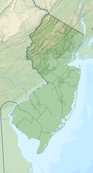
98:Show map of the United States
35:Ramapo Mountain State Forest
1521:Morristown and Erie Railway
1605:
1399:Belleville Turnpike Bridge
1541:Patriots' Path Footbridge
41:
33:Pompton Lake viewed from
26:
1589:Reservoirs in New Jersey
694:Woodcliff Lake Reservoir
227:175 acres (0.71 km)
1531:Newark-Pompton Turnpike
244:is a 175-acre man-made
155:41.006589°N 74.274974°W
1551:Straight Street Bridge
1516:Montclair-Boonton Line
68:Show map of New Jersey
1506:Hillery Street Bridge
1464:Passaic Street Bridge
1434:Jackson Street Bridge
1429:Harry Laderman Bridge
1424:Gregory Avenue Bridge
1223:Saddle Brook Township
1138:Parsippany–Troy Hills
584:Canoe Brook Reservoir
160:41.006589; -74.274974
1561:West Park Footbridge
1556:West Broadway Bridge
1536:Passaic River Bridge
1454:Monroe Street Bridge
1449:Market Street Bridge
1419:Eighth Street Bridge
1404:Bridge Street Bridge
649:Point View Reservoir
634:Monksville Reservoir
431:Little Diamond Brook
235:202 feet (62 m)
1546:Sixth Avenue Bridge
1491:Upper Passaic River
1479:Union Avenue Bridge
1389:Lower Passaic River
669:Splitrock Reservoir
536:Spring Garden Brook
526:Slippery Rock Brook
272:and ultimately the
151: /
1496:Arch Street Bridge
1409:Clay Street Bridge
1253:Upper Saddle River
866:Fairfield Township
300:on August 19, 2004
1571:
1570:
1459:Newark Drawbridge
1377:
1376:
1203:Rockaway Township
1178:Ridgewood Village
931:Hasbrouck Heights
689:White Meadow Lake
684:Wanaque Reservoir
644:Oradell Reservoir
574:Boonton Reservoir
416:Foulerton's Brook
239:
238:
232:Surface elevation
1596:
1501:Gladstone Branch
1233:South Hackensack
1213:Roxbury Township
1198:Rockaway Borough
1016:Mendham Township
814:Chatham Township
757:Boonton Township
727:Berkeley Heights
707:
579:Butler Reservoir
461:Pequannock River
364:
357:
350:
341:
334:
333:
331:
329:
324:
316:
310:
309:
307:
305:
296:. Archived from
290:
200:
199:Primary outflows
186:
166:
165:
163:
162:
161:
156:
152:
149:
148:
147:
144:
134:
99:
88:
87:
81:
69:
58:
57:
51:
31:
19:
1604:
1603:
1599:
1598:
1597:
1595:
1594:
1593:
1574:
1573:
1572:
1567:
1526:Morristown Line
1394:Avondale Bridge
1373:
1332:
1268:Victory Gardens
1086:North Arlington
1066:Mount Arlington
1056:Morris Township
1011:Mendham Borough
846:East Rutherford
809:Chatham Borough
752:Boonton Borough
698:
562:
546:Deep Voll Brook
541:Stevenson Brook
509:Ho-Ho-Kus Brook
446:Molly Ann Brook
441:McDonalds Brook
374:
368:
338:
337:
327:
325:
322:
318:
317:
313:
303:
301:
292:
291:
287:
282:
212: countries
185:Primary inflows
159:
157:
153:
150:
145:
142:
140:
138:
137:
124:
119:
103:
102:
101:
100:
97:
96:
95:
94:
93:
89:
72:
71:
70:
67:
66:
65:
64:
63:
59:
37:
17:
12:
11:
5:
1602:
1600:
1592:
1591:
1586:
1576:
1575:
1569:
1568:
1566:
1565:
1564:
1563:
1558:
1553:
1548:
1543:
1538:
1533:
1528:
1523:
1518:
1513:
1508:
1503:
1498:
1488:
1487:
1486:
1481:
1476:
1471:
1469:Pulaski Skyway
1466:
1461:
1456:
1451:
1446:
1444:Lyndhurst Draw
1441:
1436:
1431:
1426:
1421:
1416:
1411:
1406:
1401:
1396:
1385:
1383:
1379:
1378:
1375:
1374:
1372:
1371:
1366:
1361:
1356:
1351:
1346:
1340:
1338:
1334:
1333:
1331:
1330:
1325:
1320:
1315:
1313:Woodcliff Lake
1310:
1305:
1300:
1295:
1290:
1285:
1280:
1275:
1270:
1265:
1260:
1255:
1250:
1245:
1240:
1235:
1230:
1225:
1220:
1215:
1210:
1205:
1200:
1195:
1190:
1185:
1180:
1175:
1170:
1165:
1160:
1155:
1150:
1145:
1140:
1135:
1130:
1129:
1128:
1123:
1118:
1113:
1103:
1098:
1093:
1088:
1083:
1078:
1076:New Providence
1073:
1071:Mountain Lakes
1068:
1063:
1058:
1053:
1048:
1043:
1038:
1033:
1028:
1023:
1018:
1013:
1008:
1003:
998:
993:
988:
983:
978:
973:
968:
963:
958:
953:
948:
943:
938:
933:
928:
923:
918:
913:
908:
903:
898:
893:
888:
883:
881:Franklin Lakes
878:
873:
868:
863:
858:
853:
848:
843:
838:
833:
828:
823:
818:
817:
816:
811:
801:
796:
791:
790:
789:
784:
782:North Caldwell
779:
769:
764:
759:
754:
749:
744:
739:
734:
729:
724:
719:
713:
711:
704:
700:
699:
697:
696:
691:
686:
681:
676:
671:
666:
661:
656:
651:
646:
641:
636:
631:
626:
621:
616:
614:Greenwood Lake
611:
606:
601:
596:
591:
586:
581:
576:
570:
568:
564:
563:
561:
560:
555:
550:
549:
548:
538:
533:
528:
523:
518:
513:
512:
511:
501:
500:
499:
497:Whippany River
492:Rockaway River
489:
487:Primrose Brook
484:
483:
482:
481:
480:
470:
469:
468:
453:
448:
443:
438:
436:Loantaka Brook
433:
428:
423:
418:
413:
408:
403:
398:
393:
388:
382:
380:
376:
375:
369:
367:
366:
359:
352:
344:
336:
335:
311:
284:
283:
281:
278:
262:Passaic County
237:
236:
233:
229:
228:
225:
221:
220:
217:
216:
213:
206:
205:
202:
194:
193:
188:
180:
179:
174:
168:
167:
135:
129:
128:
121:Passaic County
109:
105:
104:
91:
90:
83:
82:
76:
75:
74:
73:
61:
60:
53:
52:
46:
45:
44:
43:
42:
39:
38:
32:
24:
23:
15:
13:
10:
9:
6:
4:
3:
2:
1601:
1590:
1587:
1585:
1582:
1581:
1579:
1562:
1559:
1557:
1554:
1552:
1549:
1547:
1544:
1542:
1539:
1537:
1534:
1532:
1529:
1527:
1524:
1522:
1519:
1517:
1514:
1512:
1509:
1507:
1504:
1502:
1499:
1497:
1494:
1493:
1492:
1489:
1485:
1482:
1480:
1477:
1475:
1472:
1470:
1467:
1465:
1462:
1460:
1457:
1455:
1452:
1450:
1447:
1445:
1442:
1440:
1437:
1435:
1432:
1430:
1427:
1425:
1422:
1420:
1417:
1415:
1412:
1410:
1407:
1405:
1402:
1400:
1397:
1395:
1392:
1391:
1390:
1387:
1386:
1384:
1380:
1370:
1367:
1365:
1362:
1360:
1357:
1355:
1352:
1350:
1347:
1345:
1342:
1341:
1339:
1335:
1329:
1326:
1324:
1321:
1319:
1318:Woodland Park
1316:
1314:
1311:
1309:
1306:
1304:
1301:
1299:
1296:
1294:
1291:
1289:
1286:
1284:
1281:
1279:
1276:
1274:
1271:
1269:
1266:
1264:
1261:
1259:
1256:
1254:
1251:
1249:
1246:
1244:
1241:
1239:
1236:
1234:
1231:
1229:
1226:
1224:
1221:
1219:
1216:
1214:
1211:
1209:
1206:
1204:
1201:
1199:
1196:
1194:
1193:Rochelle Park
1191:
1189:
1186:
1184:
1181:
1179:
1176:
1174:
1171:
1169:
1166:
1164:
1163:Prospect Park
1161:
1159:
1158:Pompton Lakes
1156:
1154:
1151:
1149:
1146:
1144:
1141:
1139:
1136:
1134:
1131:
1127:
1124:
1122:
1119:
1117:
1114:
1112:
1109:
1108:
1107:
1104:
1102:
1099:
1097:
1094:
1092:
1091:North Haledon
1089:
1087:
1084:
1082:
1079:
1077:
1074:
1072:
1069:
1067:
1064:
1062:
1059:
1057:
1054:
1052:
1051:Morris Plains
1049:
1047:
1044:
1042:
1039:
1037:
1034:
1032:
1029:
1027:
1024:
1022:
1019:
1017:
1014:
1012:
1009:
1007:
1004:
1002:
999:
997:
994:
992:
989:
987:
984:
982:
979:
977:
974:
972:
969:
967:
964:
962:
959:
957:
954:
952:
949:
947:
944:
942:
939:
937:
934:
932:
929:
927:
924:
922:
919:
917:
914:
912:
909:
907:
904:
902:
899:
897:
894:
892:
889:
887:
884:
882:
879:
877:
874:
872:
869:
867:
864:
862:
859:
857:
854:
852:
849:
847:
844:
842:
839:
837:
834:
832:
829:
827:
824:
822:
819:
815:
812:
810:
807:
806:
805:
802:
800:
797:
795:
792:
788:
787:West Caldwell
785:
783:
780:
778:
775:
774:
773:
772:The Caldwells
770:
768:
765:
763:
760:
758:
755:
753:
750:
748:
745:
743:
740:
738:
737:Bernardsville
735:
733:
730:
728:
725:
723:
720:
718:
715:
714:
712:
708:
705:
701:
695:
692:
690:
687:
685:
682:
680:
677:
675:
674:Sterling Lake
672:
670:
667:
665:
662:
660:
657:
655:
652:
650:
647:
645:
642:
640:
639:Mountain Lake
637:
635:
632:
630:
627:
625:
624:Lake Kinnelon
622:
620:
617:
615:
612:
610:
607:
605:
604:Franklin Lake
602:
600:
597:
595:
594:DeForest Lake
592:
590:
587:
585:
582:
580:
577:
575:
572:
571:
569:
565:
559:
556:
554:
551:
547:
544:
543:
542:
539:
537:
534:
532:
529:
527:
524:
522:
519:
517:
514:
510:
507:
506:
505:
502:
498:
495:
494:
493:
490:
488:
485:
479:
476:
475:
474:
471:
467:
466:Wanaque River
464:
463:
462:
459:
458:
457:
456:Pompton River
454:
452:
451:Peckman River
449:
447:
444:
442:
439:
437:
434:
432:
429:
427:
424:
422:
419:
417:
414:
412:
409:
407:
406:Diamond Brook
404:
402:
399:
397:
394:
392:
389:
387:
384:
383:
381:
377:
372:
371:Passaic River
365:
360:
358:
353:
351:
346:
345:
342:
321:
315:
312:
299:
295:
289:
286:
279:
277:
275:
274:Passaic River
271:
270:Pompton River
267:
263:
259:
255:
254:Pompton Lakes
251:
247:
243:
234:
226:
218:
215:United States
214:
211:
207:
203:
201:
195:
192:
189:
187:
181:
178:
175:
173:
169:
164:
136:
130:
127:
122:
117:
113:
112:Pompton Lakes
110:
80:
50:
40:
36:
30:
25:
20:
1303:West Milford
1228:Saddle River
1121:South Orange
1021:Midland Park
971:Little Falls
966:Lincoln Park
876:Florham Park
851:Elmwood Park
836:East Hanover
804:The Chathams
747:Bloomingdale
664:Rainbow Lake
654:Pompton Lake
653:
599:Estling Lake
558:Weasel Brook
531:Slough Brook
521:Second River
504:Saddle River
478:Mahwah River
473:Ramapo River
426:Goffle Brook
396:Cory's Brook
326:. Retrieved
314:
302:. Retrieved
298:the original
288:
250:Ramapo River
242:Pompton Lake
241:
240:
224:Surface area
204:Ramapo River
191:Ramapo River
92:Pompton Lake
62:Pompton Lake
22:Pompton Lake
1414:Dock Bridge
1369:Tuxedo Park
1126:West Orange
1111:East Orange
1106:The Oranges
856:Essex Fells
841:East Newark
799:Cedar Grove
762:Bridgewater
679:Verona Lake
659:Ramapo Lake
629:Lake Tappan
619:Indian Lake
553:Third River
421:Great Brook
411:First River
391:Canoe Brook
386:Black Brook
379:Tributaries
158: /
133:Coordinates
1578:Categories
1323:Wood-Ridge
1293:Washington
1278:Wallington
1218:Rutherford
1153:Pequannock
1061:Morristown
976:Livingston
901:Hackensack
891:Glen Ridge
742:Bloomfield
722:Belleville
710:New Jersey
589:Cedar Lake
516:Salt Brook
401:Dead River
280:References
266:New Jersey
146:74°16′30″W
143:41°00′24″N
126:New Jersey
1511:Main Line
1382:Crossings
1188:Riverdale
1046:Montville
1036:Montclair
1031:Mine Hill
991:Lyndhurst
986:Long Hill
951:Jefferson
941:Hillsdale
936:Hawthorne
921:Hardyston
896:Glen Rock
871:Far Hills
861:Fair Lawn
794:Carlstadt
717:Allendale
373:watershed
177:Reservoir
1344:Hillburn
1337:New York
1273:Waldwick
1208:Roseland
1183:Ringwood
1173:Randolph
1148:Paterson
1041:Montvale
1026:Millburn
961:Kinnelon
926:Harrison
886:Garfield
826:Denville
777:Caldwell
732:Bernards
108:Location
1474:PD Draw
1359:Suffern
1328:Wyckoff
1308:Wharton
1283:Wanaque
1143:Passaic
1133:Paramus
1101:Oakland
1006:Maywood
996:Madison
946:Hohokus
916:Harding
911:Hanover
906:Haledon
821:Clifton
328:June 5,
304:June 5,
248:on the
1364:Tuxedo
1354:Ramapo
1349:Monroe
1288:Warren
1263:Verona
1258:Vernon
1248:Totowa
1243:Summit
1238:Sparta
1168:Ramsey
1116:Orange
1096:Nutley
1081:Newark
1001:Mahwah
956:Kearny
767:Butler
1298:Wayne
831:Dover
703:Towns
567:Lakes
323:(PDF)
258:Wayne
210:Basin
116:Wayne
981:Lodi
330:2013
306:2013
256:and
246:lake
172:Type
260:in
1580::
264:,
114:/
363:e
356:t
349:v
332:.
308:.
123:,
118:,
Text is available under the Creative Commons Attribution-ShareAlike License. Additional terms may apply.
↑