805:
59:
42:
92:
331:
99:
66:
552:
476:
In the CDP, the population was spread out, with 30.2% under the age of 18, 9.5% from 18 to 24, 27.1% from 25 to 44, 21.7% from 45 to 64, and 11.5% who were 65 years of age or older. The median age was 33 years. For every 100 females, there were 101.3 males. For every 100 females age 18 and over,
472:
living together, 7.8% had a female householder with no husband present, and 28.9% were non-families. 25.9% of all households were made up of individuals, and 12.0% had someone living alone who was 65 years of age or older. The average household size was 2.72 and the average family size was 3.32.
440:
of 2000, there were 451 people, 166 households, and 118 families residing in the CDP. The population density was 163.9 inhabitants per square mile (63.3/km). There were 183 housing units at an average density of 66.5 per square mile (25.7/km). The racial makeup of the CDP was 99.33%
1035:
480:
The median income for a household in the CDP was $ 38,158, and the median income for a family was $ 40,625. Males had a median income of $ 31,458 versus $ 19,167 for females. The
718:
574:
1040:
853:
883:
843:
848:
838:
873:
858:
833:
828:
878:
868:
823:
863:
346:
127:
711:
330:
769:
301:
58:
91:
704:
334:
Map of Snyder County, Pennsylvania with
Municipal Labels showing Boroughs (red), Townships (white), and Census-designated places (blue).
931:
888:
893:
520:
to Port
Trevorton. A canal basin was built for coal loading from the railcars. However, a new route was built to the coal mines via
41:
181:
982:
696:
446:
596:
450:
911:
691:
505:
1005:
916:
728:
648:
600:
378:
320:
186:
921:
794:
977:
957:
941:
936:
789:
415:
672:
784:
750:
289:
159:
951:
903:
815:
501:
468:
There were 166 households, out of which 32.5% had children under the age of 18 living with them, 59.6% were
316:
32:
524:, and the bridge was removed in 1870. As the fortunes of the canal declined, so too did those of the town.
774:
761:
521:
458:
294:
926:
779:
517:
1012:
462:
262:
967:
454:
442:
497:
509:
481:
252:
533:
513:
484:
for the CDP was $ 12,363. About 6.5% of families and 9.3% of the population were below the
676:
1029:
485:
324:
174:
743:
622:
169:
361:
348:
142:
129:
243:
488:, including 14.4% of those under age 18 and 14.3% of those age 65 or over.
996:‡This populated place also has portions in an adjacent county or counties
469:
381:, the CDP has a total area of 2.8 square miles (7.3 km), all land.
277:
669:
437:
679:. Bucknell University Web Site. Susquehanna River Initiative. 2007
329:
269:
248:
670:"Susquehanna River: A Pathway Northward For Migrating Water Fowl"
700:
496:
The name of the town comes from its days as a coal port on the
803:
327:, United States. The population was 451 at the 2000 census.
644:
1036:
Census-designated places in Snyder County, Pennsylvania
991:
966:
902:
814:
760:
300:
288:
276:
259:
242:
234:
226:
221:
213:
205:
197:
192:
180:
168:
158:
23:
500:. Coal from the mines of the Zerbe Valley, near
78:Location within the U.S. state of Pennsylvania
712:
8:
508:, which was completed in 1855, crossing the
719:
705:
697:
597:"US Gazetteer files: 2010, 2000, and 1990"
465:of any race were 0.22% of the population.
388:
20:
1041:Census-designated places in Pennsylvania
544:
299:
275:
241:
220:
191:
157:
122:
50:
38:
408:
98:
65:
287:
258:
233:
225:
212:
204:
196:
179:
167:
7:
217:0.01 sq mi (0.02 km)
209:3.38 sq mi (8.76 km)
201:3.39 sq mi (8.78 km)
727:Municipalities and communities of
623:"Census of Population and Housing"
506:Trevorton and Susquehanna Railroad
398:
111:Port Trevorton (the United States)
18:CDP in Pennsylvania, United States
14:
553:"ArcGIS REST Services Directory"
504:was shipped to the town via the
97:
90:
64:
57:
40:
1:
577:. United States Census Bureau
555:. United States Census Bureau
343:Port Trevorton is located at
114:Show map of the United States
692:From the Boroughs to the Bay
238:217.10/sq mi (83.83/km)
730:Snyder County, Pennsylvania
649:United States Census Bureau
601:United States Census Bureau
379:United States Census Bureau
1057:
1001:
801:
741:
429:
414:
407:
402:
397:
394:
374:(40.686397, -76.886956).
123:
51:
39:
30:
81:Show map of Pennsylvania
575:"Census Population API"
477:there were 92.1 males.
317:census-designated place
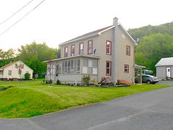
46:House in Port Trevorton
808:
335:
807:
645:"U.S. Census website"
430:U.S. Decennial Census
390:Historical population
362:40.68639°N 76.88694°W
333:
261: • Summer (
143:40.68639°N 76.88694°W
1014:United States portal
932:Mount Pleasant Mills
668:Nickelsen, Richard,
235: • Density
1007:Pennsylvania portal
603:. February 12, 2011
391:
367:40.68639; -76.88694
358: /
148:40.68639; -76.88694
139: /
809:
675:2007-09-29 at the
498:Pennsylvania Canal
389:
336:
227: • Total
214: • Water
198: • Total
1023:
1022:
983:McKees Half Falls
510:Susquehanna River
482:per capita income
434:
433:
377:According to the
310:
309:
206: • Land
1048:
1015:
1008:
806:
753:
746:
736:
731:
721:
714:
707:
698:
680:
666:
660:
659:
657:
655:
641:
635:
634:
632:
630:
619:
613:
612:
610:
608:
593:
587:
586:
584:
582:
571:
565:
564:
562:
560:
549:
534:Trevorton Bridge
447:African American
410:
405:
400:
392:
373:
372:
370:
369:
368:
363:
359:
356:
355:
354:
351:
266:
154:
153:
151:
150:
149:
144:
140:
137:
136:
135:
132:
115:
101:
100:
94:
82:
68:
67:
61:
44:
21:
1056:
1055:
1051:
1050:
1049:
1047:
1046:
1045:
1026:
1025:
1024:
1019:
1013:
1006:
997:
987:
969:
962:
898:
810:
804:
799:
756:
751:
744:
737:
734:
729:
725:
688:
683:
677:Wayback Machine
667:
663:
653:
651:
643:
642:
638:
628:
626:
621:
620:
616:
606:
604:
595:
594:
590:
580:
578:
573:
572:
568:
558:
556:
551:
550:
546:
542:
530:
494:
470:married couples
451:Native American
403:
387:
366:
364:
360:
357:
352:
349:
347:
345:
344:
341:
284:
260:
147:
145:
141:
138:
133:
130:
128:
126:
125:
119:
118:
117:
116:
113:
112:
109:
108:
107:
106:
102:
85:
84:
83:
80:
79:
76:
75:
74:
73:
69:
47:
35:
26:
19:
12:
11:
5:
1054:
1052:
1044:
1043:
1038:
1028:
1027:
1021:
1020:
1018:
1017:
1010:
1002:
999:
998:
995:
993:
989:
988:
986:
985:
980:
974:
972:
964:
963:
961:
960:
955:
949:
947:Port Trevorton
944:
939:
934:
929:
924:
919:
914:
912:Beaver Springs
908:
906:
900:
899:
897:
896:
891:
886:
881:
876:
871:
866:
861:
856:
851:
846:
841:
836:
831:
826:
820:
818:
812:
811:
802:
800:
798:
797:
792:
787:
782:
777:
772:
766:
764:
758:
757:
742:
739:
738:
726:
724:
723:
716:
709:
701:
695:
694:
687:
686:External links
684:
682:
681:
661:
636:
614:
588:
566:
543:
541:
538:
537:
536:
529:
526:
493:
490:
432:
431:
427:
426:
423:
421:
418:
412:
411:
406:
401:
396:
386:
383:
340:
337:
313:Port Trevorton
308:
307:
304:
298:
297:
292:
286:
285:
282:
280:
274:
273:
267:
257:
256:
246:
240:
239:
236:
232:
231:
228:
224:
223:
219:
218:
215:
211:
210:
207:
203:
202:
199:
195:
194:
190:
189:
184:
178:
177:
172:
166:
165:
162:
156:
155:
121:
120:
110:
105:Port Trevorton
104:
103:
96:
95:
89:
88:
87:
86:
77:
72:Port Trevorton
71:
70:
63:
62:
56:
55:
54:
53:
52:
49:
48:
45:
37:
36:
31:
28:
27:
25:Port Trevorton
24:
17:
13:
10:
9:
6:
4:
3:
2:
1053:
1042:
1039:
1037:
1034:
1033:
1031:
1016:
1011:
1009:
1004:
1003:
1000:
994:
990:
984:
981:
979:
976:
975:
973:
971:
965:
959:
956:
953:
950:
948:
945:
943:
940:
938:
935:
933:
930:
928:
925:
923:
920:
918:
917:Hummels Wharf
915:
913:
910:
909:
907:
905:
901:
895:
892:
890:
887:
885:
882:
880:
877:
875:
872:
870:
867:
865:
862:
860:
857:
855:
852:
850:
847:
845:
842:
840:
837:
835:
832:
830:
827:
825:
822:
821:
819:
817:
813:
796:
793:
791:
788:
786:
783:
781:
778:
776:
773:
771:
768:
767:
765:
763:
759:
755:
754:
747:
740:
735:United States
732:
722:
717:
715:
710:
708:
703:
702:
699:
693:
690:
689:
685:
678:
674:
671:
665:
662:
650:
646:
640:
637:
624:
618:
615:
602:
598:
592:
589:
576:
570:
567:
554:
548:
545:
539:
535:
532:
531:
527:
525:
523:
519:
515:
511:
507:
503:
499:
491:
489:
487:
483:
478:
474:
471:
466:
464:
460:
456:
452:
448:
444:
439:
428:
424:
422:
419:
417:
413:
393:
384:
382:
380:
375:
371:
338:
332:
328:
326:
322:
321:Snyder County
318:
314:
305:
303:
296:
293:
291:
281:
279:
271:
268:
264:
254:
253:Eastern (EST)
250:
247:
245:
237:
229:
216:
208:
200:
188:
185:
183:
176:
173:
171:
164:United States
163:
161:
152:
124:Coordinates:
93:
60:
43:
34:
29:
22:
16:
946:
922:Kratzerville
795:Shamokin Dam
749:
664:
652:. Retrieved
639:
627:. Retrieved
625:. Census.gov
617:
605:. Retrieved
591:
579:. Retrieved
569:
557:. Retrieved
547:
495:
486:poverty line
479:
475:
467:
435:
385:Demographics
376:
342:
325:Pennsylvania
312:
311:
290:Area code(s)
175:Pennsylvania
15:
978:Coon Hunter
970:communities
958:Troxelville
942:Penns Creek
937:Paxtonville
889:West Beaver
854:Middlecreek
790:Selinsgrove
745:County seat
654:January 31,
581:October 16,
559:October 16,
514:long bridge
365: /
295:570 and 272
146: /
1030:Categories
894:West Perry
884:Washington
785:Middleburg
770:Beavertown
752:Middleburg
540:References
453:and 0.22%
436:As of the
353:76°53′13″W
350:40°41′11″N
222:Population
134:76°53′13″W
131:40°41′11″N
992:Footnotes
952:Richfield
816:Townships
607:April 23,
502:Trevorton
339:Geography
319:(CDP) in
302:FIPS code
244:Time zone
844:Franklin
775:Freeburg
762:Boroughs
673:Archived
528:See also
522:Shamokin
459:Hispanic
449:, 0.22%
445:, 0.22%
306:42-62312
278:ZIP code
927:Kreamer
849:Jackson
839:Chapman
780:McClure
629:June 4,
518:Herndon
492:History
160:Country
874:Spring
859:Monroe
834:Center
829:Beaver
463:Latino
438:census
395:Census
187:Snyder
182:County
968:Other
879:Union
869:Perry
824:Adams
516:from
512:on a
455:Asian
443:White
315:is a
283:17864
272:(EDT)
270:UTC-4
249:UTC-5
170:State
904:CDPs
864:Penn
656:2008
631:2016
609:2011
583:2022
561:2022
416:2020
404:Note
399:Pop.
193:Area
461:or
420:734
263:DST
230:734
33:CDP
1032::
748::
733:,
647:.
599:.
457:.
409:%±
323:,
954:‡
720:e
713:t
706:v
658:.
633:.
611:.
585:.
563:.
425:—
265:)
255:)
251:(
Text is available under the Creative Commons Attribution-ShareAlike License. Additional terms may apply.