31:
47:
and location. Although
Kentucky was inhabited by Native Americans in prehistoric times, when white explorers and settlers began entering Kentucky in the mid-1700s, there were no permanent Native American settlements in the region. Instead, the country was used as hunting grounds by
124:
in
Kentucky. However, battles with the native American tribes established in the area forced these new settlers to retreat. They returned the following year, as Daniel Boone built the
61:
156:
39:
21:
148:
declared the
Transylvania Land Company illegal and created the county of Kentucky in Virginia from the land involved.
113:
141:
133:
117:
89:
129:
116:, surveying the land on behalf of Virginians who had been awarded land grants for service in the
69:
137:
85:
125:
109:
101:
77:
17:
97:
136:. The Native Americans allocated a tract of land between the Ohio River and the
121:
73:
30:
105:
44:
145:
108:, and then spent the next two years exploring Kentucky. In 1773, Captain
53:
93:
49:
43:
spans hundreds of years, and has been influenced by the area's unique
81:
65:
57:
150:
29:
92:, France relinquished control of the area of Kentucky to
88:explored areas along the Ohio River. Following the
84:, claiming much of this land for France. In 1751,
56:from the south. The area was first visited by
8:
120:. In 1774, James Harrod began constructing
62:René-Robert Cavelier, Sieur de La Salle
7:
112:led the first exploring party into
28:
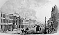
40:history of Louisville, Kentucky
1:
68:. He explored areas of the
177:
144:. In 1776, the colony of
142:Transylvania Land Company
134:Boonesborough, Kentucky
76:river valleys from the
34:
118:French and Indian War
100:created a trail from
90:French and Indian War
33:
52:from the north and
130:Fort Boonesborough
35:
164:
163:
132:at the site near
80:up to modern-day
168:
151:
138:Cumberland River
128:and established
114:Jefferson County
86:Christopher Gist
22:Featured article
176:
175:
171:
170:
169:
167:
166:
165:
160:
126:Wilderness Road
26:
25:
24:
12:
11:
5:
174:
172:
162:
161:
154:
110:Thomas Bullitt
102:North Carolina
78:Gulf of Mexico
27:
18:Portal:History
15:
14:
13:
10:
9:
6:
4:
3:
2:
173:
159:
158:
153:
152:
149:
147:
143:
139:
135:
131:
127:
123:
119:
115:
111:
107:
103:
99:
95:
91:
87:
83:
79:
75:
71:
67:
63:
59:
55:
51:
46:
42:
41:
32:
23:
19:
157:Read more...
155:
98:Daniel Boone
96:. In 1769,
38:
36:
122:Fort Harrod
70:Mississippi
60:in 1669 by
106:Tennessee
58:Europeans
54:Cherokees
45:geography
146:Virginia
140:for the
50:Shawnees
20: |
94:England
64:, from
82:Canada
66:France
16:<
74:Ohio
72:and
37:The
104:to
Text is available under the Creative Commons Attribution-ShareAlike License. Additional terms may apply.