1118:
58:
706:
42:
668:
living together, 7.5% had a female householder with no husband present, 3.2% had a male householder with no wife present, and 39.1% were non-families. 35.1% of all households were made up of individuals, and 21.9% had someone living alone who was 65 years of age or older. The average household size
721:
In the city, the population was spread out, with 23.7% under the age of 18, 5.3% from 18 to 24, 27.0% from 25 to 44, 20.0% from 45 to 64, and 24.0% who were 65 years of age or older. The median age was 42 years. For every 100 females, there were 102.7 males. For every 100 females age 18 and over,
717:
living together, 3.3% had a female householder with no husband present, and 40.1% were non-families. 36.8% of all households were made up of individuals, and 24.2% had someone living alone who was 65 years of age or older. The average household size was 2.25 and the average family size was 2.99.
685:
of 2000, there were 604 people, 269 households, and 161 families residing in the city. The population density was 702.0 inhabitants per square mile (271.0/km). There were 286 housing units at an average density of 332.4 per square mile (128.3/km). The racial makeup of the city was 99.50%
672:
The median age in the city was 45.9 years. 21.3% of residents were under the age of 18; 10% were between the ages of 18 and 24; 17.3% were from 25 to 44; 26.3% were from 45 to 64; and 25.2% were 65 years of age or older. The gender makeup of the city was 48.5% male and 51.5% female.
725:
The median income for a household in the city was $ 30,375, and the median income for a family was $ 43,250. Males had a median income of $ 30,089 versus $ 18,750 for females. The
1014:
633:
was 704.7 inhabitants per square mile (272.1/km). There were 297 housing units at an average density of 345.3 per square mile (133.3/km). The racial makeup of the city was 95.0%
1230:
1215:
1225:
893:
1007:
915:
275:
71:
855:
1000:
983:
285:
750:
57:
123:
1220:
992:
819:
638:
642:
1185:
1024:
945:
919:
795:
352:
313:
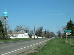
128:
841:
41:
343:
in 1881 when the railroad was extended to that point. A post office has been in operation at
Portland since 1882.
791:
584:
569:
554:
539:
524:
509:
494:
479:
464:
449:
434:
419:
404:
389:
321:
263:
47:
774:
1142:
1137:
1129:
1091:
1075:
1046:
713:
There were 269 households, out of which 28.6% had children under the age of 18 living with them, 56.5% were
1162:
1106:
1096:
1070:
695:
654:
328:
978:
923:
1080:
664:
There were 279 households, of which 25.1% had children under the age of 18 living with them, 50.2% were
1192:
1086:
1065:
699:
658:
236:
1152:
691:
687:
646:
634:
650:
630:
949:
851:
845:
726:
226:
729:
for the city was $ 15,149. About 4.3% of families and 6.0% of the population were below the
629:
of 2010, there were 606 people, 279 households, and 170 families residing in the city. The
705:
1209:
268:
730:
317:
116:
775:
U.S. Geological Survey
Geographic Names Information System: Portland, North Dakota
1039:
871:
111:
339:
The first settlement at
Portland was made in 1871. Portland was laid out and
86:
73:
217:
355:, the city has a total area of 0.86 square miles (2.23 km), all land.
733:, including 5.1% of those under age 18 and 11.5% of those age 65 or over.
1176:‡This populated place also has portions in an adjacent county or counties
714:
665:
251:
1117:
682:
626:
987:
973:
300:
704:
243:
222:
1057:
340:
32:
996:
1116:
984:
Diamond jubilee, Portland, North Dakota, July 1-2, 1882-1957
786:
784:
782:
1171:
1151:
1128:
1056:
847:
North Dakota, a Guide to the
Northern Prairie State
295:
284:
274:
262:
250:
233:
216:
208:
200:
192:
187:
179:
171:
163:
155:
150:
142:
134:
122:
110:
102:
23:
814:
812:
979:Portland's 125th Anniversary Celebration website
822:. United States Census Bureau. October 13, 2023
669:was 2.17 and the average family size was 2.76.
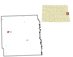
320:, United States. The population was 578 at the
1121:Map of North Dakota highlighting Traill County
1008:
8:
820:"City and Town Population Totals: 2020-2022"
327:Portland is the smaller neighbor of nearby
1015:
1001:
993:
702:of any race were 0.50% of the population.
362:
20:
661:of any race were 2.6% of the population.
1231:1881 establishments in Dakota Territory
742:
294:
273:
249:
215:
186:
178:
149:
133:
101:
66:
54:
38:
770:
768:
382:
1216:Cities in Traill County, North Dakota
283:
261:
232:
207:
199:
191:
170:
162:
154:
141:
121:
109:
7:
1226:Populated places established in 1881
694:, and 0.33% from two or more races.
653:, and 1.0% from two or more races.
175:0.00 sq mi (0.00 km)
167:0.83 sq mi (2.16 km)
159:0.83 sq mi (2.16 km)
18:City in North Dakota, United States
1023:Municipalities and communities of
950:"Census of Population and Housing"
372:
62:Location of Portland, North Dakota
14:
874:. City of Portland, North Dakota
751:"ArcGIS REST Services Directory"
56:
40:
1:
753:. United States Census Bureau
212:693.05/sq mi (267.62/km)
46:Entrance through Portland on
1026:Traill County, North Dakota
946:United States Census Bureau
920:United States Census Bureau
796:United States Census Bureau
353:United States Census Bureau
201: • Estimate
1247:
896:. Jim Forte Postal History
1181:
1114:
1037:
974:Mayville-Portland website
916:"US Gazetteer files 2010"
611:
598:
583:
568:
553:
538:
523:
508:
493:
478:
463:
448:
433:
418:
403:
388:
381:
376:
371:
368:
67:
55:
39:
30:
988:Digital Horizons website
842:Federal Writers' Project
722:there were 100.4 males.
183:984 ft (300 m)
1221:Cities in North Dakota
1122:
710:
709:Downtown Portland, ND.
25:Portland, North Dakota
1120:
792:"Explore Census Data"
708:
612:U.S. Decennial Census
364:Historical population
235: • Summer (
87:47.50056°N 97.37194°W
1194:United States portal
850:. WPA. p. 201.
301:mayvilleportland.com
209: • Density
1187:North Dakota portal
365:
92:47.50056; -97.37194
83: /
1123:
711:
631:population density
363:
193: • Total
172: • Water
156: • Total
1203:
1202:
857:978-1-62376-033-5
727:per capita income
618:
617:
351:According to the
307:
306:
164: • Land
1238:
1195:
1188:
1119:
1049:
1042:
1032:
1027:
1017:
1010:
1003:
994:
961:
960:
958:
956:
942:
936:
935:
933:
931:
922:. Archived from
912:
906:
905:
903:
901:
890:
884:
883:
881:
879:
868:
862:
861:
838:
832:
831:
829:
827:
816:
807:
806:
804:
802:
788:
777:
772:
763:
762:
760:
758:
747:
639:African American
384:
379:
374:
366:
303:
240:
98:
97:
95:
94:
93:
88:
84:
81:
80:
79:
76:
60:
44:
21:
1246:
1245:
1241:
1240:
1239:
1237:
1236:
1235:
1206:
1205:
1204:
1199:
1193:
1186:
1177:
1167:
1154:
1147:
1124:
1112:
1052:
1047:
1040:
1033:
1030:
1025:
1021:
970:
965:
964:
954:
952:
944:
943:
939:
929:
927:
926:on July 2, 2012
914:
913:
909:
899:
897:
894:"Traill County"
892:
891:
887:
877:
875:
870:
869:
865:
858:
840:
839:
835:
825:
823:
818:
817:
810:
800:
798:
790:
789:
780:
773:
766:
756:
754:
749:
748:
744:
739:
715:married couples
679:
666:married couples
643:Native American
623:
613:
377:
361:
349:
337:
299:
258:
234:
91:
89:
85:
82:
77:
74:
72:
70:
69:
63:
51:
35:
26:
19:
12:
11:
5:
1244:
1242:
1234:
1233:
1228:
1223:
1218:
1208:
1207:
1201:
1200:
1198:
1197:
1190:
1182:
1179:
1178:
1175:
1173:
1169:
1168:
1166:
1165:
1159:
1157:
1153:Unincorporated
1149:
1148:
1146:
1145:
1140:
1134:
1132:
1126:
1125:
1115:
1113:
1111:
1110:
1104:
1099:
1094:
1089:
1084:
1078:
1073:
1068:
1062:
1060:
1054:
1053:
1038:
1035:
1034:
1022:
1020:
1019:
1012:
1005:
997:
991:
990:
981:
976:
969:
968:External links
966:
963:
962:
937:
907:
885:
863:
856:
833:
808:
778:
764:
741:
740:
738:
735:
678:
675:
622:
619:
616:
615:
609:
608:
605:
603:
600:
596:
595:
592:
590:
587:
581:
580:
577:
575:
572:
566:
565:
562:
560:
557:
551:
550:
547:
545:
542:
536:
535:
532:
530:
527:
521:
520:
517:
515:
512:
506:
505:
502:
500:
497:
491:
490:
487:
485:
482:
476:
475:
472:
470:
467:
461:
460:
457:
455:
452:
446:
445:
442:
440:
437:
431:
430:
427:
425:
422:
416:
415:
412:
410:
407:
401:
400:
397:
395:
392:
386:
385:
380:
375:
370:
360:
357:
348:
345:
336:
333:
305:
304:
297:
293:
292:
289:
282:
281:
278:
272:
271:
266:
260:
259:
256:
254:
248:
247:
241:
231:
230:
220:
214:
213:
210:
206:
205:
202:
198:
197:
194:
190:
189:
185:
184:
181:
177:
176:
173:
169:
168:
165:
161:
160:
157:
153:
152:
148:
147:
144:
140:
139:
136:
132:
131:
126:
120:
119:
114:
108:
107:
104:
100:
99:
65:
64:
61:
53:
52:
45:
37:
36:
31:
28:
27:
24:
17:
13:
10:
9:
6:
4:
3:
2:
1243:
1232:
1229:
1227:
1224:
1222:
1219:
1217:
1214:
1213:
1211:
1196:
1191:
1189:
1184:
1183:
1180:
1174:
1170:
1164:
1161:
1160:
1158:
1156:
1150:
1144:
1141:
1139:
1136:
1135:
1133:
1131:
1127:
1108:
1105:
1103:
1100:
1098:
1095:
1093:
1090:
1088:
1085:
1082:
1079:
1077:
1074:
1072:
1069:
1067:
1064:
1063:
1061:
1059:
1055:
1051:
1050:
1043:
1036:
1031:United States
1028:
1018:
1013:
1011:
1006:
1004:
999:
998:
995:
989:
985:
982:
980:
977:
975:
972:
971:
967:
951:
947:
941:
938:
925:
921:
917:
911:
908:
895:
889:
886:
873:
872:"Our History"
867:
864:
859:
853:
849:
848:
843:
837:
834:
821:
815:
813:
809:
797:
793:
787:
785:
783:
779:
776:
771:
769:
765:
757:September 20,
752:
746:
743:
736:
734:
732:
728:
723:
719:
716:
707:
703:
701:
697:
693:
689:
684:
676:
674:
670:
667:
662:
660:
656:
652:
648:
644:
640:
636:
632:
628:
620:
610:
606:
604:
601:
597:
593:
591:
588:
586:
582:
578:
576:
573:
571:
567:
563:
561:
558:
556:
552:
548:
546:
543:
541:
537:
533:
531:
528:
526:
522:
518:
516:
513:
511:
507:
503:
501:
498:
496:
492:
488:
486:
483:
481:
477:
473:
471:
468:
466:
462:
458:
456:
453:
451:
447:
443:
441:
438:
436:
432:
428:
426:
423:
421:
417:
413:
411:
408:
406:
402:
398:
396:
393:
391:
387:
367:
358:
356:
354:
346:
344:
342:
334:
332:
330:
325:
323:
319:
315:
314:Traill County
312:is a city in
311:
302:
298:
290:
287:
279:
277:
270:
267:
265:
255:
253:
245:
242:
238:
228:
227:Central (CST)
224:
221:
219:
211:
203:
195:
182:
174:
166:
158:
145:
137:
130:
127:
125:
118:
115:
113:
106:United States
105:
96:
68:Coordinates:
59:
49:
43:
34:
29:
22:
16:
1101:
1045:
953:. Retrieved
940:
928:. Retrieved
924:the original
910:
898:. Retrieved
888:
876:. Retrieved
866:
846:
836:
824:. Retrieved
799:. Retrieved
755:. Retrieved
745:
731:poverty line
724:
720:
712:
680:
671:
663:
649:, 1.3% from
624:
359:Demographics
350:
338:
326:
318:North Dakota
309:
308:
117:North Dakota
15:
1155:communities
1041:County seat
900:October 25,
826:October 13,
801:October 13,
677:2000 census
651:other races
621:2010 census
614:2020 Census
599:2022 (est.)
322:2020 census
90: /
1210:Categories
737:References
681:As of the
625:As of the
288:feature ID
188:Population
135:Settlement
78:97°22′19″W
1172:Footnotes
1143:Caledonia
1138:Blanchard
1092:Hillsboro
1076:Galesburg
1048:Hillsboro
986:from the
347:Geography
276:FIPS code
264:Area code
218:Time zone
180:Elevation
75:47°30′2″N
1163:Cummings
1107:Reynolds
1102:Portland
1097:Mayville
1071:Clifford
955:July 21,
930:June 14,
878:June 13,
844:(1938).
696:Hispanic
690:, 0.17%
655:Hispanic
329:Mayville
310:Portland
280:38-63900
252:ZIP code
1081:Grandin
645:, 0.5%
641:, 1.5%
637:, 0.7%
341:platted
335:History
296:Website
291:1036227
143:Founded
103:Country
48:Hwy 200
1087:Hatton
1066:Buxton
1058:Cities
854:
700:Latino
683:census
659:Latino
627:census
519:−11.9%
459:−19.7%
369:Census
129:Traill
124:County
692:Asian
688:White
647:Asian
635:White
594:−4.6%
549:−4.0%
534:17.4%
504:−5.5%
489:16.3%
474:10.2%
444:11.1%
414:42.8%
257:58274
246:(CDT)
244:UTC-5
223:UTC-6
112:State
1130:CDPs
957:2013
932:2012
902:2015
880:2014
852:ISBN
828:2023
803:2023
759:2022
607:0.2%
585:2020
579:0.3%
570:2010
564:0.3%
555:2000
540:1990
525:1980
510:1970
495:1960
480:1950
465:1940
450:1930
435:1920
429:7.1%
420:1910
405:1900
390:1890
378:Note
373:Pop.
286:GNIS
151:Area
146:1882
138:1871
33:City
698:or
657:or
602:579
589:578
574:606
559:604
544:602
529:627
514:534
499:606
484:641
469:551
454:500
439:623
424:561
409:524
394:367
269:701
237:DST
204:579
196:578
1212::
1044::
1029:,
948:.
918:.
811:^
794:.
781:^
767:^
383:%±
331:.
324:.
316:,
1109:‡
1083:‡
1016:e
1009:t
1002:v
959:.
934:.
904:.
882:.
860:.
830:.
805:.
761:.
399:—
239:)
229:)
225:(
50:.
Text is available under the Creative Commons Attribution-ShareAlike License. Additional terms may apply.