1294:
59:
40:
479:
66:
1237:
108:
277:
lies near the end of
Neroutsos Inlet. East of Drake Island, Quatsino Narrows connects the eastern end of Quatsino Sound to Holberg Inlet and the smaller Rupert Inlet. Quatsino Narrows is a
1278:
510:
58:
1369:
1271:
503:
257:. Near its entrance, on the north side, is Forward Inlet, which branches into several smaller inlets, including the Winter Harbour and village of
1264:
496:
443:
294:
1335:
1364:
1354:
1149:
222:
605:
531:
691:
617:
165:
1293:
432:, TRIM 1:20,000 Digital Base Maps, British Columbia Integrated Land Management Bureau, Base Mapping and Geomatic Services; and
190:
44:
1359:
883:
878:
863:
261:. Koskimo Bay and Koprino Harbour are located farther east into Quatsino Sound. Drake Island, which is named after Justice
1172:
266:
483:
346:
194:
1328:
351:
316:
306:
229:. It is the northernmost of the five sounds that pierce the west coast of Vancouver Island, the others being
425:
262:
1244:
1129:
976:
898:
853:
760:
703:
321:
848:
725:
468:
407:
376:
311:
1109:
1084:
1374:
1039:
1064:
1321:
971:
966:
341:
1144:
956:
640:
1187:
1094:
39:
1124:
1049:
813:
793:
745:
660:
439:
1305:
1248:
1159:
1079:
1044:
941:
873:
858:
823:
523:
226:
218:
94:
90:
1182:
1059:
961:
936:
921:
803:
788:
750:
429:
270:
238:
179:
27:
1119:
1104:
986:
946:
843:
838:
833:
798:
783:
768:
720:
685:
650:
599:
554:
544:
539:
258:
206:
1348:
1212:
1192:
1177:
1167:
1134:
1114:
1099:
1089:
1029:
1024:
991:
981:
931:
818:
808:
778:
773:
740:
665:
655:
645:
635:
594:
584:
574:
564:
463:
402:
371:
254:
242:
230:
154:
1197:
1074:
1034:
1019:
1014:
951:
906:
888:
868:
828:
735:
670:
589:
549:
282:
234:
488:
1202:
1054:
1009:
926:
730:
712:
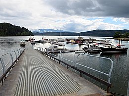
680:
675:
630:
579:
559:
519:
286:
1139:
1069:
1001:
916:
911:
625:
569:
278:
274:
198:
124:
110:
478:
16:
Body of water on the coast of
Vancouver Island in British Columbia, Canada
202:
1236:
269:
1876-1877) lies near the eastern end of
Quatsino Sound, and the long
390:
1301:
422:
217:
is a complex of coastal inlets, bays and islands on northwestern
149:
290:
492:
178:
Forward Inlet, Holberg Inlet, Koskimo Bay, Koprino
Harbour,
1309:
1252:
1158:
1000:
897:
759:
711:
702:
616:
530:
186:
174:
164:
160:
148:
100:
86:
21:
391:"List of Mayors" on "Victoria's Victoria" website
273:extends southeast from Drake Island. The town of
101:
1329:
1272:
504:
281:(which are also known in British Columbia as
8:
1336:
1322:
1279:
1265:
708:
511:
497:
489:
18:
333:
1370:British Columbia Coast geography stubs
65:
1243:This article about a location on the
438:. Weatherly Press. pp. 267–269.
295:Regional District of Mount Waddington
253:Quatsino Sound extends east from the
7:
1290:
1288:
1233:
1231:
47:, a village located in Holberg Inlet
289:(17 km/h; 10 mph) during
1308:. You can help Knowledge (XXG) by
1251:. You can help Knowledge (XXG) by
293:. The sound is located within the
14:
1292:
1235:
477:
64:
57:
38:
1:
85:
436:Waggoner Cruising Guide 2007
347:Geographical Names Data Base
285:), with currents reaching 9
78:Location in British Columbia
1391:
1365:Sounds of British Columbia
1355:Fjords of British Columbia
1287:
1230:
1245:Coast of British Columbia
52:
37:
26:
352:Natural Resources Canada
317:Quatsino Provincial Park
307:List of fjords in Canada
263:Montague Tyrwhitt-Drake
1130:Strait of Juan de Fuca
977:Queen Charlotte Strait
854:Princess Royal Channel
322:British Columbia Coast
125:50.50833°N 127.70000°W
31:
1360:Quatsino Sound region
1300:This article about a
864:Queen Charlotte Sound
849:Prince Rupert Harbour
486:at Wikimedia Commons
469:BC Geographical Names
434:Hale, Robert (2007).
423:Base Map Online Store
408:BC Geographical Names
377:BC Geographical Names
312:Quatsino First Nation
130:50.50833; -127.70000
175:Sections/sub-basins
120: /
1145:Trincomali Channel
957:Loughborough Inlet
428:2008-05-09 at the
403:"Quatsino Narrows"
1317:
1316:
1260:
1259:
1225:
1224:
1221:
1220:
1125:Strait of Georgia
1110:Satellite Channel
1050:Discovery Passage
814:Grenville Channel
794:Finlayson Channel
746:Skidegate Channel
482:Media related to
445:978-0-935727-26-5
223:Canadian province
212:
211:
150:Ocean/sea sources
1382:
1338:
1331:
1324:
1296:
1289:
1281:
1274:
1267:
1239:
1232:
1160:Vancouver Island
1150:Victoria Harbour
1085:Okisollo Channel
1080:Malaspina Strait
1045:Desolation Sound
942:Johnstone Strait
874:Seaforth Channel
859:Principe Channel
824:Juan Perez Sound
709:
704:Coastal features
524:British Columbia
513:
506:
499:
490:
481:
473:
464:"Quatsino Sound"
450:
449:
419:
413:
412:
399:
393:
388:
382:
381:
368:
362:
361:
359:
358:
342:"Quatsino Sound"
338:
227:British Columbia
219:Vancouver Island
151:
144:
143:
141:
140:
139:
137:
132:
131:
126:
121:
118:
117:
116:
113:
103:
95:British Columbia
91:Vancouver Island
68:
67:
61:
42:
19:
1390:
1389:
1385:
1384:
1383:
1381:
1380:
1379:
1345:
1344:
1343:
1342:
1286:
1285:
1228:
1226:
1217:
1183:Clayoquot Sound
1154:
1060:Homfray Channel
1040:Captain Passage
996:
962:Nodales Channel
937:Goletas Channel
922:Cordero Channel
893:
804:Fitz Hugh Sound
789:Douglas Channel
755:
751:Skidegate Inlet
698:
612:
526:
517:
462:
459:
454:
453:
446:
433:
430:Wayback Machine
421:Geography from
420:
416:
401:
400:
396:
389:
385:
370:
369:
365:
356:
354:
340:
339:
335:
330:
303:
271:Neroutsos Inlet
251:
239:Clayoquot Sound
180:Neroutsos Inlet
135:
133:
129:
127:
123:
122:
119:
114:
111:
109:
107:
106:
82:
81:
80:
79:
76:
75:
74:
73:
69:
48:
17:
12:
11:
5:
1388:
1386:
1378:
1377:
1372:
1367:
1362:
1357:
1347:
1346:
1341:
1340:
1333:
1326:
1318:
1315:
1314:
1297:
1284:
1283:
1276:
1269:
1261:
1258:
1257:
1247:, Canada is a
1240:
1223:
1222:
1219:
1218:
1216:
1215:
1210:
1208:Quatsino Sound
1205:
1200:
1195:
1190:
1185:
1180:
1175:
1170:
1164:
1162:
1156:
1155:
1153:
1152:
1147:
1142:
1137:
1132:
1127:
1122:
1120:Stuart Channel
1117:
1112:
1107:
1105:Sansum Narrows
1102:
1097:
1092:
1087:
1082:
1077:
1072:
1067:
1065:Hoskyn Channel
1062:
1057:
1052:
1047:
1042:
1037:
1032:
1027:
1022:
1017:
1012:
1006:
1004:
998:
997:
995:
994:
989:
987:Sutlej Channel
984:
979:
974:
969:
964:
959:
954:
949:
947:Kingcome Inlet
944:
939:
934:
929:
924:
919:
914:
909:
903:
901:
895:
894:
892:
891:
886:
881:
876:
871:
866:
861:
856:
851:
846:
844:Portland Inlet
841:
839:Milbanke Sound
836:
834:Laredo Channel
831:
826:
821:
816:
811:
806:
801:
799:Fisher Channel
796:
791:
786:
784:Dixon Entrance
781:
776:
771:
769:Arthur Passage
765:
763:
757:
756:
754:
753:
748:
743:
738:
733:
728:
723:
721:Cumshewa Inlet
717:
715:
706:
700:
699:
697:
696:
688:
683:
678:
673:
668:
663:
658:
653:
648:
643:
638:
633:
628:
622:
620:
614:
613:
611:
610:
602:
597:
592:
587:
582:
577:
572:
567:
562:
557:
552:
547:
542:
536:
534:
528:
527:
518:
516:
515:
508:
501:
493:
484:Quatsino Sound
475:
474:
458:
457:External links
455:
452:
451:
444:
414:
394:
383:
372:"Drake Island"
363:
332:
331:
329:
326:
325:
324:
319:
314:
309:
302:
299:
259:Winter Harbour
250:
247:
215:Quatsino Sound
210:
209:
207:Winter Harbour
188:
184:
183:
182:, Rupert Inlet
176:
172:
171:
168:
162:
161:
158:
157:
152:
146:
145:
136:Quatsino Sound
104:
98:
97:
88:
84:
83:
77:
72:Quatsino Sound
71:
70:
63:
62:
56:
55:
54:
53:
50:
49:
43:
35:
34:
24:
23:
22:Quatsino Sound
15:
13:
10:
9:
6:
4:
3:
2:
1387:
1376:
1373:
1371:
1368:
1366:
1363:
1361:
1358:
1356:
1353:
1352:
1350:
1339:
1334:
1332:
1327:
1325:
1320:
1319:
1313:
1311:
1307:
1303:
1298:
1295:
1291:
1282:
1277:
1275:
1270:
1268:
1263:
1262:
1256:
1254:
1250:
1246:
1241:
1238:
1234:
1229:
1214:
1213:San Josef Bay
1211:
1209:
1206:
1204:
1201:
1199:
1196:
1194:
1193:Kyuquot Sound
1191:
1189:
1186:
1184:
1181:
1179:
1178:Checleset Bay
1176:
1174:
1171:
1169:
1168:Barkley Sound
1166:
1165:
1163:
1161:
1157:
1151:
1148:
1146:
1143:
1141:
1138:
1136:
1135:Sutil Channel
1133:
1131:
1128:
1126:
1123:
1121:
1118:
1116:
1115:Sechelt Inlet
1113:
1111:
1108:
1106:
1103:
1101:
1100:Saanich Inlet
1098:
1096:
1093:
1091:
1090:Port San Juan
1088:
1086:
1083:
1081:
1078:
1076:
1073:
1071:
1068:
1066:
1063:
1061:
1058:
1056:
1053:
1051:
1048:
1046:
1043:
1041:
1038:
1036:
1033:
1031:
1030:Burrard Inlet
1028:
1026:
1025:Boundary Pass
1023:
1021:
1018:
1016:
1013:
1011:
1008:
1007:
1005:
1003:
999:
993:
992:Wells Passage
990:
988:
985:
983:
982:Seymour Inlet
980:
978:
975:
973:
972:Pryce Channel
970:
968:
965:
963:
960:
958:
955:
953:
950:
948:
945:
943:
940:
938:
935:
933:
932:Frederick Arm
930:
928:
925:
923:
920:
918:
915:
913:
910:
908:
905:
904:
902:
900:
899:Central Coast
896:
890:
887:
885:
882:
880:
877:
875:
872:
870:
867:
865:
862:
860:
857:
855:
852:
850:
847:
845:
842:
840:
837:
835:
832:
830:
827:
825:
822:
820:
819:Hecate Strait
817:
815:
812:
810:
809:Gardner Canal
807:
805:
802:
800:
797:
795:
792:
790:
787:
785:
782:
780:
779:Chatham Sound
777:
775:
774:Burke Channel
772:
770:
767:
766:
764:
762:
758:
752:
749:
747:
744:
742:
741:Rennell Sound
739:
737:
734:
732:
729:
727:
724:
722:
719:
718:
716:
714:
710:
707:
705:
701:
695:
693:
689:
687:
684:
682:
679:
677:
674:
672:
669:
667:
664:
662:
659:
657:
654:
652:
649:
647:
644:
642:
641:Great Central
639:
637:
634:
632:
629:
627:
624:
623:
621:
619:
615:
609:
607:
603:
601:
598:
596:
593:
591:
588:
586:
583:
581:
578:
576:
573:
571:
568:
566:
563:
561:
558:
556:
553:
551:
548:
546:
543:
541:
538:
537:
535:
533:
529:
525:
521:
514:
509:
507:
502:
500:
495:
494:
491:
487:
485:
480:
471:
470:
465:
461:
460:
456:
447:
441:
437:
431:
427:
424:
418:
415:
410:
409:
404:
398:
395:
392:
387:
384:
379:
378:
373:
367:
364:
353:
349:
348:
343:
337:
334:
327:
323:
320:
318:
315:
313:
310:
308:
305:
304:
300:
298:
296:
292:
288:
284:
283:skookumchucks
280:
276:
272:
268:
264:
260:
256:
255:Pacific Ocean
248:
246:
244:
243:Barkley Sound
240:
236:
232:
231:Kyuquot Sound
228:
224:
220:
216:
208:
204:
200:
196:
192:
189:
185:
181:
177:
173:
169:
167:
163:
159:
156:
155:Pacific Ocean
153:
147:
142:
105:
99:
96:
92:
89:
60:
51:
46:
41:
36:
33:
32:Baie Quatsino
29:
25:
20:
1310:expanding it
1299:
1253:expanding it
1242:
1227:
1207:
1198:Nootka Sound
1075:Jervis Inlet
1035:Calm Channel
1020:Boundary Bay
1015:Baynes Sound
967:Phillips Arm
952:Knight Inlet
907:Belize Inlet
889:Wright Sound
869:Rivers Inlet
829:Lama Passage
736:Masset Inlet
726:Darwin Sound
690:
604:
476:
467:
435:
417:
406:
397:
386:
375:
366:
355:. Retrieved
345:
336:
279:tidal rapids
265:, (Mayor of
252:
235:Nootka Sound
214:
213:
191:Coal Harbour
170:Drake Island
45:Coal Harbour
1375:Fjord stubs
1203:Pachena Bay
1055:Haro Strait
1010:Active Pass
927:Drury Inlet
884:Smith Sound
879:Smith Inlet
761:North Coast
731:Laskeek Bay
713:Haida Gwaii
520:Hydrography
187:Settlements
128: /
115:127°42′00″W
102:Coordinates
1349:Categories
1188:Hansen Bay
1173:Brooks Bay
1140:Toba Inlet
1095:Ramsay Arm
1070:Howe Sound
1002:Salish Sea
917:Call Inlet
912:Bute Inlet
357:2020-06-16
328:References
291:flood tide
275:Port Alice
199:Port Alice
134: (
112:50°30′30″N
686:Williston
651:Kinbasket
249:Geography
666:Okanagan
656:Kootenay
646:Harrison
636:Cowichan
600:Thompson
555:Kootenay
545:Cowichan
540:Columbia
426:Archived
301:See also
267:Victoria
203:Quatsino
87:Location
671:Shuswap
661:Nechako
595:Stikine
585:Quesnel
575:Nechako
565:Nanaimo
221:in the
195:Holberg
166:Islands
681:Teslin
676:Tagish
631:Babine
590:Skeena
550:Fraser
532:Rivers
442:
241:, and
28:French
1304:is a
1302:fjord
626:Atlin
618:Lakes
580:Peace
560:Liard
287:knots
1306:stub
1249:stub
692:more
606:more
570:Nass
440:ISBN
694:...
608:...
522:of
225:of
1351::
466:.
405:.
374:.
350:.
344:.
297:.
245:.
237:,
233:,
205:,
201:,
197:,
193:,
93:,
30::
1337:e
1330:t
1323:v
1312:.
1280:e
1273:t
1266:v
1255:.
512:e
505:t
498:v
472:.
448:.
411:.
380:.
360:.
138:)
Text is available under the Creative Commons Attribution-ShareAlike License. Additional terms may apply.