319:
affected by David Pugh, a
Welshman from Radnorshire, Wales. Young David Pugh left Wales early in 1801 and landed in Philadelphia. He took up residence in Baltimore, Maryland for about a year working and learning English. He met a fellow Welshman, Dr. Samuel Jones who had received several acres of land for his service in the Revolutionary War. Dr. Jones also acquired additional land warrants for his service in the Revolutionary War. Using acquired 25 land warrants, Dr. Jones purchased one quarter township (4,000 acres) of land in 1798. The land was located in Ohio Federal township six of range twenty in an area that was to become Radnor Township, Delaware County, Ohio.
713:
1080:
323:
journey on horseback David Pugh arrived near
Franklinton, Ohio (now a part of Columbus). He hired a local scout to take him up river to the land owned by Dr. Jones. Mr. Pugh’s letters indicated that he established a settlement named Carpenter (now in Licking County) as his headquarters for several week during the summer of 1802.
345:
Another
Welshman, Henry Perry, purchased the first one hundred-acre plot (lot 1 of tier 2) of the 4,000 acres. Henry, his wife Margaret and their children may have built the first family cabin in the area now near the northeast corner of Route 203 and Penry road. There is still a dug well
326:
Mr. Pugh recognized the value of the land he was surveying and returned to
Philadelphia in the fall of 1802 with an offer to buy the 4,000 acres. Dr. Jones was older and recognized David Pugh a worthy citizen and accepted his offer. Dr. Jones sold Pugh 3,505 acres of the 4,000 acres for $
322:
Early in 1802 Dr. Jones employed David Pugh to go to Ohio to scout and survey the 4,000 acres. As was the custom of the day the surveyor received land as payment for the survey. David received 2,000 acres apparently in the Welsh Hills area near
Reynoldsburg, Ohio. After a two- month
318:
Radnor was originally known as "Delhi", and under the latter name was laid out in 1833. Prior to being called Delhi, the town was called New
Baltimore. New Baltimore existed as early as 1814. The present name was taken from Radnor Township.The Radnor area history from 1802 until 1825 is greatly
349:
The village of New
Baltimore did not thrive and Pugh sold the 150 acres as farm land to Thomas Morton, Sr., in 1810. By 1825 a major portion of the 40 lots were under cultivation and Radnor Township was a thriving farming community. The New Baltimore plat name survived until Edward Evans
42:
338:
David Pugh lived in the area only a short time. He married Jane Murphy about 1808 and by 1815 they had moved to the Welsh-Hills community around what is now
Reynoldsburg, Ohio. They lived there the rest of their lives.
334:
In 1803 David Pugh traveled back to Wales and convinced two of his sisters and their husbands to emigrate. This event allowed many of the current Radnor families to claim the Pugh family as part of their ancestry.
330:
David Pugh’s deed for 4,000 acres was made in
Philadelphia and was recorded on February 23, 1803 in Franklin County, Ohio. In 1808 the land was sectioned off from Frankly County and became Delaware County.
350:
surveyed additional lots in 1833 and called the village Delhi. Pugh still owned some land of the original 4,000 acres up through 1850 but had moved on and was no longer part of the community.
1144:
1159:
1125:
327:
2,650. The other 495 acres had already been sold by Dr. Jones and Mr. Pugh was to locate the 495 acres in his survey and convey it to those identified by Dr. Jones.
623:
1154:
855:
461:
840:
810:
800:
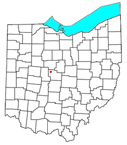
785:
342:
Pugh platted forty-one hundred acre lots from the 4,000 acres and then platted about 150 acres of the 4,000 into a village he called New
Baltimore.
1149:
1118:
845:
805:
780:
249:
835:
830:
825:
820:
815:
795:
770:
283:
126:
790:
775:
850:
747:
934:
616:
259:
55:
425:
1111:
969:
506:
200:
924:
609:
974:
964:
601:
979:
543:
History of Delaware County and Ohio: Containing a Brief History of the State of Ohio ... Biographical Sketches ... Etc
41:
465:
1012:
390:
295:
121:
765:
237:
109:
87:
541:
449:
866:
279:
32:
1087:
949:
633:
287:
114:
486:
1057:
919:
307:
210:
1050:
994:
889:
275:
959:
954:
356:
Article by Joseph Preston, Historian & Genealogist, Radnor Heritage Society Inc. and Museum
1022:
1017:
989:
701:
502:
1095:
909:
904:
527:
1027:
984:
914:
874:
742:
353:
757:
724:
680:
674:
655:
1138:
696:
242:
944:
939:
929:
899:
737:
732:
691:
685:
521:
666:
648:
583:
462:"Geographic Identifiers: 2010 Demographic Profile Data (G001): Radnor CDP, Ohio"
299:
1004:
97:
70:
57:
191:
1079:
1041:‡This populated place also has portions in an adjacent county or counties
303:
225:
450:
U.S. Geological Survey Geographic Names Information System: Radnor, Ohio
217:
196:
1091:
712:
291:
102:
605:
557:
711:
464:. U.S. Census Bureau, American Factfinder. Archived from
1099:
354:
https://www.radnorheritagesociety.org/about-radnor-ohio
558:"Old Historical City, County and State Maps of Ohio"
1145:
Unincorporated communities in Delaware County, Ohio
1036:
1003:
888:
865:
756:
723:
665:
258:
248:
236:
224:
207:
190:
182:
174:
169:
161:
153:
145:
137:
132:
120:
108:
96:
86:
23:
1160:Columbus metropolitan area, Ohio geography stubs
346:there that is said to have been Perry’s well.
18:Census-designated place in Ohio, United States
1119:
617:
526:. O. L. Baskin & Company. 1880. pp.
516:
514:
8:
1126:
1112:
624:
610:
602:
363:
20:
298:it had a population of 180. Radnor has a
716:Map of Ohio highlighting Delaware County
417:
247:
223:
189:
168:
160:
131:
85:
50:
38:
445:
443:
383:
310:at its intersection with Radnor Road.
257:
235:
206:
181:
173:
152:
144:
136:
119:
107:
95:
7:
1076:
1074:
546:. O. L. Baskin & Company. 1880.
523:History of Delaware County and Ohio
157:0.00 sq mi (0.00 km)
149:0.72 sq mi (1.87 km)
141:0.72 sq mi (1.87 km)
1155:Unincorporated communities in Ohio
1098:. You can help Knowledge (XXG) by
632:Municipalities and communities of
584:"Census of Population and Housing"
373:
14:
1078:
426:"ArcGIS REST Services Directory"
40:
1150:Welsh-American culture in Ohio
1:
428:. United States Census Bureau
1094:state location article is a
186:249.65/sq mi (96.42/km)
294:, United States. As of the
1176:
1073:
499:Ohio Atlas & Gazetteer
46:Location of Radnor in Ohio
1046:
709:
646:
404:
389:
382:
377:
372:
369:
51:
39:
30:
306:of 43066. It lies along
276:unincorporated community
165:938 ft (286 m)
280:census-designated place
33:Census-designated place
717:
715:
635:Delaware County, Ohio
405:U.S. Decennial Census
365:Historical population
209: • Summer (
71:40.38528°N 83.14583°W
1059:United States portal
468:on February 13, 2020
183: • Density
366:
76:40.38528; -83.14583
67: /
718:
564:. December 9, 2017
364:
175: • Total
154: • Water
138: • Total
1107:
1106:
1068:
1067:
497:DeLorme, (2004),
409:
408:
282:(CDP) in central
269:
268:
146: • Land
1167:
1128:
1121:
1114:
1082:
1075:
1060:
1053:
1013:Carpenter's Mill
714:
658:
651:
641:
636:
626:
619:
612:
603:
596:
595:
593:
591:
580:
574:
573:
571:
569:
554:
548:
547:
538:
532:
531:
518:
509:
495:
489:
484:
478:
477:
475:
473:
458:
452:
447:
438:
437:
435:
433:
422:
385:
380:
375:
367:
214:
82:
81:
79:
78:
77:
72:
68:
65:
64:
63:
60:
44:
21:
1175:
1174:
1170:
1169:
1168:
1166:
1165:
1164:
1135:
1134:
1133:
1132:
1088:Delaware County
1071:
1069:
1064:
1058:
1051:
1042:
1032:
999:
950:Kingston Center
891:
884:
861:
752:
719:
707:
661:
656:
649:
642:
639:
634:
630:
600:
599:
589:
587:
582:
581:
577:
567:
565:
556:
555:
551:
540:
539:
535:
520:
519:
512:
496:
492:
487:Zip Code Lookup
485:
481:
471:
469:
460:
459:
455:
448:
441:
431:
429:
424:
423:
419:
414:
378:
362:
316:
308:State Route 203
288:Delaware County
284:Radnor Township
232:
208:
75:
73:
69:
66:
61:
58:
56:
54:
53:
47:
35:
26:
19:
12:
11:
5:
1173:
1171:
1163:
1162:
1157:
1152:
1147:
1137:
1136:
1131:
1130:
1123:
1116:
1108:
1105:
1104:
1083:
1066:
1065:
1063:
1062:
1055:
1047:
1044:
1043:
1040:
1038:
1034:
1033:
1031:
1030:
1025:
1020:
1015:
1009:
1007:
1001:
1000:
998:
997:
992:
987:
982:
977:
972:
967:
962:
957:
952:
947:
942:
937:
932:
927:
922:
920:Center Village
917:
912:
907:
902:
896:
894:
890:Unincorporated
886:
885:
883:
882:
877:
871:
869:
863:
862:
860:
859:
853:
848:
843:
838:
833:
828:
823:
818:
813:
808:
803:
798:
793:
788:
783:
778:
773:
768:
762:
760:
754:
753:
751:
750:
745:
740:
735:
729:
727:
721:
720:
710:
708:
706:
705:
699:
694:
689:
683:
678:
671:
669:
663:
662:
647:
644:
643:
631:
629:
628:
621:
614:
606:
598:
597:
575:
549:
533:
510:
490:
479:
453:
439:
416:
415:
413:
410:
407:
406:
402:
401:
398:
396:
393:
387:
386:
381:
376:
371:
361:
358:
315:
312:
267:
266:
263:
256:
255:
252:
246:
245:
240:
234:
233:
230:
228:
222:
221:
215:
205:
204:
194:
188:
187:
184:
180:
179:
176:
172:
171:
167:
166:
163:
159:
158:
155:
151:
150:
147:
143:
142:
139:
135:
134:
130:
129:
124:
118:
117:
112:
106:
105:
100:
94:
93:
90:
84:
83:
49:
48:
45:
37:
36:
31:
28:
27:
24:
17:
13:
10:
9:
6:
4:
3:
2:
1172:
1161:
1158:
1156:
1153:
1151:
1148:
1146:
1143:
1142:
1140:
1129:
1124:
1122:
1117:
1115:
1110:
1109:
1103:
1101:
1097:
1093:
1089:
1084:
1081:
1077:
1072:
1061:
1056:
1054:
1049:
1048:
1045:
1039:
1035:
1029:
1026:
1024:
1021:
1019:
1016:
1014:
1011:
1010:
1008:
1006:
1002:
996:
995:White Sulphur
993:
991:
988:
986:
983:
981:
978:
976:
973:
971:
968:
966:
963:
961:
958:
956:
953:
951:
948:
946:
943:
941:
938:
936:
933:
931:
928:
926:
923:
921:
918:
916:
913:
911:
908:
906:
903:
901:
898:
897:
895:
893:
887:
881:
878:
876:
873:
872:
870:
868:
864:
857:
854:
852:
849:
847:
844:
842:
839:
837:
834:
832:
829:
827:
824:
822:
819:
817:
814:
812:
809:
807:
804:
802:
799:
797:
794:
792:
789:
787:
784:
782:
779:
777:
774:
772:
769:
767:
764:
763:
761:
759:
755:
749:
748:Shawnee Hills
746:
744:
741:
739:
736:
734:
731:
730:
728:
726:
722:
703:
700:
698:
695:
693:
690:
687:
684:
682:
679:
676:
673:
672:
670:
668:
664:
660:
659:
652:
645:
640:United States
637:
627:
622:
620:
615:
613:
608:
607:
604:
585:
579:
576:
563:
559:
553:
550:
545:
544:
537:
534:
529:
525:
524:
517:
515:
511:
508:
507:0-89933-281-1
504:
500:
494:
491:
488:
483:
480:
467:
463:
457:
454:
451:
446:
444:
440:
432:September 20,
427:
421:
418:
411:
403:
399:
397:
394:
392:
388:
368:
359:
357:
355:
351:
347:
343:
340:
336:
332:
328:
324:
320:
313:
311:
309:
305:
301:
297:
293:
289:
285:
281:
277:
273:
264:
261:
253:
251:
244:
241:
239:
229:
227:
219:
216:
212:
202:
201:Eastern (EST)
198:
195:
193:
185:
177:
164:
156:
148:
140:
128:
125:
123:
116:
113:
111:
104:
101:
99:
92:United States
91:
89:
80:
52:Coordinates:
43:
34:
29:
22:
16:
1100:expanding it
1085:
1070:
960:Lewis Center
955:Leonardsburg
935:East Liberty
879:
654:
588:. Retrieved
586:. Census.gov
578:
566:. Retrieved
561:
552:
542:
536:
522:
498:
493:
482:
470:. Retrieved
466:the original
456:
430:. Retrieved
420:
360:Demographics
352:
348:
344:
341:
337:
333:
329:
325:
321:
317:
271:
270:
25:Radnor, Ohio
15:
1052:Ohio portal
1023:Cones Mills
1018:Coles Mills
1005:Ghost towns
990:Vans Valley
970:Olive Green
892:communities
702:Westerville
650:County seat
472:December 7,
300:post office
296:2020 census
74: /
1139:Categories
910:Bellepoint
905:Alum Creek
856:Washington
412:References
262:feature ID
170:Population
62:83°08′45″W
59:40°23′07″N
1037:Footnotes
1028:Edinburgh
985:Stratford
915:Berkshire
875:Kilbourne
766:Berkshire
758:Townships
743:Ostrander
568:April 11,
501:, p. 57,
302:with the
250:FIPS code
238:Area code
192:Time zone
162:Elevation
925:Cheshire
841:Thompson
811:Marlboro
801:Kingston
786:Delaware
725:Villages
681:Delaware
675:Columbus
657:Delaware
562:Mapgeeks
304:ZIP code
254:39-65298
226:ZIP code
122:Township
115:Delaware
846:Trenton
806:Liberty
781:Concord
697:Sunbury
590:June 4,
314:History
265:2628956
88:Country
975:Orange
965:Norton
945:Hyatts
940:Harlem
930:Condit
900:Africa
880:Radnor
836:Scioto
831:Radnor
826:Porter
821:Oxford
816:Orange
796:Harlem
771:Berlin
738:Galena
733:Ashley
692:Powell
686:Dublin
667:Cities
505:
370:Census
274:is an
272:Radnor
127:Radnor
110:County
1086:This
791:Genoa
776:Brown
530:–511.
231:43066
220:(EDT)
218:UTC-4
197:UTC-5
98:State
1096:stub
1092:Ohio
980:Rome
867:CDPs
851:Troy
592:2016
570:2020
503:ISBN
474:2015
434:2022
391:2020
379:Note
374:Pop.
292:Ohio
278:and
260:GNIS
133:Area
103:Ohio
528:510
395:180
243:740
211:DST
178:180
1141::
1090:,
653::
638:,
560:.
513:^
442:^
384:%±
290:,
286:,
1127:e
1120:t
1113:v
1102:.
858:‡
704:‡
688:‡
677:‡
625:e
618:t
611:v
594:.
572:.
476:.
436:.
400:—
213:)
203:)
199:(
Text is available under the Creative Commons Attribution-ShareAlike License. Additional terms may apply.