42:
54:
872:
107:
127:
728:
745:
720:
706:
335:
393:
The township's age distribution consisted of 26.7% under the age of 18, 8.8% from 18 to 24, 23.3% from 25 to 44, 25.4% from 45 to 64, and 15.8% who were 65 years of age or older. The median age was 34.9 years. For every 100 females, there were 98.9 males. For every 100 females age 18 and over, there
389:
There were 520 households, out of which 31.00% had children under the age of 18 living with them, 55.58% were married couples living together, 8.65% had a female householder with no spouse present, and 29.04% were non-families. 26.50% of all households were made up of individuals, and 11.20% had
353:
there were 1,173 people, 520 households, and 369 families residing in the township. The population density was 32.59 inhabitants per square mile (12.58/km). There were 524 housing units at an average density of 14.56 per square mile (5.62/km). The racial makeup of the township was 94.80%
303:
According to the 2010 census, the township has a total area of 35.99 square miles (93.2 km), of which 35.97 square miles (93.2 km) (or 99.94%) is land and 0.02 square miles (0.052 km) (or 0.06%) is water.
397:
The median income for a household in the township was $ 68,421, and the median income for a family was $ 78,125. Males had a median income of $ 50,819 versus $ 29,559 for females. The
799:
67:
41:
53:
1011:
1230:
1046:
1041:
1036:
1021:
971:
966:
690:
981:
759:
734:
665:
1031:
1006:
976:
764:
754:
986:
695:
578:
996:
633:
1016:
991:
685:
1001:
792:
517:
265:
531:
785:
508:
1116:
658:
390:
someone living alone who was 65 years of age or older. The average household size was 2.53 and the average family size was 2.89.
247:
226:
513:
777:
1235:
371:
359:
579:"Population, Housing Units, Area, and Density: 2010 - County -- County Subdivision and Place -- 2010 Census Summary File 1"
651:
363:
139:
582:
375:
809:
284:
144:
449:
434:
350:
643:
1171:
1126:
99:
503:
1200:
1056:
917:
313:
536:
1121:
1111:
1064:
922:
379:
1161:
1131:
861:
831:
1207:
1151:
1106:
1091:
943:
907:
850:
383:
236:
1074:
367:
355:
1146:
927:
896:
883:
604:
401:
for the township was $ 31,515. About 4.6% of families and 7.7% of the population were below the
553:
1176:
1136:
1086:
933:
912:
891:
398:
338:
1156:
1096:
938:
901:
628:
1166:
1101:
948:
842:
1141:
958:
855:
295:. As of the 2020 census, its population was 1,173 and it contained 524 housing units.
280:
32:
1224:
292:
112:
402:
824:
119:
82:
69:
217:
405:, including 19.1% of those under age 18 and 5.8% of those age 65 or over.
1191:‡This populated place also has portions in an adjacent county or counties
288:
132:
334:
871:
243:
222:
781:
647:
674:
Places adjacent to Ricks
Township, Christian County, Illinois
870:
324:
The township contains Saint
Maurice Catholic Cemetery.
638:
532:
United States Census Bureau 2009 TIGER/Line
Shapefiles
1186:
1073:
1055:
957:
882:
841:
264:
254:
233:
216:
208:
200:
195:
187:
179:
171:
163:
158:
150:
138:
118:
98:
23:
183:0.02 sq mi (0.05 km) 0.06%
476:Morrisonville Community Unit School District 1
875:Map of Illinois highlighting Christian County
793:
659:
8:
504:"Ricks Township, Christian County, Illinois"
800:
786:
778:
666:
652:
644:
407:
386:of any race were 1.53% of the population.
20:
479:Nokomis Community Unit School District 22
518:United States Department of the Interior
1231:Townships in Christian County, Illinois
542:
263:
253:
215:
194:
186:
157:
149:
97:
62:
58:Christian County's location in Illinois
38:
581:. United States Census. Archived from
427:
232:
207:
199:
178:
170:
162:
137:
117:
50:
7:
760:Rountree Township, Montgomery County
681:
548:
546:
378:, and 4.26% from two or more races.
175:35.97 sq mi (93.2 km)
167:35.99 sq mi (93.2 km)
765:Nokomis Township, Montgomery County
755:Raymond Township, Montgomery County
509:Geographic Names Information System
18:Township in Illinois, United States
808:Municipalities and communities of
605:"Census of Population and Housing"
417:
14:
743:
726:
718:
704:
333:
125:
105:
52:
40:
514:United States Geological Survey
639:Township Officials of Illinois
1:
744:
705:
727:
719:
537:United States National Atlas
46:Location in Christian County
1252:
811:Christian County, Illinois
1196:
868:
822:
679:
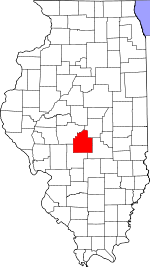
463:
448:
433:
426:
421:
416:
413:
63:
51:
39:
30:
492:State Senate District 49
191:623 ft (190 m)
634:Illinois State Archives
489:State House District 98
308:Cities, towns, villages
876:
1236:Townships in Illinois
874:
554:"Explore Census Data"
464:U.S. Decennial Census
409:Historical population
235: • Summer (
212:33/sq mi (13/km)
83:39.38861°N 89.42528°W
1209:United States portal
585:on February 12, 2020
279:is one of seventeen
209: • Density
691:Bear Creek Township
484:Political districts
410:
88:39.38861; -89.42528
79: /
877:
735:Greenwood Township
408:
394:were 104.7 males.
201: • Total
180: • Water
164: • Total
1218:
1217:
775:
774:
770:
769:
468:
467:
399:per capita income
339:Illinois Route 48
274:
273:
172: • Land
1243:
1210:
1203:
873:
834:
827:
817:
812:
802:
795:
788:
779:
747:
746:
730:
729:
722:
721:
708:
707:
696:Johnson Township
682:
668:
661:
654:
645:
617:
616:
614:
612:
601:
595:
594:
592:
590:
575:
569:
568:
566:
564:
550:
528:
526:
524:
471:School districts
429:
424:
419:
411:
372:Pacific Islander
360:African American
337:
285:Christian County
240:
154:November 7, 1865
131:
129:
128:
111:
109:
108:
94:
93:
91:
90:
89:
84:
80:
77:
76:
75:
72:
56:
44:
21:
1251:
1250:
1246:
1245:
1244:
1242:
1241:
1240:
1221:
1220:
1219:
1214:
1208:
1202:Illinois portal
1201:
1192:
1182:
1078:
1076:
1069:
1051:
953:
878:
866:
837:
832:
825:
818:
815:
810:
806:
776:
771:
731:
675:
672:
625:
620:
610:
608:
603:
602:
598:
588:
586:
577:
576:
572:
562:
560:
558:data.census.gov
552:
551:
544:
522:
520:
502:
499:
486:
473:
422:
364:Native American
347:
330:
322:
310:
301:
260:
234:
126:
124:
106:
104:
87:
85:
81:
78:
73:
70:
68:
66:
65:
59:
47:
35:
26:
19:
12:
11:
5:
1249:
1247:
1239:
1238:
1233:
1223:
1222:
1216:
1215:
1213:
1212:
1205:
1197:
1194:
1193:
1190:
1188:
1184:
1183:
1181:
1180:
1174:
1172:Willey Station
1169:
1164:
1159:
1154:
1149:
1144:
1139:
1134:
1129:
1127:Old Stonington
1124:
1119:
1114:
1109:
1104:
1099:
1094:
1089:
1083:
1081:
1077:unincorporated
1071:
1070:
1068:
1067:
1061:
1059:
1053:
1052:
1050:
1049:
1044:
1039:
1034:
1029:
1024:
1019:
1014:
1009:
1004:
999:
994:
989:
984:
979:
974:
969:
963:
961:
955:
954:
952:
951:
946:
941:
936:
931:
925:
920:
915:
910:
905:
899:
894:
888:
886:
880:
879:
869:
867:
865:
864:
859:
853:
847:
845:
839:
838:
823:
820:
819:
807:
805:
804:
797:
790:
782:
773:
772:
768:
767:
762:
757:
751:
750:
748:
741:
738:
737:
732:
724:Ricks Township
717:
715:
712:
711:
709:
702:
699:
698:
693:
688:
680:
677:
676:
673:
671:
670:
663:
656:
648:
642:
641:
636:
631:
624:
623:External links
621:
619:
618:
596:
570:
541:
540:
539:
534:
529:
498:
495:
494:
493:
490:
485:
482:
481:
480:
477:
472:
469:
466:
465:
461:
460:
457:
455:
452:
446:
445:
442:
440:
437:
431:
430:
425:
420:
415:
346:
343:
342:
341:
329:
328:Major highways
326:
321:
318:
317:
316:
309:
306:
300:
297:
277:Ricks Township
272:
271:
268:
262:
261:
258:
256:
252:
251:
241:
231:
230:
220:
214:
213:
210:
206:
205:
202:
198:
197:
193:
192:
189:
185:
184:
181:
177:
176:
173:
169:
168:
165:
161:
160:
156:
155:
152:
148:
147:
142:
136:
135:
122:
116:
115:
102:
96:
95:
61:
60:
57:
49:
48:
45:
37:
36:
31:
28:
27:
25:Ricks Township
24:
17:
13:
10:
9:
6:
4:
3:
2:
1248:
1237:
1234:
1232:
1229:
1228:
1226:
1211:
1206:
1204:
1199:
1198:
1195:
1189:
1185:
1178:
1175:
1173:
1170:
1168:
1165:
1163:
1160:
1158:
1155:
1153:
1150:
1148:
1145:
1143:
1140:
1138:
1135:
1133:
1130:
1128:
1125:
1123:
1120:
1118:
1115:
1113:
1110:
1108:
1105:
1103:
1100:
1098:
1095:
1093:
1090:
1088:
1085:
1084:
1082:
1080:
1072:
1066:
1063:
1062:
1060:
1058:
1054:
1048:
1045:
1043:
1040:
1038:
1035:
1033:
1030:
1028:
1025:
1023:
1020:
1018:
1015:
1013:
1010:
1008:
1005:
1003:
1000:
998:
995:
993:
990:
988:
985:
983:
980:
978:
975:
973:
970:
968:
965:
964:
962:
960:
956:
950:
947:
945:
942:
940:
937:
935:
932:
929:
926:
924:
921:
919:
918:Morrisonville
916:
914:
911:
909:
906:
903:
900:
898:
895:
893:
890:
889:
887:
885:
881:
863:
860:
857:
854:
852:
849:
848:
846:
844:
840:
836:
835:
828:
821:
816:United States
813:
803:
798:
796:
791:
789:
784:
783:
780:
766:
763:
761:
758:
756:
753:
752:
749:
742:
740:
739:
736:
733:
725:
716:
714:
713:
710:
703:
701:
700:
697:
694:
692:
689:
687:
686:King Township
684:
683:
678:
669:
664:
662:
657:
655:
650:
649:
646:
640:
637:
635:
632:
630:
629:City-Data.com
627:
626:
622:
606:
600:
597:
584:
580:
574:
571:
559:
555:
549:
547:
543:
538:
535:
533:
530:
519:
515:
511:
510:
505:
501:
500:
496:
491:
488:
487:
483:
478:
475:
474:
470:
462:
458:
456:
453:
451:
447:
443:
441:
438:
436:
432:
412:
406:
404:
400:
395:
391:
387:
385:
381:
377:
374:, 0.17% from
373:
369:
365:
361:
357:
352:
344:
340:
336:
332:
331:
327:
325:
319:
315:
314:Morrisonville
312:
311:
307:
305:
298:
296:
294:
290:
286:
282:
278:
269:
267:
257:
249:
245:
242:
238:
228:
224:
221:
219:
211:
203:
190:
182:
174:
166:
153:
146:
143:
141:
134:
123:
121:
114:
113:United States
103:
101:
92:
64:Coordinates:
55:
43:
34:
29:
22:
16:
1122:Millersville
1112:Hewittsville
1065:Langleyville
1026:
1012:Mount Auburn
923:Mount Auburn
830:
723:
609:. Retrieved
607:. Census.gov
599:
587:. Retrieved
583:the original
573:
561:. Retrieved
557:
521:. Retrieved
507:
403:poverty line
396:
392:
388:
348:
345:Demographics
323:
302:
276:
275:
270:17-021-63797
259:62075, 62546
15:
1162:Vanderville
1132:Osbernville
1079:communities
1047:Taylorville
862:Taylorville
833:Taylorville
826:County seat
563:January 22,
523:January 10,
376:other races
351:2020 census
151:Established
86: /
1225:Categories
1152:Sharpsburg
1107:Grove City
1092:Clarksdale
1042:Stonington
1037:South Fork
1022:Prairieton
972:Bear Creek
967:Assumption
944:Stonington
908:Jeisyville
851:Assumption
497:References
349:As of the
320:Cemeteries
196:Population
74:89°25′31″W
71:39°23′19″N
1187:Footnotes
982:Greenwood
959:Townships
299:Geography
281:townships
266:FIPS code
255:ZIP codes
218:Time zone
188:Elevation
145:Christian
1147:Rosamond
1032:Rosamond
1007:Mosquito
977:Buckhart
928:Moweaqua
897:Edinburg
884:Villages
380:Hispanic
370:, 0.00%
366:, 0.34%
362:, 0.26%
358:, 0.17%
289:Illinois
133:Illinois
33:Township
1177:Zenobia
1137:Radford
1087:Bolivia
987:Johnson
934:Owaneco
913:Kincaid
892:Bulpitt
611:June 4,
589:May 28,
100:Country
1157:Sicily
1117:Midway
1097:Dunkel
997:Locust
939:Palmer
902:Harvel
843:Cities
414:Census
384:Latino
140:County
130:
110:
1167:Velma
1102:Ellis
1075:Other
1027:Ricks
949:Tovey
459:−4.1%
454:1,173
439:1,223
368:Asian
356:White
244:UTC-5
223:UTC-6
204:1,173
120:State
1142:Roby
1017:Pana
992:King
856:Pana
613:2016
591:2013
565:2023
525:2010
450:2020
435:2010
423:Note
418:Pop.
159:Area
1057:CDP
1002:May
382:or
293:USA
283:in
248:CDT
237:DST
227:CST
1227::
829::
814:,
556:.
545:^
516:,
512:.
506:.
428:%±
291:,
287:,
1179:‡
930:‡
904:‡
858:‡
801:e
794:t
787:v
667:e
660:t
653:v
615:.
593:.
567:.
527:.
444:—
250:)
246:(
239:)
229:)
225:(
Text is available under the Creative Commons Attribution-ShareAlike License. Additional terms may apply.