1143:, and this was reviewed in 2015. However publicly available information on the area is unclear as the DEFRA Joint Nature Conservation Committee website shows the area stretching from Pinkson Creek on the Camel estuary up to Polbrock bridge, but incorporating Pinkson Creek, the River Allen to just upstream of Sladesbridge, and the Polmorla Brook almost to the edge of the Wadebridge built-up area, and incorporating all of the intertidal zone. In contrast, both the Marine Conservation Institute and ProtectedPlanet show the area from Wadebridge bridge upstream, including the Ruthern, Allen, De Lank and Stannon, all being shown as covered to their respective sources., the only part of this area considered tidal is between Wadebridge bridge and St Marys church Egloshayle.
1785:
969:
628:
546:
639:
1879:
River Allen, a common Celtic river name of unknown derivation, but the names were somewhat interchangeable, and even a hybrid Camb-alan wss recorded in the 16th
Century. By the 19th Century the name Allen was exclusively used for the River Layne which flows into the Camel just above Egloshayle and the name Camel applied to the whole length of the river. The Camel estuary appears to have been called the River Hayle from Middle Cornish "Hayle",
54:
1237:(CBWPS) is open to members. In addition the CBWPS own the Walmsley Sanctuary which covers over 20 hectares (49 acres) on the River Amble, with two further hides for use by its members. The Walmsley sanctuary is nationally important for wintering waders and wildfowl. These hides are located on the estuary below Wadebridge while upstream of Wadebridge there is a hide overlooking Treraven Meadow located 500m from Guineaport towards Bodmin
5590:
608:
1540:. The river has previously been navigable beyond Wadebridge with the highest quays being at Guineaport and Egloshayle, and ships were recorded beyond that at least as far as Pendavy a mile further upstream while Polbrock was given as the limit of navigation in 1814. The river as far as Wadebridge was considered navigable for vessels up to 150 tons in 1830 and Wadebridge was used as the location for loading granite,
1601:, sand and coal being taken up to the village and grain brought out again. Construction of the bridge at Trewornan did not prevent access to Chapel Amble, but the tidal barrage which prevents salt water going upstream past Burniere Point has left the River Amble inaccessible from the main river. Nearer to Wadebridge there was a quay at Trevilling on the north bank of the river built in the 19th century for a
6032:
5936:
42:
616:
1768:
the
Historic England Heritage at Risk Register in 2020 citing an "Immediate risk of further rapid deterioration or loss of fabric" This is perhaps unsurprising as Hellandbridge is still completely original, while Wenfordbridge and Gam Bridge, along with Pendavey, Dunmere, Poley's and Tresarret bridges, were broken by the flood of 1847 and were subsequently rebuilt.
576:. Data collected by the National River Flow Archive shows that water flow in the River Camel for 2006 was considerably below average. This correlates with reduced rainfall, particularly between the months of June and September. Data from 2013 and 2014 also shows below average annual flow but with points of higher than average flow during Winter.
1084:, particularly freestyle and wakestyle. These locations being on opposite sides of the river provide between them kitesurfing opportunities for all wind directions, although kitesurfing is not allowed at either venue during the daytime in July and August. Kitesurfing UK list Hawkers cove as one of their favourite kitesurfing spots in Cornwall.
1748:
built by John de Harlan at the instigation of Vicar of
Egloshayle Thomas Loveybond and replaced an earlier ford which was considered so dangerous to use at certain times that a chapel was built on either bank; one to pray for a safe crossing and the other to give thanks. The bridge was made a county bridge in the reign of
787:
parts of the estuary has affected the ability of vessels to access
Padstow harbour for many years, and even in May 2020 a navigation warning was issued relating to an increase in size of a spit of sand between Gun Point and St Saviours Point which is considered to have become a serious hazard to navigation.
940:. Water quality is monitored at Polzeath and Daymer Bay with water classification for the years 2012 to 2015 for both locations being "Excellent". Water quality was previously monitored at Rock, results from 2007 for all three locations on the eastern bank of the river being either "good" or "excellent".
1767:
last battle. While the heritage value of ancient crossings is great, continued use of structures that are several hundred years old and that were designed and built with lighter and less frequest traffic in mind can have a deleterious effect on the fabric of these bridges. Helland Bridge was added to
1676:
There was at one time a small chapel located at St
Saviours point downstream of Padstow where a monk would keep a light at night to assist shipping, and it is considered likely that this was associated with Bodmin Priory which held land at Padstow, although the provision of this light ceased with the
1613:
in 1834 was based on taking sand brought up to
Wadebridge by 12 ton barges that were poled under the bridge at Wadebridge with the sand then being transhipped to the railway for onward transport. From a specially built sand dock at Wadebridge the railway took the sand further up the valley, replacing
1321:
are found in the River Camel and have been fished since the 12th century when the Priory at Bodmin constructed a Salmon weir near
Dunmere and Salmon is named as a contributary species in the designation of the River Camel as a Special Area of Conservation. More recently the Camel had a reputation for
700:
can be found on the foreshore below Dinham Hill, part of Wheal
Sisters copper mine. The adit is only accessible from the foreshore at low tide, and is situated near to the location of a tide mill that is recorded at the point where Dinham Creek meets the main river. This mill is shown on a map of the
560:
The source of the Camel is at 218 metres (715 ft) above sea level and it has an average incline of 7m/km. The upper reaches of the Camel and its tributaries are mainly moorland giving way to woodland and farmland, predominantly livestock. This means that 64.8% of the catchment is grassland, with
1878:
In terms of its name there is evidence that what is now known as the River Camel has had several names in the past. The name Camel is derived from Middle
Cornish "Cam-El", "Crooked one", and seems originally to have referred only to the upper parts. The lower part of the river was referred to as the
1592:
and before construction of the railway between
Wadebridge and Padstow there was a quay at Pinxton Creek. Also on the south bank of the estuary two quays served the nearby Camel Quarry and Penquean Quarry, the quays being used to export the slate quarried there and, as the slate was raised from up to
794:
extends across the estuary. This restricts access to Padstow harbour and has been the graveyard of many ships over the years. In the past there was a proposal to build a pier on the doom bar to funnel the tide and thus scour the main channel and keep it navigable, but nothing was ever constructed. A
2665:
Minchinton and Perkins record that Dinham salt water mills were advertised for sale in 1851 (2). The 1st Edition 1:2500 OS c1880 map records a disused tidal bone mill at the site (1). A tidal pond is recorded on the 1963 OS map but this is not apparent on the current 1:10000 edition (3, 4). The CCC
1672:
meaning legion, while the name Cant is attributed by others to ownership by the De Cant family. Although Cant Hill may not have any substantiated links to the Roman period, Roman coins, ornaments and pottery have been found in the area of Brea Hill where there is believed to have been a Roman camp.
1567:
was engaged to advise on the idea. The canal was intended to be 5 foot (1.5 m) deep and 32 foot (10 m) wide, but Rennie advised that a tunnel would be required on the route and that little through traffic could be anticipated so no further effort was expended. Soon after in 1796 an act of
786:
in 1856. A new lifeboat station and slipway were built in 1931 and a second lifeboat stationed at Hawker's Cove. The station closed in 1962 because silting rendered the channel too shallow and the building used to house the lifeboat has been converted to residential use. Movement of sand in various
579:
In a river which runs for much of its length in a steep-sided valley, sudden downpours can cause water levels to rise rapidly and while floods are not unusual on the Camel, the flood of 16 July 1847 was exceptional. Caused by a waterspout and deluge on Davidstow Moor, a wall of water swept away six
1747:
bridges than any other river in Cornwall with the most notable being at Wadebridge. Referred to as "the longest and fairest bridge in Cornwall" it was the furthest bridge downstream on the river until the opening of the A39 Wadebridge bypass in 1993. Built in the 15th century Wadebridge bridge was
1659:
overlooking the river which was once thought to have been the only Roman Fort in Cornwall, and was only occupied between 60 and 80AD. Less certain is the association of a Roman legion with the area around Cant Hill. The evidence in circumstantial, with the name Cant being associated with the Latin
1260:
conservation area. This was originally designated as being upstream from a line drawn between Stepper Point and Trebetherick Point but this was extended to include all waters upstream of a line between Stepper Point and Pentire Point in 1999. Surfers at Polzeath have recounted seeing bass swimming
705:
in 2019, and almost opposite Cant Hill on the west bank is Camel Quarry with the piles of waste rock clearly visible above the river and the remains of a quay visible at low water. From here the mud gives way to sand and Gentle Jane, named after a legendary lady who treated the ills of all comers.
1625:
On the estuary itself there was no need to transport sand by barge, and 'sanding lanes' were laid from local villages directly onto the foreshore so that carts could be taken down at low tide and loaded with sand. On the southern side of the estuary 'sanding lanes' linked Higher Halwyn to Oldtown
1621:
was a common commodity for transportation in the 18th and 19th centuries and the Camel was no exception with lime kilns being recorded at Egloshayle with a quay adjacent, another at Bishop's Quay below Gonvena Hill, and one on the town side of the river adjacent to the Pomorla brook The furthest
1531:
Cornwall is an undulating county with high cliffs, rough moors and deep valleys, so rivers have been used for transport throughout history. Being one of the few safe havens on the north coast of Cornwall, the Camel Estuary has been used since Roman times and most likely earlier, and by the 18th
4355:
A quay on the south bank of the River Camel, adjacent to the old line of the London and South Western Railway (now the Camel Trail). The quay survives substantially intact, although partly obscured by modern infill to the east. It is constructed of slate stone masonry in alternate vertical and
1775:
between Wadebridge and Padstow over Petherick Creek. Good use was made of the river during construction as the metalwork was brought to Wadebridge by boat and then floated on barges down to where the bridge was being built. Sitting on Dennis Hill overlooking the bridge is an Obelisk erected to
1608:
Despite the many opportunities for transport along the estuary, historically the main traffic on the river above Padstow was to the Quays at Wadebridge where there is evidence of a dock dating back as far as Elizabethan times, and in 1830 the limit of navigation was recorded as Guineaport.
4868:
A limekiln at Wadebridge is shown at this location on the Tithe Map of 1840, when its owner was Sir William Molesworth and its occupier was Thomas Trebilcock (b1). It is shown on both the 1st and 2nd Edition 1:2500 OS maps (b2, b3), but is believed to have been derelict well before 1910
1593:
60 feet (20 m) depth, to bring in coal for the two engines used for pumping and sawing, although both quarries had ceased operation before the railway line separated them from the river. Joining the main river upstream of Camel Quarry, the River Amble was navigable up to
3585:
County Bird News: As of 1st Jan, the two expanding egret species in the UK, Cattle and Great White have been taken off the 'County Description Species' List. Care over id may still need to be taken, & recorder/committee may request further information for any particular
580:
bridges but Hellandbridge withstood the force of the water, which flowed over the structure leaving debris visible in nearby trees up to 20 feet (6 m) above the normal river level. Today the tidal parts of the River Camel are subject to flood risk, especially during
1124:, and extends in several further sections of varying size up to its source. This SSSI also includes much of the River Allen, a tributary which flows into the river immediately upstream of Egloshayle, and some smaller unnamed tributaries. In addition, there is an SSSI at
1650:
situated high on the eastern side of the Camel valley with extant ramparts up to 10 ft (3 m), and not far away on the other side of the river is an older hillfort. Rather earlier in date is Killibury Castle above Egloshayle which originates from the late
1232:
There are three birdwatching hides overlooking the River Camel. Tregunna Hide (Grid reference SW 969 738), owned by Cornwall County Council, is located by the Camel Trail and is open to the public. Burniere Hide (Grid Reference SW 982 740) is owned by the
1792:
Although the River itself has never been a location for military bases, some parts have been used periodically for military purposes. Other than the Roman forts noted above, one of the earliest military installations was at Gun Point just downstream of
3291:
469:
Mining slate for building purposes has been carried out at various locations along the river, often with small quarries being created near to where the stone was to be used. Today the only active quarry in the whole River Camel catchment area is at
1681:. More certainly associated with Bodmin Priory is the building of the bridge over the Camel at Dunmere in the 12th Century and the small chapel that stood on the Bodmin side of the river at the location that is now known as St Annes Chapel Hayes.
1072:
Canoeing and Kayaking take place on the river Camel with a dedicated access point just above the bridge at Wadebridge. Further up there are stretches that are particularly favoured such as between Tuckingmill to Penrose which has grade 2 rapids.
1583:
With boats as one of the main methods of transporting goods until the advent of the railways there were several quays along the river, often at the limit of navigation of the many tributaries and creeks on the estuary. There were quays at
1146:
There are two nature reserves on Camel and its tributaries. The Walmsley sanctuary of the Cornwall Birdwatching and Preservation Society is on the Amble marshes on the River Amble above Trewornan Bridge. Hawke's Wood reserve, owned by the
3598:
692:
has hides on both sides of the river; those on the Camel Trail are open to the public. The main river follows the western side of the valley, while on the eastern side a barrage prevents the rising tide from entering the River Amble.
1326:
placing restrictions on salmon fishing in the river in 2017. There have also been significant reductions in catches of sea trout and while a total of over 900 fish were caught in 2010, this reduced to less than 300 fish in 2016.
1655:, was in use throughout the Iron Age and was re-occupied during the Roman period. It is a scheduled monument of national importance. Also Roman in date but several miles up the valley there is the remains of a Roman fort near
3697:
1076:
Water skiing takes place on the estuary based in Rock, with four set courses located between Dennis cove and Pinkson creek. Rock is also a centre for sailing with the Rock Sailing and Waterski Club being founded in 1938
1396:
The valley and its immediate environs are, in parts, thickly wooded with managed plantations at Cardinham and Dunmere near Bodmin and Bishop's, Hustyn, and Grogley Woods between Bodmin and Wadebridge all managed by the
795:
legend as to how the Doom Bar came about describes how a local fisherman is reputed to have shot a mermaid with an arrow, with the result that she cursed Padstow by putting the sandbar between the harbour and the sea.
1461:
zone covering North Cornwall, the boundary of which encompasses the rivers Camel and Allen. The cull, which resulted in over 1500 badgers being killed in North Cornwall in 2016, is intended to reduce instances of
679:
downstream to the open sea at Padstow Bay. The quays at Wadebridge are now developed with apartments and retail space on the west bank. North of the quays, the river passes under a concrete bridge carrying the
5520:
The area has yielded up information that Slaughterbridge, on the River Camel, was undoubtedly, the site of a ferocious battle in ancient times; though, whether this was the Battle of Camlann in 542 is open to
4838:
Situated on Bishop's Quay, this kiln existed at least as early as 1834, as it appeared then in a 'for sale' notice. Run in its latter days by Messrs Martyn (b1). Marked on the 2nd Edition 1:2500 OS map
4048:
Hustyn Wood, in the Parish of St Breock, is a Forestry Commission wood, adjoining Bishop's Woods, composed of a variety of trees – areas of broadleaved trees, mature Douglas fir and mixed woodland.
4186:
The wild service tree was once widespread, if seldom abundant, in the forests of England and Wales. But, as these were cleared, it became rarer and is now confined to ancient woodlands and hedges
599:
In 2023 the Environment Agency measured water levels on the River Camel at Sladesbridge, Dunmere and Camelford, and also on the rivers Allen and De Lank which are tributaries of the River Camel.
1261:
around their surfboards in summer. Flounders can be found in the brackish waters around the entrance to Little Petherick Creek, and Daymer Bay is noted as a location for fishing from the rocks.
1717:
are believed to have ancient origins, and if this is true then there would need to be a historic crossing of the Camel, most likely somewhere near Wadebridge. There is no record of how old the
3602:
701:
location from the 1830s although no sign of it now remains. Cant Cove lies on the east bank below Cant Hill where the rotting ribs of two ship project from the mud, these being discernable on
1338:
can be seen. The largest and most unusual fish reported to have been found in the river was a sturgeon weighing 432 pounds (196 kg) which was stranded by the outgoing tide in June 1887.
1887:
beach supports this. In turn it has been suggested that the River Layne may have previously been called the River Dewi given the number of places along its course which contain the element.
896:
fishing on the River Camel, the whole of the river is a Bass conservation area with a ban on fishing from boats and an increased minimum size for fish caught from the shore. Sea fishing for
7780:
1875:
which joins the Camel though a tidal barrage near Burniere Point, and the Polmorla Brook (historically Treguddick Brook) which joins the Camel immediately above the bridge at Wadebridge.
450:
rocks, predominantly the Upper Delabole Slates, Trevose Slates and Polzeath Slates that stretch to the coast, making a land which has shallow acidic soils. Other than sedimentary rocks,
7749:
7269:
7255:
7213:
6594:
6580:
561:
a further 14.8% arable land and 12.9% woodland. Of the remaining 7.4%, 4.5% is through urban or built-up areas, 2.7% is mountain, heath and bog and the remainder is inland waters.
7744:
7208:
1847:(the worst of its kind in British history) started in 2002, and a report was issued in January 2005 but questions remain as to the long-term effects on the health of residents.
882:. Fishing from the end of August is covered by a voluntary catch-and-release agreement, and the upper reaches are designated as a fish sanctuary and fishing here is prohibited.
1580:
looking to make a connection similar to that proposed in 1794 between the rivers Camel and Fowey but again little return on the investment was predicted and nothing was built.
7246:
6571:
2627:
4077:
Bishop's Wood, in the Parish of St Breock, is a Forestry Commission wood, composed of a variety of trees – areas of broadleaved trees, mature Douglas fir and mixed woodland.
1817:. The guns were replaced in 1942 with a pair of larger guns but these in turn were removed in July 1945, although some remains of the installation was still extant in 2018.
7775:
1568:
Parliament was passed authorising a canal from Guineaport to Dunmere with a branch to Ruthernbridge but in the event no start was made and the scheme lapsed. In the 1820s
1454:
5101:
The Parish of St. Minver: The History of the Parish of St. Minver which includes the small chapelries of St. Enodoc at Trebetherick and St. Michael's at Porthilly, Rock
3030:
1322:
good runs of both salmon and sea trout up to the early 2000s, particularly in the area around Bodmin, but there was a rapid decline in the late 2010s leading to the
1605:
works and thus known as the 'Vitriol Quay', the location downstream from the town near the current A39 Wadebridge Bypass bridge being appropriate for the product.
2143:
Credis lies within the parish. It was once the location of a small copper mine. The mine employed forty men and the shaft at Credis was thirty fathoms (55m) deep.
1234:
486:
and around Pinkson Creek and a copper mine at Credis above Little Petherick, Further inland the Camel and its tributaries border the St Austell mining lodes near
6484:
5086:
Daniel Lysons and Samuel Lysons, 'Parishes: Mevagissey - Mullion', in Magna Britannia: Volume 3, Cornwall (London, 1814), pp. 227-244. British History Online
4751:
The Tithe Award for Egloshayle records a lime kiln at the location, owned by Susannah Hawken and worked by Richard Hawken (b1). No remains are now extant (b2)
1214:
have been found on the River Amble and near Burniere, and have now become sufficiently common not to require corroborating evidence when reporting sightings.
826:. The river then flows past Trebetherick Point and swings east over a rocky stretch of foreshore punctuated by sand at Greenaway before reaching the beach at
1743:
The natural progression for a road crossing a river or stream is to replace the ford with a bridge, and the River Camel and tributaries are crossed by more
1056:. It follows first the River Camel, and then Little Petherick Creek from Padstow to Little Petherick, before striking inland and crossing the county to the
4411:
Daniel Lysons and Samuel Lysons, 'Geography and geology', in Magna Britannia: Volume 3, Cornwall (London, 1814), pp. clxxxi-cxciii. British History Online
1093:
847:
1206:
was seen in the 1980s for only the second time in England and the estuary has been noted for early colonisation by egret species. In the 1980s and 1990s
1771:
One of the largest structures on the Estuary is the "Iron Bridge", a three span girder bridge of 400 ft (120 m) originally built to carry the
5998:
3879:
1559:
building in Britain the River Camel was investigated as one end of a canal looking to join the north and south coasts of Cornwall by linking to the
3905:
7239:
6564:
7710:
7160:
1721:
at Wadebridge is, but it is likely of great antiquity. There is also some speculation of a further ancient ford of the Camel in the area around
1060:. This route is a very ancient one used by travellers from Ireland and Wales making for Brittany and wishing to avoid the dangerous seas around
7085:
6785:
4974:
1871:
and the Stannon. Other tributaries include Little Petherick Creek which joins the main estuary through the Iron Bridge on the Camel Trail, the
4809:
Sand quays on the Egloshayle side of Wadebridge are recorded on the Tithe map of 1840. The quay has now been overbuilt by modern housing (h1).
5949:
1151:, is on the south side of the Camel Valley between Wadebridge and Dunmere. Here is an abandoned quarry in a mature woodland of predominantly
3487:
6685:
5616:
1458:
5735:
7135:
1132:
1097:
1614:
the previous use of pack animals that took the sand from landings at Sladesbridge and a quay at Marsh cottages near Egloshayle church.
1417:
Trees along the line of the railway, and there were also elms near the railway between Wadebridge and Padstow, now gone as a result of
7232:
7224:
7150:
6949:
6557:
6549:
6537:
6257:
6020:
5695:
5480:
5449:
5418:
5387:
5356:
5233:
5027:
1844:
1826:
843:
5255:
4266:
3129:
438:
The River Camel rises on Hendraburnick Down (UK Grid Reference SX135875) on the edge of Bodmin Moor, an area which forms part of the
145:
7475:
6905:
6865:
6815:
6442:
6436:
5907:
5870:
5842:
5823:
5765:
5190:
4924:
4594:
4558:
Some of the wharves and quays where goods such as lime and grain were loaded are still clearly visible on the west side of the creek
3525:
2831:
2598:
1883:
and while this may have been as much a description as a proper name, the continued use of the name Hayle Bay for the bay containing
1014:
From Poleys Bridge near Wenfordbridge, the Camelford Way follows the valley of the River Camel further up to the town of Camelford.
7455:
6820:
5561:
4940:
3205:
2624:
226:
4821:
4371:
4338:
5974:
5690:
5475:
5444:
5413:
5382:
5351:
5228:
5049:
5022:
4851:
4792:
4763:
4734:
3845:
1950:
886:
4169:
3627:
2616:
7715:
7700:
7690:
7170:
7140:
7095:
6984:
6939:
4060:
4005:
1836:
1437:. These were hunted up to the early 20th century but are now one of the species cited in the River Camel and Tributaries SSSI.
5325:
2648:
1240:
Sometimes nationally rare bird species have been recorded in the Camel valley or on one of the major tributaries. In 2010 an
968:
584:
after periods of high rainfall when the catchment is already saturated. The area around Wadebridge has been identified by the
7180:
6920:
6524:
6074:
6037:
2476:
1678:
1549:
953:
7165:
6690:
5638:
2678:
4031:
7730:
7285:
7185:
7019:
6610:
1610:
1410:
992:
2202:
390:
for 'the crooked one', a reference to its winding course. Historically the river was divided into three named stretches.
7295:
6625:
6494:
4780:
The Tithe Award for Egloshayle records a lime kiln at the location, owned by Nevell Norway (b1). No remains survive (b2)
2635:
1851:, who visited Camelford as environment minister, called the incident and its aftermath, "A most unbelievable scandal."
7770:
7365:
7044:
6514:
6467:
1814:
1664:
meaning 'corner' and nearby Carlyon Farm through a spelling from the 13th century of Carleghion being interpreted as
684:
bypass and past the disused Vitriol Quay. Downstream of Burniere Point the valley widens on the right with acres of
564:
The Camel's catchment area covers 413 km on the western side of Bodmin Moor, and is mainly Devonian slates and
7395:
7190:
7120:
6745:
6472:
6415:
5578:
Visitors can walk through the fields where King Arthur and Mordred were believed to have met for their last battle.
3675:
760:
4512:
3335:
1630:
to Benuick near Sea Mills, also on Little Petherick Creek. On the northern side of the estuary the access lane to
6934:
6477:
1264:
466:
is composed of greenstone as is The Rumps, a promontory on the north side of Pentire point facing Port Quin Bay.
5957:
4709:
2741:
651:
The next five and a half miles beside the broadening Camel to Padstow is the most beautiful train journey I know
627:
7790:
7400:
7350:
7059:
6964:
6860:
6750:
6710:
6489:
3979:
1690:
362:
having covered about 30 miles (50 km) making it the second longest river wholly in Cornwall. The river is
7360:
6715:
4538:
4463:
3379:
3155:
3081:
3055:
5149:
1447:
can both be seen in the valleys of the River Camel and its tributaries, with roe deer being the more common.
717:
widens and swings to the north. On the west bank, the Camel Trail crosses the triple-span “Iron Bridge” over
530:
for smelting, and tin and copper ores were the main commodity carried from Guineaport in 1830. Several small
7785:
7549:
7485:
7465:
7425:
7380:
7320:
7155:
7105:
6850:
6670:
2560:
1573:
1275:
species are regularly found on the beaches near the mouth of the river, and have been recorded as far up as
1148:
875:
815:
7004:
4312:
1552:
published in 2003 indicates that the River is now only navigable for merchant vessels as far as Brea Hill.
545:
7520:
7385:
7305:
7080:
6760:
6735:
6645:
6013:
5277:
1802:
1772:
1589:
1280:
977:
759:
is protected by Stepper Point. At the northern end of Tregirls beach is Harbour Cove and between here and
572:
at Crowdy Marsh, by abstraction of water for public supply, and by effluent from the sewage system around
5781:
2126:
1776:
celebrate the Golden Jubilee of Queen Victoria'. Erected in 1889 the granite obelisk is Grade II listed.
1693:
in Cornwall are, at best, open to speculation but although most maps of Roman Roads show nothing west of
7554:
7470:
7290:
6620:
6274:
5660:
2759:
1860:
1798:
1705:. The routes of the three main roads through Cornwall, following generally the alignment of the current
1564:
1018:
308:
7574:
6447:
3313:
588:
as a Critical Drainage Area (CDA) and due to the tidal element the risk is expected to increase due to
4412:
2782:
1831:
In July 1988, the water supply to Camelford and the surrounding area was contaminated when 20 tons of
7685:
7559:
7480:
7090:
6969:
6519:
6509:
6329:
6142:
5126:
4996:
3227:
2535:
1569:
1495:
1211:
5533:
4490:
2330:
1155:, this latter habitat also being named as contributary to the Special Area of Conservation listing.
7614:
7594:
7435:
7405:
6979:
6910:
6900:
6795:
6530:
6462:
6457:
6452:
6432:
6364:
4610:
1864:
1398:
957:
862:
fishing was listed as one of the attractions of the river and today it is known for both Trout and
292:
5087:
1701:) there is some evidence of Romans creating or using roads or paths in the county in the shape of
17:
7609:
7589:
7584:
6989:
6825:
6665:
6232:
6222:
6117:
1933:
1832:
1752:, and has been widened three times over the years, being granted Grade II listed status in 1969.
1563:. The first plan, often referred to as the "Polbrock Canal" was put forward in 1794 and engineer
1537:
1335:
1323:
1092:
The majority of the Camel Estuary, from Padstow/Porthilly upstream to Wadebridge are part of the
846:(AONB), covering the area between Padstow/Rock and Wadebridge. The estuary comprises part of the
585:
518:
oxides were also mined in the area. Although not considered a great producer, Mulberry Mine near
6994:
3931:
3653:
2986:
All tidal waters enclosed by a line drawn 116 deg true from stepper point to Trebetherick Point
1784:
638:
7564:
7515:
7495:
6974:
6895:
6770:
6499:
6379:
6217:
6006:
5903:
5866:
5838:
5819:
5761:
5732:
5186:
5182:
4920:
4590:
4143:
3521:
2917:
2827:
2594:
1909:
1737:
1503:
1422:
1418:
1386:
1245:
1222:
1218:
1203:
1188:
1140:
1113:
779:
737:
1725:, which in the same manner is likely near to the route of the current road through the town.
46:
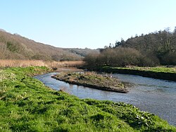
The Camel valley in winter. Taken from between Pendavey bridge and Polbrock looking upstream.
7644:
7624:
7375:
7064:
7054:
7029:
6504:
6384:
6374:
6182:
6069:
5686:
5471:
5440:
5409:
5378:
5347:
5224:
5018:
3752:
3488:"River Camel Valley and Tributaries in United Kingdom of Great Britain and Northern Ireland"
1694:
1585:
1390:
1375:
1351:
1257:
1241:
1172:
718:
668:
569:
443:
413:
395:
387:
321:
75:
2847:
1689:
Wherever there are rivers, people will need to cross them. Routes of ancient trackways and
1474:
The beaches and cliffs around the mouth of the River Camel are home to a variety of marine
1244:
was recorded on the River Amble having flown in from the River Camel nearby, and in 2016 a
870:
with the fishing season running from 1 May to 15 December. Fishing techniques used include
53:
7599:
7460:
7024:
7009:
6755:
6720:
6640:
6212:
6054:
5978:
5961:
5941:
5739:
5728:
2631:
2620:
2253:
2006:
1848:
1806:
1760:
1744:
1729:
1718:
1642:
There are several ancient defensive sites along the Camel Valley. Penhargard Castle is an
1618:
1450:
1379:
1355:
1184:
1038:
949:
733:
550:
3726:
1622:
downstream was a lime kiln at the small inlet where the current sewage works is located.
778:
In 1827, Padstow Harbour Association chose Hawker's Cove as the location for the Padstow
592:. This means that all development in the CDA has to take flooding into account including
5988:
3407:
2970:
1626:
Cove, Tregunna to the River at White House, Tregonce to Little Petherick Creek and also
1135:
as a Special Area of Conservation in April 2005 as being of European importance for the
755:
on the east, and each headland shelters sandy beaches. On the west side of the estuary,
7725:
7539:
7325:
6999:
6954:
6840:
6835:
6680:
6354:
2282:
1813:
a pair of 4 inch naval guns were mounted on Gun Point, the installation being known as
1749:
1511:
1434:
1347:
1136:
1105:
1045:
1026:
937:
913:
799:
756:
741:
607:
593:
589:
339:
212:
5971:
1954:
7764:
7695:
7664:
7654:
7619:
7579:
7500:
7490:
7430:
7310:
7130:
7125:
7115:
7100:
6944:
6915:
6890:
6855:
6695:
6675:
6655:
6615:
6409:
6324:
6294:
3631:
2875:. Red guides (9th (revised) ed.). London: Ward, Lock & Co. 1927. p. 69.
2613:
2586:
1868:
1763:, this latter so named as it is the location of an historic battle, possibly that of
1756:
1483:
1479:
1371:
1359:
1331:
1308:
1284:
1196:
1034:
1022:
996:
925:
917:
893:
885:
For fishing purposes, the River Camel is considered to be tidal from the mouth up to
807:
772:
752:
748:
656:
620:
519:
463:
359:
355:
304:
5503:
5213:. The King's England (7th ed.). London: Hodder and Stoughton. pp. 302–303.
3819:
2308:
1167:
on the estuary, the river provides an excellent location for birds. Large flocks of
615:
7659:
7649:
7634:
7604:
7529:
7420:
7370:
7256:
Geological Sites of Special Scientific Interest in Cornwall and the Isles of Scilly
7039:
6929:
6885:
6880:
6875:
6830:
6810:
6800:
6725:
6705:
6650:
6581:
Biological Sites of Special Scientific Interest in Cornwall and the Isles of Scilly
6389:
6359:
6349:
6339:
6334:
6314:
6309:
6284:
4115:"The distribution of the Wild Service Tree, Sorbus torminalis in the British Isles"
3546:
3107:
2454:
1872:
1810:
1801:
sited guns here when there was considered a threat of invasion by the Spanish, and
1594:
1304:
1221:
can be seen, while the Cornwall Wildlife Trust reserve at Hawkes Wood is noted for
1207:
1128:
on the River Amble which flows into the Camel Estuary between Wadebridge and Rock.
1109:
1081:
823:
483:
459:
451:
375:
350:
its catchment area covers much of North Cornwall. The river flows into the eastern
41:
4882:"Cornwall XXV.2 (Egloshayle; St Breock; St Kew; St Minver Highlands; Wadebridge))"
4239:
2942:
5813:
3953:
1096:
and thus considered worthy of special landscape protection. There are also five
834:. North of Polzeath, Pentire Point marks the northeast extremity of the estuary.
7669:
7340:
7049:
7014:
6845:
6790:
6740:
6730:
6700:
6635:
6404:
6399:
6394:
6319:
6304:
6289:
6157:
5023:"Roman fort called 'Nanstallon Roman fort' 135m south west of Tregear (1007273)"
3357:
2498:
1840:
1764:
1560:
1487:
1402:
1318:
1300:
1288:
1152:
1057:
984:
973:
879:
871:
702:
526:
between 1859 and 1916. Records show that copper ore was shipped from Padstow to
347:
343:
196:
191:
131:
4637:"Cornwall XXV.1 (St Breock; St Issey; St Minver Highlands; St Minver Lowlands)"
4213:
2890:
7534:
7415:
7390:
7355:
6870:
6780:
6765:
6344:
6249:
6202:
6192:
6102:
5931:
5206:
3778:
1755:
Moving upstream from Wadebridge, the other listed bridges are Helland Bridge,
1656:
1652:
1631:
1577:
1545:
1363:
1292:
1164:
1004:
933:
900:
is also a feature of the River Camel, particularly in the sandy parts between
819:
811:
764:
685:
676:
539:
531:
367:
351:
3461:
1248:
was recorded on the River Camel at various locations between Rock and Dinham
241:
228:
160:
147:
7525:
7505:
7335:
7330:
6925:
6775:
6369:
6299:
6207:
6137:
6112:
4114:
1722:
1702:
1507:
1499:
1463:
1406:
1393:. Both are the subject of manual control on various stretches of the river.
1374:
is home to many species of marsh plants. Above Egloshayle there are beds of
1296:
1276:
1226:
1210:
were to be seen on mudflats at low tide, and more recently large numbers of
1180:
1061:
867:
710:
554:
515:
511:
455:
3568:
2070:
1183:
nest at several locations, particularly near to the bridge in Wadebridge.
7705:
7639:
7569:
7440:
7345:
7034:
6630:
6237:
6187:
6162:
6147:
6107:
6043:
6031:
5993:
3253:
1884:
1714:
1710:
1706:
1643:
1627:
1541:
1514:
and blunt tellin (Arcopagia crassa) can also be found as far upstream as
1491:
1475:
1444:
1440:
1421:. Another tree that is uncommon, but is found in the Camel valley is the
1272:
1121:
929:
897:
827:
791:
768:
681:
643:
535:
507:
471:
447:
335:
102:
3462:"River Camel Valley and Tributaries Site of Special Scientific Interest"
3001:
2704:
2421:
2399:
2377:
2231:
2177:
2155:
7720:
7629:
7450:
7445:
7300:
7175:
6805:
6227:
6197:
6177:
6172:
6132:
5966:
4267:"More than 1,500 badgers killed in Cornwall during recent anti-TB cull"
2009:. Cornwall Regionally Important Geological/Geomorphological Sites Group
1794:
1733:
1647:
1602:
1598:
1533:
1515:
1192:
1049:
1030:
1008:
988:
956:
are maintained. Particularly accessible are those on land owned by the
921:
901:
831:
803:
729:
722:
714:
632:
565:
487:
439:
430:
was reserved for the stretch of river between its source and Trecarne.
379:
371:
208:
92:
5549:
Slaughter Bridge still remains a candidate for the Camlann battle site
2092:
1279:
and Dennis Cove. Species whose egg cases have been identified include
7544:
7510:
7410:
7145:
6959:
6167:
6092:
5983:
5954:
5882:
The Camel Footpath : From Wadebridge to Bodmin and Wenfordbridge
4975:"Slight univallate hillfort in Dunmere Wood 235m WNW of Crabb's Pool"
4881:
4636:
3435:
1698:
1314:
1176:
1000:
863:
573:
568:, with some shales and sandstones. Water volumes are affected by the
503:
499:
479:
5476:"SLAUGHTERBRIDGE 500 METRES TO SOUTH EAST OF WORTHY MANOR (1142724)"
3846:"Marine sightings of Basking Shark 'Cetorhinus maximus' in Cornwall"
4413:
http://www.british-history.ac.uk/magna-britannia/vol3/clxxxi-cxciii
6243:
6127:
6122:
5900:
Map & Guide to Exploring the River Camel & The Camel Trail
5414:"ROADBRIDGE 70 METRES TO NORTH EAST OF COOMBE MILLHOUSE (1142355)"
3630:. Cornwall Birdwatching & Preservation Society. Archived from
2666:
1999–2001 vertical aerial photograph shows no survival of the mill
1783:
1556:
1498:) are commonly found on rocks that are covered at high tide, with
1367:
1268:
1168:
1053:
976:
crosses Petherick Creek on this bridge which formerly carried the
967:
859:
637:
626:
614:
606:
544:
527:
3575:. Cornwall Bird Watching and Preservation Society. 9 January 2019
1736:
and Rock since 1337, the title to run the ferry resting with the
7315:
7110:
6660:
6152:
6097:
783:
697:
581:
495:
475:
363:
7228:
6553:
6002:
5902:. Friendly Guide (First ed.). Penzance: Cormorant Design.
5154:(Quoted from) Western Morning News and Mercury, 2 December 1924
5088:
http://www.british-history.ac.uk/magna-britannia/vol3/pp227-244
4468:. Southampton: Maritime and Coastguard Agency. 2003. p. 18
2873:
A pictorial and descriptive guide to Newquay and North Cornwall
1478:, and on beaches exposed to longshore drift one can also find
1414:
523:
491:
426:) was the stretch between Egloshayle and Trecarne, whilst the
4722:
most of Cornwall's tiny ports had a lime kiln in the vicinity
1482:
washed up with the tide, particularly after westerly storms.
3698:"First sighting of a Dalmatian pelican in the Camel Estuary"
1334:
can be seen at the mouth of the river and very occasionally
1120:
SSSI covers much of the Camel Valley between Egloshayle and
4764:"Lime kiln known as 'Hellgelders', marked on the Tithe Map"
2254:"James, Retire, Colbiggan & Rosewarrick Mine, Cornwall"
1100:(SSSIs) along the length of the Camel. Four small SSSIs at
4491:"Waterways that were Never Built section "Polbrock Canal""
2518:
2516:
1536:
was the second largest importer of coal in Cornwall after
689:
7270:
Summarised data for all sites (biological and geological)
6595:
Summarised data for all sites (biological and geological)
4735:"Lime kiln known as 'Trevillian' recorded on Tithe Award"
1805:
expanded these, and guns were also sited here during the
4539:"Little Petherick Conservation Area Character Statement"
2360:
2358:
948:
The steep-sided parts of the Camel valley are ideal for
4941:"Iron Age defended settlement called Penhargard Castle"
3802:
3800:
3406:
Joint Nature Conservation Committee (25 January 2016).
1910:"Cornwall Rivers Project | Geography | Camel and Allen"
4356:
horizontal bedding, with granite capstones (JRS, 2002)
1453:
can be found throughout the Camel Valley, but in 2016
1385:
The camel is home to two invasive non-native species;
1378:
while the wooded slopes of the valley are filled with
1179:
often pauses a few days to fish in spring and autumn.
775:
periods, and use of Harbour Cove for trading vessels.
4674:. Vol. 1. Wadebridge: Westward Press. p. 6.
3511:
3509:
3002:"UK bass legislation: Location of bass nursery areas"
2783:"Local Notice to Mariners #9/2020 issued 12 May 2020"
408:) was the name for the estuary up to Egloshayle, the
5863:
The Camel Footpath : From Padstow to Wadebridge
4587:
An Illustrated History of the North Cornwall Railway
3008:. Bass Anglers Sportfishing Society. 1 February 2016
2971:"Bass nursery areas and other conservation measures"
2781:
Bryn Philips, Padstow Harbour Master (12 May 2020).
2625:
List of place-names agreed by the MAGA Signage Panel
2536:"Critical Drainage Area (CDA) Cornwall – Wadebridge"
631:
The estuary of the River Camel looking seaward from
7678:
7278:
7262:
7073:
6603:
6587:
6425:
6267:
6083:
6062:
5972:
Saints' Way page on Cornwall County Council website
5865:. Cornish Walkabout Books. Padstow: Lodenek Press.
3206:"Guide to the River Camel (Tuckingmill to Penrose)"
1989:
1987:
1350:the flora is distinctly maritime, characterised by
1080:Daymer Bay and Hawkers Cove are good locations for
298:
286:
278:
273:
265:
257:
218:
202:
190:
176:
137:
125:
117:
108:
98:
88:
83:
63:
34:
5994:The Camel Trail on Cornwall County Council website
5884:. Cornish Walkabout Books. Padstow: Lodenek Press.
4548:. North Cornwall District Council. 1997. p. 3
3549:. Cornwall Birdwatching & Preservation Society
2561:"Find river, sea, groundwater and rainfall levels"
1548:onto ships for onward transport. Advice from the
1425:, an indicator of ancient woodland or hedgerows.
1370:tolerate more exposed sites, while the quarry on
924:, while on the eastern bank moving upstream from
822:with a beach north of which is the settlement of
763:evidence has been found of occupation during the
458:and at Pentire Point which is composed mainly of
442:spine of Cornwall. The river's course is through
58:Sketch map of the River Camel and its tributaries
7781:Sites of Special Scientific Interest in Cornwall
7750:Sites of Special Scientific Interest in Somerset
7214:Sites of Special Scientific Interest in Somerset
5955:Cornwall Birdwatching & Preservation Society
5639:"Helland Bridge, St. Mabyn / Helland – Cornwall"
5256:"08Jul93 UK: CAMEL CROSSING – WADEBRIDGE BYPASS"
2449:
2447:
2445:
2443:
2441:
2439:
1859:The main tributaries of the River Camel are the
798:On the east side of the estuary, the village of
5298:
4696:
4657:
4399:
4088:
3192:
2725:
2679:"Ordnance Survuey Unions – Camelford 1830–1840"
649:
5127:"Roman Inscribed Stone 1m South of St Piran's"
2614:Place-names in the Standard Written Form (SWF)
1235:Cornwall Birdwatching and Preservation Society
690:Cornwall Birdwatching and Preservation Society
534:pits also operated in the 19th century around
7745:Sites of Special Scientific Interest in Devon
7240:
7209:Sites of Special Scientific Interest in Devon
6565:
6014:
4997:"Killibury Castle later Prehistoric hillfort"
3826:. Bodmin Anglers Association. 1 November 2018
2976:. Ministry of Agriculture, Fisheries and Food
2884:
2882:
2226:
2224:
892:Although not often mentioned when discussing
67:
8:
3727:"SEA FISHING ALONG THE NORTH CORNWALL COAST"
2736:
2734:
2331:"The Copper Ore trade of South West England"
1217:Upstream and on several of its tributaries,
790:Beyond Hawkers Cove a sand bar known as the
5812:Duxbury, Brenda; Williams, Michael (1987).
5172:
5170:
4615:Grace's Guide to British Industrial History
3721:
3719:
3541:
3539:
3537:
3401:
3399:
3397:
3025:
3023:
2965:
2963:
2937:
2935:
2685:. University of Portsmouth and others. 2017
2026:
2024:
1953:. British Geological Survey. Archived from
1938:A Concise Dictionary of Cornish Place-names
1094:Cornwall Area of Outstanding Natural Beauty
848:Cornwall Area of Outstanding Natural Beauty
7247:
7233:
7225:
6572:
6558:
6550:
6021:
6007:
5999:
5591:"Seventy-one historic landmarks 'at risk'"
4124:. Botanical Society of Britain and Ireland
2197:
2195:
1433:The Camel and its tributaries are home to
623:with Trebetherick Point in the foreground.
52:
7776:Special Areas of Conservation in Cornwall
4580:
4578:
4366:
4364:
3820:"Extension of EA restrictions 01/11/2018"
3601:. Cornwall Wildlife Trust. Archived from
2996:
2994:
1788:The napoleonic gun platform at Gun Point.
842:The Camel Estuary has been designated an
810:and marine leisure. From Rock, dunes and
688:where the River Amble flows in. Here the
646:sandbank extends across the Camel estuary
619:The estuary of the River Camel seen from
474:but there has previously been mining for
7711:Shipman Head & Shipman Down (Bryher)
5751:
5749:
5747:
5179:Cornwall's bridge & viaduct heritage
4589:. Caernarfon: Irwell Press. p. 94.
3772:
3770:
3676:"American Bittern at Walmsley Sanctuary"
3622:
3620:
3086:Environment Agency Bathing Water Quality
3060:Environment Agency Bathing Water Quality
2748:. Season 2008. Episode 10. 9 March 2008.
2277:
2275:
4919:. Padstow: Tabb House. pp. 47–48.
4822:"A lime kiln situated on Bishop's Quay"
4485:
4483:
4388:A sand wharf on the Camel at Egloshayle
4144:"Sorbus torminalis – Wild Service-tree"
3520:. Buckingham: Barracuda Books Limited.
3260:. Rock Sailing and Water Ski Club. 2017
3110:. North Cornwall District Council. 2008
2364:
1901:
732:stands on the west bank from where the
522:produced in the region of 1300 tons of
462:. Across the mouth of the River Camel
5833:Fairclough, Tony; Wills, Alan (1979).
5280:. intocornwall.com/awmp creative media
5074:
4902:
4852:"WADEBRIDGE – Post Medieval lime kiln"
4710:"History Of Lime Pointing In Cornwall"
4684:
4569:
4525:
4450:
4299:
4287:
4100:
3866:
3806:
3234:. Rock Sailing and Waterski Club. 2017
3130:"Cardinham Woods Mountain Bike Trails"
3082:"Bathing Water Profile for Dammer Bay"
2522:
2457:. Natural Environment Research Council
2113:
2057:
2045:
1759:, Coombe Mill Bridge, Gam Bridge, and
1131:The River Camel was designated by the
960:at Cardinham Woods and Hustyns Woods.
721:then passes below Dennis Hill and its
31:
7146:Pool Of Bryher & Popplestone Bank
7136:Pentle Bay, Merrick And Round Islands
4465:MERCHANT SHIPPING NOTICE MSN 1776 (M)
4372:"MARSH COTTAGES – Post Medieval quay"
4006:"Bishop's, Hustyn, and Grogley Woods"
3468:. Marine Conservation Institute. 2019
3442:. Joint Nature Conservation Committee
3382:. Joint Nature Conservation Committee
3336:"Kitesurfing Hawker's Cove, Cornwall"
3031:"Flounder Fishing on the River Camel"
740:) carries people across the river to
611:Sketch map of the River Camel estuary
7:
6686:Carricknath Point to Porthbean Beach
5716:
5113:
4961:
4617:. Grace's Guide Ltd. 8 February 2020
4493:. Inland Waterways Association. 2013
4438:
4150:. Cornish Biodiversity Network. 2017
3678:. South West Optics. 2 November 2010
3278:
3180:
3056:"Bathing Water Profile for Polzeath"
2501:. Centre for Ecology & Hydrology
1993:
1171:can be seen in winter, preyed on by
1098:Sites of Special Scientific Interest
782:. Operations were taken over by the
747:The mouth of the Camel lies between
7116:Higher Moors and Porth Hellick Pool
6786:Hayle Estuary & Carrack Gladden
5989:The Camel Trail on Sustrans website
5921:(First ed.). London: Batsford.
5383:"BRIDGE AT WENFORDBRIDGE (1311310)"
3932:"Invasive weeds on the River Camel"
1634:has its origins as a sanding lane.
1133:Joint Nature Conservation Committee
912:On the western bank Hawker's Cove,
7456:Lower Fal & Helford Intertidal
7431:Hingston Down Quarry & Consols
6950:River Camel Valley and Tributaries
6821:Lower Fal & Helford Intertidal
6538:Index of Cornwall-related articles
6258:List of civil parishes in Cornwall
5782:"William Camden, Britannia (1607)"
5696:National Heritage List for England
5481:National Heritage List for England
5450:National Heritage List for England
5419:National Heritage List for England
5388:National Heritage List for England
5357:National Heritage List for England
5312:The Post Office Cornwall Directory
5234:National Heritage List for England
5028:National Heritage List for England
4313:"Declared Accounts: Customs, Coal"
3436:"Marine Protected Areas in the UK"
2649:"DINHAM – Post Medieval tide mill"
2455:"49001 – Camel at Denby: Land Use"
1835:was poured into the wrong tank at
1827:Camelford water pollution incident
1728:Further down towards the sea, the
1118:River Camel Valley and Tributaries
844:Area of Outstanding Natural Beauty
490:, and mines in this area produced
25:
18:River Camel Valley and Tributaries
7476:Mullion Cliff to Predannack Cliff
6866:Mullion Cliff to Predannack Cliff
5314:. Post Office. 1873. p. 890.
4793:"WADEBRIDGE – Post Medieval quay"
4339:"GUINEAPORT – Post Medieval quay"
4265:Graham Smith (17 December 2016).
2742:"From Constantinople to Cornwall"
1362:and heather in the turf. Stunted
1037:. It crosses the river using the
269:413 km (159 sq mi)
7635:Trevose Head and Constantine Bay
7040:Trevose Head and Constantine Bay
6940:Redlake Meadows & Hoggs Moor
6906:Plymouth Sound Shores And Cliffs
6030:
5967:River Camel page at swuklink.com
5934:
5891:Sea-shells on Cornwall's beaches
5758:Cornish Place Names and Language
5258:. Construction News. 8 July 1993
4174:www.cornwallwildlifetrust.org.uk
3415:NATURA 2000 – STANDARD DATA FORM
2809:Cornwall's structure and scenery
2683:A vision of Britain through time
2033:Cornwall's structure and scenery
1978:Cornwall's structure and scenery
1914:www.cornwallriversproject.org.uk
1732:has crossed the estuary between
1617:In common with much of Cornwall
1576:considered the possibility of a
916:and St Georges Cove lie between
40:
7161:Shipman Head & Shipman Down
6985:Steeple Point to Marsland Mouth
6691:Carrine Common & Penwethers
6485:Population of major settlements
5835:Bodmin and Wadebridge 1834–1978
5733:Poisoned: The Camelford scandal
5661:"Little Petherick Creek bridge"
5326:"Wadebridge Bridge, Wadebridge"
4917:St Minver, It's Bays and Byways
3848:. Cornwall Wildlife Trust. 2008
3656:. camelbirder. 22 November 2012
2788:. Padstow Harbour Commissioners
1837:Lowermoor Water Treatment Works
7020:Tregonetha & Belowda Downs
6921:Porthgwarra to Pordenack Point
6641:Borlasevath and Retallack Moor
6075:Council of the Isles of Scilly
5788:. The University of Birmingham
4202:, p. 7, 18 September 1908
3777:Evans, Jon (8 December 2008).
3569:"News: January 2019 News Page"
3258:Rock Sailing and Waterski Club
2541:. Environment Agency. May 2015
2283:"Mulberry Hill Mine, Cornwall"
2203:"Pentireglaze mines, Cornwall"
1679:dissolution of the monasteries
1550:Maritime and Coastguard Agency
1466:but has proved controversial.
1116:are on the estuary, while the
991:, follows the trackbed of the
866:fishing, and particularly for
220: • coordinates
139: • coordinates
1:
7716:St Martin's Sedimentary Shore
7346:Coverack Cove and Dolor Point
7296:Bedruthan Steps and Park Head
7171:St Martin's Sedimentary Shore
6626:Bedruthan Steps and Park Head
5984:South West Coast Path website
5854:Pebbles on Cornwall's beaches
5229:"WADEBRIDGE BRIDGE (1142975)"
4611:"Camel Slab and Slate Quarry"
2920:. Perran Springs Holiday Park
2916:Perran Springs Holiday Park.
2889:Jon Evans (8 December 2008).
2811:. Tor Mark Press. p. 47.
2035:. Tor Mark Press. p. 37.
1980:. Tor Mark Press. p. 22.
1611:Bodmin and Wadebridge Railway
1411:Bodmin and Wadebridge Railway
1021:follows the River Camel from
993:Bodmin and Wadebridge Railway
814:sands extend north as far as
696:Downstream from the Amble an
109:Physical characteristics
7371:Cudden Point to Prussia Cove
6816:Lower Bostraze and Leswidden
5837:. Truro: D Bradford Barton.
5818:. St Teath: Bossiney Books.
5534:"Slaughter Bridge, Cornwall"
4319:. University of London. 2019
3753:"Great Eggcase Hunt Results"
3408:"Site UK0030056 River Camel"
3228:"Camel Estuary Ski Area Map"
2918:"Fishing on the River Camel"
2636:Cornish Language Partnership
178: • elevation
7366:Cuckoo Rock to Turbot Point
7086:Big Pool and Browarth Point
7045:Upper Fal Estuary and Woods
5950:Birdlife on the River Camel
5756:Weatherhill, Craig (1995).
5299:Duxbury & Williams 1987
5150:"ANCIENT ROADS IN CORNWALL"
4697:Duxbury & Williams 1987
4658:Duxbury & Williams 1987
4400:Fairclough & Wills 1979
4214:"Red Deer-(Cervus elaphus)"
4089:Fairclough & Wills 1979
3193:Duxbury & Williams 1987
2726:Duxbury & Williams 1987
2073:. British Geological Survey
1951:"Geology of Britain viewer"
1855:Tributaries and their names
1815:Padstow Coastal Gun Battery
1597:on high spring tides, with
1195:are found on the river and
204: • location
127: • location
7807:
7696:Peninnis Head (St. Mary's)
7691:Chapel Down (St. Martin's)
7396:Gerrans Bay to Camels Cove
6801:Kernick and Ottery Meadows
6771:Greenscoombe Wood, Luckett
6746:Gerrans Bay to Camels Cove
5352:"Helland Bridge (1020812)"
5328:. British Listed Buildings
5056:. SouthWest in Focus. 2019
4856:www.heritagegateway.org.uk
4826:www.heritagegateway.org.uk
4797:www.heritagegateway.org.uk
4768:www.heritagegateway.org.uk
4739:www.heritagegateway.org.uk
4376:www.heritagegateway.org.uk
4343:www.heritagegateway.org.uk
3934:. Westcountry Rivers Trust
3088:. Environment Agency. 2016
3062:. Environment Agency. 2016
2826:. Bodmin: Bossiney Books.
2653:www.heritagegateway.org.uk
2479:. Westcountry Rivers Trust
2378:"Durfold China Clay Works"
2207:www.cornwall-calling.co.uk
1824:
1522:History and infrastructure
27:River in Cornwall, England
7739:
7701:Porth Seal (St. Martin's)
7441:Kingsand to Sandway Point
7416:Gwithian to Mexico Towans
7331:Carn Grey Rock and Quarry
7199:
7151:Rushy Bay and Heathy Hill
6781:Gwithian to Mexico Towans
6051:
5977:21 September 2008 at the
5665:www.forgottonrelics.co.uk
5504:"King Arthur in Cornwall"
4240:"Fallow Deer-(Dama dama)"
4176:. Cornwall Wildlife Trust
3292:"Kitesurfing in Cornwall"
3254:"History The early years"
3208:. The UK rivers guidebook
2422:"Temple China Clay Works"
2400:"Carwen China Clay Works"
1646:defended settlement near
1358:on exposed clifftops and
1088:Wildlife and conservation
736:(officially owned by the
549:The young River Camel at
186:
113:
51:
39:
7401:Godrevy Head to St Agnes
7351:Coverack to Porthoustock
7286:Aire Point to Carrick Du
7060:West Cornwall Bryophytes
6965:Rosenannon Bog and Downs
6751:Godrevy Head to St Agnes
6711:Coverack to Porthoustock
6611:Aire Point to Carrick Du
5641:. Historic England. 2020
5619:. Historic England. 2020
5538:legendofkingarthur.co.uk
5502:Gregory, Edward (2016).
5129:. Historic England. 2020
4858:. Heritage Gateway. 2012
4828:. Heritage Gateway. 2012
4799:. Heritage Gateway. 2012
4770:. Heritage Gateway. 2012
4741:. Heritage Gateway. 2012
4378:. Heritage Gateway. 2012
4345:. Heritage Gateway. 2012
4200:Cornish & Devon Post
4148:Flora of Cornwall (1999)
4010:www.woodlandtrust.org.uk
3984:www.woodlandtrust.org.uk
3912:. Cornwall Council. 2019
3886:. Cornwall Council. 2019
3654:"camel estuary wildlife"
3314:"Kitesurfing Daymer Bay"
2655:. Heritage Gateway. 2012
1821:Water pollution incident
1588:and Trevorrick Mills on
1163:With the large areas of
1003:at Dunmere, and through
999:, past the outskirts of
300: • right
182:218 m (715 ft)
7466:Meneage Coastal Section
7381:Duckpool to Furzey Cove
7321:Caerthillian to Kennack
6851:Meneage Coastal Section
6671:Caerthillian to Kennack
6631:Boconnoc Park and Woods
5786:The philological museum
5617:"Heritage at Risk 2020"
5278:"History of Wadebridge"
5050:"Nanstallon Roman Fort"
4884:. Ordnance Survey. 1881
4639:. Ordnance Survey. 1907
3733:. Cornwall Online. 2019
3704:. Tindle Newspapers Ltd
3494:. ProtectedPlanet. 2019
3492:www.protectedplanet.net
2593:. London: John Murray.
2309:"Mulberry Pit Tin Mine"
1574:Isambard Kingdom Brunel
1409:trees. Before that the
1149:Cornwall Wildlife Trust
288: • left
261:48 km (30 mi)
7521:Porthleven Cliffs East
7386:East Lizard Heathlands
7306:Boscastle to Widemouth
6761:Goss and Tregoss Moors
6736:East Lizard Heathlands
6646:Boscastle to Widemouth
5917:Rodgers, John (1948).
5852:Ferris, L. C. (1969).
5566:www.bbc.co.uk/cornwall
5562:"The Legend of Arthur"
5445:"GAM BRIDGE (1311392)"
5177:Kentley, Eric (2005).
4670:Hoyle, Ronnie (1983).
4317:British History Online
3958:www.forestryengland.uk
3785:. Diamond Publications
3628:"Reserves & Hides"
3518:The Nature of Cornwall
3360:. cornwall-aonb.gov.uk
3358:"03 The Camel Estuary"
3338:. Kitesurfing UK. 2020
3316:. Kitesurfing UK. 2020
3294:. Kitesurfing UK. 2020
2897:. Diamond Publications
1789:
1773:North Cornwall Railway
1590:Little Petherick Creek
1527:Transport and Industry
1281:Small-spotted catshark
987:, used by walkers and
980:
978:North Cornwall Railway
818:. Beyond Brea Hill is
719:Little Petherick Creek
713:on the east bank, the
672:
665:
647:
635:
624:
612:
557:
417:
399:
325:
68:
7471:Mulberry Downs Quarry
7291:Baulk Head to Mullion
6621:Baulk Head to Mullion
5960:1 August 2013 at the
5880:Ingrey, Jack (1989).
5861:Ingrey, Jack (1984).
5667:. Four by Three. 2017
5597:. BBC Spotlight. 2020
5508:www.king-arthur.co.uk
5211:Arthus Mee's Cornwall
5054:cornwallinfocus.co.uk
4977:. AncientMonuments.uk
4943:. AncientMonuments.uk
4915:Ingrey, Jack (1994).
4244:Cornwall Mammal Group
4218:Cornwall Mammal Group
4067:. AWMP Creative Media
4038:. AWMP Creative Media
3731:cornwall-online.co.uk
3516:Bere, Rennie (1982).
3162:. More Dirt Ltd. 2019
3136:. More Dirt Ltd. 2019
3035:Fishing-hotspot.co.uk
2824:North Cornwall Camera
2178:"Bodmin Moor Consols"
2133:. AWMP Creative Media
1787:
1555:During the period of
1019:South West Coast Path
971:
641:
630:
618:
610:
548:
434:Geology and hydrology
7743:Neighbouring areas:
7686:Castle Down (Tresco)
7560:St Agnes Beacon Pits
7481:Penberthy Croft Mine
7141:Plains and Great Bay
7091:Castle Down (Tresco)
6970:St Austell Clay Pits
5889:Pascoe, Ann (n.d.).
4585:Wroe, David (1994).
4428:. 1830. p. 135.
4065:www.intocornwall.com
4036:www.intocornwall.com
4012:. The Woodland Trust
3986:. The Woodland Trust
3702:North Cornwall today
3605:on 14 September 2009
3547:"Walmsley Sanctuary"
3108:"Water Quality 2007"
2853:. Cornwall AONB unit
2822:Bishop, Ray (1994).
2567:. Environment Agency
2131:www.intocornwall.com
1609:Construction of the
1532:century the port of
1496:Chthamalus stellatus
728:The fishing port of
213:North Cornwall coast
7436:Kennack to Coverack
7406:Great Wheal Fortune
6911:Polruan to Polperro
6901:Phoenix United Mine
6796:Kennack to Coverack
6531:Outline of Cornwall
6086:(cities in italics)
6063:Unitary authorities
5898:Reid, Neil (1996).
5691:"OBELISK (1289848)"
5568:. BBC. 25 July 2008
5103:. 1974. p. 10.
4546:www.cornwall.gov.uk
4170:"Wild service tree"
3980:"Dunmere, Eastwood"
3880:"Japanese knotweed"
3824:Bodminanglers.co.uk
3755:. Shark Trust. 2019
2630:15 May 2013 at the
2619:15 May 2013 at the
2591:Betjeman's Cornwall
2350:Table 3 and Table 4
2093:"Pentireglaze Mine"
1413:planted avenues of
1399:Forestry Commission
1336:bottlenose dolphins
958:Forestry Commission
908:Beaches and bathing
667:The Camel Estuary (
661:Betjeman's Cornwall
370:and is popular for
274:Basin features
238: /
157: /
7771:Rivers of Cornwall
7670:Yeolmbridge Quarry
7610:Tregargus Quarries
7605:Trebetherick Point
7585:Stourscombe Quarry
7575:St Michael's Mount
7336:Clicker Tor Quarry
7204:Neighbouring areas
7050:Upper Fowey Valley
7005:Tamar–Tavy Estuary
6826:Lymsworthy Meadows
6666:Cabilla Manor Wood
6636:Bodmin Moor, North
6525:Places of interest
6223:St Just in Penwith
5738:2008-05-20 at the
4999:. Historic England
4269:. Cornwall Reports
3960:. Forestry England
3906:"Himalayan balsam"
2209:. cornwall calling
2127:"Little Petherick"
1957:on 2 December 2016
1934:Weatherhill, Craig
1843:. An inquiry into
1833:aluminium sulphate
1790:
1512:banded wedge shell
1324:Environment Agency
1199:further upstream.
1110:Trebetherick Point
981:
648:
636:
625:
613:
586:Environment Agency
558:
161:50.6582°N 4.6379°W
121:Hendraburnick Down
7758:
7757:
7565:St Erth Sand Pits
7555:South Terras Mine
7516:Porthleven Cliffs
7496:Pentire Peninsula
7222:
7221:
6896:Pentire Peninsula
6547:
6546:
6084:Major settlements
6038:Ceremonial county
5893:. Tor Mark Press.
5856:. Tor Mark Press.
5760:. Sigma Leisure.
5731:, 16 April 2006,
5183:Twelveheads Press
5116:, pp. 12–13.
4712:. Oak Ridge. 2019
4572:, pp. 12–14.
4513:"Imagined canals"
4426:Pigot's Directory
4113:Roper, P (1993).
3954:"Cardinham Woods"
3779:"The River Camel"
3183:, pp. 36–37.
2947:Sea Trout Fishing
2943:"The River Camel"
2891:"The River Camel"
2760:"Padstow History"
2525:, pp. 44–46.
2477:"camel and allen"
2338:www.aditnow.co.uk
2287:Cornwall in focus
2258:Cornwall in focus
1809:. In 1940 during
1738:Duchy of Cornwall
1668:meaning camp and
1504:common periwinkle
1423:wild service tree
1419:Dutch elm disease
1405:as well as mixed
1387:Japanese knotweed
1256:The estuary is a
1246:Dalmatian pelican
1204:belted kingfisher
1173:peregrine falcons
1114:Pentire Peninsula
887:Egloshayle church
830:, a location for
738:Duchy of Cornwall
675:) stretches from
446:upper and middle
314:
313:
16:(Redirected from
7798:
7625:Trevaunance Cove
7411:Greystone Quarry
7376:De Lank Quarries
7249:
7242:
7235:
7226:
7205:
7055:Ventongimps Moor
6980:St Nectan's Glen
6574:
6567:
6560:
6551:
6070:Cornwall Council
6046:
6040:
6035:
6034:
6023:
6016:
6009:
6000:
5944:
5939:
5938:
5937:
5922:
5913:
5894:
5885:
5876:
5857:
5848:
5829:
5798:
5797:
5795:
5793:
5778:
5772:
5771:
5753:
5742:
5726:
5720:
5714:
5708:
5707:
5705:
5703:
5687:Historic England
5683:
5677:
5676:
5674:
5672:
5657:
5651:
5650:
5648:
5646:
5635:
5629:
5628:
5626:
5624:
5613:
5607:
5606:
5604:
5602:
5595:BBC News website
5587:
5581:
5580:
5575:
5573:
5558:
5552:
5551:
5546:
5544:
5530:
5524:
5523:
5517:
5515:
5510:. Edward Gregory
5499:
5493:
5492:
5490:
5488:
5472:Historic England
5468:
5462:
5461:
5459:
5457:
5441:Historic England
5437:
5431:
5430:
5428:
5426:
5410:Historic England
5406:
5400:
5399:
5397:
5395:
5379:Historic England
5375:
5369:
5368:
5366:
5364:
5348:Historic England
5344:
5338:
5337:
5335:
5333:
5322:
5316:
5315:
5308:
5302:
5296:
5290:
5289:
5287:
5285:
5274:
5268:
5267:
5265:
5263:
5252:
5246:
5245:
5243:
5241:
5225:Historic England
5221:
5215:
5214:
5203:
5197:
5196:
5174:
5165:
5164:
5162:
5160:
5145:
5139:
5138:
5136:
5134:
5123:
5117:
5111:
5105:
5104:
5097:
5091:
5084:
5078:
5072:
5066:
5065:
5063:
5061:
5046:
5040:
5039:
5037:
5035:
5019:Historic England
5015:
5009:
5008:
5006:
5004:
4993:
4987:
4986:
4984:
4982:
4971:
4965:
4959:
4953:
4952:
4950:
4948:
4937:
4931:
4930:
4912:
4906:
4900:
4894:
4893:
4891:
4889:
4878:
4872:
4871:
4865:
4863:
4848:
4842:
4841:
4835:
4833:
4818:
4812:
4811:
4806:
4804:
4789:
4783:
4782:
4777:
4775:
4760:
4754:
4753:
4748:
4746:
4731:
4725:
4724:
4719:
4717:
4706:
4700:
4694:
4688:
4682:
4676:
4675:
4667:
4661:
4655:
4649:
4648:
4646:
4644:
4633:
4627:
4626:
4624:
4622:
4607:
4601:
4600:
4582:
4573:
4567:
4561:
4560:
4555:
4553:
4543:
4535:
4529:
4523:
4517:
4516:
4509:
4503:
4502:
4500:
4498:
4487:
4478:
4477:
4475:
4473:
4460:
4454:
4448:
4442:
4436:
4430:
4429:
4422:
4416:
4409:
4403:
4397:
4391:
4390:
4385:
4383:
4368:
4359:
4358:
4352:
4350:
4335:
4329:
4328:
4326:
4324:
4309:
4303:
4302:, p. 30-31.
4297:
4291:
4285:
4279:
4278:
4276:
4274:
4262:
4256:
4255:
4253:
4251:
4236:
4230:
4229:
4227:
4225:
4210:
4204:
4203:
4198:"Otter hounds",
4195:
4189:
4188:
4183:
4181:
4166:
4160:
4159:
4157:
4155:
4140:
4134:
4133:
4131:
4129:
4119:
4110:
4104:
4098:
4092:
4086:
4080:
4079:
4074:
4072:
4061:"Bishop's Woods"
4057:
4051:
4050:
4045:
4043:
4028:
4022:
4021:
4019:
4017:
4002:
3996:
3995:
3993:
3991:
3976:
3970:
3969:
3967:
3965:
3950:
3944:
3943:
3941:
3939:
3928:
3922:
3921:
3919:
3917:
3902:
3896:
3895:
3893:
3891:
3876:
3870:
3864:
3858:
3857:
3855:
3853:
3842:
3836:
3835:
3833:
3831:
3816:
3810:
3804:
3795:
3794:
3792:
3790:
3774:
3765:
3764:
3762:
3760:
3749:
3743:
3742:
3740:
3738:
3723:
3714:
3713:
3711:
3709:
3694:
3688:
3687:
3685:
3683:
3672:
3666:
3665:
3663:
3661:
3650:
3644:
3643:
3641:
3639:
3624:
3615:
3614:
3612:
3610:
3595:
3589:
3588:
3582:
3580:
3565:
3559:
3558:
3556:
3554:
3543:
3532:
3531:
3513:
3504:
3503:
3501:
3499:
3484:
3478:
3477:
3475:
3473:
3458:
3452:
3451:
3449:
3447:
3432:
3426:
3425:
3423:
3421:
3412:
3403:
3392:
3391:
3389:
3387:
3376:
3370:
3369:
3367:
3365:
3354:
3348:
3347:
3345:
3343:
3332:
3326:
3325:
3323:
3321:
3310:
3304:
3303:
3301:
3299:
3288:
3282:
3276:
3270:
3269:
3267:
3265:
3250:
3244:
3243:
3241:
3239:
3224:
3218:
3217:
3215:
3213:
3202:
3196:
3190:
3184:
3178:
3172:
3171:
3169:
3167:
3160:www.moredirt.com
3152:
3146:
3145:
3143:
3141:
3134:www.moredirt.com
3126:
3120:
3119:
3117:
3115:
3104:
3098:
3097:
3095:
3093:
3078:
3072:
3071:
3069:
3067:
3052:
3046:
3045:
3043:
3041:
3027:
3018:
3017:
3015:
3013:
2998:
2989:
2988:
2983:
2981:
2975:
2967:
2958:
2957:
2955:
2953:
2939:
2930:
2929:
2927:
2925:
2913:
2907:
2906:
2904:
2902:
2886:
2877:
2876:
2869:
2863:
2862:
2860:
2858:
2852:
2844:
2838:
2837:
2819:
2813:
2812:
2804:
2798:
2797:
2795:
2793:
2787:
2778:
2772:
2771:
2769:
2767:
2756:
2750:
2749:
2738:
2729:
2723:
2717:
2716:
2714:
2712:
2701:
2695:
2694:
2692:
2690:
2675:
2669:
2668:
2662:
2660:
2645:
2639:
2611:
2605:
2604:
2583:
2577:
2576:
2574:
2572:
2557:
2551:
2550:
2548:
2546:
2540:
2532:
2526:
2520:
2511:
2510:
2508:
2506:
2499:"Camel at Denby"
2495:
2489:
2488:
2486:
2484:
2473:
2467:
2466:
2464:
2462:
2451:
2434:
2433:
2431:
2429:
2418:
2412:
2411:
2409:
2407:
2396:
2390:
2389:
2387:
2385:
2374:
2368:
2362:
2353:
2352:
2347:
2345:
2335:
2327:
2321:
2320:
2318:
2316:
2305:
2299:
2298:
2296:
2294:
2279:
2270:
2269:
2267:
2265:
2250:
2244:
2243:
2241:
2239:
2228:
2219:
2218:
2216:
2214:
2199:
2190:
2189:
2187:
2185:
2174:
2168:
2167:
2165:
2163:
2152:
2146:
2145:
2140:
2138:
2123:
2117:
2111:
2105:
2104:
2102:
2100:
2089:
2083:
2082:
2080:
2078:
2067:
2061:
2055:
2049:
2043:
2037:
2036:
2028:
2019:
2018:
2016:
2014:
2003:
1997:
1991:
1982:
1981:
1973:
1967:
1966:
1964:
1962:
1947:
1941:
1931:
1925:
1924:
1922:
1920:
1906:
1703:Roman Milestones
1695:Isca Dumnoniorum
1586:Little Petherick
1572:, the father of
1391:Himalayan balsam
1376:yellow flag iris
1242:American bittern
1175:, and a migrant
751:on the west and
663:
454:can be found at
388:Cornish language
334:) is a river in
301:
289:
253:
252:
250:
249:
248:
243:
242:50.578°N 4.939°W
239:
236:
235:
234:
231:
179:
172:
171:
169:
168:
167:
166:50.6582; -4.6379
162:
158:
155:
154:
153:
150:
140:
128:
79:
71:
56:
44:
32:
21:
7806:
7805:
7801:
7800:
7799:
7797:
7796:
7795:
7791:Camel catchment
7761:
7760:
7759:
7754:
7735:
7679:Isles of Scilly
7674:
7640:Viverdon Quarry
7615:Trelavour Downs
7600:Tintagel Cliffs
7570:St Mewan Beacon
7461:Luxulyan Quarry
7356:Crocadon Quarry
7274:
7258:
7253:
7223:
7218:
7203:
7195:
7191:Wingletang Down
7074:Isles of Scilly
7069:
7025:Tregonning Hill
7010:Tintagel Cliffs
6995:Sylvia's Meadow
6756:Goonhilly Downs
6741:Eglarooze Cliff
6721:Crowhill Valley
6599:
6583:
6578:
6548:
6543:
6520:Hundreds/shires
6468:Flora and fauna
6421:
6263:
6252:
6213:St Columb Major
6085:
6079:
6058:
6055:Cornwall Portal
6047:
6042:
6036:
6029:
6027:
5979:Wayback Machine
5962:Wayback Machine
5942:Cornwall portal
5940:
5935:
5933:
5930:
5925:
5916:
5910:
5897:
5888:
5879:
5873:
5860:
5851:
5845:
5832:
5826:
5815:The River Camel
5811:
5807:
5802:
5801:
5791:
5789:
5780:
5779:
5775:
5768:
5755:
5754:
5745:
5740:Wayback Machine
5729:The Independent
5727:
5723:
5715:
5711:
5701:
5699:
5685:
5684:
5680:
5670:
5668:
5659:
5658:
5654:
5644:
5642:
5637:
5636:
5632:
5622:
5620:
5615:
5614:
5610:
5600:
5598:
5589:
5588:
5584:
5571:
5569:
5560:
5559:
5555:
5542:
5540:
5532:
5531:
5527:
5513:
5511:
5501:
5500:
5496:
5486:
5484:
5470:
5469:
5465:
5455:
5453:
5439:
5438:
5434:
5424:
5422:
5408:
5407:
5403:
5393:
5391:
5377:
5376:
5372:
5362:
5360:
5346:
5345:
5341:
5331:
5329:
5324:
5323:
5319:
5310:
5309:
5305:
5297:
5293:
5283:
5281:
5276:
5275:
5271:
5261:
5259:
5254:
5253:
5249:
5239:
5237:
5223:
5222:
5218:
5205:
5204:
5200:
5193:
5176:
5175:
5168:
5158:
5156:
5147:
5146:
5142:
5132:
5130:
5125:
5124:
5120:
5112:
5108:
5099:
5098:
5094:
5085:
5081:
5073:
5069:
5059:
5057:
5048:
5047:
5043:
5033:
5031:
5017:
5016:
5012:
5002:
5000:
4995:
4994:
4990:
4980:
4978:
4973:
4972:
4968:
4960:
4956:
4946:
4944:
4939:
4938:
4934:
4927:
4914:
4913:
4909:
4901:
4897:
4887:
4885:
4880:
4879:
4875:
4861:
4859:
4850:
4849:
4845:
4831:
4829:
4820:
4819:
4815:
4802:
4800:
4791:
4790:
4786:
4773:
4771:
4762:
4761:
4757:
4744:
4742:
4733:
4732:
4728:
4715:
4713:
4708:
4707:
4703:
4695:
4691:
4683:
4679:
4669:
4668:
4664:
4656:
4652:
4642:
4640:
4635:
4634:
4630:
4620:
4618:
4609:
4608:
4604:
4597:
4584:
4583:
4576:
4568:
4564:
4551:
4549:
4541:
4537:
4536:
4532:
4524:
4520:
4511:
4510:
4506:
4496:
4494:
4489:
4488:
4481:
4471:
4469:
4462:
4461:
4457:
4449:
4445:
4437:
4433:
4424:
4423:
4419:
4410:
4406:
4398:
4394:
4381:
4379:
4370:
4369:
4362:
4348:
4346:
4337:
4336:
4332:
4322:
4320:
4311:
4310:
4306:
4298:
4294:
4286:
4282:
4272:
4270:
4264:
4263:
4259:
4249:
4247:
4238:
4237:
4233:
4223:
4221:
4212:
4211:
4207:
4197:
4196:
4192:
4179:
4177:
4168:
4167:
4163:
4153:
4151:
4142:
4141:
4137:
4127:
4125:
4117:
4112:
4111:
4107:
4099:
4095:
4087:
4083:
4070:
4068:
4059:
4058:
4054:
4041:
4039:
4030:
4029:
4025:
4015:
4013:
4004:
4003:
3999:
3989:
3987:
3978:
3977:
3973:
3963:
3961:
3952:
3951:
3947:
3937:
3935:
3930:
3929:
3925:
3915:
3913:
3910:cornwall.gov.uk
3904:
3903:
3899:
3889:
3887:
3884:cornwall.gov.uk
3878:
3877:
3873:
3865:
3861:
3851:
3849:
3844:
3843:
3839:
3829:
3827:
3818:
3817:
3813:
3805:
3798:
3788:
3786:
3783:Gethooked.co.uk
3776:
3775:
3768:
3758:
3756:
3751:
3750:
3746:
3736:
3734:
3725:
3724:
3717:
3707:
3705:
3696:
3695:
3691:
3681:
3679:
3674:
3673:
3669:
3659:
3657:
3652:
3651:
3647:
3637:
3635:
3626:
3625:
3618:
3608:
3606:
3597:
3596:
3592:
3578:
3576:
3567:
3566:
3562:
3552:
3550:
3545:
3544:
3535:
3528:
3515:
3514:
3507:
3497:
3495:
3486:
3485:
3481:
3471:
3469:
3466:www.mpatlas.org
3460:
3459:
3455:
3445:
3443:
3434:
3433:
3429:
3419:
3417:
3410:
3405:
3404:
3395:
3385:
3383:
3378:
3377:
3373:
3363:
3361:
3356:
3355:
3351:
3341:
3339:
3334:
3333:
3329:
3319:
3317:
3312:
3311:
3307:
3297:
3295:
3290:
3289:
3285:
3277:
3273:
3263:
3261:
3252:
3251:
3247:
3237:
3235:
3232:www.rswsc.co.uk
3226:
3225:
3221:
3211:
3209:
3204:
3203:
3199:
3191:
3187:
3179:
3175:
3165:
3163:
3156:"Hustyns Woods"
3154:
3153:
3149:
3139:
3137:
3128:
3127:
3123:
3113:
3111:
3106:
3105:
3101:
3091:
3089:
3080:
3079:
3075:
3065:
3063:
3054:
3053:
3049:
3039:
3037:
3029:
3028:
3021:
3011:
3009:
3000:
2999:
2992:
2979:
2977:
2973:
2969:
2968:
2961:
2951:
2949:
2941:
2940:
2933:
2923:
2921:
2915:
2914:
2910:
2900:
2898:
2888:
2887:
2880:
2871:
2870:
2866:
2856:
2854:
2850:
2848:"Camel Estuary"
2846:
2845:
2841:
2834:
2821:
2820:
2816:
2806:
2805:
2801:
2791:
2789:
2785:
2780:
2779:
2775:
2765:
2763:
2758:
2757:
2753:
2740:
2739:
2732:
2724:
2720:
2710:
2708:
2703:
2702:
2698:
2688:
2686:
2677:
2676:
2672:
2658:
2656:
2647:
2646:
2642:
2632:Wayback Machine
2621:Wayback Machine
2612:
2608:
2601:
2585:
2584:
2580:
2570:
2568:
2559:
2558:
2554:
2544:
2542:
2538:
2534:
2533:
2529:
2521:
2514:
2504:
2502:
2497:
2496:
2492:
2482:
2480:
2475:
2474:
2470:
2460:
2458:
2453:
2452:
2437:
2427:
2425:
2420:
2419:
2415:
2405:
2403:
2398:
2397:
2393:
2383:
2381:
2376:
2375:
2371:
2363:
2356:
2343:
2341:
2333:
2329:
2328:
2324:
2314:
2312:
2311:. aditnow.co.uk
2307:
2306:
2302:
2292:
2290:
2281:
2280:
2273:
2263:
2261:
2252:
2251:
2247:
2237:
2235:
2232:"Wheal Sisters"
2230:
2229:
2222:
2212:
2210:
2201:
2200:
2193:
2183:
2181:
2176:
2175:
2171:
2161:
2159:
2156:"Penbugle Mine"
2154:
2153:
2149:
2136:
2134:
2125:
2124:
2120:
2112:
2108:
2098:
2096:
2091:
2090:
2086:
2076:
2074:
2069:
2068:
2064:
2056:
2052:
2044:
2040:
2030:
2029:
2022:
2012:
2010:
2005:
2004:
2000:
1992:
1985:
1975:
1974:
1970:
1960:
1958:
1949:
1948:
1944:
1932:
1928:
1918:
1916:
1908:
1907:
1903:
1898:
1893:
1857:
1849:Michael Meacher
1829:
1823:
1807:Napoleonic wars
1803:Queen Elizabeth
1782:
1761:Slaughterbridge
1730:Black Tor Ferry
1687:
1640:
1529:
1524:
1508:tidal rockpools
1472:
1431:
1344:
1254:
1161:
1090:
1070:
1048:footpath links
1039:Black Tor Ferry
966:
950:mountain biking
946:
944:Mountain biking
910:
856:
840:
734:Black Tor Ferry
664:
655:
605:
594:rainfall runoff
551:Slaughterbridge
514:and associated
510:in the form of
436:
386:comes from the
342:on the edge of
299:
287:
246:
244:
240:
237:
232:
229:
227:
225:
224:
221:
205:
177:
165:
163:
159:
156:
151:
148:
146:
144:
143:
138:
126:
73:
59:
47:
28:
23:
22:
15:
12:
11:
5:
7804:
7802:
7794:
7793:
7788:
7786:Cornish Killas
7783:
7778:
7773:
7763:
7762:
7756:
7755:
7753:
7752:
7747:
7740:
7737:
7736:
7734:
7733:
7728:
7726:Watermill Cove
7723:
7718:
7713:
7708:
7703:
7698:
7693:
7688:
7682:
7680:
7676:
7675:
7673:
7672:
7667:
7662:
7657:
7652:
7647:
7642:
7637:
7632:
7627:
7622:
7617:
7612:
7607:
7602:
7597:
7592:
7587:
7582:
7577:
7572:
7567:
7562:
7557:
7552:
7547:
7542:
7537:
7532:
7523:
7518:
7513:
7508:
7503:
7498:
7493:
7488:
7483:
7478:
7473:
7468:
7463:
7458:
7453:
7448:
7443:
7438:
7433:
7428:
7423:
7418:
7413:
7408:
7403:
7398:
7393:
7388:
7383:
7378:
7373:
7368:
7363:
7358:
7353:
7348:
7343:
7338:
7333:
7328:
7326:Cameron Quarry
7323:
7318:
7313:
7308:
7303:
7301:Belowda Beacon
7298:
7293:
7288:
7282:
7280:
7276:
7275:
7273:
7272:
7266:
7264:
7260:
7259:
7254:
7252:
7251:
7244:
7237:
7229:
7220:
7219:
7217:
7216:
7211:
7206:
7200:
7197:
7196:
7194:
7193:
7188:
7183:
7178:
7173:
7168:
7163:
7158:
7153:
7148:
7143:
7138:
7133:
7128:
7123:
7118:
7113:
7108:
7103:
7098:
7093:
7088:
7083:
7077:
7075:
7071:
7070:
7068:
7067:
7062:
7057:
7052:
7047:
7042:
7037:
7032:
7030:Trehane Barton
7027:
7022:
7017:
7012:
7007:
7002:
7000:Talland Barton
6997:
6992:
6987:
6982:
6977:
6975:St John's Lake
6972:
6967:
6962:
6957:
6952:
6947:
6942:
6937:
6932:
6923:
6918:
6913:
6908:
6903:
6898:
6893:
6888:
6883:
6878:
6873:
6868:
6863:
6861:Minster Church
6858:
6853:
6848:
6843:
6841:Marazion Marsh
6838:
6836:Malpas Estuary
6833:
6831:Lynher Estuary
6828:
6823:
6818:
6813:
6808:
6803:
6798:
6793:
6788:
6783:
6778:
6773:
6768:
6763:
6758:
6753:
6748:
6743:
6738:
6733:
6728:
6723:
6718:
6713:
6708:
6703:
6698:
6693:
6688:
6683:
6681:Carrick Heaths
6678:
6673:
6668:
6663:
6658:
6653:
6648:
6643:
6638:
6633:
6628:
6623:
6618:
6613:
6607:
6605:
6601:
6600:
6598:
6597:
6591:
6589:
6585:
6584:
6579:
6577:
6576:
6569:
6562:
6554:
6545:
6544:
6542:
6541:
6534:
6527:
6522:
6517:
6512:
6507:
6502:
6497:
6495:Notable people
6492:
6487:
6482:
6481:
6480:
6470:
6465:
6460:
6455:
6450:
6445:
6440:
6429:
6427:
6423:
6422:
6420:
6419:
6412:
6407:
6402:
6397:
6392:
6387:
6382:
6377:
6372:
6367:
6362:
6357:
6352:
6347:
6342:
6337:
6332:
6327:
6322:
6317:
6312:
6307:
6302:
6297:
6292:
6287:
6282:
6277:
6271:
6269:
6265:
6264:
6262:
6261:
6247:
6240:
6235:
6230:
6225:
6220:
6215:
6210:
6205:
6200:
6195:
6190:
6185:
6180:
6175:
6170:
6165:
6160:
6155:
6150:
6145:
6140:
6135:
6130:
6125:
6120:
6115:
6110:
6105:
6100:
6095:
6089:
6087:
6081:
6080:
6078:
6077:
6072:
6066:
6064:
6060:
6059:
6052:
6049:
6048:
6028:
6026:
6025:
6018:
6011:
6003:
5997:
5996:
5991:
5986:
5981:
5969:
5964:
5952:
5946:
5945:
5929:
5928:External links
5926:
5924:
5923:
5919:English rivers
5914:
5908:
5895:
5886:
5877:
5871:
5858:
5849:
5843:
5830:
5824:
5808:
5806:
5803:
5800:
5799:
5773:
5766:
5743:
5721:
5709:
5678:
5652:
5630:
5608:
5582:
5553:
5525:
5494:
5463:
5432:
5401:
5370:
5339:
5317:
5303:
5291:
5269:
5247:
5216:
5198:
5191:
5166:
5140:
5118:
5106:
5092:
5079:
5067:
5041:
5010:
4988:
4966:
4954:
4932:
4925:
4907:
4895:
4873:
4843:
4813:
4784:
4755:
4726:
4701:
4689:
4677:
4672:Old Wadebridge
4662:
4650:
4628:
4602:
4595:
4574:
4562:
4530:
4518:
4515:. 5 July 2018.
4504:
4479:
4455:
4443:
4431:
4417:
4404:
4392:
4360:
4330:
4304:
4292:
4280:
4257:
4231:
4205:
4190:
4161:
4135:
4105:
4093:
4081:
4052:
4032:"Hustyn Woods"
4023:
3997:
3971:
3945:
3923:
3897:
3871:
3859:
3837:
3811:
3796:
3766:
3744:
3715:
3689:
3667:
3645:
3616:
3590:
3573:Cornwall Birds
3560:
3533:
3526:
3505:
3479:
3453:
3427:
3393:
3371:
3349:
3327:
3305:
3283:
3271:
3245:
3219:
3197:
3185:
3173:
3147:
3121:
3099:
3073:
3047:
3019:
2990:
2959:
2931:
2908:
2878:
2864:
2839:
2832:
2814:
2799:
2773:
2751:
2730:
2718:
2705:"Camel Quarry"
2696:
2670:
2640:
2606:
2599:
2587:Betjeman, John
2578:
2552:
2527:
2512:
2490:
2468:
2435:
2413:
2391:
2369:
2354:
2322:
2300:
2289:. Shimbo. 2019
2271:
2260:. Shimbo. 2019
2245:
2220:
2191:
2169:
2147:
2118:
2106:
2084:
2071:"BGS GeoIndex"
2062:
2050:
2038:
2020:
1998:
1983:
1968:
1942:
1926:
1900:
1899:
1897:
1894:
1892:
1889:
1856:
1853:
1825:Main article:
1822:
1819:
1781:
1778:
1686:
1683:
1639:
1638:Historic sites
1636:
1528:
1525:
1523:
1520:
1471:
1468:
1430:
1427:
1348:Atlantic Ocean
1343:
1340:
1332:basking sharks
1285:Small-eyed Ray
1253:
1250:
1160:
1157:
1089:
1086:
1069:
1066:
965:
962:
952:, and several
945:
942:
914:Tregirls beach
909:
906:
904:and Cant Hill
855:
852:
839:
836:
802:is centre for
757:Tregirls beach
711:Porthilly Cove
653:
604:
601:
590:climate change
435:
432:
338:, England. It
312:
311:
302:
296:
295:
290:
284:
283:
280:
276:
275:
271:
270:
267:
263:
262:
259:
255:
254:
247:50.578; -4.939
222:
219:
216:
215:
206:
203:
200:
199:
194:
188:
187:
184:
183:
180:
174:
173:
141:
135:
134:
129:
123:
122:
119:
115:
114:
111:
110:
106:
105:
100:
96:
95:
90:
86:
85:
81:
80:
65:
61:
60:
57:
49:
48:
45:
37:
36:
26:
24:
14:
13:
10:
9:
6:
4:
3:
2:
7803:
7792:
7789:
7787:
7784:
7782:
7779:
7777:
7774:
7772:
7769:
7768:
7766:
7751:
7748:
7746:
7742:
7741:
7738:
7732:
7729:
7727:
7724:
7722:
7719:
7717:
7714:
7712:
7709:
7707:
7704:
7702:
7699:
7697:
7694:
7692:
7689:
7687:
7684:
7683:
7681:
7677:
7671:
7668:
7666:
7665:Wheal Penrose
7663:
7661:
7658:
7656:
7655:Wheal Gorland
7653:
7651:
7648:
7646:
7643:
7641:
7638:
7636:
7633:
7631:
7628:
7626:
7623:
7621:
7620:Tremearne Par
7618:
7616:
7613:
7611:
7608:
7606:
7603:
7601:
7598:
7596:
7593:
7591:
7588:
7586:
7583:
7581:
7580:Stepper Point
7578:
7576:
7573:
7571:
7568:
7566:
7563:
7561:
7558:
7556:
7553:
7551:
7548:
7546:
7543:
7541:
7538:
7536:
7533:
7531:
7527:
7524:
7522:
7519:
7517:
7514:
7512:
7509:
7507:
7504:
7502:
7501:Polyne Quarry
7499:
7497:
7494:
7492:
7491:Penlee Quarry
7489:
7487:
7484:
7482:
7479:
7477:
7474:
7472:
7469:
7467:
7464:
7462:
7459:
7457:
7454:
7452:
7449:
7447:
7444:
7442:
7439:
7437:
7434:
7432:
7429:
7427:
7424:
7422:
7419:
7417:
7414:
7412:
7409:
7407:
7404:
7402:
7399:
7397:
7394:
7392:
7389:
7387:
7384:
7382:
7379:
7377:
7374:
7372:
7369:
7367:
7364:
7362:
7359:
7357:
7354:
7352:
7349:
7347:
7344:
7342:
7339:
7337:
7334:
7332:
7329:
7327:
7324:
7322:
7319:
7317:
7314:
7312:
7309:
7307:
7304:
7302:
7299:
7297:
7294:
7292:
7289:
7287:
7284:
7283:
7281:
7277:
7271:
7268:
7267:
7265:
7261:
7257:
7250:
7245:
7243:
7238:
7236:
7231:
7230:
7227:
7215:
7212:
7210:
7207:
7202:
7201:
7198:
7192:
7189:
7187:
7184:
7182:
7181:Western Rocks
7179:
7177:
7174:
7172:
7169:
7167:
7164:
7162:
7159:
7157:
7154:
7152:
7149:
7147:
7144:
7142:
7139:
7137:
7134:
7132:
7131:Peninnis Head
7129:
7127:
7126:Norrard Rocks
7124:
7122:
7119:
7117:
7114:
7112:
7109:
7107:
7104:
7102:
7101:Eastern Isles
7099:
7097:
7094:
7092:
7089:
7087:
7084:
7082:
7079:
7078:
7076:
7072:
7066:
7063:
7061:
7058:
7056:
7053:
7051:
7048:
7046:
7043:
7041:
7038:
7036:
7033:
7031:
7028:
7026:
7023:
7021:
7018:
7016:
7013:
7011:
7008:
7006:
7003:
7001:
6998:
6996:
6993:
6991:
6988:
6986:
6983:
6981:
6978:
6976:
6973:
6971:
6968:
6966:
6963:
6961:
6958:
6956:
6953:
6951:
6948:
6946:
6945:Retire Common
6943:
6941:
6938:
6936:
6933:
6931:
6927:
6924:
6922:
6919:
6917:
6916:Polyne Quarry
6914:
6912:
6909:
6907:
6904:
6902:
6899:
6897:
6894:
6892:
6891:Penhale Dunes
6889:
6887:
6884:
6882:
6881:Ottery Valley
6879:
6877:
6874:
6872:
6869:
6867:
6864:
6862:
6859:
6857:
6854:
6852:
6849:
6847:
6844:
6842:
6839:
6837:
6834:
6832:
6829:
6827:
6824:
6822:
6819:
6817:
6814:
6812:
6809:
6807:
6804:
6802:
6799:
6797:
6794:
6792:
6789:
6787:
6784:
6782:
6779:
6777:
6774:
6772:
6769:
6767:
6764:
6762:
6759:
6757:
6754:
6752:
6749:
6747:
6744:
6742:
6739:
6737:
6734:
6732:
6729:
6727:
6724:
6722:
6719:
6717:
6714:
6712:
6709:
6707:
6704:
6702:
6699:
6697:
6696:Chyenhal Moor
6694:
6692:
6689:
6687:
6684:
6682:
6679:
6677:
6676:Carnkief Pond
6674:
6672:
6669:
6667:
6664:
6662:
6659:
6657:
6656:Breney Common
6654:
6652:
6649:
6647:
6644:
6642:
6639:
6637:
6634:
6632:
6629:
6627:
6624:
6622:
6619:
6617:
6616:Amble Marshes
6614:
6612:
6609:
6608:
6606:
6602:
6596:
6593:
6592:
6590:
6586:
6582:
6575:
6570:
6568:
6563:
6561:
6556:
6555:
6552:
6540:
6539:
6535:
6533:
6532:
6528:
6526:
6523:
6521:
6518:
6516:
6513:
6511:
6508:
6506:
6503:
6501:
6498:
6496:
6493:
6491:
6488:
6486:
6483:
6479:
6478:List of farms
6476:
6475:
6474:
6471:
6469:
6466:
6464:
6461:
6459:
6456:
6454:
6451:
6449:
6446:
6444:
6443:Status debate
6441:
6438:
6434:
6431:
6430:
6428:
6424:
6418:
6417:
6413:
6411:
6408:
6406:
6403:
6401:
6398:
6396:
6393:
6391:
6388:
6386:
6383:
6381:
6378:
6376:
6373:
6371:
6368:
6366:
6363:
6361:
6358:
6356:
6353:
6351:
6348:
6346:
6343:
6341:
6338:
6336:
6333:
6331:
6328:
6326:
6323:
6321:
6318:
6316:
6313:
6311:
6308:
6306:
6303:
6301:
6298:
6296:
6293:
6291:
6288:
6286:
6283:
6281:
6278:
6276:
6273:
6272:
6270:
6266:
6260:
6259:
6255:
6251:
6248:
6246:
6245:
6241:
6239:
6236:
6234:
6231:
6229:
6226:
6224:
6221:
6219:
6216:
6214:
6211:
6209:
6206:
6204:
6201:
6199:
6196:
6194:
6191:
6189:
6186:
6184:
6181:
6179:
6176:
6174:
6171:
6169:
6166:
6164:
6161:
6159:
6156:
6154:
6151:
6149:
6146:
6144:
6141:
6139:
6136:
6134:
6131:
6129:
6126:
6124:
6121:
6119:
6116:
6114:
6111:
6109:
6106:
6104:
6101:
6099:
6096:
6094:
6091:
6090:
6088:
6082:
6076:
6073:
6071:
6068:
6067:
6065:
6061:
6057:
6056:
6050:
6045:
6039:
6033:
6024:
6019:
6017:
6012:
6010:
6005:
6004:
6001:
5995:
5992:
5990:
5987:
5985:
5982:
5980:
5976:
5973:
5970:
5968:
5965:
5963:
5959:
5956:
5953:
5951:
5948:
5947:
5943:
5932:
5927:
5920:
5915:
5911:
5909:0-9520874-1-3
5905:
5901:
5896:
5892:
5887:
5883:
5878:
5874:
5872:0-946143-06-4
5868:
5864:
5859:
5855:
5850:
5846:
5844:0-85153-343-4
5840:
5836:
5831:
5827:
5825:0-948158-26-3
5821:
5817:
5816:
5810:
5809:
5804:
5787:
5783:
5777:
5774:
5769:
5767:1-85058-462-1
5763:
5759:
5752:
5750:
5748:
5744:
5741:
5737:
5734:
5730:
5725:
5722:
5719:, p. 14.
5718:
5713:
5710:
5698:
5697:
5692:
5688:
5682:
5679:
5666:
5662:
5656:
5653:
5640:
5634:
5631:
5618:
5612:
5609:
5596:
5592:
5586:
5583:
5579:
5567:
5563:
5557:
5554:
5550:
5539:
5535:
5529:
5526:
5522:
5509:
5505:
5498:
5495:
5483:
5482:
5477:
5473:
5467:
5464:
5452:
5451:
5446:
5442:
5436:
5433:
5421:
5420:
5415:
5411:
5405:
5402:
5390:
5389:
5384:
5380:
5374:
5371:
5359:
5358:
5353:
5349:
5343:
5340:
5327:
5321:
5318:
5313:
5307:
5304:
5301:, p. 28.
5300:
5295:
5292:
5279:
5273:
5270:
5257:
5251:
5248:
5236:
5235:
5230:
5226:
5220:
5217:
5212:
5208:
5202:
5199:
5194:
5192:0-906294-58-4
5188:
5184:
5180:
5173:
5171:
5167:
5155:
5151:
5148:T.H. ROGERS.
5144:
5141:
5128:
5122:
5119:
5115:
5110:
5107:
5102:
5096:
5093:
5089:
5083:
5080:
5077:, p. 18.
5076:
5071:
5068:
5055:
5051:
5045:
5042:
5030:
5029:
5024:
5020:
5014:
5011:
4998:
4992:
4989:
4976:
4970:
4967:
4964:, p. 34.
4963:
4958:
4955:
4942:
4936:
4933:
4928:
4926:1-873951-07-8
4922:
4918:
4911:
4908:
4905:, p. 15.
4904:
4899:
4896:
4883:
4877:
4874:
4870:
4857:
4853:
4847:
4844:
4840:
4827:
4823:
4817:
4814:
4810:
4798:
4794:
4788:
4785:
4781:
4769:
4765:
4759:
4756:
4752:
4740:
4736:
4730:
4727:
4723:
4711:
4705:
4702:
4699:, p. 33.
4698:
4693:
4690:
4686:
4681:
4678:
4673:
4666:
4663:
4660:, p. 43.
4659:
4654:
4651:
4638:
4632:
4629:
4616:
4612:
4606:
4603:
4598:
4596:1-871608-63-5
4592:
4588:
4581:
4579:
4575:
4571:
4566:
4563:
4559:
4547:
4540:
4534:
4531:
4528:, p. 14.
4527:
4522:
4519:
4514:
4508:
4505:
4492:
4486:
4484:
4480:
4467:
4466:
4459:
4456:
4453:, p. 31.
4452:
4447:
4444:
4440:
4435:
4432:
4427:
4421:
4418:
4414:
4408:
4405:
4402:, p. 21.
4401:
4396:
4393:
4389:
4377:
4373:
4367:
4365:
4361:
4357:
4344:
4340:
4334:
4331:
4318:
4314:
4308:
4305:
4301:
4296:
4293:
4289:
4284:
4281:
4268:
4261:
4258:
4245:
4241:
4235:
4232:
4219:
4215:
4209:
4206:
4201:
4194:
4191:
4187:
4175:
4171:
4165:
4162:
4149:
4145:
4139:
4136:
4123:
4116:
4109:
4106:
4103:, p. 21.
4102:
4097:
4094:
4091:, p. 14.
4090:
4085:
4082:
4078:
4066:
4062:
4056:
4053:
4049:
4037:
4033:
4027:
4024:
4011:
4007:
4001:
3998:
3985:
3981:
3975:
3972:
3959:
3955:
3949:
3946:
3933:
3927:
3924:
3911:
3907:
3901:
3898:
3885:
3881:
3875:
3872:
3869:, p. 12.
3868:
3863:
3860:
3847:
3841:
3838:
3825:
3821:
3815:
3812:
3809:, p. 37.
3808:
3803:
3801:
3797:
3784:
3780:
3773:
3771:
3767:
3754:
3748:
3745:
3732:
3728:
3722:
3720:
3716:
3703:
3699:
3693:
3690:
3677:
3671:
3668:
3655:
3649:
3646:
3634:on 5 May 2010
3633:
3629:
3623:
3621:
3617:
3604:
3600:
3599:"Hawkes Wood"
3594:
3591:
3587:
3574:
3570:
3564:
3561:
3548:
3542:
3540:
3538:
3534:
3529:
3527:0-86023-163-1
3523:
3519:
3512:
3510:
3506:
3493:
3489:
3483:
3480:
3467:
3463:
3457:
3454:
3441:
3437:
3431:
3428:
3416:
3409:
3402:
3400:
3398:
3394:
3381:
3380:"River Camel"
3375:
3372:
3359:
3353:
3350:
3337:
3331:
3328:
3315:
3309:
3306:
3293:
3287:
3284:
3281:, p. 40.
3280:
3275:
3272:
3259:
3255:
3249:
3246:
3233:
3229:
3223:
3220:
3207:
3201:
3198:
3194:
3189:
3186:
3182:
3177:
3174:
3161:
3157:
3151:
3148:
3135:
3131:
3125:
3122:
3109:
3103:
3100:
3087:
3083:
3077:
3074:
3061:
3057:
3051:
3048:
3036:
3032:
3026:
3024:
3020:
3007:
3003:
2997:
2995:
2991:
2987:
2972:
2966:
2964:
2960:
2948:
2944:
2938:
2936:
2932:
2919:
2912:
2909:
2896:
2892:
2885:
2883:
2879:
2874:
2868:
2865:
2849:
2843:
2840:
2835:
2833:0-948158-97-2
2829:
2825:
2818:
2815:
2810:
2807:Barton, R M.
2803:
2800:
2784:
2777:
2774:
2761:
2755:
2752:
2747:
2743:
2737:
2735:
2731:
2728:, p. 46.
2727:
2722:
2719:
2706:
2700:
2697:
2684:
2680:
2674:
2671:
2667:
2654:
2650:
2644:
2641:
2637:
2633:
2629:
2626:
2622:
2618:
2615:
2610:
2607:
2602:
2600:0-7195-4106-9
2596:
2592:
2588:
2582:
2579:
2566:
2562:
2556:
2553:
2537:
2531:
2528:
2524:
2519:
2517:
2513:
2500:
2494:
2491:
2478:
2472:
2469:
2456:
2450:
2448:
2446:
2444:
2442:
2440:
2436:
2423:
2417:
2414:
2401:
2395:
2392:
2379:
2373:
2370:
2367:, p. 91.
2366:
2361:
2359:
2355:
2351:
2339:
2332:
2326:
2323:
2310:
2304:
2301:
2288:
2284:
2278:
2276:
2272:
2259:
2255:
2249:
2246:
2233:
2227:
2225:
2221:
2208:
2204:
2198:
2196:
2192:
2179:
2173:
2170:
2157:
2151:
2148:
2144:
2132:
2128:
2122:
2119:
2116:, p. 19.
2115:
2110:
2107:
2094:
2088:
2085:
2072:
2066:
2063:
2060:, p. 24.
2059:
2054:
2051:
2048:, p. 12.
2047:
2042:
2039:
2034:
2031:Barton, R M.
2027:
2025:
2021:
2008:
2002:
1999:
1995:
1990:
1988:
1984:
1979:
1976:Barton, R M.
1972:
1969:
1956:
1952:
1946:
1943:
1939:
1935:
1930:
1927:
1915:
1911:
1905:
1902:
1895:
1890:
1888:
1886:
1882:
1876:
1874:
1870:
1866:
1862:
1854:
1852:
1850:
1846:
1842:
1838:
1834:
1828:
1820:
1818:
1816:
1812:
1808:
1804:
1800:
1796:
1786:
1779:
1777:
1774:
1769:
1766:
1765:King Arthur's
1762:
1758:
1757:Wenfordbridge
1753:
1751:
1746:
1741:
1739:
1735:
1731:
1726:
1724:
1720:
1716:
1712:
1708:
1704:
1700:
1696:
1692:
1684:
1682:
1680:
1674:
1671:
1667:
1663:
1658:
1654:
1649:
1645:
1637:
1635:
1633:
1629:
1623:
1620:
1615:
1612:
1606:
1604:
1600:
1596:
1591:
1587:
1581:
1579:
1575:
1571:
1566:
1562:
1558:
1553:
1551:
1547:
1543:
1539:
1535:
1526:
1521:
1519:
1517:
1513:
1509:
1505:
1501:
1497:
1493:
1489:
1485:
1484:Common limpet
1481:
1477:
1469:
1467:
1465:
1460:
1456:
1452:
1448:
1446:
1442:
1438:
1436:
1428:
1426:
1424:
1420:
1416:
1412:
1408:
1404:
1400:
1394:
1392:
1388:
1383:
1381:
1377:
1373:
1372:Stepper Point
1369:
1365:
1361:
1360:spring squill
1357:
1353:
1349:
1341:
1339:
1337:
1333:
1330:Occasionally
1328:
1325:
1320:
1316:
1312:
1310:
1309:Thornback Ray
1306:
1302:
1298:
1294:
1290:
1286:
1282:
1278:
1274:
1270:
1266:
1262:
1259:
1251:
1249:
1247:
1243:
1238:
1236:
1230:
1228:
1224:
1220:
1215:
1213:
1212:cattle egrets
1209:
1208:little egrets
1205:
1200:
1198:
1194:
1190:
1186:
1182:
1178:
1174:
1170:
1166:
1158:
1156:
1154:
1150:
1144:
1142:
1138:
1134:
1129:
1127:
1126:Amble Marshes
1123:
1119:
1115:
1111:
1107:
1103:
1099:
1095:
1087:
1085:
1083:
1078:
1074:
1067:
1065:
1063:
1059:
1055:
1051:
1047:
1042:
1040:
1036:
1035:Stepper Point
1032:
1028:
1024:
1023:Pentire Point
1020:
1015:
1012:
1010:
1006:
1002:
998:
997:Wenfordbridge
994:
990:
986:
979:
975:
970:
963:
961:
959:
955:
951:
943:
941:
939:
935:
931:
927:
926:Pentire Point
923:
919:
918:Stepper Point
915:
907:
905:
903:
899:
895:
890:
888:
883:
881:
877:
873:
869:
865:
861:
858:In the 1920s
853:
851:
849:
845:
837:
835:
833:
829:
825:
821:
817:
813:
809:
808:dinghy racing
805:
801:
796:
793:
788:
785:
781:
776:
774:
770:
766:
762:
761:Hawker's Cove
758:
754:
753:Pentire Point
750:
749:Stepper Point
745:
743:
739:
735:
731:
726:
724:
720:
716:
712:
707:
704:
699:
694:
691:
687:
683:
678:
674:
670:
662:
658:
657:John Betjeman
652:
645:
640:
634:
629:
622:
621:Pentire Point
617:
609:
602:
600:
597:
595:
591:
587:
583:
577:
575:
571:
567:
562:
556:
552:
547:
543:
541:
537:
533:
529:
525:
521:
520:Ruthernbridge
517:
513:
509:
505:
501:
497:
493:
489:
485:
481:
477:
473:
467:
465:
464:Stepper Point
461:
457:
453:
452:Igneous rocks
449:
445:
441:
433:
431:
429:
425:
424:shining river
421:
420:
415:
411:
407:
403:
402:
397:
393:
389:
385:
381:
377:
373:
369:
365:
361:
360:Pentire Point
357:
356:Stepper Point
353:
349:
346:and with its
345:
341:
337:
333:
332:crooked river
329:
328:
323:
319:
310:
306:
305:De Lank River
303:
297:
294:
293:River Ruthern
291:
285:
281:
277:
272:
268:
264:
260:
256:
251:
223:
217:
214:
210:
207:
201:
198:
195:
193:
189:
185:
181:
175:
170:
142:
136:
133:
130:
124:
120:
116:
112:
107:
104:
101:
97:
94:
91:
87:
82:
77:
70:
66:
62:
55:
50:
43:
38:
33:
30:
19:
7731:White Island
7660:Wheal Martyn
7650:Wheal Alfred
7550:Rosenun Lane
7530:Whitsand Bay
7486:Penlee Point
7446:Lidcott Mine
7426:Hawkstor Pit
7421:Harbour Cove
7186:White Island
7035:Trelow Downs
6930:Whitsand Bay
6876:Newlyn Downs
6856:Merthen Wood
6811:Loggans Moor
6731:Draynes Wood
6726:Dozmary Pool
6536:
6529:
6416:full list...
6414:
6279:
6256:
6253:
6242:
6053:
5918:
5899:
5890:
5881:
5862:
5853:
5834:
5814:
5790:. Retrieved
5785:
5776:
5757:
5724:
5712:
5700:. Retrieved
5694:
5681:
5669:. Retrieved
5664:
5655:
5643:. Retrieved
5633:
5621:. Retrieved
5611:
5599:. Retrieved
5594:
5585:
5577:
5570:. Retrieved
5565:
5556:
5548:
5541:. Retrieved
5537:
5528:
5519:
5512:. Retrieved
5507:
5497:
5485:. Retrieved
5479:
5466:
5454:. Retrieved
5448:
5435:
5423:. Retrieved
5417:
5404:
5392:. Retrieved
5386:
5373:
5361:. Retrieved
5355:
5342:
5330:. Retrieved
5320:
5311:
5306:
5294:
5282:. Retrieved
5272:
5260:. Retrieved
5250:
5238:. Retrieved
5232:
5219:
5210:
5201:
5178:
5157:. Retrieved
5153:
5143:
5131:. Retrieved
5121:
5109:
5100:
5095:
5082:
5070:
5058:. Retrieved
5053:
5044:
5032:. Retrieved
5026:
5013:
5001:. Retrieved
4991:
4979:. Retrieved
4969:
4957:
4945:. Retrieved
4935:
4916:
4910:
4898:
4886:. Retrieved
4876:
4867:
4860:. Retrieved
4855:
4846:
4837:
4830:. Retrieved
4825:
4816:
4808:
4801:. Retrieved
4796:
4787:
4779:
4772:. Retrieved
4767:
4758:
4750:
4743:. Retrieved
4738:
4729:
4721:
4714:. Retrieved
4704:
4692:
4687:, p. 7.
4680:
4671:
4665:
4653:
4641:. Retrieved
4631:
4619:. Retrieved
4614:
4605:
4586:
4565:
4557:
4550:. Retrieved
4545:
4533:
4521:
4507:
4495:. Retrieved
4470:. Retrieved
4464:
4458:
4446:
4441:, p. 4.
4434:
4425:
4420:
4407:
4395:
4387:
4380:. Retrieved
4375:
4354:
4347:. Retrieved
4342:
4333:
4321:. Retrieved
4316:
4307:
4295:
4290:, p. 8.
4283:
4271:. Retrieved
4260:
4248:. Retrieved
4243:
4234:
4222:. Retrieved
4217:
4208:
4199:
4193:
4185:
4180:29 September
4178:. Retrieved
4173:
4164:
4154:29 September
4152:. Retrieved
4147:
4138:
4128:29 September
4126:. Retrieved
4121:
4108:
4096:
4084:
4076:
4071:29 September
4069:. Retrieved
4064:
4055:
4047:
4042:29 September
4040:. Retrieved
4035:
4026:
4016:29 September
4014:. Retrieved
4009:
4000:
3990:29 September
3988:. Retrieved
3983:
3974:
3964:29 September
3962:. Retrieved
3957:
3948:
3936:. Retrieved
3926:
3914:. Retrieved
3909:
3900:
3888:. Retrieved
3883:
3874:
3862:
3850:. Retrieved
3840:
3828:. Retrieved
3823:
3814:
3787:. Retrieved
3782:
3757:. Retrieved
3747:
3735:. Retrieved
3730:
3706:. Retrieved
3701:
3692:
3680:. Retrieved
3670:
3658:. Retrieved
3648:
3636:. Retrieved
3632:the original
3607:. Retrieved
3603:the original
3593:
3584:
3577:. Retrieved
3572:
3563:
3551:. Retrieved
3517:
3496:. Retrieved
3491:
3482:
3470:. Retrieved
3465:
3456:
3444:. Retrieved
3440:defra.gov.uk
3439:
3430:
3418:. Retrieved
3414:
3384:. Retrieved
3374:
3362:. Retrieved
3352:
3340:. Retrieved
3330:
3318:. Retrieved
3308:
3296:. Retrieved
3286:
3274:
3264:28 September
3262:. Retrieved
3257:
3248:
3236:. Retrieved
3231:
3222:
3210:. Retrieved
3200:
3195:, p. 9.
3188:
3176:
3166:29 September
3164:. Retrieved
3159:
3150:
3140:29 September
3138:. Retrieved
3133:
3124:
3112:. Retrieved
3102:
3092:23 September
3090:. Retrieved
3085:
3076:
3066:23 September
3064:. Retrieved
3059:
3050:
3038:. Retrieved
3034:
3010:. Retrieved
3005:
2985:
2978:. Retrieved
2950:. Retrieved
2946:
2922:. Retrieved
2911:
2899:. Retrieved
2894:
2872:
2867:
2855:. Retrieved
2842:
2823:
2817:
2808:
2802:
2790:. Retrieved
2776:
2764:. Retrieved
2762:. RNLI. 2007
2754:
2745:
2721:
2709:. Retrieved
2707:. mindat.org
2699:
2687:. Retrieved
2682:
2673:
2664:
2657:. Retrieved
2652:
2643:
2609:
2590:
2581:
2569:. Retrieved
2564:
2555:
2543:. Retrieved
2530:
2503:. Retrieved
2493:
2481:. Retrieved
2471:
2459:. Retrieved
2426:. Retrieved
2424:. mindat.org
2416:
2404:. Retrieved
2402:. mindat.org
2394:
2382:. Retrieved
2380:. mindat.org
2372:
2365:Rodgers 1948
2349:
2342:. Retrieved
2337:
2325:
2313:. Retrieved
2303:
2291:. Retrieved
2286:
2262:. Retrieved
2257:
2248:
2236:. Retrieved
2234:. mindat.org
2211:. Retrieved
2206:
2182:. Retrieved
2180:. mindat.org
2172:
2160:. Retrieved
2158:. mindat.org
2150:
2142:
2135:. Retrieved
2130:
2121:
2109:
2097:. Retrieved
2095:. mindat.org
2087:
2075:. Retrieved
2065:
2053:
2041:
2032:
2011:. Retrieved
2001:
1996:, p. 7.
1977:
1971:
1959:. Retrieved
1955:the original
1945:
1937:
1929:
1917:. Retrieved
1913:
1904:
1880:
1877:
1858:
1845:the incident
1830:
1811:World War II
1791:
1770:
1754:
1742:
1727:
1688:
1675:
1669:
1665:
1661:
1641:
1624:
1616:
1607:
1595:Chapel Amble
1582:
1554:
1530:
1473:
1457:announced a
1449:
1439:
1432:
1401:with mature
1395:
1384:
1345:
1329:
1313:
1305:Undulate Ray
1263:
1255:
1239:
1231:
1216:
1201:
1162:
1145:
1130:
1125:
1117:
1102:Harbour Cove
1101:
1091:
1079:
1075:
1071:
1068:Water sports
1043:
1016:
1013:
982:
947:
911:
891:
884:
857:
841:
824:Trebetherick
797:
789:
777:
746:
727:
708:
695:
666:
660:
650:
598:
582:spring tides
578:
563:
559:
553:upstream of
484:Pentire Head
468:
460:pillow lavas
437:
427:
423:
418:
409:
405:
400:
391:
383:
376:birdwatching
366:upstream to
331:
326:
317:
315:
29:
7645:West Lizard
7630:Trevone Bay
7545:Rosemullion
7391:Folly Rocks
7361:Crow's Nest
7341:Cligga Head
7121:Lower Moors
7096:Chapel Down
7065:West Lizard
7015:Treen Cliff
6960:Rosemullion
6846:Meddon Moor
6791:Kelsey Head
6716:Crow's Nest
6706:Coombe Mill
6701:Cligga Head
6651:Brendonmoor
6158:Lostwithiel
5521:speculation
5332:11 November
5284:11 November
5207:Mee, Arthur
5075:Ingrey 1984
4903:Ingrey 1984
4685:Ingrey 1984
4570:Ingrey 1984
4526:Ingrey 1989
4451:Ingrey 1984
4300:Pascoe n.d.
4288:Pascoe n.d.
4101:Ingrey 1984
3867:Ingrey 1984
3807:Ingrey 1989
3708:25 November
3660:2 September
3212:21 November
2895:Get Hooked!
2711:3 September
2523:Ingrey 1989
2505:21 February
2461:21 February
2428:3 September
2406:3 September
2384:3 September
2315:3 September
2238:3 September
2184:3 September
2162:3 September
2114:Ingrey 1984
2099:3 September
2058:Ferris 1969
2046:Ferris 1969
1919:2 September
1873:River Amble
1841:Bodmin Moor
1691:Roman Roads
1570:Marc Brunel
1565:John Rennie
1561:River Fowey
1488:blue mussel
1459:badger cull
1403:Douglas fir
1382:in spring.
1356:sea campion
1289:Spotted Ray
1219:kingfishers
1153:sessile oak
1082:Kitesurfing
1058:River Fowey
1046:Saints' Way
1029:, and from
985:Camel Trail
974:Camel Trail
880:Fly fishing
703:Google Maps
673:Heyl Kammel
444:sedimentary
410:River Allen
382:. The name
348:tributaries
344:Bodmin Moor
327:Dowr Kammel
318:River Camel
309:River Allen
279:Tributaries
245: /
197:Padstow Bay
164: /
132:Bodmin Moor
69:Dowr Kammel
64:Native name
35:River Camel
7765:Categories
7540:Rock Dunes
7535:Roche Rock
7316:Bude Coast
7166:St Helen's
7106:Great Pool
6955:Rock Dunes
6871:Nance Wood
6766:Greenamoor
6661:Bude Coast
6490:Demography
6385:St Austell
6375:Port Navas
6250:Wadebridge
6203:St Austell
6193:Porthleven
6143:Launceston
6103:Callington
5805:References
5645:15 October
5623:15 October
5601:15 October
5262:10 October
5159:10 October
5133:10 October
5003:23 January
4621:18 October
4273:30 January
4250:28 January
4224:28 January
3759:27 October
3682:1 February
3638:25 January
3609:28 January
3553:25 January
3342:17 October
3320:17 October
3298:17 October
3040:26 January
3006:UKBass.com
2952:26 January
2924:26 January
2901:26 January
2792:17 October
2689:17 October
2571:4 November
2545:17 October
1891:References
1799:Henry VIII
1657:Nanstallon
1653:Bronze Age
1632:Daymer Bay
1578:ship canal
1546:china Clay
1364:blackthorn
1301:Blonde Ray
1297:Cuckoo Ray
1293:Nursehound
1227:tawny owls
1223:nuthatches
1181:Mute swans
1165:salt marsh
1106:Rock Dunes
1005:Wadebridge
934:Daymer Bay
838:Recreation
820:Daymer Bay
812:intertidal
765:Bronze Age
686:salt marsh
677:Wadebridge
540:St Breward
532:China Clay
422:, meaning
404:, meaning
368:Egloshayle
352:Celtic Sea
330:, meaning
266:Basin size
230:50°34′41″N
149:50°39′30″N
7526:Rame Head
7506:Polyphant
6926:Rame Head
6886:Park Wood
6776:Grimscott
6500:The Duchy
6437:Civil War
6370:Pont Pill
6254:See also:
6208:St Blazey
6138:Hugh Town
6113:Camelford
5717:Reid 1996
5181:. Truro:
5114:Reid 1996
4962:Reid 1996
4888:3 January
4643:3 January
4439:Reid 1996
3938:26 August
3852:11 August
3586:sighting.
3386:26 August
3279:Reid 1996
3181:Reid 1996
3114:11 August
2857:27 August
2746:Time Team
2483:5 January
2340:. Aditnow
2077:14 August
2013:12 August
1994:Reid 1996
1896:Citations
1723:Camelford
1685:Crossings
1506:found in
1500:dog whelk
1464:Bovine TB
1407:deciduous
1380:bluebells
1319:sea trout
1277:Porthilly
1265:Egg cases
1062:Lands End
868:Sea trout
816:Brea Hill
570:reservoir
555:Camelford
516:manganese
512:haematite
456:Brea Hill
419:Dowr Alen
233:4°56′20″W
152:4°38′16″W
7706:Porthloo
7595:Tater-du
7590:Swanpool
7511:Porthcew
7451:Loe Pool
7311:Boscawen
7279:Cornwall
6990:Swanpool
6935:Red Moor
6806:Loe Pool
6604:Cornwall
6510:Politics
6355:Menalhyl
6238:Torpoint
6233:Stratton
6188:Penzance
6163:Marazion
6148:Liskeard
6118:Falmouth
6108:Camborne
6044:Cornwall
5975:Archived
5958:Archived
5792:25 March
5736:Archived
5702:18 March
5572:28 April
5543:28 April
5514:28 April
5487:18 March
5456:18 March
5425:18 March
5394:18 March
5363:18 March
5240:18 March
5209:(1955).
5060:29 April
5034:18 March
4981:29 April
4947:29 April
4122:bsbi.org
3830:27 April
3789:27 April
3737:27 April
3579:28 April
3012:27 April
2980:27 April
2628:Archived
2623: :
2617:Archived
2589:(1984).
2007:"Killas"
1961:9 August
1885:Polzeath
1780:Military
1697:(modern
1670:leighion
1644:Iron Age
1628:St Issey
1542:iron ore
1538:Falmouth
1492:barnacle
1490:and the
1476:molluscs
1470:Molluscs
1445:roe deer
1441:Red deer
1258:sea bass
1189:shoveler
1185:Shelduck
1141:bullhead
1139:and the
1122:Blisland
989:cyclists
930:Polzeath
898:Flounder
872:spinning
828:Polzeath
792:Doom Bar
780:lifeboat
769:Iron Age
654:—
644:Doom Bar
536:Blisland
508:Iron ore
472:Delabole
448:Devonian
354:between
336:Cornwall
103:Cornwall
84:Location
7263:Summary
6588:Summary
6515:Schools
6505:Diocese
6463:Fishing
6458:Economy
6453:Culture
6433:History
6410:Valency
6325:Helford
6295:De Lank
6228:Saltash
6218:St Ives
6198:Redruth
6178:Padstow
6173:Newquay
6133:Helston
2766:7 March
1940:, 2009.
1881:estuary
1869:De Lank
1865:Ruthern
1795:Padstow
1750:James I
1734:Padstow
1648:Helland
1603:Vitriol
1599:seaweed
1534:Padstow
1516:Padstow
1451:Badgers
1429:Mammals
1346:By the
1193:mallard
1050:Padstow
1031:Padstow
1009:Padstow
964:Walking
932:beach,
922:Padstow
902:Padstow
874:, worm
854:Angling
832:surfing
804:sailing
730:Padstow
723:obelisk
715:estuary
669:Cornish
633:Padstow
603:Estuary
566:granite
488:Lanivet
440:granite
414:Cornish
406:estuary
396:Cornish
380:fishing
372:sailing
322:Cornish
209:Padstow
93:England
89:Country
76:Cornish
7528:&
7156:Samson
6928:&
6473:Places
6426:Topics
6390:Seaton
6360:Ottery
6350:Lynher
6340:Lerryn
6335:Kensey
6310:Gannel
6285:Carnon
6268:Rivers
6183:Penryn
6168:Newlyn
6093:Bodmin
5906:
5869:
5841:
5822:
5764:
5189:
4923:
4862:9 June
4832:9 June
4803:9 June
4774:9 June
4745:9 June
4716:9 June
4593:
4497:7 June
4472:7 June
4382:9 June
4349:9 June
4323:21 May
4246:. 2018
4220:. 2018
3524:
3498:2 June
3472:2 June
3446:2 June
3420:7 June
3364:24 May
3238:2 June
2830:
2659:9 June
2597:
2565:gov.uk
2344:8 June
2293:8 June
2264:8 June
2213:8 June
1867:, the
1863:, the
1745:listed
1699:Exeter
1510:. The
1480:shells
1435:otters
1352:thrift
1315:Salmon
1307:, and
1177:osprey
1169:waders
1001:Bodmin
954:trails
864:Salmon
574:Bodmin
504:copper
502:, and
500:silver
480:silver
282:
258:Length
118:Source
99:Region
72:
7081:Annet
6405:Truro
6400:Tiddy
6395:Tamar
6320:Hayle
6315:Gover
6305:Fowey
6290:Cober
6280:Camel
6275:Allen
6244:Truro
6128:Hayle
6123:Fowey
5671:5 May
4869:(b4).
4552:5 May
4542:(PDF)
4118:(PDF)
3916:3 May
3890:3 May
3411:(PDF)
2974:(PDF)
2851:(PDF)
2786:(PDF)
2539:(PDF)
2334:(PDF)
2137:5 May
1861:Allen
1662:canti
1557:canal
1455:DEFRA
1368:gorse
1342:Flora
1269:shark
1267:from
1159:Birds
1137:otter
1054:Fowey
1052:with
995:from
860:Trout
773:Roman
709:From
528:Neath
428:Camel
384:Camel
364:tidal
340:rises
192:Mouth
7721:Teän
7176:Teän
7111:Gugh
6448:Flag
6345:Looe
6330:Inny
6153:Looe
6098:Bude
5904:ISBN
5867:ISBN
5839:ISBN
5820:ISBN
5794:2023
5762:ISBN
5704:2018
5673:2019
5647:2020
5625:2020
5603:2020
5574:2019
5545:2019
5516:2019
5489:2018
5458:2018
5427:2018
5396:2018
5365:2018
5334:2016
5286:2016
5264:2020
5242:2018
5187:ISBN
5161:2020
5135:2020
5062:2019
5036:2018
5005:2021
4983:2019
4949:2019
4921:ISBN
4890:2021
4864:2019
4839:(b2)
4834:2019
4805:2019
4776:2019
4747:2019
4718:2019
4645:2021
4623:2020
4591:ISBN
4554:2019
4499:2020
4474:2020
4384:2019
4351:2019
4325:2022
4275:2020
4252:2020
4226:2020
4182:2019
4156:2019
4130:2019
4073:2019
4044:2019
4018:2019
3992:2019
3966:2019
3940:2008
3918:2019
3892:2019
3854:2008
3832:2019
3791:2019
3761:2020
3739:2019
3710:2016
3684:2020
3662:2016
3640:2010
3611:2010
3581:2019
3555:2010
3522:ISBN
3500:2019
3474:2019
3448:2019
3422:2020
3388:2008
3366:2020
3344:2020
3322:2020
3300:2020
3266:2019
3240:2019
3214:2011
3168:2019
3142:2019
3116:2008
3094:2016
3068:2016
3042:2020
3014:2019
2982:2019
2954:2020
2926:2020
2903:2020
2859:2008
2828:ISBN
2794:2020
2768:2013
2713:2016
2691:2020
2661:2019
2595:ISBN
2573:2023
2547:2020
2507:2016
2485:2010
2463:2016
2430:2016
2408:2016
2386:2016
2346:2019
2317:2016
2295:2019
2266:2019
2240:2016
2215:2019
2186:2016
2164:2016
2139:2019
2101:2016
2079:2008
2015:2008
1963:2016
1921:2017
1719:ford
1713:and
1619:lime
1544:and
1502:and
1443:and
1389:and
1366:and
1354:and
1317:and
1271:and
1252:Fish
1225:and
1197:teal
1191:and
1112:and
1044:The
1027:Rock
1017:The
983:The
972:The
938:Rock
936:and
920:and
894:Bass
878:and
876:bait
800:Rock
784:RNLI
771:and
742:Rock
698:adit
642:The
538:and
496:lead
478:and
476:lead
401:Heyl
392:Heyl
378:and
358:and
316:The
6380:Red
6365:Par
6300:Fal
6041:of
1839:on
1715:A39
1711:A38
1707:A30
1666:car
1415:elm
1273:ray
1033:to
1025:to
1007:to
928:is
682:A39
524:tin
492:tin
482:on
7767::
5784:.
5746:^
5693:.
5689:.
5663:.
5593:.
5576:.
5564:.
5547:.
5536:.
5518:.
5506:.
5478:.
5474:.
5447:.
5443:.
5416:.
5412:.
5385:.
5381:.
5354:.
5350:.
5231:.
5227:.
5185:.
5169:^
5152:.
5052:.
5025:.
5021:.
4866:.
4854:.
4836:.
4824:.
4807:.
4795:.
4778:.
4766:.
4749:.
4737:.
4720:.
4613:.
4577:^
4556:.
4544:.
4482:^
4386:.
4374:.
4363:^
4353:.
4341:.
4315:.
4242:.
4216:.
4184:.
4172:.
4146:.
4120:.
4075:.
4063:.
4046:.
4034:.
4008:.
3982:.
3956:.
3908:.
3882:.
3822:.
3799:^
3781:.
3769:^
3729:.
3718:^
3700:.
3619:^
3583:.
3571:.
3536:^
3508:^
3490:.
3464:.
3438:.
3413:.
3396:^
3256:.
3230:.
3158:.
3132:.
3084:.
3058:.
3033:.
3022:^
3004:.
2993:^
2984:.
2962:^
2945:.
2934:^
2893:.
2881:^
2744:.
2733:^
2681:.
2663:.
2651:.
2634:.
2563:.
2515:^
2438:^
2357:^
2348:.
2336:.
2285:.
2274:^
2256:.
2223:^
2205:.
2194:^
2141:.
2129:.
2023:^
1986:^
1936:.
1912:.
1797:.
1740:.
1709:,
1518:.
1486:,
1311:.
1303:,
1299:,
1295:,
1291:,
1287:,
1283:,
1229:.
1202:A
1187:,
1108:,
1104:,
1064:.
1041:.
1011:.
889:.
850:.
806:,
767:,
744:.
725:.
671::
659:,
596:.
542:.
506:.
498:,
494:,
416::
398::
374:,
324::
307:,
211:,
7248:e
7241:t
7234:v
6573:e
6566:t
6559:v
6439:)
6435:(
6022:e
6015:t
6008:v
5912:.
5875:.
5847:.
5828:.
5796:.
5770:.
5706:.
5675:.
5649:.
5627:.
5605:.
5491:.
5460:.
5429:.
5398:.
5367:.
5336:.
5288:.
5266:.
5244:.
5195:.
5163:.
5137:.
5090:.
5064:.
5038:.
5007:.
4985:.
4951:.
4929:.
4892:.
4647:.
4625:.
4599:.
4501:.
4476:.
4415:.
4327:.
4277:.
4254:.
4228:.
4158:.
4132:.
4020:.
3994:.
3968:.
3942:.
3920:.
3894:.
3856:.
3834:.
3793:.
3763:.
3741:.
3712:.
3686:.
3664:.
3642:.
3613:.
3557:.
3530:.
3502:.
3476:.
3450:.
3424:.
3390:.
3368:.
3346:.
3324:.
3302:.
3268:.
3242:.
3216:.
3170:.
3144:.
3118:.
3096:.
3070:.
3044:.
3016:.
2956:.
2928:.
2905:.
2861:.
2836:.
2796:.
2770:.
2715:.
2693:.
2638:.
2603:.
2575:.
2549:.
2509:.
2487:.
2465:.
2432:.
2410:.
2388:.
2319:.
2297:.
2268:.
2242:.
2217:.
2188:.
2166:.
2103:.
2081:.
2017:.
1965:.
1923:.
1494:(
412:(
394:(
320:(
78:)
74:(
20:)
Text is available under the Creative Commons Attribution-ShareAlike License. Additional terms may apply.