19:
278:
273:
268:
244:
175:
18:
237:
161:
283:
166:
230:
118:. At Sydenham, the section of the river that ran in a culvert under the gas works has been opened up and landscaped.
107:
81:
263:
73:
65:
115:
99:. Land on either side is given up to sports grounds and a flood watch is kept continually on it.
56:
The River Pool is 5.1 kilometres (3.2 mi) in length, and rises with its tributaries between
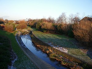
38:
23:
77:
57:
143:
214:
257:
122:
61:
125:
fell into the River Pool whilst promoting volunteering to clean up the waterway.
114:, includes a conservation site and naturalised areas; the route is part of the
111:
96:
89:
190:
177:
103:
69:
85:
37:, is an urban river in south London, England. It is a tributary of the
106:, the River Pool Walkway, running north from Lennard Road near the
17:
218:
213:This article related to a river in England is a
162:Details of London's rivers, including River Pool
148:, BBC News, 4 June 2009 (Accessed 22 Jul 2010)
238:
8:
279:Geography of the London Borough of Lewisham
95:For much of its length the river lies in a
274:Geography of the London Borough of Bromley
269:Geography of the London Borough of Croydon
245:
231:
134:
7:
210:
208:
68:. It then flows northwards through
14:
144:Boris Johnson stumbles into river
88:. Two of its tributaries are the
167:Environment Agency Flood Report
84:, to join the Ravensbourne in
1:
217:. You can help Knowledge by
121:In June 2009, London Mayor
300:
207:
108:Midland Bank Sports Ground
82:London Borough of Lewisham
92:and the Chaffinch Brook.
74:London Borough of Bromley
66:London Borough of Croydon
51:Course of the River Pool
116:National Cycle Network
26:
21:
191:51.43889°N 0.02667°W
284:England river stubs
187: /
196:51.43889; -0.02667
39:River Ravensbourne
27:
226:
225:
291:
264:Rivers of London
247:
240:
233:
209:
202:
201:
199:
198:
197:
192:
188:
185:
184:
183:
180:
149:
139:
299:
298:
294:
293:
292:
290:
289:
288:
254:
253:
252:
251:
205:
195:
193:
189:
186:
181:
178:
176:
174:
173:
172:
158:
153:
152:
140:
136:
131:
54:
53:
52:
47:
12:
11:
5:
297:
295:
287:
286:
281:
276:
271:
266:
256:
255:
250:
249:
242:
235:
227:
224:
223:
170:
169:
164:
157:
156:External links
154:
151:
150:
133:
132:
130:
127:
50:
49:
48:
46:
43:
13:
10:
9:
6:
4:
3:
2:
296:
285:
282:
280:
277:
275:
272:
270:
267:
265:
262:
261:
259:
248:
243:
241:
236:
234:
229:
228:
222:
220:
216:
211:
206:
203:
200:
168:
165:
163:
160:
159:
155:
147:
145:
138:
135:
128:
126:
124:
123:Boris Johnson
119:
117:
113:
109:
105:
100:
98:
93:
91:
87:
83:
79:
75:
71:
67:
63:
59:
44:
42:
40:
36:
32:
25:
22:The river in
20:
16:
219:expanding it
212:
204:
171:
141:
137:
120:
101:
94:
62:West Wickham
55:
34:
30:
28:
15:
194: /
258:Categories
179:51°26′20″N
129:References
112:Cator Park
97:floodplain
90:River Beck
35:Pool River
31:River Pool
24:Bell Green
182:0°01′36″W
104:Beckenham
70:Beckenham
45:Geography
78:Sydenham
102:In New
86:Catford
80:in the
72:in the
64:in the
58:Shirley
76:, and
33:, or
215:stub
110:and
60:and
29:The
260::
146:'
41:.
246:e
239:t
232:v
221:.
142:'
Text is available under the Creative Commons Attribution-ShareAlike License. Additional terms may apply.