42:
909:
545:
of 2000, there were 57 people, 20 households, and 16 families residing in the town. The population density was 263.7 inhabitants per square mile (101.8/km). There were 26 housing units at an average density of 120.3 units per square mile (46.4 units/km). The racial makeup of the town was 98.25%
557:
living together, 15.0% had a female householder with no husband present, and 20.0% were non-families. 15.0% of all households were made up of individuals, and 10.0% had someone living alone who was 65 years of age or older. The average household size was 2.85 and the average family size was 3.19.
561:
In the town, the population was spread out, with 29.8% under the age of 18, 10.5% from 18 to 24, 38.6% from 25 to 44, 15.8% from 45 to 64, and 5.3% who were 65 years of age or older. The median age was 29 years. For every 100 females, there were 62.9 males. For every 100 females age 18 and over,
41:
565:
The median income for a household in the town was $ 28,125, and the median income for a family was $ 35,000. Males had a median income of $ 27,917 versus $ 14,063 for females. The
831:
1036:
62:
1026:
261:, United States. The population was 35 at the 2010 census. Riverside surrendered its municipal charter effective August 18, 2016, due to low population.
288:
116:
228:
1031:
824:
238:
817:
733:
693:
203:
646:
809:
765:
669:"Profile of General Population and Housing Characteristics: 2010 Demographic Profile Data (DP-1): Riverside town, Georgia"
697:
769:
672:
621:
320:
507:
492:
477:
462:
447:
432:
417:
402:
387:
372:
357:
841:
274:
254:
121:
94:
47:
553:
There were 20 households, out of which 50.0% had children under the age of 18 living with them, 60.0% were
996:
593:
1003:
958:
892:
569:
for the town was $ 10,102. There were 25.0% of families and 29.0% of the population living below the
258:
213:
109:
51:
968:
948:
547:
791:
933:
887:
863:
749:
729:
566:
270:
963:
938:
928:
882:
897:
1020:
570:
856:
104:
303:
290:
77:
64:
194:
323:, the town had a total area of 0.2 square miles (0.52 km), all land.
987:‡This populated place also has portions in an adjacent county or counties
554:
720:
542:
908:
220:
199:
920:
874:
573:, including 44.0% of under eighteens and none of those over 64.
32:
813:
907:
642:
668:
617:
269:
The community was named for its riverside setting on the
694:"Riverside, Ga., is no more. How about it, Johns Creek?"
982:
947:
919:
873:
237:
227:
210:
193:
185:
177:
169:
164:
156:
148:
140:
132:
127:
115:
103:
93:
23:
588:
586:
751:Acts Passed by the General Assembly of Georgia
722:Georgia Place-Names: Their History and Origins
825:
8:
912:Map of Georgia highlighting Colquitt County
832:
818:
810:
766:"US Gazetteer files: 2010, 2000, and 1990"
330:
277:incorporated Riverside as a town in 1907.
20:
728:. Macon, GA: Winship Press. p. 189.
1037:Populated places disestablished in 2016
594:"Population and Housing Unit Estimates"
582:
226:
192:
163:
155:
126:
92:
57:
38:
350:
612:
610:
236:
209:
184:
176:
168:
147:
139:
131:
114:
102:
7:
550:, and 1.75% from two or more races.
840:Municipalities and communities of
792:"Census of Population and Housing"
340:
14:
1027:Towns in Colquitt County, Georgia
754:. J. Johnston. 1907. p. 894.
144:0.2 sq mi (0.6 km)
136:0.2 sq mi (0.6 km)
40:
647:United States Geological Survey
643:"US Board on Geographic Names"
18:Town in Georgia, United States
1:
1032:Towns in Georgia (U.S. state)
152:0 sq mi (0 km)
698:Atlanta Journal-Constitution
770:United States Census Bureau
719:Krakow, Kenneth K. (1975).
673:United States Census Bureau
622:United States Census Bureau
321:United States Census Bureau
178: • Estimate
1053:
992:
905:
854:
534:
521:
506:
491:
476:
461:
446:
431:
416:
401:
386:
371:
356:
349:
344:
339:
336:
316:(31.178587, -83.805121).
285:Riverside was located at
58:
39:
30:
843:Colquitt County, Georgia
275:Georgia General Assembly
562:there were 90.5 males.
160:279 ft (85 m)
913:
189:180/sq mi (58/km)
911:
618:"U.S. Census website"
535:U.S. Decennial Census
332:Historical population
304:31.17861°N 83.80500°W
212: • Summer (
78:31.17861°N 83.80500°W
1005:United States portal
186: • Density
772:. February 12, 2011
333:
309:31.17861; -83.80500
300: /
83:31.17861; -83.80500
74: /
914:
700:. October 25, 2016
649:. October 25, 2007
331:
170: • Total
149: • Water
133: • Total
25:Riverside, Georgia
1014:
1013:
567:per capita income
539:
538:
319:According to the
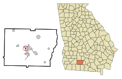
271:Ochlockonee River
248:
247:
141: • Land
50:and the state of
1044:
1006:
999:
910:
866:
859:
849:
844:
834:
827:
820:
811:
804:
803:
801:
799:
788:
782:
781:
779:
777:
762:
756:
755:
746:
740:
739:
727:
716:
710:
709:
707:
705:
690:
684:
683:
681:
679:
665:
659:
658:
656:
654:
639:
633:
632:
630:
628:
614:
605:
604:
602:
600:
590:
352:
347:
342:
334:
315:
314:
312:
311:
310:
305:
301:
298:
297:
296:
293:
217:
89:
88:
86:
85:
84:
79:
75:
72:
71:
70:
67:
44:
21:
1052:
1051:
1047:
1046:
1045:
1043:
1042:
1041:
1017:
1016:
1015:
1010:
1004:
997:
988:
978:
950:
949:Unincorporated
943:
915:
903:
869:
864:
857:
850:
847:
842:
838:
808:
807:
797:
795:
790:
789:
785:
775:
773:
764:
763:
759:
748:
747:
743:
736:
725:
718:
717:
713:
703:
701:
692:
691:
687:
677:
675:
667:
666:
662:
652:
650:
641:
640:
636:
626:
624:
616:
615:
608:
598:
596:
592:
591:
584:
579:
555:married couples
345:
329:
308:
306:
302:
299:
294:
291:
289:
287:
286:
283:
267:
255:Colquitt County
211:
82:
80:
76:
73:
68:
65:
63:
61:
60:
54:
48:Colquitt County
35:
26:
19:
12:
11:
5:
1050:
1048:
1040:
1039:
1034:
1029:
1019:
1018:
1012:
1011:
1009:
1008:
1001:
998:Georgia portal
993:
990:
989:
986:
984:
980:
979:
977:
976:
971:
966:
961:
955:
953:
945:
944:
942:
941:
936:
931:
925:
923:
917:
916:
906:
904:
902:
901:
895:
890:
885:
879:
877:
871:
870:
855:
852:
851:
839:
837:
836:
829:
822:
814:
806:
805:
783:
757:
741:
734:
711:
685:
660:
634:
606:
581:
580:
578:
575:
537:
536:
532:
531:
528:
526:
523:
519:
518:
515:
513:
510:
504:
503:
500:
498:
495:
489:
488:
485:
483:
480:
474:
473:
470:
468:
465:
459:
458:
455:
453:
450:
444:
443:
440:
438:
435:
429:
428:
425:
423:
420:
414:
413:
410:
408:
405:
399:
398:
395:
393:
390:
384:
383:
380:
378:
375:
369:
368:
365:
363:
360:
354:
353:
348:
343:
338:
328:
325:
282:
279:
266:
263:
253:was a town in
246:
245:
242:
235:
234:
231:
225:
224:
218:
208:
207:
197:
191:
190:
187:
183:
182:
179:
175:
174:
171:
167:
166:
162:
161:
158:
154:
153:
150:
146:
145:
142:
138:
137:
134:
130:
129:
125:
124:
119:
113:
112:
107:
101:
100:
97:
91:
90:
56:
55:
45:
37:
36:
31:
28:
27:
24:
17:
13:
10:
9:
6:
4:
3:
2:
1049:
1038:
1035:
1033:
1030:
1028:
1025:
1024:
1022:
1007:
1002:
1000:
995:
994:
991:
985:
981:
975:
972:
970:
967:
965:
962:
960:
957:
956:
954:
952:
946:
940:
937:
935:
932:
930:
927:
926:
924:
922:
918:
899:
896:
894:
891:
889:
886:
884:
881:
880:
878:
876:
872:
868:
867:
860:
853:
848:United States
845:
835:
830:
828:
823:
821:
816:
815:
812:
793:
787:
784:
771:
767:
761:
758:
753:
752:
745:
742:
737:
735:0-915430-00-2
731:
724:
723:
715:
712:
699:
695:
689:
686:
674:
670:
664:
661:
648:
644:
638:
635:
623:
619:
613:
611:
607:
595:
589:
587:
583:
576:
574:
572:
568:
563:
559:
556:
551:
549:
544:
533:
529:
527:
524:
520:
516:
514:
511:
509:
505:
501:
499:
496:
494:
490:
486:
484:
481:
479:
475:
471:
469:
466:
464:
460:
456:
454:
451:
449:
445:
441:
439:
436:
434:
430:
426:
424:
421:
419:
415:
411:
409:
406:
404:
400:
396:
394:
391:
389:
385:
381:
379:
376:
374:
370:
366:
364:
361:
359:
355:
335:
326:
324:
322:
317:
313:
280:
278:
276:
272:
264:
262:
260:
256:
252:
243:
240:
232:
230:
222:
219:
215:
205:
204:Eastern (EST)
201:
198:
196:
188:
180:
172:
159:
151:
143:
135:
123:
120:
118:
111:
108:
106:
99:United States
98:
96:
87:
59:Coordinates:
53:
49:
43:
34:
29:
22:
16:
973:
862:
796:. Retrieved
794:. Census.gov
786:
774:. Retrieved
760:
750:
744:
721:
714:
702:. Retrieved
688:
676:. Retrieved
663:
651:. Retrieved
637:
625:. Retrieved
597:. Retrieved
571:poverty line
564:
560:
552:
540:
327:Demographics
318:
284:
268:
250:
249:
46:Location in
15:
959:Autreyville
951:communities
893:Norman Park
858:County seat
678:February 1,
653:January 31,
627:January 31,
522:2016 (est.)
307: /
81: /
1021:Categories
969:Hartsfield
577:References
541:As of the
295:83°48′18″W
292:31°10′43″N
241:feature ID
165:Population
69:83°48′18″W
66:31°10′43″N
983:Footnotes
974:Riverside
776:April 23,
704:April 18,
281:Geography
251:Riverside
229:FIPS code
195:Time zone
157:Elevation
934:Ellenton
888:Moultrie
865:Moultrie
233:13-65604
122:Colquitt
964:Barbers
939:Funston
798:June 4,
599:June 9,
265:History
259:Georgia
244:0332869
110:Georgia
95:Country
52:Georgia
929:Berlin
883:Doerun
875:Cities
732:
543:census
517:−38.6%
502:−23.0%
487:−25.3%
472:−13.2%
457:−65.3%
442:−16.7%
337:Census
273:. The
117:County
921:Towns
898:Omega
726:(PDF)
548:White
427:28.7%
397:18.1%
382:46.5%
223:(EDT)
221:UTC-4
200:UTC-5
105:State
800:2015
778:2011
730:ISBN
706:2020
680:2012
655:2008
629:2008
601:2017
530:0.0%
508:2010
493:2000
478:1990
463:1980
448:1970
433:1960
418:1950
412:4.4%
403:1940
388:1930
373:1920
358:1910
346:Note
341:Pop.
239:GNIS
128:Area
33:Town
452:114
437:329
422:395
407:307
392:294
377:249
362:170
214:DST
1023::
861::
846:,
768:.
696:.
671:.
645:.
620:.
609:^
585:^
525:35
512:35
497:57
482:74
467:99
351:%±
257:,
181:35
173:35
900:‡
833:e
826:t
819:v
802:.
780:.
738:.
708:.
682:.
657:.
631:.
603:.
367:—
216:)
206:)
202:(
Text is available under the Creative Commons Attribution-ShareAlike License. Additional terms may apply.