616:
53:
118:
138:
65:
413:
In the town, the population was spread out, with 29.7% under the age of 18, 6.3% from 18 to 24, 30.1% from 25 to 44, 26.3% from 45 to 64, and 7.6% who were 65 years of age or older. The median age was 37 years. For every 100 females, there were 111.0 males. For every 100 females age 18 and over,
409:
living together, 4.6% had a female householder with no husband present, and 15.4% were non-families. 12.0% of all households were made up of individuals, and 4.9% had someone living alone who was 65 years of age or older. The average household size was 2.96 and the average family size was 3.21.
362:, the town has a total area of 35.1 square miles (91.0 km), of which, 35.1 square miles (91.0 km) is land and 0.04 square miles (0.1 km) (0.09%) is water.
417:
The median income for a household in the town was $ 58,177, and the median income for a family was $ 60,385. Males had a median income of $ 40,048 versus $ 23,750 for females. The
544:
378:
was 40.0 people per square mile (15.4/km). There were 489 housing units at an average density of 13.9 per square mile (5.4/km). The racial makeup of the town was 98.29%
921:
1098:
78:
981:
860:
537:
1059:
742:
697:
266:
951:
634:
762:
712:
727:
530:
835:
757:
276:
1007:
890:
840:
707:
1002:
439:
64:
229:
875:
522:
465:
343:
is a former community at the intersection of Herold Road and
Hickory Grove Road. Light development occupies the immediate area.
383:
150:
895:
777:
434:
1103:
865:
825:
737:
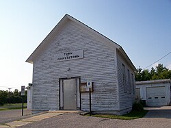
732:
554:
494:
391:
359:
306:
155:
752:
314:
52:
1036:
880:
644:
639:
330:
254:
110:
349:
is an unincorporated community a mile west of
Maribel at the intersection of County Road Z and Rosecrans Road.
931:
911:
795:
787:
405:
There were 474 households, out of which 42.4% had children under the age of 18 living with them, 77.0% were
996:
971:
946:
870:
850:
664:
395:
926:
830:
772:
659:
605:
1043:
986:
961:
767:
600:
576:
399:
239:
956:
936:
916:
845:
810:
674:
654:
626:
387:
379:
900:
800:
722:
669:
649:
375:
334:
1013:
906:
885:
855:
820:
717:
418:
374:
of 2000, there were 1,403 people, 474 households, and 401 families residing in the town. The
976:
941:
747:
684:
587:
421:
for the town was $ 20,941. About 2.4% of families and 3.8% of the population were below the
991:
966:
692:
595:
1092:
259:
123:
17:
422:
333:
located at the intersection of County Road R and Zander Road 3 miles northeast of
569:
130:
1074:
1061:
93:
80:
310:
220:
143:
1027:‡This populated place also has portions in an adjacent county or counties
425:, including 4.7% of those under age 18 and 2.0% of those age 65 or over.
406:
371:
517:
246:
225:
43:
526:
291:
614:
461:
490:
1022:
809:
786:
683:
625:
586:
286:
275:
265:
253:
236:
219:
211:
203:
198:
190:
182:
174:
166:
161:
149:
129:
109:
34:
402:people of any race were 0.64% of the population.
538:
8:
545:
531:
523:
31:
450:
285:
264:
252:
218:
197:
189:
160:
108:
73:
61:
49:
485:
483:
456:
454:
274:
235:
210:
202:
181:
173:
165:
148:
128:
7:
1099:Towns in Manitowoc County, Wisconsin
394:, and 0.43% from two or more races.
178:35.1 sq mi (90.9 km)
170:35.1 sq mi (91.0 km)
553:Municipalities and communities of
313:, in the United States. As of the
69:Location of Cooperstown, Wisconsin
25:
440:Cherney Maribel Caves County Park
317:, the town population was 1,403.
186:0.0 sq mi (0.1 km)
136:
116:
63:
51:
29:Town in Wisconsin, United States
466:United States Geological Survey
462:"US Board on Geographic Names"
1:
556:Manitowoc County, Wisconsin
495:United States Census Bureau
360:United States Census Bureau
1120:
1032:
612:
567:
435:Devil's River State Trail
215:40.0/sq mi (15.4/km)
74:
62:
50:
41:
414:there were 112.0 males.
331:unincorporated community
194:896 ft (273 m)
619:
36:Cooperstown, Wisconsin
1075:44.31278°N 87.77444°W
618:
491:"U.S. Census website"
238: • Summer (
94:44.28361°N 87.81944°W
1045:United States portal
212: • Density
18:Rosecrans, Wisconsin
1080:44.31278; -87.77444
1071: /
518:Town of Cooperstown
99:44.28361; -87.81944
90: /
1104:Towns in Wisconsin
620:
468:. October 25, 2007
429:Points of interest
376:population density
204: • Total
183: • Water
167: • Total
1054:
1053:
419:per capita income
358:According to the
300:
299:
292:townofcooperstown
175: • Land
16:(Redirected from
1111:
1086:
1085:
1083:
1082:
1081:
1076:
1072:
1069:
1068:
1067:
1064:
1046:
1039:
1038:Wisconsin portal
866:Kellners Corners
733:Manitowoc Rapids
617:
579:
572:
562:
557:
547:
540:
533:
524:
506:
505:
503:
501:
487:
478:
477:
475:
473:
458:
307:Manitowoc County
296:
293:
243:
142:
140:
139:
122:
120:
119:
105:
104:
102:
101:
100:
95:
91:
88:
87:
86:
83:
67:
55:
32:
21:
1119:
1118:
1114:
1113:
1112:
1110:
1109:
1108:
1089:
1088:
1079:
1077:
1073:
1070:
1065:
1062:
1060:
1058:
1057:
1055:
1050:
1044:
1037:
1028:
1018:
812:
805:
782:
679:
621:
615:
610:
582:
577:
570:
563:
560:
555:
551:
514:
509:
499:
497:
489:
488:
481:
471:
469:
460:
459:
452:
448:
431:
407:married couples
384:Native American
368:
356:
323:
290:
237:
137:
135:
117:
115:
98:
96:
92:
89:
84:
81:
79:
77:
76:
70:
58:
46:
37:
30:
23:
22:
15:
12:
11:
5:
1117:
1115:
1107:
1106:
1101:
1091:
1090:
1052:
1051:
1049:
1048:
1041:
1033:
1030:
1029:
1026:
1024:
1020:
1019:
1017:
1016:
1011:
1005:
1000:
994:
989:
984:
979:
974:
969:
964:
959:
954:
949:
944:
939:
934:
929:
924:
919:
914:
909:
904:
898:
893:
888:
883:
878:
873:
868:
863:
858:
853:
848:
843:
838:
833:
828:
823:
817:
815:
807:
806:
804:
803:
798:
792:
790:
784:
783:
781:
780:
775:
770:
765:
760:
755:
750:
745:
740:
735:
730:
725:
720:
715:
710:
705:
700:
695:
689:
687:
681:
680:
678:
677:
672:
667:
662:
657:
652:
647:
642:
637:
631:
629:
623:
622:
613:
611:
609:
608:
603:
598:
592:
590:
584:
583:
568:
565:
564:
552:
550:
549:
542:
535:
527:
521:
520:
513:
512:External links
510:
508:
507:
479:
449:
447:
444:
443:
442:
437:
430:
427:
367:
364:
355:
352:
351:
350:
344:
338:
322:
319:
298:
297:
288:
284:
283:
280:
273:
272:
269:
263:
262:
257:
251:
250:
244:
234:
233:
223:
217:
216:
213:
209:
208:
205:
201:
200:
196:
195:
192:
188:
187:
184:
180:
179:
176:
172:
171:
168:
164:
163:
159:
158:
153:
147:
146:
133:
127:
126:
113:
107:
106:
72:
71:
68:
60:
59:
56:
48:
47:
42:
39:
38:
35:
28:
24:
14:
13:
10:
9:
6:
4:
3:
2:
1116:
1105:
1102:
1100:
1097:
1096:
1094:
1087:
1084:
1047:
1042:
1040:
1035:
1034:
1031:
1025:
1021:
1015:
1012:
1009:
1006:
1004:
1001:
998:
995:
993:
990:
988:
985:
983:
982:Spring Valley
980:
978:
975:
973:
970:
968:
965:
963:
960:
958:
955:
953:
950:
948:
945:
943:
940:
938:
935:
933:
930:
928:
925:
923:
920:
918:
915:
913:
910:
908:
905:
902:
899:
897:
894:
892:
889:
887:
884:
882:
881:Louis Corners
879:
877:
874:
872:
869:
867:
864:
862:
861:Hickory Grove
859:
857:
854:
852:
849:
847:
844:
842:
839:
837:
834:
832:
829:
827:
824:
822:
819:
818:
816:
814:
808:
802:
799:
797:
794:
793:
791:
789:
785:
779:
776:
774:
771:
769:
766:
764:
761:
759:
756:
754:
751:
749:
746:
744:
741:
739:
736:
734:
731:
729:
726:
724:
721:
719:
716:
714:
711:
709:
706:
704:
701:
699:
696:
694:
691:
690:
688:
686:
682:
676:
673:
671:
668:
666:
663:
661:
658:
656:
653:
651:
648:
646:
645:Kellnersville
643:
641:
640:Francis Creek
638:
636:
633:
632:
630:
628:
624:
607:
604:
602:
599:
597:
594:
593:
591:
589:
585:
581:
580:
573:
566:
561:United States
558:
548:
543:
541:
536:
534:
529:
528:
525:
519:
516:
515:
511:
496:
492:
486:
484:
480:
467:
463:
457:
455:
451:
445:
441:
438:
436:
433:
432:
428:
426:
424:
420:
415:
411:
408:
403:
401:
397:
393:
390:, 0.21% from
389:
385:
381:
377:
373:
365:
363:
361:
353:
348:
345:
342:
341:Hickory Grove
339:
336:
332:
328:
325:
324:
320:
318:
316:
312:
308:
305:is a town in
304:
295:
289:
281:
278:
270:
268:
261:
258:
256:
248:
245:
241:
231:
230:Central (CST)
227:
224:
222:
214:
206:
193:
185:
177:
169:
157:
154:
152:
145:
134:
132:
125:
124:United States
114:
112:
103:
75:Coordinates:
66:
54:
45:
40:
33:
27:
19:
1056:
932:North Grimms
912:Menchalville
796:Clarks Mills
702:
575:
498:. Retrieved
470:. Retrieved
423:poverty line
416:
412:
404:
369:
366:Demographics
357:
346:
340:
326:
302:
301:
26:
1078: /
997:Tisch Mills
972:School Hill
947:Reifs Mills
891:Maple Grove
871:Kingsbridge
851:Fisherville
841:Cooperstown
813:communities
743:Maple Grove
703:Cooperstown
698:Centerville
665:St. Nazianz
571:County seat
500:January 31,
472:January 31,
392:other races
327:Cooperstown
321:Communities
315:2000 census
303:Cooperstown
97: /
1093:Categories
1066:87°46′28″W
1063:44°18′46″N
1003:Two Creeks
927:Newtonburg
831:Cato Falls
778:Two Rivers
773:Two Creeks
660:Reedsville
606:Two Rivers
446:References
370:As of the
279:feature ID
199:Population
85:87°49′10″W
1023:Footnotes
987:Steinthal
962:Rosecrans
952:Rockville
768:Schleswig
738:Manitowoc
635:Cleveland
601:Manitowoc
578:Manitowoc
354:Geography
347:Rosecrans
311:Wisconsin
267:FIPS code
255:Area code
221:Time zone
191:Elevation
156:Manitowoc
144:Wisconsin
82:44°17′1″N
57:Town Hall
957:Rockwood
937:Northeim
917:Millhome
876:Larrabee
846:Duveneck
763:Rockland
753:Mishicot
713:Franklin
675:Whitelaw
655:Mishicot
627:Villages
396:Hispanic
386:, 0.57%
382:, 0.50%
271:55-16950
901:Meggers
801:Collins
728:Liberty
723:Kossuth
670:Valders
650:Maribel
335:Maribel
287:Website
282:1583015
111:Country
1014:Zander
922:Newton
907:Melnik
886:Madsen
856:Grimms
836:Clover
821:Branch
758:Newton
718:Gibson
588:Cities
400:Latino
372:census
329:is an
151:County
141:
121:
1008:Wells
977:Shoto
942:Osman
896:Meeme
811:Other
748:Meeme
708:Eaton
685:Towns
388:Asian
380:White
249:(CDT)
247:UTC-5
226:UTC-6
207:1,403
131:State
992:Taus
967:Rube
826:Cato
788:CDPs
693:Cato
596:Kiel
502:2008
474:2008
294:.com
277:GNIS
162:Area
44:Town
398:or
260:920
240:DST
1095::
574::
559:,
493:.
482:^
464:.
453:^
309:,
1010:‡
999:‡
903:‡
546:e
539:t
532:v
504:.
476:.
337:.
242:)
232:)
228:(
20:)
Text is available under the Creative Commons Attribution-ShareAlike License. Additional terms may apply.