20:
166:
with regard to economic and social development. As of 2007, there were 05 banking agencies in the town. There was a well-developed retail infrastructure serving the surrounding area of cattle and agricultural lands. There were 5,961 automobiles in all of the municipality (2007), about one for every 05 inhabitants.
267:
who arrived in the region in 1836 with his family and settled on a cattle ranch which later developed into a small settlement around a chapel. In 1852 the first settlement, known as Confusão, after a local ranch, was raised to a district with the name of São
Sebastião do Pouso Alegre. Later the name
165:
The most important economic activities are cattle raising, commerce, and agriculture. The GDP in 2005 was R$ 277 million, with 166 million generated by services, 18 million generated by industry, and 66 million generated by agriculture. São
Gotardo is in the top tier of municipalities in the state
169:
São
Gotardo is a large producer of agricultural products, especially coffee and corn. The high elevation combined with tropical latitude allows it to produce coffee and wheat. In the rural area there were 825 establishments (2006) occupying 61,000 hectares (planted area of 14,000 ha and natural
66:
in the upper Abaeté River valley. The region is made up of a plateau called Mata da Corda. The climate is mild and frost can occur in the dry season (from May to
September). Neighboring municipalities are:
170:
pasture of 35,000 ha.). About 3,000 persons were dependent on agriculture. 113 of the farms had tractors, a ratio of one in 7 farms. There were 43,000 head of cattle in 2006. The main crops were:
207:
In the health sector there were 13 health clinics and 02 hospitals with 44 beds In the educational sector there were 12 pre-primary schools, 17 primary schools, and 05 middle schools.
43:
429:
382:
390:
297:
243:
in São Paulo with 0.919, while the lowest was
Setubinha. In more recent statistics (considering 5,507 municipalities)
31:
212:
38:. Its population as of 2020 was 35,782 people and its land area is 854 km. The city belongs to the
312:
240:
260:
47:
84:
39:
19:
232:
268:
was changed to pay homage to the founder, who unexpectedly gained sainthood in the new name.
123:
283:
129:
76:
301:
294:
244:
153:
111:
63:
51:
423:
88:
80:
35:
357:
343:
248:
405:
392:
323:
368:
236:
135:
117:
68:
62:
The urban center is located at an elevation of 1,100 meters southeast of
251:
has the lowest rating in the country, 467, putting it in last place.
147:
141:
72:
18:
231:
The highest ranking municipality in Minas Gerais in 2000 was
221:
National ranking: 439 out of 5,138 municipalities as of 2000
16:
Town and municipality in the state of Minas Gerais, Brazil
218:
State ranking: 30 out of 853 municipalities as of 2000
227:Life expectancy: 73 (average of males and females)
8:
353:
351:
34:located in the northwest of the state of
276:
239:with 0.568. Nationally the highest was
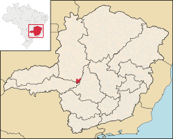
23:Location of São Gotardo in Minas Gerais
383:List of municipalities in Minas Gerais
339:
337:
335:
333:
331:
7:
54:. It became a municipality in 1915.
44:Triângulo Mineiro e Alto Paranaiba
14:
235:with 0.841, while the lowest was
430:Municipalities in Minas Gerais
1:
446:
369:Prefeitura de São Gotardo
259:The name is inspired by
195:soybeans: 1,500 hectares
213:Human Development Index
183:potatoes: 110 hectares
177:coffee: 2,820 hectares
24:
406:19.31083°S 46.04889°W
174:avocado: 120 hectares
126:: 55 km (BR-262)
22:
411:-19.31083; -46.04889
203:Health and education
192:corn: 3,600 hectares
402: /
198:wheat: 130 hectares
189:beans: 420 hectares
186:onions: 77 hectares
180:garlic: 65 hectares
161:Economic activities
85:Santa Rosa da Serra
300:2008-02-23 at the
255:Origin of the Name
241:São Caetano do Sul
224:Literacy rate: 88%
87:to the south, and
25:
437:
417:
416:
414:
413:
412:
407:
403:
400:
399:
398:
395:
371:
366:
360:
355:
346:
341:
326:
321:
315:
310:
304:
292:
286:
281:
247:in the state of
107:
106:
102:
445:
444:
440:
439:
438:
436:
435:
434:
420:
419:
410:
408:
404:
401:
396:
393:
391:
389:
388:
379:
374:
367:
363:
356:
349:
342:
329:
322:
318:
311:
307:
302:Wayback Machine
293:
289:
282:
278:
274:
257:
233:Poços de Caldas
205:
163:
108:
104:
100:
98:
97:
60:
30:is a Brazilian
17:
12:
11:
5:
443:
441:
433:
432:
422:
421:
386:
385:
378:
375:
373:
372:
361:
347:
327:
316:
305:
287:
275:
273:
270:
256:
253:
229:
228:
225:
222:
219:
216:
215:: 0.807 (2000)
204:
201:
200:
199:
196:
193:
190:
187:
184:
181:
178:
175:
162:
159:
158:
157:
154:Belo Horizonte
151:
145:
139:
133:
127:
121:
115:
112:Patos de Minas
96:
93:
75:to the North,
64:Patos de Minas
59:
56:
52:Patos de Minas
15:
13:
10:
9:
6:
4:
3:
2:
442:
431:
428:
427:
425:
418:
415:
384:
381:
380:
376:
370:
365:
362:
359:
354:
352:
348:
345:
340:
338:
336:
334:
332:
328:
325:
320:
317:
314:
309:
306:
303:
299:
296:
291:
288:
285:
280:
277:
271:
269:
266:
264:
254:
252:
250:
246:
242:
238:
234:
226:
223:
220:
217:
214:
210:
209:
208:
202:
197:
194:
191:
188:
185:
182:
179:
176:
173:
172:
171:
167:
160:
156:: 295 km
155:
152:
149:
146:
143:
140:
137:
134:
131:
130:Rio Paranaíba
128:
125:
122:
120:: 163 km
119:
116:
114:: 101 km
113:
110:
109:
103:
94:
92:
91:to the west.
90:
89:Quartel Geral
86:
82:
79:to the east,
78:
77:Rio Paranaíba
74:
70:
65:
57:
55:
53:
49:
45:
41:
37:
33:
29:
21:
387:
364:
319:
308:
290:
279:
262:
258:
230:
206:
168:
164:
144:: 43 km
138:: 22 km
132:: 20 km
81:Campos Altos
61:
36:Minas Gerais
32:municipality
27:
26:
409: /
150::50 km
48:microregion
46:and to the
28:São Gotardo
397:46°02′56″W
394:19°18′39″S
358:Frigoletto
324:Aonde fica
295:Citybrazil
272:References
249:Pernambuco
211:Municipal
40:mesoregion
284:IBGE 2020
237:Setubinha
124:Estalagem
95:Distances
424:Category
377:See also
298:Archived
261:Joaquim
136:Matutina
69:Matutina
58:Location
265:de Lima
263:Gotardo
313:DER MG
245:Manari
148:Arapua
99:": -->
142:Tiros
118:Araxá
73:Tiros
344:IBGE
101:edit
83:and
71:and
50:of
42:of
426::
350:^
330:^
105:]
Text is available under the Creative Commons Attribution-ShareAlike License. Additional terms may apply.