20:
394:
100:
Services and agriculture are the most important economic activities. A regional cheese called "queijo da canastra" is produced here. The GDP in 2005 was approximately R$ 56 million, with 2 million reais from taxes, 20 million reais from services, 2 million reais from industry, and 31 million reais
101:
from agriculture. There were 778 rural producers on 139,000 hectares of land. 160 farms had tractors (2006). Approximately 2,200 persons were dependent on agriculture. The main crops are coffee, rice, beans, and corn. There were 55,000 head of cattle (2006).
34:. Its population as of 2020 was 7,076 people living in a total area of 2,100 km. The city belongs to the meso-region of Oeste de Minas and to the micro-region of Piumhi. It became a municipality in 1938.
435:
454:
112:
In the health sector there were 4 public health clinics and 1 hospital with 14 beds (2005). Patients with more serious health conditions are transported to
358:
459:
191:
464:
428:
151:
In 2000 the per capita monthly income of R$ 256.00 was below the state and national average of R$ 276.00 and R$ 297.00 respectively.
43:
42:
The city center of São Roque de Minas is located at an elevation of 818 meters on a plateau about 10 kilometers east of the
256:
421:
174:
in São Paulo with 0.919, while the lowest was
Setubinha. In more recent statistics (considering 5,507 municipalities)
124:. Educational needs of 1,250 students were met by 7 primary schools, 2 middle schools, and 5 pre-primary schools.
129:
74:
54:
47:
104:
There were no banks (2007) and 1,029 automobiles (2007), giving a ratio of 6 inhabitants per automobile.
19:
171:
46:
entrance. Most of the municipality is occupied by the national park, which contains the source of the
113:
78:
209:
163:
152:
393:
260:
315:
70:
405:
175:
85:
448:
66:
401:
31:
155:
had the highest per capita monthly income in 2000 with R$ 435.00. The lowest was
350:
326:
304:
231:
253:
293:
282:
271:
220:
179:
373:
360:
167:
156:
58:
50:. The park contains 71,525 hectares with a perimeter of 173.4 km.
16:
Brazilian municipality located in the west of the state of Minas Gerais
182:
has the lowest rating in the country—0,467—putting it in last place.
121:
117:
89:
62:
23:
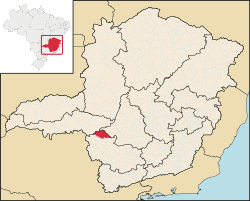
Location of São Roque de Minas on a map of the state of Minas Gerais
345:
242:
18:
30:
is a
Brazilian municipality located in the west of the state of
340:
162:
The highest ranking municipality in Minas Gerais in 2000 was
138:
National ranking: 1426 out of 5,138 municipalities as of 2000
92:
is 58 km. In 2000 the connecting roads were not paved.
409:
135:
State ranking: 186 out of 853 municipalities as of 2000
144:Life expectancy: 74 (average of males and females)
147:Infant mortality rate: 27.2 in 1,000 live births.
88:is 334 km. The distance to regional center
429:
8:
436:
422:
170:with 0.568. Nationally the highest was
202:
400:This geographical article relating to
192:List of municipalities in Minas Gerais
7:
390:
388:
455:1962 establishments in Minas Gerais
14:
166:with 0.841, while the lowest was
53:Neighboring municipalities are:
392:
351:UNESCO site on the national park
44:Serra da Canastra National Park
460:Municipalities in Minas Gerais
1:
465:Minas Gerais geography stubs
408:. You can help Knowledge by
481:
387:
130:Human Development Index
24:
374:20.24500°S 46.36583°W
22:
379:-20.24500; -46.36583
108:Health and education
370: /
96:Economic activities
48:São Francisco River
259:2008-09-28 at the
172:São Caetano do Sul
141:Literacy rate: 88%
28:São Roque de Minas
25:
417:
416:
346:Serra da Canastra
243:Serra da Canastra
472:
438:
431:
424:
396:
389:
385:
384:
382:
381:
380:
375:
371:
368:
367:
366:
363:
329:
324:
318:
313:
307:
302:
296:
291:
285:
280:
274:
269:
263:
251:
245:
240:
234:
229:
223:
218:
212:
207:
178:in the state of
84:The distance to
480:
479:
475:
474:
473:
471:
470:
469:
445:
444:
443:
442:
378:
376:
372:
369:
364:
361:
359:
357:
356:
337:
332:
325:
321:
314:
310:
303:
299:
292:
288:
281:
277:
270:
266:
261:Wayback Machine
252:
248:
241:
237:
230:
226:
219:
215:
208:
204:
200:
188:
164:Poços de Caldas
159:with R$ 73.00.
153:Poços de Caldas
110:
98:
40:
17:
12:
11:
5:
478:
476:
468:
467:
462:
457:
447:
446:
441:
440:
433:
426:
418:
415:
414:
397:
354:
353:
348:
343:
336:
335:External links
333:
331:
330:
319:
308:
297:
286:
275:
264:
246:
235:
224:
213:
201:
199:
196:
195:
194:
187:
184:
149:
148:
145:
142:
139:
136:
133:
132:: 0.766 (2000)
109:
106:
97:
94:
86:Belo Horizonte
39:
36:
15:
13:
10:
9:
6:
4:
3:
2:
477:
466:
463:
461:
458:
456:
453:
452:
450:
439:
434:
432:
427:
425:
420:
419:
413:
411:
407:
403:
398:
395:
391:
386:
383:
352:
349:
347:
344:
342:
339:
338:
334:
328:
323:
320:
317:
312:
309:
306:
301:
298:
295:
290:
287:
284:
279:
276:
273:
268:
265:
262:
258:
255:
250:
247:
244:
239:
236:
233:
228:
225:
222:
217:
214:
211:
206:
203:
197:
193:
190:
189:
185:
183:
181:
177:
173:
169:
165:
160:
158:
154:
146:
143:
140:
137:
134:
131:
127:
126:
125:
123:
119:
115:
107:
105:
102:
95:
93:
91:
87:
82:
80:
76:
72:
68:
67:Vargem Bonita
64:
60:
56:
51:
49:
45:
37:
35:
33:
29:
21:
410:expanding it
402:Minas Gerais
399:
355:
322:
311:
300:
289:
278:
267:
249:
238:
227:
216:
205:
161:
150:
111:
103:
99:
83:
71:Delfinópolis
52:
41:
32:Minas Gerais
27:
26:
377: /
449:Categories
365:46°21′57″W
362:20°14′42″S
327:Frigoletto
305:Frigoletto
254:Citybrazil
198:References
180:Pernambuco
128:Municipal
316:São Roque
210:IBGE 2020
168:Setubinha
157:Setubinha
75:Conquista
341:Canastra
257:Archived
186:See also
55:Medeiros
38:Location
232:UNESCO
176:Manari
122:Franca
118:Piumhi
114:Passos
90:Piumhi
79:Tapira
65:(SE),
63:Piumhi
61:(E),
59:Bambuí
404:is a
81:(W).
57:(N),
406:stub
294:IBGE
283:IBGE
272:IBGE
221:IBGE
120:or
77:and
73:(S)
69:and
451::
116:,
437:e
430:t
423:v
412:.
Text is available under the Creative Commons Attribution-ShareAlike License. Additional terms may apply.