1070:
527:
1360:
1463:
55:
383:
1524:
443:
460:
71:
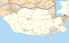
313:, and the hamlets of Ogmore Village, Castle-upon-Alun, Heol-y-Mynydd, Norton and Pont-yr-Brown It is notable for coastal geology and scenery, limestone downlands and fossilised primitive mammals, sea cliffs and beaches, two Iron Age hillforts, three medieval castle sites, (one, Ogmore Castle, still extant), two stepping stone river crossings and a clapper bridge. Three long distance paths cross the community. It is the western limit of the Vale of Glamorgan Heritage Coast, and has a visitor centre and tourist facilities.
1384:
2993:
1540:(440 yd) upstream gives safe access along the coast path. Downstream, a substantial modern bridge over the River Ogmore gives access to a sewage works, but is not a through route. The only roads out of the community are therefore to the east and south-east. The B4265 south-east to Wick is the only route out of the community that doesn't cross a river or stream. Two minor roads cross the Clemenstone Brook, one at Heol Shwlac, the other at Pont Fach. Pont Groes Gwta (
1691:, OS grid ref.SS88187395) this replaced a corrugated iron building that was originally a reading room for the up-market visitors to Southerndown. Built in 1876, it began holding summertime services under the name Southerndown Mission from 1877, and was holding regular Sunday school meetings by 1888. The tin hall lasted until 1968 when a road widening scheme required its demolition, and a replacement Church was built.
4152:
4141:
2855:
2872:
2847:
2828:
78:
1337:, SS91137483) is a medieval castle or fortification with little documentation. It appears under that name as far back as the mid-12th century. It gives its name to the hamlet of Castle-upon-Alun where two medieval doorways re-use dressed stone apparently from the stone castle, and also to Old Castle Down, the hillside above the hamlet.
1121:, SS881769). The first building was in place by 1117, and included a tidal moat. The stone keep claims to be "one of the oldest Norman stone buildings in South East Wales". Built by the Londres family, the castle passed by marriage to Henry of Lancaster, and became crown property in 1399. As well as a scheduled monument it is a grade I
1620:, OS grid ref.SS9099750. Five openings through the 18th-century raised path allow the stream through, with flat stone lintels. Further downstream, the roads east from St Brides Major village crosses the Alun at Pontalun, and the road from Ogmore crosses it at the confluence with the River Ewenny, both by inconspicuous modern bridges.
4129:
1351:, by contrast, is a 19th-century settlement (having been a scatter of three cottages in 1840. Its expansion was due to seaside holiday makers, although it only acquired official recognition as a name in 1920, when St Brides Major parish was divided into three wards, by which time Ogmore-by-Sea was a small but thriving resort.
1368:
community. Along the coast both Sutton Stone (a stone valued for its lack of grain and slow hardening once it is exposed to air, so it can be carved and sawn) and lead and other minerals have been extracted. Inland, the Duchy quarry near Castle-upon-Alun is now disused, but two large quarries, the Pant Quarry (operated by
781:, OS grid Ref. SS887727) This is a promontory fort, 60 metres (200 ft) above the sea on the Trwyn y Witch headland. The northern half of the enclosed area has eroded away, and later castles and then a mansion were built over part of the ramparts. Within the surviving enclosed land there is evidence of 21 roundhouses.
183:
1391:
Tourism is the other substantial employment in the community. Ogmore-by-Sea and
Southerndown have had hotels, inns and restaurants since the mid-19th century, due to the popularity of the rugged coastline, and continue to provide guest houses, holiday cottages, and even tipi accommodation within the
1408:
run across the community. Heol-y-Milwyr (The
Soldiers' Way) ran from Merthyr Mawr to St Brides Major via Ogmore Castle and Croes Antoni. The Heol-y-mynydd goes up onto the downs via a valley called Pant Mari Flanders, which also has a medieval well. Other trackways, Heol-y-slough and Heol Las also
1065:
The paucity of early medieval settlement evidence is most probably due to continuity of use. The Iron Age sites may have continued in use well beyond the Roman period, and the later medieval sites are probably built on earlier settlements. Norman features are found in St
Bridget's Church and Ogmore
837:
In 1818 workmen cam across three burials with a substantial collection of items from the very end of the Iron Age: knives, spear heads, ornate enamelled helmets, and thick copper skull-caps. The items were recorded at the time, but lost afterwards. There is no scheduled site as the location within
1287:
Dunraven Castle, a
Victorian mansion at Trwyn y Witch headland, was demolished in 1962. Before its development as a castellated mansion it appears to have been a medieval castle, and then a manor house. Although it was within the Norman Lordship of the de Londres of Ogmore, it was granted to the
1367:
Agriculture has been the traditional mainstay of the local economy, with farms being historically found in all the old villages, plus the hamlets of Pitcot, Durval, Heol-y-Mynydd, Norton and Pont-yr-Brown and isolated farms. Mining and quarrying have also been carried on in various parts of the
516:
clay infill accumulated in the
Carboniferous limestone fissures. The limestone is quarried at these two sites (Pant Quarry near Castle-upon-Alun, Ewenny Quarry close by in Ewenny community) the clay infill is recorded, stored, and then examined by geologists. The infill has identified the most
1539:
rivers within the community that allow vehicle access northwards. The nearest crossing is inland at Ewenny. There are pedestrian crossings northwards. The Ogmore Castle stepping stones are passable provided tides and river flows are not high. A footbridge over the River Ewenny 400 metres
1580:, OS grid ref.SS91837475), a two-arched 18th-century stone bridge, crosses the Afon Alun east of Castle-upon-Alun. Stepsau Duon stepping stones and a ford also cross the Alun, as described above, and further west the Clapper bridge provides a pedestrian crossing of the Alun at
1283:
St
Bridget's Church itself, a grade II* listed building, is first documented in 1141, with a Norman chancel arch as its earliest remaining feature. It is now part of a combined parish of Ewenny and St Brides Major, having been the parish church of St Brides Major.
467:
Ogmore Down occupies the northern part of the community, and is a large area of common grazing land. Irregular boundaries to the unenclosed land show where medieval encroachments occurred, and the northeastern part of the common, near Ogmore
Village, is now the
831:, is on a natural promontory overlooking the Ewenny valley, at its confluence with the River Ogmore. It has a substantial defensive earthwork enclosing 0.5 hectares (1.2 acres), and it may be that some of the scarp slopes have been steepened for better defence.
390:
Four rivers feature in the eastern, northern and western boundaries of the community, tributaries one into another. In the east the modest
Clemenstone Brook, and other small channels drain from wetlands at the eastern extremity of the community, including the
1800:
In 2009 a campaign by residents of Ogmore-by-Sea to create two communities, St Brides Major and Ogmore-by-Sea, was presented to the
Boundary Commission. After consultation, with petitions on both sides being collected, the Commission recommended no change.
480:
butterflies. South of Ogmore Down are two hills just over 100 metres (330 ft) above sea level. To the west is
Beacons Down (101 metres (331 ft)), and to the east, separated by the St Brides Gorge, is Old Castle Down (102 metres (335 ft)).
2092:
1827:
1889:
450:
The largest area of standing water is Pwll y Mêr. This is a village pond within the St Brides Major Conservation Area. The outflow from the pool enters a crevice in the limestone to join the Afon Dawel (Silent River), an underground stream.
1061:, OS grid ref. SS893751) This scheduled monument is a heavily weathered socket-stone for a stone cross. It is probably pre-Norman, and is set in the ground beside the road north of St Brides Major village, with an accompanying name plaque.
1005:
for a comparable example). It has a tenon at the bottom, for slotting into a base, and has inscriptions on both wide sides. Both are highly abbreviated and abraded, so the transcriptions are speculative in places, but one side may read,
493:. Duchy Quarry, a disused quarry on the eastern slopes of the hill, above the Alun Gorge, reveals the particular geological feature of the SSSI. The Carboniferous limestone acquired deep cracks and fissures, which then filled up with
1647:
and other local churches, a possession of Gloucester Abbey, both having been given to the abbey in 1141. It contains a number of medieval tombs and memorials, but the building itself was heavily restored by Egbert Moxham in 1851.
4073:
1905:
329:. Along the northern boundary are the steep-sided valleys of the Rivers Ogmore and Ewenny. The high ground above these valleys includes large areas of common grazing land, on thin limestone soils, including
2089:
1886:
4083:
950:
790:
2023:
1242:
1751:
1697:
1583:
1543:
1422:
1654:
1069:
1288:
Butler family (or Boteler), reputedly in return for faithful service when Ogmore Castle was under attack. The Butlers have various tombs in St Bridget's Church from the 12th to 16th centuries.
721:, is a low bracken-covered mound on common land near the road at Heol y Mynydd. A group of 5 ploughed-out barrows is also tentatively identified in a field south of St Brides Major village.
673:
period was found near Ogmore-by-Sea, suggesting human activity some 6,000 years ago. However the earliest direct evidence of habitation within the community is of two burial mounds from the
680:
570:
866:
1419:
runs through the northern edge of the community, travelling between Cardiff and Bridgend. The line opened in 1897, with Southerndown Road station at Croes Cwta, east of Castle-upon-Alun (
744:
1963:
906:
1142:
1300:
1745:
Chapel, Penylan Road, was built in 1859, replacing a building of 1824. It closed in 1987 and is now a house. Horeb Baptist Church, Ewenny Road, was built in 1863 and closed in 2003.
1179:, SS881769). This is a rare survival of a complete medieval stepping stone river crossing. The 33 square blocks provide pedestrian access across the River Ewenny near Ogmore Castle
431:, which in turn is the county boundary, flowing south-west for 2.5 kilometres (1.6 mi) between the steep rough limestone grassland of Ogmore Down and the vast sand dunes of
348:, both for its geology and botanic value. The 153 hectares (380 acres) stretch of shore, cliff, cliff-top, and several short, steep valleys, reveal the local geological strata.
4078:
4021:
1459:, SS917747) The station closed in 1961, and the line itself closed to passenger traffic in 1964, but resumed a passenger service in 2005, although the station did not re-open.
1084:
1190:
1024:
3741:
3678:
1478:
1639:
within Bridgend deanery. For much of its history it was a Parish in its own right, co-inciding with the civil parish and more recently community boundaries. Until the
207:
1623:
The railway, built in 1885, has two bridges over minor roads, and four times crosses the Afon Alun over impressive brick arches in its journey along the Alun valley.
423:. The River Ewenny then flows due west, and is the boundary of both the community and the county borough. Flowing through Ogmore Moor, and between Ogmore village and
620:
2785:
1515:
enters the community (if travelling clockwise) over the Stepsau Duon stepping stones, and takes a route over the Downs, descending along Heol-y-Milwyr to Ogmore.
4183:
476:
course, laid out in 1904. The steep valley sides above the River Ewenny are wooded, but most of the unenclosed common is limestone heath grassland, notable for
70:
4113:
3686:
2928:
1010:, which would translate as "Be it that Arthmail gave (this) field to God and Glywys and Nertat and his daughter". The other, even more damaged, may have,
997:
From the pre-Norman period, two parts of two stone crosses are known. At Ogmore Castle, an 11th-century stone cross fragment was found in 1929. Now in the
356:
period, 200 million years ago, these rocks were already tilted and eroded. A new deposition phase created more sedimentary rocks, including a red Triassic
249:
526:
4103:
3600:
647:
4098:
4068:
642:
2719:
1462:
1359:
637:
564:
4108:
3731:
2449:
321:
5 kilometres (3.1 mi) of south-west facing coastline forms one side of the community. This is an SSSI and part of the Vale of Glamorgan
1816:
1487:
runs for some 6 kilometres (3.7 mi) from Ogmore Castle to the community boundary south of Trwyn y Witch, taking in the length of the
3691:
382:
241:
200:
195:
4088:
2778:
2683:
1496:
1231:
also called 'Stepson Downs' and 'Pant y Brown', these are 15 stone steps across the Afon Alun, alongside a ford near Castle-upon-Alun.
322:
3508:
2965:
2132:
1523:
333:
SSSI. The southern part of the community includes the village of St Brides Major, the Dunraven estate and Clemenstone Meadow SSSI.
2731:
3890:
3643:
231:
2518:
489:, designated for both its Carboniferous limestone geology and the range of grassland habitats that support rare wildflowers and
4178:
4093:
3067:
2921:
2344:
1376:) produce both aggregates and cement from the limestone (along with the nearby Ewenny Quarry, in Ewenny community, operated by
632:
155:
442:
4011:
3518:
2577:
2499:
863:
There is very little indication as to Roman period habitation in St Brides Major community. A field system on Beacons Down (
1347:(on the Dunraven estate), and Castle-upon-Alun (near the castle at Oldcastle-upon-Alun) are the four medieval settlements.
459:
2771:
1738:
400:
396:
54:
2707:
2567:
1631:
The 12th-century Church of St Bridget, in St Brides Major is now in the combined Parish of Ewenny and St Brides Major, a
3981:
3628:
3503:
3163:
2537:
4001:
3996:
3976:
3920:
3253:
3052:
3017:
1987:
1651:
The other Anglican Church within the parish is All Saints, Southerndown. Built in 1968 alongside the cricket pitch, (
2743:
2484:
1975:
4156:
3885:
3623:
3403:
3393:
3223:
3117:
3082:
2914:
2755:
403:
forms the northern boundary for 5 kilometres (3.1 mi) as it flows north-west through the Alun Gorge, a deeply
21:
3448:
1922:
4006:
3653:
3533:
3413:
2946:
556:
548:
137:
842:
described the finds as "the richest and most remarkable of their kind known to have been discovered in Britain".
4042:
3986:
3910:
3759:
3613:
3528:
3398:
3373:
3283:
3213:
3007:
2960:
1788:, OS grid ref.SS88397557) This small single roomed building, local tradition suggests, was a penance chapel of
998:
521:
169:
3458:
1383:
2461:
1279:, SS894750) Cross, Medieval stone cross shaft and socket, on a base of six steps, in St Bridget's Churchyard.
4052:
4016:
3900:
3578:
3137:
2807:
2345:
CCW Historic Landscape: Merthyr Mawr, Kenfig and Margam Burrows: Historical Processes, Themes and Background
838:
the parish was not recorded, although in 2001, Old Castle Down was tentatively identified. Writing in 1925,
567:, and covers 2.4 hectares (5.9 acres). It is open to public, with a main entrance near Castle-upon-Alun at (
349:
236:
212:
4047:
4037:
2861:
1742:
1413:
1393:
469:
357:
16:
This article is about the St Brides Major community council area, Vale of Glamorgan. For the village, see
2108:
1838:
3991:
3971:
3961:
3905:
2992:
2122:
477:
130:
3618:
2893:
2817:
2124:
Catalogue of the Mesolithic and Neolithic Collections in the National Museums & Galleries of Wales
3726:
3663:
3498:
3112:
1014:, "In the Name of the Most High God, the Cross of Jesus for the family of Brancu, (son of) Brancia".
1002:
3849:
3438:
2888:
2695:
2652:
2306:
3880:
3864:
3809:
3764:
3754:
3443:
3328:
3268:
3122:
3087:
2629:
365:
3854:
3348:
2423:
2399:
2376:
2360:
2329:
2294:
2282:
2270:
2235:
2223:
2200:
2177:
2165:
3895:
3784:
3721:
3388:
3383:
3363:
3333:
3042:
2065:
1488:
1377:
718:
560:
372:
342:
188:
119:
3543:
3453:
2553:
2592:
501:
remains of reptiles and primitive mammals. Most notable was the 1949 discovery of teeth of the
3423:
3203:
2937:
2573:
2128:
2057:
1228:
903:, OS grid ref. SS887755) may indicate a farmstead from this period, cropmarks at Pitcot Farm (
408:
326:
298:
294:
145:
91:
3553:
3408:
4133:
3779:
3473:
2049:
1937:
1734:, OS grid ref.SS86857490) was built in 1968, having previously met in the founder's garage.
1483:
839:
552:
404:
3936:
3769:
3648:
3638:
3478:
3278:
3127:
2882:
2838:
2522:
2503:
2096:
1893:
1636:
1501:
1340:
1292:
1122:
828:
482:
436:
330:
302:
17:
1125:, and substantial ruined walls remain, in a picturesque location beside the River Ewenny
547:
known locally as Wild Daffodil Wood after its most distinctive feature, a large area of
3839:
3814:
3804:
3774:
3696:
3062:
2977:
1505:
1001:, this is a wide 'stem' which would once have included a circular cross-head. (See the
286:
39:
4172:
3915:
3824:
3716:
3711:
3706:
3701:
3668:
3608:
3418:
3273:
3228:
2664:
2541:
2515:
1644:
1348:
1128:
424:
306:
2473:
2259:
2247:
2189:
2037:
1792:, a place where monks from the Abbey would spend time reflecting on their misdeeds.
4145:
3844:
3834:
3819:
3749:
3563:
3538:
3513:
3483:
3313:
3178:
2906:
2756:
Review of Community Boundaries in the County Borough of The Vale Of Glamorgan, 2009
2534:
2411:
2388:
2372:
2356:
2318:
2212:
2154:
2069:
1789:
1536:
1532:
1369:
1344:
502:
490:
432:
428:
416:
310:
2605:
2496:
3658:
3558:
3548:
3468:
3358:
3308:
3248:
3238:
3208:
3188:
3183:
3022:
2641:
2011:
1640:
944:
392:
368:
much sought-after for carved stonework, and so widely quarried where it occurs.
517:
complete fossilised remains of species of primitive mammals anywhere on earth.
3956:
3951:
3946:
3859:
3588:
3568:
3523:
3368:
3353:
3323:
3193:
3168:
3037:
3012:
2609:
1942:
1373:
674:
540:
1767:
1753:
1748:
The remains of a medieval chapel stand in a remote location on Ogmore Down. (
1713:
1699:
1670:
1656:
1599:
1585:
1559:
1545:
1438:
1424:
1343:(clustered around St Bridget's Church), Ogmore village (near Ogmore Castle),
1316:
1302:
1258:
1244:
1206:
1192:
1158:
1144:
1100:
1086:
1040:
1026:
966:
952:
922:
908:
882:
868:
806:
792:
760:
746:
696:
682:
586:
572:
264:
251:
3829:
3583:
3493:
3428:
3318:
3288:
3263:
3107:
3077:
2972:
849:
670:
666:
352:
from upwards of 300 million years ago lies at the present sea level. By the
2763:
2435:
2061:
1976:
St. Brides Major, Southerndown and Ogmore-by-Sea Community Website: History
3941:
3633:
3488:
3378:
3303:
3258:
3198:
3173:
3158:
3153:
3097:
3032:
2812:
1923:"Certain Effects of Glacial Events in the Vale of Glamorgan, South Wales"
1632:
731:
726:
513:
494:
361:
353:
1855:
3433:
3343:
3338:
3298:
3293:
3072:
3057:
3047:
2982:
1999:
1500:
includes a section of the coast path, and also takes in the village of
463:
B4265 through St Brides Gorge, between Beacons Down and Old Castle Down
412:
325:, with rocky limestone cliffs, broad sandy beaches and deeply fissured
3573:
3463:
3243:
3233:
3132:
3092:
3027:
2569:
An Inventory of the Ancient Monuments in Glamorgan Volume 2; Volume 4
2168:: 00231m. Scheduled by Cadw SAM No: GM242: Heol y Mynydd Round Barrow
2053:
498:
420:
2012:
Valeways Walk 29 & 29a, Ogmore-by-Sea: Cliffs, Dunes and Common
3218:
1522:
1461:
1382:
1358:
525:
441:
381:
161:
1694:
Ogmore-By-Sea Evangelical Church, Church Close, off Hazelwood, (
1466:
Clapper Bridge over the Afon Alun on the Valeways Heritage Trail
544:
486:
473:
345:
2910:
2767:
1008:
EST QUOD DED ARTHMAIL AGRUM DO ET GLIGUIS ET NERTAT ET FILIE SU
1012:/ DI SUM(M)I CRO/S(?) IH(ES)U(?) GENTI/ BRANCUT/ BRANCIE(?)/
2426:: 00324m. Cadw SAM: GM174: St Bride's Major Churchyard Cross
2226:: 00467m. Cadw SAM: GM466: Promontory Fort on Fleming's Down
341:
Much of the coastline of the community is designated as the
1066:
Castle. The following are medieval Scheduled Monuments:-
947:, and Roman pottery has been found at Castle-upon-Alun (
943:, OS grid ref. SS887755) have been suggested as being a
301:, South Wales. Its largest settlement is the village of
1527:
Railway Bridge at Croes-Cwtta, east of Castle-upon-Alun
1936:(44). International Glaciological Society: 261–266.
4061:
4030:
3929:
3873:
3797:
3740:
3677:
3597:
3146:
3000:
2953:
2684:
Vale of Glamorgan County Treasures, St Brides Major
2203:: 00329m. Cadw SAM: GM350: Dunraven Castle Hillfort
852:, in fields inland from the Trwyn y Witch headland.
206:
194:
182:
168:
154:
136:
117:
109:
101:
34:
1741:Chapels within St Brides Major village. Bryn Sion
2708:The Story of St Bridget’s Church, St Brides Major
2462:dyndryfan-dunraven-castle, hellohistoria.blogspot
2720:St Brides Conservation Area Appraisal, June 2008
2379::00273m. Cadw SAM: GM184: Ogmore Stepping Stones
2155:RCAHMW records at www.coflein.gov.uk NPRN: 93140
1504:and Castle-upon-Alun, crossing the Alun via the
2166:Glamorgan-Gwent Archaeological Trust (GGAT) PRN
59:Coastal cliffs at Southerndown, St Brides Major
2127:. Cardiff: National Museum Wales. p. 72.
1887:www.ccgc.gov.uk sssi sites: southerndown coast
539:The slopes west of the River Alun include the
2922:
2779:
2732:The Story of All Saints’ Church, Southerndown
1964:St Brides Major Conservation Area Summary.pdf
1849:
1847:
1396:has provided an added attraction since 1905.
8:
2679:
2677:
2675:
2673:
2474:coflein NPRN for Oldcastle-upon-Alun: 300402
1988:GGAT Historic Landscape: HLCA016 Ogmore Down
530:Fresh ferns and bluebells. Castle-upon-Alun.
2038:"A Symmetrodont Tooth from the Rhaeto-Lias"
1392:community. The presence of the prestigious
724:There are two scheduled monuments from the
3674:
2929:
2915:
2907:
2786:
2772:
2764:
2485:stbridesmajor.co.uk community history site
1916:
1914:
1856:"Geological Walks in Wales: Ogmore-by-Sea"
677:, on the limestone hills of Beacons Down (
105:20.44 km (7.89 sq mi)
31:
2307:Celtic Inscribed Stones Project - OGMOR/1
1941:
848:Three Iron Age enclosures are known from
20:. For other places called St Brides, see
2363:: 00234m. Cadw SAM: GM037: Ogmore Castle
2090:CCGC SSSI sites Ewenny and Pant Quarries
1068:
559:are also abundant, with a tree cover of
458:
439:through the broad sands of 'The Flats'.
2445:
2443:
2332:: 00323m. Cadw SAM: GM333: Croes Antoni
1809:
177:
153:
100:
77:
51:
2402::00962m. Cadw SAM: GM185: Stepsau Duon
1882:
1880:
565:Wildlife Trust of South and West Wales
551:planted in the 19th century, although
2665:stbridesmajor.co.uk community website
2340:
2338:
1865:. South Wales Geologists' Association
978:Castle-up-Alun Roman pottery findspot
827:, OS grid ref. SS889768) This inland
386:Portobello Island on the River Ogmore
305:, and also includes the villages of
205:
193:
181:
167:
135:
127:
116:
7:
4184:Communities in the Vale of Glamorgan
2803:
618:Map this section's coordinates using
3692:Church of the Holy Cross, Cowbridge
2696:Church in Wales Deaneries: Bridgend
2036:Kuhne, Walter G (21 October 1950).
1372:) and Lithalun Quarry (operated by
717:, SS884751). The best preserved, a
364:limestone known as Sutton Stone, a
3732:St Illtyd's Church, Llantwit Major
1497:Valeways Millennium Heritage Trail
14:
1450:site of Southerndown Road station
1270:St Bride's Major Churchyard Cross
1073:Ogmore Castle and Stepping Stones
818:Promontory Fort on Fleming's Down
784:Promontory Fort on Fleming's Down
4151:
4150:
4139:
4127:
3891:Barry Council Office and Library
3644:Egerton Grey Country House Hotel
2991:
2938:Vale of Glamorgan County Borough
2870:
2853:
2845:
2826:
2653:Bridgend Circular Walk leaflet 3
1725:Ogmore-By-Sea Evangelical Church
1511:The 13 kilometres (8.1 mi)
563:. The reserve is managed by the
76:
69:
53:
3068:Michaelston-le-Pit and Leckwith
2630:Wales Coast Path maps, Region H
2309:1999. Accessed 18 November 2013
1779:Penance Chapel, St Brides Major
1571:Pont Groes Gwta, Castle-up-Alun
2436:/details/ coflein NPRN: 00325m
2248:coflein NPRN:302497 and 409853
2000:Southerndown Golf Club website
1906:Clemenstone Meadows, Wick SSSI
1817:Vision of Britain: 1961 Census
1682:All Saints Church Southerndown
1611:Clapper Bridge, Castle-up-Alun
1531:There are no bridges over the
1479:South Wales and Severn Estuary
1:
3687:Church of St John the Baptist
2871:
2827:
1363:Pant Quarry, St Bride's Major
607:, OS grid Ref. SS90847493).
509:Ewenny and Pant Quarries SSSI
497:sediments in which are found
4084:Registered parks and gardens
3629:Cosmeston Lakes Country Park
2854:
2846:
2109:welshwildlife.org Coed y Bwl
1387:Ogmore by Sea from The Flats
3921:Wenvoe transmitting station
3018:Cowbridge with Llanblethian
2744:stbridesmajor.co.uk history
2734:, accessed 30 November 2013
2698:, accessed 30 November 2013
2686:, accessed 27 November 2013
2667:, accessed 27 November 2013
2595:, accessed 27 November 2013
2556:, accessed 26 November 2013
2544:, accessed 25 November 2013
2525:, accessed 25 November 2013
2516:Agg-net.com Lithalun Quarry
2506:, accessed 25 November 2013
2450:St Bridget's Church history
2250:, accessed 18 November 2013
2026:, accessed 10 November 2013
1990:, accessed 10 November 2013
1908:, accessed 10 November 2013
1839:stbridesmajor.co.uk general
1643:the Church was, along with
1519:Bridges and river crossings
648:GPX (secondary coordinates)
485:is a 79-hectare (200-acre)
446:Pwll y Mêr, St Brides Major
399:near Castle-upon-Alun. The
297:on the western edge of the
4200:
3886:Barry Island Pleasure Park
3624:Cosmeston Medieval Village
3329:Llandough (near Cowbridge)
3118:St Nicholas and Bonvilston
2722:, accessed 1 December 2013
2002:accessed 10 November 2013.
1290:
1126:
987:, OS grid ref. SS912744).
708:Heol y Mynydd Round Barrow
519:
472:, a championship standard
370:
22:St Brides (disambiguation)
15:
4122:
3911:Llandow Industrial Estate
3654:St Lythans burial chamber
2989:
2947:Vale of Glamorgan Council
2944:
2801:
2710:accessed 30 November 2013
2655:accessed 26 November 2013
2632:Accessed 26 November 2013
2535:Agg-net.com Ewenny Quarry
2487:accessed 24 November 2013
2464:accessed 21 November 2013
2452:accessed 21 November 2013
2347:accessed 21 November 2013
2111:Accessed 24 November 2013
2099:accessed 25 November 2013
2014:accessed 10 November 2013
1978:accessed 21 November 2013
1966:accessed 21 November 2013
1943:10.1017/S0022143000019286
1854:Howe, S.R. (March 1996).
894:Beacons Down Roman Fields
643:GPX (primary coordinates)
598:Coed y Bwl nature reserve
222:
218:
178:
128:
64:
52:
29:Human settlement in Wales
4043:Glamorganshire Golf Club
3760:Cowbridge Grammar School
3614:The Bulwarks, Porthkerry
3334:Llandough (near Penarth)
2795:Neighbouring communities
2758:accessed 9 November 2013
2554:Countryfile.com Days Out
2121:Burrow, Stephen (2003).
1896:accessed 5 November 2013
1841:accessed 4 November 2013
999:National Museum of Wales
772:Dunraven Castle Hillfort
738:Dunraven Castle Hillfort
626:Download coordinates as:
522:Ewenny and Pant Quarries
4053:Wenvoe Castle Golf Club
2497:Agg-net.com Pant Quarry
1921:Crampton, C.B. (1966).
1472:long-distance footpaths
934:Pitcot Farm Roman villa
611:Settlement and land use
350:Carboniferous Limestone
337:Southerndown Coast SSSI
4179:Geography of Glamorgan
4048:Southerndown Golf Club
4038:Barry Town United F.C.
3901:Aberthaw Power Station
2808:Merthyr Mawr Community
1528:
1513:Bridgend Circular Walk
1467:
1414:Vale of Glamorgan Line
1394:Southerndown Golf Club
1388:
1364:
1170:Ogmore Stepping Stones
1136:Ogmore Stepping Stones
1074:
660:Prehistoric settlement
531:
470:Southerndown Golf Club
464:
447:
387:
290:
124:95/km (250/sq mi)
43:
3962:Barry Tourist Railway
3906:Aberthaw Cement Works
2746:, accessed 1 Dec 2013
1930:Journal of Glaciology
1743:Calvinistic Methodist
1526:
1474:cross the community.
1465:
1386:
1362:
1297:Oldcastle-upon-Alun (
1072:
638:GPX (all coordinates)
529:
478:high brown fritillary
462:
445:
395:SSSI. These join the
385:
360:, and a creamy white
317:Geology and Landscape
3664:Welsh Hawking Centre
3499:St Georges super Ely
3113:St Georges-super-Ely
2862:Colwinston Community
2260:coflein NPRN: 401652
2190:coflein NPRN: 300161
2024:Old Castle Down SSSI
435:Common, to join the
170:Sovereign state
90:Location within the
4079:Scheduled Monuments
3881:Barry Memorial Hall
3810:East Aberthaw Coast
3765:Cowbridge Town Hall
3755:The Blue Anchor Inn
3444:Peterston-super-Ely
3123:Sully and Lavernock
3088:Peterston-super-Ely
2642:valeways leaflet 22
2606:"Vale of Glamorgan"
2412:coflein NPRN: 94597
2389:coflein NPRN: 23628
2373:coflein NPRN: 32814
2357:coflein NPRN: 93019
2319:coflein NPRN: 93213
2213:coflein NPRN: 94716
1768:51.4681°N 3.60820°W
1763: /
1714:51.4617°N 3.63015°W
1709: /
1671:51.4534°N 3.61063°W
1666: /
1600:51.4641°N 3.57062°W
1595: /
1555: /
1434: /
1328:Oldcastle-upon-Alun
1317:51.4619°N 3.56853°W
1312: /
1254: /
1202: /
1154: /
1096: /
1036: /
962: /
918: /
878: /
802: /
756: /
692: /
587:51.4628°N 3.57279°W
582: /
261: /
138:Principal area
3896:Barry Dock Offices
3785:St Quintins Castle
3722:Old Beaupre Castle
3619:The Captain's Wife
3384:Michaelston-le-Pit
2521:2013-12-02 at the
2502:2013-12-02 at the
2095:2013-12-03 at the
1892:2013-11-09 at the
1560:51.4614°N 3.5584°W
1529:
1489:Southerndown Coast
1468:
1439:51.4609°N 3.5603°W
1389:
1378:Lafarge Aggregates
1365:
1207:51.4695°N 3.5722°W
1159:51.4808°N 3.6122°W
1101:51.4805°N 3.6115°W
1075:
1041:51.4648°N 3.5946°W
967:51.4582°N 3.5670°W
923:51.4506°N 3.5887°W
883:51.4675°N 3.6037°W
807:51.4794°N 3.6009°W
761:51.4425°N 3.6025°W
719:scheduled monument
697:51.4641°N 3.6078°W
543:Nature Reserve, a
532:
465:
448:
405:incised meandering
393:Clemenstone Meadow
388:
373:Southerndown Coast
343:Southerndown Coast
327:wave-cut platforms
265:51.4604°N 3.5925°W
4166:
4165:
3793:
3792:
3727:St Donat's Castle
3204:Culverhouse Cross
2904:
2903:
2899:
2898:
2894:Llandow Community
2593:pastthetracks.com
2048:(4225): 696–697.
1796:Boundary campaign
1773:51.4681; -3.60820
1719:51.4617; -3.63015
1676:51.4534; -3.61063
1605:51.4641; -3.57062
1409:cross the downs.
1322:51.4619; -3.56853
1259:51.4633°N 3.593°W
1013:
1009:
592:51.4628; -3.57279
409:glacial meltwater
299:Vale of Glamorgan
280:
279:
242:Vale of Glamorgan
146:Vale of Glamorgan
92:Vale of Glamorgan
4191:
4154:
4153:
4144:
4143:
4142:
4132:
4131:
4130:
4089:Lord Lieutenants
3780:Llandough Castle
3675:
3601:listed buildings
3474:St Andrews Major
3103:St Bride's Major
2995:
2954:Main settlements
2931:
2924:
2917:
2908:
2874:
2873:
2857:
2856:
2849:
2848:
2830:
2829:
2818:Ewenny Community
2804:
2788:
2781:
2774:
2765:
2759:
2753:
2747:
2741:
2735:
2729:
2723:
2717:
2711:
2705:
2699:
2693:
2687:
2681:
2668:
2662:
2656:
2650:
2644:
2639:
2633:
2627:
2621:
2620:
2618:
2616:
2602:
2596:
2590:
2584:
2583:
2563:
2557:
2551:
2545:
2532:
2526:
2513:
2507:
2494:
2488:
2482:
2476:
2471:
2465:
2459:
2453:
2447:
2438:
2433:
2427:
2421:
2415:
2409:
2403:
2397:
2391:
2386:
2380:
2370:
2364:
2354:
2348:
2342:
2333:
2327:
2321:
2316:
2310:
2304:
2298:
2292:
2286:
2280:
2274:
2268:
2262:
2257:
2251:
2245:
2239:
2233:
2227:
2221:
2215:
2210:
2204:
2198:
2192:
2187:
2181:
2175:
2169:
2163:
2157:
2152:
2146:
2145:
2143:
2141:
2118:
2112:
2106:
2100:
2087:
2081:
2080:
2078:
2076:
2054:10.1038/166696a0
2033:
2027:
2021:
2015:
2009:
2003:
1997:
1991:
1985:
1979:
1973:
1967:
1961:
1955:
1954:
1952:
1950:
1945:
1927:
1918:
1909:
1903:
1897:
1884:
1875:
1874:
1872:
1870:
1860:
1851:
1842:
1836:
1830:
1825:
1819:
1814:
1787:
1786:
1784:
1783:
1782:
1780:
1775:
1774:
1769:
1764:
1761:
1760:
1759:
1756:
1733:
1732:
1730:
1729:
1728:
1726:
1721:
1720:
1715:
1710:
1707:
1706:
1705:
1702:
1690:
1689:
1687:
1686:
1685:
1683:
1678:
1677:
1672:
1667:
1664:
1663:
1662:
1659:
1619:
1618:
1616:
1615:
1614:
1612:
1607:
1606:
1601:
1596:
1593:
1592:
1591:
1588:
1579:
1578:
1576:
1575:
1574:
1572:
1567:
1566:
1565:51.4614; -3.5584
1561:
1556:
1553:
1552:
1551:
1548:
1484:Wales Coast Path
1458:
1457:
1455:
1454:
1453:
1451:
1446:
1445:
1444:51.4609; -3.5603
1440:
1435:
1432:
1431:
1430:
1427:
1404:Several ancient
1336:
1335:
1333:
1332:
1331:
1329:
1324:
1323:
1318:
1313:
1310:
1309:
1308:
1305:
1278:
1277:
1275:
1274:
1273:
1271:
1266:
1265:
1260:
1255:
1252:
1251:
1250:
1247:
1236:Churchyard Cross
1226:
1225:
1223:
1222:
1221:
1219:
1214:
1213:
1212:51.4695; -3.5722
1208:
1203:
1200:
1199:
1198:
1195:
1178:
1177:
1175:
1174:
1173:
1171:
1166:
1165:
1164:51.4808; -3.6122
1160:
1155:
1152:
1151:
1150:
1147:
1120:
1119:
1117:
1116:
1115:
1113:
1108:
1107:
1106:51.4805; -3.6115
1102:
1097:
1094:
1093:
1092:
1089:
1060:
1059:
1057:
1056:
1055:
1053:
1048:
1047:
1046:51.4648; -3.5946
1042:
1037:
1034:
1033:
1032:
1029:
1011:
1007:
986:
985:
983:
982:
981:
979:
974:
973:
972:51.4582; -3.5670
968:
963:
960:
959:
958:
955:
942:
941:
939:
938:
937:
935:
930:
929:
928:51.4506; -3.5887
924:
919:
916:
915:
914:
911:
902:
901:
899:
898:
897:
895:
890:
889:
888:51.4675; -3.6037
884:
879:
876:
875:
874:
871:
840:Mortimer Wheeler
826:
825:
823:
822:
821:
819:
814:
813:
812:51.4794; -3.6009
808:
803:
800:
799:
798:
795:
780:
779:
777:
776:
775:
773:
768:
767:
766:51.4425; -3.6025
762:
757:
754:
753:
752:
749:
716:
715:
713:
712:
711:
709:
704:
703:
702:51.4641; -3.6078
698:
693:
690:
689:
688:
685:
606:
605:
603:
602:
601:
599:
594:
593:
588:
583:
580:
579:
578:
575:
378:Rivers and pools
276:
275:
273:
272:
271:
270:51.4604; -3.5925
266:
262:
259:
258:
257:
254:
228:
164:
80:
79:
73:
57:
32:
4199:
4198:
4194:
4193:
4192:
4190:
4189:
4188:
4169:
4168:
4167:
4162:
4140:
4138:
4128:
4126:
4118:
4057:
4026:
3937:Cardiff Airport
3925:
3869:
3789:
3770:Dyffryn Gardens
3736:
3673:
3649:Porthkerry Park
3639:Dunraven Castle
3599:
3593:
3479:St Brides Major
3279:Gwern-y-Steeple
3142:
3128:Welsh St Donats
2996:
2987:
2949:
2940:
2935:
2905:
2900:
2883:Bristol Channel
2858:
2851:St Brides Major
2839:Bristol Channel
2797:
2792:
2762:
2754:
2750:
2742:
2738:
2730:
2726:
2718:
2714:
2706:
2702:
2694:
2690:
2682:
2671:
2663:
2659:
2651:
2647:
2640:
2636:
2628:
2624:
2614:
2612:
2604:
2603:
2599:
2591:
2587:
2580:
2566:RCAHMW (1982).
2565:
2564:
2560:
2552:
2548:
2533:
2529:
2523:Wayback Machine
2514:
2510:
2504:Wayback Machine
2495:
2491:
2483:
2479:
2472:
2468:
2460:
2456:
2448:
2441:
2434:
2430:
2422:
2418:
2410:
2406:
2398:
2394:
2387:
2383:
2371:
2367:
2355:
2351:
2343:
2336:
2328:
2324:
2317:
2313:
2305:
2301:
2293:
2289:
2281:
2277:
2269:
2265:
2258:
2254:
2246:
2242:
2234:
2230:
2222:
2218:
2211:
2207:
2199:
2195:
2188:
2184:
2176:
2172:
2164:
2160:
2153:
2149:
2139:
2137:
2135:
2120:
2119:
2115:
2107:
2103:
2097:Wayback Machine
2088:
2084:
2074:
2072:
2035:
2034:
2030:
2022:
2018:
2010:
2006:
1998:
1994:
1986:
1982:
1974:
1970:
1962:
1958:
1948:
1946:
1925:
1920:
1919:
1912:
1904:
1900:
1894:Wayback Machine
1885:
1878:
1868:
1866:
1863:www.swga.org.uk
1858:
1853:
1852:
1845:
1837:
1833:
1826:
1822:
1815:
1811:
1807:
1798:
1778:
1776:
1772:
1770:
1766:
1765:
1762:
1757:
1754:
1752:
1750:
1749:
1737:There were two
1724:
1722:
1718:
1716:
1712:
1711:
1708:
1703:
1700:
1698:
1696:
1695:
1681:
1679:
1675:
1673:
1669:
1668:
1665:
1660:
1657:
1655:
1653:
1652:
1637:Church in Wales
1629:
1610:
1608:
1604:
1602:
1598:
1597:
1594:
1589:
1586:
1584:
1582:
1581:
1570:
1568:
1564:
1562:
1558:
1557:
1554:
1549:
1546:
1544:
1542:
1541:
1521:
1502:St Brides Major
1481:section of the
1449:
1447:
1443:
1441:
1437:
1436:
1433:
1428:
1425:
1423:
1421:
1420:
1402:
1357:
1341:St Brides Major
1327:
1325:
1321:
1319:
1315:
1314:
1311:
1306:
1303:
1301:
1299:
1298:
1295:
1293:Dunraven Castle
1269:
1267:
1264:51.4633; -3.593
1263:
1261:
1257:
1256:
1253:
1248:
1245:
1243:
1241:
1240:
1229:Stepping stones
1217:
1215:
1211:
1209:
1205:
1204:
1201:
1196:
1193:
1191:
1189:
1188:
1169:
1167:
1163:
1161:
1157:
1156:
1153:
1148:
1145:
1143:
1141:
1140:
1131:
1123:listed building
1111:
1109:
1105:
1103:
1099:
1098:
1095:
1090:
1087:
1085:
1083:
1082:
1051:
1049:
1045:
1043:
1039:
1038:
1035:
1030:
1027:
1025:
1023:
1022:
1003:Cross of Grutne
993:
992:Medieval period
977:
975:
971:
969:
965:
964:
961:
956:
953:
951:
949:
948:
933:
931:
927:
925:
921:
920:
917:
912:
909:
907:
905:
904:
893:
891:
887:
885:
881:
880:
877:
872:
869:
867:
865:
864:
859:
829:promontory fort
817:
815:
811:
809:
805:
804:
801:
796:
793:
791:
789:
788:
771:
769:
765:
763:
759:
758:
755:
750:
747:
745:
743:
742:
707:
705:
701:
699:
695:
694:
691:
686:
683:
681:
679:
678:
669:from the early
661:
656:
655:
654:
653:
652:
613:
597:
595:
591:
589:
585:
584:
581:
576:
573:
571:
569:
568:
537:
535:Coed y Bwl SSSI
524:
511:
483:Old Castle Down
457:
455:Limestone Downs
437:Bristol Channel
427:, it joins the
415:. It joins the
411:after the last
407:valley, cut by
380:
375:
339:
331:Old Castle Down
319:
303:St Brides Major
283:St Brides Major
269:
267:
263:
260:
255:
252:
250:
248:
247:
246:
226:
160:
150:
97:
96:
95:
94:
88:
87:
86:
85:
84:St Brides Major
81:
60:
48:
35:St Brides Major
30:
25:
18:St Brides Major
12:
11:
5:
4197:
4195:
4187:
4186:
4181:
4171:
4170:
4164:
4163:
4161:
4160:
4148:
4136:
4123:
4120:
4119:
4117:
4116:
4111:
4106:
4101:
4099:Country houses
4096:
4091:
4086:
4081:
4076:
4071:
4065:
4063:
4059:
4058:
4056:
4055:
4050:
4045:
4040:
4034:
4032:
4028:
4027:
4025:
4024:
4022:Rhoose Cardiff
4019:
4014:
4012:Llantwit Major
4009:
4004:
3999:
3994:
3989:
3984:
3979:
3974:
3969:
3965:
3964:
3959:
3954:
3949:
3944:
3939:
3933:
3931:
3927:
3926:
3924:
3923:
3918:
3913:
3908:
3903:
3898:
3893:
3888:
3883:
3877:
3875:
3871:
3870:
3868:
3867:
3862:
3857:
3852:
3850:Nant y Stepsau
3847:
3842:
3840:Cadoxton River
3837:
3832:
3827:
3822:
3817:
3812:
3807:
3805:Breaksea Point
3801:
3799:
3795:
3794:
3791:
3790:
3788:
3787:
3782:
3777:
3775:Gileston Manor
3772:
3767:
3762:
3757:
3752:
3746:
3744:
3738:
3737:
3735:
3734:
3729:
3724:
3719:
3714:
3709:
3704:
3699:
3697:Coedarhydyglyn
3694:
3689:
3683:
3681:
3672:
3671:
3666:
3661:
3656:
3651:
3646:
3641:
3636:
3631:
3626:
3621:
3616:
3611:
3605:
3603:
3595:
3594:
3592:
3591:
3586:
3581:
3576:
3571:
3566:
3561:
3556:
3551:
3546:
3541:
3536:
3531:
3526:
3521:
3516:
3511:
3509:St Mary Church
3506:
3501:
3496:
3491:
3486:
3481:
3476:
3471:
3466:
3461:
3456:
3451:
3446:
3441:
3439:Pentre Meyrick
3436:
3431:
3426:
3421:
3416:
3411:
3406:
3401:
3396:
3391:
3386:
3381:
3376:
3371:
3366:
3361:
3356:
3351:
3346:
3341:
3336:
3331:
3326:
3321:
3316:
3311:
3306:
3301:
3296:
3291:
3286:
3281:
3276:
3271:
3266:
3261:
3256:
3251:
3246:
3241:
3236:
3231:
3226:
3221:
3216:
3211:
3206:
3201:
3196:
3191:
3186:
3181:
3176:
3171:
3166:
3161:
3156:
3150:
3148:
3144:
3143:
3141:
3140:
3135:
3130:
3125:
3120:
3115:
3110:
3105:
3100:
3095:
3090:
3085:
3080:
3075:
3070:
3065:
3063:Llantwit Major
3060:
3055:
3050:
3045:
3040:
3035:
3030:
3025:
3020:
3015:
3010:
3004:
3002:
2998:
2997:
2990:
2988:
2986:
2985:
2980:
2978:Llantwit Major
2975:
2970:
2969:
2968:
2957:
2955:
2951:
2950:
2945:
2942:
2941:
2936:
2934:
2933:
2926:
2919:
2911:
2902:
2901:
2897:
2896:
2891:
2889:Wick Community
2886:
2878:
2877:
2875:
2868:
2865:
2864:
2859:
2844:
2842:
2834:
2833:
2831:
2824:
2821:
2820:
2815:
2810:
2802:
2799:
2798:
2793:
2791:
2790:
2783:
2776:
2768:
2761:
2760:
2748:
2736:
2724:
2712:
2700:
2688:
2669:
2657:
2645:
2634:
2622:
2597:
2585:
2578:
2558:
2546:
2540:2013-11-26 at
2527:
2508:
2489:
2477:
2466:
2454:
2439:
2428:
2416:
2404:
2392:
2381:
2365:
2349:
2334:
2322:
2311:
2299:
2287:
2275:
2263:
2252:
2240:
2228:
2216:
2205:
2193:
2182:
2170:
2158:
2147:
2133:
2113:
2101:
2082:
2028:
2016:
2004:
1992:
1980:
1968:
1956:
1910:
1898:
1876:
1843:
1831:
1820:
1808:
1806:
1803:
1797:
1794:
1739:non-conformist
1628:
1625:
1520:
1517:
1506:Clapper bridge
1401:
1398:
1356:
1353:
1291:Main article:
1281:
1280:
1237:
1233:
1232:
1185:
1181:
1180:
1137:
1133:
1132:
1127:Main article:
1079:
1063:
1062:
1019:
991:
857:
854:
853:
846:
843:
835:
832:
785:
782:
739:
659:
651:
650:
645:
640:
635:
629:
623:
616:
615:
614:
612:
609:
549:wild daffodils
536:
533:
520:Main article:
510:
507:
456:
453:
379:
376:
371:Main article:
338:
335:
323:Heritage Coast
318:
315:
278:
277:
245:
244:
239:
234:
229:
227:List of places
223:
220:
219:
216:
215:
210:
204:
203:
198:
192:
191:
186:
180:
179:
176:
175:
174:United Kingdom
172:
166:
165:
158:
152:
151:
149:
148:
142:
140:
134:
133:
126:
125:
122:
115:
114:
111:
107:
106:
103:
99:
98:
89:
83:
82:
75:
74:
68:
67:
66:
65:
62:
61:
58:
50:
49:
47:
46:
36:
28:
13:
10:
9:
6:
4:
3:
2:
4196:
4185:
4182:
4180:
4177:
4176:
4174:
4159:
4158:
4149:
4147:
4137:
4135:
4125:
4124:
4121:
4115:
4112:
4110:
4107:
4105:
4102:
4100:
4097:
4095:
4094:High Sheriffs
4092:
4090:
4087:
4085:
4082:
4080:
4077:
4075:
4072:
4070:
4067:
4066:
4064:
4060:
4054:
4051:
4049:
4046:
4044:
4041:
4039:
4036:
4035:
4033:
4029:
4023:
4020:
4018:
4015:
4013:
4010:
4008:
4005:
4003:
4000:
3998:
3995:
3993:
3990:
3988:
3985:
3983:
3980:
3978:
3975:
3973:
3970:
3967:
3966:
3963:
3960:
3958:
3955:
3953:
3950:
3948:
3945:
3943:
3940:
3938:
3935:
3934:
3932:
3928:
3922:
3919:
3917:
3916:Wenvoe Quarry
3914:
3912:
3909:
3907:
3904:
3902:
3899:
3897:
3894:
3892:
3889:
3887:
3884:
3882:
3879:
3878:
3876:
3872:
3866:
3865:River Waycock
3863:
3861:
3858:
3856:
3853:
3851:
3848:
3846:
3843:
3841:
3838:
3836:
3833:
3831:
3828:
3826:
3825:Tresilian Bay
3823:
3821:
3818:
3816:
3815:Collugh Beach
3813:
3811:
3808:
3806:
3803:
3802:
3800:
3796:
3786:
3783:
3781:
3778:
3776:
3773:
3771:
3768:
3766:
3763:
3761:
3758:
3756:
3753:
3751:
3748:
3747:
3745:
3743:
3739:
3733:
3730:
3728:
3725:
3723:
3720:
3718:
3717:Ogmore Castle
3715:
3713:
3712:Hensol Castle
3710:
3708:
3707:Fonmon Castle
3705:
3703:
3702:Ewenny Priory
3700:
3698:
3695:
3693:
3690:
3688:
3685:
3684:
3682:
3680:
3676:
3670:
3669:Wenvoe Castle
3667:
3665:
3662:
3660:
3657:
3655:
3652:
3650:
3647:
3645:
3642:
3640:
3637:
3635:
3632:
3630:
3627:
3625:
3622:
3620:
3617:
3615:
3612:
3610:
3609:The Bendricks
3607:
3606:
3604:
3602:
3598:Landmarks and
3596:
3590:
3587:
3585:
3582:
3580:
3577:
3575:
3572:
3570:
3567:
3565:
3562:
3560:
3557:
3555:
3552:
3550:
3547:
3545:
3542:
3540:
3537:
3535:
3532:
3530:
3527:
3525:
3522:
3520:
3517:
3515:
3512:
3510:
3507:
3505:
3502:
3500:
3497:
3495:
3492:
3490:
3487:
3485:
3482:
3480:
3477:
3475:
3472:
3470:
3467:
3465:
3462:
3460:
3457:
3455:
3452:
3450:
3447:
3445:
3442:
3440:
3437:
3435:
3432:
3430:
3427:
3425:
3422:
3420:
3419:Ogmore-by-Sea
3417:
3415:
3412:
3410:
3407:
3405:
3402:
3400:
3397:
3395:
3392:
3390:
3387:
3385:
3382:
3380:
3377:
3375:
3372:
3370:
3367:
3365:
3362:
3360:
3357:
3355:
3352:
3350:
3347:
3345:
3342:
3340:
3337:
3335:
3332:
3330:
3327:
3325:
3322:
3320:
3317:
3315:
3312:
3310:
3307:
3305:
3302:
3300:
3297:
3295:
3292:
3290:
3287:
3285:
3282:
3280:
3277:
3275:
3274:Great Hamston
3272:
3270:
3269:Graig Penllyn
3267:
3265:
3262:
3260:
3257:
3255:
3252:
3250:
3247:
3245:
3242:
3240:
3237:
3235:
3232:
3230:
3229:Eglwys Brewis
3227:
3225:
3222:
3220:
3217:
3215:
3212:
3210:
3207:
3205:
3202:
3200:
3197:
3195:
3192:
3190:
3187:
3185:
3182:
3180:
3177:
3175:
3172:
3170:
3167:
3165:
3162:
3160:
3157:
3155:
3152:
3151:
3149:
3145:
3139:
3136:
3134:
3131:
3129:
3126:
3124:
3121:
3119:
3116:
3114:
3111:
3109:
3106:
3104:
3101:
3099:
3096:
3094:
3091:
3089:
3086:
3084:
3081:
3079:
3076:
3074:
3071:
3069:
3066:
3064:
3061:
3059:
3056:
3054:
3051:
3049:
3046:
3044:
3041:
3039:
3036:
3034:
3031:
3029:
3026:
3024:
3021:
3019:
3016:
3014:
3011:
3009:
3006:
3005:
3003:
2999:
2994:
2984:
2981:
2979:
2976:
2974:
2971:
2967:
2964:
2963:
2962:
2959:
2958:
2956:
2952:
2948:
2943:
2939:
2932:
2927:
2925:
2920:
2918:
2913:
2912:
2909:
2895:
2892:
2890:
2887:
2885:
2884:
2880:
2879:
2876:
2869:
2867:
2866:
2863:
2860:
2852:
2843:
2841:
2840:
2836:
2835:
2832:
2825:
2823:
2822:
2819:
2816:
2814:
2811:
2809:
2806:
2805:
2800:
2796:
2789:
2784:
2782:
2777:
2775:
2770:
2769:
2766:
2757:
2752:
2749:
2745:
2740:
2737:
2733:
2728:
2725:
2721:
2716:
2713:
2709:
2704:
2701:
2697:
2692:
2689:
2685:
2680:
2678:
2676:
2674:
2670:
2666:
2661:
2658:
2654:
2649:
2646:
2643:
2638:
2635:
2631:
2626:
2623:
2611:
2607:
2601:
2598:
2594:
2589:
2586:
2581:
2575:
2571:
2570:
2562:
2559:
2555:
2550:
2547:
2543:
2542:archive.today
2539:
2536:
2531:
2528:
2524:
2520:
2517:
2512:
2509:
2505:
2501:
2498:
2493:
2490:
2486:
2481:
2478:
2475:
2470:
2467:
2463:
2458:
2455:
2451:
2446:
2444:
2440:
2437:
2432:
2429:
2425:
2420:
2417:
2413:
2408:
2405:
2401:
2396:
2393:
2390:
2385:
2382:
2378:
2374:
2369:
2366:
2362:
2358:
2353:
2350:
2346:
2341:
2339:
2335:
2331:
2326:
2323:
2320:
2315:
2312:
2308:
2303:
2300:
2296:
2291:
2288:
2284:
2279:
2276:
2272:
2267:
2264:
2261:
2256:
2253:
2249:
2244:
2241:
2237:
2232:
2229:
2225:
2220:
2217:
2214:
2209:
2206:
2202:
2197:
2194:
2191:
2186:
2183:
2179:
2174:
2171:
2167:
2162:
2159:
2156:
2151:
2148:
2136:
2134:9780720005165
2130:
2126:
2125:
2117:
2114:
2110:
2105:
2102:
2098:
2094:
2091:
2086:
2083:
2071:
2067:
2063:
2059:
2055:
2051:
2047:
2043:
2039:
2032:
2029:
2025:
2020:
2017:
2013:
2008:
2005:
2001:
1996:
1993:
1989:
1984:
1981:
1977:
1972:
1969:
1965:
1960:
1957:
1944:
1939:
1935:
1931:
1924:
1917:
1915:
1911:
1907:
1902:
1899:
1895:
1891:
1888:
1883:
1881:
1877:
1864:
1857:
1850:
1848:
1844:
1840:
1835:
1832:
1829:
1824:
1821:
1818:
1813:
1810:
1804:
1802:
1795:
1793:
1791:
1785:
1746:
1744:
1740:
1735:
1731:
1692:
1688:
1649:
1646:
1645:Ewenny Priory
1642:
1638:
1634:
1626:
1624:
1621:
1617:
1577:
1538:
1534:
1525:
1518:
1516:
1514:
1509:
1507:
1503:
1499:
1498:
1492:
1490:
1486:
1485:
1480:
1475:
1473:
1464:
1460:
1456:
1418:
1415:
1410:
1407:
1399:
1397:
1395:
1385:
1381:
1379:
1375:
1371:
1361:
1354:
1352:
1350:
1349:Ogmore-by-Sea
1346:
1342:
1338:
1334:
1294:
1289:
1285:
1276:
1238:
1235:
1234:
1230:
1224:
1186:
1183:
1182:
1176:
1138:
1135:
1134:
1130:
1129:Ogmore Castle
1124:
1118:
1112:Ogmore Castle
1080:
1078:Ogmore Castle
1077:
1076:
1071:
1067:
1058:
1020:
1017:
1016:
1015:
1004:
1000:
995:
994:
988:
984:
946:
940:
900:
861:
860:
851:
847:
844:
841:
836:
833:
830:
824:
786:
783:
778:
740:
737:
736:
735:
733:
729:
728:
722:
720:
714:
676:
672:
668:
663:
662:
649:
646:
644:
641:
639:
636:
634:
631:
630:
628:
627:
622:
621:OpenStreetMap
619:
610:
608:
604:
566:
562:
558:
554:
550:
546:
542:
534:
528:
523:
518:
515:
508:
506:
504:
500:
496:
492:
491:invertebrates
488:
484:
479:
475:
471:
461:
454:
452:
444:
440:
438:
434:
430:
426:
425:Ogmore Castle
422:
418:
414:
410:
406:
402:
398:
394:
384:
377:
374:
369:
367:
363:
359:
355:
351:
347:
344:
336:
334:
332:
328:
324:
316:
314:
312:
308:
307:Ogmore-by-Sea
304:
300:
296:
292:
288:
284:
274:
243:
240:
238:
235:
233:
230:
225:
224:
221:
217:
214:
211:
209:
202:
199:
197:
190:
187:
185:
173:
171:
163:
159:
157:
147:
144:
143:
141:
139:
132:
123:
121:
112:
108:
104:
93:
72:
63:
56:
45:
41:
38:
37:
33:
27:
23:
19:
4155:
3982:Barry Island
3855:River Kenson
3845:Ewenny River
3835:Afon Col-huw
3820:Sully Island
3750:Barry Castle
3564:Twyn-yr-Odyn
3539:The Herberts
3514:St Mary Hill
3484:Southerndown
3349:Llanmihangel
3314:Llanblethian
3179:Boys Village
3102:
2881:
2850:
2837:
2794:
2751:
2739:
2727:
2715:
2703:
2691:
2660:
2648:
2637:
2625:
2613:. Retrieved
2600:
2588:
2568:
2561:
2549:
2530:
2511:
2492:
2480:
2469:
2457:
2431:
2419:
2407:
2395:
2384:
2368:
2352:
2325:
2314:
2302:
2290:
2278:
2266:
2255:
2243:
2231:
2219:
2208:
2196:
2185:
2173:
2161:
2150:
2138:. Retrieved
2123:
2116:
2104:
2085:
2073:. Retrieved
2045:
2041:
2031:
2019:
2007:
1995:
1983:
1971:
1959:
1947:. Retrieved
1933:
1929:
1901:
1867:. Retrieved
1862:
1834:
1828:Census, 2011
1823:
1812:
1799:
1790:Margam Abbey
1747:
1736:
1693:
1650:
1630:
1622:
1530:
1512:
1510:
1495:
1493:
1482:
1476:
1471:
1469:
1416:
1411:
1405:
1403:
1390:
1370:Tarmac Group
1366:
1345:Southerndown
1339:
1296:
1286:
1282:
1227:, SS908756)
1218:Stepsau Duon
1184:Stepsau Duon
1064:
1052:Croes Antoni
1018:Croes Antoni
996:
990:
989:
862:
858:Roman period
856:
855:
725:
723:
664:
658:
657:
625:
624:
617:
561:ash woodland
553:wood anemone
538:
512:
503:Morganucodon
466:
449:
433:Merthyr Mawr
429:River Ogmore
417:River Ewenny
389:
358:conglomerate
340:
320:
311:Southerndown
282:
281:
26:
4002:Dingle Road
3997:Dinas Powys
3977:Barry Docks
3659:Tinkinswood
3559:Trerhyngyll
3549:Tredodridge
3519:St Nicholas
3469:Sigingstone
3389:Middlecross
3364:Llantwithyn
3359:Llantrithyd
3309:Llanbethery
3249:Font-y-Gary
3239:Flemingston
3209:Dinas Powys
3189:Clemenstone
3184:Clawdd Coch
3023:Dinas Powys
3001:Communities
2615:26 November
2140:24 November
2075:24 November
1771: /
1717: /
1674: /
1641:Reformation
1603: /
1563: /
1442: /
1320: /
1262: /
1210: /
1162: /
1104: /
1044: /
970: /
945:Roman villa
926: /
886: /
834:Inhumations
810: /
764: /
700: /
590: /
291:Sant-y-Brid
268: /
201:South Wales
189:South Wales
113:1,940
44:Sant-y-Brid
4173:Categories
4114:Public art
3957:B4265 road
3952:A4226 road
3947:A4050 road
3860:River Thaw
3589:Ystradowen
3569:Walterston
3544:Tre-Aubrey
3524:St Lythans
3454:Picketston
3404:Northcliff
3369:Llysworney
3354:Llansannor
3324:Llancarfan
3194:Colwinston
3169:Bonvilston
3038:Llancarfan
3013:Colwinston
2610:Railfuture
2579:011701141X
1949:8 November
1869:5 November
1805:References
1777: (
1755:51°28′05″N
1723: (
1701:51°27′42″N
1680: (
1658:51°27′12″N
1609: (
1587:51°27′51″N
1569: (
1547:51°27′41″N
1448: (
1426:51°27′39″N
1374:Hanson plc
1326: (
1304:51°27′43″N
1268: (
1246:51°27′48″N
1216: (
1194:51°28′10″N
1168: (
1146:51°28′51″N
1110: (
1088:51°28′50″N
1050: (
1028:51°27′53″N
976: (
954:51°27′30″N
932: (
910:51°27′02″N
892: (
870:51°28′03″N
845:Enclosures
816: (
794:51°28′46″N
770: (
748:51°26′33″N
706: (
684:51°27′51″N
675:Bronze Age
596: (
574:51°27′46″N
541:Coed y Bwl
499:fossilised
401:River Alun
253:51°27′37″N
110:Population
4134:Geography
4007:Eastbrook
3930:Transport
3830:Afon Alun
3798:Geography
3742:Grade II*
3584:Wrinstone
3504:St Hilary
3494:St Donats
3449:Pen-y-Lan
3429:Pendoylan
3319:Llancadle
3289:Lavernock
3264:Goldsland
3164:Broughton
3108:St Donats
3078:Pendoylan
3043:Llandough
2973:Cowbridge
1758:3°36′30″W
1704:3°37′49″W
1661:3°36′38″W
1590:3°34′14″W
1550:3°33′30″W
1429:3°33′37″W
1406:trackways
1400:Transport
1307:3°34′07″W
1249:3°35′35″W
1197:3°34′20″W
1149:3°36′44″W
1091:3°36′41″W
1031:3°35′41″W
957:3°34′01″W
913:3°35′19″W
873:3°36′13″W
850:cropmarks
797:3°36′03″W
751:3°36′09″W
732:hillforts
687:3°36′28″W
671:Neolithic
667:stone axe
577:3°34′22″W
557:bluebells
419:south of
397:Afon Alun
366:freestone
295:community
256:3°35′33″W
208:Ambulance
4157:Category
3987:Cadaxton
3968:Stations
3942:A48 road
3634:Dimlands
3489:St Athan
3424:Pancross
3379:Marcross
3304:Llanmaes
3259:Gileston
3254:Frampton
3199:Corntown
3174:Boverton
3159:Aberthin
3154:Aberthaw
3147:Villages
3098:St Athan
3053:Llanfair
3033:Llanmaes
2966:template
2813:Bridgend
2538:Archived
2519:Archived
2500:Archived
2424:GGAT PRN
2400:GGAT PRN
2377:GGAT PRN
2361:GGAT PRN
2330:GGAT PRN
2297:: 00289m
2295:GGAT PRN
2285:: 04229m
2283:GGAT PRN
2273:: 02005s
2271:GGAT PRN
2238:: 00425m
2236:GGAT PRN
2224:GGAT PRN
2201:GGAT PRN
2180:: 03817s
2178:GGAT PRN
2093:Archived
2062:14780202
1890:Archived
1633:benefice
1627:Religion
727:Iron Age
514:Jurassic
495:Jurassic
362:Jurassic
354:Triassic
4104:Museums
4069:Schools
4017:Penarth
3874:Economy
3679:Grade I
3554:Treguff
3434:Penmark
3409:Nurston
3394:Moulton
3344:Llangan
3339:Llandow
3299:Llampha
3294:Lidmore
3224:Dyffryn
3083:Penllyn
3073:Penarth
3058:Llangan
3048:Llandow
2983:Penarth
2070:4259960
1635:of the
1417:railway
1355:Economy
730:, both
413:ice age
293:) is a
156:Country
120:Density
118:•
4062:Topics
3574:Wenvoe
3534:Sutton
3464:Rhoose
3414:Ogmore
3399:Newton
3374:Maendy
3284:Kenson
3244:Fonmon
3234:Ewenny
3133:Wenvoe
3093:Rhoose
3028:Ewenny
2576:
2131:
2068:
2060:
2042:Nature
1537:Ogmore
1533:Ewenny
1491:SSSI.
1470:Three
421:Ewenny
184:Police
129:
4146:Wales
4109:Books
4074:SSSIs
4031:Sport
3992:Cogan
3972:Barry
3529:Sully
3459:Prisk
3219:Drope
3214:Downs
3008:Barry
2961:Barry
2066:S2CID
1926:(PDF)
1859:(PDF)
287:Welsh
237:Wales
213:Welsh
162:Wales
40:Welsh
3579:Wick
3138:Wick
2617:2013
2574:ISBN
2142:2013
2129:ISBN
2077:2013
2058:PMID
1951:2013
1871:2013
1494:The
1477:The
1412:The
555:and
545:SSSI
487:SSSI
474:golf
346:SSSI
309:and
196:Fire
131:East
102:Area
2050:doi
2046:166
1938:doi
1535:or
1380:).
633:KML
4175::
2672:^
2608:.
2572:.
2442:^
2375:.
2359:.
2337:^
2064:.
2056:.
2044:.
2040:.
1932:.
1928:.
1913:^
1879:^
1861:.
1846:^
1508:.
734::
665:A
505:.
289::
232:UK
42::
2930:e
2923:t
2916:v
2787:e
2780:t
2773:v
2619:.
2582:.
2414:.
2144:.
2079:.
2052::
1953:.
1940::
1934:6
1873:.
1781:)
1727:)
1684:)
1613:)
1573:)
1452:)
1330:)
1272:)
1239:(
1220:)
1187:(
1172:)
1139:(
1114:)
1081:(
1054:)
1021:(
980:)
936:)
896:)
820:)
787:(
774:)
741:(
710:)
600:)
285:(
24:.
Text is available under the Creative Commons Attribution-ShareAlike License. Additional terms may apply.