306:
44:
435:
401:
242:
227:
127:
104:
396:
99:
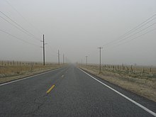
321:, and from there heads east towards Oak City. As the route approaches Oak City, it turns to the north before passing through the town as Main Street. After leaving town, the route gradually turns to the northeast before turning north again to enter the town of Leamington, ending at its intersection with
345:
from Oak City to Delta. In addition, the original portion of the highway from Oak City north to
Lynndyl was rerouted instead to run north to Leamington, some 5.5 miles (8.9 km) to the east, which reflects the current alignment of the route.
205:
664:
341:
in 1931, and renumbered to State Route 125 in 1933. In 1953, the route was extended from its southern terminus in Oak City, taking over the western portion of
483:
188:
607:
510:
66:
559:
31:
659:
342:
198:
193:
210:
632:
579:
535:
641:
Route 125. From route 26 near
Leamington southerly to Oak City thence westerly to route 26 east of Delta.
404:
107:
438:
408:
355:
282:
245:
230:
130:
111:
503:
600:
474:
422:
294:
134:
313:
State Route 125 starts about 3 miles (4.8 km) east of Delta, at the intersection of
278:
17:
653:
334:
266:
153:
305:
564:
412:
322:
318:
286:
115:
314:
290:
270:
43:
304:
482:
274:
163:
277:. Spanning 21.8 miles (35.1 km), it converts the town of
449:
1.000 mi = 1.609 km; 1.000 km = 0.621 mi
470:
465:
627:
625:
530:
528:
173:
159:
149:
144:
121:
93:
88:
80:
72:
59:
39:
635:(1953). "Chapter 45: Designation of State Roads".
538:(1931). "Chapter 55: Designation of State Roads".
337:south to Oak City was originally designated as
554:
552:
8:
84:1931 (as SR-126, renumbered in 1933)–present
498:
496:
484:Template:Attached KML/Utah State Route 125
360:
219:
665:Utah State Routes in Millard County, Utah
588:(125) From Lynndyl southerly to Oak City.
544:(126) From Lynndyl southerly to Oak City.
487:
492:
36:
601:"State Route 135 highway resolutions"
432:
426:
393:
387:
7:
76:21.855 mi (35.172 km)
27:State highway in Utah, United States
504:"State Route 125 Highway reference"
372:
25:
608:Utah Department of Transportation
511:Utah Department of Transportation
433:
399:
394:
240:
225:
125:
102:
97:
42:
32:Utah State Route 125 (1931-1933)
1:
367:
293:to the west, and the town of
30:For the former highway, see
681:
29:
448:
443:
429:
421:
416:
390:
384:
379:
376:
371:
366:
363:
218:
182:Utah State Highway System
178:
169:
140:
64:
55:
488:KML is not from Wikidata
354:The entire route is in
660:State highways in Utah
633:Utah State Legislature
582:(1933). "Chapter 30".
580:Utah State Legislature
560:"Utah State Route 125"
536:Utah State Legislature
310:
18:State Route 125 (Utah)
308:
637:Session Laws of Utah
584:Session Laws of Utah
540:Session Laws of Utah
343:Utah State Route 135
259:Utah State Route 125
350:Major intersections
513:. 29 December 2008
311:
454:
453:
444:Northern terminus
301:Route description
285:with the city of
256:
255:
252:
251:
60:Route information
16:(Redirected from
672:
644:
643:
629:
620:
619:
617:
615:
605:
597:
591:
590:
576:
570:
569:
556:
547:
546:
532:
523:
522:
520:
518:
508:
500:
478:
437:
436:
417:Western terminus
403:
402:
398:
397:
374:
369:
361:
248:
244:
243:
233:
229:
228:
220:
129:
128:
106:
105:
101:
100:
46:
37:
21:
680:
679:
675:
674:
673:
671:
670:
669:
650:
649:
648:
647:
631:
630:
623:
613:
611:
610:. November 2008
603:
599:
598:
594:
578:
577:
573:
558:
557:
550:
534:
533:
526:
516:
514:
506:
502:
501:
494:
489:
486:
481:
480:
479:
463:
459:
450:
434:
400:
395:
352:
339:State Route 126
331:
303:
241:
239:
226:
224:
126:
103:
98:
89:Major junctions
51:
50:
49:State Route 125
47:
35:
28:
23:
22:
15:
12:
11:
5:
678:
676:
668:
667:
662:
652:
651:
646:
645:
621:
592:
571:
548:
524:
491:
490:
462:
461:
460:
458:
455:
452:
451:
446:
445:
442:
431:
428:
425:
419:
418:
415:
392:
389:
386:
382:
381:
378:
375:
370:
365:
356:Millard County
351:
348:
333:The road from
330:
327:
302:
299:
297:to the north.
283:Millard County
254:
253:
250:
249:
236:
234:
216:
215:
214:
213:
208:
203:
201:
196:
191:
185:
184:
176:
175:
174:Highway system
171:
170:
167:
166:
161:
157:
156:
151:
147:
146:
142:
141:
138:
137:
123:
122:North end
119:
118:
95:
94:South end
91:
90:
86:
85:
82:
78:
77:
74:
70:
69:
65:Maintained by
62:
61:
57:
56:
53:
52:
48:
41:
40:
26:
24:
14:
13:
10:
9:
6:
4:
3:
2:
677:
666:
663:
661:
658:
657:
655:
642:
638:
634:
628:
626:
622:
609:
602:
596:
593:
589:
585:
581:
575:
572:
567:
566:
561:
555:
553:
549:
545:
541:
537:
531:
529:
525:
512:
505:
499:
497:
493:
485:
476:
472:
468:
467:
456:
447:
441:(Main Street)
440:
424:
420:
414:
410:
406:
383:
362:
359:
357:
349:
347:
344:
340:
336:
328:
326:
324:
320:
316:
307:
300:
298:
296:
292:
288:
284:
280:
276:
272:
268:
267:state highway
264:
260:
247:
237:
235:
232:
222:
221:
217:
212:
209:
207:
204:
202:
200:
197:
195:
192:
190:
187:
186:
183:
180:
179:
177:
172:
168:
165:
162:
158:
155:
154:United States
152:
148:
143:
139:
136:
132:
124:
120:
117:
113:
109:
96:
92:
87:
83:
79:
75:
71:
68:
63:
58:
54:
45:
38:
33:
19:
640:
636:
612:. Retrieved
595:
587:
583:
574:
563:
543:
539:
515:. Retrieved
464:
377:Destinations
353:
338:
332:
312:
262:
258:
257:
181:
565:Google Maps
654:Categories
457:References
423:Leamington
405:US 50
295:Leamington
271:U.S. state
189:Interstate
135:Leamington
108:US 50
614:26 April
517:26 April
466:KML file
411: –
407: /
364:Location
279:Oak City
145:Location
114:east of
110: /
562:(Map).
385:
335:Lynndyl
329:History
269:in the
265:) is a
150:Country
81:Existed
439:SR-132
430:35.172
427:21.855
409:SR-136
323:SR-132
319:SR-136
309:SR-125
263:SR-125
246:SR-126
231:SR-124
211:Scenic
131:SR-132
112:SR-136
73:Length
604:(PDF)
507:(PDF)
413:Delta
391:0.000
388:0.000
380:Notes
315:US-50
291:US-50
287:Delta
206:Minor
199:State
160:State
133:near
116:Delta
616:2011
519:2011
475:help
471:edit
317:and
289:and
275:Utah
164:Utah
67:UDOT
281:in
273:of
656::
639:.
624:^
606:.
586:.
551:^
542:.
527:^
509:.
495:^
473:•
373:km
368:mi
358:.
325:.
238:→
223:←
194:US
618:.
568:.
521:.
477:)
469:(
261:(
34:.
20:)
Text is available under the Creative Commons Attribution-ShareAlike License. Additional terms may apply.