42:
54:
829:
694:
711:
686:
669:
277:. As of the 2010 census, its population was 243 and it contained 122 housing units. Stockland Township formed as Crab Apple Township in September 1864, but changed its name to Stockland Township on an unknown date.
41:
762:
67:
1012:
1067:
725:
1062:
53:
1205:
1047:
977:
1037:
628:
1072:
1032:
962:
700:
1057:
1017:
1002:
997:
987:
546:
1077:
1042:
1027:
1007:
992:
982:
957:
720:
678:
653:
648:
1052:
972:
967:
336:
300:
601:
1022:
500:
486:
453:
247:
755:
658:
477:
748:
621:
229:
208:
482:
1210:
740:
547:"Population, Housing Units, Area, and Density: 2010 - County -- County Subdivision and Place -- 2010 Census Summary File 1"
614:
121:
550:
606:
772:
266:
126:
1127:
99:
472:
285:
According to the 2010 census, the township has a total area of 53.51 square miles (138.6 km), all land.
1175:
879:
505:
1107:
869:
853:
1137:
522:
294:
1182:
934:
218:
1152:
1092:
929:
904:
330:
1147:
1142:
1132:
1117:
939:
919:
894:
884:
863:
840:
572:
596:
924:
909:
889:
874:
858:
818:
794:
1122:
1112:
914:
848:
813:
1102:
805:
949:
899:
262:
32:
1199:
274:
787:
109:
351:
338:
315:
302:
82:
69:
199:
1166:‡This populated place also has portions in an adjacent county or counties
270:
114:
367:(This list is based on USGS data and may include former settlements.)
828:
225:
204:
637:
Places adjacent to
Stockland Township, Iroquois County, Illinois
744:
610:
827:
501:
United States Census Bureau 2007 TIGER/Line
Shapefiles
1161:
1091:
948:
839:
804:
375:The township contains Sugar Creek Chapel Cemetery.
246:
236:
215:
198:
190:
182:
177:
169:
161:
153:
145:
140:
132:
120:
108:
98:
23:
517:
515:
473:"Stockland Township, Iroquois County, Illinois"
756:
701:Parish Grove Township, Benton County, Indiana
622:
8:
832:Map of Illinois highlighting Iroquois County
763:
749:
741:
629:
615:
607:
402:
20:
541:
539:
487:United States Department of the Interior
523:"Population and Housing Unit Estimates"
511:
245:
235:
197:
176:
168:
139:
131:
97:
62:
38:
1206:Townships in Iroquois County, Illinois
549:. United States Census. Archived from
422:
165:0 sq mi (0 km) 0%
58:Iroquois County's location in Illinois
659:York Township, Benton County, Indiana
454:Illinois' 15th congressional district
214:
189:
181:
160:
157:53.51 sq mi (138.6 km)
152:
149:53.51 sq mi (138.6 km)
144:
119:
107:
50:
7:
644:
478:Geographic Names Information System
18:Township in Illinois, United States
771:Municipalities and communities of
573:"Census of Population and Housing"
412:
14:
709:
692:
684:
667:
52:
40:
483:United States Geological Survey
1:
710:
668:
693:
685:
506:United States National Atlas
379:Airports and landing strips
183: • Estimate
46:Location in Iroquois County
1227:
1171:
825:
785:
774:Iroquois County, Illinois
642:
440:
428:
421:
416:
411:
408:
63:
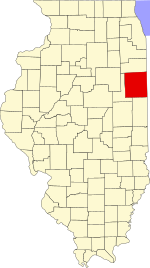
51:
39:
30:
461:State Senate District 53
458:State House District 105
173:666 ft (203 m)
602:Illinois State Archives
352:40.614481°N 87.592803°W
316:40.650314°N 87.600026°W
194:4.5/sq mi (1.7/km)
833:
726:Prairie Green Township
1211:Townships in Illinois
831:
441:U.S. Decennial Census
404:Historical population
357:40.614481; -87.592803
321:40.650314; -87.600026
261:is one of twenty-six
217: • Summer (
83:40.63528°N 87.59361°W
1184:United States portal
553:on February 12, 2020
289:Unincorporated towns
191: • Density
448:Political districts
405:
348: /
312: /
241:60953, 60966, 60967
88:40.63528; -87.59361
79: /
834:
690:Stockland Township
403:
259:Stockland Township
162: • Water
146: • Total
25:Stockland Township
1193:
1192:
738:
737:
733:
732:
445:
444:
256:
255:
154: • Land
1218:
1185:
1178:
830:
797:
790:
780:
775:
765:
758:
751:
742:
721:Lovejoy Township
713:
712:
696:
695:
688:
687:
679:Milford Township
671:
670:
654:Sheldon Township
649:Belmont Township
645:
631:
624:
617:
608:
585:
584:
582:
580:
569:
563:
562:
560:
558:
543:
534:
533:
531:
529:
519:
497:
495:
493:
424:
419:
414:
406:
363:
362:
360:
359:
358:
353:
349:
346:
345:
344:
341:
327:
326:
324:
323:
322:
317:
313:
310:
309:
308:
305:
222:
94:
93:
91:
90:
89:
84:
80:
77:
76:
75:
72:
56:
44:
21:
1226:
1225:
1221:
1220:
1219:
1217:
1216:
1215:
1196:
1195:
1194:
1189:
1183:
1177:Illinois portal
1176:
1167:
1157:
1094:
1087:
944:
835:
823:
800:
795:
788:
781:
778:
773:
769:
739:
734:
697:
638:
635:
593:
588:
578:
576:
571:
570:
566:
556:
554:
545:
544:
537:
527:
525:
521:
520:
513:
491:
489:
471:
468:
450:
417:
401:
391:
384:Wichman Airport
381:
373:
356:
354:
350:
347:
342:
339:
337:
335:
334:
320:
318:
314:
311:
306:
303:
301:
299:
298:
291:
283:
267:Iroquois County
242:
216:
87:
85:
81:
78:
73:
70:
68:
66:
65:
59:
47:
35:
26:
19:
12:
11:
5:
1224:
1222:
1214:
1213:
1208:
1198:
1197:
1191:
1190:
1188:
1187:
1180:
1172:
1169:
1168:
1165:
1163:
1159:
1158:
1156:
1155:
1150:
1145:
1140:
1135:
1130:
1128:Fountain Creek
1125:
1120:
1115:
1110:
1105:
1099:
1097:
1093:Unincorporated
1089:
1088:
1086:
1085:
1080:
1075:
1070:
1065:
1060:
1055:
1050:
1045:
1040:
1035:
1030:
1025:
1020:
1015:
1013:Fountain Creek
1010:
1005:
1000:
995:
990:
985:
980:
975:
970:
965:
960:
954:
952:
946:
945:
943:
942:
937:
932:
927:
922:
917:
912:
907:
902:
897:
892:
887:
882:
877:
872:
867:
861:
856:
851:
845:
843:
837:
836:
826:
824:
822:
821:
816:
810:
808:
802:
801:
786:
783:
782:
770:
768:
767:
760:
753:
745:
736:
735:
731:
730:
728:
723:
717:
716:
714:
707:
704:
703:
698:
683:
681:
675:
674:
672:
665:
662:
661:
656:
651:
643:
640:
639:
636:
634:
633:
626:
619:
611:
605:
604:
599:
592:
591:External links
589:
587:
586:
564:
535:
510:
509:
508:
503:
498:
467:
464:
463:
462:
459:
456:
449:
446:
443:
442:
438:
437:
435:
433:
430:
426:
425:
420:
415:
410:
400:
397:
396:
395:
390:
387:
386:
385:
380:
377:
372:
369:
365:
364:
328:
290:
287:
282:
279:
254:
253:
250:
244:
243:
240:
238:
234:
233:
223:
213:
212:
202:
196:
195:
192:
188:
187:
184:
180:
179:
175:
174:
171:
167:
166:
163:
159:
158:
155:
151:
150:
147:
143:
142:
138:
137:
136:September 1864
134:
130:
129:
124:
118:
117:
112:
106:
105:
102:
96:
95:
61:
60:
57:
49:
48:
45:
37:
36:
31:
28:
27:
24:
17:
13:
10:
9:
6:
4:
3:
2:
1223:
1212:
1209:
1207:
1204:
1203:
1201:
1186:
1181:
1179:
1174:
1173:
1170:
1164:
1160:
1154:
1151:
1149:
1146:
1144:
1141:
1139:
1136:
1134:
1131:
1129:
1126:
1124:
1121:
1119:
1116:
1114:
1111:
1109:
1106:
1104:
1101:
1100:
1098:
1096:
1090:
1084:
1081:
1079:
1076:
1074:
1071:
1069:
1068:Prairie Green
1066:
1064:
1061:
1059:
1056:
1054:
1051:
1049:
1046:
1044:
1041:
1039:
1036:
1034:
1031:
1029:
1026:
1024:
1021:
1019:
1016:
1014:
1011:
1009:
1006:
1004:
1001:
999:
996:
994:
991:
989:
986:
984:
981:
979:
976:
974:
971:
969:
966:
964:
961:
959:
956:
955:
953:
951:
947:
941:
938:
936:
933:
931:
928:
926:
923:
921:
918:
916:
913:
911:
908:
906:
903:
901:
898:
896:
893:
891:
888:
886:
883:
881:
880:Crescent City
878:
876:
873:
871:
868:
865:
862:
860:
857:
855:
852:
850:
847:
846:
844:
842:
838:
820:
817:
815:
812:
811:
809:
807:
803:
799:
798:
791:
784:
779:United States
776:
766:
761:
759:
754:
752:
747:
746:
743:
729:
727:
724:
722:
719:
718:
715:
708:
706:
705:
702:
699:
691:
682:
680:
677:
676:
673:
666:
664:
663:
660:
657:
655:
652:
650:
647:
646:
641:
632:
627:
625:
620:
618:
613:
612:
609:
603:
600:
598:
597:City-Data.com
595:
594:
590:
574:
568:
565:
552:
548:
542:
540:
536:
524:
518:
516:
512:
507:
504:
502:
499:
488:
484:
480:
479:
474:
470:
469:
465:
460:
457:
455:
452:
451:
447:
439:
436:
434:
431:
427:
407:
398:
393:
392:
388:
383:
382:
378:
376:
370:
368:
361:
332:
329:
325:
296:
293:
292:
288:
286:
280:
278:
276:
272:
268:
264:
260:
251:
249:
239:
231:
227:
224:
220:
210:
206:
203:
201:
193:
185:
172:
164:
156:
148:
135:
128:
125:
123:
116:
113:
111:
104:United States
103:
101:
92:
64:Coordinates:
55:
43:
34:
29:
22:
16:
1108:Claytonville
1082:
1063:Pigeon Grove
793:
689:
577:. Retrieved
575:. Census.gov
567:
555:. Retrieved
551:the original
526:. Retrieved
490:. Retrieved
476:
399:Demographics
374:
366:
284:
258:
257:
252:17-075-72773
15:
1095:communities
1048:Milks Grove
978:Beaverville
870:Cissna Park
854:Beaverville
789:County seat
492:January 17,
429:2016 (est.)
394:Dawson Park
355: /
319: /
133:Established
86: /
1200:Categories
1038:Middleport
935:Wellington
466:References
371:Cemeteries
343:87°35′34″W
340:40°36′52″N
307:87°36′00″W
304:40°39′01″N
178:Population
74:87°35′37″W
71:40°38′07″N
1162:Footnotes
1153:Stockland
1083:Stockland
1073:Ridgeland
1033:Martinton
963:Ash Grove
950:Townships
930:Thawville
905:Martinton
389:Landmarks
331:Stockland
281:Geography
263:townships
248:FIPS code
237:ZIP codes
200:Time zone
170:Elevation
1148:Pittwood
1143:La Hogue
1138:L'Erable
1133:Goodwine
1118:Eastburn
1058:Papineau
1018:Iroquois
1003:Danforth
998:Crescent
988:Chebanse
940:Woodland
920:Papineau
895:Iroquois
885:Danforth
864:Chebanse
841:Villages
271:Illinois
127:Iroquois
115:Illinois
33:Township
1078:Sheldon
1043:Milford
1028:Lovejoy
1008:Douglas
993:Concord
983:Belmont
958:Artesia
925:Sheldon
910:Milford
890:Donovan
875:Clifton
859:Buckley
819:Watseka
796:Watseka
579:June 4,
557:May 28,
528:June 9,
100:Country
1123:Effner
1113:Delrey
1053:Onarga
973:Beaver
968:Ashkum
915:Onarga
849:Ashkum
814:Gilman
806:Cities
409:Census
295:Cutmer
122:County
1103:Bryce
226:UTC-5
205:UTC-6
110:State
1023:Loda
900:Loda
581:2016
559:2013
530:2017
494:2010
418:Note
413:Pop.
141:Area
432:232
333:at
297:at
275:USA
265:in
230:CDT
219:DST
209:CST
186:232
1202::
792::
777:,
538:^
514:^
485:,
481:.
475:.
423:%±
273:,
269:,
866:‡
764:e
757:t
750:v
630:e
623:t
616:v
583:.
561:.
532:.
496:.
232:)
228:(
221:)
211:)
207:(
Text is available under the Creative Commons Attribution-ShareAlike License. Additional terms may apply.