69:
81:
295:
1021:
524:
509:
536:
551:
53:
165:
348:
was formed from a section of
Newport Township. Sugarloaf Township was finally formed in 1809 from a portion of Nescopeck; it was named after Sugarloaf Mountain (a cone-shaped mountain in the valley). Sugarloaf originally included what is now
704:
living together, 6.6% had a female householder with no husband present, and 22.7% were non-families. 19.6% of all households were made up of individuals, and 10.1% had someone living alone who was 65 years of age or older.
711:
Within the township, the population was spread out, with 19.9% under the age of 18, 17.3% from 18 to 24, 23.5% from 25 to 44, 25.9% from 45 to 64, and 13.3% who were 65 years of age or older. The median age was 38 years.
68:
1792:
337:. After the skirmish, burial parties arrived in the valley to bury the slain soldiers. Settlers were attracted to the region from the stories they heard from those who visited the valley.
944:
718:
The median income for a household in the township was $ 53,611, and the median income for a family was $ 62,256. Males had a median income of $ 39,911 versus $ 25,234 for females.
340:
It is believed that George
Easterday was the first white settler in what is now Sugarloaf Township. Additional colonists followed in Easterday's footsteps; they were mostly from
80:
1402:
1831:
1237:
470:
350:
392:, the township has a total area of 22.5 square miles (58.2 km), of which 22.5 square miles (58.2 km) is land and 0.07% is water. The township is drained by the
1317:
1307:
482:
19:
1277:
1252:
1367:
1332:
1292:
1282:
1267:
1262:
1327:
1322:
1312:
1297:
1342:
1287:
1272:
1257:
1247:
666:
The population density was 166.6 inhabitants per square mile (64.3/km). There were 1,302 housing units at an average density of 59.4 per square mile (22.9/km).
488:
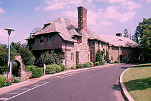
358:
1397:
1382:
1302:
464:
354:
1377:
1337:
1242:
937:
1626:
1445:
246:
1711:
1601:
1430:
52:
930:
1836:
1425:
330:
1621:
1232:
1347:
1049:
749:
476:
345:
341:
197:
113:
922:
1357:
779:
1641:
1352:
674:
334:
303:
1407:
1387:
1362:
850:
678:
442:
430:
426:
326:
1686:
1551:
1154:
954:
541:
403:
279:
118:
1769:
1696:
1636:
1460:
1372:
1194:
1189:
889:
686:
458:
389:
1726:
1721:
1541:
1506:
1495:
1440:
1199:
1179:
1144:
1099:
1079:
1010:
976:
414:
294:
1736:
1706:
1671:
1586:
1536:
1511:
1204:
1184:
1174:
1169:
625:
610:
595:
311:
523:
1691:
1656:
1651:
1521:
1214:
1129:
1124:
1104:
1089:
234:
91:
715:
For every 100 females, there were 105.9 males. For every 100 females age 18 and over, there were 102.8 males.
700:
There were 1,222 households, out of which 30.4% had children under the age of 18 living with them, 67.3% were
508:
445:. Hazleton Area operates public schools, including the Valley Elementary-Middle School in Sugarloaf Township.
1731:
1701:
1681:
1676:
1531:
1500:
1490:
1485:
1450:
1417:
1224:
1139:
1059:
1054:
1000:
496:
418:
43:
1741:
1631:
1616:
1526:
1480:
1475:
1465:
1455:
1159:
1149:
1114:
1094:
1031:
1005:
995:
690:
514:
239:
1606:
1591:
1546:
1209:
1164:
1134:
422:
535:
318:
and the territory that is now the
Conyngham Valley remained virtually unchartered for quite some time.
1776:
1746:
1716:
1666:
1661:
1596:
1556:
1516:
1470:
1119:
1084:
1074:
1069:
1064:
1039:
694:
207:
1646:
1611:
1576:
1566:
1435:
1109:
1044:
987:
682:
670:
446:
58:
399:
322:
307:
863:
376:
were erected between 1815 and 1820 by
Benjamin and George Koening. Stephen Yost built the first
663:
of 2000, there were 3,652 people, 1,222 households, and 944 families residing in the township.
433:
crosses the southeastern corner of
Sugarloaf, where it interchanges with PA 93 in Black Ridge.
298:
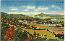
Illustration of
Sugarloaf Township, Conyngham Valley, Luzerne County, between ca. 1930 and 1945
799:
722:
550:
393:
315:
811:
369:
832:
1825:
1581:
729:
283:
106:
969:
728:
Approximately 2.7% of families and 5.6% of the population were living below the
377:
101:
1807:
1794:
373:
188:
732:, including 4.3% of those under age 18 and 13.8% of those age 65 or over.
708:
The average household size was 2.60 and the average family size was 2.98.
449:
is located in the southeastern corner of the township (near Black Ridge).
286:, United States. The population was 3,879 at the time of the 2020 census.
1760:‡This populated place also has portions in an adjacent county or counties
701:
407:
222:
406:
and Butler
Mountains form its southern border. Most of the township is
365:
660:
846:
413:
Its unincorporated communities include Black Ridge, Council Crest,
293:
214:
193:
926:
915:
261:
1019:
396:. The municipality is in Luzerne County's Conyngham Valley.
314:). The first colonists established settlements close to the
885:
18:
321:
The world first heard of the
Conyngham Valley after the
773:
771:
769:
767:
302:
Present-day
Sugarloaf Township was initially part of
73:
Map of Luzerne County highlighting Sugarloaf Township
1755:
1565:
1416:
1223:
1030:
986:
255:
245:
233:
221:
204:
187:
179:
171:
158:
153:
145:
137:
129:
124:
112:
100:
90:
30:
20:Sugarloaf Township, Pennsylvania (disambiguation)
85:Map of Pennsylvania highlighting Luzerne County
938:
669:The racial makeup of the township was 98.03%
8:
780:"City and Town Population Totals: 2020—2021"
278:for short, is a township that is located in
827:
825:
823:
821:
402:forms its natural northern boundary, while
945:
931:
923:
697:of any race were 0.71% of the population.
568:
429:in the northern half of the municipality.
425:serves the township and interchanges with
27:
1832:Townships in Luzerne County, Pennsylvania
741:
254:
244:
220:
186:
152:
123:
89:
65:
49:
25:Township in Pennsylvania, United States
807:
797:
588:
232:
203:
178:
170:
157:
144:
141:22.45 sq mi (58.16 km)
136:
133:22.47 sq mi (58.20 km)
128:
111:
99:
77:
7:
689:, and 0.36% from two or more races.
529:Little Nescopeck Creek in Sugarloaf
149:0.02 sq mi (0.04 km)
953:Municipalities and communities of
864:"Census of Population and Housing"
578:
306:(one of the original townships of
14:
549:
534:
522:
507:
164:
163:
79:
67:
51:
725:for the township was $ 22,444.
441:Sugarloaf Township is part of
1:
853:. Retrieved on July 18, 2016.
851:Hazleton Area School District
752:. United States Census Bureau
495:Sugarloaf Township encircles
443:Hazleton Area School District
325:of 1780 in which roughly ten
956:Luzerne County, Pennsylvania
364:John Cawley built the first
183:180.64/sq mi (69.74/km)
890:United States Census Bureau
750:"2016 U.S. Gazetteer Files"
390:United States Census Bureau
172: • Estimate
1853:
453:Neighboring municipalities
329:were killed by a group of
17:
1837:Townships in Pennsylvania
1765:
1017:
967:
652:
639:
624:
609:
594:
587:
582:
577:
574:
333:and perhaps a handful of
312:Northeastern Pennsylvania
78:
66:
50:
41:
1486:Misericordia University
1024:
515:Little Nescopeck Creek
299:
1808:41.01667°N 76.12639°W
1023:
886:"U.S. Census website"
653:U.S. Decennial Census
570:Historical population
297:
206: • Summer (
1778:United States portal
1426:Beech Mountain Lakes
833:"Sugarloaf Township"
471:Black Creek Township
180: • Density
1813:41.01667; -76.12639
1804: /
1771:Pennsylvania portal
1622:Glen Summit Springs
778:Bureau, US Census.
571:
556:I-80 near Sugarloaf
483:Hollenback Township
447:Penn State Hazleton
372:in 1810. The first
59:Penn State Hazleton
32:Sugarloaf Township,
1050:Bear Creek Village
1025:
810:has generic name (
786:. US Census Bureau
569:
477:Nescopeck Township
400:Nescopeck Mountain
346:Nescopeck Township
342:Northampton County
323:Sugarloaf massacre
300:
272:Sugarloaf Township
159: • Total
146: • Water
130: • Total
1787:
1786:
723:per capita income
657:
656:
497:Conyngham Borough
394:Susquehanna River
388:According to the
316:Susquehanna River
269:
268:
138: • Land
57:"Highacres" (now
1844:
1819:
1818:
1816:
1815:
1814:
1809:
1805:
1802:
1801:
1800:
1797:
1779:
1772:
1642:Huntington Mills
1022:
979:
972:
962:
957:
947:
940:
933:
924:
919:
918:
916:Official website
901:
900:
898:
896:
882:
876:
875:
873:
871:
860:
854:
843:
837:
836:
829:
816:
815:
809:
805:
803:
795:
793:
791:
775:
762:
761:
759:
757:
746:
675:African American
590:
585:
580:
572:
553:
538:
526:
511:
331:Native Americans
304:Newport Township
265:
264:
262:Official website
211:
167:
166:
83:
71:
61:), built in 1924
55:
28:
1852:
1851:
1847:
1846:
1845:
1843:
1842:
1841:
1822:
1821:
1812:
1810:
1806:
1803:
1798:
1795:
1793:
1791:
1790:
1788:
1783:
1777:
1770:
1761:
1751:
1568:
1561:
1412:
1219:
1026:
1020:
1015:
982:
977:
970:
963:
960:
955:
951:
914:
913:
910:
905:
904:
894:
892:
884:
883:
879:
869:
867:
862:
861:
857:
844:
840:
831:
830:
819:
806:
796:
789:
787:
777:
776:
765:
755:
753:
748:
747:
743:
738:
702:married couples
679:Native American
583:
567:
562:
561:
560:
559:
558:
557:
554:
546:
545:
539:
531:
530:
527:
519:
518:
512:
489:Butler Township
455:
439:
386:
370:Nescopeck Creek
292:
260:
259:
229:
205:
86:
74:
62:
46:
37:
35:
34:Luzerne County,
33:
26:
23:
12:
11:
5:
1850:
1848:
1840:
1839:
1834:
1824:
1823:
1785:
1784:
1782:
1781:
1774:
1766:
1763:
1762:
1759:
1757:
1753:
1752:
1750:
1749:
1744:
1739:
1734:
1729:
1724:
1719:
1714:
1709:
1704:
1699:
1694:
1689:
1687:Mountain Grove
1684:
1679:
1674:
1669:
1664:
1659:
1654:
1649:
1644:
1639:
1634:
1629:
1624:
1619:
1614:
1609:
1604:
1599:
1594:
1589:
1584:
1579:
1573:
1571:
1567:Unincorporated
1563:
1562:
1560:
1559:
1554:
1552:West Nanticoke
1549:
1544:
1539:
1534:
1529:
1524:
1519:
1514:
1509:
1504:
1498:
1493:
1488:
1483:
1478:
1473:
1468:
1463:
1458:
1453:
1448:
1443:
1438:
1433:
1428:
1422:
1420:
1414:
1413:
1411:
1410:
1405:
1400:
1395:
1390:
1385:
1380:
1375:
1370:
1365:
1360:
1355:
1350:
1345:
1340:
1335:
1330:
1325:
1320:
1315:
1310:
1305:
1300:
1295:
1290:
1285:
1280:
1275:
1270:
1265:
1260:
1255:
1250:
1245:
1240:
1235:
1229:
1227:
1221:
1220:
1218:
1217:
1212:
1207:
1202:
1197:
1192:
1187:
1182:
1177:
1172:
1167:
1162:
1157:
1155:Penn Lake Park
1152:
1147:
1142:
1137:
1132:
1127:
1122:
1117:
1112:
1107:
1102:
1097:
1092:
1087:
1082:
1077:
1072:
1067:
1062:
1057:
1052:
1047:
1042:
1036:
1034:
1028:
1027:
1018:
1016:
1014:
1013:
1008:
1003:
998:
992:
990:
984:
983:
968:
965:
964:
952:
950:
949:
942:
935:
927:
921:
920:
909:
908:External links
906:
903:
902:
877:
855:
838:
817:
763:
740:
739:
737:
734:
655:
654:
650:
649:
646:
644:
641:
637:
636:
633:
631:
628:
622:
621:
618:
616:
613:
607:
606:
603:
601:
598:
592:
591:
586:
581:
576:
566:
563:
555:
548:
547:
544:near Sugarloaf
540:
533:
532:
528:
521:
520:
513:
506:
505:
504:
503:
502:
501:
493:
492:
486:
480:
474:
468:
465:Hazle Township
462:
454:
451:
438:
435:
385:
382:
291:
288:
280:Luzerne County
267:
266:
257:
253:
252:
249:
243:
242:
237:
231:
230:
227:
225:
219:
218:
212:
202:
201:
191:
185:
184:
181:
177:
176:
173:
169:
168:
160:
156:
155:
151:
150:
147:
143:
142:
139:
135:
134:
131:
127:
126:
122:
121:
116:
110:
109:
104:
98:
97:
94:
88:
87:
84:
76:
75:
72:
64:
63:
56:
48:
47:
42:
39:
38:
31:
24:
13:
10:
9:
6:
4:
3:
2:
1849:
1838:
1835:
1833:
1830:
1829:
1827:
1820:
1817:
1780:
1775:
1773:
1768:
1767:
1764:
1758:
1754:
1748:
1745:
1743:
1740:
1738:
1735:
1733:
1730:
1728:
1725:
1723:
1720:
1718:
1715:
1713:
1710:
1708:
1705:
1703:
1700:
1698:
1697:Port Griffith
1695:
1693:
1690:
1688:
1685:
1683:
1680:
1678:
1675:
1673:
1670:
1668:
1665:
1663:
1660:
1658:
1655:
1653:
1650:
1648:
1645:
1643:
1640:
1638:
1637:Hunlock Creek
1635:
1633:
1630:
1628:
1625:
1623:
1620:
1618:
1615:
1613:
1610:
1608:
1605:
1603:
1600:
1598:
1595:
1593:
1590:
1588:
1585:
1583:
1582:Back Mountain
1580:
1578:
1575:
1574:
1572:
1570:
1564:
1558:
1555:
1553:
1550:
1548:
1545:
1543:
1540:
1538:
1535:
1533:
1530:
1528:
1525:
1523:
1520:
1518:
1515:
1513:
1510:
1508:
1505:
1502:
1499:
1497:
1494:
1492:
1489:
1487:
1484:
1482:
1479:
1477:
1474:
1472:
1469:
1467:
1464:
1462:
1461:Hickory Hills
1459:
1457:
1454:
1452:
1449:
1447:
1444:
1442:
1439:
1437:
1434:
1432:
1429:
1427:
1424:
1423:
1421:
1419:
1415:
1409:
1406:
1404:
1401:
1399:
1396:
1394:
1391:
1389:
1386:
1384:
1381:
1379:
1376:
1374:
1371:
1369:
1366:
1364:
1361:
1359:
1356:
1354:
1351:
1349:
1346:
1344:
1341:
1339:
1336:
1334:
1331:
1329:
1326:
1324:
1321:
1319:
1316:
1314:
1311:
1309:
1306:
1304:
1301:
1299:
1296:
1294:
1291:
1289:
1286:
1284:
1281:
1279:
1276:
1274:
1271:
1269:
1266:
1264:
1261:
1259:
1256:
1254:
1251:
1249:
1246:
1244:
1241:
1239:
1236:
1234:
1231:
1230:
1228:
1226:
1222:
1216:
1213:
1211:
1208:
1206:
1203:
1201:
1198:
1196:
1195:West Pittston
1193:
1191:
1190:West Hazleton
1188:
1186:
1183:
1181:
1178:
1176:
1173:
1171:
1168:
1166:
1163:
1161:
1158:
1156:
1153:
1151:
1148:
1146:
1143:
1141:
1138:
1136:
1133:
1131:
1128:
1126:
1123:
1121:
1118:
1116:
1113:
1111:
1108:
1106:
1103:
1101:
1098:
1096:
1093:
1091:
1088:
1086:
1083:
1081:
1078:
1076:
1073:
1071:
1068:
1066:
1063:
1061:
1058:
1056:
1053:
1051:
1048:
1046:
1043:
1041:
1038:
1037:
1035:
1033:
1029:
1012:
1009:
1007:
1004:
1002:
999:
997:
994:
993:
991:
989:
985:
981:
980:
973:
966:
961:United States
958:
948:
943:
941:
936:
934:
929:
928:
925:
917:
912:
911:
907:
891:
887:
881:
878:
865:
859:
856:
852:
848:
842:
839:
834:
828:
826:
824:
822:
818:
813:
801:
785:
781:
774:
772:
770:
768:
764:
751:
745:
742:
735:
733:
731:
726:
724:
719:
716:
713:
709:
706:
703:
698:
696:
692:
688:
685:, 0.22% from
684:
680:
676:
672:
667:
664:
662:
651:
647:
645:
642:
638:
634:
632:
629:
627:
623:
619:
617:
614:
612:
608:
604:
602:
599:
597:
593:
573:
564:
552:
543:
537:
525:
516:
510:
500:
498:
490:
487:
484:
481:
478:
475:
472:
469:
466:
463:
460:
459:West Hazleton
457:
456:
452:
450:
448:
444:
436:
434:
432:
428:
424:
420:
416:
411:
409:
405:
401:
397:
395:
391:
383:
381:
379:
375:
371:
367:
362:
360:
356:
352:
347:
343:
338:
336:
332:
328:
324:
319:
317:
313:
309:
305:
296:
289:
287:
285:
281:
277:
273:
263:
258:
250:
248:
241:
238:
236:
226:
224:
216:
213:
209:
199:
198:Eastern (EST)
195:
192:
190:
182:
174:
161:
148:
140:
132:
120:
117:
115:
108:
105:
103:
96:United States
95:
93:
82:
70:
60:
54:
45:
40:
29:
21:
16:
1789:
1727:Sybertsville
1722:Sweet Valley
1542:Upper Exeter
1507:Pardeesville
1496:Mountain Top
1441:East Berwick
1403:Wilkes-Barre
1392:
1200:West Wyoming
1180:Swoyersville
1145:New Columbus
1100:Harveys Lake
1080:Edwardsville
1011:Wilkes-Barre
978:Wilkes-Barre
975:
893:. Retrieved
880:
868:. Retrieved
866:. Census.gov
858:
841:
808:|last1=
788:. Retrieved
783:
754:. Retrieved
744:
730:poverty line
727:
720:
717:
714:
710:
707:
699:
668:
665:
658:
565:Demographics
517:in Sugarloaf
494:
440:
415:Sybertsville
412:
398:
387:
363:
339:
320:
301:
284:Pennsylvania
275:
271:
270:
251:42-079-75064
235:Area code(s)
107:Pennsylvania
36:Pennsylvania
15:
1811: /
1737:Wapwallopen
1707:Saint Johns
1672:Milnesville
1627:Harveyville
1587:Beach Haven
1569:communities
1537:Trucksville
1512:Pikes Creek
1238:Black Creek
1205:White Haven
1185:Warrior Run
1175:Sugar Notch
1170:Shickshinny
971:County seat
895:January 31,
687:other races
640:2021 (est.)
479:(northwest)
361:Townships.
351:Black Creek
344:. In 1792,
308:Connecticut
240:570 and 272
1826:Categories
1799:76°07′35″W
1796:41°01′00″N
1692:Old Boston
1657:Korn Krest
1652:Koonsville
1522:Shavertown
1446:Georgetown
1318:Huntington
1308:Hollenback
1233:Bear Creek
1215:Yatesville
1130:Laurel Run
1125:Larksville
1105:Hughestown
1090:Forty Fort
784:Census.gov
756:August 14,
736:References
659:As of the
378:steam mill
374:gristmills
154:Population
1756:Footnotes
1732:Tomhicken
1712:Sandy Run
1702:Rock Glen
1682:Mossville
1677:Moosehead
1602:Cranberry
1532:Silkworth
1501:Nuremberg
1491:Mocanaqua
1451:Glen Lyon
1431:Browntown
1393:Sugarloaf
1348:Nescopeck
1278:Fairmount
1253:Conyngham
1225:Townships
1140:Nescopeck
1060:Courtdale
1055:Conyngham
1001:Nanticoke
847:Locate Us
790:August 4,
437:Education
419:Tomhicken
384:Geography
380:in 1865.
335:loyalists
327:Americans
276:Sugarloaf
247:FIPS code
189:Time zone
1742:Waterton
1632:Humboldt
1617:Ebervale
1527:Sheatown
1481:Lattimer
1476:Inkerman
1466:Hilldale
1456:Harleigh
1368:Plymouth
1358:Pittston
1333:Kingston
1293:Franklin
1283:Fairview
1268:Dorrance
1263:Dennison
1160:Plymouth
1150:Nuangola
1115:Kingston
1095:Freeland
1032:Boroughs
1006:Pittston
996:Hazleton
800:cite web
691:Hispanic
681:, 1.01%
677:, 0.11%
673:, 0.27%
408:farmland
223:ZIP code
44:Township
1607:Drifton
1592:Breslau
1547:Wanamie
1353:Newport
1328:Jenkins
1323:Jackson
1313:Hunlock
1298:Hanover
1210:Wyoming
1165:Pringle
1135:Luzerne
870:June 4,
485:(north)
467:(south)
461:(south)
366:sawmill
290:History
256:Website
119:Luzerne
92:Country
1747:Zenith
1717:Suscon
1667:Lehman
1662:Kunkle
1597:Cambra
1557:Weston
1517:Plains
1471:Hudson
1408:Wright
1388:Slocum
1363:Plains
1343:Lehman
1288:Foster
1273:Exeter
1258:Dallas
1248:Butler
1120:Laflin
1085:Exeter
1075:Duryea
1070:Dupont
1065:Dallas
1040:Ashley
988:Cities
695:Latino
661:census
575:Census
491:(east)
473:(west)
417:, and
359:Butler
357:, and
162:3,879
114:County
1647:Japan
1612:Drums
1577:Alden
1436:Chase
1398:Union
1383:Salem
1303:Hazle
1110:Jeddo
1045:Avoca
683:Asian
671:White
643:3,885
635:−7.9%
630:3,879
620:15.3%
615:4,211
600:3,652
423:PA 93
355:Hazle
274:, or
228:18249
217:(EDT)
215:UTC-4
194:UTC-5
175:3,885
102:State
1418:CDPs
1378:Ross
1373:Rice
1338:Lake
1243:Buck
897:2008
872:2016
812:help
792:2022
758:2017
721:The
648:0.2%
626:2020
611:2010
596:2000
584:Note
579:Pop.
542:I-80
431:I-81
427:I-80
404:Buck
125:Area
849:."
693:or
368:on
310:in
208:DST
1828::
974::
959:,
888:.
820:^
804::
802:}}
798:{{
782:.
766:^
589:%±
499:.
421:.
410:.
353:,
282:,
1503:‡
946:e
939:t
932:v
899:.
874:.
845:"
835:.
814:)
794:.
760:.
605:—
210:)
200:)
196:(
22:.
Text is available under the Creative Commons Attribution-ShareAlike License. Additional terms may apply.