76:
48:
83:
55:
31:
285:. It is a large village site centering on the first half of the Jōmon period and extends over an area of 35,000 square meters. As a result of excavation surveys by the Akita Prefectural Board of Education and the Noshiro City Board of Education since 2003, a number of remains were confirmed. These included the foundations of 44
293:-style dwellings with a length of up to 31 meters, and 109 flask-shaped pits (storage holes) for food storage. Many of the flask-shaped storage holes were two meters deep, and some contained the remnants of discarded shells. Of note was a polished
305:. Some stone fragments of the same type of rock were also found in the vicinity, leading to the speculation that the stone ax was made locally from raw materials obtained by trade with Hokkaido.
312:
and stone weights which were used with fishing nets, as well as numerous examples of Jōmon-period earthenware, including cylindrical pots with evidence that they were used for cooking.
75:
281:
The
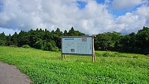
Sugisawadai ruins are located on the north side of the Shinonome Plateau, at an altitude of about 35 meters in the lower Yonedai River area, near the
346:
420:
410:
132:
47:
425:
323:, the Sugisawano ruins, located a short distance to the south, which are not part of the National Historic Site designation.
370:
405:
415:
387:
319:, a portion of the site was occupied by a later village, and there is another extensive ruin from the
327:
250:
270:
218:
298:
262:
120:
254:
196:
258:
106:
399:
320:
316:
286:
282:
366:
334:
309:
297:
from the early Jōmon period which was made of a type of stone found only in the
30:
294:
147:
134:
290:
302:
331:
266:
110:
326:
The site is located approximately a 30-minute walk from
257:
settlement located in what is now part of the city of
207:
202:
192:
187:
179:
171:
163:
126:
116:
102:
240:
234:
8:
16:
308:Other artifacts recovered included a stone
15:
82:
54:
358:
347:List of Historic Sites of Japan (Akita)
7:
14:
253:containing the ruins of a large
81:
74:
53:
46:
29:
271:National Historic Site of Japan
219:National Historic Site of Japan
1:
421:Archaeological sites in Japan
269:. The site was designated a
65:Show map of Akita Prefecture
411:History of Akita Prefecture
371:Agency for Cultural Affairs
241:
442:
388:Noshiro city official site
289:, including 4 large oval
235:
215:
40:
28:
21:
90:Sugisawadai Site (Japan)
426:Historic Sites of Japan
167:35 m (115 ft)
148:40.25194°N 140.05361°E
328:Kita-Noshiro Station
251:archaeological site
153:40.25194; 140.05361
144: /
18:
208:Public access
242:Sugisawadai iseki
230:Sugisawadai ruins
226:
225:
93:Show map of Japan
62:Sugisawadai ruins
35:Sugisawadai ruins
17:Sugisawadai ruins
433:
392:
375:
374:
363:
248:
247:
244:
238:
237:
159:
158:
156:
155:
154:
149:
145:
142:
141:
140:
137:
94:
85:
84:
78:
66:
57:
56:
50:
33:
19:
441:
440:
436:
435:
434:
432:
431:
430:
396:
395:
390:
384:
379:
378:
369:(in Japanese).
365:
364:
360:
355:
343:
279:
245:
232:
222:
221:
152:
150:
146:
143:
138:
135:
133:
131:
130:
98:
97:
96:
95:
92:
91:
88:
87:
86:
69:
68:
67:
64:
63:
60:
59:
58:
36:
24:
12:
11:
5:
439:
437:
429:
428:
423:
418:
416:Noshiro, Akita
413:
408:
398:
397:
394:
393:
383:
382:External links
380:
377:
376:
357:
356:
354:
351:
350:
349:
342:
339:
278:
275:
259:Noshiro, Akita
224:
223:
217:
216:
213:
212:
209:
205:
204:
200:
199:
194:
190:
189:
185:
184:
181:
177:
176:
173:
169:
168:
165:
161:
160:
128:
124:
123:
118:
114:
113:
107:Noshiro, Akita
104:
100:
99:
89:
80:
79:
73:
72:
71:
70:
61:
52:
51:
45:
44:
43:
42:
41:
38:
37:
34:
26:
25:
22:
13:
10:
9:
6:
4:
3:
2:
438:
427:
424:
422:
419:
417:
414:
412:
409:
407:
404:
403:
401:
391:(in Japanese)
389:
386:
385:
381:
372:
368:
362:
359:
352:
348:
345:
344:
340:
338:
336:
333:
329:
324:
322:
318:
313:
311:
306:
304:
300:
299:Hidaka region
296:
292:
288:
287:pit dwellings
284:
276:
274:
272:
268:
264:
263:Tōhoku region
260:
256:
252:
243:
231:
220:
214:
211:No facilities
210:
206:
201:
198:
195:
191:
186:
182:
178:
174:
170:
166:
162:
157:
129:
125:
122:
121:Tōhoku region
119:
115:
112:
108:
105:
101:
77:
49:
39:
32:
27:
20:
406:Jōmon period
361:
325:
321:Yayoi period
317:Heian period
314:
307:
283:Sea of Japan
280:
255:Jōmon period
229:
227:
197:Jōmon period
315:During the
310:sarcophagus
151: /
139:140°03′13″E
127:Coordinates
400:Categories
353:References
203:Site notes
183:3714.79 m2
175:settlement
136:40°15′07″N
335:Gonō Line
291:longhouse
273:in 1981.
341:See also
303:Hokkaido
295:stone ax
277:Overview
164:Altitude
103:Location
367:"杉沢台遺跡"
332:JR East
330:on the
261:in the
193:Periods
188:History
249:is an
117:Region
267:Japan
236:杉沢台遺跡
111:Japan
23:杉沢台遺跡
228:The
180:Area
172:Type
301:of
265:of
402::
337:.
239:,
109:,
373:.
246:)
233:(
Text is available under the Creative Commons Attribution-ShareAlike License. Additional terms may apply.