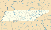
42:
186:
221:
228:
193:
617:
404:. The airport previously had the designation M33 prior to being changed to XNX. The airport was named Sumner County Regional Airport prior to June 2019. This airport is included in the
627:
142:
622:
405:
561:
41:
220:
185:
362:
341:
75:
612:
528:
451:
For the 12-month period ending
December 31, 2017, the airport had 33,750 aircraft operations, an average of 92 per day: 96%
484:
135:
385:
573:
514:
393:
409:
125:
510:
389:
365:
117:
78:
460:
354:
64:
53:
17:
452:
445:
413:
464:
437:
595:
606:
401:
377:
468:
585:
472:
157:
144:
589:
554:
433:
397:
381:
456:
463:. At that time there were 77 aircraft based at this airport: 75% single-
429:
373:
579:
441:
271:
258:
425:
518:. Federal Aviation Administration. Effective May 24, 2018.
618:
Buildings and structures in Sumner County, Tennessee
444:: 17/35 is 6,300 by 100 feet (1,920 x 30 m) with an
538:. Federal Aviation Administration. October 4, 2010.
529:"2011–2015 NPIAS Report, Appendix A (PDF, 2.03 MB)"
424:Music City Executive Airport covers an area of 332
326:
318:
309:
257:
173:
134:
123:
113:
105:
97:
92:
32:
8:
536:National Plan of Integrated Airport Systems
406:National Plan of Integrated Airport Systems
628:Transportation in Sumner County, Tennessee
315:
29:
496:
109:Music City Executive Airport Authority
506:
504:
502:
500:
7:
623:County airports in the United States
27:Airport in Tennessee, United States
25:
372:) is a publicly-owned public-use
226:
219:
207:Location of airport in Tennessee
191:
184:
40:
562:FAA Terminal Procedures for XNX
342:Federal Aviation Administration
104:
18:Sumner County Regional Airport
1:
564:, effective September 5, 2024
511:FAA Airport Form 5010 for XNX
485:List of airports in Tennessee
248:Show map of the United States
580:airport information for KXNX
574:airport information for KXNX
569:Resources for this airport:
351:Music City Executive Airport
34:Music City Executive Airport
596:aeronautical chart for KXNX
227:
192:
644:
436:of 583 feet (179 m) above
386:central business district
338:
314:
278:
275:
270:
266:
178:
48:
39:
408:for 2011 to 2015, which
130:583 ft / 177 m
467:, 12% multi-engine, 8%
420:Facilities and aircraft
613:Airports in Tennessee
210:Show map of Tennessee
158:36.37667°N 86.40861°W
590:live flight tracker
586:airport information
319:Aircraft operations
245:(the United States)
163:36.37667; -86.40861
154: /
118:Gallatin, Tennessee
517:
376:located two
348:
347:
334:
333:
310:Statistics (2012)
305:
304:
16:(Redirected from
635:
558:
557:
555:Official website
540:
539:
533:
525:
519:
513:
508:
453:general aviation
414:general aviation
316:
268:
267:
261:
249:
230:
229:
223:
211:
195:
194:
188:
169:
168:
166:
165:
164:
159:
155:
152:
151:
150:
147:
85:
84:
71:
70:
60:
44:
30:
21:
643:
642:
638:
637:
636:
634:
633:
632:
603:
602:
553:
552:
549:
544:
543:
531:
527:
526:
522:
509:
498:
493:
481:
422:
344:
259:
253:
252:
251:
250:
247:
246:
240:
239:
238:
237:
231:
214:
213:
212:
209:
208:
205:
204:
203:
202:
196:
162:
160:
156:
153:
148:
145:
143:
141:
140:
124:Elevation
88:
82:
74:
68:
63:
52:
35:
28:
23:
22:
15:
12:
11:
5:
641:
639:
631:
630:
625:
620:
615:
605:
604:
601:
600:
599:
598:
592:
582:
576:
567:
565:
559:
548:
547:External links
545:
542:
541:
520:
495:
494:
492:
489:
488:
487:
480:
477:
438:mean sea level
421:
418:
384:) east of the
378:nautical miles
346:
345:
339:
336:
335:
332:
331:
328:
327:Based aircraft
324:
323:
320:
312:
311:
307:
306:
303:
302:
299:
296:
293:
289:
288:
285:
281:
280:
277:
274:
264:
263:
255:
254:
241:
233:
232:
225:
224:
218:
217:
216:
215:
206:
198:
197:
190:
189:
183:
182:
181:
180:
179:
176:
175:
171:
170:
138:
132:
131:
128:
121:
120:
115:
111:
110:
107:
103:
102:
99:
95:
94:
90:
89:
87:
86:
72:
61:
49:
46:
45:
37:
36:
33:
26:
24:
14:
13:
10:
9:
6:
4:
3:
2:
640:
629:
626:
624:
621:
619:
616:
614:
611:
610:
608:
597:
593:
591:
587:
583:
581:
577:
575:
571:
570:
568:
566:
563:
560:
556:
551:
550:
546:
537:
530:
524:
521:
516:
512:
507:
505:
503:
501:
497:
490:
486:
483:
482:
478:
476:
474:
471:, and <1%
470:
466:
462:
459:, and <1%
458:
454:
449:
447:
443:
440:. It has one
439:
435:
431:
427:
419:
417:
415:
411:
407:
403:
402:United States
399:
395:
394:Sumner County
391:
387:
383:
379:
375:
371:
367:
364:
360:
356:
352:
343:
337:
329:
325:
321:
317:
313:
308:
300:
297:
294:
291:
290:
286:
283:
282:
273:
269:
265:
262:
256:
244:
236:
222:
201:
187:
177:
172:
167:
139:
137:
133:
129:
127:
122:
119:
116:
112:
108:
100:
96:
91:
80:
77:
73:
66:
62:
59:
55:
51:
50:
47:
43:
38:
31:
19:
584:FlightAware
535:
523:
450:
423:
392:, a city in
369:
358:
350:
349:
242:
234:
199:
98:Airport type
57:
410:categorized
161: /
149:086°24′31″W
136:Coordinates
607:Categories
594:SkyVector
491:References
473:helicopter
448:pavement.
146:36°22′36″N
434:elevation
416:airport.
398:Tennessee
272:Direction
479:See also
461:military
457:air taxi
432:) at an
412:it as a
390:Gallatin
380:(4
340:Source:
301:Asphalt
279:Surface
578:AirNav
446:asphalt
374:airport
276:Length
260:Runways
93:Summary
465:engine
442:runway
322:33,750
298:1,920
295:6,300
292:17/35
114:Serves
101:Public
532:(PDF)
455:, 4%
428:(134
426:acres
106:Owner
588:and
572:FAA
359:KXNX
355:ICAO
126:AMSL
69:KXNX
65:ICAO
58:none
54:IATA
515:PDF
469:jet
388:of
370:XNX
366:LID
363:FAA
284:ft
243:XNX
235:XNX
200:XNX
174:Map
83:XNX
79:LID
76:FAA
609::
534:.
499:^
475:.
430:ha
400:,
396:,
382:km
368::
361:,
357::
330:59
287:m
81::
67::
56::
353:(
20:)
Text is available under the Creative Commons Attribution-ShareAlike License. Additional terms may apply.


