54:
669:
73:
42:
80:
351:
has part of its land base reservation in
Superior Township, based west of Brimley. It operates two casinos on its reservation, one of which is in Superior Township, to generate funds for education and welfare of its people.
372:, the township has a total area of 104.7 square miles (271.1 km), of which 103.0 square miles (266.7 km) is land and 1.7 square miles (4.4 km), or 1.62%, is water.
104:
1176:
607:
1166:
734:
517:
53:
729:
600:
299:
72:
41:
436:
of 2000, there were 1,329 people, 515 households, and 384 families residing in the township. In 2010, its population then grew to 1,337.
309:
957:
706:
593:
380:
492:
554:
1079:
546:
Michigan Place Names: The
History of the Founding and the Naming of More Than Five Thousand Past and Present Michigan Communities
250:
411:
is an unincorporated community on M-28, about 8 miles (13 km) southwest of
Brimley. The name comes from the acronym of the
1112:
779:
1171:
585:
789:
1089:
794:
724:
158:
877:
759:
749:
460:
369:
521:
1107:
887:
769:
754:
658:
639:
348:
1084:
907:
744:
739:
617:
341:
329:
163:
59:
1059:
764:
688:
398:
287:
136:
480:
1136:
1049:
837:
804:
680:
518:"Geographic Identifiers: 2010 Demographic Profile Data (G001): Superior township, Chippewa County, Michigan"
402:
774:
1039:
922:
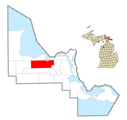
857:
481:
U.S. Geological Survey
Geographic Names Information System: Superior Township, Chippewa County, Michigan
1143:
1069:
1064:
1034:
927:
260:
1074:
982:
977:
942:
932:
882:
847:
827:
817:
376:
1099:
1044:
1019:
1013:
997:
987:
967:
902:
892:
353:
1054:
1024:
992:
972:
952:
937:
912:
897:
862:
852:
842:
812:
550:
393:
1029:
962:
947:
867:
698:
544:
1003:
917:
368:
Superior
Township is located in north of the center of Chippewa County. According to the
1008:
872:
716:
325:
32:
1160:
357:
292:
632:
333:
146:
119:
106:
241:
1127:‡This populated place also has portions in an adjacent county or counties.
379:
is located several miles south of the community of Raco and extends into
337:
275:
151:
668:
433:
580:
267:
246:
650:
589:
667:
520:. U.S. Census Bureau, American Factfinder. Archived from
456:
1122:
1098:
826:
803:
715:
697:
679:
649:
308:
298:
286:
274:
257:
240:
232:
224:
219:
211:
203:
195:
187:
182:
174:
169:
157:
145:
135:
23:
672:Map of Michigan highlighting Chippewa County.svg
601:
549:. Wayne State University Press. p. 463.
356:is also within the township on the shores of
8:
1177:Michigan populated places on Lake Superior
608:
594:
586:
20:
79:
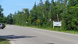
46:Community of Brimley along W. 6 Mile Road
18:Civil township in Michigan, United States
445:
297:
273:
239:
218:
210:
181:
168:
134:
99:
65:
50:
38:
1167:Townships in Chippewa County, Michigan
451:
449:
307:
285:
256:
231:
223:
202:
199:103.0 sq mi (266.7 km)
194:
191:104.7 sq mi (271.1 km)
186:
173:
156:
144:
92:Location within the state of Michigan
7:
405:(CDP) in the north of the township.
616:Municipalities and communities of
340:. The population was 1,276 at the
14:
207:1.7 sq mi (4.4 km)
78:
71:
52:
40:
1:
1113:Sault Ste. Marie Reservation
461:United States Census Bureau
370:United States Census Bureau
25:Superior Township, Michigan
1193:
1108:Bay Mills Indian Community
349:Bay Mills Indian Community
1132:
665:
630:
619:Chippewa County, Michigan
347:The federally recognized
100:
66:
51:
39:
30:
399:unincorporated community
215:810 ft (247 m)
403:census-designated place
175: • Supervisor
1080:Westons Iroquois Beach
673:
543:Romig, Walter (1973).
236:12/sq mi (4.7/km)
1172:Townships in Michigan
671:
493:"Explore Census Data"
457:"U.S. Census website"
259: • Summer (
120:46.37778°N 84.65778°W
1145:United States portal
524:on February 12, 2020
233: • Density
1100:Indian reservations
377:Delirium Wilderness
125:46.37778; -84.65778
116: /
1090:Whitehouse Landing
674:
354:Brimley State Park
225: • Total
204: • Water
188: • Total
1154:
1153:
878:Dollar Settlement
581:Superior Township
322:Superior Township
319:
318:
196: • Land
86:Superior Township
1184:
1146:
1139:
888:Dorgans Crossing
699:Charter township
670:
659:Sault Ste. Marie
642:
641:Sault Ste. Marie
635:
625:
620:
610:
603:
596:
587:
568:
567:
565:
563:
540:
534:
533:
531:
529:
514:
508:
507:
505:
503:
489:
483:
478:
472:
471:
469:
467:
453:
415:ichardson &
381:Kinross Township
264:
178:Richard Phillips
131:
130:
128:
127:
126:
121:
117:
114:
113:
112:
109:
82:
81:
75:
58:Location within
56:
44:
21:
1192:
1191:
1187:
1186:
1185:
1183:
1182:
1181:
1157:
1156:
1155:
1150:
1144:
1138:Michigan portal
1137:
1128:
1118:
1094:
1085:Whitefish Point
908:Eckerman Corner
829:
822:
799:
717:Civil townships
711:
693:
675:
663:
645:
640:
633:
626:
623:
618:
614:
577:
572:
571:
561:
559:
557:
542:
541:
537:
527:
525:
516:
515:
511:
501:
499:
497:data.census.gov
491:
490:
486:
479:
475:
465:
463:
455:
454:
447:
442:
430:
389:
366:
330:Chippewa County
282:
281:49715 (Brimley)
258:
124:
122:
118:
115:
110:
107:
105:
103:
102:
96:
95:
94:
93:
90:
89:
88:
87:
83:
62:
60:Chippewa County
47:
35:
26:
19:
12:
11:
5:
1190:
1188:
1180:
1179:
1174:
1169:
1159:
1158:
1152:
1151:
1149:
1148:
1141:
1133:
1130:
1129:
1126:
1124:
1120:
1119:
1117:
1116:
1110:
1104:
1102:
1096:
1095:
1093:
1092:
1087:
1082:
1077:
1072:
1067:
1062:
1060:Strongs Corner
1057:
1052:
1047:
1042:
1037:
1032:
1027:
1022:
1017:
1011:
1006:
1001:
995:
990:
985:
980:
975:
970:
965:
960:
955:
950:
945:
940:
935:
930:
925:
920:
915:
910:
905:
900:
895:
890:
885:
880:
875:
870:
865:
860:
855:
850:
845:
840:
834:
832:
824:
823:
821:
820:
815:
809:
807:
801:
800:
798:
797:
792:
787:
782:
777:
772:
767:
762:
757:
752:
747:
742:
737:
732:
727:
721:
719:
713:
712:
710:
709:
703:
701:
695:
694:
692:
691:
689:DeTour Village
685:
683:
677:
676:
666:
664:
662:
661:
655:
653:
647:
646:
631:
628:
627:
615:
613:
612:
605:
598:
590:
584:
583:
576:
575:External links
573:
570:
569:
555:
535:
509:
484:
473:
444:
443:
441:
438:
429:
426:
425:
424:
406:
388:
385:
383:to the south.
365:
362:
326:civil township
317:
316:
313:
306:
305:
302:
296:
295:
290:
284:
283:
280:
278:
272:
271:
265:
255:
254:
244:
238:
237:
234:
230:
229:
226:
222:
221:
217:
216:
213:
209:
208:
205:
201:
200:
197:
193:
192:
189:
185:
184:
180:
179:
176:
172:
171:
167:
166:
161:
155:
154:
149:
143:
142:
139:
133:
132:
98:
97:
91:
85:
84:
77:
76:
70:
69:
68:
67:
64:
63:
57:
49:
48:
45:
37:
36:
33:Civil township
31:
28:
27:
24:
17:
13:
10:
9:
6:
4:
3:
2:
1189:
1178:
1175:
1173:
1170:
1168:
1165:
1164:
1162:
1147:
1142:
1140:
1135:
1134:
1131:
1125:
1121:
1114:
1111:
1109:
1106:
1105:
1103:
1101:
1097:
1091:
1088:
1086:
1083:
1081:
1078:
1076:
1073:
1071:
1068:
1066:
1063:
1061:
1058:
1056:
1053:
1051:
1050:Stirlingville
1048:
1046:
1043:
1041:
1038:
1036:
1033:
1031:
1028:
1026:
1023:
1021:
1018:
1015:
1012:
1010:
1007:
1005:
1002:
999:
996:
994:
991:
989:
986:
984:
981:
979:
976:
974:
971:
969:
966:
964:
961:
959:
956:
954:
951:
949:
946:
944:
941:
939:
936:
934:
931:
929:
926:
924:
921:
919:
916:
914:
911:
909:
906:
904:
901:
899:
896:
894:
891:
889:
886:
884:
881:
879:
876:
874:
871:
869:
866:
864:
861:
859:
856:
854:
851:
849:
846:
844:
841:
839:
838:Baie de Wasai
836:
835:
833:
831:
825:
819:
816:
814:
811:
810:
808:
806:
802:
796:
793:
791:
788:
786:
783:
781:
778:
776:
773:
771:
768:
766:
763:
761:
758:
756:
753:
751:
748:
746:
743:
741:
738:
736:
733:
731:
728:
726:
723:
722:
720:
718:
714:
708:
705:
704:
702:
700:
696:
690:
687:
686:
684:
682:
678:
660:
657:
656:
654:
652:
648:
644:
643:
636:
629:
624:United States
621:
611:
606:
604:
599:
597:
592:
591:
588:
582:
579:
578:
574:
558:
556:9780814318386
552:
548:
547:
539:
536:
528:September 26,
523:
519:
513:
510:
498:
494:
488:
485:
482:
477:
474:
462:
458:
452:
450:
446:
439:
437:
435:
427:
422:
418:
414:
410:
407:
404:
400:
396:
395:
391:
390:
386:
384:
382:
378:
373:
371:
363:
361:
359:
358:Lake Superior
355:
350:
345:
343:
339:
335:
331:
327:
323:
314:
311:
303:
301:
294:
291:
289:
279:
277:
269:
266:
262:
252:
251:Eastern (EST)
248:
245:
243:
235:
227:
214:
206:
198:
190:
177:
165:
162:
160:
153:
150:
148:
141:United States
140:
138:
129:
101:Coordinates:
74:
61:
55:
43:
34:
29:
22:
16:
784:
780:Sugar Island
638:
560:. Retrieved
545:
538:
526:. Retrieved
522:the original
512:
500:. Retrieved
496:
487:
476:
464:. Retrieved
431:
428:Demographics
420:
416:
412:
408:
392:
374:
367:
346:
321:
320:
15:
1040:Snug Harbor
923:Gardenville
858:Churchville
830:communities
634:County seat
562:October 25,
466:January 31,
387:Communities
342:2020 census
123: /
1161:Categories
1070:Trout Lake
1065:Timberlost
1035:Shelldrake
928:Goetzville
790:Trout Lake
440:References
432:As of the
334:U.S. state
312:feature ID
220:Population
170:Government
111:84°39′28″W
108:46°22′40″N
1123:Footnotes
1075:Vermilion
983:Oak Ridge
978:Munuscong
943:Johnswood
933:Homestead
883:Donaldson
848:Bay Mills
818:Kincheloe
795:Whitefish
725:Bay Mills
364:Geography
300:FIPS code
288:Area code
242:Time zone
212:Elevation
1045:Stalwart
1020:Rosedale
1014:Rockview
998:Pickford
988:Paradise
968:McCarron
903:Eckerman
893:Drummond
785:Superior
760:Pickford
750:Drummond
735:Chippewa
338:Michigan
304:26-77540
276:ZIP code
164:Chippewa
152:Michigan
1055:Strongs
1025:Rudyard
993:Payment
973:Mission
958:Lincoln
953:Kinross
938:Hulbert
913:Emerson
898:Dryburg
863:Cordell
853:Brassar
843:Barbeau
813:Brimley
770:Rudyard
755:Hulbert
707:Kinross
681:Village
394:Brimley
332:in the
315:1627140
137:Country
1030:Seewhy
963:Maxton
948:Kelden
868:Dafter
745:DeTour
740:Dafter
553:
502:May 2,
434:census
423:mpany.
397:is an
159:County
1004:Raber
918:Fibre
828:Other
765:Raber
730:Bruce
419:very
324:is a
270:(EDT)
268:UTC-4
247:UTC-5
228:1,276
147:State
1009:Raco
873:Dick
805:CDPs
651:City
564:2017
551:ISBN
530:2014
504:2024
468:2008
409:Raco
401:and
375:The
310:GNIS
183:Area
775:Soo
336:of
328:of
293:906
261:DST
1163::
637::
622:,
495:.
459:.
448:^
421:CO
360:.
344:.
1115:‡
1016:‡
1000:‡
609:e
602:t
595:v
566:.
532:.
506:.
470:.
417:A
413:R
263:)
253:)
249:(
Text is available under the Creative Commons Attribution-ShareAlike License. Additional terms may apply.