98:
372:
81:
131:
396:
204:
242:
384:
66:
757:
56:
41:
360:
781:
223:
138:
105:
347:
The tower of the
Protestant Church dates from around 1300 and is much older than and detached from the church. The tower is entirely built in bricks including the spire, and is the only all brick tower in the northern provinces of the Netherlands. The original church was heavily damaged by the
622:
586:
579:
822:
97:
572:
234:
295:
166:
846:
80:
307:
851:
371:
130:
722:
348:
Spanish in the late-16th century. In 1617, a new church was built and replaced in 1734. In 1840, Surhuizum was home to 664 people.
815:
727:
732:
737:
215:
395:
808:
478:
383:
65:
742:
841:
760:
322:
40:
55:
359:
520:
425:
344:
The village was first mentioned in 1224 as
Sutherhusum, and means "houses in the south".
792:
697:
687:
672:
653:
341:. It had a population of around 1300 in 2017. Surhuizum is known for its church tower.
835:
667:
595:
330:
246:
241:
621:
638:
705:
643:
494:
338:
208:
203:
610:
181:
168:
788:
334:
227:
222:
780:
657:
648:
682:
662:
630:
546:
453:
564:
568:
796:
715:
696:
629:
602:
306:
294:
286:
278:
273:
265:
257:
252:
233:
214:
197:
21:
816:
580:
8:
823:
809:
587:
573:
565:
18:
412:
355:
293:
272:
264:
251:
196:
161:
89:
77:
49:
37:
420:
418:
416:
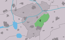
85:Location in Achtkarspelen municipality
305:
285:
277:
256:
232:
213:
7:
777:
775:
426:"Kerncijfers wijken en buurten 2021"
261:14.92 km (5.76 sq mi)
14:
495:"Surhuizum - (geografische naam)"
137:
104:
16:Village in Friesland, Netherlands
779:
756:
755:
620:
394:
382:
370:
358:
240:
221:
202:
136:
129:
103:
96:
79:
64:
54:
39:
460:(in Dutch). Het Waterschapshuis
458:Actueel Hoogtebestand Nederland
1:
847:Populated places in Friesland
795:. You can help Knowledge by
430:Central Bureau of Statistics
117:Location in the Netherlands
868:
774:
852:Friesland geography stubs
751:
618:
454:"Postcodetool for 9283TA"
162:
90:
78:
50:
38:
31:
521:"De toren van Surhuizum"
723:Church of Augustinusga
153:Show map of Netherlands
150:Surhuizum (Netherlands)
791:location article is a
326:
290:85/km (220/sq mi)
728:Church of Buitenpost
603:Administrative centre
120:Show map of Friesland
287: • Density
269:1 m (3 ft)
733:Church of Drogeham
389:View on the village
333:in the province of
178: /
738:Church of Twijzel
329:) is a village in
279: • Total
258: • Total
804:
803:
769:
768:
316:
315:
859:
825:
818:
811:
783:
776:
759:
758:
624:
589:
582:
575:
566:
559:
558:
556:
554:
543:
537:
536:
534:
532:
517:
511:
510:
508:
506:
491:
485:
484:
481:- Achtkarspelen
476:
470:
469:
467:
465:
450:
444:
443:
438:
436:
422:
398:
386:
374:
362:
245:
244:
226:
225:
207:
206:
193:
192:
190:
189:
188:
183:
182:53.200°N 6.183°E
179:
176:
175:
174:
171:
154:
140:
139:
133:
121:
107:
106:
100:
83:
68:
58:
45:Surhuizum Church
43:
19:
867:
866:
862:
861:
860:
858:
857:
856:
832:
831:
830:
829:
772:
770:
765:
747:
711:
692:
625:
616:
598:
593:
563:
562:
552:
550:
545:
544:
540:
530:
528:
519:
518:
514:
504:
502:
493:
492:
488:
482:
477:
473:
463:
461:
452:
451:
447:
434:
432:
424:
423:
414:
409:
402:
399:
390:
387:
378:
375:
366:
363:
354:
302:
239:
220:
201:
186:
184:
180:
177:
172:
169:
167:
165:
164:
158:
157:
156:
155:
152:
151:
148:
147:
146:
145:
141:
124:
123:
122:
119:
118:
115:
114:
113:
112:
108:
86:
74:
73:
72:
71:
62:
61:
46:
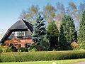
34:
27:
24:
17:
12:
11:
5:
865:
863:
855:
854:
849:
844:
834:
833:
828:
827:
820:
813:
805:
802:
801:
784:
767:
766:
764:
763:
752:
749:
748:
746:
745:
740:
735:
730:
725:
719:
717:
713:
712:
710:
709:
702:
700:
694:
693:
691:
690:
688:Twijzelerheide
685:
680:
675:
673:Surhuisterveen
670:
665:
660:
654:Gerkesklooster
651:
646:
641:
635:
633:
627:
626:
619:
617:
615:
614:
606:
604:
600:
599:
594:
592:
591:
584:
577:
569:
561:
560:
538:
512:
499:Etymologiebank
486:
471:
445:
411:
410:
408:
405:
404:
403:
401:Farm Kortwoude
400:
393:
391:
388:
381:
379:
376:
369:
367:
364:
357:
353:
350:
314:
313:
310:
304:
303:
300:
298:
292:
291:
288:
284:
283:
280:
276:
275:
271:
270:
267:
263:
262:
259:
255:
254:
250:
249:
237:
231:
230:
218:
212:
211:
199:
195:
194:
160:
159:
149:
143:
142:
135:
134:
128:
127:
126:
125:
116:
110:
109:
102:
101:
95:
94:
93:
92:
91:
88:
87:
84:
76:
75:
69:
63:
59:
53:
52:
51:
48:
47:
44:
36:
35:
32:
29:
28:
25:
22:
15:
13:
10:
9:
6:
4:
3:
2:
864:
853:
850:
848:
845:
843:
842:Achtkarspelen
840:
839:
837:
826:
821:
819:
814:
812:
807:
806:
800:
798:
794:
790:
785:
782:
778:
773:
762:
754:
753:
750:
744:
741:
739:
736:
734:
731:
729:
726:
724:
721:
720:
718:
714:
707:
704:
703:
701:
699:
695:
689:
686:
684:
681:
679:
676:
674:
671:
669:
668:Kootstertille
666:
664:
661:
659:
655:
652:
650:
647:
645:
642:
640:
637:
636:
634:
632:
628:
623:
613:
612:
608:
607:
605:
601:
597:
596:Achtkarspelen
590:
585:
583:
578:
576:
571:
570:
567:
548:
542:
539:
526:
522:
516:
513:
500:
496:
490:
487:
480:
475:
472:
459:
455:
449:
446:
442:
431:
427:
421:
419:
417:
413:
406:
397:
392:
385:
380:
377:Former school
373:
368:
365:Former smithy
361:
356:
351:
349:
345:
342:
340:
336:
332:
331:Achtkarspelen
328:
324:
320:
311:
309:
299:
297:
289:
281:
268:
260:
248:
247:Achtkarspelen
243:
238:
236:
229:
224:
219:
217:
210:
205:
200:
191:
187:53.200; 6.183
163:Coordinates:
132:
99:
82:
67:
57:
42:
30:
20:
797:expanding it
786:
771:
677:
639:Augustinusga
609:
551:. Retrieved
541:
529:. Retrieved
525:Ald Surhuzum
524:
515:
503:. Retrieved
498:
489:
474:
462:. Retrieved
457:
448:
440:
433:. Retrieved
429:
346:
343:
323:West Frisian
318:
317:
308:Dialing code
235:Municipality
70:Coat of arms
708:(partially)
644:Boelenslaan
547:"Surhuizum"
441:two entries
339:Netherlands
296:Postal code
209:Netherlands
185: /
836:Categories
611:Buitenpost
549:(in Dutch)
527:(in Dutch)
501:(in Dutch)
483:(in Dutch)
407:References
274:Population
789:Friesland
716:Landmarks
678:Surhuizum
335:Friesland
319:Surhuizum
266:Elevation
228:Friesland
144:Surhuizum
111:Surhuizum
23:Surhuizum
761:Category
743:De Mûnts
706:Kûkherne
658:Stroobos
649:Drogeham
631:Villages
553:29 March
531:29 March
505:29 March
479:Villages
464:29 March
435:29 March
327:Surhuzum
216:Province
26:Surhuzum
698:Hamlets
683:Twijzel
663:Harkema
352:Gallery
198:Country
170:53°12′N
33:Village
337:, the
173:6°11′E
787:This
282:1,275
793:stub
555:2022
533:2022
507:2022
466:2022
437:2022
312:0512
301:9283
253:Area
60:Flag
838::
523:.
497:.
456:.
439:.
428:.
415:^
325::
824:e
817:t
810:v
799:.
656:-
588:e
581:t
574:v
557:.
535:.
509:.
468:.
321:(
Text is available under the Creative Commons Attribution-ShareAlike License. Additional terms may apply.