64:
36:
71:
43:
319:
were conducted by the
Isesaki City Board of Education. These excavations found a warehouse group of 15 cornerstone buildings and more than 40 pit pillar buildings within an area of approximately 60,000 square meters. This facility was used from the second half of the 7th century to the first half of
335:
In the 2005 survey, the foundation stones for a unique octagonal granary was found. This corresponded to a building that was documentation in ancient records and was a rare case where archaeological findings precisely matched ancient records.
291:, known as (郡, gun, kōri), composed of 2–20 townships in 715 AD. Each of the units had an administrative complex built on a semi-standardized layout based on contemporary Chinese design.
63:
120:
345:
433:
423:
35:
320:
the 10th century, and correspond to a government facility for storing grains and other produce received as tax revenues for ancient
438:
315:. It is located on slightly elevated ground near the conjunction of the Wata and Segawa Rivers. From 2002 to 2011, 18
369:
388:
316:
428:
405:
321:
224:
288:
278:
252:
194:
325:
240:
244:
108:
236:
94:
417:
274:
232:
172:
365:
269:
264:
228:
168:
135:
122:
283:
235:
regional administrative complex, located in what is now the city of
248:
98:
287:(provincial capital), and each province was divided into smaller
267:, after the establishment of a centralized government under the
332:, or administrative complex, itself remains undiscovered.
383:Shively, Donald H.; McCullough, William H. (1999).
183:
178:
164:
159:
151:
114:
104:
90:
70:
42:
306:
216:
300:
210:
8:
16:
385:Cambridge History of Japan vol. II (p.31f.)
328:. The exact location of the corresponding
15:
357:
346:List of Historic Sites of Japan (Gunma)
206:Kōzuke Province Sai District Shōsō Site
50:Kōzuke Province Sai District Shōsō Site
17:Kōzuke Province Sai District Shōsō Site
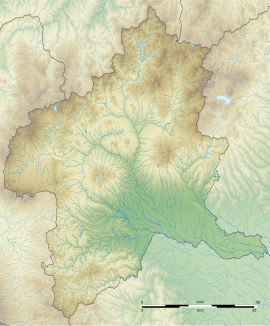
7:
294:The site was formerly known as the
14:
218:Kōzuke no kuni Sai-gun shōsō ato
78:Sai District Shōsō ruins (Japan)
69:
62:
41:
34:
253:National Historic Site of Japan
195:National Historic Site of Japan
1:
434:Archaeological sites in Japan
251:. The site was designated a
53:Show map of Gunma Prefecture
424:History of Gunma Prefecture
370:Agency for Cultural Affairs
307:
217:
455:
406:Isesaki City official site
389:Cambridge University Press
317:archaeological excavations
187:Yes (no public facilities}
301:
281:was standardized under a
211:
191:
28:
21:
289:administrative districts
439:Historic Sites of Japan
277:, local rule over the
136:36.31139°N 139.19667°E
227:with the ruins of a
155:91,072 square meters
225:archaeological site
141:36.31139; 139.19667
132: /
18:
184:Public access
202:
201:
81:Show map of Japan
446:
410:
393:
392:
380:
374:
373:
362:
314:
313:
310:
304:
303:
243:in the northern
241:Gunma Prefecture
222:
220:
214:
213:
147:
146:
144:
143:
142:
137:
133:
130:
129:
128:
125:
82:
73:
72:
66:
54:
45:
44:
38:
19:
454:
453:
449:
448:
447:
445:
444:
443:
414:
413:
408:
402:
397:
396:
382:
381:
377:
368:(in Japanese).
364:
363:
359:
354:
342:
326:Kōzuke Province
311:
298:
261:
208:
198:
197:
140:
138:
134:
131:
126:
123:
121:
119:
118:
86:
85:
84:
83:
80:
79:
76:
75:
74:
57:
56:
55:
52:
51:
48:
47:
46:
24:
12:
11:
5:
452:
450:
442:
441:
436:
431:
429:Isesaki, Gunma
426:
416:
415:
412:
411:
401:
400:External links
398:
395:
394:
375:
356:
355:
353:
350:
349:
348:
341:
338:
308:Sangenya iseki
260:
257:
200:
199:
193:
192:
189:
188:
185:
181:
180:
176:
175:
166:
162:
161:
157:
156:
153:
149:
148:
116:
112:
111:
106:
102:
101:
95:Isesaki, Gunma
92:
88:
87:
77:
68:
67:
61:
60:
59:
58:
49:
40:
39:
33:
32:
31:
30:
29:
26:
25:
22:
13:
10:
9:
6:
4:
3:
2:
451:
440:
437:
435:
432:
430:
427:
425:
422:
421:
419:
409:(in Japanese)
407:
404:
403:
399:
390:
386:
379:
376:
371:
367:
361:
358:
351:
347:
344:
343:
339:
337:
333:
331:
327:
323:
318:
309:
297:
296:Sangenya Site
292:
290:
286:
285:
280:
276:
275:Taika Reforms
272:
271:
266:
258:
256:
254:
250:
246:
242:
238:
234:
230:
226:
219:
207:
196:
190:
186:
182:
177:
174:
170:
167:
163:
158:
154:
150:
145:
117:
113:
110:
107:
103:
100:
96:
93:
89:
65:
37:
27:
20:
384:
378:
360:
334:
329:
322:Sai District
295:
293:
282:
268:
263:In the late
262:
245:Kantō region
233:Heian period
205:
203:
173:Heian period
109:Kantō region
366:"上野国佐位郡正倉跡"
273:system and
265:Nara period
139: /
127:139°11′48″E
115:Coordinates
418:Categories
352:References
179:Site notes
124:36°18′41″N
279:provinces
255:in 2014.
212:上野国佐位郡正倉跡
23:上野国佐位郡正倉跡
340:See also
270:Ritsuryō
259:Overview
91:Location
237:Isesaki
165:Periods
160:History
284:kokufu
223:is an
105:Region
330:kanga
302:三軒屋遺跡
249:Japan
99:Japan
229:Nara
204:The
169:Nara
152:Area
324:in
247:of
231:to
171:to
420::
387:.
305:,
239:,
215:,
97:,
391:.
372:.
312:)
299:(
221:)
209:(
Text is available under the Creative Commons Attribution-ShareAlike License. Additional terms may apply.