611:– Starting from the meeting point of the parishes of St. Peter, St. James and St. Andrew and continuing in an easterly direction to its junction with the public road leading from Rock Hall Plantation to Rock Hall Village: then in a north- westerly direction along this public road to its junction at Rock Hall Tenantry with a track leading to Roebuck Village; then along this track in a generally northerly direction to its junction at Roebuck Village with the unclassified public road leading from Four Hills Plantation to Indian Ground; then continuing in a generally northerly direction along this road to its junction with the public road leading from Orange Hill Plantation to Welchtown Plantation; then continuing in a northerly direction along this road to its junction at Welchtown Plantation with the public road leading from Farley Hill to Portland; then in a north-westerly direction along this road to its junction at Portland with the public road called Highway 1; then in an easterly and northerly direction along Highway 1 to the junction at Diamond Comer with the public road called Highway B; then in a generally easterly direction along Highway B passing through Nicholas and Cherry Tree Hill to the junction of this road with the public road leading to Boscobelle; then in a north-easterly direction along this road to the junction with the private road leading to Fosters Funland; then in a generally easterly direction along this road and along the southern section of the loop at the end; and then continuing in an easterly direction to the sea.
627:– Starting from the meeting point of the parishes of St. James, St. Andrew, and St. Thomas and proceeding along the gully in a south-westerly direction to the centre-line of the bridge at Lancaster where it crosses the public road known as Highway 2A; then in a generally southerly direction to its junction at St. Thomas’ Church with the public road leading from Seaview; then in a westerly direction along the public road to a point marked by a monument (B.8) placed on the southern side of the road; then in a southerly direction along a line joining this point to another monument (B.3) placed on the northern side of an unclassified road leading to Molyneux and to the centre line of the road; then in a westerly and southerly direction along this road to its junction with the public road leading from Bennetts Plantation to Sandy Lane; then in an easterly direction along this road to its junction at Bennetts with the public road called Highway 2A; then in a southerly direction along Highway 2A to its junction at Warrens with the public road called Clermont Road. This is the junction point of the parishes of St. James, St. Thomas, and St. Michael.
619:– Starting from the meeting point of the parishes of St. James, St. Thomas, and St. Michael and proceeding generally westwards along the public road called Clermont Road to its junction with the public road called Husbands Road; then in a southerly direction along this road to its junction with University Drive; then in a westerly and southerly direction along University Drive to the centre of the roundabout at the intersection of this road and Highway 1; then in a north-westerly direction along Highway 1 to a point just south of its junction with an unclassified road called Batt's Rock Road; then from this point in a straight line (bearing 263°07'21") through a monument (B. 18) to the sea.
603:– Starting from the meeting point of the parishes of St. Peter, St. James and St. Andrew; then in a southerly direction along the line joining this point to the centre of the old millwall at Springhead Plantation; then in a straight line to a monument (B.5) at the acute bend in the public road at Gregg Farm: then in a southerly direction along this road to where it crosses the gully (monument (B.6) on the western side of the road): then along this gully to its junction with three other gullies. This is the meeting point of the parishes of St. James, St. Andrew and St. Thomas.
43:
52:
754:
867:
742:
241:
Though the beach area is a haven for wealthy tourists and foreign expatriates, St. James as a whole is far from exclusive. As one of the bigger parishes of
Barbados, it is home to over 20,000 nationals in its various districts, across various social strata. The parish is home to the prestigious
647:
Primary schools are in Fitts
Village (Good Shepherd Primary), Orange Hill (St. Silas Primary), Trents (St. James Primary), West Terrace (West Terrace Primary) and Weston (St. Albans Primary).
677:
785:
251:
201:. Increasingly St. James is becoming known as the playground of the rich and famous, and as a haven for sun-starved tourists with its up-market hotel resorts.
65:
227:(formerly known as Jamestown, named after the King himself); this settlement turned Barbados into what would later be known colloquially as "Little England".
687:
51:
778:
204:
In local colloquium, St. James was known as the "Gold Coast", but due to its ongoing popularity, it is now often referred to as the "
746:
528:
513:
394:
335:
299:
887:
518:
523:
399:
315:
363:
892:
771:
637:
502:
389:
340:
330:
254:(such as the seafront Fitts Village) are abuzz with activity, near-familial camaraderie, and an active social atmosphere.
243:
533:
476:
350:
404:
345:
486:
466:
451:
446:
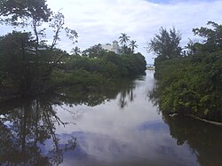
436:
425:
415:
471:
461:
384:
379:
374:
289:
278:
507:
441:
431:
368:
320:
310:
491:
456:
420:
325:
305:
283:
544:
497:
481:
294:
235:
250:, founded over a century ago by British plantation owner Colonel Henry Drax. At its most rural, the parish's many
840:
805:
575:
125:
855:
850:
830:
815:
810:
584:
557:
133:
845:
566:
273:
The parish contains the following towns, villages, localities, settlements, hamlets and neighbourhoods:
263:
42:
835:
825:
794:
190:
33:
238:
and the
Portvale Sugar Factory, one of the few remaining operational sugar factories on the island.
757:
682:
230:
Noted for its shopping and restaurants in
Holetown, Saint James, is central to Barbados' bustling
220:
428:, including Prior Park Gardens, Prior Park Heights, Prior Park Crescent and Prior Park Close
410:
636:
St. James is the home of five primary and two secondary schools. Secondary school are the
753:
716:
216:
205:
881:
538:
663:
215:
The parish also has great historic significance, as it was here that the first
212:, pristine beaches, luxury hotel resorts, and consistently high land prices.
197:("St. James") is an area located in the western central part of the country of
223:, the British claimed Barbados upon landing in St. James' present-day town of
80:
67:
247:
741:
866:
356:
224:
209:
198:
178:
110:
100:
763:
231:
641:
407:, including Baywoods, Endeavour, Deanstown Terrace and Gilkes Village
510:, including Wanstead Gardens, Wanstead Heights and Wanstead Terrace
371:, including Husbands Gardens, Husbands Heights and Husbands Terrace
246:, one of the foremost schools not only in Barbados, but also the
767:
494:
including
Oakwood Park, Kings Village and Thorpes Terrace
208:", reflective of the parish's many glitzy beach-front
717:"Barbados, Chapter 108: Parish Boundaries (1986-18)"
234:
industry, with historical attractions including the
177:
169:
161:
156:
148:
143:
131:
121:
116:
106:
96:
24:
678:"Property in the Caribbean: Welcome to Barbados"
666:, International Organization for Standardization
219:settlers landed in 1625. Under the authority of
56:Map of Barbados showing the Saint James parish
779:
711:
709:
707:
705:
8:
786:
772:
764:
50:
21:
656:
176:
155:
142:
115:
105:
95:
60:
48:
39:
719:. The Barbados Parliament. 1986-10-16
168:
160:
147:
130:
120:
7:
14:
676:Tyzack, Anna (19 February 2010).
360:(1,595), including Jamestown Park
865:
752:
740:
541:, including West Terrace Gardens
41:
642:Fredrick Smith Secondary School
152:31 km (12 sq mi)
552:Parishes bordering Saint James
1:
760:travel guide from Wikivoyage
286:, including Appleby Gardens
909:
261:
862:
801:
173:920/km (2,400/sq mi)
61:
49:
40:
31:
302:including Bagatelle Yard
236:St. James Parish Church
126:Parliamentary democracy
888:Saint James, Barbados
747:Saint James, Barbados
264:Geography of Barbados
893:Parishes of Barbados
795:Parishes of Barbados
749:at Wikimedia Commons
640:in Husbands and the
170: • Density
690:on 22 February 2010
683:The Daily Telegraph
77: /
595:Defined boundaries
529:Water Hall Terrace
514:Warrens Park North
395:Meadowvale Heights
162: • Total
149: • Total
19:Parish in Barbados
16:Parish in Barbados
875:
874:
745:Media related to
617:With St. Michael:
336:Greenwich Village
300:Bagatelle Terrace
187:
186:
122: • Type
81:13.217°N 59.617°W
900:
870:
869:
788:
781:
774:
765:
756:
744:
728:
727:
725:
724:
713:
700:
699:
697:
695:
686:. Archived from
673:
667:
664:iso:code:3166:BB
661:
625:With St. Thomas:
601:With St. Andrew:
519:Warrens Crescent
411:Oxnards Crescent
269:Populated places
92:
91:
89:
88:
87:
82:
78:
75:
74:
73:
70:
54:
45:
22:
908:
907:
903:
902:
901:
899:
898:
897:
878:
877:
876:
871:
864:
860:
797:
792:
737:
732:
731:
722:
720:
715:
714:
703:
693:
691:
675:
674:
670:
662:
658:
653:
638:Queen's College
634:
609:With St. Peter:
597:
554:
549:
524:Warrens Heights
400:Mount Standfast
316:Crystal Heights
271:
266:
260:
244:Queen's College
86:13.217; -59.617
85:
83:
79:
76:
71:
68:
66:
64:
63:
57:
36:
27:
20:
17:
12:
11:
5:
906:
904:
896:
895:
890:
880:
879:
873:
872:
863:
861:
859:
858:
853:
848:
843:
838:
833:
828:
823:
818:
813:
808:
802:
799:
798:
793:
791:
790:
783:
776:
768:
762:
761:
750:
736:
735:External links
733:
730:
729:
701:
668:
655:
654:
652:
649:
633:
630:
629:
628:
621:
620:
613:
612:
605:
604:
596:
593:
592:
591:
582:
573:
564:
553:
550:
548:
547:
542:
536:
531:
526:
521:
516:
511:
505:
500:
495:
489:
484:
479:
474:
469:
464:
459:
454:
449:
444:
439:
434:
429:
423:
418:
413:
408:
402:
397:
392:
387:
382:
377:
372:
366:
364:Hoytes Village
361:
353:
348:
343:
338:
333:
328:
323:
318:
313:
308:
303:
297:
292:
287:
281:
275:
270:
267:
262:Main article:
259:
256:
206:Platinum Coast
185:
184:
181:
175:
174:
171:
167:
166:
163:
159:
158:
154:
153:
150:
146:
145:
141:
140:
137:
129:
128:
123:
119:
118:
114:
113:
108:
104:
103:
98:
94:
93:
59:
58:
55:
47:
46:
38:
37:
32:
29:
28:
25:
18:
15:
13:
10:
9:
6:
4:
3:
2:
905:
894:
891:
889:
886:
885:
883:
868:
857:
854:
852:
849:
847:
844:
842:
841:Saint Michael
839:
837:
834:
832:
829:
827:
824:
822:
819:
817:
814:
812:
809:
807:
806:Christ Church
804:
803:
800:
796:
789:
784:
782:
777:
775:
770:
769:
766:
759:
755:
751:
748:
743:
739:
738:
734:
718:
712:
710:
708:
706:
702:
689:
685:
684:
679:
672:
669:
665:
660:
657:
650:
648:
645:
644:in Holetown.
643:
639:
631:
626:
623:
622:
618:
615:
614:
610:
607:
606:
602:
599:
598:
594:
590:
586:
583:
581:
577:
576:Saint Michael
574:
572:
568:
565:
563:
559:
556:
555:
551:
546:
543:
540:
537:
535:
532:
530:
527:
525:
522:
520:
517:
515:
512:
509:
506:
504:
503:Upper Carlton
501:
499:
496:
493:
490:
488:
485:
483:
480:
478:
475:
473:
470:
468:
465:
463:
460:
458:
455:
453:
450:
448:
445:
443:
440:
438:
435:
433:
430:
427:
424:
422:
419:
417:
414:
412:
409:
406:
403:
401:
398:
396:
393:
391:
390:Lower Carlton
388:
386:
383:
381:
378:
376:
373:
370:
367:
365:
362:
359:
358:
354:
352:
349:
347:
344:
342:
341:Halls Village
339:
337:
334:
332:
331:Fitts Village
329:
327:
324:
322:
319:
317:
314:
312:
309:
307:
304:
301:
298:
296:
293:
291:
288:
285:
282:
280:
277:
276:
274:
268:
265:
257:
255:
253:
249:
245:
239:
237:
233:
228:
226:
222:
218:
213:
211:
207:
202:
200:
196:
192:
182:
180:
179:ISO 3166 code
172:
164:
151:
138:
135:
134:Parliamentary
132: •
127:
124:
112:
109:
102:
99:
90:
62:Coordinates:
53:
44:
35:
30:
23:
856:Saint Thomas
851:Saint Philip
831:Saint Joseph
820:
816:Saint George
811:Saint Andrew
721:. Retrieved
692:. Retrieved
688:the original
681:
671:
659:
646:
635:
624:
616:
608:
600:
588:
585:Saint Thomas
579:
570:
561:
558:Saint Andrew
539:West Terrace
534:Westmoreland
477:Sunset Crest
355:
351:Holders Hill
272:
240:
229:
214:
203:
194:
188:
107:Largest city
846:Saint Peter
821:Saint James
758:Saint James
567:Saint Peter
405:Orange Hill
346:Haynesville
195:Saint James
136: seats
84: /
26:Saint James
882:Categories
836:Saint Lucy
826:Saint John
723:2023-04-04
651:References
487:The Garden
467:Springhead
452:Sandy Lane
447:Rock Dundo
437:Reeds Hill
426:Prior Park
416:Paynes Bay
221:King James
157:Population
117:Government
632:Education
589:Southeast
472:St. Silas
462:Sion Hill
385:Lazaretto
380:Lascelles
375:Lancaster
290:Arch Hall
279:Apes Hill
258:Geography
248:Caribbean
508:Wanstead
442:Ridgeway
432:Prospect
369:Husbands
357:Holetown
321:Derricks
311:Clermont
252:villages
225:Holetown
210:mansions
199:Barbados
111:Holetown
101:Barbados
694:24 June
492:Thorpes
457:Seaview
421:Porters
326:Durants
306:Blowers
284:Appleby
232:tourist
217:British
97:Country
72:59°37′W
69:13°13′N
545:Weston
498:Trents
482:Taitts
295:Bakers
191:parish
165:28,498
34:Parish
580:South
571:North
183:BB-04
696:2010
562:East
189:The
144:Area
193:of
884::
704:^
680:.
587:-
578:-
569:-
560:-
787:e
780:t
773:v
726:.
698:.
139:3
Text is available under the Creative Commons Attribution-ShareAlike License. Additional terms may apply.