51:
1498:
362:
102:
275:
It has an average altitude of 300 meters above sea level. Its landscape is composed of the
Transversal volcanic system, the Balsas depression; Silla, Cruz and Picacho hills; La bolita, Cutzamala, and the Balsas rivers; San Lucas and the Chumbitaro creeks. The climate is tropical, dry steppe, with
287:
The name of San Lucas dates from the colonial era in honor to the San Lucas Virgin. The first
Augustines arrived to evangelize. In 1553, Fray Juan de Moya gathered the natives and founded a new congregation. In 1765 Joseph Marcelino Palomino, a local priest integrated San Lucas to the parish of
267:
The municipality is located at the southeast of the state bordering the
Mexican state of Guerrero. It has a territory of 468.01 km2, which represents the 9% of the state of Michoacán. San Lucas takes part of the San Lucas municipality. The government is constituted by a municipal president, one
1534:
279:
The ecosystem is dominated by tropical thorny forests with huisache, teteche, cardon, amolé, viejito and cueramo. Tropical deciduous includes parota, ceiba, and mesquite dominate the ecosystem.
622:
288:
Cutzio. In 1763 an earthquake affected the church and it was about to fall in pieces. The locals tried to build another one but they could not due to their lack of money.
64:
50:
1559:
1506:
872:
1580:
350:
1519:
328:
852:
1544:
936:
626:
446:
417:
896:
892:
1539:
477:
421:
1442:
1396:
1022:
1392:
401:
1282:
1529:
996:
856:
385:
245:
1157:
706:
1472:
1347:
1042:
702:
607:
577:
1292:
1262:
1002:
1422:
1412:
1252:
1202:
646:
642:
431:
1466:
1452:
1226:
1032:
966:
742:
343:
314:
269:
712:
1367:
1272:
806:
1524:
1307:
1117:
1107:
692:
597:
557:
407:
252:
41:
1416:
1101:
1062:
882:
876:
822:
547:
497:
491:
537:
517:
1402:
1357:
1151:
1081:
1012:
902:
832:
772:
732:
666:
561:
511:
137:
1432:
1196:
986:
672:
1514:
1382:
1331:
1317:
1242:
1236:
1216:
1052:
962:
836:
756:
736:
1406:
926:
842:
766:
501:
1186:
1167:
992:
636:
616:
268:
syndic, and three regidors. Other principal communities include Angao, San Pedro, Tacupa, Riva
Palacio,
232:
211:
1131:
1127:
952:
912:
866:
481:
336:
1549:
1486:
1351:
1026:
906:
812:
802:
686:
601:
527:
461:
457:
221:
1091:
1056:
816:
531:
452:
150:
1141:
932:
1497:
272:
and
Tamarindo. San Lucas’ principal crafts are the production of palm hats, huaraches and more.
726:
1446:
467:
1222:
826:
716:
676:
114:
1286:
471:
1046:
17:
1462:
1327:
1161:
722:
571:
1574:
1554:
1476:
1212:
1121:
1111:
1036:
982:
956:
581:
442:
1266:
1006:
916:
846:
427:
1482:
1426:
1256:
1206:
1192:
1072:
1066:
922:
662:
507:
367:
361:
256:
119:
1456:
1302:
1097:
786:
782:
746:
487:
1311:
1276:
1087:
1077:
1016:
696:
612:
591:
587:
567:
276:
temperatures between 20.2 and 35.3 C. The annual average rainfall is 906.5mm.
79:
66:
1296:
1182:
976:
972:
886:
752:
437:
411:
202:
551:
1361:
1341:
1337:
1232:
862:
776:
656:
652:
541:
521:
397:
1386:
1376:
1372:
1321:
1246:
1176:
1172:
1137:
946:
942:
762:
682:
376:
1436:
796:
792:
632:
249:
107:
228:
207:
332:
1505:
384:
218:
201:
193:
185:
180:
172:
164:
159:
148:
143:
133:
125:
113:
95:
32:
344:
8:
351:
337:
329:
29:
297:
200:
179:
171:
168:468.01 km (180.70 sq mi)
158:
142:
132:
124:
94:
59:
47:
1535:Insurgente José María Morelos y Pavón
217:
192:
184:
163:
147:
112:
7:
309:
307:
305:
303:
301:
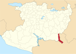
55:Location of San Lucas in Michoacán
25:
315:"Michoacán de Ocampo - San Lucas"
27:Municipality in Michoacán, Mexico
1496:
360:
100:
49:
997:Nuevo San Juan Parangaricutiro
319:Enciclopedia de los Municipios
1:
627:Coalcomán de Vázquez Pallares
623:Coalcomán de Vázquez Pallares
447:Apatzingán de la Constitución
1581:Municipalities of Michoacán
1293:Tiquicheo de Nicolas Romero
1597:
176:300 m (1,000 ft)
1494:
374:
60:
48:
39:
1417:Vista Hermosa de Negrete
432:Angamacutiro de la Unión
18:San Lucas (municipality)
1520:Barranca del Cupatitzio
1467:Zinapécuaro de Figueroa
1227:Tangancícuaro de Arista
1082:Penjamillo de Degollado
1515:Alberca de los Espinos
1217:Santiago Tangamandapio
807:Ixtlán de los Hervores
197:39/km (100/sq mi)
80:18.57694°N 100.78556°W
34:San Lucas Municipality
1197:Tacámbaro de Codallos
1187:Susupuato de Guerrero
1168:Santa Clara del Cobre
993:Nuevo Parangaricutiro
987:Nocupétaro de Morelos
647:Cojumatlán de Régules
643:Cojumatlán de Régules
637:Coeneo de la Libertad
617:Coahuayana de Hidalgo
492:Briseñas de Matamoros
220: • Summer (
1560:Zicuirán-Infiernillo
1237:Tanhuato de Guerrero
907:Los Reyes de Salgado
757:Huaniqueo de Morales
687:Cuitzeo del Porvenir
667:Copándaro de Galeana
602:Churumuco de Morelos
512:Carácuaro de Morelos
194: • Density
85:18.57694; -100.78556
1397:Venustiano Carranza
1393:Venustiano Carranza
1332:Tumbiscatío de Ruiz
1057:Paracho de Verduzco
927:Maravatío de Ocampo
843:José Sixto Verduzco
837:Jiquilpan de Juárez
817:Jacona de Plancarte
502:Buenavista Tomatlán
155:Efraín Serrato Diaz
151:Municipal president
76: /
1142:Sahuayo de Morelos
1102:Purépero de Echaíz
937:San José de Gracia
933:Marcos Castellanos
867:Jungapeo de Juárez
402:Acuitzio del Canje
186: • Total
165: • Total
1568:
1567:
1550:Pico de Tancítaro
1545:Monarch Butterfly
1540:Lago de Camécuaro
1487:Heroica Zitácuaro
1447:Zamora de Hidalgo
390:(municipal seats)
239:
238:
16:(Redirected from
1588:
1530:Cerro de Garnica
1500:
1092:Peribán de Ramos
767:Huetamo de Núñez
677:Cotija de la Paz
453:Aporo, Michoacán
365:
364:
353:
346:
339:
330:
323:
322:
311:
225:
106:
104:
103:
91:
90:
88:
87:
86:
81:
77:
74:
73:
72:
69:
53:
30:
21:
1596:
1595:
1591:
1590:
1589:
1587:
1586:
1585:
1571:
1570:
1569:
1564:
1507:Protected areas
1501:
1492:
897:Lázaro Cárdenas
893:Lázaro Cárdenas
707:Epitacio Huerta
703:Epitacio Huerta
472:Ario de Rosales
389:
387:
380:
370:
359:
357:
327:
326:
321:. INAFED. 2010.
313:
312:
299:
294:
285:
265:
219:
101:
99:
84:
82:
78:
75:
70:
67:
65:
63:
62:
56:
44:
35:
28:
23:
22:
15:
12:
11:
5:
1594:
1592:
1584:
1583:
1573:
1572:
1566:
1565:
1563:
1562:
1557:
1552:
1547:
1542:
1537:
1532:
1527:
1522:
1517:
1511:
1509:
1503:
1502:
1495:
1493:
1491:
1490:
1480:
1470:
1460:
1450:
1440:
1430:
1420:
1410:
1400:
1390:
1380:
1370:
1365:
1355:
1345:
1335:
1325:
1315:
1305:
1300:
1290:
1280:
1270:
1260:
1250:
1240:
1230:
1220:
1210:
1200:
1190:
1180:
1170:
1165:
1162:Santa Ana Maya
1158:Santa Ana Maya
1155:
1145:
1135:
1125:
1115:
1105:
1095:
1085:
1075:
1070:
1060:
1050:
1040:
1030:
1020:
1010:
1000:
990:
980:
970:
960:
950:
940:
930:
920:
910:
900:
890:
880:
870:
860:
850:
840:
830:
820:
810:
800:
790:
780:
770:
760:
750:
740:
730:
723:Gabriel Zamora
720:
710:
700:
690:
680:
670:
660:
650:
640:
630:
620:
610:
608:Ciudad Hidalgo
605:
595:
585:
575:
572:Villa Victoria
565:
555:
545:
535:
525:
515:
505:
495:
485:
475:
465:
455:
450:
440:
435:
425:
422:Álvaro Obregón
418:Álvaro Obregón
415:
405:
394:
392:
386:Municipalities
382:
381:
375:
372:
371:
358:
356:
355:
348:
341:
333:
325:
324:
296:
295:
293:
290:
284:
281:
264:
261:
237:
236:
226:
216:
215:
205:
199:
198:
195:
191:
190:
187:
183:
182:
178:
177:
174:
170:
169:
166:
162:
161:
157:
156:
153:
146:
145:
141:
140:
135:
134:Municipal seat
131:
130:
127:
123:
122:
117:
111:
110:
97:
93:
92:
58:
57:
54:
46:
45:
40:
37:
36:
33:
26:
24:
14:
13:
10:
9:
6:
4:
3:
2:
1593:
1582:
1579:
1578:
1576:
1561:
1558:
1556:
1555:Zacapu Lagoon
1553:
1551:
1548:
1546:
1543:
1541:
1538:
1536:
1533:
1531:
1528:
1526:
1523:
1521:
1518:
1516:
1513:
1512:
1510:
1508:
1504:
1499:
1488:
1484:
1481:
1478:
1477:Ziracuaretiro
1474:
1473:Ziracuaretiro
1471:
1468:
1464:
1461:
1458:
1454:
1451:
1448:
1444:
1441:
1438:
1434:
1431:
1428:
1424:
1421:
1418:
1414:
1413:Vista Hermosa
1411:
1408:
1404:
1401:
1398:
1394:
1391:
1388:
1384:
1381:
1378:
1374:
1371:
1369:
1366:
1363:
1359:
1356:
1353:
1349:
1346:
1343:
1339:
1336:
1333:
1329:
1326:
1323:
1319:
1316:
1313:
1309:
1306:
1304:
1301:
1298:
1294:
1291:
1288:
1284:
1281:
1278:
1274:
1271:
1268:
1264:
1261:
1258:
1254:
1251:
1248:
1244:
1241:
1238:
1234:
1231:
1228:
1224:
1223:Tangancícuaro
1221:
1218:
1214:
1213:Tangamandapio
1211:
1208:
1204:
1201:
1198:
1194:
1191:
1188:
1184:
1181:
1178:
1174:
1171:
1169:
1166:
1163:
1159:
1156:
1153:
1149:
1146:
1143:
1139:
1136:
1133:
1129:
1126:
1123:
1119:
1116:
1113:
1109:
1106:
1103:
1099:
1096:
1093:
1089:
1086:
1083:
1079:
1076:
1074:
1071:
1068:
1064:
1061:
1058:
1054:
1051:
1048:
1044:
1041:
1038:
1034:
1031:
1028:
1024:
1021:
1018:
1014:
1011:
1008:
1004:
1001:
998:
994:
991:
988:
984:
981:
978:
974:
971:
968:
964:
961:
958:
957:Villa Morelos
954:
951:
948:
944:
941:
938:
934:
931:
928:
924:
921:
918:
914:
911:
908:
904:
901:
898:
894:
891:
888:
884:
881:
878:
874:
871:
868:
864:
861:
858:
857:Benito Juárez
854:
851:
848:
844:
841:
838:
834:
831:
828:
827:Villa Jiménez
824:
821:
818:
814:
811:
808:
804:
801:
798:
794:
791:
788:
784:
781:
778:
774:
771:
768:
764:
761:
758:
754:
751:
748:
744:
741:
738:
734:
731:
728:
724:
721:
718:
717:Erongarícuaro
714:
713:Erongarícuaro
711:
708:
704:
701:
698:
694:
691:
688:
684:
681:
678:
674:
671:
668:
664:
661:
658:
654:
651:
648:
644:
641:
638:
634:
631:
628:
624:
621:
618:
614:
611:
609:
606:
603:
599:
596:
593:
589:
586:
583:
579:
576:
573:
569:
566:
563:
559:
556:
553:
549:
546:
543:
539:
536:
533:
529:
526:
523:
519:
516:
513:
509:
506:
503:
499:
496:
493:
489:
486:
483:
479:
476:
473:
469:
466:
463:
459:
456:
454:
451:
448:
444:
441:
439:
436:
433:
429:
426:
423:
419:
416:
413:
409:
406:
403:
399:
396:
395:
393:
391:
383:
378:
373:
369:
363:
354:
349:
347:
342:
340:
335:
334:
331:
320:
316:
310:
308:
306:
304:
302:
298:
291:
289:
282:
280:
277:
273:
271:
262:
260:
258:
254:
251:
247:
243:
234:
230:
227:
223:
213:
209:
206:
204:
196:
188:
175:
167:
154:
152:
149: •
139:
136:
128:
121:
118:
116:
109:
98:
89:
61:Coordinates:
52:
43:
38:
31:
19:
1368:Tzintzuntzan
1267:Tepalcatepec
1263:Tepalcatepec
1147:
1047:Panindícuaro
1043:Panindícuaro
1007:Nuevo Urecho
1003:Nuevo Urecho
967:Nueva Italia
917:Villa Madero
847:Pastor Ortiz
428:Angamacutiro
318:
286:
278:
274:
270:Monte Grande
266:
246:municipality
241:
240:
42:Municipality
1463:Zinapécuaro
1328:Tumbiscatío
1303:Tlalpujahua
787:Indaparapeo
783:Indaparapeo
747:Huandacareo
743:Huandacareo
126:Established
83: /
71:100°47′08″W
1525:Bosencheve
1312:Tlazazalca
1308:Tlazazalca
1287:Tingüindín
1283:Tingüindín
1277:Tingambato
1273:Tingambato
1122:Queréndaro
1118:Queréndaro
1112:Puruándiro
1108:Puruándiro
1078:Penjamillo
1037:Pajacuarán
1033:Pajacuarán
983:Nocupétaro
877:Lagunillas
873:Lagunillas
737:La Huacana
733:La Huacana
697:Ecuandureo
693:Ecuandureo
613:Coahuayana
592:Churintzio
588:Churintzio
582:Chucándiro
578:Chucándiro
568:Chinicuila
498:Buenavista
443:Apatzingán
292:References
181:Population
144:Government
68:18°34′37″N
1483:Zitácuaro
1427:Yurécuaro
1423:Yurécuaro
1297:Tiquicheo
1257:Tarímbaro
1253:Tarímbaro
1207:Tancítaro
1203:Tancítaro
1193:Tacámbaro
1183:Susupuato
1152:San Lucas
1148:San Lucas
1073:Pátzcuaro
1067:Parácuaro
1063:Parácuaro
977:Nahuatzen
973:Nahuatzen
923:Maravatío
903:Los Reyes
887:La Piedad
883:La Piedad
833:Jiquilpan
753:Huaniqueo
727:Lombardía
663:Copándaro
598:Churumuco
562:Chilchota
558:Chilchota
508:Carácuaro
438:Angangueo
412:Aguililla
408:Aguililla
379:(capital)
368:Michoacán
366:State of
263:Geography
257:Michoacán
242:San Lucas
203:Time zone
173:Elevation
138:San Lucas
120:Michoacán
1575:Category
1457:Zináparo
1453:Zináparo
1407:Villamar
1403:Villamar
1362:Tuzantla
1358:Tuzantla
1342:Turicato
1338:Turicato
1233:Tanhuato
1098:Purépero
863:Jungapeo
777:Huiramba
773:Huiramba
657:Contepec
653:Contepec
542:Chavinda
538:Chavinda
522:Charapan
518:Charapan
488:Briseñas
398:Acuitzio
1387:Uruapan
1383:Uruapan
1377:Tzitzio
1373:Tzitzio
1322:Tocumbo
1318:Tocumbo
1247:Taretan
1243:Taretan
1177:Senguio
1173:Senguio
1138:Sahuayo
1132:Quiroga
1128:Quiroga
1088:Peribán
1053:Paracho
1017:Numarán
1013:Numarán
953:Morelos
947:Morelia
943:Morelia
823:Jiménez
763:Huetamo
683:Cuitzeo
482:Arteaga
478:Arteaga
377:Morelia
283:History
250:Mexican
248:in the
96:Country
1443:Zamora
1437:Zacapu
1433:Zacapu
1352:Tuxpan
1348:Tuxpan
1027:Ocampo
1023:Ocampo
963:Múgica
913:Madero
853:Juárez
813:Jacona
803:Ixtlán
797:Irimbo
793:Irimbo
673:Cotija
633:Coeneo
552:Cherán
548:Cherán
462:Aquila
458:Aquila
189:18,461
108:Mexico
105:
532:Charo
528:Charo
253:state
244:is a
229:UTC-5
208:UTC-6
115:State
468:Ario
160:Area
129:1927
388:and
255:of
233:CDT
222:DST
212:CST
1577::
317:.
300:^
259:.
1489:)
1485:(
1479:)
1475:(
1469:)
1465:(
1459:)
1455:(
1449:)
1445:(
1439:)
1435:(
1429:)
1425:(
1419:)
1415:(
1409:)
1405:(
1399:)
1395:(
1389:)
1385:(
1379:)
1375:(
1364:)
1360:(
1354:)
1350:(
1344:)
1340:(
1334:)
1330:(
1324:)
1320:(
1314:)
1310:(
1299:)
1295:(
1289:)
1285:(
1279:)
1275:(
1269:)
1265:(
1259:)
1255:(
1249:)
1245:(
1239:)
1235:(
1229:)
1225:(
1219:)
1215:(
1209:)
1205:(
1199:)
1195:(
1189:)
1185:(
1179:)
1175:(
1164:)
1160:(
1154:)
1150:(
1144:)
1140:(
1134:)
1130:(
1124:)
1120:(
1114:)
1110:(
1104:)
1100:(
1094:)
1090:(
1084:)
1080:(
1069:)
1065:(
1059:)
1055:(
1049:)
1045:(
1039:)
1035:(
1029:)
1025:(
1019:)
1015:(
1009:)
1005:(
999:)
995:(
989:)
985:(
979:)
975:(
969:)
965:(
959:)
955:(
949:)
945:(
939:)
935:(
929:)
925:(
919:)
915:(
909:)
905:(
899:)
895:(
889:)
885:(
879:)
875:(
869:)
865:(
859:)
855:(
849:)
845:(
839:)
835:(
829:)
825:(
819:)
815:(
809:)
805:(
799:)
795:(
789:)
785:(
779:)
775:(
769:)
765:(
759:)
755:(
749:)
745:(
739:)
735:(
729:)
725:(
719:)
715:(
709:)
705:(
699:)
695:(
689:)
685:(
679:)
675:(
669:)
665:(
659:)
655:(
649:)
645:(
639:)
635:(
629:)
625:(
619:)
615:(
604:)
600:(
594:)
590:(
584:)
580:(
574:)
570:(
564:)
560:(
554:)
550:(
544:)
540:(
534:)
530:(
524:)
520:(
514:)
510:(
504:)
500:(
494:)
490:(
484:)
480:(
474:)
470:(
464:)
460:(
449:)
445:(
434:)
430:(
424:)
420:(
414:)
410:(
404:)
400:(
352:e
345:t
338:v
235:)
231:(
224:)
214:)
210:(
20:)
Text is available under the Creative Commons Attribution-ShareAlike License. Additional terms may apply.