110:
117:
33:
26:
362:
259:
Georgen. In addition, a smaller mining field existed close to
Bollschweiler (Kuckucksbad). Here, mining was shut down in 1939 however, because the iron ore contained only 20-30 % of iron and was therefore not worth mining. In 1942 mining was already ceased, because, in addition to the low iron content, the course of war led to an increased availability of iron ore from France (
347:
A memorial cross on the Schönberg above
Leutenberg and Ebringen commemorates the battle of Freiburg on 3 August 1644. The cross replaced the ossuary, where the bones of the fallen soldiers were buried thirty years after the battle. The mass grave became a place of pilgrimage, much to the displeasure
258:
Most of the mining took place in two different areas:The northern pit, located in Sankt
Georgen (a district of Freiburg) and a southern pit in the Ebringen district, from which smaller amount of ore was extracted. Ore from the southern pit was transported via cableway to the loading station in Sankt
339:
had lost on 27 July to
Bavarian troops after several weeks of siege. The French managed to conquer the district of Bohl on the western slopes of the Schönberg, although with heavy losses. The Bavarian troops retreated over the Schönberg into fortified positions on the Lorettoberg and were thus able
312:, that has now been demolished. Other prominent sights are the upper Schönberger Hof, a farm on the southern slope of the mountain, and the lower Schönberger Hof, a restaurant with a view of the city of Freiburg. The old castle ruin of Schneeburg is located on a western subsummit of the Schönberg.
237:
The lower areas on the western slope are covered by thick layers of loess. The eastern slope of the Schönberg falls steeply towards a valley called the
Hexental. At the foot of the eastern slope, the Kapuzinerbuck (a mountain named after the Friars Minor Capuchin) is evidence of major landslides.
343:
France sustained heavy losses during the Battle of
Freiburg: 1100 soldiers died conquering the district of Bohl, whereas Bavaria only lost 300 men. During the battle the suburbs of Freiburg were destroyed and the villages around the Schönberg were sacked and thereby severely damaged.
348:
of the church. Bones were often stolen as they were venerated as relics. The church could not prevent further pilgrimages so
Ildefons of Arx ordered the remaining bones to be taken away in 1791, which meant the end of the pilgrimages over the next few decades.
246:
Trying to achieve autarky, the Third Reich intensified iron ore mining in 1935 which is why the deeper layers of the mountain are well explored today. In close proximity to the town center of
Ebringen, two derricks had been erected, which were operating all
275:
Between 1700 and 1900 the standard German name of the mountain - "Schönberg" - progressively replaced the
Allemann or Middle High German name "Schirnberg" or "Schimberg" for official purposes. Schönberg is an etymological wrong transcription of the dialect
229:
This includes a small tuff vent on the southern slope close to the chapel of
Berghausen and a bigger vent on the northern slope close to the restaurant Schönberger Hof. Along the south east slope, to the west of the former clay pit is a 100 m long basalt
206:
and the Rhine plain, the Schönberg forms the third prominent area of land around Freiburg, the foothills of the Black Forest. To the east, the Schönberg is separated from the Black Forest by a valley called the Hexental, to the south by the Staufen
451:
tree, that was not cleared and thus spread rapidly. Since the mid-twentieth century the forest has been on the advance and it requires regular care to prevent a forestation of the edge of the meadows. A diploma thesis found that in the early 18th
488:, also called geophytes, grow between the vines. Firmly rooted in the ground they survive the intense cultivation of the vineyard. They are largely of Mediterranean origin. Special mention should be made of the very common
542:
293:
It can be assumed that people started visiting the Schönberg 160,000 years ago. Two sites at Bollschweil and Ehrenstetten are 100,000 years old. Bones of mammoths, wild cattle and
66:
711:
226:. Due to geological disturbance and rift valleys the surface provides evidence from all periods of the Mesozoic era, as well as signs of volcanic activity of the tertiary era.
464:
Vineyards are grown on the western and southern slopes and sporadically even on the southeast slopes. In these altitudes a number of short-living plant species, so-called
109:
218:
Together with the Hohfirst (493.6 meters) in the south and the Ölberg (416.4 meters), which is the southernmost spur, the mountain forms the Schönbergmassiv (Schönberg
365:
Different stages of forestation on the Schönberg in the 20th century. Dark green: Forest around 1900; light green: Increase of forests until 2000. Scale: 2km to 1.5km.
308:, a regional public broadcasting cooperation from the southwest of Germany. This 58 meter high steel lattice mast, built in 2012, was erected next to an old
335:, directly opposite the eastern slope of the Schönberg. France's main goal was to regain control over the city of Freiburg, which the allied troops of
267:(a method used in steel production) for the metallurgy of acid iron ore. This method made the supply of calcareous ore from the Schönberg unnecessary.
392:
grow in the deep and damp soil and form a dense canopy . For this reason, low shrubbery is almost entirely absent and only shade tolerant plants like
385:, but due to the many different types of soil and the local climate there are many different forest communities, as well as monocultures.
284:) or from the Middle High German scina/schine relating to the flattened shape. It has nothing to do with the word "schön" = "pretty".
668:
617:
456:
the local people cultivated the soil of the upper and lower plateaus, although these plateaus were forest regions at that time.
297:
were found here. Evidence of hand axes and spearheads indicates that permanent settlement of the Schönberg began at that time.
187:
183:
643:
539:
59:
500:. Since the end of the seventies the flora has been pushed back by lawn thatch, which is frequently used for mulching.
472:
per year and thus survive even frequent weed control as an entire species. Amongst the most well known species are the
696:
469:
280:
The word "schin" either derives from the Middle High German word "schin = "shine, visible from a distance" (engl.
612:
Ebringen, Herrschaft und Gemeinde, Bd. 1, Clausdieter Schott und Edmund Weeger (Hrsg.), Rombach-Verlag Freiburg,
531:
440:
grow here. Oak and hornbeam forests grow in some places. Ash-alder communities dominate the headwater regions.
191:
263:) and Sweden.The main reason for the cessation, however, might have been caused by the intensified use of the
32:
301:
381:
of the actual mountain are covered with forest. The dominant tree of this mixed deciduous forest is the
369:
The higher mountain slopes of the Schönberg are not suitable for farming, but they are used either for
264:
691:
421:
328:
151:
129:
323:
On the third of August 1644 the western slope of the Schönberg was the site of the first day of the
437:
25:
433:
324:
309:
361:
305:
664:
613:
497:
443:
It can be assumed that in earlier centuries, when the forests were used as grazing lands, the
294:
223:
212:
492:
and wild garlic, from which this community of herbs derives its name. Less frequent are the
481:
179:
535:
473:
405:
401:
382:
592:
447:
was less prominent than it is today. Evidence of this is the striking frequency of the
315:
The Jesuit castle at Merzhausen (northern district of Freiburg) is also worth visiting.
409:
300:
The main neolithic settlement was located on top of the mountain, where there is now a
252:
705:
493:
444:
340:
to successfully hold the mountain and the city of Freiburg against the French enemy.
331:. Fighting between Bavarian and French troops continued on the 5 and 9 August on the
686:
681:
465:
370:
203:
170:
The mountain belongs to Ebringen but the slopes also form part of the districts of
429:
336:
332:
171:
404:
grow there. The major part of the forest stands on dry and nutrient-poor soil.
417:
389:
175:
555:
Ebringer Dorfgeschichte Nr. 2. Ebringen unterm Hakenkreuz. Zeitzeugenberichte
373:
or grazing. 9.4 km of the Schönberg massif (which is in total 24 km
211:
to the north the Bay of Freiburg (Freiburger Bucht) and to the west lies the
81:
68:
155:
567:
509:
260:
159:
661:
Der Schönberg – Natur- und Kulturgeschichte eines Schwarzwald-Vorberges
489:
393:
133:
663:, 472 S., 48 Farbtafeln und 200 sw-Abb. Lavori-Verlag, Freiburg 2006,
150:(earlier known as Schirnberg) is located on the southern outskirts of
528:
477:
413:
219:
49:
448:
425:
360:
629:
Mitteilungsblatt der Gemeinde Ebringen KW 44 vom 2. November 2012
222:), a promontory of the Black Forest, which itself is part of the
485:
397:
231:
215:. The area thus enclosed is 8 km long and 4 km wide.
568:"Connection from the pitch in the South to the loading place"
31:
162:(a prominent mountain) of the municipality of Ebringen.
644:
badische-zeitung.de, Lokales, Ebringen, 3. Februar 2012
420:
are to be found here. In addition, pinnate coralroot,
553:
Arbeitsgemeinschaft Ebringer Dorfgeschichte (Hrsg.):
468:, dominate. They are able to produce three to four
97:
58:
48:
43:
30:Aerial view of Schoenberg, looking from the north
18:
158:the
8:
116:
15:
712:Mountains and hills of Baden-Württemberg
687:Schönberg zwischen Hexental und Rheintal
521:
682:Eisenerzbergbau am Schönberg 1937–1942
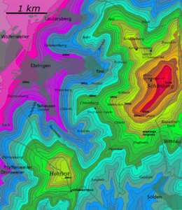
38:Contour map of the Schönberg, 10m-gaps
251:Water from the local creek served as
7:
416:, as well as the non-local conifer
14:
115:
108:
24:
640:Gemeinde verdankt dem Wald viel
593:"Iron ore mine of St. Georgen"
1:
327:, that took place during the
540:Bundesamtes für Naturschutz
728:
154:and at 644.9 meters above
54:645 m (2,116 ft)
697:Waldohreulen am Schönberg
557:, Ebringen 2008, S. 59 f.
438:red and white helleborine
102:
23:
194:(a suburb of Freiburg).
494:hairy star of Bethlehem
659:Helge Körner (Hrsg.):
394:enchanter's-nightshade
366:
286:
36:
364:
319:Historical background
278:
35:
265:Paschke-Peetz-Method
152:Freiburg im Breisgau
123:Schönberg (Ebringen)
82:47.95472°N 7.80556°E
19:Schönberg (Ebringen)
388:Mainly beeches and
78: /
692:Käfer am Schönberg
646:(19. Februar 2012)
534:2012-12-19 at the
434:bird's-nest orchid
367:
325:Battle of Freiburg
310:transmission tower
202:Together with the
44:Highest point
37:
377:) and 3.4 km
329:Thirty Years' War
295:woolly rhinoceros
224:Upper Rhine Plain
144:
143:
130:Baden-Württemberg
87:47.95472; 7.80556
719:
647:
636:
630:
627:
621:
610:
604:
603:
601:
599:
589:
583:
582:
580:
578:
564:
558:
551:
545:
526:
482:birdeye speedway
119:
118:
112:
93:
92:
90:
89:
88:
83:
79:
76:
75:
74:
71:
28:
16:
727:
726:
722:
721:
720:
718:
717:
716:
702:
701:
678:
656:
651:
650:
638:Silvia Faller:
637:
633:
628:
624:
611:
607:
597:
595:
591:
590:
586:
576:
574:
566:
565:
561:
552:
548:
536:Wayback Machine
527:
523:
518:
506:
484:. Furthermore,
462:
359:
354:
321:
291:
273:
244:
200:
168:
140:
139:
138:
137:
136:
127:
126:
125:
124:
120:
86:
84:
80:
77:
72:
69:
67:
65:
64:
39:
12:
11:
5:
725:
723:
715:
714:
704:
703:
700:
699:
694:
689:
684:
677:
676:External links
674:
673:
672:
655:
652:
649:
648:
631:
622:
605:
584:
559:
546:
520:
519:
517:
514:
513:
512:
505:
502:
496:and the local
490:grape hyacinth
461:
458:
432:, for example
358:
355:
353:
350:
320:
317:
290:
287:
272:
269:
253:drilling fluid
243:
240:
199:
196:
167:
164:
142:
141:
128:
122:
121:
114:
113:
107:
106:
105:
104:
103:
100:
99:
95:
94:
62:
56:
55:
52:
46:
45:
41:
40:
29:
21:
20:
13:
10:
9:
6:
4:
3:
2:
724:
713:
710:
709:
707:
698:
695:
693:
690:
688:
685:
683:
680:
679:
675:
670:
669:3-935737-53-X
666:
662:
658:
657:
653:
645:
641:
635:
632:
626:
623:
619:
618:3-9802758-0-9
615:
609:
606:
594:
588:
585:
573:
569:
563:
560:
556:
550:
547:
544:
541:
537:
533:
530:
529:Kartendienste
525:
522:
515:
511:
508:
507:
503:
501:
499:
495:
491:
487:
483:
479:
475:
471:
467:
466:annual plants
459:
457:
455:
450:
446:
445:woodland edge
441:
439:
435:
431:
427:
424:, as well as
423:
422:dog's mercury
419:
415:
411:
407:
403:
399:
395:
391:
386:
384:
380:
376:
372:
363:
356:
351:
349:
345:
341:
338:
334:
330:
326:
318:
316:
313:
311:
307:
303:
298:
296:
288:
285:
283:
277:
270:
268:
266:
262:
256:
254:
250:
241:
239:
235:
233:
227:
225:
221:
216:
214:
210:
205:
197:
195:
193:
192:Sankt Georgen
189:
185:
181:
177:
173:
165:
163:
161:
157:
153:
149:
135:
131:
111:
101:
96:
91:
63:
61:
57:
53:
51:
47:
42:
34:
27:
22:
17:
660:
639:
634:
625:
608:
596:. Retrieved
587:
575:. Retrieved
571:
562:
554:
549:
524:
478:dead-nettles
463:
453:
442:
428:and various
387:
383:common beech
378:
374:
371:silviculture
368:
346:
342:
322:
314:
299:
292:
281:
279:
274:
257:
248:
245:
236:
228:
217:
208:
204:Black Forest
201:
169:
166:Municipality
147:
145:
486:bulb plants
470:generations
460:Viticulture
410:field maple
406:Durmast oak
390:silver firs
337:Saxe-Weimar
333:Lorettoberg
302:radio tower
213:Rhine Plain
172:Schallstadt
85: /
60:Coordinates
654:Literature
543:(Hinweise)
516:References
498:wild tulip
418:scots pine
289:Settlement
176:Merzhausen
70:47°57′17″N
572:kartan.de
414:whitebeam
271:Etymology
156:sea level
148:Schönberg
98:Geography
73:7°48′20″E
50:Elevation
706:Category
620:, S. 364
532:Archived
510:Jennetal
474:cickweed
402:woodruff
276:variant.
261:Lorraine
160:Hausberg
504:Valleys
452:century
430:orchids
304:of the
198:Geology
184:Wittnau
134:Germany
667:
616:
598:13 May
577:13 May
357:Forest
242:Mining
220:massif
190:, and
188:Sölden
449:holly
426:carex
352:Flora
282:shine
207:Basin
665:ISBN
642:In:
614:ISBN
600:2010
579:2010
538:des
480:and
436:and
412:and
400:and
398:arum
232:Lode
146:The
306:SWR
247:day
708::
570:.
476:,
408:,
396:,
255:.
234:.
186:,
182:,
180:Au
178:,
174:,
132:,
671:.
602:.
581:.
454:,
379:²
375:²
249:.
209:,
Text is available under the Creative Commons Attribution-ShareAlike License. Additional terms may apply.