915:
42:
57:
77:
110:
117:
84:
559:
570:
629:
In the township the population was spread out, with 30.6% under the age of 18, 8.3% from 18 to 24, 28.3% from 25 to 44, 23.5% from 45 to 64, and 9.2% who were 65 years of age or older. The median age was 34 years. For every 100 females, there were 101.1 males. For every 100 females age 18 and over,
625:
living together, 9.5% had a female householder with no husband present, and 21.2% were non-families. 16.8% of all households were made up of individuals, and 5.0% had someone living alone who was 65 years of age or older. The average household size was 2.93 and the average family size was 3.26.
589:
of 2000, there were 1,822 people, 619 households, and 487 families residing in the township. The population density was 62.1 inhabitants per square mile (24.0/km). There were 660 housing units at an average density of 22.5 per square mile (8.7/km). The racial makeup of the township was 97.37%
633:
The median income for a household in the township was $ 42,361, and the median income for a family was $ 47,065. Males had a median income of $ 32,008 versus $ 23,850 for females. The
548:, the township has a total area of 29.45 square miles (76.28 km), of which 29.21 square miles (75.65 km) is land and 0.24 square miles (0.62 km) (0.81%) is water.
838:
1291:
1276:
1047:
1007:
489:
476:
is a former settlement within the township just east of the community of
Mosherville. The community had a station along the former railway line belonging to the
1286:
145:
1057:
972:
831:
373:
109:
41:
76:
824:
383:
56:
1105:
439:
507:
308:
746:
477:
816:
784:
1281:
682:
595:
1052:
1012:
599:
1022:
1002:
197:
485:
1042:
714:
607:
545:
1228:
1032:
997:
987:
848:
453:
202:
62:
658:
650:
1180:
1027:
1017:
992:
562:
481:
461:
1140:
1135:
982:
977:
361:
734:
771:
1246:
1120:
1067:
926:
621:
There were 619 households, out of which 37.5% had children under the age of 18 living with them, 64.8% were
573:
649:
The township is served by two separate public school district. The majority of the township is served by
611:
1150:
949:
496:
352:
47:
1253:
1160:
1080:
944:
899:
894:
750:
662:
654:
615:
346:
340:
318:
1190:
1185:
1170:
1095:
1085:
889:
870:
603:
591:
501:
1175:
1125:
637:
for the township was $ 17,427. About 6.3% of families and 8.6% of the population were below the
1233:
1110:
1075:
954:
904:
634:
1223:
1213:
1165:
1145:
1130:
1115:
939:
686:
413:
1208:
1155:
934:
231:
1218:
964:
449:
32:
1270:
735:
U.S. Geological Survey
Geographic Names Information System: Scipio Township, Michigan
366:
638:
772:
U.S. Geological Survey
Geographic Names Information System: Moshersville, Michigan
863:
1200:
185:
522:
509:
160:
147:
299:
641:, including 9.9% of those under age 18 and 15.3% of those age 65 or over.
914:
622:
565:(E. Chicago Road) enters briefly in the southeast corner of the township.
457:
333:
190:
657:. A small portion of the northwest corner of the township is served by
586:
811:
576:(Homer Road) enters briefly in the southwest corner of the township.
398:
325:
304:
881:
820:
484:. While the community no longer exists, it can be seen on the
428:
913:
431:
710:
419:
440:
416:
425:
1199:
1094:
1066:
963:
925:
880:
783:Michigan Geographic Framework (November 15, 2013).
422:
393:
382:
372:
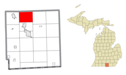
360:
332:
315:
298:
290:
282:
277:
269:
261:
253:
245:
240:
229:
221:
216:
208:
196:
184:
176:
23:
918:Map of Michigan highlighting Hillsdale County.svg
832:
687:"Scipio Township, Hillsdale County, Michigan"
8:
839:
825:
817:
618:of any race were 0.55% of the population.
20:
1292:1836 establishments in Michigan Territory
18:Civil township in Michigan, United States
1277:Townships in Hillsdale County, Michigan
674:
392:
371:
331:
297:
276:
268:
239:
215:
207:
175:
140:
116:
83:
68:
53:
38:
705:
703:
381:
359:
314:
289:
281:
260:
257:29.21 sq mi (75.65 km)
252:
249:29.45 sq mi (76.28 km)
244:
228:
220:
195:
183:
96:Location within the state of Michigan
7:
1287:Populated places established in 1836
747:"Resident seeks stories of long ago"
610:, and 0.88% from two or more races.
785:"Hillsdale County School Districts"
460:. The population was 1,902 at the
265:0.24 sq mi (0.62 km)
847:Municipalities and communities of
14:
129:Location within the United States
812:Scipio Township official website
568:
557:
412:
115:
108:
82:
75:
55:
40:
478:Fort Wayne and Jackson Railroad
683:Michigan Townships Association
1:
132:Show map of the United States
659:Litchfield Community Schools
651:Jonesville Community Schools
715:United States Census Bureau
1308:
850:Hillsdale County, Michigan
273:1,070 ft (326 m)
1242:
911:
861:
482:New York Central Railroad
294:65.1/sq mi (25.1/km)
141:
69:
54:
39:
30:
25:Scipio Township, Michigan
502:unincorporated community
492:maps of Scipio Township.
46:Former township hall in
630:there were 99.4 males.
504:within the township at
222: • Supervisor
919:
1282:Townships in Michigan
917:
711:"U.S. Census website"
523:42.06028°N 84.65944°W
456:in the U.S. state of
317: • Summer (
161:42.03639°N 84.66111°W
1255:United States portal
751:Hillsdale Daily News
291: • Density
99:Show map of Michigan
528:42.06028; -84.65944
519: /
166:42.03639; -84.66111
157: /
920:
753:. November 9, 2013
546:U.S. Census Bureau
283: • Total
262: • Water
246: • Total
1264:
1263:
635:per capita income
544:According to the
405:
404:
254: • Land
1299:
1256:
1249:
1229:East Mosherville
916:
873:
866:
856:
851:
841:
834:
827:
818:
799:
798:
796:
794:
789:
780:
774:
769:
763:
762:
760:
758:
743:
737:
732:
726:
725:
723:
721:
707:
698:
697:
695:
693:
679:
653:to the south in
596:African American
572:
571:
561:
560:
534:
533:
531:
530:
529:
524:
520:
517:
516:
515:
512:
474:East Mosherville
454:Hillsdale County
444:
438:
437:
434:
433:
430:
427:
424:
421:
418:
401:
399:Official website
322:
172:
171:
169:
168:
167:
162:
158:
155:
154:
153:
150:
133:
119:
118:
112:
100:
86:
85:
79:
63:Hillsdale County
61:Location within
59:
44:
21:
1307:
1306:
1302:
1301:
1300:
1298:
1297:
1296:
1267:
1266:
1265:
1260:
1254:
1248:Michigan portal
1247:
1238:
1195:
1181:Somerset Center
1097:
1090:
1062:
965:Civil townships
959:
921:
909:
876:
871:
864:
857:
854:
849:
845:
808:
803:
802:
792:
790:
787:
782:
781:
777:
770:
766:
756:
754:
745:
744:
740:
733:
729:
719:
717:
709:
708:
701:
691:
689:
681:
680:
676:
671:
661:to the west in
647:
623:married couples
600:Native American
583:
569:
558:
554:
542:
527:
525:
521:
518:
513:
510:
508:
506:
505:
470:
442:
415:
411:
408:Scipio Township
397:
356:
350:
344:
316:
165:
163:
159:
156:
151:
148:
146:
144:
143:
137:
136:
135:
134:
131:
130:
127:
126:
125:
124:
123:Scipio Township
120:
103:
102:
101:
98:
97:
94:
93:
92:
91:
90:Scipio Township
87:
65:
50:
35:
26:
19:
12:
11:
5:
1305:
1303:
1295:
1294:
1289:
1284:
1279:
1269:
1268:
1262:
1261:
1259:
1258:
1251:
1243:
1240:
1239:
1237:
1236:
1231:
1226:
1221:
1216:
1211:
1205:
1203:
1197:
1196:
1194:
1193:
1188:
1183:
1178:
1173:
1168:
1163:
1158:
1153:
1148:
1143:
1141:Locust Corners
1138:
1136:Lickly Corners
1133:
1128:
1123:
1118:
1113:
1108:
1102:
1100:
1092:
1091:
1089:
1088:
1083:
1078:
1072:
1070:
1064:
1063:
1061:
1060:
1055:
1050:
1045:
1040:
1035:
1030:
1025:
1020:
1015:
1010:
1005:
1000:
995:
990:
985:
980:
975:
969:
967:
961:
960:
958:
957:
952:
947:
942:
937:
931:
929:
923:
922:
912:
910:
908:
907:
902:
897:
892:
886:
884:
878:
877:
862:
859:
858:
846:
844:
843:
836:
829:
821:
815:
814:
807:
806:External links
804:
801:
800:
775:
764:
738:
727:
699:
673:
672:
670:
667:
646:
643:
582:
579:
578:
577:
566:
553:
552:Major highways
550:
541:
538:
537:
536:
493:
480:branch of the
469:
466:
450:civil township
403:
402:
395:
391:
390:
387:
380:
379:
376:
370:
369:
364:
358:
357:
338:
336:
330:
329:
323:
313:
312:
302:
296:
295:
292:
288:
287:
284:
280:
279:
275:
274:
271:
267:
266:
263:
259:
258:
255:
251:
250:
247:
243:
242:
238:
237:
234:
227:
226:
223:
219:
218:
214:
213:
210:
206:
205:
200:
194:
193:
188:
182:
181:
178:
174:
173:
139:
138:
128:
122:
121:
114:
113:
107:
106:
105:
104:
95:
89:
88:
81:
80:
74:
73:
72:
71:
70:
67:
66:
60:
52:
51:
45:
37:
36:
33:Civil township
31:
28:
27:
24:
17:
13:
10:
9:
6:
4:
3:
2:
1304:
1293:
1290:
1288:
1285:
1283:
1280:
1278:
1275:
1274:
1272:
1257:
1252:
1250:
1245:
1244:
1241:
1235:
1232:
1230:
1227:
1225:
1222:
1220:
1217:
1215:
1212:
1210:
1207:
1206:
1204:
1202:
1198:
1192:
1189:
1187:
1184:
1182:
1179:
1177:
1174:
1172:
1169:
1167:
1164:
1162:
1159:
1157:
1154:
1152:
1149:
1147:
1144:
1142:
1139:
1137:
1134:
1132:
1129:
1127:
1124:
1122:
1121:Fountain Park
1119:
1117:
1114:
1112:
1109:
1107:
1104:
1103:
1101:
1099:
1093:
1087:
1084:
1082:
1079:
1077:
1074:
1073:
1071:
1069:
1065:
1059:
1056:
1054:
1051:
1049:
1046:
1044:
1041:
1039:
1036:
1034:
1031:
1029:
1026:
1024:
1021:
1019:
1016:
1014:
1011:
1009:
1006:
1004:
1001:
999:
996:
994:
991:
989:
986:
984:
981:
979:
976:
974:
971:
970:
968:
966:
962:
956:
953:
951:
948:
946:
943:
941:
938:
936:
933:
932:
930:
928:
924:
906:
903:
901:
898:
896:
893:
891:
888:
887:
885:
883:
879:
875:
874:
867:
860:
855:United States
852:
842:
837:
835:
830:
828:
823:
822:
819:
813:
810:
809:
805:
786:
779:
776:
773:
768:
765:
752:
748:
742:
739:
736:
731:
728:
716:
712:
706:
704:
700:
688:
684:
678:
675:
668:
666:
664:
660:
656:
652:
644:
642:
640:
636:
631:
627:
624:
619:
617:
613:
609:
606:, 0.22% from
605:
601:
597:
593:
588:
580:
575:
567:
564:
556:
555:
551:
549:
547:
539:
532:
503:
499:
498:
494:
491:
487:
483:
479:
475:
472:
471:
467:
465:
463:
459:
455:
451:
447:
446:
436:
409:
400:
396:
388:
385:
377:
375:
368:
365:
363:
354:
348:
342:
337:
335:
327:
324:
320:
310:
309:Eastern (EST)
306:
303:
301:
293:
285:
272:
264:
256:
248:
235:
233:
230: •
224:
211:
204:
201:
199:
192:
189:
187:
180:United States
179:
170:
142:Coordinates:
111:
78:
64:
58:
49:
43:
34:
29:
22:
16:
1037:
869:
793:December 26,
791:. Retrieved
778:
767:
755:. Retrieved
741:
730:
718:. Retrieved
692:December 26,
690:. Retrieved
677:
648:
639:poverty line
632:
628:
620:
584:
581:Demographics
543:
495:
473:
407:
406:
15:
1201:Ghost towns
1151:Mosherville
1098:communities
950:North Adams
865:County seat
720:January 31,
608:other races
526: /
497:Mosherville
468:Communities
462:2020 census
353:Mosherville
334:ZIP code(s)
225:Todd Miller
209:Established
164: /
48:Mosherville
1271:Categories
1161:Prattville
1081:Lake LeAnn
1053:Woodbridge
1013:Litchfield
945:Montgomery
900:Litchfield
895:Jonesville
669:References
663:Litchfield
655:Jonesville
585:As of the
563:US 12
514:84°39′34″W
511:42°03′37″N
386:feature ID
347:Litchfield
341:Jonesville
278:Population
236:Judy Leedy
217:Government
152:84°39′40″W
149:42°02′11″N
1191:Wheatland
1186:Steamburg
1171:Shadyside
1086:Pittsford
1048:Wheatland
1023:Pittsford
1008:Jefferson
1003:Hillsdale
890:Hillsdale
872:Hillsdale
757:April 23,
645:Education
540:Geography
374:FIPS code
362:Area code
300:Time zone
270:Elevation
203:Hillsdale
1176:Somerset
1126:Frontier
1043:Somerset
927:Villages
685:(2022).
612:Hispanic
602:, 0.55%
598:, 0.77%
594:, 0.22%
458:Michigan
378:26-71980
191:Michigan
1234:Florida
1111:Bankers
1076:Cambria
1033:Reading
998:Fayette
988:Cambria
955:Waldron
905:Reading
448:) is a
394:Website
389:1627052
351:49258 (
345:49252 (
339:49250 (
177:Country
1224:Church
1214:Bakers
1166:Ransom
1146:Moscow
1131:Jerome
1116:Betzer
1106:Austin
1058:Wright
1038:Scipio
1028:Ransom
1018:Moscow
993:Camden
940:Camden
882:Cities
616:Latino
587:census
500:is an
198:County
1209:Amboy
1156:Osseo
1096:Other
983:Amboy
978:Allen
973:Adams
935:Allen
788:(PDF)
604:Asian
592:White
328:(EDT)
326:UTC-4
305:UTC-5
286:1,902
232:Clerk
186:State
1219:Cass
1068:CDPs
795:2022
759:2023
722:2008
694:2022
574:M-99
490:1916
488:and
486:1872
441:sip-
384:GNIS
241:Area
212:1836
614:or
452:of
445:-oh
367:517
319:DST
1273::
868::
853:,
749:.
713:.
702:^
665:.
464:.
443:EE
432:oʊ
429:iː
840:e
833:t
826:v
797:.
761:.
724:.
696:.
535:.
435:/
426:p
423:ˈ
420:ɪ
417:s
414:/
410:(
355:)
349:)
343:)
321:)
311:)
307:(
Text is available under the Creative Commons Attribution-ShareAlike License. Additional terms may apply.