73:
101:
129:
136:
108:
80:
302:
56:
269:
established in 2004. Between 1980 and 1995 the site was a massive logging concessions area. After 1995, the park became a site for illegal logging, which resulted in up to 85 percent of the 568,700-hectare total park area being destroyed. By 2012, less than 1 percent of the park's total area has
331:
However, the western part is now protected as either
National Park or National Laboratory Research Area. A study of the area shows that the hydrological integrity of the forest has been maintained, and it is therefore ecologically resilient, although since it is close to the regional capital
352:
population in the
Sabangau catchment is estimated to be in the tens of thousands, but is declining fast. Efforts are underway to establish long-term ecological monitoring in the forest.
587:
429:
951:
72:
309:
The severely degraded eastern part of the forest, between the
Sabangau and the Kayahan, is officially designated for agriculture. However, since the failure of the
482:
100:
468:
809:
961:
458:
Ecological Impact of the One
Million Hectare Rice Project in Cantral Kalimantan, Indonesia, Using Remote Sensing and GIS. Boehm, H-D.V. and Siegert, F.
580:
941:
185:
128:
956:
981:
946:
573:
875:
814:
727:
596:
986:
671:
661:
839:
676:
630:
433:
519:
509:
THE IMPORTANCE OF ECOLOGICAL MONITORING FOR HABITAT MANAGEMENT - A CASE STUDY IN THE SABANGAU FOREST, CENTRAL KALIMANTAN, INDONESIA
996:
788:
773:
635:
498:
The
Orangutan Tropical Peatland Research Project:Monitoring ape populations in the Sabangau Forest, Central Kalimantan, Indonesia
991:
829:
696:
310:
41:
971:
885:
742:
480:
Density and population estimate of gibbons (Hylobates albibarbis) in the
Sabangau catchment, Central Kalimantan, Indonesia
479:
895:
880:
844:
824:
732:
722:
666:
615:
328:
where orangutans may cross the river. A satellite view shows a grid of logging roads throughout most of the forest.
317:
forest in an attempt to create rice paddies, no further efforts are being made to make it suitable for this purpose.
890:
865:
737:
966:
936:
706:
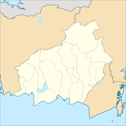
701:
691:
283:
294:
rivers. The peat swamp forest is a dual ecosystem, with diverse tropical trees standing on a 10m - 12m layer of
915:
910:
834:
651:
270:
been reforested and at the current rate, it will take several centuries to restore it to its pre-logged state.
900:
610:
531:
976:
849:
783:
620:
384:
905:
819:
778:
656:
254:
870:
625:
446:
793:
747:
380:
508:
469:
IMPLICATIONS OF GROUNDWATER LEVEL FLUCTUATIONS FOR A TROPICAL PEATLAND ECOSYSTEM IN SOUTHEAST ASIA
298:- partly decayed and waterlogged plant material - which in turn covers relatively infertile soil.
356:
348:
population, estimated at 6,910 individuals in 2003, and other rare or unique species. The total
250:
159:
497:
364:
279:
486:
372:
321:
457:
757:
287:
407:
17:
930:
686:
291:
173:
45:
681:
349:
333:
325:
565:
258:
200:
187:
345:
301:
262:
163:
55:
266:
379:). Some 150,000 ha of swamp forest has been recognised as an
300:
314:
295:
569:
560:
282:. It flows through the Kelompok Hutan Kahayan or Sabangau
430:"Can Heavily Deforested Sebangau National Park Be Saved?"
858:
802:
766:
715:
644:
603:
278:The national park is centered on Sabangau River, a
232:
224:
216:
179:
169:
155:
34:
60:Sabangau River and surrounding peat swamp forests
135:
107:
79:
581:
8:
87:Location of Sabangau National Park in Borneo
588:
574:
566:
344:The forest is home to the world’s largest
31:
952:Tourist attractions in Central Kalimantan
320:The forest has been damaged by legal and
396:
402:
400:
220:5,687 km (2,196 sq mi)
7:
355:Vulnerable bird species include the
324:. There is no longer any continuous
154:
408:"Profile of Sabangau National Park"
115:Sabangau National Park (Kalimantan)
962:Important Bird Areas of Kalimantan
447:orangutantrop.com: Sabangau Forest
143:Sabangau National Park (Indonesia)
25:
410:(in Indonesian). TN Sebangau.com
134:
127:
106:
99:
78:
71:
54:
942:Geography of Central Kalimantan
313:, which drained large areas of
223:
168:
538:. BirdLife International. 2024
432:. 21 July 2012. Archived from
90:Show map of Central Kalimantan
1:
957:Protected areas of Kalimantan
286:(5,300 km), between the
982:Borneo lowland rain forests
947:National parks of Indonesia
597:National parks of Indonesia
1013:
520:Birdlife.org Hutan Kahayan
305:Orangutan in Sabah, Borneo
27:National park in Indonesia
987:Borneo peat swamp forests
65:
53:
39:
249:) is a national park in
997:Sundaland heath forests
810:Bantimurung-Bulusaraung
485:March 26, 2009, at the
604:Bali and Nusa Tenggara
385:BirdLife International
306:
265:part of the island of
243:Sabangau National Park
118:Show map of Kalimantan
35:Sabangau National Park
18:Sebangau National Park
992:Sunda Shelf mangroves
876:Bukit Barisan Selatan
815:Bogani Nani Wartabone
728:Bukit Baka Bukit Raya
377:Leptoptilus javanicus
304:
255:province of Indonesia
146:Show map of Indonesia
972:Pulang Pisau Regency
672:Mount Gede Pangrango
662:Bromo Tengger Semeru
561:Orangutan Foundation
336:it remains at risk.
236:Ministry of Forestry
840:Rawa Aopa Watumohai
631:Laiwangi Wanggameti
381:Important Bird Area
245:(sometimes spelled
233:Governing body
197: /
789:Teluk Cenderawasih
774:Aketajawe-Lolobata
636:Manupeu Tanah Daru
536:BirdLife Data Zone
357:large green pigeon
307:
251:Central Kalimantan
160:Central Kalimantan
924:
923:
436:on 6 August 2012.
311:Mega Rice Project
284:peat swamp forest
240:
239:
201:2.583°S 113.667°E
170:Nearest city
16:(Redirected from
1004:
967:Katingan Regency
937:IUCN Category II
830:Kepulauan Togean
767:Maluku and Papua
697:Kepulauan Seribu
590:
583:
576:
567:
548:
547:
545:
543:
528:
522:
517:
511:
506:
500:
495:
489:
477:
471:
466:
460:
455:
449:
444:
438:
437:
426:
420:
419:
417:
415:
404:
322:illegal forestry
280:blackwater river
212:
211:
209:
208:
207:
202:
198:
195:
194:
193:
190:
147:
138:
137:
131:
119:
110:
109:
103:
91:
82:
81:
75:
58:
32:
21:
1012:
1011:
1007:
1006:
1005:
1003:
1002:
1001:
927:
926:
925:
920:
886:Bukit Tigapuluh
854:
798:
762:
743:Kayan Mentarang
711:
640:
599:
594:
557:
552:
551:
541:
539:
532:"Hutan Kahayan"
530:
529:
525:
518:
514:
507:
503:
496:
492:
487:Wayback Machine
478:
474:
467:
463:
456:
452:
445:
441:
428:
427:
423:
413:
411:
406:
405:
398:
393:
373:lesser adjutant
363:) and possibly
361:Treron capellei
342:
276:
206:-2.583; 113.667
205:
203:
199:
196:
191:
188:
186:
184:
183:
151:
150:
149:
148:
145:
144:
141:
140:
139:
122:
121:
120:
117:
116:
113:
112:
111:
94:
93:
92:
89:
88:
85:
84:
83:
61:
49:
28:
23:
22:
15:
12:
11:
5:
1010:
1008:
1000:
999:
994:
989:
984:
979:
974:
969:
964:
959:
954:
949:
944:
939:
929:
928:
922:
921:
919:
918:
913:
908:
903:
898:
896:Kerinci Seblat
893:
888:
883:
881:Bukit Duabelas
878:
873:
868:
862:
860:
856:
855:
853:
852:
847:
845:Taka Bone Rate
842:
837:
832:
827:
825:Gandang Dewata
822:
817:
812:
806:
804:
800:
799:
797:
796:
791:
786:
781:
776:
770:
768:
764:
763:
761:
760:
758:Tanjung Puting
755:
750:
745:
740:
735:
733:Danau Sentarum
730:
725:
723:Betung Kerihun
719:
717:
713:
712:
710:
709:
704:
699:
694:
689:
684:
679:
674:
669:
664:
659:
654:
648:
646:
642:
641:
639:
638:
633:
628:
623:
618:
613:
607:
605:
601:
600:
595:
593:
592:
585:
578:
570:
564:
563:
556:
555:External links
553:
550:
549:
523:
512:
501:
490:
472:
461:
450:
439:
421:
395:
394:
392:
389:
369:Ciconia stormi
341:
338:
275:
272:
238:
237:
234:
230:
229:
226:
222:
221:
218:
214:
213:
181:
177:
176:
171:
167:
166:
157:
153:
152:
142:
133:
132:
126:
125:
124:
123:
114:
105:
104:
98:
97:
96:
95:
86:
77:
76:
70:
69:
68:
67:
66:
63:
62:
59:
51:
50:
40:
37:
36:
26:
24:
14:
13:
10:
9:
6:
4:
3:
2:
1009:
998:
995:
993:
990:
988:
985:
983:
980:
978:
977:Palangka Raya
975:
973:
970:
968:
965:
963:
960:
958:
955:
953:
950:
948:
945:
943:
940:
938:
935:
934:
932:
917:
914:
912:
909:
907:
904:
902:
899:
897:
894:
892:
889:
887:
884:
882:
879:
877:
874:
872:
869:
867:
864:
863:
861:
857:
851:
848:
846:
843:
841:
838:
836:
833:
831:
828:
826:
823:
821:
818:
816:
813:
811:
808:
807:
805:
801:
795:
792:
790:
787:
785:
782:
780:
777:
775:
772:
771:
769:
765:
759:
756:
754:
751:
749:
746:
744:
741:
739:
736:
734:
731:
729:
726:
724:
721:
720:
718:
714:
708:
705:
703:
700:
698:
695:
693:
690:
688:
687:Mount Merbabu
685:
683:
680:
678:
677:Mount Halimun
675:
673:
670:
668:
667:Mount Ciremai
665:
663:
660:
658:
655:
653:
650:
649:
647:
643:
637:
634:
632:
629:
627:
624:
622:
619:
617:
616:Mount Rinjani
614:
612:
609:
608:
606:
602:
598:
591:
586:
584:
579:
577:
572:
571:
568:
562:
559:
558:
554:
537:
533:
527:
524:
521:
516:
513:
510:
505:
502:
499:
494:
491:
488:
484:
481:
476:
473:
470:
465:
462:
459:
454:
451:
448:
443:
440:
435:
431:
425:
422:
409:
403:
401:
397:
390:
388:
386:
382:
378:
374:
370:
366:
365:Storm's stork
362:
358:
353:
351:
347:
339:
337:
335:
329:
327:
323:
318:
316:
312:
303:
299:
297:
293:
289:
285:
281:
273:
271:
268:
264:
260:
256:
252:
248:
244:
235:
231:
227:
219:
215:
210:
182:
178:
175:
174:Palangka Raya
172:
165:
161:
158:
130:
102:
74:
64:
57:
52:
47:
46:national park
43:
42:IUCN category
38:
33:
30:
19:
891:Mount Leuser
866:Batang Gadis
752:
738:Mount Palung
682:Mount Merapi
540:. Retrieved
535:
526:
515:
504:
493:
475:
464:
453:
442:
434:the original
424:
412:. Retrieved
376:
368:
360:
354:
350:agile gibbon
343:
334:Palangkaraya
330:
326:forest cover
319:
308:
277:
246:
242:
241:
29:
707:Ujung Kulon
702:Meru Betiri
692:Karimunjawa
414:14 December
225:Established
204: /
180:Coordinates
931:Categories
916:Way Kambas
911:Tesso Nilo
835:Lore Lindu
716:Kalimantan
652:Alas Purwo
611:Bali Barat
391:References
263:Indonesian
259:Kalimantan
901:Sembilang
542:20 August
383:(IBA) by
346:orangutan
274:Geography
164:Indonesia
850:Wakatobi
803:Sulawesi
784:Manusela
753:Sabangau
621:Kelimutu
483:Archived
288:Katingan
247:Sebangau
192:113°40′E
156:Location
906:Siberut
859:Sumatra
820:Bunaken
779:Lorentz
657:Baluran
340:Ecology
292:Kahayan
871:Berbak
626:Komodo
371:) and
267:Borneo
261:, the
189:2°35′S
794:Wasur
748:Kutai
645:Java
544:2024
416:2021
315:peat
296:peat
290:and
253:, a
228:2004
217:Area
44:II (
257:in
933::
534:.
399:^
387:.
162:,
589:e
582:t
575:v
546:.
418:.
375:(
367:(
359:(
48:)
20:)
Text is available under the Creative Commons Attribution-ShareAlike License. Additional terms may apply.