452:
440:
464:
150:
143:
425:
36:
648:
392:
extends some 3 km from the mountain. the psammite/shale/marl country rocks of the
Breijera formation are well exposed to the west of Serra de Monchique, forming jagged outcrops and dramatic gorges, which since the destructive introduction of
439:
405:
Serra de
Monchique is threatened by continued aggressive eucalyptus 'cash-crop' farming, recent publications have shown the water table to be lowering significantly and many endemic species to be on the brink of extinction, including
451:
616:
Brito, José C.; Godinho, Raquel; Luı́s, Cristina; Paulo, Octávio S.; Crespo, Eduardo G. (1999-08-01). "Management strategies for conservation of the lizard
Lacerta schreiberi in Portugal".
372:, for which 'Foia' is the type locality). At c.63 km Monchique the fourth largest miaskitic nepheline-syenite intrusion so far discovered. It is assumed to be of '
527:
Continental
Lithospheric Contribution to Alkaline Magmatism: Isotopic (Nd, Sr, Pb) and Geochemical (REE) Evidence from Serra de Monchique and Mount Ormonde Complexes
567:
463:
673:
196:
538:
Rock, N. M. S. (1982-04-15). "The Late
Cretaceous Alkaline Igneous Province in the Iberian Peninsula, and its tectonic significance".
592:
142:
678:
526:
485:
78:
504:
652:
189:
71:
424:
357:
The
Monchique Range is part of the Late-Cretaceous Iberian Alkaline Igneous Province and is related to the
411:
384:
of similar foyaitic composition are seen within the mass at two locations and an associated dyke swarm of
377:
319:
658:
480:
346:
358:
323:
318:
plantations which are detrimental to the native forest cover. The range is named after the town of
245:
338:
331:
257:
407:
291:
54:
303:
369:
625:
549:
540:
250:
415:
389:
238:
629:
593:"Written question - Quarries in Natura 2000 area, Monchique, Portugal - E-004949/2011"
667:
553:
365:
342:
35:
385:
394:
307:
211:
198:
93:
80:
431:
381:
373:
306:. It is covered in forest and parts of the range have been transformed into
647:
568:"How the Eucalyptus Tree Empties Wells and Feeds Forest Fires in Portugal"
361:
327:
287:
172:
283:
262:
233:
182:
515:
376:' form, from its regular contact altitude to the Breijera formation (
315:
290:, about 20 km inshore. The chain's highest point is the peak of
61:
302:
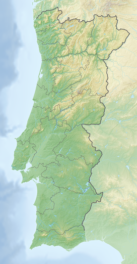
The
Monchique Range is the southwesternmost mountain range of the
266:
311:
368:. The inselberg is formed primarily of nepheline-syenites (
445:
View of the rough
Algarvian terrain and the Atlantic Ocean
294:, at 902 m. 774 m high Picota is another notable peak.
397:
farming in 1976, now run dry most of the year round.
282:) is a chain of mountains in the western part of the
256:
244:
232:
227:
188:
178:
168:
130:
122:
114:
109:
70:
60:
50:
45:
21:
8:
505:Profiling Portugal - the Serra de Monchique
18:
497:
420:
149:
7:
659:Around Monchique and the mountains
349:have their sources in this range.
14:
126:7 km (4.3 mi) NW/SE
118:32 km (20 mi) NE/SW
646:
486:Geology of the Iberian Peninsula
462:
450:
438:
423:
148:
141:
34:
516:Monchique - Algarve - Portugal
40:View of the Serra de Monchique
1:
630:10.1016/S0006-3207(99)00002-6
554:10.1016/0024-4937(82)90004-4
469:Stream at Barranco de Pisões
334:also located in this range.
674:Mountain ranges of Portugal
414:and many more listed under
695:
66:902 m (2,959 ft)
16:Mountain range in Portugal
416:European Union protection
135:
33:
26:
679:Natura 2000 in Portugal
618:Biological Conservation
572:Ecopoliticstoday's Blog
322:, located in the area.
597:www.europarl.europa.eu
457:Eucalyptus plantations
412:Iberian emerald lizard
481:Geography of Portugal
655:at Wikimedia Commons
324:Caldas de Monchique
208: /
90: /
653:Serra de Monchique
408:the Bonellis Eagle
332:geothermal springs
276:Serra de Monchique
46:Highest point
28:Serra de Monchique
651:Media related to
304:Iberian Peninsula
272:
271:
190:Range coordinates
686:
650:
634:
633:
613:
607:
606:
604:
603:
589:
583:
582:
580:
579:
564:
558:
557:
535:
529:
524:
518:
513:
507:
502:
466:
454:
442:
427:
326:is a well-known
223:
222:
220:
219:
218:
213:
212:37.317°N 8.600°W
209:
206:
205:
204:
201:
152:
151:
145:
105:
104:
102:
101:
100:
95:
94:37.317°N 8.600°W
91:
88:
87:
86:
83:
38:
19:
694:
693:
689:
688:
687:
685:
684:
683:
664:
663:
643:
638:
637:
615:
614:
610:
601:
599:
591:
590:
586:
577:
575:
566:
565:
561:
537:
536:
532:
525:
521:
514:
510:
503:
499:
494:
477:
470:
467:
458:
455:
446:
443:
434:
428:
403:
355:
300:
280:Monchique Range
251:Late Cretaceous
216:
214:
210:
207:
202:
199:
197:
195:
194:
164:
163:
162:
161:
160:
159:
158:
157:
156:Monchique Range
153:
98:
96:
92:
89:
84:
81:
79:
77:
76:
41:
22:Monchique Range
17:
12:
11:
5:
692:
690:
682:
681:
676:
666:
665:
662:
661:
656:
642:
641:External links
639:
636:
635:
624:(3): 311–319.
608:
584:
559:
548:(2): 111–131.
530:
519:
508:
496:
495:
493:
490:
489:
488:
483:
476:
473:
472:
471:
468:
461:
459:
456:
449:
447:
444:
437:
435:
429:
422:
402:
399:
354:
351:
299:
296:
270:
269:
260:
254:
253:
248:
242:
241:
236:
230:
229:
225:
224:
217:37.317; -8.600
192:
186:
185:
180:
176:
175:
170:
166:
165:
155:
154:
147:
146:
140:
139:
138:
137:
136:
133:
132:
128:
127:
124:
120:
119:
116:
112:
111:
107:
106:
99:37.317; -8.600
74:
68:
67:
64:
58:
57:
52:
48:
47:
43:
42:
39:
31:
30:
24:
23:
15:
13:
10:
9:
6:
4:
3:
2:
691:
680:
677:
675:
672:
671:
669:
660:
657:
654:
649:
645:
644:
640:
631:
627:
623:
619:
612:
609:
598:
594:
588:
585:
573:
569:
563:
560:
555:
551:
547:
543:
542:
534:
531:
528:
523:
520:
517:
512:
509:
506:
501:
498:
491:
487:
484:
482:
479:
478:
474:
465:
460:
453:
448:
441:
436:
433:
426:
421:
419:
417:
413:
409:
400:
398:
396:
391:
387:
383:
379:
375:
371:
367:
366:Gorringe Bank
363:
360:
359:Mount Ormonde
352:
350:
348:
344:
340:
335:
333:
329:
325:
321:
317:
313:
309:
305:
297:
295:
293:
289:
285:
281:
277:
268:
264:
261:
259:
255:
252:
249:
247:
243:
240:
237:
235:
231:
226:
221:
193:
191:
187:
184:
181:
177:
174:
171:
167:
144:
134:
129:
125:
121:
117:
113:
108:
103:
75:
73:
69:
65:
63:
59:
56:
53:
49:
44:
37:
32:
29:
25:
20:
621:
617:
611:
600:. Retrieved
596:
587:
576:. Retrieved
574:. 2014-06-08
571:
562:
545:
539:
533:
522:
511:
500:
404:
386:lamprophyres
378:country rock
356:
336:
301:
279:
275:
273:
258:Type of rock
27:
374:laccolithic
298:Description
246:Age of rock
215: /
97: /
72:Coordinates
668:Categories
602:2016-06-22
578:2016-06-22
492:References
395:eucalyptus
382:Pegmatites
308:eucalyptus
286:region of
110:Dimensions
432:Monchique
320:Monchique
131:Geography
62:Elevation
475:See also
430:View of
390:picrites
362:seamount
347:Odiáxere
328:spa town
288:Portugal
173:Portugal
401:Ecology
370:foyaite
364:in the
353:Geology
343:Aljezur
337:Rivers
284:Algarve
263:Syenite
234:Orogeny
228:Geology
200:37°19′N
183:Algarve
169:Country
82:37°19′N
541:Lithos
410:, the
316:acacia
239:Alpine
203:8°36′W
179:Region
115:Length
85:8°36′W
339:Seixe
330:with
267:slate
123:Width
388:and
345:and
314:and
312:pine
292:Fóia
274:The
55:Fóia
51:Peak
626:doi
550:doi
380:).
670::
622:89
620:.
595:.
570:.
546:15
544:.
418:.
341:,
310:,
265:,
632:.
628::
605:.
581:.
556:.
552::
278:(
Text is available under the Creative Commons Attribution-ShareAlike License. Additional terms may apply.