379:
45:
78:
1101:
368:
151:
85:
52:
358:
The
Narmada river bringing in freshwater from the Vindyachal Ranges has developed Shahpura into an agrarian economy. The land of the Narmada basin with its fertile alluvial soil gives good yields of sorghum, wheat, rice, and millet in the villages around Shahpura. Important among commercial crops are
350:, Shahpura had a population of 13,601. Males constitute 52% of the population and females 48%. Shahpura has an average literacy rate of 72%, higher than the national average of 59.5%: male literacy is 77%, and female literacy is 67%. In Shahpura, 14% of the population is under 6 years of age.
1142:
1161:
514:
44:
1166:
113:
432:
1135:
257:
77:
1128:
507:
284:
163:
1060:
761:
302:
500:
378:
252:
175:
471:
1075:
1050:
1045:
791:
1080:
1055:
1040:
826:
786:
458:
1070:
756:
648:
402:
1065:
948:
708:
399:
Shahpura is connected by railway and roadway . NH 45 is passed from
Shahpura.Daily buses runs from here.
996:
801:
565:
917:
698:
433:"Census of India 2001: Data from the 2001 Census, including cities, villages and towns (Provisional)"
232:
436:
776:
600:
806:
628:
738:
555:
532:
524:
277:
180:
1100:
1022:
884:
849:
483:
273:
492:
1112:
1108:
963:
836:
658:
420:
288:
216:
168:
375:
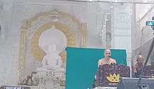
There are seven Jain temples in
Shahpura. Many tourist place located around Shahpura.
1155:
335:
245:
864:
854:
683:
678:
459:"Shahpura Nagar Panchayat City Population Census 2011-2024 | Madhya Pradesh"
1017:
953:
930:
874:
703:
570:
367:
472:
https://www.kisanupaj.com/MandiBhav/mp/Jabalpur/Shahpura%20(Bhitoni)-mandi-bhav
1012:
859:
688:
638:
585:
317:
304:
128:
115:
991:
981:
943:
766:
751:
713:
673:
653:
387:
228:
223:
484:"Bhitoni Railway Station Map/Atlas WCR/West Central Zone - Railway Enquiry"
771:
608:
590:
550:
545:
240:
986:
976:
971:
925:
907:
897:
892:
869:
796:
781:
728:
693:
668:
633:
623:
618:
560:
935:
902:
821:
816:
746:
723:
718:
663:
613:
575:
540:
347:
844:
643:
377:
366:
331:
281:
156:
580:
496:
405:
give service to
Shahpura town many train halts from here.
1116:
1031:
1005:
962:
916:
883:
835:
737:
599:
531:
251:
239:
222:
212:
207:
199:
194:
186:
174:
162:
144:
23:
1136:
508:
8:
435:. Census Commission of India. Archived from
1143:
1129:
515:
501:
493:
330:. It has an average elevation of 381
20:
84:
51:
413:
238:
221:
206:
193:
185:
143:
108:
36:
1107:This article related to a location in
359:pulses, oilseeds, cotton, sugar cane.
1162:Cities and towns in Jabalpur district
421:Falling Rain Genomics, Inc - Shahpura
250:
211:
198:
173:
161:
7:
1097:
1095:
14:
64:Location in Madhya Pradesh, India
1099:
149:
83:
76:
50:
43:
1167:Madhya Pradesh geography stubs
1:
762:Gun Carriage Factory Jabalpur
382:Bhedaghat Dhuandhar Waterfall
371:Jain Mandir Shahpura Jabalpur
18:Town in Madhya Pradesh, India
1115:. You can help Knowledge by
1183:
1094:
190:381 m (1,250 ft)
67:Show map of Madhya Pradesh
792:Ordnance Factory Khamaria
109:
37:
30:
827:Vehicle Factory Jabalpur
97:Shahpura Bhitoni (India)
403:Bhitoni railway station
299:Shahpura is located at
383:
372:
381:
370:
213: • Official
918:Narsinghpur district
699:Neuton Chikhli Kalan
523:Cities and towns in
253:Vehicle registration
777:Jabalpur Cantonment
601:Chhindwara district
314: /
125: /
1034:in other divisions
629:Chandameta-Butaria
384:
373:
200: • Total
1124:
1123:
1089:
1088:
739:Jabalpur district
533:Balaghat district
525:Jabalpur division
346:As of 2001 India
278:Jabalpur district
263:
262:
100:Show map of India
1174:
1145:
1138:
1131:
1103:
1096:
1032:Cities and towns
517:
510:
503:
494:
488:
487:
480:
474:
469:
463:
462:
455:
449:
448:
446:
444:
429:
423:
418:
329:
328:
326:
325:
324:
319:
315:
312:
311:
310:
307:
272:is a town and a
270:Shahpura Bhitoni
155:
153:
152:
140:
139:
137:
136:
135:
130:
126:
123:
122:
121:
118:
101:
91:Shahpura Bhitoni
87:
86:
80:
68:
58:Shahpura Bhitoni
54:
53:
47:
25:Shahpura Bhitoni
21:
1182:
1181:
1177:
1176:
1175:
1173:
1172:
1171:
1152:
1151:
1150:
1149:
1092:
1090:
1085:
1033:
1027:
1001:
958:
912:
885:Mandla district
879:
850:Vijayraghavgarh
831:
733:
595:
527:
521:
491:
482:
481:
477:
470:
466:
457:
456:
452:
442:
440:
439:on 16 June 2004
431:
430:
426:
419:
415:
411:
397:
365:
356:
344:
322:
320:
318:23.13°N 79.67°E
316:
313:
308:
305:
303:
301:
300:
297:
274:nagar panchayat
150:
148:
133:
131:
129:23.13°N 79.67°E
127:
124:
119:
116:
114:
112:
111:
105:
104:
103:
102:
99:
98:
95:
94:
93:
92:
88:
71:
70:
69:
66:
65:
62:
61:
60:
59:
55:
33:
26:
19:
12:
11:
5:
1180:
1178:
1170:
1169:
1164:
1154:
1153:
1148:
1147:
1140:
1133:
1125:
1122:
1121:
1109:Madhya Pradesh
1104:
1087:
1086:
1084:
1083:
1078:
1073:
1068:
1063:
1058:
1053:
1048:
1043:
1037:
1035:
1029:
1028:
1026:
1025:
1020:
1015:
1009:
1007:
1006:Related topics
1003:
1002:
1000:
999:
994:
989:
984:
979:
974:
968:
966:
964:Seoni district
960:
959:
957:
956:
951:
946:
941:
938:
933:
928:
922:
920:
914:
913:
911:
910:
905:
900:
895:
889:
887:
881:
880:
878:
877:
872:
867:
862:
857:
852:
847:
841:
839:
837:Katni district
833:
832:
830:
829:
824:
819:
814:
809:
804:
799:
794:
789:
784:
779:
774:
769:
764:
759:
754:
749:
743:
741:
735:
734:
732:
731:
726:
721:
716:
711:
706:
701:
696:
691:
686:
681:
676:
671:
666:
661:
656:
651:
646:
641:
636:
631:
626:
621:
616:
611:
605:
603:
597:
596:
594:
593:
588:
583:
578:
573:
568:
563:
558:
553:
548:
543:
537:
535:
529:
528:
522:
520:
519:
512:
505:
497:
490:
489:
475:
464:
450:
424:
412:
410:
407:
396:
395:Transportation
393:
392:
391:
364:
361:
355:
352:
343:
340:
296:
293:
289:Madhya Pradesh
261:
260:
255:
249:
248:
243:
237:
236:
226:
220:
219:
214:
210:
209:
205:
204:
201:
197:
196:
192:
191:
188:
184:
183:
178:
172:
171:
169:Madhya Pradesh
166:
160:
159:
146:
142:
141:
107:
106:
96:
90:
89:
82:
81:
75:
74:
73:
72:
63:
57:
56:
49:
48:
42:
41:
40:
39:
38:
35:
34:
31:
28:
27:
24:
17:
13:
10:
9:
6:
4:
3:
2:
1179:
1168:
1165:
1163:
1160:
1159:
1157:
1146:
1141:
1139:
1134:
1132:
1127:
1126:
1120:
1118:
1114:
1110:
1105:
1102:
1098:
1093:
1082:
1079:
1077:
1074:
1072:
1069:
1067:
1064:
1062:
1059:
1057:
1054:
1052:
1049:
1047:
1044:
1042:
1039:
1038:
1036:
1030:
1024:
1021:
1019:
1016:
1014:
1011:
1010:
1008:
1004:
998:
995:
993:
990:
988:
985:
983:
980:
978:
975:
973:
970:
969:
967:
965:
961:
955:
952:
950:
947:
945:
942:
939:
937:
934:
932:
929:
927:
924:
923:
921:
919:
915:
909:
906:
904:
901:
899:
896:
894:
891:
890:
888:
886:
882:
876:
873:
871:
868:
866:
863:
861:
858:
856:
853:
851:
848:
846:
843:
842:
840:
838:
834:
828:
825:
823:
820:
818:
815:
813:
810:
808:
805:
803:
800:
798:
795:
793:
790:
788:
785:
783:
780:
778:
775:
773:
770:
768:
765:
763:
760:
758:
755:
753:
750:
748:
745:
744:
742:
740:
736:
730:
727:
725:
722:
720:
717:
715:
712:
710:
707:
705:
702:
700:
697:
695:
692:
690:
687:
685:
682:
680:
677:
675:
672:
670:
667:
665:
662:
660:
657:
655:
652:
650:
647:
645:
642:
640:
637:
635:
632:
630:
627:
625:
622:
620:
617:
615:
612:
610:
607:
606:
604:
602:
598:
592:
589:
587:
584:
582:
579:
577:
574:
572:
569:
567:
564:
562:
559:
557:
554:
552:
549:
547:
544:
542:
539:
538:
536:
534:
530:
526:
518:
513:
511:
506:
504:
499:
498:
495:
485:
479:
476:
473:
468:
465:
460:
454:
451:
438:
434:
428:
425:
422:
417:
414:
408:
406:
404:
400:
394:
389:
386:
385:
380:
376:
369:
362:
360:
353:
351:
349:
341:
339:
337:
333:
327:
294:
292:
290:
286:
283:
279:
275:
271:
267:
259:
256:
254:
247:
244:
242:
241:ISO 3166 code
234:
230:
227:
225:
218:
215:
202:
189:
182:
179:
177:
170:
167:
165:
158:
147:
138:
110:Coordinates:
79:
46:
29:
22:
16:
1117:expanding it
1106:
1091:
1061:Narmadapuram
811:
684:Kali Chhapar
679:Jata Chhapar
478:
467:
453:
441:. Retrieved
437:the original
427:
416:
401:
398:
390:, 18 KM away
374:
357:
345:
342:Demographics
323:23.13; 79.67
298:
269:
265:
264:
134:23.13; 79.67
15:
1018:Bundelkhand
954:Narsinghpur
931:Tendu Kheda
875:Dhimarkheda
704:Palachourai
571:Malaj Khand
334:(1249
321: /
132: /
1156:Categories
1013:Mahakoshal
860:Bahoriband
689:Lodhikheda
639:Chhindwara
586:Wara Seoni
443:1 November
409:References
195:Population
992:Lakhnadon
982:Kanhiwara
944:Gadarwara
767:Gwarighat
752:Bhedaghat
714:Pandhurna
674:Junnardeo
654:Dighawani
388:Bhedaghat
295:Geography
224:Time zone
208:Languages
187:Elevation
1023:Patalkot
940:Saikhera
812:Shahpura
807:Pipariya
787:Manegaon
772:Jabalpur
609:Amarwara
591:Lalbarra
551:Bharveli
546:Balaghat
266:Shahpura
229:UTC+5:30
181:Jabalpur
176:District
1076:Shahdol
1051:Gwalior
1046:Chambal
987:Keolari
977:Ghansor
972:Barghat
926:Chichli
908:Nainpur
898:Deodara
893:Bamhani
870:Badwara
797:Panagar
782:Majholi
757:Bilpura
729:Sirgora
694:Mohgaon
669:Iklehra
659:Parasia
649:Deogarh
634:Chourai
624:Bhamodi
619:Barkuhi
561:Katangi
556:Hirapur
363:Temples
354:Economy
309:79°40′E
306:23°08′N
280:in the
145:Country
120:79°40′E
117:23°08′N
1081:Ujjain
1056:Indore
1041:Bhopal
949:Kareli
936:Bohani
903:Mandla
822:Suhagi
817:Sihora
747:Barela
724:Sethia
719:Sausar
709:Panara
664:Harrai
614:Ambada
576:Tirodi
541:Baihar
348:census
332:metres
282:Indian
203:13,601
154:
1111:is a
1071:Sagar
997:Seoni
865:Rithi
855:Barhi
845:Katni
802:Patan
644:Damua
566:Linga
285:state
246:IN-MP
217:Hindi
164:State
157:India
1113:stub
1066:Rewa
581:Ukwa
445:2008
336:feet
32:Town
338:).
287:of
276:in
268:or
233:IST
1158::
291:.
258:MP
1144:e
1137:t
1130:v
1119:.
516:e
509:t
502:v
486:.
461:.
447:.
235:)
231:(
Text is available under the Creative Commons Attribution-ShareAlike License. Additional terms may apply.