262:
60:
478:
281:
40:
270:
67:
403:
site from the
Sheboygan Falls Dam (approximately at Monroe Street in that city eastward) since June 1986. Dredging along the section most affected by Tecumseh was completed in 2005, while dredging of the former Camp Marina/WPS site in Sheboygan was completed by the summer of 2012. Cautions on
611:
220:
621:
616:
606:
165:
409:
59:
541:
399:
and other chemicals which make any form of swimming in the river east of
Sheboygan Falls' western limits impossible, thus it has been a working
631:
626:
558:
502:
492:
261:
522:
372:
332:
88:
601:
344:
336:
100:
92:
356:
134:
24:
347:
before turning southeastwardly back into
Sheboygan County. Along its course the river flows past the village of
340:
96:
421:
396:
392:
564:
408:
and warnings about consumption of fish in the
Sheboygan River east of the Falls Dam are also enforced by the
126:
477:
363:
and the city of
Sheboygan, where it enters Lake Michigan. At Sheboygan Falls it collects its two largest
280:
348:
312:
122:
118:
45:
454:
383:
Because of past heavy manufacturing on the eastern portion of the river from companies such as
554:
498:
384:
360:
316:
114:
352:
285:
130:
110:
39:
20:
470:
388:
595:
308:
300:
274:
206:
440:
U.S. Geological Survey. National
Hydrography Dataset high-resolution flowline data.
368:
269:
323:, meaning 'hollow bone', 'noise underground' or 'river disappearing underground'.
577:
Environmental
Protection Agency report on pollutants in the lower Sheboygan River
518:
581:
311:. It is about 81 mi (130 km) long and enters the lake at the city of
201:
576:
235:
222:
180:
167:
19:
This article is about the river in
Wisconsin. For the river in Michigan, see
400:
364:
304:
565:
U.S. Geological Survey
Geographic Names Information System: Sheboygan River
441:
546:
405:
582:
Wisconsin
Department of Natural Resources Sheboygan River Basin page
412:, and posted at all boat launches along Sheboygan's river frontage.
395:
near Sheboygan's downtown, the riverbed has a high concentration of
296:
279:
268:
260:
586:
335:
and initially flows northeastwardly through northwestern
251:
212:
200:
157:
149:
140:
106:
84:
79:
32:
455:"Winnebago Took Its Name from an Indian Tribe"
8:
519:"Sheboygan River and Harbor Superfund Site"
23:. For other places with the same name, see
587:Sheboygan River Basin Partnership website
542:Columbia Gazetteer of North America entry
410:Wisconsin Department of Natural Resources
612:Rivers of Fond du Lac County, Wisconsin
433:
66:
273:The mouth of the Sheboygan River into
29:
622:Rivers of Sheboygan County, Wisconsin
617:Rivers of Manitowoc County, Wisconsin
331:The Sheboygan River rises in eastern
7:
491:Herman, Jennifer (January 1, 2008).
607:Rivers of Calumet County, Wisconsin
391:, and the predecessor companies of
14:
16:River in Wisconsin, United States
476:
65:
58:
38:
551:Wisconsin Atlas & Gazetteer
523:Environmental Protection Agency
461:. December 28, 1963. p. 14
553:. Freeport, Maine: DeLorme.
497:. State History Publications.
284:The frozen Sheboygan River in
214: • coordinates
159: • coordinates
1:
141:Physical characteristics
632:Superfund sites in Wisconsin
627:Tributaries of Lake Michigan
444:, accessed December 19, 2011
315:. The name of the river is
648:
18:
507:– via Google Books.
196:
145:
53:
37:
422:List of Wisconsin rivers
393:Wisconsin Public Service
255:81 mi (130 km)
181:43.7097152°N 88.267878°W
44:Riverfront in downtown
494:Wisconsin Encyclopedia
288:
277:
266:
186:43.7097152; -88.267878
48:near the river's mouth
283:
272:
264:
236:43.74888°N 87.70314°W
387:in Sheboygan Falls,
602:Rivers of Wisconsin
241:43.74888; -87.70314
232: /
177: /
333:Fond du Lac County
289:
278:
267:
459:The Post-Crescent
385:Tecumseh Products
359:, the village of
343:and southwestern
259:
258:
639:
534:
533:
531:
529:
515:
509:
508:
488:
482:
481:
480:
474:
468:
466:
451:
445:
442:The National Map
438:
351:, the cities of
345:Manitowoc County
337:Sheboygan County
321:Shawb-wa-way-gun
247:
246:
244:
243:
242:
237:
233:
230:
229:
228:
225:
192:
191:
189:
188:
187:
182:
178:
175:
174:
173:
170:
160:
69:
68:
62:
42:
30:
647:
646:
642:
641:
640:
638:
637:
636:
592:
591:
573:
538:
537:
527:
525:
517:
516:
512:
505:
490:
489:
485:
475:
464:
462:
453:
452:
448:
439:
435:
430:
418:
381:
357:Sheboygan Falls
339:, southeastern
329:
293:Sheboygan River
240:
238:
234:
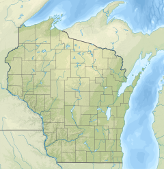
231:
226:
223:
221:
219:
218:
215:
185:
183:
179:
176:
171:
168:
166:
164:
163:
158:
135:Sheboygan Falls
75:
74:
73:
72:
71:
70:
49:
33:Sheboygan River
28:
21:Cheboygan River
17:
12:
11:
5:
645:
643:
635:
634:
629:
624:
619:
614:
609:
604:
594:
593:
590:
589:
584:
579:
572:
571:External links
569:
568:
567:
562:
544:
536:
535:
510:
503:
483:
471:Newspapers.com
446:
432:
431:
429:
426:
425:
424:
417:
414:
389:Kohler Company
380:
377:
341:Calumet County
328:
325:
257:
256:
253:
249:
248:
216:
213:
210:
209:
204:
198:
197:
194:
193:
161:
155:
154:
151:
147:
146:
143:
142:
138:
137:
108:
104:
103:
86:
82:
81:
77:
76:
64:
63:
57:
56:
55:
54:
51:
50:
43:
35:
34:
15:
13:
10:
9:
6:
4:
3:
2:
644:
633:
630:
628:
625:
623:
620:
618:
615:
613:
610:
608:
605:
603:
600:
599:
597:
588:
585:
583:
580:
578:
575:
574:
570:
566:
563:
560:
559:0-89933-247-1
556:
552:
548:
545:
543:
540:
539:
524:
520:
514:
511:
506:
504:9781878592613
500:
496:
495:
487:
484:
479:
472:
460:
456:
450:
447:
443:
437:
434:
427:
423:
420:
419:
415:
413:
411:
407:
402:
398:
394:
390:
386:
379:Water quality
378:
376:
374:
370:
366:
362:
358:
354:
350:
346:
342:
338:
334:
326:
324:
322:
318:
314:
310:
309:United States
306:
302:
301:Lake Michigan
298:
294:
287:
282:
276:
275:Lake Michigan
271:
263:
254:
250:
245:
217:
211:
208:
207:Lake Michigan
205:
203:
199:
195:
190:
162:
156:
152:
148:
144:
139:
136:
132:
128:
124:
120:
116:
112:
109:
105:
102:
98:
94:
90:
87:
83:
78:
61:
52:
47:
41:
36:
31:
26:
22:
550:
528:15 September
526:. Retrieved
513:
493:
486:
469:– via
463:. Retrieved
458:
449:
436:
382:
369:Mullet River
330:
320:
292:
290:
127:Elkhart Lake
373:Onion River
365:tributaries
319:in origin,
303:in eastern
299:flowing to
239: /
184: /
89:Fond du Lac
596:Categories
465:August 25,
428:References
227:87°42′11″W
224:43°44′56″N
172:88°16′04″W
169:43°42′35″N
549:(1992).
401:Superfund
349:St. Cloud
313:Sheboygan
305:Wisconsin
123:St. Cloud
119:St. Peter
101:Manitowoc
93:Sheboygan
46:Sheboygan
25:Sheboygan
416:See also
371:and the
317:Chippewa
85:Counties
80:Location
547:DeLorme
406:fishing
307:in the
97:Calumet
557:
501:
367:, the
361:Kohler
327:Course
252:Length
153:
150:Source
115:Dundee
107:Cities
297:river
295:is a
202:Mouth
555:ISBN
530:2011
499:ISBN
467:2014
397:PCBs
355:and
353:Kiel
291:The
286:Kiel
131:Kiel
111:Eden
265:Map
598::
521:.
457:.
375:.
133:;
129:;
125:;
121:;
117:;
113:;
99:;
95:;
91:;
561:.
532:.
473:.
27:.
Text is available under the Creative Commons Attribution-ShareAlike License. Additional terms may apply.