66:
78:
45:
695:
420:
601:
396:
In the township the population was spread out, with 24.2% under the age of 18, 6.7% from 18 to 24, 26.7% from 25 to 44, 25.4% from 45 to 64, and 17.1% who were 65 years of age or older. The median age was 40 years. For every 100 females, there were 96.6 males. For every 100 females age 18 and over,
392:
living together, 9.8% had a female householder with no husband present, and 31.3% were non-families. 27.0% of all households were made up of individuals, and 13.7% had someone living alone who was 65 years of age or older. The average household size was 2.44 and the average family size was 2.94.
352:
of 2000, there were 2,346 people, 955 households, and 656 families residing in the township. The population density was 39.9 inhabitants per square mile (15.4/km). There were 1,277 housing units at an average density of 21.7/sq mi (8.4/km). The racial makeup of the township was 98.72%
44:
65:
400:
The median income for a household in the township was $ 35,400, and the median income for a family was $ 42,500. Males had a median income of $ 33,295 versus $ 19,536 for females. The
605:
1035:
633:
836:
756:
1074:
841:
751:
77:
811:
786:
831:
801:
771:
766:
791:
761:
977:
988:
851:
776:
250:, the township has a total area of 58.7 square miles (152.1 km), of which 58.7 square miles (152.1 km) is land and 0.02% is water.
796:
781:
626:
619:
1079:
816:
579:
433:
452:
821:
611:
482:
238:, United States. The population was 1,849 at the 2020 census, down from 2,121 at the 2010 census and 2,346 at the 2000 census.
924:
846:
370:
358:
362:
919:
1011:
806:
643:
554:
374:
247:
231:
113:
934:
894:
874:
733:
723:
314:
299:
284:
53:
49:
216:
889:
884:
861:
743:
718:
713:
388:
There were 955 households, out of which 29.6% had children under the age of 18 living with them, 55.2% were
35:
982:
869:
728:
705:
378:
108:
954:
929:
879:
208:
1018:
944:
939:
914:
684:
665:
382:
197:
949:
904:
676:
425:
366:
354:
404:
for the township was $ 16,423. About 7.2% of families and 11.3% of the population were below the
528:
972:
502:
401:
187:
583:
514:
1068:
405:
235:
101:
658:
964:
415:
96:
1050:
1037:
178:
600:
408:, including 17.2% of those under age 18 and 4.1% of those age 65 or over.
1002:‡This populated place also has portions in an adjacent county or counties
389:
580:"'Too many old people': A rural Pa. town reckons with population loss"
349:
204:
183:
615:
693:
550:
476:
474:
472:
470:
997:
963:
903:
860:
742:
704:
675:
215:
194:
177:
169:
161:
153:
148:
140:
132:
124:
119:
107:
95:
87:
26:
606:Sheffield Township, Warren County, Pennsylvania
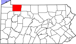
70:Location of Sheffield Township in Warren County
627:
8:
483:"City and Town Population Totals: 2020-2022"
634:
620:
612:
385:of any race were 0.72% of the population.
257:
23:
82:Location of Warren County in Pennsylvania
1075:Townships in Warren County, Pennsylvania
444:
214:
176:
147:
118:
86:
62:
41:
21:Township in Pennsylvania, United States
16:Township in Pennsylvania, United States
510:
500:
277:
136:59.16 sq mi (153.24 km)
128:59.17 sq mi (153.25 km)
193:
168:
160:
152:
139:
131:
123:
106:
94:
74:
7:
377:, and 0.51% from two or more races.
144:0.01 sq mi (0.01 km)
642:Municipalities and communities of
529:"Census of Population and Housing"
267:
14:
434:List of townships in Pennsylvania
599:
418:
76:
64:
43:
1:
455:. United States Census Bureau
578:Craig, Tim (June 23, 2024).
645:Warren County, Pennsylvania
555:United States Census Bureau
453:"2016 U.S. Gazetteer Files"
248:United States Census Bureau
173:34.23/sq mi (13.21/km)
162: • Estimate
50:South Branch Tionesta Creek
1096:
1080:Townships in Pennsylvania
1007:
691:
656:
341:
328:
313:
298:
283:
276:
271:
266:
263:
75:
63:
54:Allegheny National Forest
42:
33:
397:there were 92.7 males.
698:
1051:41.62472°N 78.98306°W
697:
551:"U.S. Census website"
342:U.S. Decennial Census
259:Historical population
196: • Summer (
1020:United States portal
608:at Wikimedia Commons
170: • Density
1056:41.62472; -78.98306
1047: /
1013:Pennsylvania portal
481:Bureau, US Census.
426:Pennsylvania portal
260:
699:
513:has generic name (
489:. US Census Bureau
258:
228:Sheffield Township
154: • Total
141: • Water
125: • Total
28:Sheffield Township
1029:
1028:
604:Media related to
402:per capita income
346:
345:
246:According to the
230:is a township in
225:
224:
133: • Land
1087:
1062:
1061:
1059:
1058:
1057:
1052:
1048:
1045:
1044:
1043:
1040:
1021:
1014:
925:Chandlers Valley
696:
668:
661:
651:
646:
636:
629:
622:
613:
603:
594:
592:
590:
566:
565:
563:
561:
547:
541:
540:
538:
536:
525:
519:
518:
512:
508:
506:
498:
496:
494:
478:
465:
464:
462:
460:
449:
428:
423:
422:
421:
371:Pacific Islander
359:African American
279:
274:
269:
261:
201:
80:
68:
56:in the township,
47:
24:
1095:
1094:
1090:
1089:
1088:
1086:
1085:
1084:
1065:
1064:
1055:
1053:
1049:
1046:
1041:
1038:
1036:
1034:
1033:
1032:
1030:
1025:
1019:
1012:
1003:
993:
959:
906:
899:
856:
738:
700:
694:
689:
671:
666:
659:
652:
649:
644:
640:
588:
586:
584:Washington Post
577:
574:
569:
559:
557:
549:
548:
544:
534:
532:
527:
526:
522:
509:
499:
492:
490:
480:
479:
468:
458:
456:
451:
450:
446:
442:
424:
419:
417:
414:
390:married couples
363:Native American
272:
256:
244:
195:
83:
71:
59:
57:
38:
29:
22:
17:
12:
11:
5:
1093:
1091:
1083:
1082:
1077:
1067:
1066:
1027:
1026:
1024:
1023:
1016:
1008:
1005:
1004:
1001:
999:
995:
994:
992:
991:
986:
980:
975:
969:
967:
961:
960:
958:
957:
952:
947:
942:
937:
932:
927:
922:
920:Backup Corners
917:
911:
909:
905:Unincorporated
901:
900:
898:
897:
892:
887:
882:
877:
872:
866:
864:
858:
857:
855:
854:
849:
844:
839:
834:
829:
824:
819:
814:
809:
804:
799:
794:
789:
784:
779:
774:
769:
764:
759:
754:
748:
746:
740:
739:
737:
736:
731:
726:
721:
716:
710:
708:
702:
701:
692:
690:
688:
687:
681:
679:
673:
672:
657:
654:
653:
641:
639:
638:
631:
624:
616:
610:
609:
596:
595:
573:
572:External links
570:
568:
567:
542:
520:
466:
443:
441:
438:
437:
436:
430:
429:
413:
410:
344:
343:
339:
338:
335:
333:
330:
326:
325:
322:
320:
317:
311:
310:
307:
305:
302:
296:
295:
292:
290:
287:
281:
280:
275:
270:
265:
255:
252:
243:
240:
223:
222:
219:
213:
212:
202:
192:
191:
181:
175:
174:
171:
167:
166:
163:
159:
158:
155:
151:
150:
146:
145:
142:
138:
137:
134:
130:
129:
126:
122:
121:
117:
116:
111:
105:
104:
99:
93:
92:
89:
85:
84:
81:
73:
72:
69:
61:
60:
48:
40:
39:
34:
31:
30:
27:
20:
15:
13:
10:
9:
6:
4:
3:
2:
1092:
1081:
1078:
1076:
1073:
1072:
1070:
1063:
1060:
1022:
1017:
1015:
1010:
1009:
1006:
1000:
996:
990:
987:
984:
981:
979:
976:
974:
971:
970:
968:
966:
962:
956:
953:
951:
948:
946:
943:
941:
938:
936:
933:
931:
928:
926:
923:
921:
918:
916:
913:
912:
910:
908:
902:
896:
893:
891:
888:
886:
883:
881:
878:
876:
873:
871:
868:
867:
865:
863:
859:
853:
850:
848:
845:
843:
840:
838:
835:
833:
830:
828:
825:
823:
820:
818:
815:
813:
810:
808:
805:
803:
800:
798:
795:
793:
790:
788:
785:
783:
780:
778:
775:
773:
770:
768:
765:
763:
760:
758:
755:
753:
750:
749:
747:
745:
741:
735:
732:
730:
727:
725:
722:
720:
717:
715:
712:
711:
709:
707:
703:
686:
683:
682:
680:
678:
674:
670:
669:
662:
655:
650:United States
647:
637:
632:
630:
625:
623:
618:
617:
614:
607:
602:
598:
597:
585:
581:
576:
575:
571:
556:
552:
546:
543:
530:
524:
521:
516:
504:
488:
484:
477:
475:
473:
471:
467:
454:
448:
445:
439:
435:
432:
431:
427:
416:
411:
409:
407:
403:
398:
394:
391:
386:
384:
380:
376:
373:, 0.17% from
372:
368:
364:
360:
356:
351:
340:
336:
334:
331:
327:
323:
321:
318:
316:
312:
308:
306:
303:
301:
297:
293:
291:
288:
286:
282:
262:
253:
251:
249:
241:
239:
237:
233:
232:Warren County
229:
220:
218:
210:
206:
203:
199:
189:
185:
182:
180:
172:
164:
156:
143:
135:
127:
115:
114:Warren County
112:
110:
103:
100:
98:
91:United States
90:
79:
67:
55:
51:
46:
37:
32:
25:
19:
1031:
935:Grand Valley
895:Warren South
875:North Warren
837:Spring Creek
826:
757:Cherry Grove
664:
587:. Retrieved
558:. Retrieved
545:
533:. Retrieved
531:. Census.gov
523:
511:|last1=
493:September 4,
491:. Retrieved
486:
457:. Retrieved
447:
406:poverty line
399:
395:
387:
347:
254:Demographics
245:
236:Pennsylvania
227:
226:
102:Pennsylvania
18:
1054: /
973:Cornplanter
965:Ghost towns
907:communities
842:Sugar Grove
752:Brokenstraw
734:Youngsville
724:Sugar Grove
660:County seat
560:January 31,
375:other races
329:2022 (est.)
52:within the
1069:Categories
1042:78°58′59″W
1039:41°37′29″N
817:Pittsfield
812:Pine Grove
787:Farmington
487:Census.gov
459:August 14,
440:References
348:As of the
149:Population
998:Footnotes
890:Starbrick
885:Sheffield
832:Southwest
827:Sheffield
802:Limestone
772:Deerfield
767:Conewango
744:Townships
719:Clarendon
714:Bear Lake
242:Geography
217:Area code
179:Time zone
58:June 2011
983:Fagundus
870:Columbus
822:Pleasant
792:Freehold
762:Columbus
729:Tidioute
706:Boroughs
589:June 23,
503:cite web
412:See also
379:Hispanic
369:, 0.13%
365:, 0.04%
361:, 0.17%
357:, 0.26%
36:Township
978:Corydon
955:Torpedo
930:Garland
880:Russell
847:Triumph
535:June 4,
88:Country
989:Kinzua
945:Lander
940:Irvine
915:Akeley
852:Watson
777:Eldred
685:Warren
667:Warren
383:Latino
350:census
324:−12.8%
264:Census
109:County
950:Tiona
797:Glade
367:Asian
355:White
337:−2.4%
332:1,805
319:1,849
309:−9.6%
304:2,121
289:2,346
205:UTC-5
184:UTC-4
165:1,805
157:1,849
97:State
862:CDPs
807:Mead
677:City
591:2024
562:2008
537:2016
515:help
495:2023
461:2017
315:2020
300:2010
285:2000
273:Note
268:Pop.
120:Area
782:Elk
381:or
221:814
209:EDT
198:DST
188:EST
1071::
663::
648:,
582:.
553:.
507::
505:}}
501:{{
485:.
469:^
278:%±
234:,
985:‡
635:e
628:t
621:v
593:.
564:.
539:.
517:)
497:.
463:.
294:—
211:)
207:(
200:)
190:)
186:(
Text is available under the Creative Commons Attribution-ShareAlike License. Additional terms may apply.