29:
54:
47:
217:
In 1716 the construction of the
Sieberstollen had begun at the base of the Sieberberg mountain. The adit was driven through from two ends with hammer and pick only supported by four lightholes. When the first phase of construction had finished the adit had an overall length of 3530 m.
112:
46:
205:
In the beginning of the 18th century the 25 mines in Sankt Andreasberg had their highest output and the deepest drainage adit
406:
226:
In the following years the adit was expanded and connected to other mines. In 1804 it was connected to the
Wennsglückt pit.
248:
Two years later a hydroelectric power station was installed 190 m beneath ground in the Samson Pit. It is one of two
245:
In 1910 mining activities in Sankt
Andreasberg were stopped. All constructions beneath the Sieberstollen were flooded.
396:
401:
194:
28:
249:
179:
206:
190:
171:
78:
82:
302:
230:
183:
175:
369:
356:
Hausmann: Ueber den gegenwärtigen
Zustand und die Wichtigkeit des Hannoverschen Harzes
289:
Calvör: Acta
Historico-Chronologico-Mechanica circa metallurgiam in Hercynia superiori
390:
263:
92:
186:
into which it discharges its water. The opening position is in the Sieber Valley.
259:
Until now the
Sieberstollen is the deepest draining adit in Sankt Andreasberg.
234:
127:
114:
253:
233:
driven by water wheels up to 12 m were used. Two of them were in the
229:
To raise the water from adits beneath the level of the
Sieberstollen
308:. Ministry for Science and Culture of Lower Saxony. 2008. p. 26
189:
The first 11.7 km of the 13.1 km adit forms part of the
18:
Mine in Sankt
Andreasberg, Landkreis Goslar, Lower Saxony, Germany
163:
256:. The Sieberstollen is discharging its water into the Sieber.
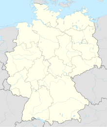
252:
in that pit which generate electricity from the waters of the
342:
Keferstein: Teutschland, geognostisch-geologisch dargestellt
148:
143:
106:
98:
88:
74:
35:
8:
21:
27:
20:
283:
281:
279:
275:
328:Ließmann: Historischer Bergbau im Harz
53:
7:
303:"Upper Harz Water Management System"
14:
52:
45:
262:The water here is said to have
1:
237:beneath the Sieberstollen.
128:51.70153306°N 10.48304694°E
423:
250:underground power stations
213:Construction and Operation
195:UNESCO World Heritage Site
182:and named after the river
40:
26:
180:mining in the Upper Harz
178:. It was created during
170:) for water drainage in
133:51.70153306; 10.48304694
407:Upper Harz Water Regale
330:. 2010. p. 238 ff.
209:had reached its limit.
191:Upper Harz Water Regale
193:and has been declared
291:. 1763. p. 34 f.
344:. 1828. p. 495.
207:Grünhirscher Stollen
168:Wasserlösungsstollen
370:"Der Sieberstollen"
358:. 1832. p. 93.
124: /
66:Location in Germany
23:
397:Mining in the Harz
402:Sankt Andreasberg
172:Sankt Andreasberg
156:
155:
79:Sankt Andreasberg
414:
381:
380:
378:
376:
366:
360:
359:
352:
346:
345:
338:
332:
331:
324:
318:
317:
315:
313:
307:
299:
293:
292:
285:
139:
138:
136:
135:
134:
129:
125:
122:
121:
120:
117:
83:Landkreis Goslar
56:
55:
49:
31:
24:
422:
421:
417:
416:
415:
413:
412:
411:
387:
386:
385:
384:
374:
372:
368:
367:
363:
354:
353:
349:
340:
339:
335:
326:
325:
321:
311:
309:
305:
301:
300:
296:
287:
286:
277:
272:
243:
231:flatrot systems
224:
215:
203:
132:
130:
126:
123:
119:010°28′58.969″E
118:
115:
113:
111:
110:
70:
69:
68:
67:
64:
63:
62:
61:
57:
19:
12:
11:
5:
420:
418:
410:
409:
404:
399:
389:
388:
383:
382:
361:
347:
333:
319:
294:
274:
273:
271:
268:
264:Hallucinogenic
242:
239:
223:
220:
214:
211:
202:
199:
176:Harz mountains
154:
153:
150:
146:
145:
141:
140:
108:
104:
103:
100:
96:
95:
90:
86:
85:
76:
72:
71:
65:
59:
58:
51:
50:
44:
43:
42:
41:
38:
37:
33:
32:
17:
13:
10:
9:
6:
4:
3:
2:
419:
408:
405:
403:
400:
398:
395:
394:
392:
371:
365:
362:
357:
351:
348:
343:
337:
334:
329:
323:
320:
304:
298:
295:
290:
284:
282:
280:
276:
269:
267:
265:
260:
257:
255:
251:
246:
240:
238:
236:
232:
227:
221:
219:
212:
210:
208:
200:
198:
196:
192:
187:
185:
181:
177:
173:
169:
165:
161:
160:Sieberstollen
151:
147:
142:
137:
116:51°42′5.519″N
109:
105:
101:
97:
94:
91:
87:
84:
80:
77:
73:
60:Sieberstollen
48:
39:
34:
30:
25:
22:Sieberstollen
16:
373:. Retrieved
364:
355:
350:
341:
336:
327:
322:
310:. Retrieved
297:
288:
261:
258:
247:
244:
228:
225:
216:
204:
188:
167:
159:
157:
93:Lower Saxony
15:
375:11 December
241:Current use
131: /
107:Coordinates
391:Categories
312:2 December
270:References
235:Samson Pit
266:effects.
254:Oderteich
222:Expansion
197:in 2010.
174:, in the
166:(German:
75:Location
36:Location
201:History
144:History
102:Germany
99:Country
184:Sieber
162:is an
149:Opened
306:(PDF)
89:State
377:2015
314:2015
164:adit
158:The
152:1716
393::
278:^
81:,
379:.
316:.
Text is available under the Creative Commons Attribution-ShareAlike License. Additional terms may apply.

