203:
215:
754:
701:
20:
88:. Due to marshy conditions and frequent flooding in the original location, in the 1890s, the village was reestablished at a new location several kilometres to the north (its current location) and the original village was demolished. The efforts were financed and supported by Dénes Andrássy of the
202:
817:
214:
100:("Dennis-new-ville"), apparently adopted in honour of Andrássy's support for the 1890s project. This newer name has also become common in the Zemplín dialect of Slovak, as
798:
275:
827:
236:
791:
268:
474:
434:
369:
715:
669:
514:
569:
519:
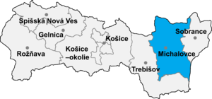
499:
822:
784:
394:
329:
261:
84:
The original village lay several kilometres to the south of its current location, closer to the neighbouring village of
429:
409:
444:
679:
624:
684:
494:
629:
311:
324:
554:
764:
539:
534:
634:
161:
761:
574:
559:
285:
231:
62:
23:
484:
614:
46:
659:
172:
The village has three bus stops on its main street and is serviced by regular bus lines between
93:
654:
524:
768:
184:
41:
354:
253:
399:
359:
304:
811:
544:
374:
66:
27:
349:
58:
753:
609:
604:
439:
664:
469:
459:
454:
384:
89:
248:
19:
549:
529:
504:
479:
419:
404:
364:
297:
173:
137:
125:
730:
717:
594:
145:
689:
619:
509:
424:
389:
700:
639:
599:
589:
584:
564:
489:
464:
449:
344:
334:
188:
177:
117:
85:
96:. The colloquial Hungarian name of the current village of Sliepkovce is
649:
379:
339:
157:
141:
113:
78:
54:
674:
644:
319:
208:
Roman
Catholic church of the Transfiguration of Christ in Sliepkovce
414:
18:
121:
257:
220:
Memorial on grave of Mikuláš Klanica, Sliepkovce cemetery
772:
232:
List of municipalities and towns in
Michalovce District
818:Villages and municipalities in Michalovce District
792:
269:
8:
249:http://www.statistics.sk/mosmis/eng/run.html
237:List of municipalities and towns in Slovakia
799:
785:
276:
262:
254:
81:the village was first mentioned in 1345.
198:
40:
7:
750:
748:
16:Village and municipality in Slovakia
828:Michalovce District geography stubs
771:. You can help Knowledge (XXG) by
14:
752:
699:
213:
201:
156:The village has a small public
1:
124:of 6.456 km². It has a
120:of 105 metres and covers an
410:Jastrabie pri Michalovciach
844:
747:
696:
292:
187:is 6 kilometres away at
164:pitch, built in 1946.
50:
42:[ˈslɪepkɔwtse]
30:
540:Poruba pod Vihorlatom
535:Petrovce nad Laborcom
69:of eastern Slovakia.
38:Slovak pronunciation:
22:
762:Michalovce District
727: /
560:Rakovec nad Ondavou
430:Kapušianske Kľačany
325:Bánovce nad Ondavou
286:Michalovce District
63:Michalovce District
24:Michalovce District
685:Zemplínske Kopčany
615:Trnava pri Laborci
445:Krišovská Liesková
284:Municipalities of
79:historical records
31:
780:
779:
731:48.667°N 21.950°E
709:
708:
680:Zemplínska Široká
525:Pavlovce nad Uhom
495:Maťovské Vojkovce
835:
823:Zemplín (region)
801:
794:
787:
756:
749:
742:
741:
739:
738:
737:
732:
728:
725:
724:
723:
720:
704:
703:
625:Tušická Nová Ves
278:
271:
264:
255:
217:
205:
44:
39:
843:
842:
838:
837:
836:
834:
833:
832:
808:
807:
806:
805:
745:
735:
733:
729:
726:
721:
718:
716:
714:
713:
712:
710:
705:
698:
694:
660:Vysoká nad Uhom
288:
282:
245:
228:
221:
218:
209:
206:
197:
185:railway station
170:
154:
134:
128:of 704 people.
110:
75:
37:
17:
12:
11:
5:
841:
839:
831:
830:
825:
820:
810:
809:
804:
803:
796:
789:
781:
778:
777:
757:
736:48.667; 21.950
707:
706:
697:
695:
693:
692:
687:
682:
677:
672:
667:
662:
657:
652:
647:
642:
637:
635:Veľké Slemence
632:
630:Veľké Raškovce
627:
622:
617:
612:
607:
602:
597:
592:
587:
582:
577:
572:
567:
562:
557:
552:
547:
542:
537:
532:
527:
522:
517:
512:
507:
502:
497:
492:
487:
482:
477:
472:
467:
462:
457:
452:
447:
442:
437:
432:
427:
422:
417:
412:
407:
402:
397:
392:
387:
382:
377:
372:
367:
362:
357:
352:
347:
342:
337:
332:
327:
322:
316:
315:
312:Veľké Kapušany
308:
301:
293:
290:
289:
283:
281:
280:
273:
266:
258:
252:
251:
244:
243:External links
241:
240:
239:
234:
227:
224:
223:
222:
219:
212:
210:
207:
200:
196:
193:
169:
166:
153:
150:
133:
130:
109:
106:
74:
71:
15:
13:
10:
9:
6:
4:
3:
2:
840:
829:
826:
824:
821:
819:
816:
815:
813:
802:
797:
795:
790:
788:
783:
782:
776:
774:
770:
767:article is a
766:
763:
758:
755:
751:
746:
743:
740:
702:
691:
688:
686:
683:
681:
678:
676:
673:
671:
668:
666:
663:
661:
658:
656:
653:
651:
648:
646:
643:
641:
638:
636:
633:
631:
628:
626:
623:
621:
618:
616:
613:
611:
608:
606:
603:
601:
598:
596:
593:
591:
588:
586:
583:
581:
578:
576:
573:
571:
568:
566:
563:
561:
558:
556:
555:Pusté Čemerné
553:
551:
548:
546:
543:
541:
538:
536:
533:
531:
528:
526:
523:
521:
518:
516:
513:
511:
508:
506:
503:
501:
498:
496:
493:
491:
488:
486:
485:Malé Raškovce
483:
481:
478:
476:
473:
471:
468:
466:
463:
461:
458:
456:
453:
451:
448:
446:
443:
441:
438:
436:
433:
431:
428:
426:
423:
421:
418:
416:
413:
411:
408:
406:
403:
401:
398:
396:
393:
391:
388:
386:
383:
381:
378:
376:
373:
371:
368:
366:
363:
361:
358:
356:
353:
351:
348:
346:
343:
341:
338:
336:
333:
331:
328:
326:
323:
321:
318:
317:
314:
313:
309:
307:
306:
302:
300:
299:
295:
294:
291:
287:
279:
274:
272:
267:
265:
260:
259:
256:
250:
247:
246:
242:
238:
235:
233:
230:
229:
225:
216:
211:
204:
199:
194:
192:
190:
186:
181:
179:
175:
167:
165:
163:
159:
151:
149:
147:
143:
140:is about 99%
139:
131:
129:
127:
123:
119:
115:
107:
105:
103:
99:
95:
91:
87:
82:
80:
72:
70:
68:
67:Kosice Region
64:
60:
56:
52:
48:
43:
35:
29:
28:Kosice Region
25:
21:
773:expanding it
759:
744:
711:
579:
310:
303:
296:
183:The nearest
182:
171:
155:
135:
111:
101:
97:
94:Krásna Hôrka
92:family from
83:
76:
59:municipality
33:
32:
734: /
360:Čierne Pole
116:lies at an
98:Dénesújfalu
51:Dénesújfalu
812:Categories
580:Sliepkovce
545:Pozdišovce
530:Petrikovce
505:Nacina Ves
375:Falkušovce
298:Michalovce
174:Michalovce
138:population
126:population
34:Sliepkovce
765:geography
610:Trhovište
605:Šamudovce
595:Stretavka
575:Slavkovce
440:Krásnovce
355:Čičarovce
168:Transport
146:ethnicity
132:Ethnicity
108:Geography
47:Hungarian
665:Zalužice
590:Stretava
500:Moravany
490:Markovce
460:Laškovce
455:Lastomír
435:Klokočov
400:Iňačovce
370:Dúbravka
345:Budkovce
335:Bracovce
305:Strážske
226:See also
189:Budkovce
178:Budkovce
162:football
160:, and a
118:altitude
90:Andrássy
86:Budkovce
722:21°57′E
719:48°40′N
670:Závadka
655:Vrbnica
550:Ptrukša
480:Malčice
420:Kačanov
405:Ižkovce
395:Horovce
380:Hatalov
365:Drahňov
350:Čečehov
340:Budince
195:Gallery
158:library
152:Culture
114:village
73:History
65:in the
55:village
53:) is a
26:in the
690:Žbince
675:Zbudza
645:Vojany
620:Tušice
515:Oreské
510:Oborín
425:Kaluža
390:Hnojné
320:Bajany
142:Slovak
760:This
640:Vinné
600:Suché
585:Staré
570:Senné
565:Ruská
520:Palín
475:Lúčky
470:Ložín
465:Lesné
450:Kusín
415:Jovsa
385:Hažín
102:Deneš
769:stub
650:Voľa
330:Beša
176:and
136:The
122:area
112:The
57:and
144:in
77:In
61:in
814::
191:.
180:.
148:.
104:.
49::
45:,
800:e
793:t
786:v
775:.
277:e
270:t
263:v
36:(
Text is available under the Creative Commons Attribution-ShareAlike License. Additional terms may apply.