1128:
42:
54:
1016:
774:
living together, 18.6% had a female householder with no husband present, and 32.6% were non-families. 28.6% of all households were made up of individuals, and 14.6% had someone living alone who was 65 years of age or older. The average household size was 2.67 and the average family size was 3.32.
778:
In the city, the population was spread out, with 30.9% under the age of 18, 9.2% from 18 to 24, 24.9% from 25 to 44, 20.0% from 45 to 64, and 15.0% who were 65 years of age or older. The median age was 34 years. For every 100 females, there were 94.1 males. For every 100 females age 18 and over,
738:
of 2000, there were 1,704 people, 639 households, and 430 families residing in the city. The population density was 571.1 inhabitants per square mile (220.5/km). There were 768 housing units at an average density of 257.4 per square mile (99.4/km). The racial makeup of the city was 54.17%
1000:
Note: the US Census treats
Hispanic/Latino as an ethnic category. This table excludes Latinos from the racial categories and assigns them to a separate category. Hispanics/Latinos can be of any race.
782:
The median income for a household in the city was $ 26,208, and the median income for a family was $ 34,844. Males had a median income of $ 25,679 versus $ 17,379 for females. The
1056:
1298:
886:
628:
249:
799:
642:
67:
1049:
344:
259:
1308:
323:
53:
41:
819:
200:
388:, Somerville has a total area of 3.0 square miles (7.7 km), of which 0.02 square miles (0.05 km), or 0.60%, is water.
1042:
1217:
744:
1034:
748:
699:
614:
1245:
862:
756:
385:
934:
890:
728:
572:
557:
542:
527:
512:
497:
482:
467:
452:
437:
422:
340:
121:
1303:
237:
99:
843:
1139:
770:
There were 639 households, out of which 31.6% had children under the age of 18 living with them, 43.8% were
1240:
1066:
760:
370:
332:
126:
685:
970:
1275:
1268:
1255:
764:
210:
1182:
1147:
752:
740:
1250:
1235:
1197:
355:
Somerville is located near the southern border of
Burleson County and is bordered to the west by
912:
1152:
786:
for the city was $ 12,995. About 18.3% of families and 24.0% of the population were below the
783:
1192:
1162:
291:
1202:
1107:
1088:
660:
374:
356:
378:
887:"Geographic Identifiers: 2010 Demographic Profile Data (G001): Somerville city, Texas"
1292:
646:
242:
1172:
1167:
1112:
1021:
787:
364:
731:, there were 1,312 people, 438 households, and 284 families residing in the city.
1212:
1157:
1081:
360:
1227:
1207:
1011:
109:
844:
U.S. Geological Survey
Geographic Names Information System: Somerville, Texas
82:
69:
191:
790:, including 34.5% of those under age 18 and 15.8% of those age 65 or over.
771:
225:
343:. Somerville is named for Albert Somerville the first president of the
735:
373:
passes through the city, leading northwest 17 miles (27 km) to
336:
217:
196:
114:
1099:
32:
1038:
306:
1126:
1029:
274:
958:
377:, the county seat, and southeast 15 miles (24 km) to
889:. U.S. Census Bureau, American Factfinder. Archived from
858:
312:
300:
324:
297:
315:
309:
1226:
1181:
1138:
1098:
303:
294:
269:
258:
248:
236:
224:
207:
190:
182:
174:
169:
161:
153:
145:
137:
132:
120:
108:
98:
23:
339:, United States. The population was 1,312 at the
971:"About the Hispanic Population and its Origin"
1050:
881:
879:
8:
1127:
767:of any race were 21.48% of the population.
1057:
1043:
1035:
395:
20:
595:Somerville racial composition as of 2020
592:
993:
811:
268:
247:
223:
189:
168:
160:
131:
97:
62:
50:
38:
839:
837:
800:Somerville Independent School District
415:
853:
851:
257:
235:
206:
181:
173:
152:
144:
136:
119:
107:
7:
759:, and 2.35% from two or more races.
1030:City of Somerville official website
345:Gulf, Colorado and Santa Fe Railway
157:0.02 sq mi (0.04 km)
149:2.98 sq mi (7.71 km)
141:2.99 sq mi (7.75 km)
1065:Municipalities and communities of
913:"Census of Population and Housing"
405:
14:
1299:Cities in Burleson County, Texas
1014:
290:
52:
40:
1:
822:. United States Census Bureau
186:492.44/sq mi (190.13/km)
58:Location of Somerville, Texas
798:Somerville is served by the
18:City in Texas, United States
863:United States Census Bureau
820:"2019 U.S. Gazetteer Files"
386:United States Census Bureau
1325:
1264:
1124:
1079:
729:2020 United States census
629:Black or African American
586:
571:
556:
541:
526:
511:
496:
481:
466:
451:
436:
421:
414:
409:
404:
401:
63:
51:
39:
30:
959:https://www.census.gov/
779:there were 87.3 males.
165:249 ft (76 m)
1132:
1068:Burleson County, Texas
371:Texas State Highway 36
1309:Bryan–College Station
1130:
935:"Explore Census Data"
859:"U.S. Census website"
674:Some Other Race (NH)
587:U.S. Decennial Census
397:Historical population
209: • Summer (
83:30.34583°N 96.53111°W
1277:United States portal
893:on February 12, 2020
598:(NH = Non-Hispanic)
183: • Density
1131:Burleson County map
599:
398:
88:30.34583; -96.53111
79: /
46:Downtown Somerville
1133:
700:Hispanic or Latino
686:Mixed/Multi-Racial
593:
396:
175: • Total
154: • Water
138: • Total
1286:
1285:
784:per capita income
725:
724:
591:
590:
384:According to the
359:, a reservoir on
283:
282:
146: • Land
25:Somerville, Texas
1316:
1278:
1271:
1129:
1091:
1084:
1074:
1069:
1059:
1052:
1045:
1036:
1024:
1019:
1018:
1017:
1001:
998:
986:
985:
983:
981:
967:
961:
956:
950:
949:
947:
945:
931:
925:
924:
922:
920:
909:
903:
902:
900:
898:
883:
874:
873:
871:
869:
855:
846:
841:
832:
831:
829:
827:
816:
745:African American
600:
417:
412:
407:
399:
327:
322:
321:
318:
317:
314:
311:
308:
305:
302:
299:
296:
279:
276:
214:
94:
93:
91:
90:
89:
84:
80:
77:
76:
75:
72:
56:
44:
21:
1324:
1323:
1319:
1318:
1317:
1315:
1314:
1313:
1304:Cities in Texas
1289:
1288:
1287:
1282:
1276:
1269:
1260:
1222:
1184:
1177:
1134:
1122:
1094:
1089:
1082:
1075:
1072:
1067:
1063:
1020:
1015:
1013:
1010:
1005:
1004:
999:
995:
990:
989:
979:
977:
969:
968:
964:
957:
953:
943:
941:
939:data.census.gov
933:
932:
928:
918:
916:
911:
910:
906:
896:
894:
885:
884:
877:
867:
865:
857:
856:
849:
842:
835:
825:
823:
818:
817:
813:
808:
796:
772:married couples
749:Native American
643:Native American
597:
410:
394:
357:Somerville Lake
353:
333:Burleson County
331:) is a city in
325:
293:
289:
273:
232:
208:
87:
85:
81:
78:
73:
70:
68:
66:
65:
59:
47:
35:
26:
19:
12:
11:
5:
1322:
1320:
1312:
1311:
1306:
1301:
1291:
1290:
1284:
1283:
1281:
1280:
1273:
1265:
1262:
1261:
1259:
1258:
1253:
1248:
1243:
1238:
1232:
1230:
1224:
1223:
1221:
1220:
1215:
1210:
1205:
1200:
1195:
1189:
1187:
1183:Unincorporated
1179:
1178:
1176:
1175:
1170:
1165:
1160:
1155:
1150:
1144:
1142:
1136:
1135:
1125:
1123:
1121:
1120:
1115:
1110:
1104:
1102:
1096:
1095:
1080:
1077:
1076:
1064:
1062:
1061:
1054:
1047:
1039:
1033:
1032:
1026:
1025:
1009:
1008:External links
1006:
1003:
1002:
992:
991:
988:
987:
975:www.census.gov
962:
951:
926:
904:
875:
847:
833:
810:
809:
807:
804:
795:
792:
755:, 11.80% from
723:
722:
720:
715:
709:
708:
705:
702:
696:
695:
692:
689:
682:
681:
678:
675:
671:
670:
667:
664:
657:
656:
653:
650:
639:
638:
635:
632:
625:
624:
621:
618:
611:
610:
607:
604:
589:
588:
584:
583:
580:
578:
575:
569:
568:
565:
563:
560:
554:
553:
550:
548:
545:
539:
538:
535:
533:
530:
524:
523:
520:
518:
515:
509:
508:
505:
503:
500:
494:
493:
490:
488:
485:
479:
478:
475:
473:
470:
464:
463:
460:
458:
455:
449:
448:
445:
443:
440:
434:
433:
430:
428:
425:
419:
418:
413:
408:
403:
393:
390:
363:, part of the
352:
349:
281:
280:
271:
267:
266:
263:
256:
255:
252:
246:
245:
240:
234:
233:
230:
228:
222:
221:
215:
205:
204:
194:
188:
187:
184:
180:
179:
176:
172:
171:
167:
166:
163:
159:
158:
155:
151:
150:
147:
143:
142:
139:
135:
134:
130:
129:
124:
118:
117:
112:
106:
105:
102:
96:
95:
61:
60:
57:
49:
48:
45:
37:
36:
31:
28:
27:
24:
17:
13:
10:
9:
6:
4:
3:
2:
1321:
1310:
1307:
1305:
1302:
1300:
1297:
1296:
1294:
1279:
1274:
1272:
1267:
1266:
1263:
1257:
1254:
1252:
1249:
1247:
1244:
1242:
1241:Chances Store
1239:
1237:
1234:
1233:
1231:
1229:
1225:
1219:
1216:
1214:
1211:
1209:
1206:
1204:
1201:
1199:
1196:
1194:
1191:
1190:
1188:
1186:
1180:
1174:
1171:
1169:
1166:
1164:
1161:
1159:
1156:
1154:
1151:
1149:
1146:
1145:
1143:
1141:
1137:
1119:
1116:
1114:
1111:
1109:
1106:
1105:
1103:
1101:
1097:
1093:
1092:
1085:
1078:
1073:United States
1070:
1060:
1055:
1053:
1048:
1046:
1041:
1040:
1037:
1031:
1028:
1027:
1023:
1012:
1007:
997:
994:
976:
972:
966:
963:
960:
955:
952:
940:
936:
930:
927:
914:
908:
905:
892:
888:
882:
880:
876:
864:
860:
854:
852:
848:
845:
840:
838:
834:
821:
815:
812:
805:
803:
801:
793:
791:
789:
785:
780:
776:
773:
768:
766:
762:
758:
754:
750:
746:
742:
737:
732:
730:
721:
719:
716:
714:
711:
710:
706:
703:
701:
698:
697:
693:
690:
687:
684:
683:
679:
676:
673:
672:
668:
665:
662:
659:
658:
654:
651:
648:
647:Alaska Native
644:
641:
640:
636:
633:
630:
627:
626:
622:
619:
616:
613:
612:
608:
605:
602:
601:
596:
585:
581:
579:
576:
574:
570:
566:
564:
561:
559:
555:
551:
549:
546:
544:
540:
536:
534:
531:
529:
525:
521:
519:
516:
514:
510:
506:
504:
501:
499:
495:
491:
489:
486:
484:
480:
476:
474:
471:
469:
465:
461:
459:
456:
454:
450:
446:
444:
441:
439:
435:
431:
429:
426:
424:
420:
400:
391:
389:
387:
382:
380:
376:
372:
368:
366:
362:
358:
350:
348:
346:
342:
338:
334:
330:
329:
320:
287:
278:
272:
264:
261:
253:
251:
244:
241:
239:
229:
227:
219:
216:
212:
202:
201:Central (CST)
198:
195:
193:
185:
177:
164:
156:
148:
140:
128:
125:
123:
116:
113:
111:
104:United States
103:
101:
92:
64:Coordinates:
55:
43:
34:
29:
22:
16:
1270:Texas portal
1148:Beaver Creek
1117:
1087:
1022:Texas portal
996:
978:. Retrieved
974:
965:
954:
942:. Retrieved
938:
929:
917:. Retrieved
915:. Census.gov
907:
895:. Retrieved
891:the original
866:. Retrieved
824:. Retrieved
814:
797:
788:poverty line
781:
777:
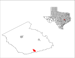
769:
733:
726:
717:
712:
594:
392:Demographics
383:
369:
365:Brazos River
354:
285:
284:
275:somervilletx
231:77839, 77879
15:
1228:Ghost towns
1198:Cooks Point
1185:communities
1083:County seat
868:January 31,
757:other races
609:Percentage
361:Yegua Creek
341:2020 census
86: /
1293:Categories
1153:Cade Lakes
1118:Somerville
806:References
734:As of the
727:As of the
286:Somerville
262:feature ID
170:Population
74:96°31′52″W
71:30°20′45″N
1193:Chriesman
1163:Deanville
897:April 23,
826:August 7,
794:Education
743:, 30.52%
351:Geography
250:FIPS code
238:Area code
226:ZIP codes
192:Time zone
162:Elevation
1256:Scofield
1246:Goodwill
1203:Frenstat
1108:Caldwell
1090:Caldwell
761:Hispanic
751:, 0.12%
747:, 1.06%
375:Caldwell
254:48-68720
127:Burleson
980:May 18,
944:May 25,
919:June 4,
707:33.46%
637:22.18%
623:38.19%
606:Number
379:Brenham
367:basin.
328:-ər-vil
270:Website
265:2411928
100:Country
1218:Wilcox
1100:Cities
765:Latino
736:census
694:4.65%
680:0.84%
655:0.38%
567:−19.2%
537:−15.0%
492:−17.4%
477:−12.1%
462:−29.1%
402:Census
122:County
1251:Merle
1236:Birch
1173:Tunis
1168:Lyons
1113:Snook
753:Asian
741:White
718:1,312
713:Total
688:(NH)
669:0.3%
663:(NH)
661:Asian
649:(NH)
631:(NH)
617:(NH)
615:White
603:Race
582:−4.7%
577:1,312
562:1,376
552:10.5%
547:1,704
532:1,542
522:45.1%
517:1,814
502:1,250
487:1,177
472:1,425
457:1,621
447:21.7%
442:2,287
427:1,879
337:Texas
220:(CDT)
218:UTC-5
197:UTC-6
178:1,312
115:Texas
110:State
1213:Rita
1158:Clay
1140:CDPs
982:2022
946:2022
921:2015
899:2014
870:2008
828:2020
704:439
634:291
620:501
573:2020
558:2010
543:2000
528:1990
513:1980
507:6.2%
498:1970
483:1960
468:1950
453:1940
438:1930
423:1920
411:Note
406:Pop.
277:.gov
260:GNIS
133:Area
33:City
1208:Hix
763:or
691:61
677:11
645:or
326:SUM
243:979
211:DST
1295::
1086::
1071:,
973:.
937:.
878:^
861:.
850:^
836:^
802:.
666:4
652:5
416:%±
381:.
347:.
335:,
307:ər
1058:e
1051:t
1044:v
984:.
948:.
923:.
901:.
872:.
830:.
432:—
319:/
316:l
313:ɪ
310:v
304:m
301:ʌ
298:s
295:ˈ
292:/
288:(
213:)
203:)
199:(
Text is available under the Creative Commons Attribution-ShareAlike License. Additional terms may apply.